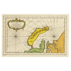
Items Similar to Original Engraved Map of Saint Lucia in the West Indies by Bellin, 1758


Want more images or videos?
Request additional images or videos from the seller
Original Engraved Map of Saint Lucia in the West Indies by Bellin, 1758
About the Item
The "Carte de L’Isle de Sainte Lucie" by Jacques Nicolas Bellin, a prominent figure as the Royal Hydrographer and engineer of the French Navy, is a remarkable antique map showcasing the intricate details of Saint Lucia island in the Caribbean Sea.
**Title:** Carte de L’Isle de Sainte Lucie
**Mapmaker:** Jacques Nicolas Bellin (1703 – 1772)
**Published for:** Antoine-François Prevost's "L`Histoire Generale des Voyages"
This finely crafted map is a copperplate engraving, meticulously detailed and enhanced with hand coloring, reflecting Bellin's expertise as a cartographer. The use of copperplate engraving allowed for precise and intricate lines, while the hand coloring adds visual distinction to various geographical features.
Key features of the map include:
1. **Geographical Accuracy:** Bellin's expertise as the Royal Hydrographer ensured a high level of accuracy in depicting the island's geography, including its coastline, inland features, and surrounding waters.
2. **Decorative Elements:** The map features a decorative title cartouche, a characteristic embellishment often found in antique maps, adding aesthetic appeal and a sense of grandeur to the piece.
3. **Detailing:** It highlights significant aspects of Saint Lucia, such as towns, topographical features, coastal landmarks, and even navigational information.
Published as part of Prevost's "L`Histoire Generale des Voyages," a comprehensive collection of travel accounts and geographic explorations, this map holds historical significance. Its inclusion in such an esteemed compilation speaks to its value as a representation of geographic knowledge and exploration during the 18th century.
The collaboration between Bellin, renowned for his contributions to naval cartography, and Prevost's renowned publication, coupled with the elegant engraving techniques and hand coloring, elevates this map to a valuable artifact, offering both historical and aesthetic appreciation for collectors and enthusiasts of cartography and exploration.
VERSO: There is nothing printed on the reverse side, which is plain
AUTHENTICITY: This is an authentic historic print, published at the date stated above. I do not offer reproductions. It is not a modern copy. The term 'original' when applied to a print means that it was printed at the first or original date of publication; it does not imply that the item is unique. 'Print' means any image created by applying an inked block to paper or card under pressure by any method including wood engraving, steel engraving, copperplate, wood cut and lithography.
- Dimensions:Height: 9.65 in (24.5 cm)Width: 13 in (33 cm)Depth: 0 in (0.02 mm)
- Materials and Techniques:Paper,Engraved
- Period:1750-1759
- Date of Manufacture:1758
- Condition:Very Good; Thin on hand laid (verge) paper, but very clean and very suitable for framing. Flattened folding line. Most antiquarian maps and prints are subject to some normal aging due to use and time which is not obtrusive unless otherwise stated.
- Seller Location:Langweer, NL
- Reference Number:
About the Seller
5.0
Platinum Seller
These expertly vetted sellers are 1stDibs' most experienced sellers and are rated highest by our customers.
Established in 2009
1stDibs seller since 2017
1,950 sales on 1stDibs
Typical response time: <1 hour
- ShippingRetrieving quote...Ships From: Langweer, Netherlands
- Return PolicyA return for this item may be initiated within 14 days of delivery.
More From This SellerView All
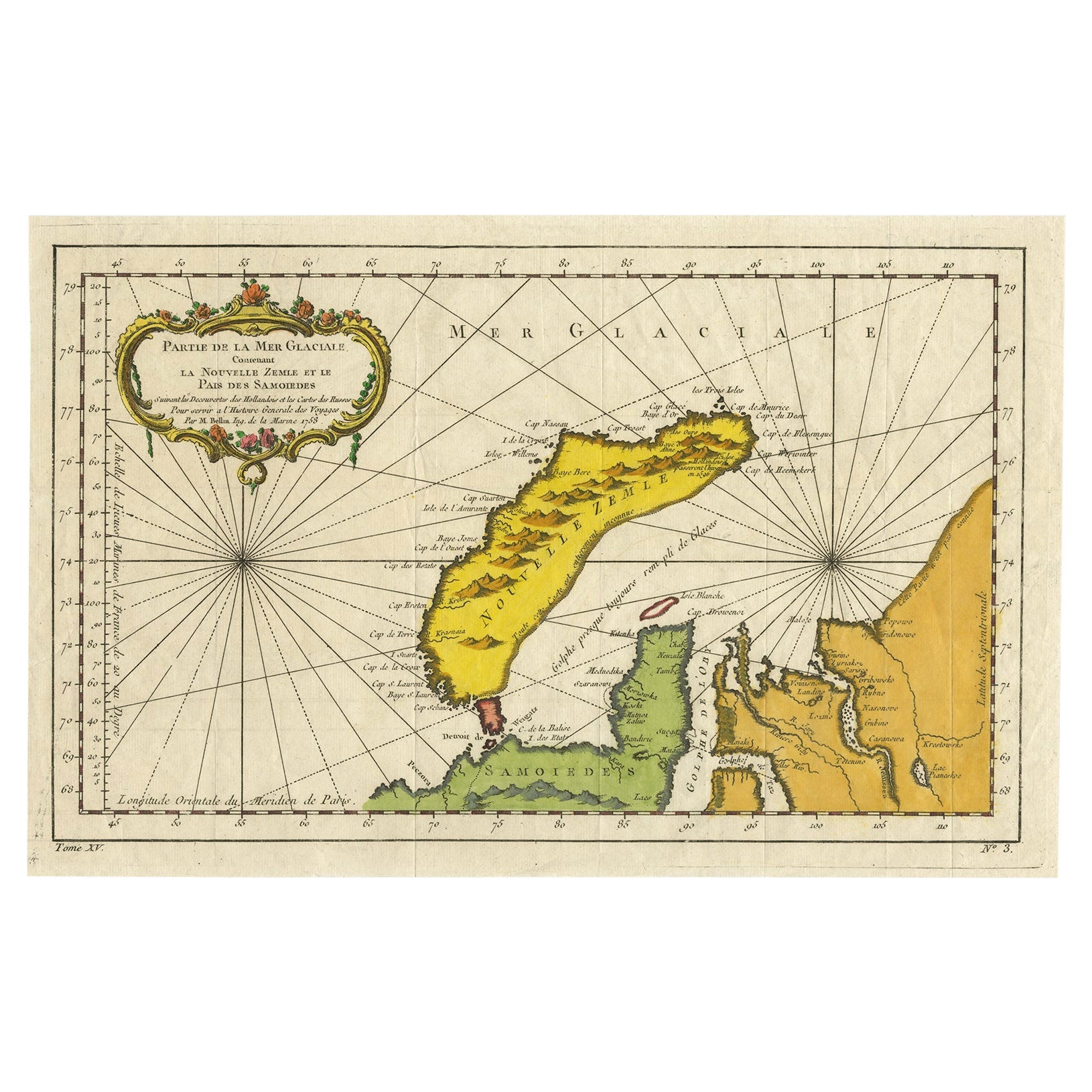
- Antique Map of Novaya Zemlya by Bellin, 1758Located in Langweer, NLAntique map titled 'Partie de la Mer Glaciale Contenant la Nouvelle Zemle et le Pais des Samoiedes'. This map features Novaya Zemlya, the island off northern Russia in the Barents Se...Category
Antique 18th Century Maps
MaterialsPaper
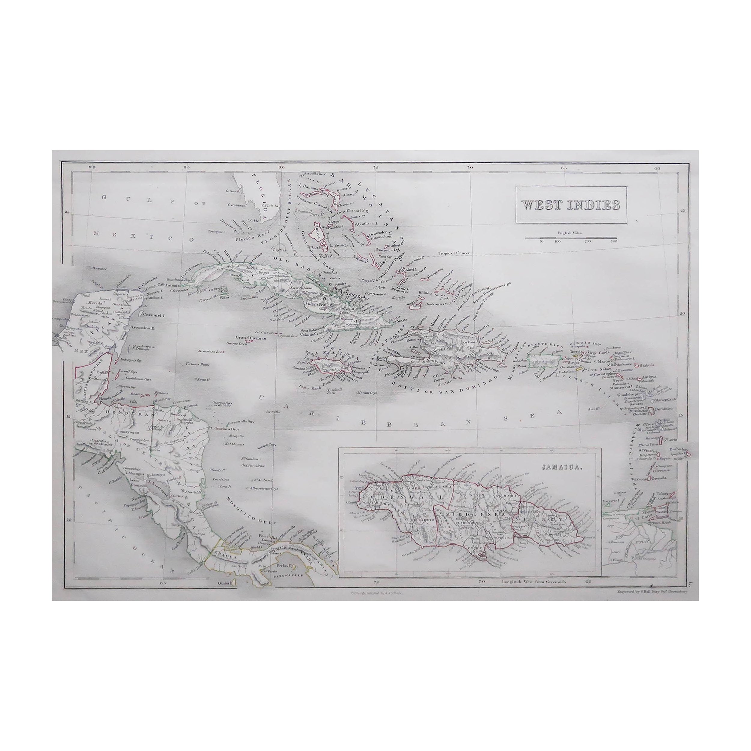
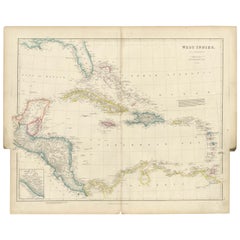
- Original Antique Map of the West Indies by J. Arrowsmith, 1842Located in Langweer, NLTitle: "J. Arrowsmith's 19th Century Map of the West Indies" This original antique map, crafted by J. Arrowsmith, details the West Indies with a focus on the Caribbean Sea and its s...Category
Antique Early 19th Century Maps
MaterialsPaper
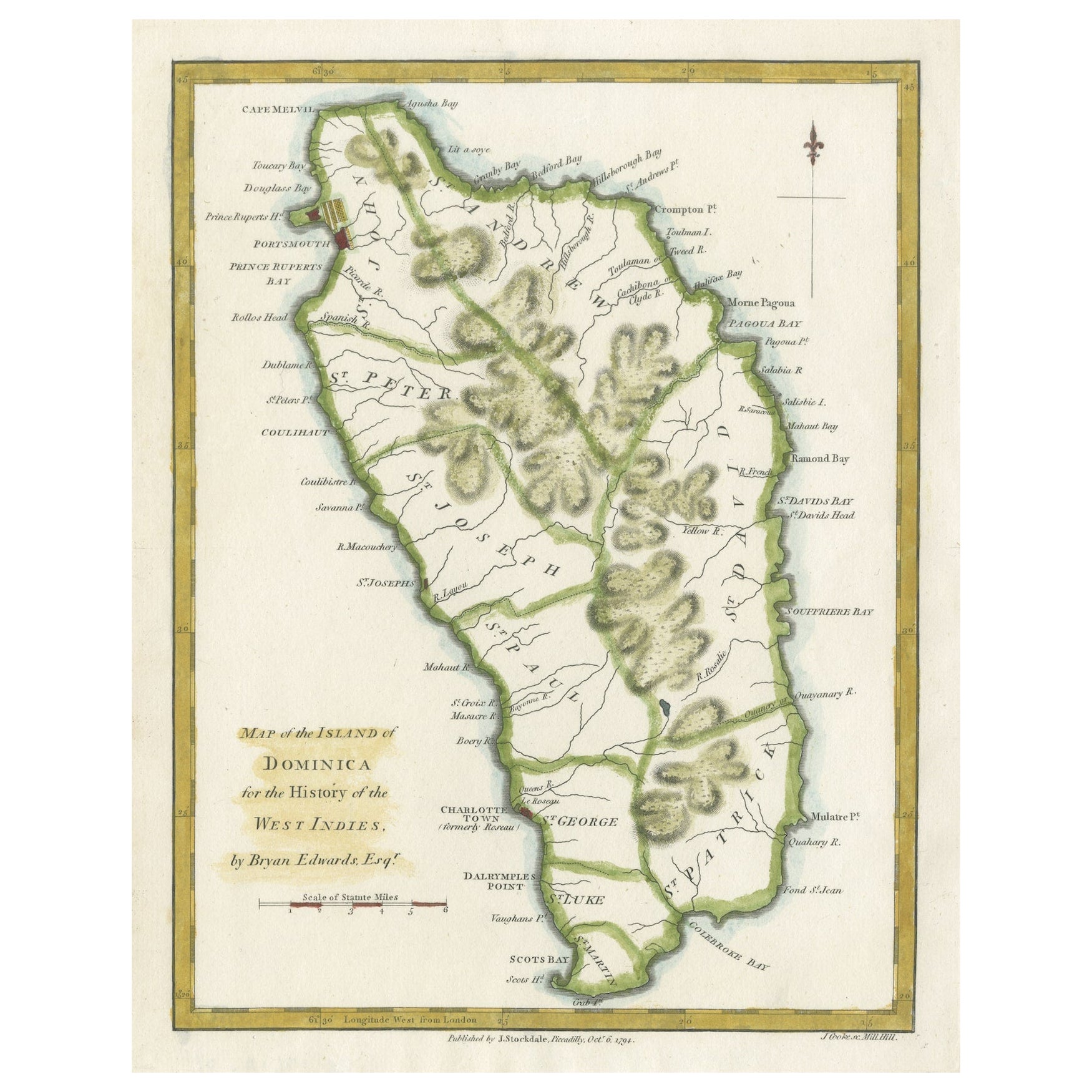
- Original Antique Map of the Island of Dominica in the West Indies, 1794Located in Langweer, NLMAP OF THE ISLAND OF DOMINICA for the History of the West Indies, by Bryan Edwards. Esq. Dominica, an island renowned for its lucrative exports of sugar, cocoa, and coffee, operated...Category
Antique 1790s Maps
MaterialsPaper
- Antique Map of Nova Zembla ‘Russia’ by J.N. Bellin, 1758Located in Langweer, NLAn interesting map of Nova Zembla and surrounding areas. With details on the eastern tip of Nova Zembla of the place where the stranded Dutch sailors under Willem Barentsz spent the ...Category
Antique Mid-18th Century Maps
MaterialsPaper
- Antique Map of the West Indies by Wyld '1845'Located in Langweer, NLAntique map titled 'Map of the West India Islands'. Original antique map of the West Indies, including Cuba, the Bahamas, the Antilles a...Category
Antique Mid-19th Century Maps
MaterialsPaper
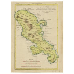
- Original Antique Map of Martinique Island In The West Indies by Bonne, circa1780Located in Langweer, NLAntique map titled 'Carte de l'Isle de la Martinique Colonie Francoise dans les Isles Antilles'. Detailed map of the French Island of Martinique. Many towns and harbours, anchor pl...Category
Antique 18th Century Maps
MaterialsPaper


You May Also Like
- Large Original Antique Map of The West Indies by Sidney Hall, 1847Located in St Annes, LancashireGreat map of The West Indies Drawn and engraved by Sidney Hall Steel engraving Original colour outline Published by A & C Black. 1847 Unframed Free shipping.Category
Antique 1840s Scottish Maps
MaterialsPaper
- West Coast of Africa, Guinea & Sierra Leone: An 18th Century Map by BellinBy Jacques-Nicolas BellinLocated in Alamo, CAJacques Bellin's copper-plate map entitled "Partie de la Coste de Guinee Dupuis la Riviere de Sierra Leona Jusquau Cap das Palmas", depicting the coast of Guinea and Sierra Leone in ...Category
Antique Mid-18th Century French Maps
MaterialsPaper
- Original Antique Map of Sweden, Engraved by Barlow, 1806Located in St Annes, LancashireGreat map of Sweden Copper-plate engraving by Barlow Published by Brightly & Kinnersly, Bungay, Suffolk. 1806 Unframed.Category
Antique Early 1800s English Maps
MaterialsPaper
- Seminal guide to the East and West Indies, with 42 coloured maps and platesBy Jan Huygen van LinschotenLocated in ZWIJNDRECHT, NLSeminal guide to the East and West Indies, with 42 double-page and folding plates, including 6 maps, all engravings beautifully coloured by a contemporary hand LINSCHOTEN, Jan Huygh...Category
Antique Early 17th Century Dutch Dutch Colonial Books
MaterialsPaper
- Original Antique Map of Switzerland, Engraved By Barlow, Dated 1807Located in St Annes, LancashireGreat map of Switzerland Copper-plate engraving by Barlow Published by Brightly & Kinnersly, Bungay, Suffolk. Dated 1807 Unframed.Category
Antique Early 1800s English Maps
MaterialsPaper
- Cricket Print, England v. West Indies at the Oval, by Arthur WeaverBy Arthur WeaverLocated in Oxfordshire, GB1990's Arthur Weaver Oval Cricket Ground Print, England v West Indies. A colourful cricket lithograph signed by the artist, Arthur Weaver, of the 'Final Test' at The Oval Cricket Gr...Category
1990s English Sporting Art Sports Equipment and Memorabilia
MaterialsPaper


Recently Viewed
View AllMore Ways To Browse
Ree Brown
Winkler Prins
Very Large Map
Antique American Victorian Furniture
A Plan City And Castle Of Batavia
Cheshire Map
John Speed Isle Of Wight Maps
Malacca Strait Map
Antique Map Of South Korea
Map Of Maine Et Loire
Mapp Plate
Marthas Vineyard Map
Nantucket Chart
Native American Mountie
Nicolaes Visscher II On Sale
Vintage Marthas Vineyard Map
W. & A.K. Johnston On Sale
Yemen 1789