Items Similar to Renaissance Mapping of Sumatra: Featuring Singapore in Münster’s Woodcut, c.1590


Want more images or videos?
Request additional images or videos from the seller
1 of 8
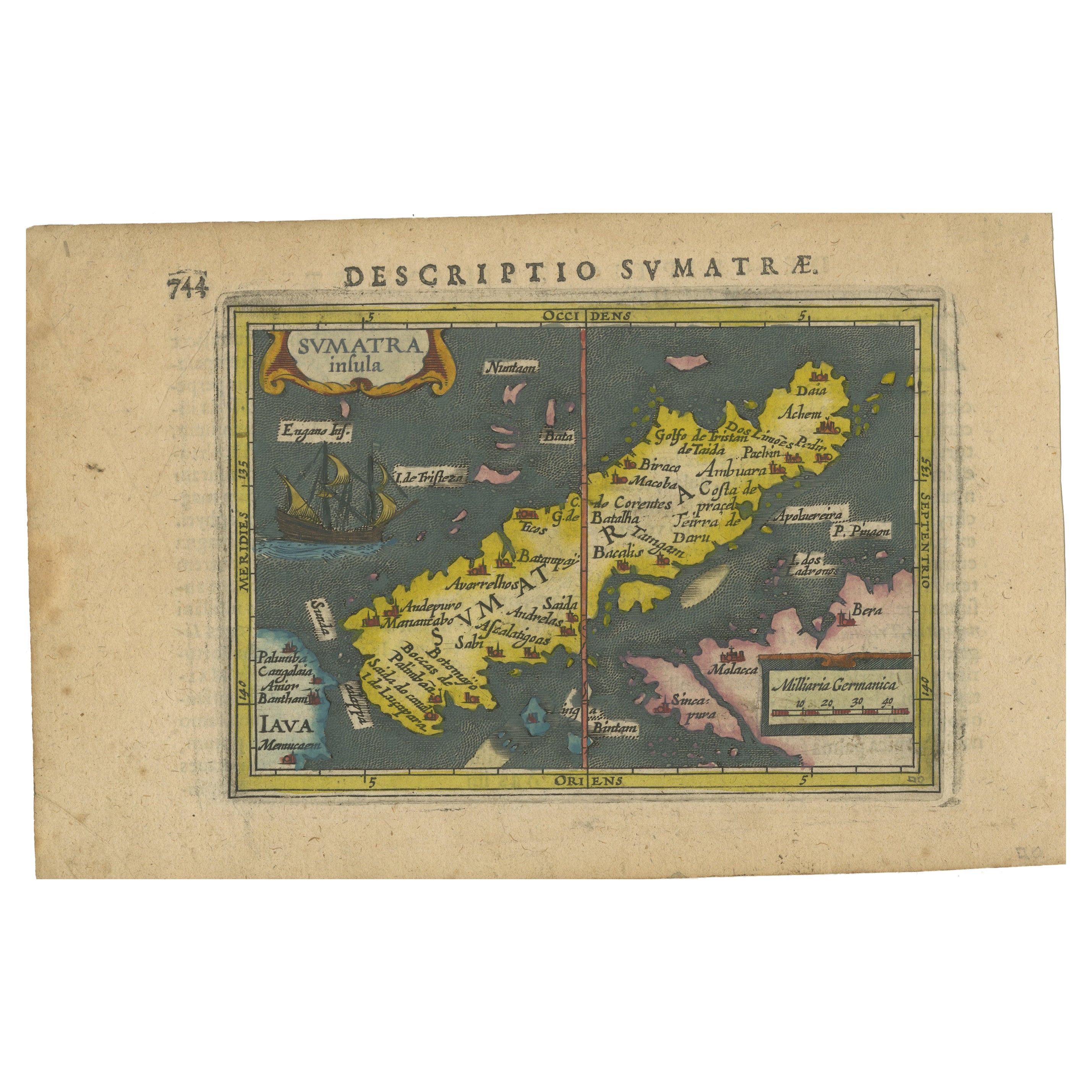
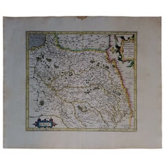
Renaissance Mapping of Sumatra: Featuring Singapore in Münster’s Woodcut, c.1590
About the Item
Description: Antique map titled 'Sumatra ein grosse Insel / so von den alten Geographen Taprobana genennt worden'. Beautiful map of Sumatra and the southern part of Malaysia, with Singapore shown as Cinglolo. Large cartouche of a man riding an elephant. Both Sumatra and Sri Lanka have been associated with the mythical island of Taprobana. This map originates from 'Cosmographia' published posthumously by Münster's stepson Hienrich Petri.
The German text block appears to be an excerpt from an old document or book. Here is the English translation:
"We learn from Varthema that in Taprobana, which is now Sumatra, there are better and also stronger than average elephants. It is also said that the pepper of this island is better than elsewhere, which the inhabitants of Malabar take in large quantities, because it is lighter than other pepper, so that one can trade it for their weight in gold.
Pliny writes that in ancient times people believed that this island was another world. On the side of Alexander the Great, one learned that it was an island and not a continent; his deeds have taught us that it is one of the islands that is rich in gold and precious stones in India. He also writes that an embassy was sent to the emperor of the whole country of India by Claudius Caesar, which told of the peculiarities, goods and customs of the country, and among other things, that there are trees that bear wool, as has been seen for several hundred years among people, worse than they."
About the maker:
Sebastian Munster is generally regarded as one of the important map makers of the 16th Century. Munster was a linguist and mathematician, who initially taught Hebrew in Heidelberg. He issued his first mapping of Germany in 1529, after which he issued a call for geographical information about Germany to scholars throughout the country. The response was better than hoped for, and included substantial foreign material, which supplied him with up to date, if not necessarily accurate maps, for the issuance of his Geographia in 1540. This work was issued in a number of editions and followed by his highly influential Cosmographia, which was first issued in 1544 and thereafter in a number of expanded editions until 1628.
- Dimensions:Height: 13.39 in (34 cm)Width: 16.34 in (41.5 cm)Depth: 0 in (0.02 mm)
- Materials and Techniques:
- Period:
- Date of Manufacture:circa 1590
- Condition:Good. Cleaned and stabilized, still a little stained in places. OVerall a very attractive woodcut of over 400 years old! Study the image carefully.
- Seller Location:Langweer, NL
- Reference Number:
About the Seller
5.0
Platinum Seller
These expertly vetted sellers are 1stDibs' most experienced sellers and are rated highest by our customers.
Established in 2009
1stDibs seller since 2017
1,929 sales on 1stDibs
Typical response time: <1 hour
- ShippingRetrieving quote...Ships From: Langweer, Netherlands
- Return PolicyA return for this item may be initiated within 14 days of delivery.
More From This SellerView All
- Authentic Old Map of Sumatra, Malaysia and Singapore, 1745Located in Langweer, NLTitle: "Kaartje van't Eiland Sumatra en de Maleidse Kust gelegen na de stelling van de G. de L'Isle" Published by Jacob Keizer and by Jan de Lat Creator: Keizer, Jacob, active 1706...Category
Antique 1740s Maps
MaterialsPaper
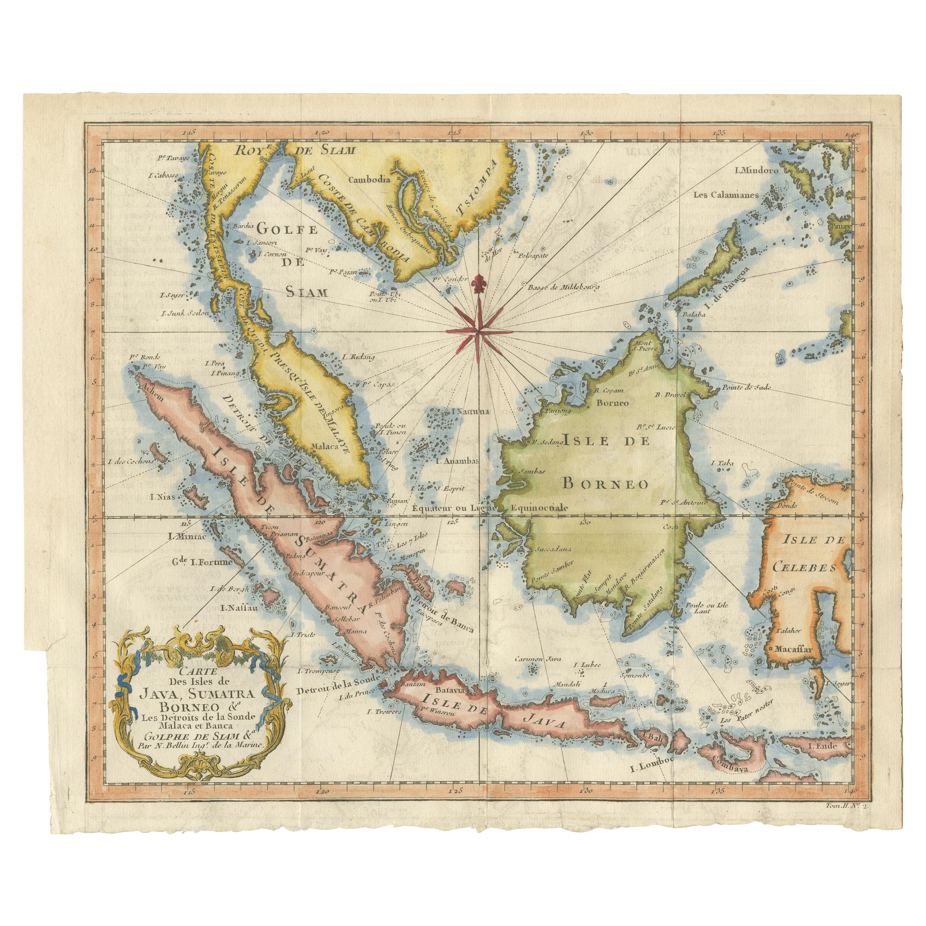
- Antique Engraving of Malaysia, Brunei, Singapore, Java, Borneo, Sumatra, c.1750Located in Langweer, NLNice decorative and detailed map from the Gulf of Siam and Mindoro to Timo, Java and Sumatra Borneo and Roy de Siam. Large compass rose and nice cartouche. Title: Carte des Isles ...Category
Antique Mid-18th Century Maps
MaterialsPaper
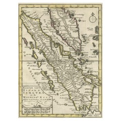
- 1616 Bertius Map of Sumatra, Singapore and the Straits of MalaccaLocated in Langweer, NLTitle: "1616 Bertius Map of Sumatra and the Straits of Malacca" Description: This is an exquisite 1616 original antique map by Petrus Bertius, titled "Sumatra Insula," showcasing Su...Category
Antique Early 17th Century Maps
MaterialsPaper
- Antique Map of Singapore, Malaysia, Borneo, Sumatra and Java (Indonesia), 1739Located in Langweer, NL"Antique map titled 'Nieuwe kaart van de Sundasche Eilanden als Borneo, Sumatra en Groot Iava & c'. Detailed map of Southeast Asia, extending from the tip of Cambodia to Java. This m...Category
Antique 18th Century Maps
MaterialsPaper
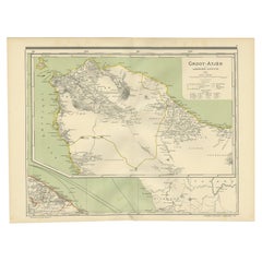
- Antique Map of Aceh in Sumatra, Indonesia, 1900Located in Langweer, NLAntique map titled 'Groot-Atjeh en aangrenzende Kuststaten'. Old map of Aceh, with surrounding coastal regions. This map originates from 'Atlas van Nederlandsch Oost- en West-Indië' ...Category
20th Century Maps
MaterialsPaper
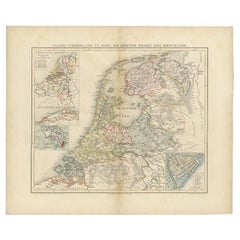
- Antique Map of the Netherlands in 1590 by Mees, 1854Located in Langweer, NLAntique map titled 'Noord-Nederland in 1590. De eerste tijden der Republiek'. Map of the Netherlands in 1590. This map originates from 'Historische Atlas van Noord-Nederland'. Ar...Category
Antique 19th Century Maps
MaterialsPaper


You May Also Like
- 1590 Ortelius Map of Calais and Vermandois, France and Vicinity Ric.a014Located in Norton, MA1590 Ortelius map of Calais and Vermandois, France and Vicinity Ric.a014 Two rare regional Abraham Ortelius maps on a single folio sheet. Left map, entitled Caletensium, depic...Category
Antique 16th Century Dutch Maps
MaterialsPaper
- Large Original Vintage Map of S.E Asia, with a Vignette of SingaporeLocated in St Annes, LancashireGreat map of South East Asia Original color. Good condition Published by Alexander Gross Unframed.Category
Vintage 1920s English Maps
MaterialsPaper
- 1590 Mercator Map Entitled "France Picardie Champaigne, Ric.0001Located in Norton, MADescription: Published in Amsterdam by Mercator/Hondius ca. 1590. Ric.0001 Artists and Engravers: Map : 'France Picardie Champaigne cum regionibus adiacentibus'. (Map of the french provinces of Picardie and Champagne.) Copper engraved map of the french provinces of Picardie and Champagne, showing the cities of Caen, Paris, Melun, Auxerre, Verdun, etc. Copperplate engraving on verge type hand laid paper with watermark. Description: Published in Amsterdam by Mercator/Hondius ca. 1600.Artists and Engravers: Mercator was born in Rupelmonde in Flanders and studied in Louvain under Gemma Frisius, Dutch writer, astronomer and mathematician. The excellence of his work brought him the patronage of Charles V, but in spite of his favor with the Emperor he was caught up in the persecution of Lutheran protestants and charged with heresy, fortunately without serious consequences. No doubt the fear of further persecution influenced his move in 1552 to Duisburg, where he continued the production of maps, globes and instruments. Mercator's sons and grandsons, were all cartographers and made their contributions in various ways to his atlas. Rumold, in particular, was responsible for the complete edition in 1595. The map plates...Category
Antique 16th Century Dutch Maps
MaterialsPaper
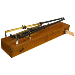
- Large Vintage Pantagraph, English, Brass, Scientific Mapping InstrumentLocated in Hele, Devon, GBThis is a large vintage pantagraph. An English, brass scientific mapping instrument, dating to the mid-20th century, circa 1950. Fascinating scale and mechanical interest Displays a...Category
Mid-20th Century English Scientific Instruments
MaterialsBrass
- "Pucci - A Renaissance in Fashion" 1st EditionLocated in Hanover, MA"Pucci - A Renaissance in Fashion" by Shirley Kennedy, 1st edition, printed in Japan in 1991. All excellent near perfect condition. Cloth cover. First white page...Category
Late 20th Century Japanese Books
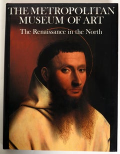
- Metropolitan Museum of Art: the Renaissance in the North, 1st EdLocated in valatie, NYThe Metropolitan Museum of Art: The Renaissance in the North. Published by The Metropolitan Museum of Art, NY, 1987. 1st Ed hardcover with dust jacket. At roughly the same time that Italian art was beginning to reflect a reawakening of the classical spirit—an epoch and style we call the Renaissance—the arts of Northern Europe were experiencing their own efflorescence. Painting, sculpture, and the graphic arts were pursued with a new vigor in the Netherlands, in Germany, in France, and in England, and resulted in a vast body of work that constitutes one of the glories of Western civilization. During the fourteenth and fifteenth centuries, the masters of the North developed styles quite distinct from those in the South: an attention to minute detail, particularly with regard to landscape, but also in domestic interiors; and an emotive piety that dramatized the sorrow and suffering of the Passion. Jan van Eyck's Crucifixion and Last Judgment present a horrific vision of the death of Christ and the damnation of sinners, set against a deep and distant landscape, sensitively and realistically rendered. The Lamentation by Petrus Christus...Category
Vintage 1980s American Books
MaterialsPaper


Recently Viewed
View AllMore Ways To Browse
La Syrie Antique
Laos Antique Map
Moravia Map
Nova Totius
Antique Indiana Map
Antique Map Delaware
Antique Maps Rhode Island
Antique Map Of North And East Asia 1751
Republic Of Texas Map
Vintage Road Maps Collectables
Astrological Map
Astrology Map
Atlas Indu
English County Maps By Blaeu
Kiels Antiques
Mauritius Antique Map
Old Cypriot Maps
Tanzania Antique Map