Objekte ähnlich wie 1896 "Territory of Arizona" Map, Published by the General Land Office


Möchten Sie mehr Bilder oder Videos?
Zusätzliche Bilder oder Videos von dem*der Anbieter*in anfordern
1 von 5
1896 "Territory of Arizona" Map, Published by the General Land Office
Angaben zum Objekt
Presented is an attractive "Territory of Arizona” map, from the “Report of the Governor of Arizona to the Secretary of the Interior." First published in 1894, this 1896 edition was revised and reconstructed by R. H. Morton and published by the General Land Office, based on “official Records of the General Land Office and other sources under the supervision of Harry King, C.E.” The report gave extensive detail regarding the territory’s population, including Native Americans of Arizona, the agriculture, mining, taxation, banks, transportation, immigration and tourism, as well as the current challenges to the territory’s development. This beautifully colored and highly detailed map was bound in the back of the 142 page Report. The map was lettered by M. Hendges and R.M. Towson.
The map is outlined by county in pink and detailed in black, with town names, roads, wagon roads, railroads, and mountains labeled. Intricate brown hachured mountain areas and the blue waterways combine to provide great visual impact. The map shows the extent of nine Indian reservations, outlined in green, and at least four military reservations, including Fort Apache, colored in solid red. The Grand Canyon is also shown and labeled as a Forest Reserve in pale pink. Any private land claims, confirmed and unconfirmed, are outlined in red, while townships not yet subdivided are identified with a circled cross.
Arizona, formerly part of the Territory of New Mexico, was organized as a separate territory on February 24, 1863. The United States acquired the region under the terms of the 1848 Treaty of Guadalupe Hidalgo and the 1853 Gadsden Purchase.
In the 1870s and 1880s, particularly after the arrival of the railroad in 1880, the population of the Arizona Territory expanded rapidly. With many Native American tribes relocated to reservations, white settlers drawn by the rich agricultural and mineral resources arrived in the region. Gold was discovered in 1863 near the first capital, Prescott. The 1877 discoveries of silver at Tombstone, near Tucson, and copper at Bisbee, also brought many settlers hoping to strike it rich. Many Mormon settlers moved south from Utah and Mexicans emigrated north. The flow of European emigrants also increased markedly thanks to the railroad. By the beginning of the 20th century, the population of the Arizona Territory exceeded 100,000. As the population grew, there was increasing sentiment for statehood, which was finally granted in 1912.
CONDITION:
Very good condition. Lithographed folding map, printed with original color. Map paper is lightly toned, color is strong and attractive. Fold lines, as issued. The map was removed from the original "Report of the Governor of Arizona to the Secretary of the Interior" booklet. Original booklet included. The booklet has red paper covers,142 pages with text and tables describing the territory including immigration, taxation, mining, banks, railroads, and much more. The booklet binding is tight and paper is clean, but the red paper covers have wear and lifting at the spine and a small chip at the right edge on the front cover.
Accompanied by our company's letter of authenticity.
- Maße:Höhe: 73,03 cm (28,75 in)Breite: 63,5 cm (25 in)Tiefe: 2,54 cm (1 in)
- Materialien und Methoden:
- Zeitalter:
- Herstellungsjahr:1896
- Zustand:Am Original vorgenommene Ergänzungen oder Änderungen: Framed according to archival standards by Artem Art Services in Colorado Springs, CO. Abnutzung dem Alter und der Nutzung entsprechend.
- Anbieterstandort:Colorado Springs, CO
- Referenznummer:Anbieter*in: M3921stDibs: LU909745349572
Anbieterinformationen
4,9
Platin-Anbieter*in
Premium-Anbieter*innen mit einer Bewertung über 4,7 und 24 Stunden Reaktionszeit
Gründungsjahr 2010
1stDibs-Anbieter*in seit 2011
452 Verkäufe auf 1stDibs
Typische Antwortzeit: 1 Stunde
- VersandAngebot wird abgerufen …Versand von: Colorado Springs, CO
- Rückgabebedingungen
Einige Inhalte dieser Seite wurden automatisch übersetzt. Daher kann 1stDibs nicht die Richtigkeit der Übersetzungen garantieren. Englisch ist die Standardsprache dieser Website.
Authentizitätsgarantie
Im unwahrscheinlichen Fall eines Problems mit der Echtheit eines Objekts kontaktieren Sie uns bitte innerhalb von 1 Jahr für eine volle Rückerstattung. DetailsGeld-Zurück-Garantie
Wenn Ihr Objekt nicht der Beschreibung entspricht, beim Transport beschädigt wurde oder nicht ankommt, kontaktieren Sie uns bitte innerhalb von 7 Tagen für eine vollständige Rückerstattung. DetailsStornierung innerhalb von 24 Stunden
Sie können Ihren Kauf jederzeit innerhalb von 24 Stunden stornieren, ohne jegliche Gründe dafür angeben zu müssen.Geprüfte Anbieter*innen
Unsere Anbieter*innen unterliegen strengen Dienstleistungs- und Qualitätsstandards, wodurch wir die Seriosität unserer Angebote gewährleisten können.Preisgarantie
Wenn Sie feststellen, dass ein*e Anbieter*in dasselbe Objekt anderswo zu einem niedrigeren Preis anbietet, werden wir den Preis entsprechend anpassen.Zuverlässige weltweite Lieferung
Unsere erstklassigen Versandunternehmen bieten spezielle Versandoptionen weltweit, einschließlich individueller Lieferung.Mehr von diesem*dieser Anbieter*in
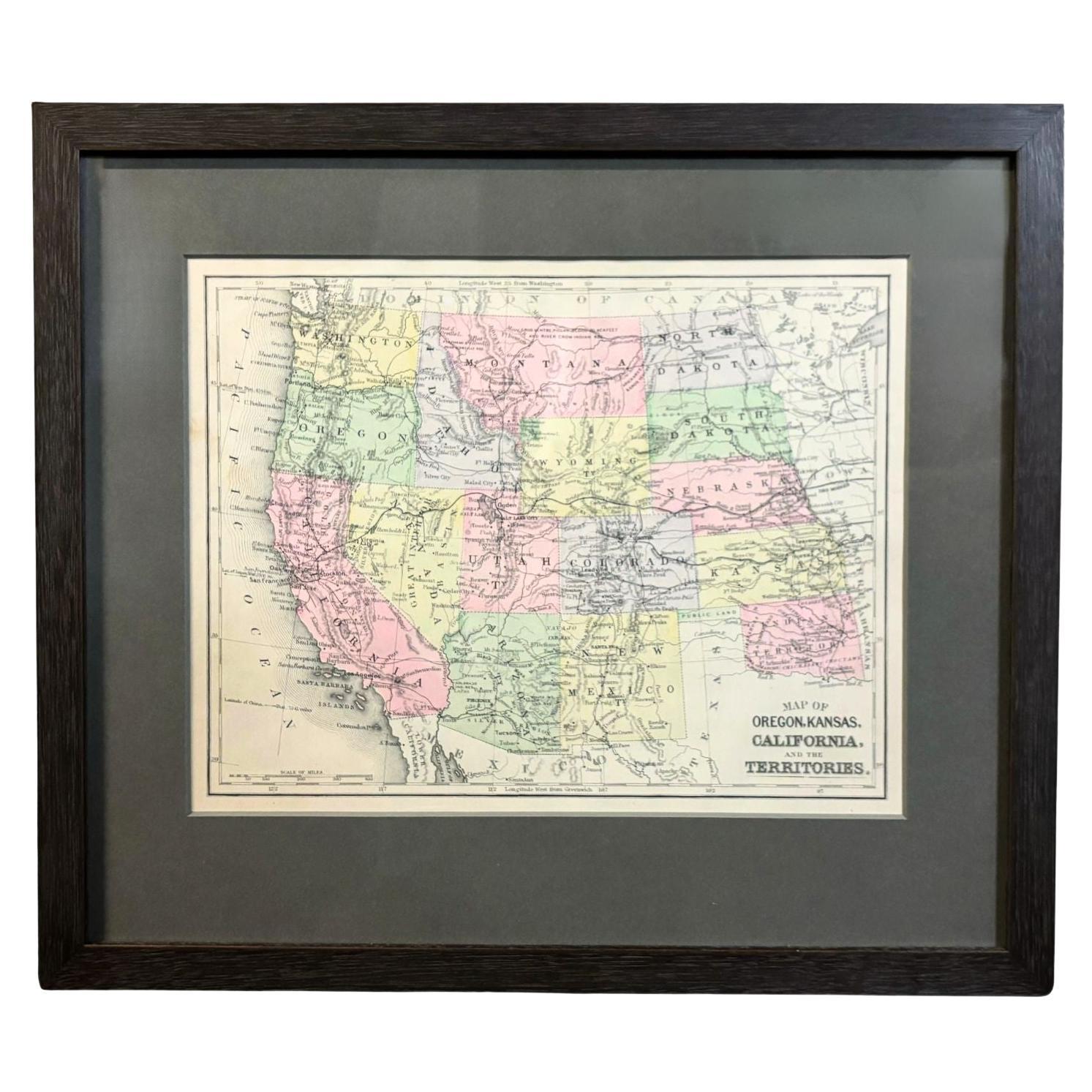
Alle anzeigen1890 „Map of Oregon, Kansas, California, and the Territories“ von S. A. Mitchell
Von Samuel Augustus Mitchell 1
Präsentiert wird eine Karte von 1890 "Map of Oregon, Kansas, California, and the Territories" von S. A. Mitchell Jr. Die Karte wurde in dem in Philadelphia herausgegebenen Atlas "Mit...
Kategorie
Antik, 1890er, amerikanisch, Viktorianisch, Landkarten
Materialien
Papier

Map of the City of Washington aus dem Jahr 1840, herausgegeben von William M. Morrison
Diese 1840 gedruckte Karte ist eine detaillierte Darstellung von Washington, D.C. in der Mitte des 19. Jahrhunderts. Die Karte zeigt Blocknummern, Bezirke und Regierungsgebäude sowie...
Kategorie
Antik, 1840er, amerikanisch, Federal, Landkarten
Materialien
Papier

Wandkarte der Vereinigten Staaten 1842 von J. H. Young, herausgegeben von S. A. Mitchell
Präsentiert wird eine hängende "Karte der Vereinigten Staaten" von 1842, gestochen von J. H. Young und veröffentlicht von Samuel Augustus Mitchell, Philadelphia. Dies ist ein schönes...
Kategorie
Antik, 1840er, amerikanisch, Landkarten
Materialien
Papier

"Taylor and His Generals":: Erstausgabe:: veröffentlicht von E. H. Butler & Co.:: 1847
Taylor und seine Generäle. New York: E.H. Butler & Co., 1847. Erstausgabe. Neu gebunden in Viertelleder und Marmorpapier-Karton. Untergebracht in einem maßgefertigtem Schuber.
Präse...
Kategorie
Antik, 1840er, amerikanisch, Bücher
Materialien
Papier

1859 „Map of the United States of America..." von J. H. Colton
Von J.H. Colton
Präsentiert wird eine "Karte der Vereinigten Staaten von Amerika, der britischen Provinzen, Mexikos, der Westindischen Inseln und Mittelamerikas mit einem Teil von New Granada und Ve...
Kategorie
Antik, 1850er, amerikanisch, Landkarten
Materialien
Papier

Ornamental Map of the United States & Mexico aus dem Jahr 1847 von H. Phelps
Angeboten wird eine originale Zierkarte der USA von 1847 mit dem Titel "Ornamental Map of the United States & Mexico" von Humphrey Phelps. Die Karte wurde im Auftrag des Kongresses v...
Kategorie
Antik, 1840er, amerikanisch, Landkarten
Materialien
Papier

Das könnte Ihnen auch gefallen
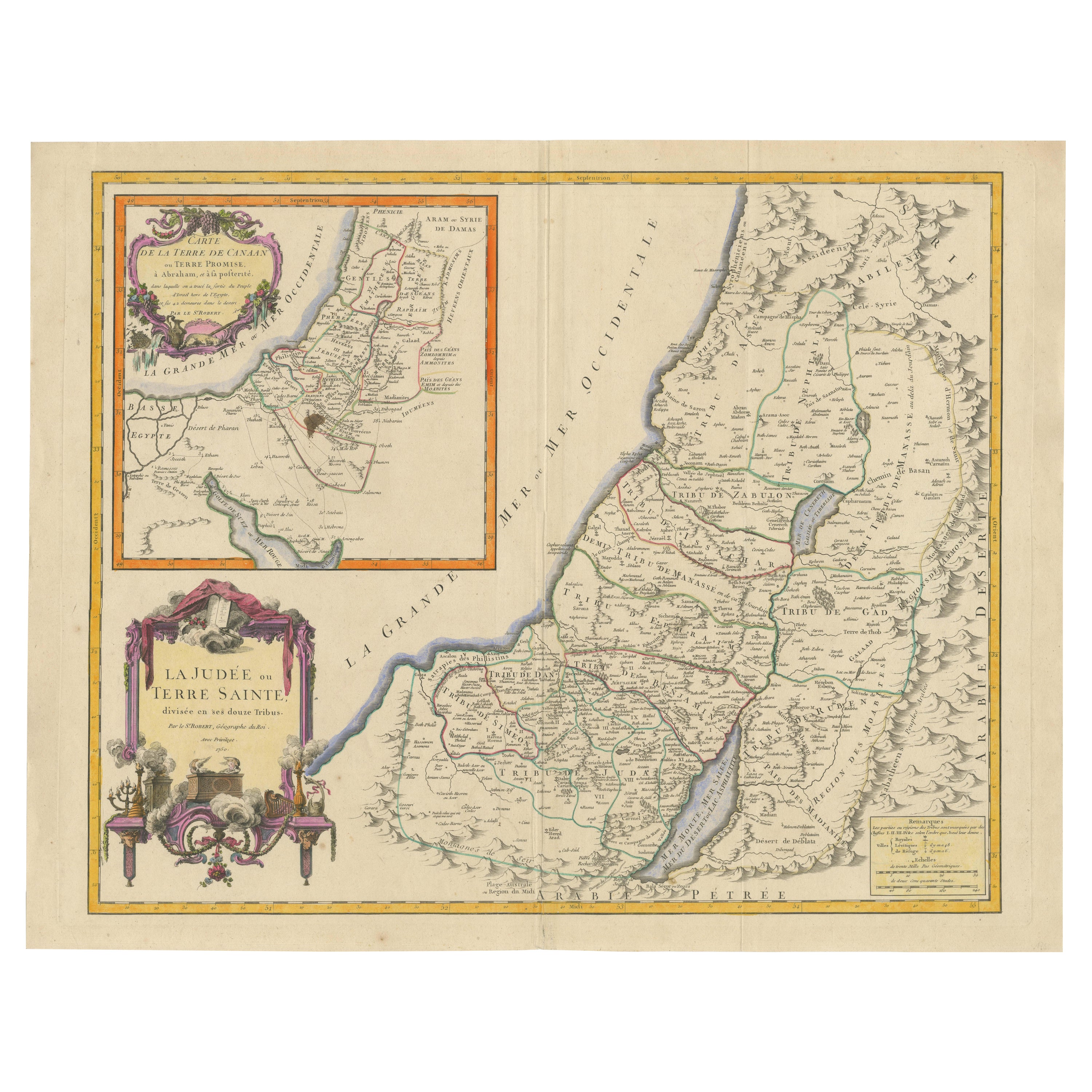
Map of the Holy Land 1750: The Land of Canaan and the Twelve Tribes, Karte des Heiligen Landes
Carte de la Terre de Canaan ou Terre Promise
Kartograph: Le St. Robert
Datum der Veröffentlichung: 1750
Diese exquisite Karte aus dem 18. Jahrhundert, "Carte de la Terre de Canaan o...
Kategorie
Antik, 1750er, Landkarten
Materialien
Papier
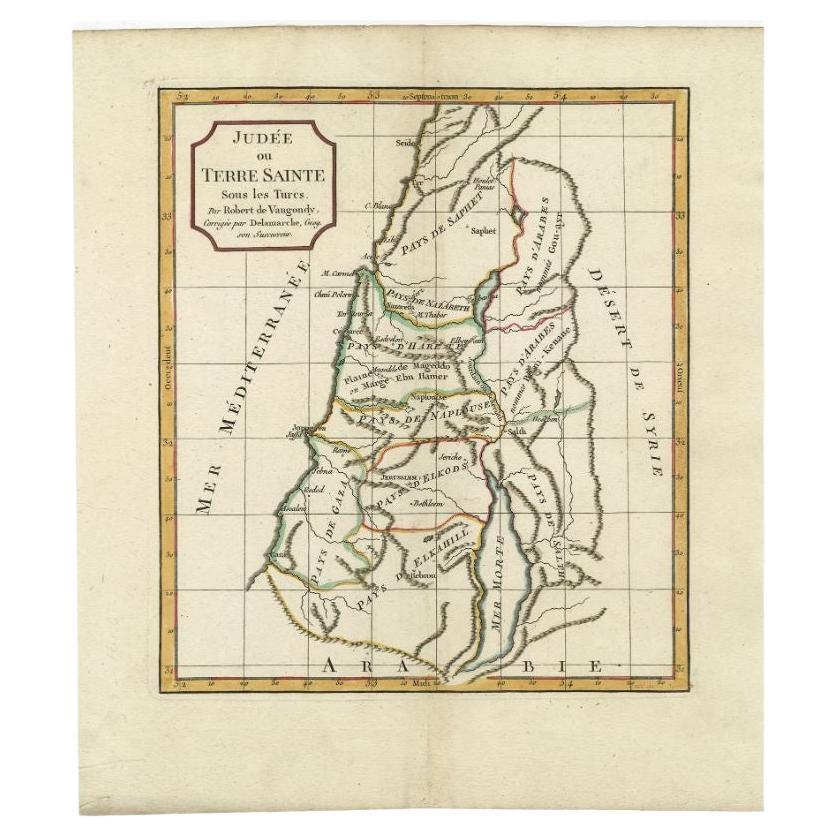
Antike Karte des Heiligen Landes von Delamarche, 1806
Von Charles Francois Delamarche
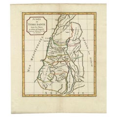
Antike Karte mit dem Titel 'Judee ou Terre Sainte sous les Turcs'. Diese Karte zeigt das heilige Land unter den Türken. Von Robert de Vaugondy, überarbeitet und herausgegeben von Del...
Kategorie
Antik, 19. Jahrhundert, Landkarten
Materialien
Papier
Antike Karte des Heiligen Landes von Schut, 1710
Antike Karte des Heiligen Landes mit dem Titel 'Het Beloofde Landt Canaan' Sehr detaillierte und dekorative Karte des Heiligen Landes mit Segelschiffen und Kompassrose verziert. Nied...
Kategorie
Antik, 18. Jahrhundert, Landkarten
Materialien
Papier

390 $ Angebotspreis
20 % Rabatt
Antike Karte des Heiligen Landes von Keur, 1748
Antike Karte des Heiligen Landes mit dem Titel 'De Gelegentheyd van t'Paradys ende t'Landt Canaan, Mitsgaders d'eerst bewoonde Landen der Patriarchen'. Enthält fünf dekorative Vignet...
Kategorie
Antik, 18. Jahrhundert, Landkarten
Materialien
Papier

323 $ Angebotspreis
20 % Rabatt
Antike Karte des Heiligen Landes von Danckerts, um 1710
Antike Karte mit dem Titel 'Afbeeldinge van de Veertich-Iaarige Reyse der Kinderen Israëls uyt Egypten door de Roode Zee en de Woestyne tot in 't Beloofde Landt Canaan'. Karte des He...
Kategorie
Antik, 18. Jahrhundert, Landkarten
Materialien
Papier

332 $ Angebotspreis
20 % Rabatt
Antike Karte des Heiligen Landes, ca. 1717
Antike Karte Israel mit dem Titel 'Tabula Geographica Terrae Sanctae'. Seltene Ausgabe nach einer Karte des Heiligen Landes von J. Bonfrerius. Die Karte ist so ausgerichtet, dass Nor...
Kategorie
Antik, 18. Jahrhundert, Landkarten
Materialien
Papier

362 $ Angebotspreis
20 % Rabatt