Objekte ähnlich wie Antique Map of England and Wales, 1903, with Detailed Counties and Railways

Möchten Sie mehr Bilder oder Videos?
Zusätzliche Bilder oder Videos von dem*der Anbieter*in anfordern
1 von 10
Antique Map of England and Wales, 1903, with Detailed Counties and Railways
Angaben zum Objekt
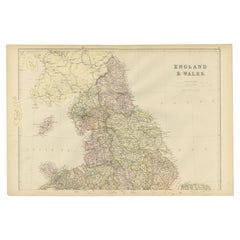
Title: Antique Map of England and Wales, 1903, with Detailed Counties and Railways
Description:
This beautifully detailed antique map, titled "England and Wales," was engraved and published in 1903 by the esteemed cartographic firm W. & A.K. Johnston in Edinburgh and London. It offers a comprehensive and precise depiction of England and Wales at the turn of the 20th century, capturing the dynamic infrastructure and geography of the era.
The map intricately delineates county boundaries with delicate coloring in pastel hues of pink, green, and yellow, each carefully engraved to create a visually striking and harmonious composition. Major cities, towns, and an extensive network of railways are all clearly marked, reflecting the rapid industrial expansion and urban growth that characterized this period. The fine detail also highlights the natural geography of the region, from mountain ranges and rivers to coastal features and offshore islands.
This map is not just a piece of historical documentation—it is a glimpse into a time when the United Kingdom was at the peak of its industrial might and global influence. Railways, noted with precision, underscore the transformation of the landscape and the vital role of transportation in connecting communities and fostering economic growth.
For collectors, this map is a testament to the artistry and accuracy of Johnston’s cartography, combining technical excellence with an aesthetic that remains timeless. It’s an ideal centerpiece for anyone interested in British history, geography, or antique maps.
Condition report:
The map is in very good antique condition, with only minor age-related foxing and slight edge toning that do not detract from its clarity and charm. The colors remain vivid and the paper is well-preserved. Folding line as issued.
Framing tips:
A classic wooden frame in rich mahogany or walnut will add warmth and sophistication to this antique map. Use a light cream or off-white matting to enhance the fine details and bring out the soft pastel colors, creating a refined and elegant presentation for any setting.
- Maße:Höhe: 36,8 cm (14,49 in)Breite: 48 cm (18,9 in)Tiefe: 0,2 mm (0,01 in)
- Materialien und Methoden:
- Zeitalter:
- Herstellungsjahr:1903
- Zustand:This map is in very good antique condition. Minor foxing and light toning around the edges, consistent with its age, do not detract from its beauty. The colors remain fresh and the paper stable. Folding line as issued.
- Anbieterstandort:Langweer, NL
- Referenznummer:Anbieter*in: BG-13577-41stDibs: LU3054345241002
Anbieterinformationen
5,0
Anerkannte Anbieter*innen
Diese renommierten Anbieter*innen sind führend in der Branche und repräsentieren die höchste Klasse in Sachen Qualität und Design.
Gold-Anbieter*in
Premium-Anbieter*innen mit einer Bewertung über 4,3 und 24 Stunden Reaktionszeit
Gründungsjahr 2009
1stDibs-Anbieter*in seit 2017
2.446 Verkäufe auf 1stDibs
Typische Antwortzeit: 1 Stunde
- VersandAngebot wird abgerufen …Versand von: Langweer, Niederlande
- Rückgabebedingungen
Einige Inhalte dieser Seite wurden automatisch übersetzt. Daher kann 1stDibs nicht die Richtigkeit der Übersetzungen garantieren. Englisch ist die Standardsprache dieser Website.
Authentizitätsgarantie
Im unwahrscheinlichen Fall eines Problems mit der Echtheit eines Objekts kontaktieren Sie uns bitte innerhalb von 1 Jahr für eine volle Rückerstattung. DetailsGeld-Zurück-Garantie
Wenn Ihr Objekt nicht der Beschreibung entspricht, beim Transport beschädigt wurde oder nicht ankommt, kontaktieren Sie uns bitte innerhalb von 7 Tagen für eine vollständige Rückerstattung. DetailsStornierung innerhalb von 24 Stunden
Sie können Ihren Kauf jederzeit innerhalb von 24 Stunden stornieren, ohne jegliche Gründe dafür angeben zu müssen.Geprüfte Anbieter*innen
Unsere Anbieter*innen unterliegen strengen Dienstleistungs- und Qualitätsstandards, wodurch wir die Seriosität unserer Angebote gewährleisten können.Preisgarantie
Wenn Sie feststellen, dass ein*e Anbieter*in dasselbe Objekt anderswo zu einem niedrigeren Preis anbietet, werden wir den Preis entsprechend anpassen.Zuverlässige weltweite Lieferung
Unsere erstklassigen Versandunternehmen bieten spezielle Versandoptionen weltweit, einschließlich individueller Lieferung.Mehr von diesem*dieser Anbieter*in
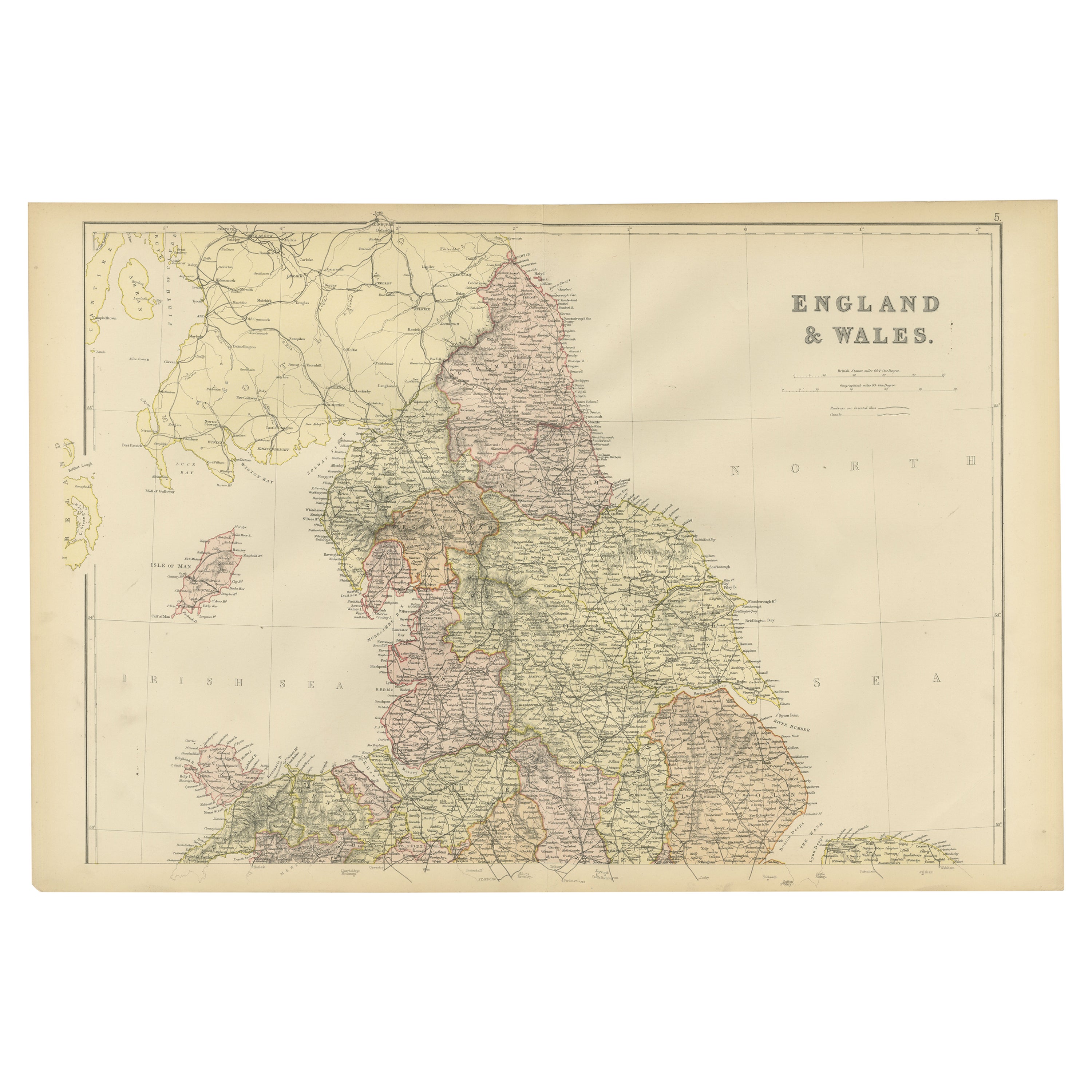
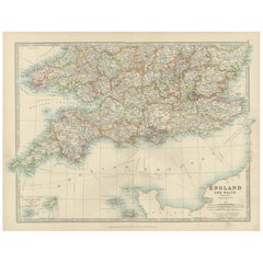
Alle anzeigenAntique Map of Southern England & Wales, 1903, with Coastal Details and Railways
Title: Antique Map of Southern England and Wales, 1903, with Coastal Details and Railways
Description:
This detailed antique map, titled "England and Wales (Southern Sheet I)," was ...
Kategorie
Frühes 20. Jahrhundert, Landkarten
Materialien
Papier
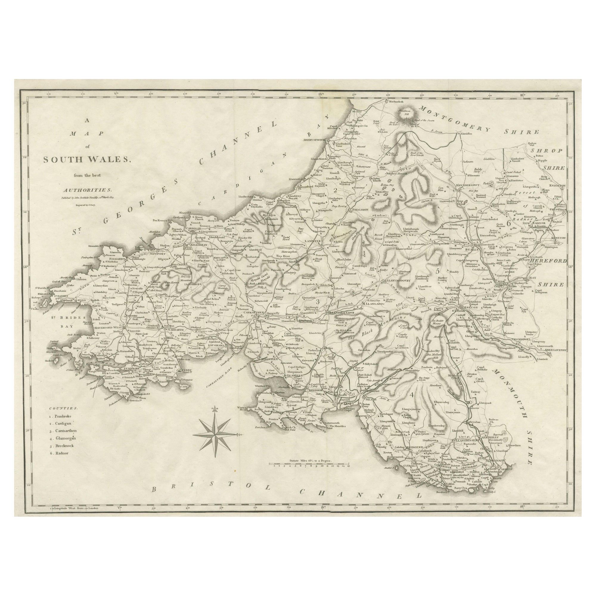
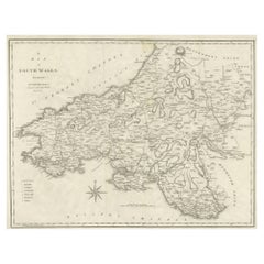
Große antike Grafschaftskarte von Südwales, England
Antike Karte mit dem Titel 'A Map of South Wales from the best Authorities'. Original alte Grafschaftskarte von Südwales, England. Gestochen von John Cary's. Stammt aus dem "New Brit...
Kategorie
Antik, Frühes 19. Jahrhundert, Landkarten
Materialien
Papier
167 $ Angebotspreis
20 % Rabatt
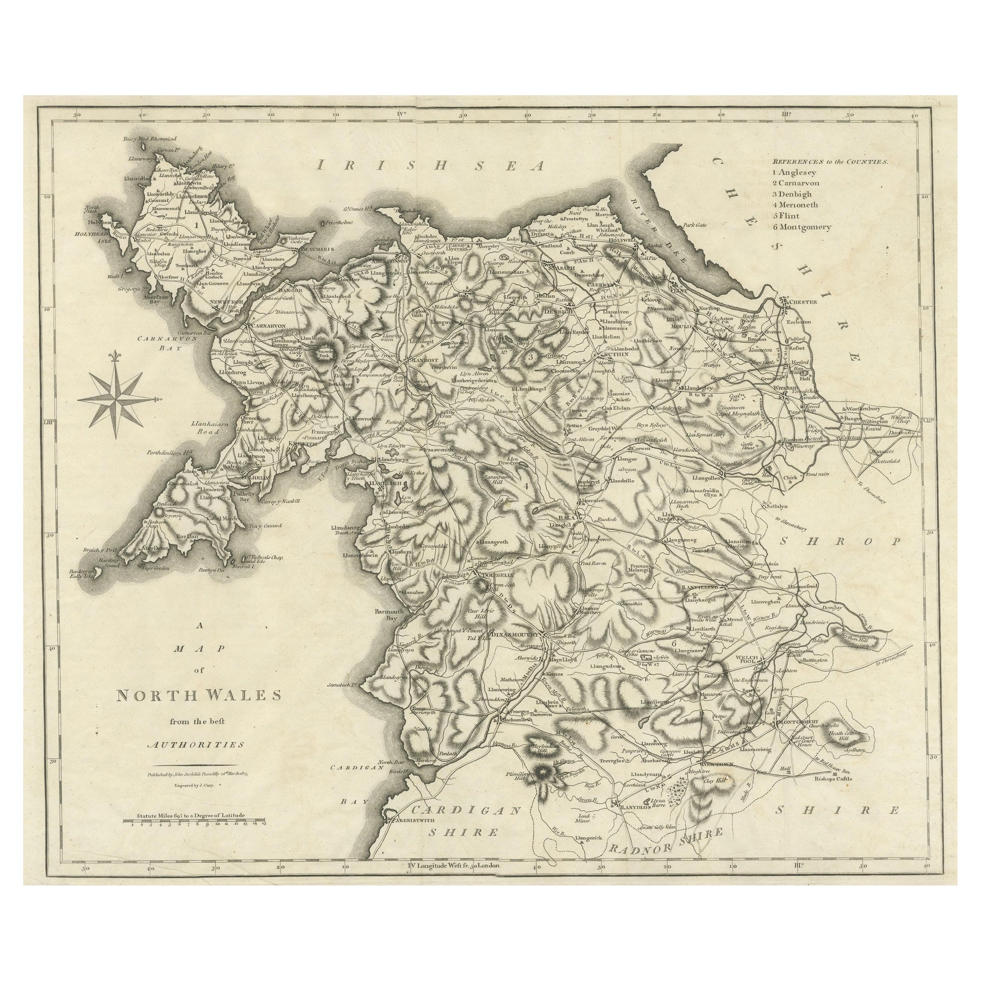
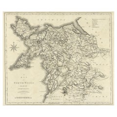
Große antike Grafschaftskarte von Nordwales, England
Antike Karte mit dem Titel 'A Map of North Wales from the best Authorities'. Original alte Grafschaftskarte von Nordwales, England. Gestochen von John Cary's. Stammt aus dem "New Bri...
Kategorie
Antik, Frühes 19. Jahrhundert, Landkarten
Materialien
Papier
167 $ Angebotspreis
20 % Rabatt
Bunte, detaillierte, antike Karte von England und Wales, 1882
Entdecken Sie die historische Pracht von England und Wales" mit dieser antiken Karte! Als Teil einer bedeutenden Sammlung bietet diese Karte einen fesselnden Blick auf die bezaubernd...
Kategorie
Antik, 1880er, Landkarten
Materialien
Papier
158 $ Angebotspreis
20 % Rabatt
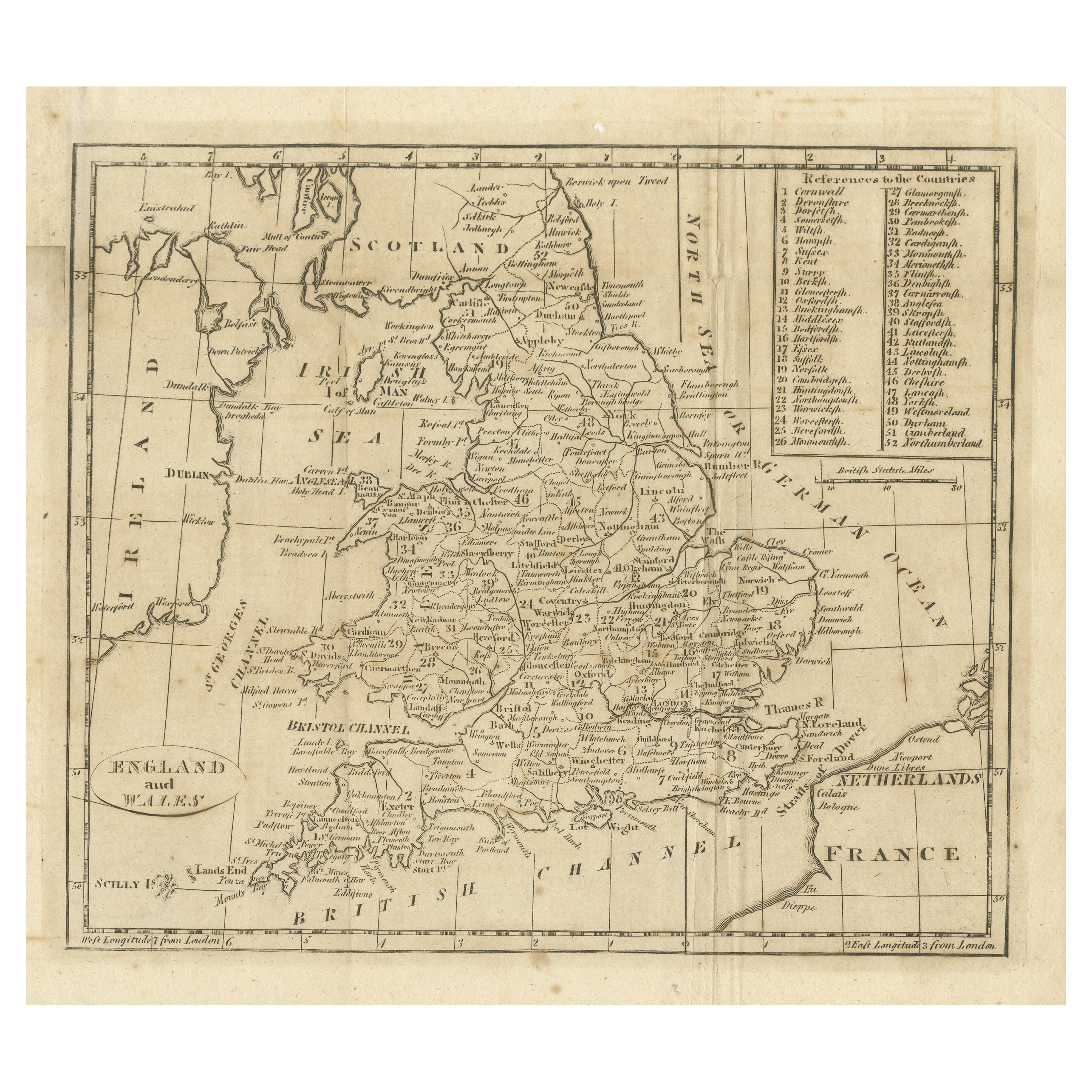
Antike Karte von England und Wales, mit Referenzen zu den Grafschaften
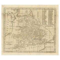
Antike Karte mit dem Titel 'England und Wales'. Originale antike Karte von England und Wales, mit Hinweisen auf die Grafschaften. Quelle unbekannt, muss noch ermittelt werden. Veröff...
Kategorie
Antik, Frühes 19. Jahrhundert, Landkarten
Materialien
Papier
130 $ Angebotspreis
20 % Rabatt
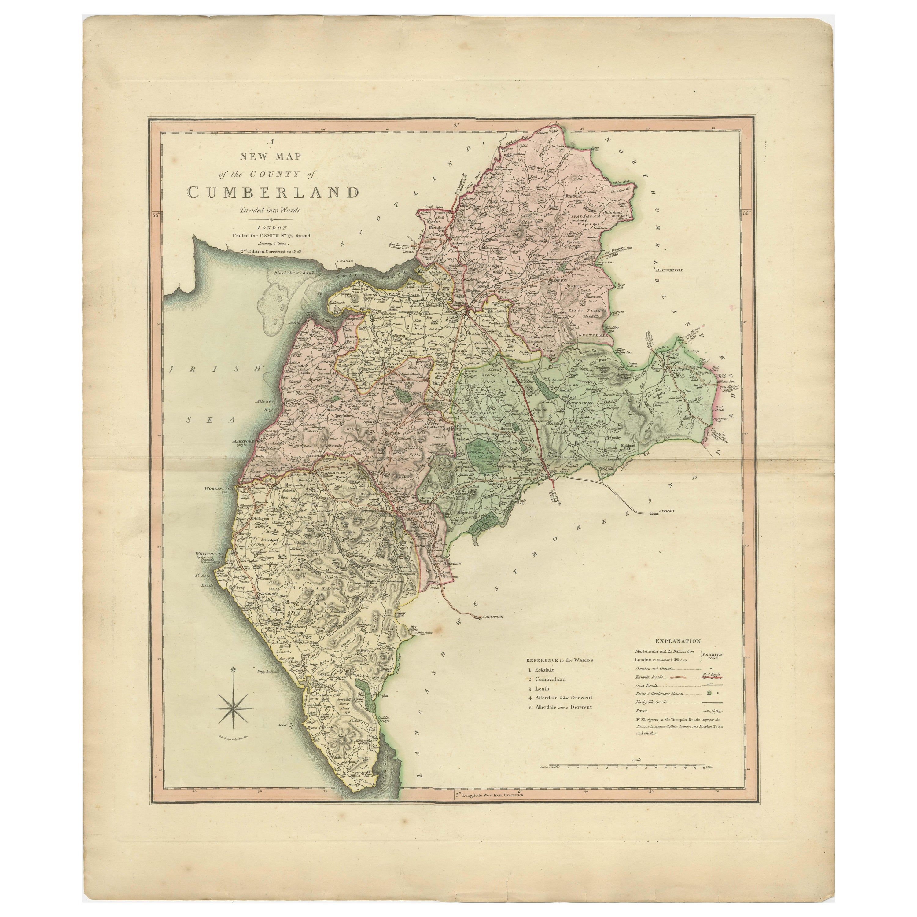
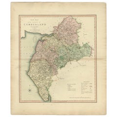
Antike dekorative und detaillierte Grafschaftskarte von Cumberland, England, 1804
Antike Grafschaftskarte von Cumberland, erstmals veröffentlicht um 1800. Zu den abgebildeten Dörfern, Städten und Gemeinden gehören Carlisle, Penrith, Copeland Forest und Wigton.
...
Kategorie
Antik, Anfang 1800, Landkarten
Materialien
Papier
302 $ Angebotspreis
20 % Rabatt
Das könnte Ihnen auch gefallen
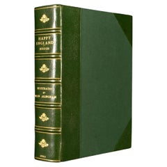
1903 Glückliches England
Von Helen Allingham
Ein wunderschönes, signiertes Werk in limitierter Auflage, das Helen Allinghams Aquarellbilder von England zeigt.
Die Deluxe-Ausgabe. Limitiert auf 750 Exemplare, dies ist die Numme...
Kategorie
Antik, Frühes 20. Jhdt., Britisch, Bücher
Materialien
Papier
1.309 $
Hampshire County, Großbritannien/England: 1607: Eine Karte von Camden's „Britannia“
Von John Norden
Eine frühe handkolorierte Karte der britischen Grafschaft Hampshire, veröffentlicht in der 1607 erschienenen Ausgabe von William Camdens großer historischer Beschreibung der britisch...
Kategorie
Antik, Anfang des 17. Jahrhunderts, Englisch, Landkarten
Materialien
Papier

Original Antike Karte des amerikanischen Staates Tennessee, 1903
Antique map of Tennessee
Published By A & C Black. 1903
Original colour
Good condition
Unframed.
Free shipping
Kategorie
Antik, Frühes 20. Jhdt., Englisch, Landkarten
Materialien
Papier

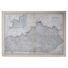
Original Antike Karte des amerikanischen Staates Kentucky, 1903
Antike Karte von Kentucky
Veröffentlicht von A & C Black. 1903
Original Farbe
Guter Zustand
Ungerahmt.
Kostenloser Versand
Kategorie
Antik, Frühes 20. Jhdt., Englisch, Landkarten
Materialien
Papier
Original Antike Karte des amerikanischen Staates Mississippi, 1903
Antike Landkarte von Mississippi
Veröffentlicht von A & C Black. 1903
Original Farbe
Guter Zustand
Ungerahmt.
Kostenloser Versand
Kategorie
Antik, Frühes 20. Jhdt., Englisch, Landkarten
Materialien
Papier

Originale antike Karte des amerikanischen Staates Massachusetts, 1903
Antique map of Vermont and New Hampshire
Published By A & C Black. 1903
Original colour
Good condition
Unframed.
Free shipping
Kategorie
Antik, Frühes 20. Jhdt., Englisch, Landkarten
Materialien
Papier
