Objekte ähnlich wie Antique Map of Palestine or The Holy Land, 1903, with Biblical Details

Möchten Sie mehr Bilder oder Videos?
Zusätzliche Bilder oder Videos von dem*der Anbieter*in anfordern
1 von 10
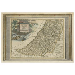
Antique Map of Palestine or The Holy Land, 1903, with Biblical Details
Angaben zum Objekt
Title: Antique Map of Palestine or The Holy Land, 1903, with Biblical and Geographical Details
Description:
This antique map, titled "Palestine or The Holy Land," was engraved and published in 1903 by W. & A.K. Johnston in Edinburgh and London. It offers a detailed and meticulously rendered depiction of the region known for its profound historical and spiritual significance to the three major Abrahamic religions.
The map shows the territories along the eastern coast of the Mediterranean Sea, extending from the ancient city of Sidon in the north to the Sinai Peninsula in the south. It is hand-colored in soft pastel shades to delineate boundaries and key landmarks, including major biblical sites, ancient cities, rivers, and mountain ranges. The Jordan River and Dead Sea are prominently featured, along with Jerusalem, Bethlehem, Nazareth, and other key locations that have shaped the historical narrative of the Holy Land.
Beyond its spiritual importance, this map also captures the geography and infrastructure of the early 20th century, reflecting the region’s position as a crossroads for trade, pilgrimage, and empire. The fine engraving and delicate typography reflect the cartographic precision and artistry of Johnston’s team.
For collectors, historians, and those interested in the rich tapestry of Middle Eastern history, this map is a rare and evocative piece. It not only illustrates the geography of an ancient land but also evokes the timeless cultural and spiritual resonance that has defined Palestine for millennia.
Condition report:
This map is in very good antique condition, with minor age-related foxing and gentle toning along the edges. The colors remain vivid and the paper is well-preserved, retaining the clarity and charm of the original engraving.
Framing tips:
A classic wooden frame in dark walnut or cherry will add warmth and sophistication to this piece. Use a cream or off-white matting to highlight the delicate pastel colors and intricate detailing, creating a timeless and elegant focal point for any home, study, or sacred space.
- Maße:Höhe: 47 cm (18,51 in)Breite: 36,8 cm (14,49 in)Tiefe: 0,2 mm (0,01 in)
- Materialien und Methoden:
- Zeitalter:
- Herstellungsjahr:1903
- Zustand:This map is in very good antique condition, with minor age-related foxing and gentle toning along the edges. The colors remain vivid and the paper is well-preserved, retaining the clarity and charm of the original engraving. Folding line as issued.
- Anbieterstandort:Langweer, NL
- Referenznummer:Anbieter*in: BG-13577-251stDibs: LU3054345262352
Anbieterinformationen
5,0
Anerkannte Anbieter*innen
Diese renommierten Anbieter*innen sind führend in der Branche und repräsentieren die höchste Klasse in Sachen Qualität und Design.
Gold-Anbieter*in
Premium-Anbieter*innen mit einer Bewertung über 4,3 und 24 Stunden Reaktionszeit
Gründungsjahr 2009
1stDibs-Anbieter*in seit 2017
2.452 Verkäufe auf 1stDibs
Typische Antwortzeit: <1 Stunde
- VersandAngebot wird abgerufen …Versand von: Langweer, Niederlande
- Rückgabebedingungen
Einige Inhalte dieser Seite wurden automatisch übersetzt. Daher kann 1stDibs nicht die Richtigkeit der Übersetzungen garantieren. Englisch ist die Standardsprache dieser Website.
Authentizitätsgarantie
Im unwahrscheinlichen Fall eines Problems mit der Echtheit eines Objekts kontaktieren Sie uns bitte innerhalb von 1 Jahr für eine volle Rückerstattung. DetailsGeld-Zurück-Garantie
Wenn Ihr Objekt nicht der Beschreibung entspricht, beim Transport beschädigt wurde oder nicht ankommt, kontaktieren Sie uns bitte innerhalb von 7 Tagen für eine vollständige Rückerstattung. DetailsStornierung innerhalb von 24 Stunden
Sie können Ihren Kauf jederzeit innerhalb von 24 Stunden stornieren, ohne jegliche Gründe dafür angeben zu müssen.Geprüfte Anbieter*innen
Unsere Anbieter*innen unterliegen strengen Dienstleistungs- und Qualitätsstandards, wodurch wir die Seriosität unserer Angebote gewährleisten können.Preisgarantie
Wenn Sie feststellen, dass ein*e Anbieter*in dasselbe Objekt anderswo zu einem niedrigeren Preis anbietet, werden wir den Preis entsprechend anpassen.Zuverlässige weltweite Lieferung
Unsere erstklassigen Versandunternehmen bieten spezielle Versandoptionen weltweit, einschließlich individueller Lieferung.Mehr von diesem*dieser Anbieter*in
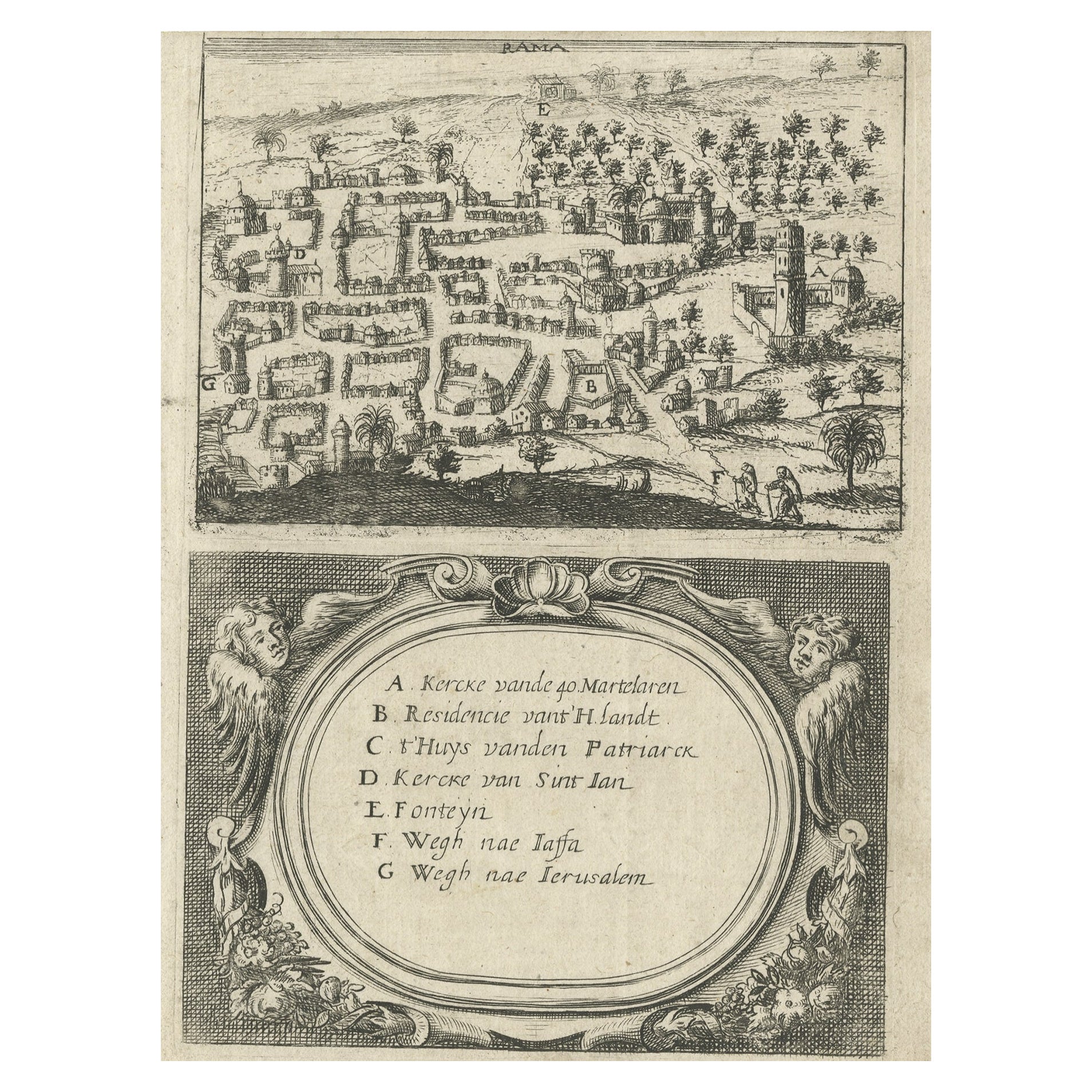
Alle anzeigenSeltene Karte von Rama oder Ramma „Ramallah“ in Palästina oder dem Heiligen Land, ca. 1730
Antike Karte mit dem Titel 'Rama'.
Diese Karte zeigt eine Ansicht von Ramma (Ramallah?) in Palästina oder dem Heiligen Land. Mit niederländischer Legende. Quelle unbekannt, muss ...
Kategorie
Antik, 1730er, Landkarten
Materialien
Papier
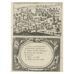
261 $ Angebotspreis
20 % Rabatt
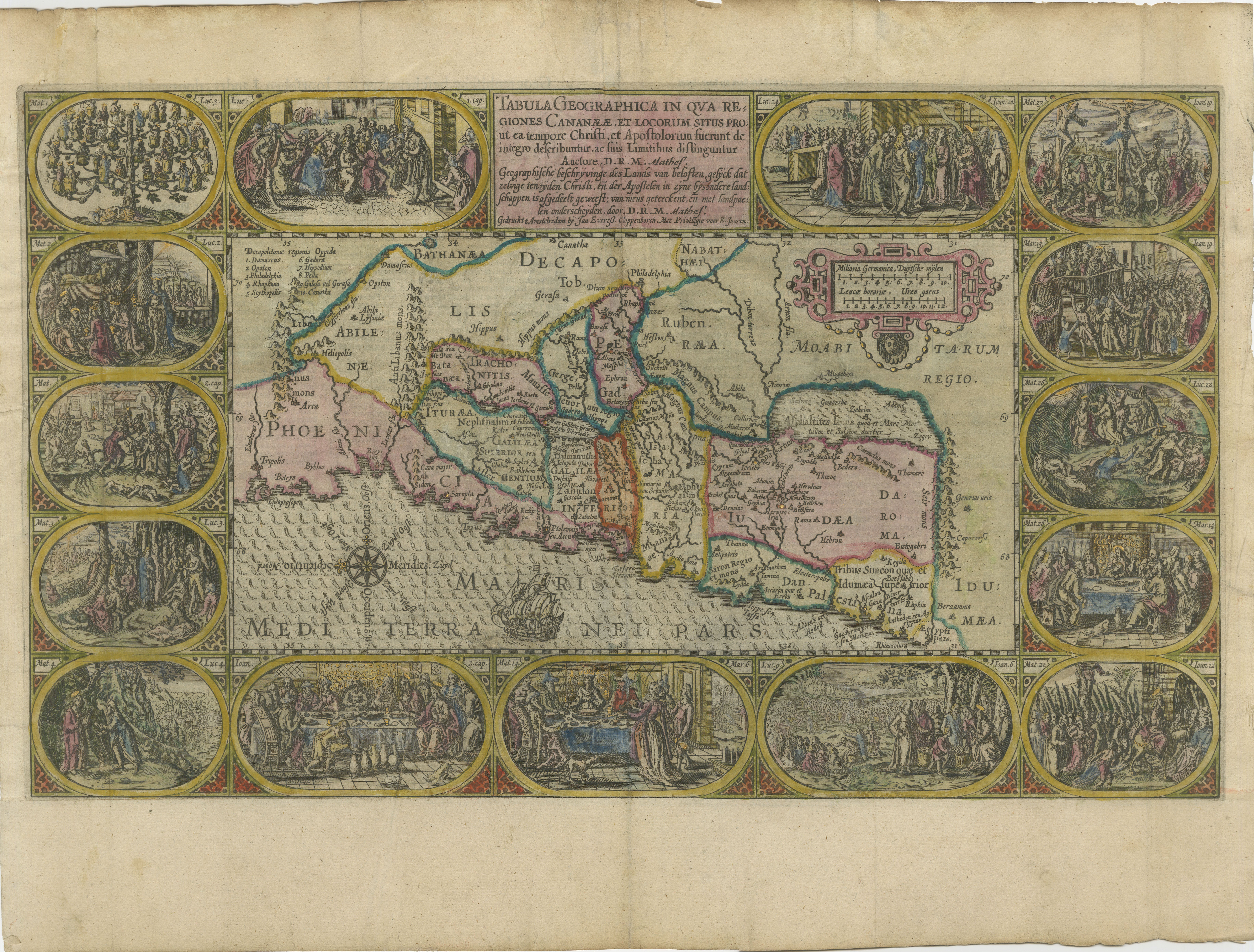
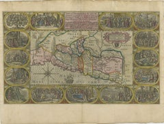
1625 Petrus Plancius / Cloppenburg Karte des Heiligen Landes mit biblischen Vignetten
1625 Petrus Plancius / Johannes Cloppenburg Karte des Heiligen Landes mit biblischen Vignetten
Diese exquisite Karte von Petrus Plancius und Johannes Cloppenburg aus dem Jahr 1625 ...
Kategorie
Antik, 1620er, Landkarten
Materialien
Papier
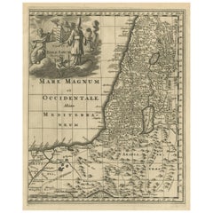
Antike Karte des Heiligen Landes, ca. 1717
Antike Karte Israel mit dem Titel 'Tabula Geographica Terrae Sanctae'. Seltene Ausgabe nach einer Karte des Heiligen Landes von J. Bonfrerius. Die Karte ist so ausgerichtet, dass Nor...
Kategorie
Antik, 18. Jahrhundert, Landkarten
Materialien
Papier

364 $ Angebotspreis
20 % Rabatt
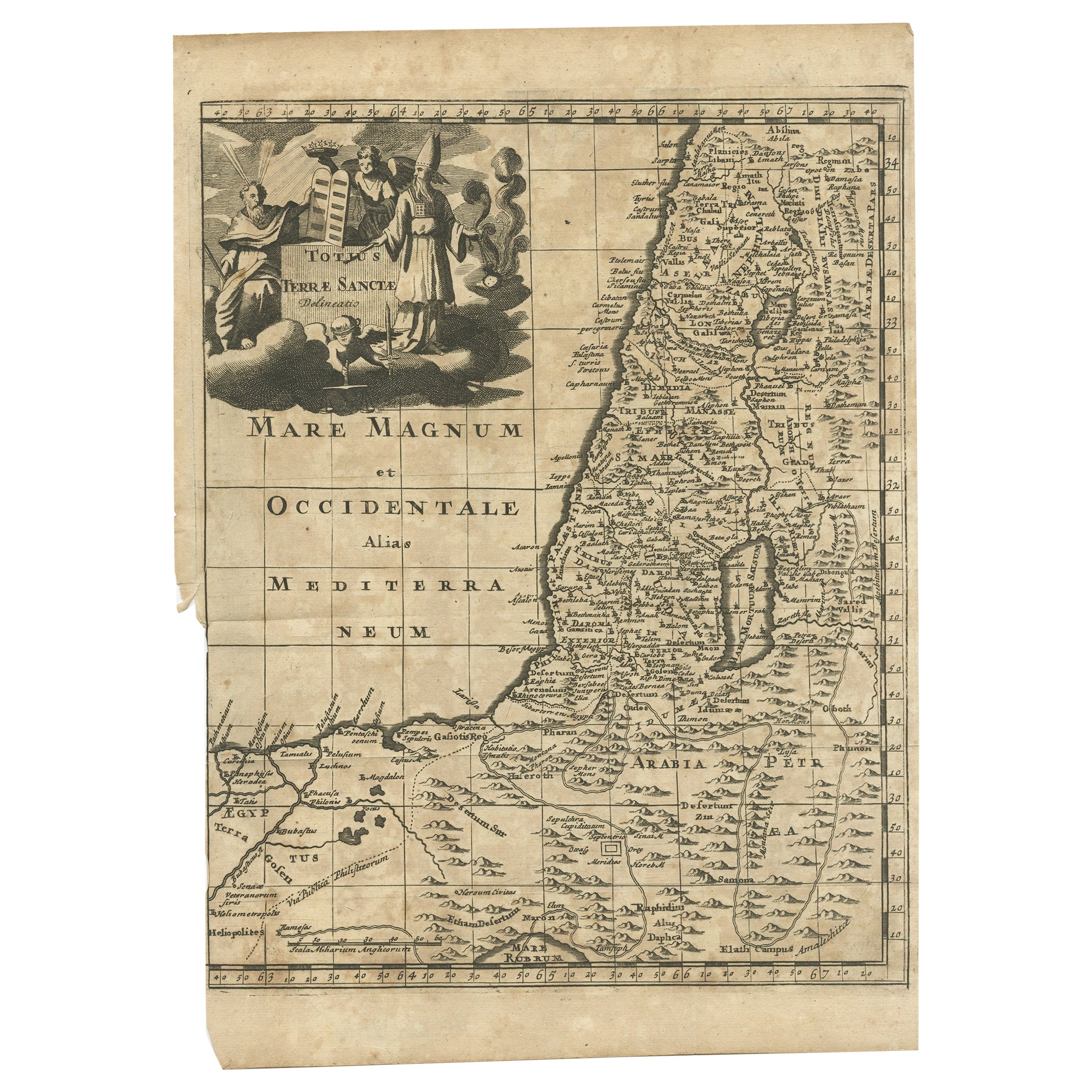
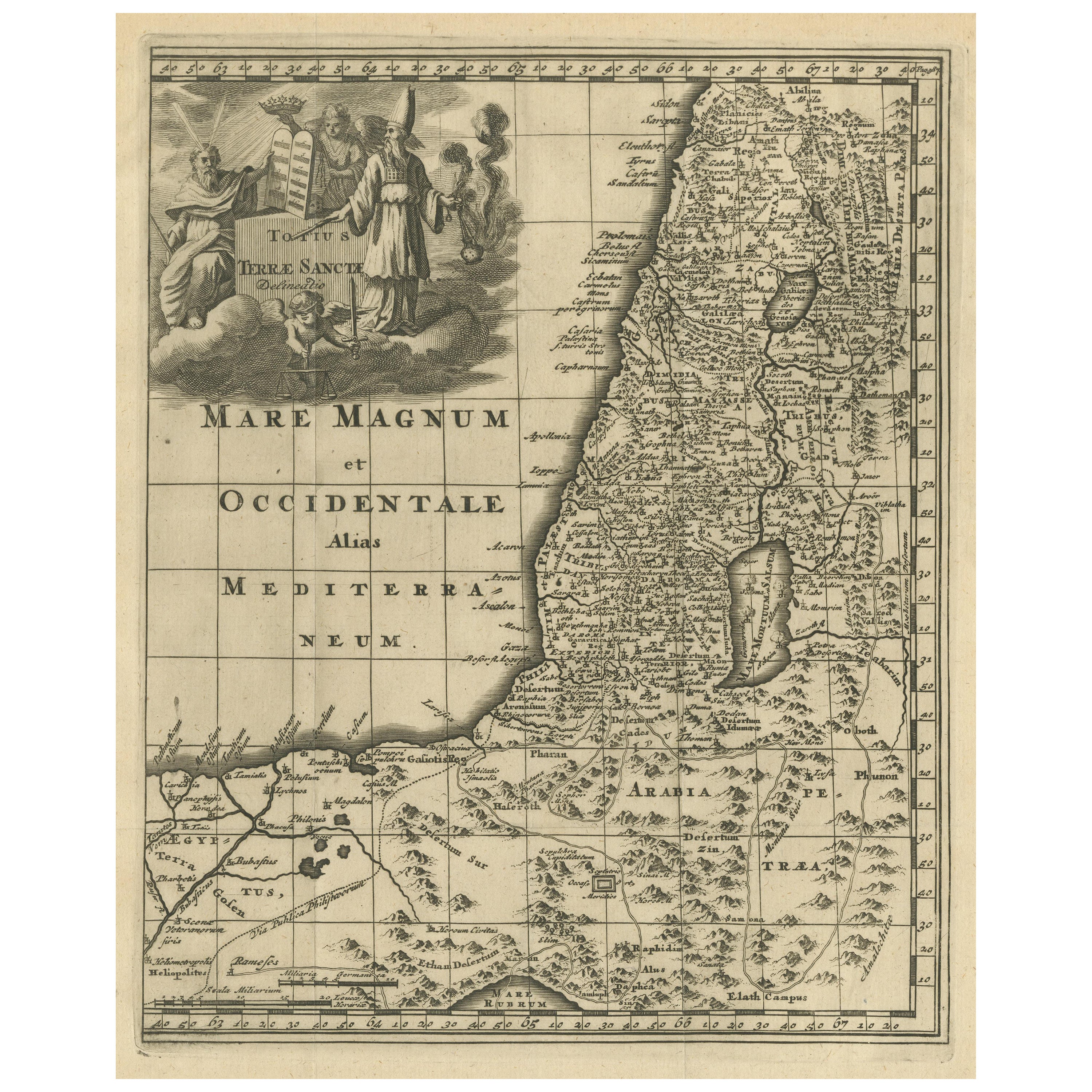
Antike Karte des Heiligen Landes, um 1710
Antike Karte mit dem Titel 'Totius Terrae Sanctae Delineatio'. Karte des Heiligen Landes, die bis nach Ägypten reicht und den Weg der Kinder Israels bei ihrem Auszug aus Ägypten in d...
Kategorie
Antik, 18. Jahrhundert, Landkarten
Materialien
Papier

112 $ Angebotspreis
20 % Rabatt
Originale antike Karte des Heiligen Landes mit dekorativer Kartusche
Antike Karte mit dem Titel 'Totius Terrae Sanctae'. Originale alte Karte des Heiligen Landes, mit einer großen dekorativen Kartusche. Der Begriff "Heiliges Land" bezieht sich gewöhnl...
Kategorie
Antik, Spätes 17. Jahrhundert, Landkarten
Materialien
Papier
364 $ Angebotspreis
20 % Rabatt
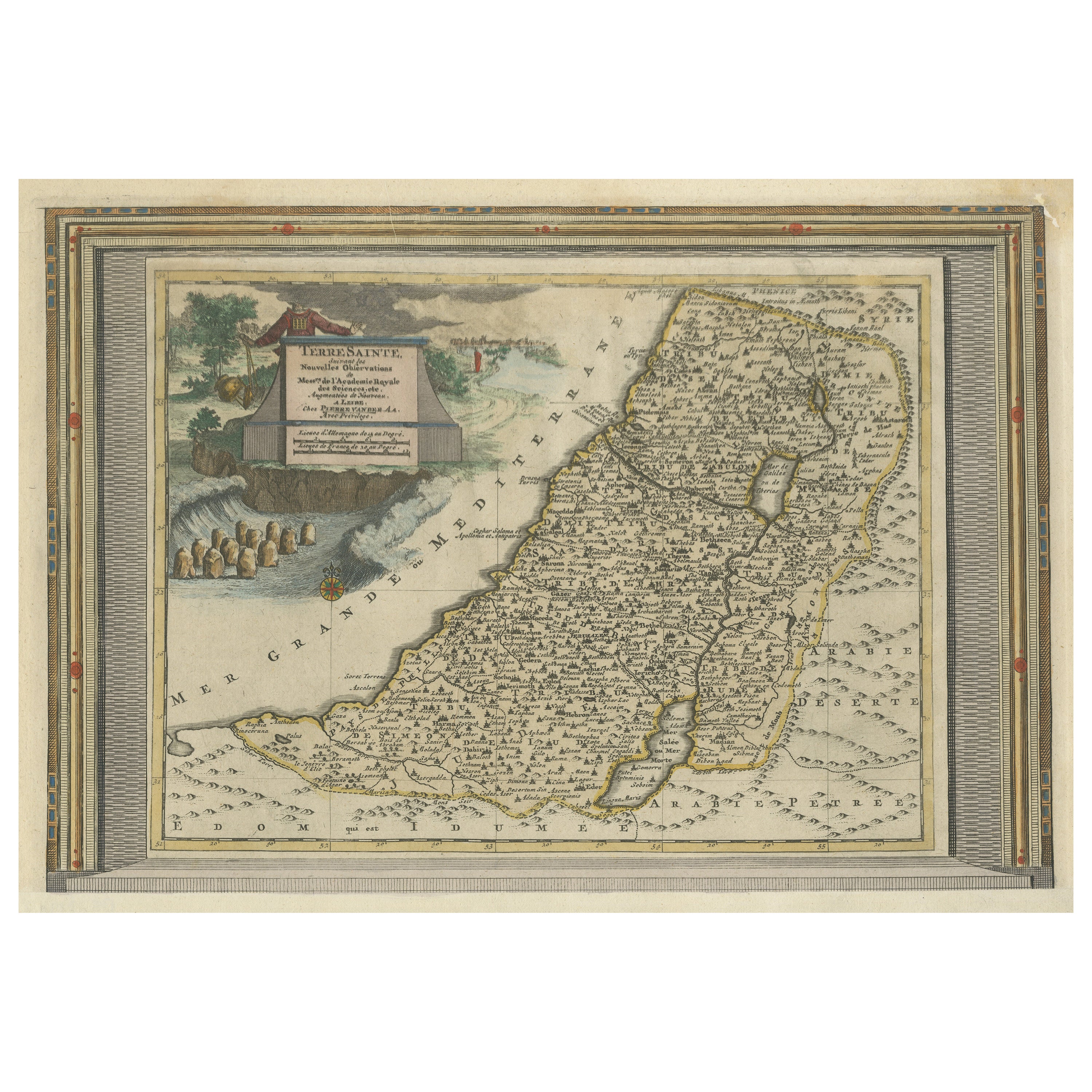
Antike Karte des Heiligen Landes mit Bilderrahmenbordüre
Antike Karte mit dem Titel 'Terre Sainte Suivant les Nouvelles Observations (..)'. Originale alte Karte des Heiligen Landes mit Bilderrahmenumrandung. Der Begriff "Heiliges Land" bez...
Kategorie
Antik, Frühes 18. Jahrhundert, Landkarten
Materialien
Papier
821 $ Angebotspreis
20 % Rabatt
Kostenloser Versand
Das könnte Ihnen auch gefallen
Das Heilige Land zu der Zeit Jesu: Eine niederländische Karte aus dem 17. Jahrhundert von Visscher
Von Nicolaes Visscher II
Diese detaillierte niederländische Karte mit dem Titel "Het Beloofe de Landt Canaan door wandelt van onsen Salichmaecker Iesu Christo, nessens syne Apostelen" von Nicolaes Visscher w...
Kategorie
Antik, Mitte 17. Jahrhundert, Niederländisch, Landkarten
Materialien
Papier

Original Antike Karte des amerikanischen Staates Minnesota, 1903
Antike Karte von Minnesota
Veröffentlicht von A & C Black. 1903
Original Farbe
Guter Zustand
Ungerahmt.
Kostenloser Versand
Kategorie
Antik, Frühes 20. Jhdt., Englisch, Landkarten
Materialien
Papier

Original Antike Karte des amerikanischen Staates Alabama, 1903
Antique map of Alabama
Published By A & C Black. 1903
Original colour
Good condition
Unframed.
Free shipping
Kategorie
Antik, Frühes 20. Jhdt., Englisch, Landkarten
Materialien
Papier

Original Antike Karte des amerikanischen Staates Alaska, 1903
Antike Karte von Alaska
Veröffentlicht von A & C Black. 1903
Original Farbe
Guter Zustand
Ungerahmt.
Kostenloser Versand
Kategorie
Antik, Frühes 20. Jhdt., Englisch, Landkarten
Materialien
Papier

Original Antike Karte des amerikanischen Staates Nebraska, 1903
Antike Karte von Nebraska
Veröffentlicht von A & C Black. 1903
Original Farbe
Guter Zustand
Ungerahmt.
Kostenloser Versand
Kategorie
Antik, Frühes 20. Jhdt., Englisch, Landkarten
Materialien
Papier

Antike Karte des amerikanischen Staates Washington, 1903
Antike Karte von Washington
Veröffentlicht von A & C Black. 1903
Original Farbe
Guter Zustand
Ungerahmt.
Kostenloser Versand
Kategorie
Antik, Frühes 20. Jhdt., Englisch, Landkarten
Materialien
Papier
