Objekte ähnlich wie Antique Map of Southern India and South Eastern Provinces, 1903

Möchten Sie mehr Bilder oder Videos?
Zusätzliche Bilder oder Videos von dem*der Anbieter*in anfordern
1 von 10
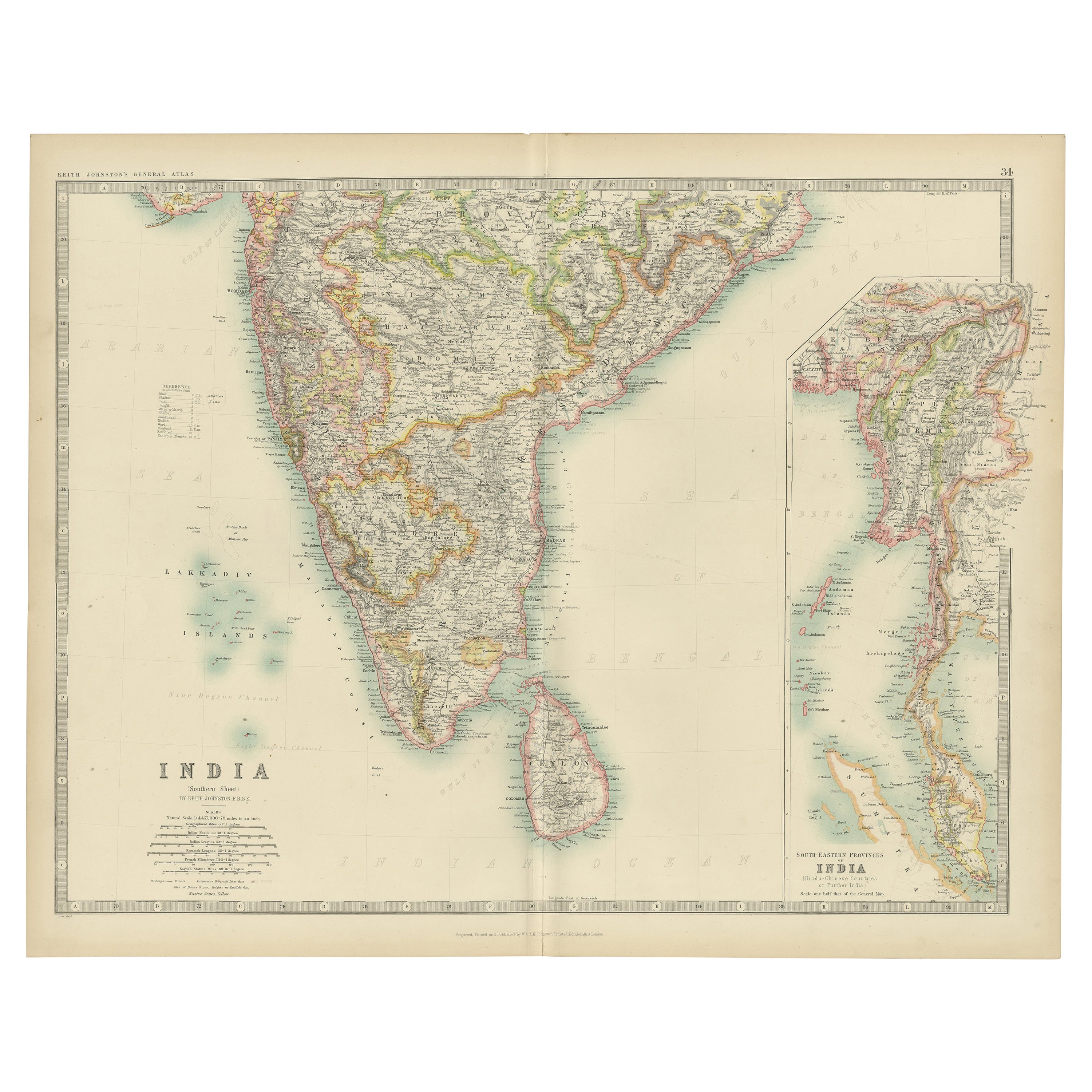
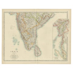
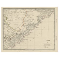
Antique Map of Southern India and South Eastern Provinces, 1903
Angaben zum Objekt
Title: Antique Map of Southern India and South Eastern Provinces, 1903, with Intricate Detail
Description:
This antique map, titled "India (Southern Sheet) and the South Eastern Provinces," was engraved and published in 1903 by W. & A.K. Johnston in Edinburgh and London. It provides a beautiful and detailed depiction of the southern part of the Indian subcontinent and the southeastern provinces of what is now Myanmar (Burma).
The map is delicately colored in soft pastel shades to highlight provincial and regional boundaries, illustrating the rich geographical and cultural diversity of the region. Major cities, rivers, mountain ranges, and coastal features are marked with precision, reflecting the cartographic skill and artistry of Johnston’s team. The inset map of the South Eastern Provinces provides a closer look at the territories of Burma and its relationship to the Indian subcontinent.
This map captures the dynamic interplay between ancient cultures and British colonial influence at the turn of the 20th century, offering a fascinating window into an era of significant political and social change. The careful engraving and elegant typography make this map not just a historical document, but also a work of art that celebrates the beauty and complexity of southern Asia.
For collectors, historians, and lovers of Indian history and culture, this map is a testament to a time of exploration, trade, and cultural exchange, showcasing the enduring legacy of these lands at the crossroads of empires.
Condition report:
This map is in very good antique condition, with minor age-related foxing and gentle toning along the edges. The colors remain vibrant and the paper is stable and well-preserved.
Framing tips:
A classic wooden frame in walnut or cherry will enhance the warm pastel tones and intricate detailing of the map. Use a cream or off-white matting to highlight the refined linework and create a sophisticated, timeless focal point for any home, study, or library.
- Maße:Höhe: 36,8 cm (14,49 in)Breite: 47 cm (18,51 in)Tiefe: 0,2 mm (0,01 in)
- Materialien und Methoden:
- Zeitalter:
- Herstellungsjahr:1903
- Zustand:This map is in very good antique condition, with minor age-related foxing and gentle toning along the edges. The colors remain vibrant and the paper is stable and well-preserved. Folding line as issued.
- Anbieterstandort:Langweer, NL
- Referenznummer:Anbieter*in: BG-13577-291stDibs: LU3054345262582
Anbieterinformationen
5,0
Anerkannte Anbieter*innen
Diese renommierten Anbieter*innen sind führend in der Branche und repräsentieren die höchste Klasse in Sachen Qualität und Design.
Gold-Anbieter*in
Premium-Anbieter*innen mit einer Bewertung über 4,3 und 24 Stunden Reaktionszeit
Gründungsjahr 2009
1stDibs-Anbieter*in seit 2017
2.462 Verkäufe auf 1stDibs
Typische Antwortzeit: <1 Stunde
- VersandAngebot wird abgerufen …Versand von: Langweer, Niederlande
- Rückgabebedingungen
Einige Inhalte dieser Seite wurden automatisch übersetzt. Daher kann 1stDibs nicht die Richtigkeit der Übersetzungen garantieren. Englisch ist die Standardsprache dieser Website.
Authentizitätsgarantie
Im unwahrscheinlichen Fall eines Problems mit der Echtheit eines Objekts kontaktieren Sie uns bitte innerhalb von 1 Jahr für eine volle Rückerstattung. DetailsGeld-Zurück-Garantie
Wenn Ihr Objekt nicht der Beschreibung entspricht, beim Transport beschädigt wurde oder nicht ankommt, kontaktieren Sie uns bitte innerhalb von 7 Tagen für eine vollständige Rückerstattung. DetailsStornierung innerhalb von 24 Stunden
Sie können Ihren Kauf jederzeit innerhalb von 24 Stunden stornieren, ohne jegliche Gründe dafür angeben zu müssen.Geprüfte Anbieter*innen
Unsere Anbieter*innen unterliegen strengen Dienstleistungs- und Qualitätsstandards, wodurch wir die Seriosität unserer Angebote gewährleisten können.Preisgarantie
Wenn Sie feststellen, dass ein*e Anbieter*in dasselbe Objekt anderswo zu einem niedrigeren Preis anbietet, werden wir den Preis entsprechend anpassen.Zuverlässige weltweite Lieferung
Unsere erstklassigen Versandunternehmen bieten spezielle Versandoptionen weltweit, einschließlich individueller Lieferung.Mehr von diesem*dieser Anbieter*in
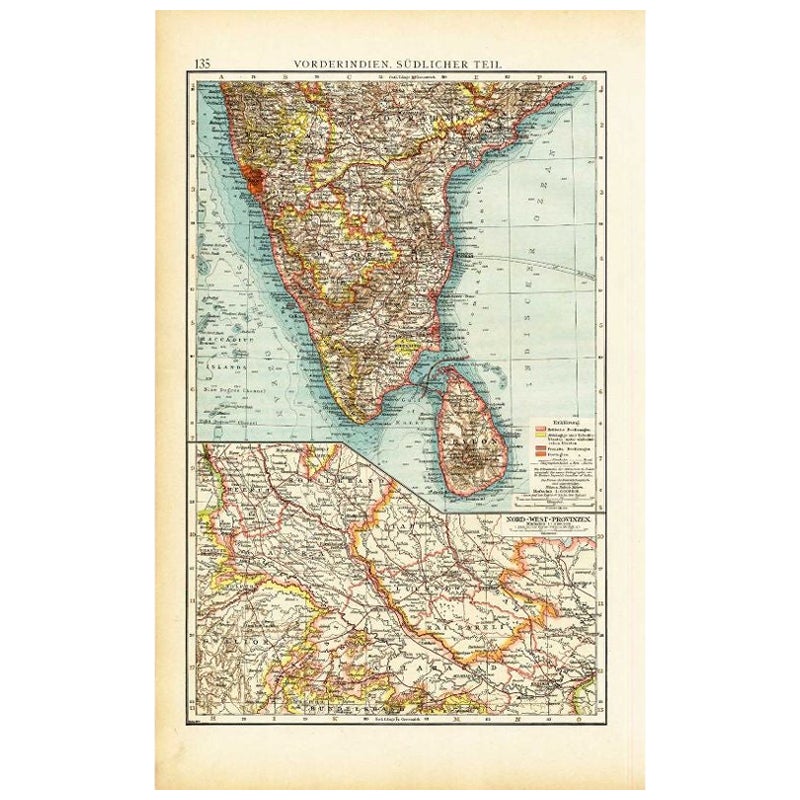
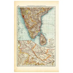
Alle anzeigenAntike Karte von Südindien von Andree, 1904
"Antike Karte mit dem Titel 'Vorderindien, sudlicher Teil'. Karte von Indien, südlicher Teil. Diese Karte stammt aus "Andrees Allgemeiner Handatlas in 126 Haupt- und 139 Nebenkarten"...
Kategorie
20. Jahrhundert, Landkarten
Materialien
Papier
67 $ Angebotspreis
20 % Rabatt
Antike Karte von Indien ( Südindien) von Johnston (1909)
Antike Karte mit dem Titel 'Indien'. Original antike Karte von Indien Südliches Blatt. Mit beigefügten Karten der südöstlichen Provinzen Indiens. D...
Kategorie
Frühes 20. Jahrhundert, Landkarten
Materialien
Papier
232 $ Angebotspreis
20 % Rabatt
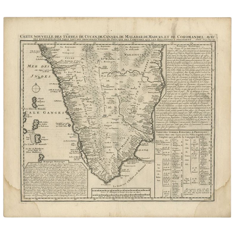
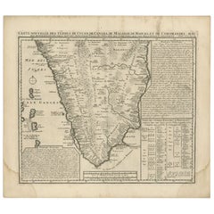
Antike Karte von Südindien von Chatelain, um 1720
"Antike Karte mit dem Titel 'Carte Nouvelle des Terres de Cucan, de Canara, de Malabar, de Madura, et de Coromandel'. Karte des südlichen Teils Indiens, die aus Chatelains "Atlas His...
Kategorie
Antik, 18. Jahrhundert, Landkarten
Materialien
Papier
288 $ Angebotspreis
20 % Rabatt
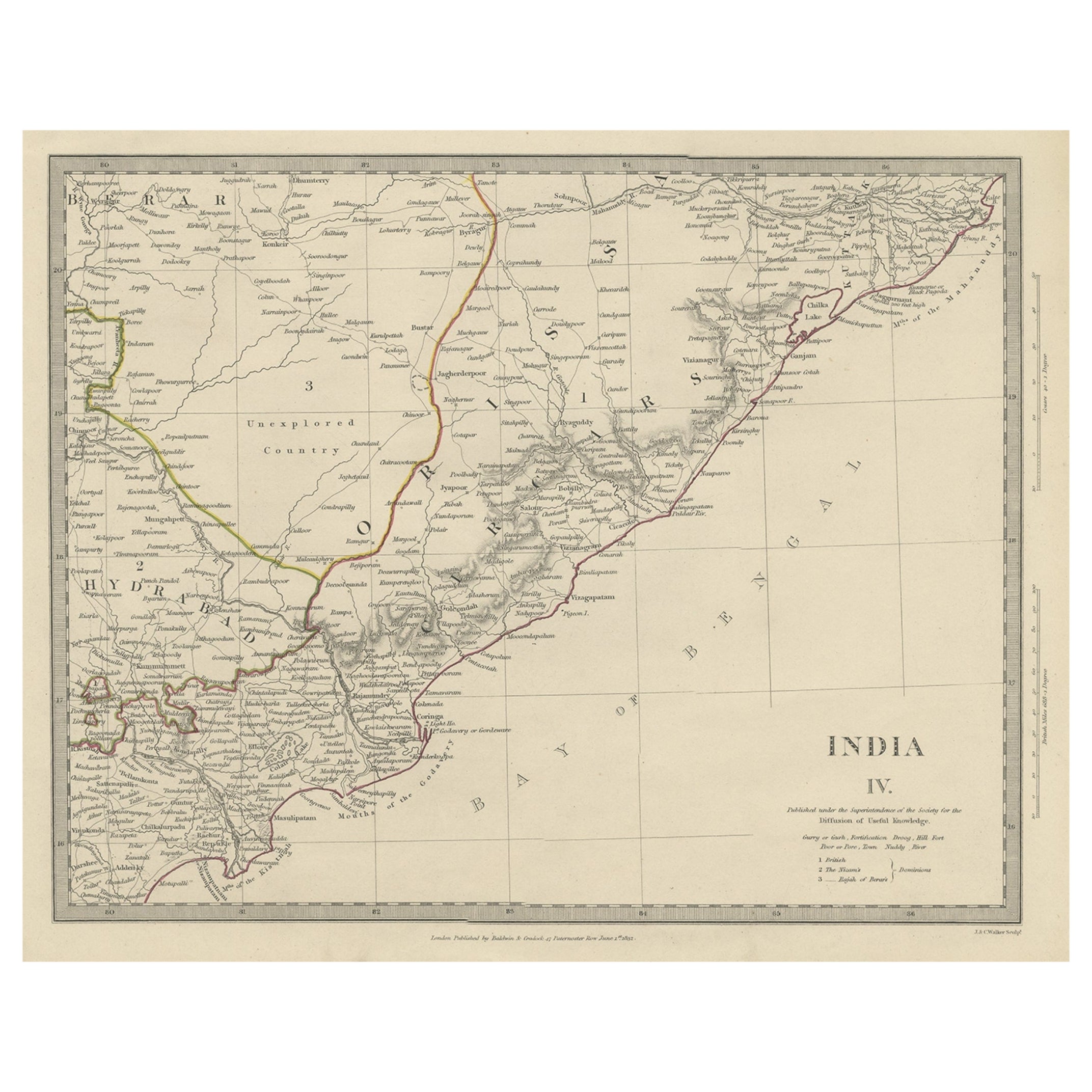
Interessante, detaillierte, antike Karte von Ostindien, 1832
Antike Karte mit dem Titel 'Indien IV'. Alte Stahlstichkarte des östlichen Teils von Indien, einschließlich des Golfs von Bengalen, Hydrabad und Masulipatam.
Artisten und Graveure...
Kategorie
Antik, 19. Jahrhundert, Landkarten
Materialien
Papier
269 $ Angebotspreis
20 % Rabatt
Antique Map of Southern Scotland, 1903, with Coastal and Inland Details
Title: Antique Map of Southern Scotland, 1903, with Coastal and Inland Details
Description:
This exquisite antique map, titled "Scotland (Southern Sheet I)," was engraved and publis...
Kategorie
Frühes 20. Jahrhundert, Landkarten
Materialien
Papier

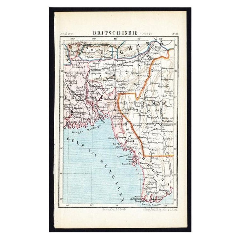
Antike Karte von Ostindien von Kuyper, um 1880
Tafel 55 : 'Britsch-Indie, Oost.' (Britisch-Indien, Osten). Diese lithographierte Karte stammt aus: 'Wereld-atlas voor Kantoor en Huiskamer' (übersetzt: Weltatlas für das Büro und da...
Kategorie
Antik, 19. Jahrhundert, Landkarten
Materialien
Papier
Das könnte Ihnen auch gefallen
Original Antike Karte des amerikanischen Staates Michigan ( Südteil ), 1903
Antike Karte von Michigan (südlicher Teil)
Veröffentlicht von A & C Black. 1903
Original Farbe
Guter Zustand
Ungerahmt.
Kostenloser Versand
Kategorie
Antik, Frühes 20. Jhdt., Englisch, Landkarten
Materialien
Papier

Original Antike Karte des amerikanischen Staates Ohio ( Südteil ), 1903
Antike Karte von Ohio (südlicher Teil)
Veröffentlicht von A & C Black. 1903
Original Farbe
Guter Zustand
Ungerahmt.
Kostenloser Versand
Kategorie
Antik, Frühes 20. Jhdt., Englisch, Landkarten
Materialien
Papier

Original Antike Karte des amerikanischen Staates Kalifornien (Teil Südkaliforniens), 1903
Antike Karte von Kalifornien (südlicher Teil)
Veröffentlicht von A & C Black. 1903
Original Farbe
Guter Zustand
Ungerahmt.
Kostenloser Versand
Kategorie
Antik, Frühes 20. Jhdt., Englisch, Landkarten
Materialien
Papier

49 $
Kostenloser Versand
Original Antike Karte des amerikanischen Staates Illinois ( Südteil ), 1903
Antike Karte von Illinois (südlicher Teil)
Veröffentlicht von A & C Black. 1903
Original Farbe
Guter Zustand
Ungerahmt.
Kostenloser Versand
Kategorie
Antik, Frühes 20. Jhdt., Englisch, Landkarten
Materialien
Papier

Original Antike Karte des amerikanischen Staates Missouri (Teil Südamerikas), 1903
Antike Landkarte von Missouri ( Südlicher Teil )
Veröffentlicht von A & C Black. 1903
Original Farbe
Guter Zustand
Ungerahmt.
Kostenloser Versand
Kategorie
Antik, Frühes 20. Jhdt., Englisch, Landkarten
Materialien
Papier

49 $
Kostenloser Versand
Original Antike Karte des amerikanischen Staates Pennsylvania ( östlicher Teil), 1903
Antique map of Pennsylvania ( Eastern part )
Published By A & C Black. 1903
Original colour
Good condition
Unframed.
Free shipping
Kategorie
Antik, Frühes 20. Jhdt., Englisch, Landkarten
Materialien
Papier

49 $
Kostenloser Versand