Objekte ähnlich wie Antique Map of Spain and Portugal, 1903, Regional Boundaries and Coastal Detail


Möchten Sie mehr Bilder oder Videos?
Zusätzliche Bilder oder Videos von dem*der Anbieter*in anfordern
1 von 9
Antique Map of Spain and Portugal, 1903, Regional Boundaries and Coastal Detail
Angaben zum Objekt
Antique Map of Spain and Portugal, 1903, Featuring Regional Boundaries and Coastal Detail
Description: This antique map, titled "Spain & Portugal," was engraved and published in 1903 by W. & A.K. Johnston in Edinburgh and London. It offers a finely detailed and colorful representation of the Iberian Peninsula during the early 20th century, capturing the rich geography and political divisions of Spain and Portugal.
The map is meticulously engraved, with distinct pastel shades of green, yellow, pink, and blue highlighting the various provinces and administrative regions. From the rugged coastlines of Galicia and the Bay of Biscay to the sun-drenched shores of Andalusia and the Mediterranean, this map’s detail and artistry bring the entire Iberian Peninsula to life. Major cities like Madrid, Lisbon, Barcelona, and Seville are all clearly marked, alongside an intricate network of railways and roads that exemplify the region’s connectivity during this period of growth and modernization.
Of special note are the Balearic Islands—Mallorca, Menorca, and Ibiza—shown in crisp detail off the eastern coast of Spain, adding further maritime interest to this beautiful piece. The map’s precise linework, delicate typography, and refined color palette reflect the exceptional skill of the Johnston cartographic team.
For collectors, historians, and those with a passion for Spanish and Portuguese heritage, this map offers a captivating glimpse into the past, encapsulating the cultural richness and natural beauty of the Iberian Peninsula at a time of significant political and social evolution.
Condition report:
The map is in very good antique condition, with slight age-related toning and minor foxing typical for a piece of this age. The colors remain vibrant and the paper is stable and well-preserved.
Framing tips:
Choose a classic wooden frame in walnut or mahogany to enhance the warm pastel tones and complement the intricate detail. A cream or off-white matting will further highlight the soft coloring and elegant craftsmanship, making this map a refined and timeless centerpiece in any space.
- Maße:Höhe: 36,8 cm (14,49 in)Breite: 48 cm (18,9 in)Tiefe: 0,2 mm (0,01 in)
- Materialien und Methoden:
- Zeitalter:
- Herstellungsjahr:1903
- Zustand:The map is in very good antique condition, with minor age-related foxing and slight edge toning typical for its vintage. The colors remain vibrant and the paper is stable and well-preserved. Folding line as issued.
- Anbieterstandort:Langweer, NL
- Referenznummer:Anbieter*in: BG-13577-101stDibs: LU3054345241592
Anbieterinformationen
5,0
Anerkannte Anbieter*innen
Diese renommierten Anbieter*innen sind führend in der Branche und repräsentieren die höchste Klasse in Sachen Qualität und Design.
Gold-Anbieter*in
Premium-Anbieter*innen mit einer Bewertung über 4,3 und 24 Stunden Reaktionszeit
Gründungsjahr 2009
1stDibs-Anbieter*in seit 2017
2.462 Verkäufe auf 1stDibs
Typische Antwortzeit: <1 Stunde
- VersandAngebot wird abgerufen …Versand von: Langweer, Niederlande
- Rückgabebedingungen
Einige Inhalte dieser Seite wurden automatisch übersetzt. Daher kann 1stDibs nicht die Richtigkeit der Übersetzungen garantieren. Englisch ist die Standardsprache dieser Website.
Authentizitätsgarantie
Im unwahrscheinlichen Fall eines Problems mit der Echtheit eines Objekts kontaktieren Sie uns bitte innerhalb von 1 Jahr für eine volle Rückerstattung. DetailsGeld-Zurück-Garantie
Wenn Ihr Objekt nicht der Beschreibung entspricht, beim Transport beschädigt wurde oder nicht ankommt, kontaktieren Sie uns bitte innerhalb von 7 Tagen für eine vollständige Rückerstattung. DetailsStornierung innerhalb von 24 Stunden
Sie können Ihren Kauf jederzeit innerhalb von 24 Stunden stornieren, ohne jegliche Gründe dafür angeben zu müssen.Geprüfte Anbieter*innen
Unsere Anbieter*innen unterliegen strengen Dienstleistungs- und Qualitätsstandards, wodurch wir die Seriosität unserer Angebote gewährleisten können.Preisgarantie
Wenn Sie feststellen, dass ein*e Anbieter*in dasselbe Objekt anderswo zu einem niedrigeren Preis anbietet, werden wir den Preis entsprechend anpassen.Zuverlässige weltweite Lieferung
Unsere erstklassigen Versandunternehmen bieten spezielle Versandoptionen weltweit, einschließlich individueller Lieferung.Mehr von diesem*dieser Anbieter*in
Alle anzeigenAntique Map of Ireland, 1903, with Intricate County Boundaries & Coastal Details
Title: Antique Map of Ireland, 1903, with Intricate County Boundaries and Coastal Detail
Description:
This antique map of Ireland, engraved and published in 1903 by the esteemed W. ...
Kategorie
Frühes 20. Jahrhundert, Landkarten
Materialien
Papier

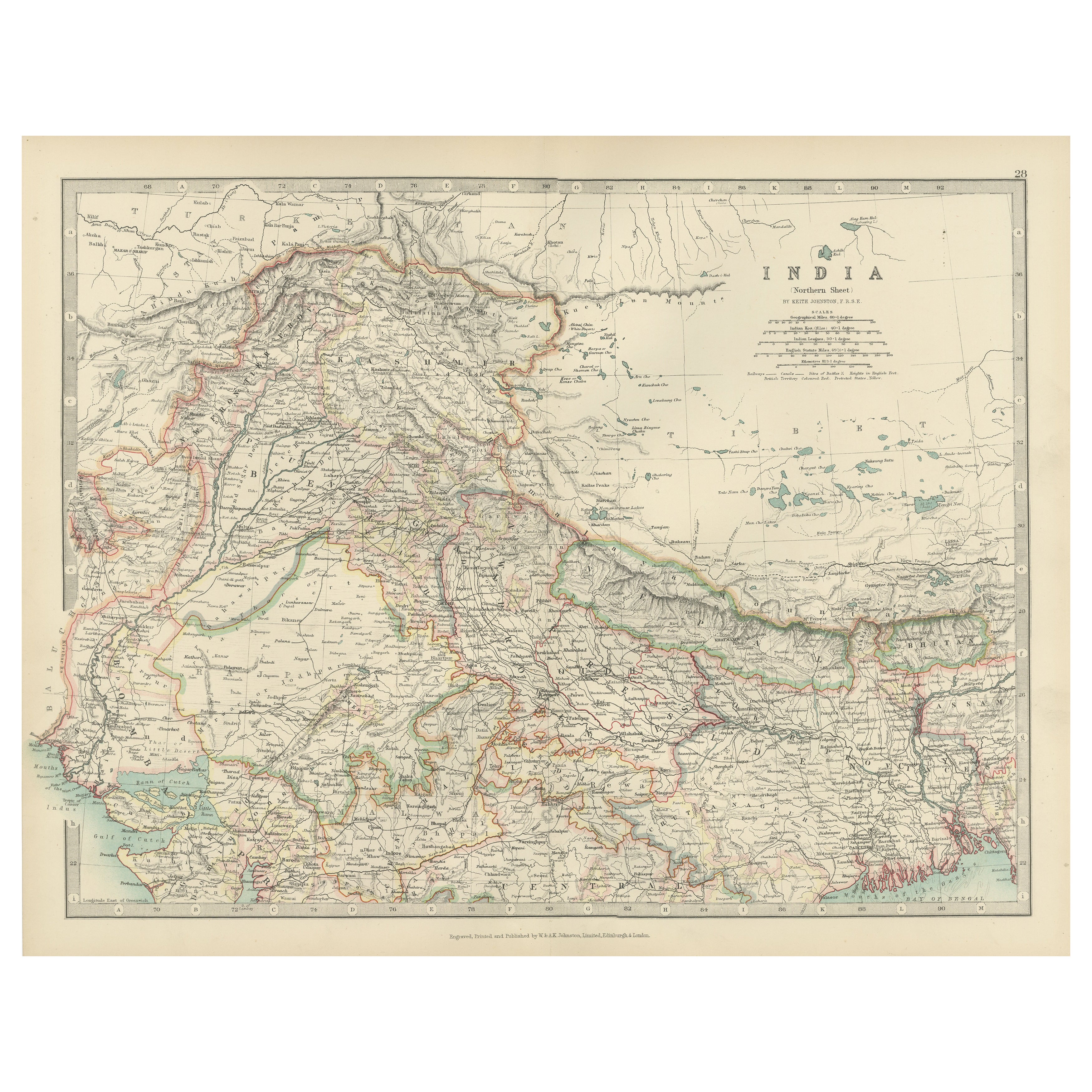
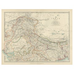
Antique Map of Northern India, Featuring Boundaries & Himalayan Detail, 1903
Antique Map of Northern India, 1903, Featuring Provincial Boundaries and Himalayan Detail
This antique map, titled "India (Northern Sheet)," was engraved and published in 1903 by W....
Kategorie
Frühes 20. Jahrhundert, Landkarten
Materialien
Papier
Antique Map of Europe, 1903, with Intricate Political Boundaries and Rich Detail
Title: Antique Map of Europe, 1903, with Intricate Political Boundaries and Rich Detail
Description:
This antique map, titled "Europe," is a finely engraved and beautifully colored ...
Kategorie
Frühes 20. Jahrhundert, Landkarten
Materialien
Papier

Antique Map of Southern Scotland, 1903, with Coastal and Inland Details
Title: Antique Map of Southern Scotland, 1903, with Coastal and Inland Details
Description:
This exquisite antique map, titled "Scotland (Southern Sheet I)," was engraved and publis...
Kategorie
Frühes 20. Jahrhundert, Landkarten
Materialien
Papier

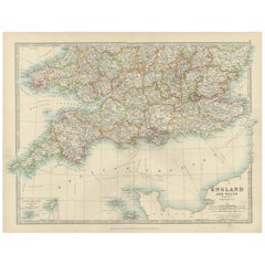
Antique Map of Southern England & Wales, 1903, with Coastal Details and Railways
Title: Antique Map of Southern England and Wales, 1903, with Coastal Details and Railways
Description:
This detailed antique map, titled "England and Wales (Southern Sheet I)," was ...
Kategorie
Frühes 20. Jahrhundert, Landkarten
Materialien
Papier
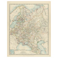
Antique Map of European Russia, 1903, with Colorful Provincial Boundaries
Title: Antique Map of European Russia, 1903, with Colorful Provincial Boundaries
Description:
This antique map, titled "European Russia," was engraved and published in 1903 by W. & ...
Kategorie
Frühes 20. Jahrhundert, Landkarten
Materialien
Papier
Das könnte Ihnen auch gefallen
Originale antike Karte von Spanien und Portugal, um 1790
Super-Karte von Spanien und Portugal
Kupferstich von A. Bell
Veröffentlicht, ca. 1790.
Ungerahmt.
Kategorie
Antik, 1790er, Englisch, Sonstiges, Landkarten
Materialien
Papier

Original Antike Karte des amerikanischen Staates Minnesota, 1903
Antike Karte von Minnesota
Veröffentlicht von A & C Black. 1903
Original Farbe
Guter Zustand
Ungerahmt.
Kostenloser Versand
Kategorie
Antik, Frühes 20. Jhdt., Englisch, Landkarten
Materialien
Papier

Original Antike Karte des amerikanischen Staates Alabama, 1903
Antique map of Alabama
Published By A & C Black. 1903
Original colour
Good condition
Unframed.
Free shipping
Kategorie
Antik, Frühes 20. Jhdt., Englisch, Landkarten
Materialien
Papier

Original Antike Karte des amerikanischen Staates Alaska, 1903
Antike Karte von Alaska
Veröffentlicht von A & C Black. 1903
Original Farbe
Guter Zustand
Ungerahmt.
Kostenloser Versand
Kategorie
Antik, Frühes 20. Jhdt., Englisch, Landkarten
Materialien
Papier

Original Antike Karte des amerikanischen Staates Nebraska, 1903
Antike Karte von Nebraska
Veröffentlicht von A & C Black. 1903
Original Farbe
Guter Zustand
Ungerahmt.
Kostenloser Versand
Kategorie
Antik, Frühes 20. Jhdt., Englisch, Landkarten
Materialien
Papier

Antike Karte des amerikanischen Staates Washington, 1903
Antike Karte von Washington
Veröffentlicht von A & C Black. 1903
Original Farbe
Guter Zustand
Ungerahmt.
Kostenloser Versand
Kategorie
Antik, Frühes 20. Jhdt., Englisch, Landkarten
Materialien
Papier
