Objekte ähnlich wie Antique World Map on Mercator's Projection, Ocean Currents and Trade Routes 1903

Möchten Sie mehr Bilder oder Videos?
Zusätzliche Bilder oder Videos von dem*der Anbieter*in anfordern
1 von 11
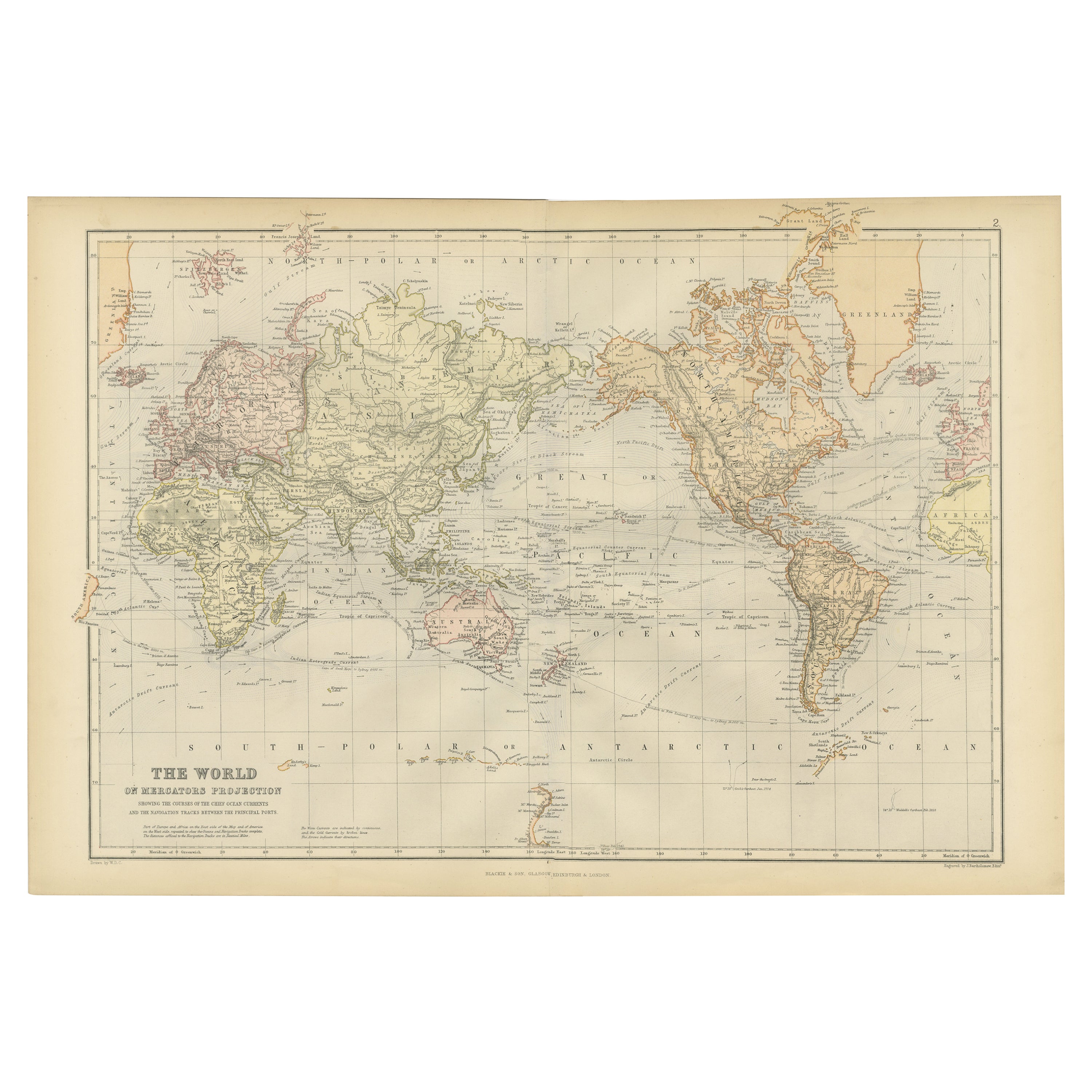
Antique World Map on Mercator's Projection, Ocean Currents and Trade Routes 1903
Angaben zum Objekt
Title: Antique World Map on Mercator's Projection, 1903, Showing Ocean Currents and Trade Routes
Description:
This antique map, titled "Chart of the World on Mercator's Projection," is an exceptional piece of cartographic history from the 1903 edition published by W. & A.K. Johnston in Edinburgh and London. This detailed map offers a comprehensive view of the world at the turn of the 20th century, depicted using the Mercator projection that was favored for its accurate representation of navigational courses.
What makes this map particularly fascinating is its inclusion of ocean currents and trade routes, which were essential for global navigation and commerce during this era. The map meticulously traces the direction of ocean currents with flowing blue arrows, illustrating how maritime trade relied on these natural forces to connect continents and empires. Shipping lanes and submarine telegraph cables are also indicated, highlighting the technological advances and expanding global networks of the early 20th century.
The coloring of the map is gentle and refined, with continents outlined in muted pastel shades of pink, green, and yellow. This elegant coloring scheme, combined with the precise typography and detailed topographical features, makes the map not only an informative document but also an attractive work of art suitable for display.
This map offers a rare glimpse into the geopolitical and scientific understanding of the world over 120 years ago. The boundaries and political divisions of the time reflect the colonial empires and spheres of influence, revealing a world on the cusp of enormous political and technological changes. For collectors, historians, and map enthusiasts, this piece is a window into the global connectivity and the ambitions of an era marked by exploration and industrial growth.
Condition report:
This map is in good antique condition. Minor age-related foxing and toning are visible, typical for a piece of this vintage, but the map retains strong color and clear detail. Folding line as issued.
Framing tips:
Consider a dark wood frame, such as walnut or cherry, to enhance the classic look of the map. A light cream or ivory matting will complement the soft pastel colors and lend a refined presentation, making this map an eye-catching and historically significant addition to any space.
- Maße:Höhe: 36,8 cm (14,49 in)Breite: 48 cm (18,9 in)Tiefe: 0,2 mm (0,01 in)
- Materialien und Methoden:
- Zeitalter:
- Herstellungsjahr:1903
- Zustand:This map is in good antique condition. Minor age-related foxing and toning are visible, typical for a piece of this vintage, but the map retains strong color and clear detail. Folding line as issued. Please study the scans carefully.
- Anbieterstandort:Langweer, NL
- Referenznummer:Anbieter*in: BG-13577-21stDibs: LU3054345240822
Anbieterinformationen
5,0
Anerkannte Anbieter*innen
Diese renommierten Anbieter*innen sind führend in der Branche und repräsentieren die höchste Klasse in Sachen Qualität und Design.
Gold-Anbieter*in
Premium-Anbieter*innen mit einer Bewertung über 4,3 und 24 Stunden Reaktionszeit
Gründungsjahr 2009
1stDibs-Anbieter*in seit 2017
2.452 Verkäufe auf 1stDibs
Typische Antwortzeit: <1 Stunde
- VersandAngebot wird abgerufen …Versand von: Langweer, Niederlande
- Rückgabebedingungen
Einige Inhalte dieser Seite wurden automatisch übersetzt. Daher kann 1stDibs nicht die Richtigkeit der Übersetzungen garantieren. Englisch ist die Standardsprache dieser Website.
Authentizitätsgarantie
Im unwahrscheinlichen Fall eines Problems mit der Echtheit eines Objekts kontaktieren Sie uns bitte innerhalb von 1 Jahr für eine volle Rückerstattung. DetailsGeld-Zurück-Garantie
Wenn Ihr Objekt nicht der Beschreibung entspricht, beim Transport beschädigt wurde oder nicht ankommt, kontaktieren Sie uns bitte innerhalb von 7 Tagen für eine vollständige Rückerstattung. DetailsStornierung innerhalb von 24 Stunden
Sie können Ihren Kauf jederzeit innerhalb von 24 Stunden stornieren, ohne jegliche Gründe dafür angeben zu müssen.Geprüfte Anbieter*innen
Unsere Anbieter*innen unterliegen strengen Dienstleistungs- und Qualitätsstandards, wodurch wir die Seriosität unserer Angebote gewährleisten können.Preisgarantie
Wenn Sie feststellen, dass ein*e Anbieter*in dasselbe Objekt anderswo zu einem niedrigeren Preis anbietet, werden wir den Preis entsprechend anpassen.Zuverlässige weltweite Lieferung
Unsere erstklassigen Versandunternehmen bieten spezielle Versandoptionen weltweit, einschließlich individueller Lieferung.Mehr von diesem*dieser Anbieter*in
Alle anzeigenAntike Karte der Welt auf Mercator's Projection, 1788
Antike Karte mit dem Titel 'Kaart van de Geheele Wereld (...)'. Ungewöhnliche kleine Weltkarte in Mercator-Projektion. Schöne Details über die Inseln in der ganzen Welt. Dekorative T...
Kategorie
Antik, Spätes 18. Jahrhundert, Landkarten
Materialien
Papier

698 $ Angebotspreis
20 % Rabatt
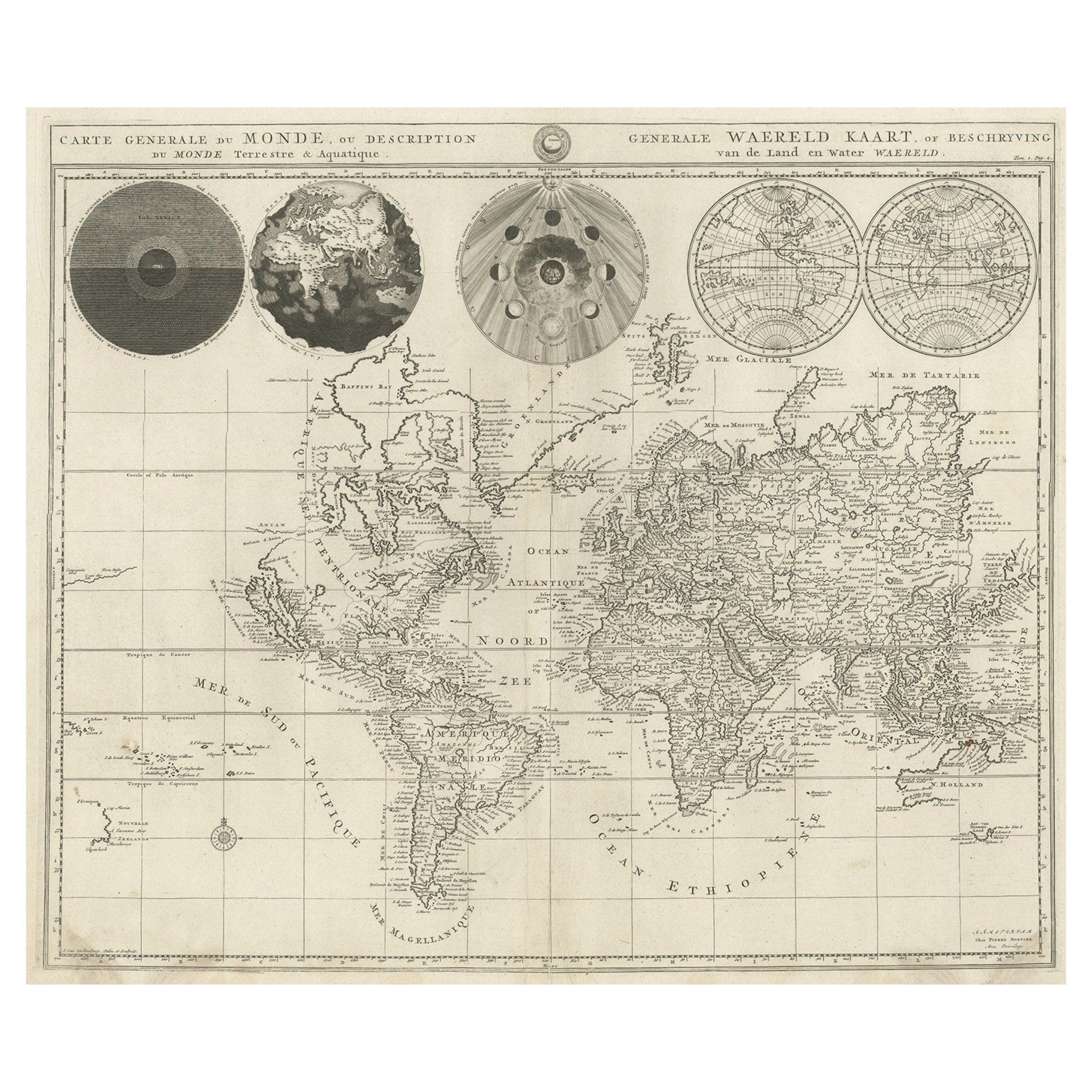
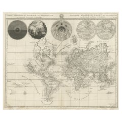
Antike, detaillierte Weltkarte nach Mercator's Projektion, 1700
Antike Weltkarte mit dem Titel 'Carte generale du monde, ou description du monde terrestre & Aquatique - Generale Waereld kaart, of beschryving van de land en water waereld'. Dies is...
Kategorie
Antik, 17. Jahrhundert, Landkarten
Materialien
Papier
855 $ Angebotspreis
25 % Rabatt
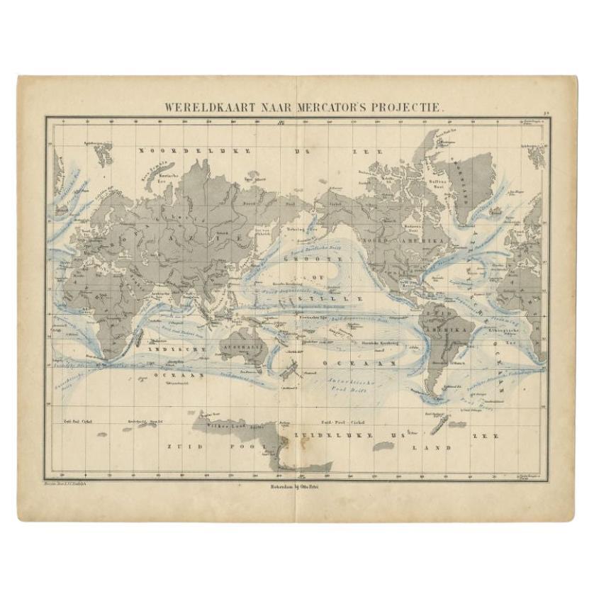
Antike antike Mercator-Projektions-Weltkarte von Petri, um 1873
Antike Weltkarte mit dem Titel 'Wereldkaart naar Mercator's Projectie'. Alte Karte der Welt. Diese Karte stammt aus dem 'School-Atlas van alle Deelen der Aarde'.
Künstler und Gra...
Kategorie
Antik, 19. Jahrhundert, Landkarten
Materialien
Papier

116 $ Angebotspreis
20 % Rabatt
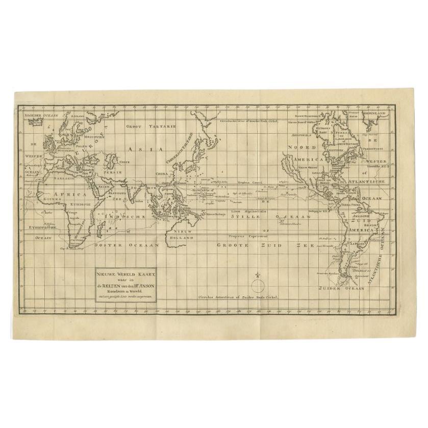
Antike Karte der Welt auf Mercator-Projektion von Anson, 1749
Antike Karte mit dem Titel 'Nieuwe Wereld Kaart waar in de Reizen van den Hr. Anson rondsom de Wereld". Antike Weltkarte nach der Mercator-Projektion aus einer holländischen Ausgabe ...
Kategorie
Antik, 18. Jahrhundert, Landkarten
Materialien
Papier

427 $ Angebotspreis
25 % Rabatt
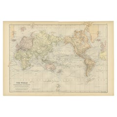
Bunte, detaillierte, antike Karte der Welt auf Mercators-Projektion, 1882
Die "Welt der Mercator-Projektion" ist eine Karte mit einer atemberaubenden Darstellung der globalen Geografie und der Seeschifffahrt aus einer Zeit, die von Entdeckungen und Erkundu...
Kategorie
Antik, 1880er, Landkarten
Materialien
Papier
232 $ Angebotspreis
20 % Rabatt
Antike Karte der Welt, Mercator-Projektion, von Wyld, 1845
Antike Karte mit dem Titel "Die Welt". Original antike Weltkarte, auf Mercator-Projektion. Diese Karte stammt aus "An Atlas of the World, Comprehending Separate Maps of its Various C...
Kategorie
Antik, Mittleres 19. Jahrhundert, Landkarten
Materialien
Papier

325 $ Angebotspreis
20 % Rabatt
Das könnte Ihnen auch gefallen
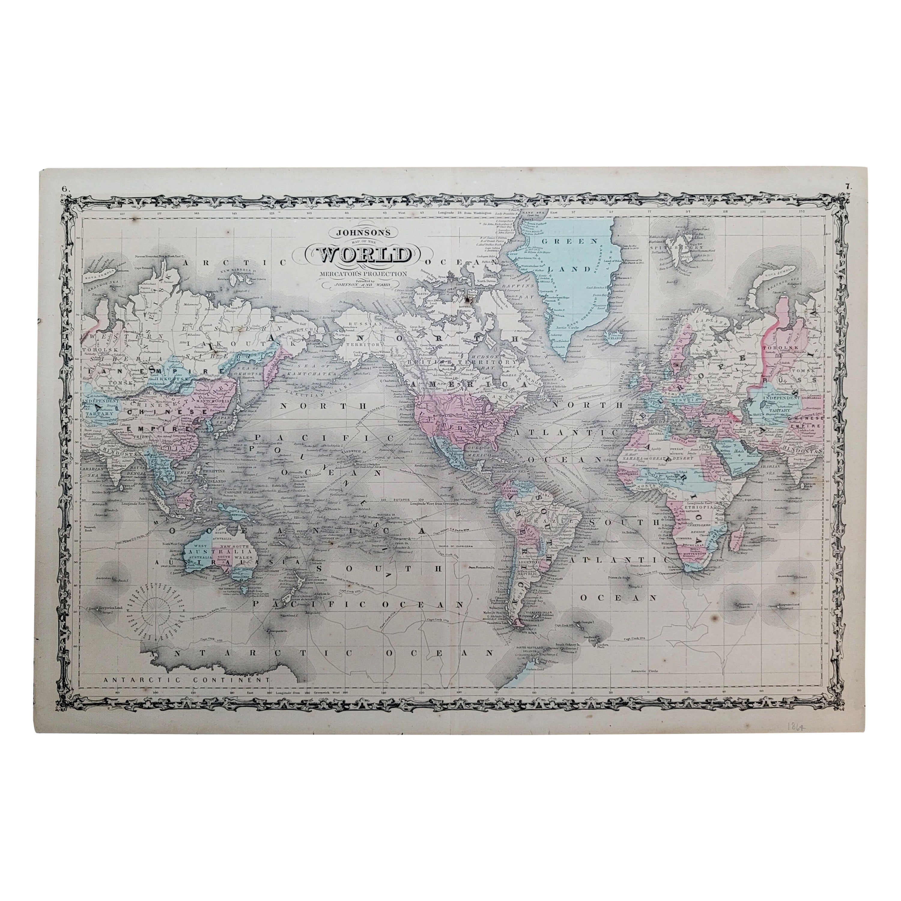
1864 Johnson's Map of the World auf Mercator's Projection, Ric.B009
Eine Johnson's Karte von 1864
die Welt auf der Mercator-Projektion
Ric.b009
Über dieses Element
"Diese antike Karte stammt aus Johnson's New Illustrated (Steel Plate) Fami...
Kategorie
Antik, 19. Jahrhundert, Niederländisch, Landkarten
Materialien
Papier

Gerahmte Mercator Hondius Hispania Nova Atlas Kleine Karte
Gerahmtes koloriertes Exemplar dieser dekorativen und wichtigen Miniaturkarte. Neu gerahmt in braunem Holzrahmen mit Goldverzierung.
Mercator Hondius "Atlas Minor" veröffentlicht i...
Kategorie
Antik, 17. Jahrhundert, Niederländisch, Spanisch Kolonial, Landkarten
Materialien
Glas, Holz, Papier

Weltreliefkarte
Große Weltreliefkarte.
Maße: Breite 232 cm.
Höhe 158 cm.
Kategorie
Mitte des 20. Jahrhunderts, Deutsch, Moderne der Mitte des Jahrhunderts,...
Materialien
Acryl

2.094 $
1590 Mercator-Karte mit dem Titel „“Frankreich Picardie Champaigne, Ric.0001
Beschreibung: Veröffentlicht in Amsterdam von Mercator/Hondius ca. 1590.
Ric.0001
Künstler und Graveure: Karte : 'Frankreich Picardie Champaigne cum regionibus adiacentibus'. (Ka...
Kategorie
Antik, 16. Jahrhundert, Niederländisch, Landkarten
Materialien
Papier
Original Antike Karte des amerikanischen Staates Minnesota, 1903
Antike Karte von Minnesota
Veröffentlicht von A & C Black. 1903
Original Farbe
Guter Zustand
Ungerahmt.
Kostenloser Versand
Kategorie
Antik, Frühes 20. Jhdt., Englisch, Landkarten
Materialien
Papier

Original Antike Karte des amerikanischen Staates Alabama, 1903
Antique map of Alabama
Published By A & C Black. 1903
Original colour
Good condition
Unframed.
Free shipping
Kategorie
Antik, Frühes 20. Jhdt., Englisch, Landkarten
Materialien
Papier
