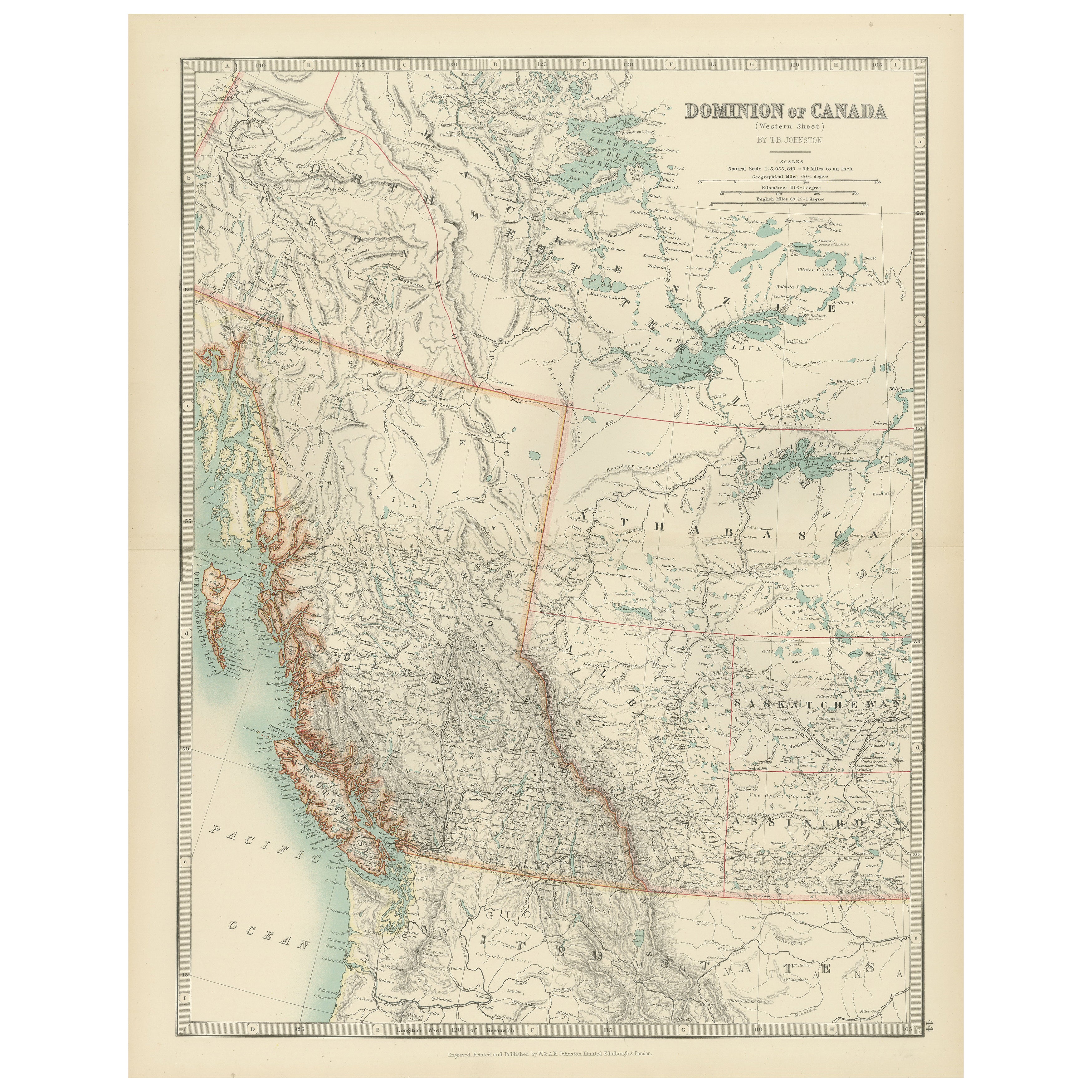
Objekte ähnlich wie Canada Map 1903 - Dominion of Canada, West Central Sheet

Möchten Sie mehr Bilder oder Videos?
Zusätzliche Bilder oder Videos von dem*der Anbieter*in anfordern
1 von 10
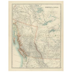
Canada Map 1903 - Dominion of Canada, West Central Sheet
Angaben zum Objekt
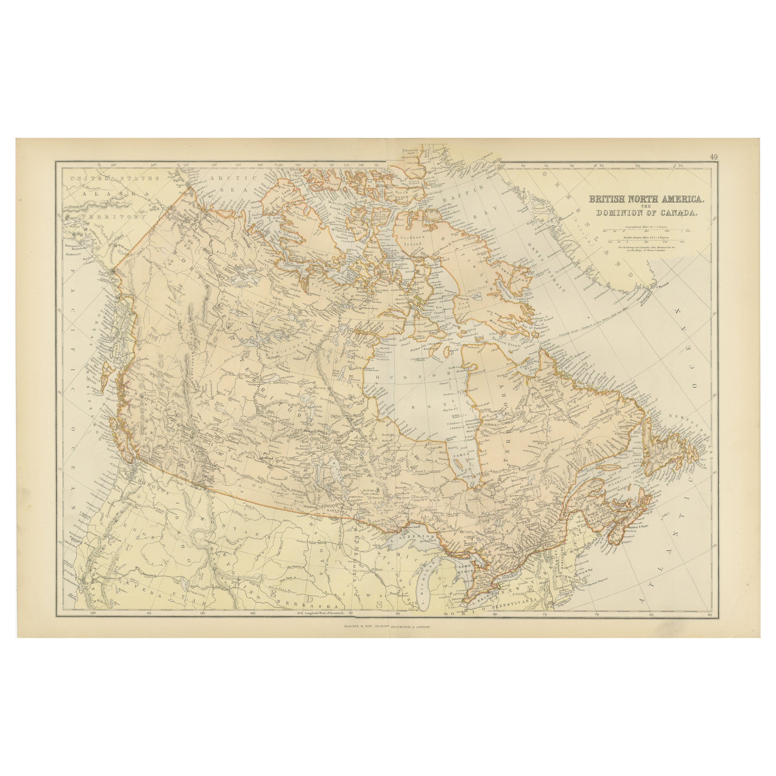
Title: Canada Map 1903 - Dominion of Canada, West Central Sheet
Description:
This fascinating 1903 map of the Dominion of Canada’s West Central regions by T.R. Johnston offers a vivid glimpse into the geographical and political landscape of early 20th-century Canada. It captures the expansive territory stretching across the heart of the Canadian Shield and the Hudson Bay basin. The map’s meticulous detail highlights key features including the Hudson Bay, parts of Manitoba, Saskatchewan, and Ontario, as well as the vast networks of rivers and lakes that define this rugged landscape.
Railway lines, postal routes, and settlements are intricately marked, reflecting the growing infrastructure that was pivotal for trade and migration during the era. The beautifully engraved coastlines and precise border delineations reveal the cartographer’s commitment to accuracy and artistry. The elegant typography and muted color palette add to its classic appeal, making it an exceptional example of antique cartography.
This map not only showcases the physical terrain but also speaks to the spirit of exploration and the consolidation of the Canadian territories during this dynamic period in history. It is a testament to the country’s rich natural resources and the challenges of development in remote and sparsely populated areas.
Condition:
This antique map is in excellent condition, with some mild toning typical of age. The colors remain bright, and there are no major tears or foxing, making it ideal for display or as part of a historical collection.
Framing Tips:
To highlight the natural tones of the map, consider a warm wooden frame, such as walnut or oak, with a cream or pale mat to create a subtle contrast. A protective UV-filtering glass will help preserve the delicate details and coloration, ensuring that this historical piece continues to inspire for years to come.
- Maße:Höhe: 47 cm (18,51 in)Breite: 36,8 cm (14,49 in)Tiefe: 0,2 mm (0,01 in)
- Materialien und Methoden:
- Zeitalter:
- Herstellungsjahr:1903
- Zustand:This antique map is in excellent condition, with some mild toning typical of age. The colors remain bright, and there are no major tears or foxing, making it ideal for display or as part of a historical collection.
- Anbieterstandort:Langweer, NL
- Referenznummer:Anbieter*in: BG-13577-431stDibs: LU3054345291602
Anbieterinformationen
5,0
Anerkannte Anbieter*innen
Diese renommierten Anbieter*innen sind führend in der Branche und repräsentieren die höchste Klasse in Sachen Qualität und Design.
Gold-Anbieter*in
Premium-Anbieter*innen mit einer Bewertung über 4,3 und 24 Stunden Reaktionszeit
Gründungsjahr 2009
1stDibs-Anbieter*in seit 2017
2.462 Verkäufe auf 1stDibs
Typische Antwortzeit: <1 Stunde
- VersandAngebot wird abgerufen …Versand von: Langweer, Niederlande
- Rückgabebedingungen
Einige Inhalte dieser Seite wurden automatisch übersetzt. Daher kann 1stDibs nicht die Richtigkeit der Übersetzungen garantieren. Englisch ist die Standardsprache dieser Website.
Authentizitätsgarantie
Im unwahrscheinlichen Fall eines Problems mit der Echtheit eines Objekts kontaktieren Sie uns bitte innerhalb von 1 Jahr für eine volle Rückerstattung. DetailsGeld-Zurück-Garantie
Wenn Ihr Objekt nicht der Beschreibung entspricht, beim Transport beschädigt wurde oder nicht ankommt, kontaktieren Sie uns bitte innerhalb von 7 Tagen für eine vollständige Rückerstattung. DetailsStornierung innerhalb von 24 Stunden
Sie können Ihren Kauf jederzeit innerhalb von 24 Stunden stornieren, ohne jegliche Gründe dafür angeben zu müssen.Geprüfte Anbieter*innen
Unsere Anbieter*innen unterliegen strengen Dienstleistungs- und Qualitätsstandards, wodurch wir die Seriosität unserer Angebote gewährleisten können.Preisgarantie
Wenn Sie feststellen, dass ein*e Anbieter*in dasselbe Objekt anderswo zu einem niedrigeren Preis anbietet, werden wir den Preis entsprechend anpassen.Zuverlässige weltweite Lieferung
Unsere erstklassigen Versandunternehmen bieten spezielle Versandoptionen weltweit, einschließlich individueller Lieferung.Mehr von diesem*dieser Anbieter*in
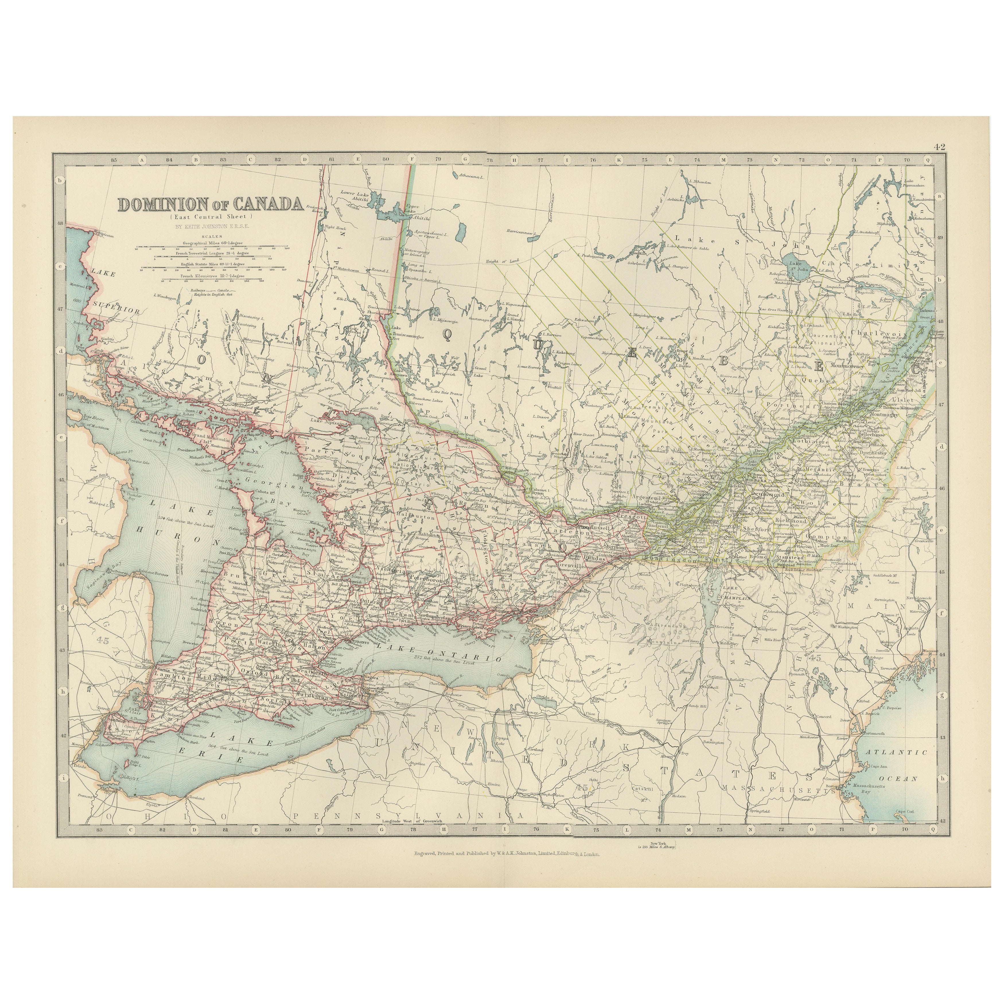
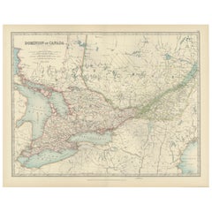
Alle anzeigenCanada Map 1903 - East Central Dominion - Ontario, Quebec & More
Canada Map 1903 - East Central Dominion - Ontario, Quebec & More
This captivating antique map, titled "Dominion of Canada (East Central Sheet)" and published in 1903 by Keith Johnst...
Kategorie
Frühes 20. Jahrhundert, Landkarten
Materialien
Papier
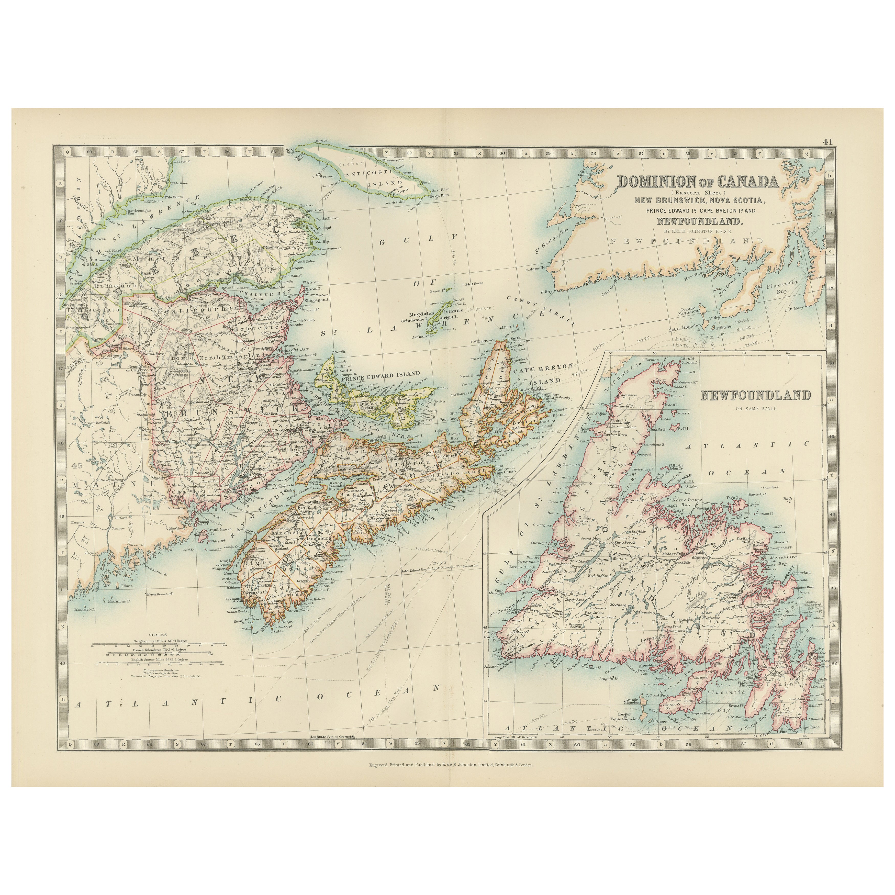
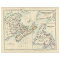
Canada Dominion Map 1903 - A Detailed View of Eastern Canada and Newfoundland
North America, 1903 - A Colorful Historical Map with Detailed Borders
This attractive map of North America was engraved, printed, and published by W. & A.K. Johnston in 1903. A wond...
Kategorie
Frühes 20. Jahrhundert, Landkarten
Materialien
Papier
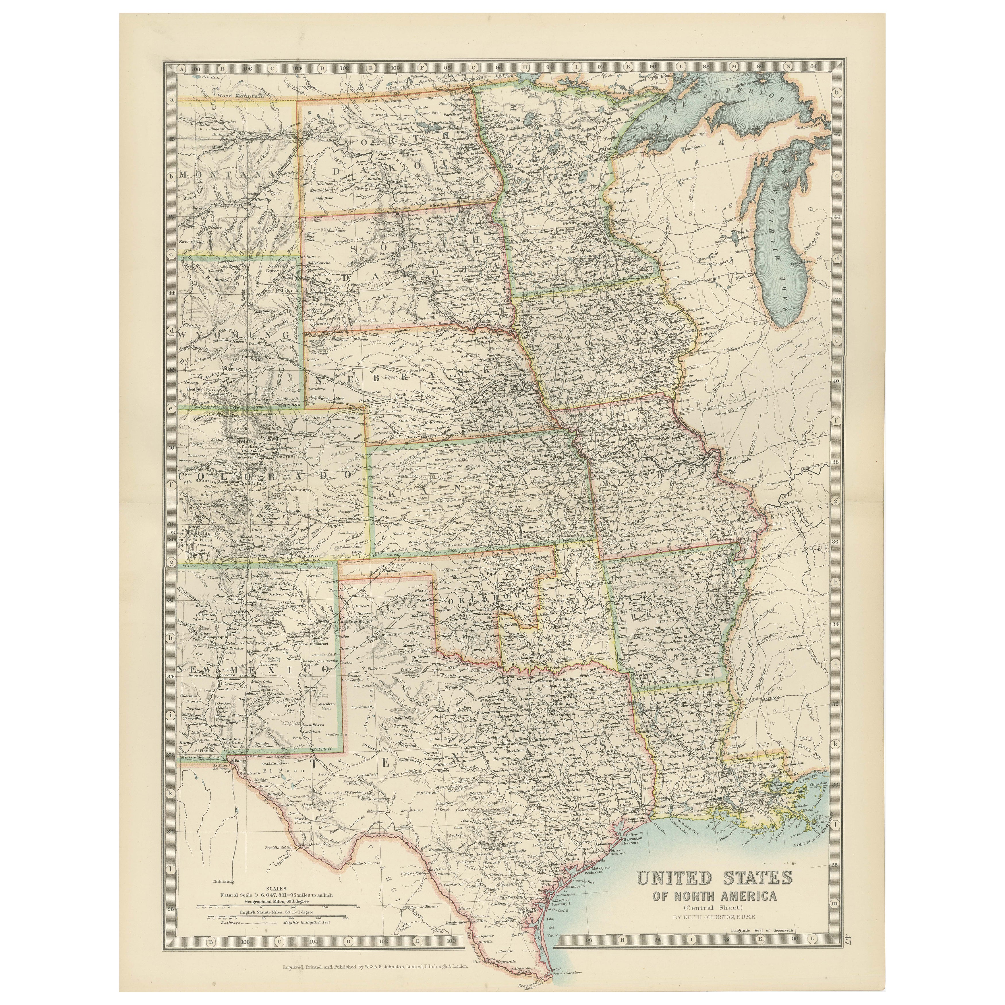
Map of United States Central Sheet 1903 – Railroads, States, and Topography
Map of United States Central Sheet 1903 – Railroads, States, and Topography
This is a finely engraved and beautifully colored map titled "United States of North America (Central She...
Kategorie
Frühes 20. Jahrhundert, Landkarten
Materialien
Papier
Canada’s West – 1903 Engraved Map by Johnston – Unique and Historic
This beautiful and detailed map, titled "Dominion of Canada (Western Sheet)," was created by Keith Johnston and published in 1903.
It presents a fascinating depiction of Canada's w...
Kategorie
Frühes 20. Jahrhundert, Landkarten
Materialien
Papier
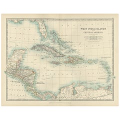
Map of the West India Islands and Central America – Colorful 1903 Engraving
Map of the West India Islands and Central America – Colorful 1903 Engraving
This vibrant engraved map, titled "West India Islands and Central America," was created by Keith Johnston...
Kategorie
Frühes 20. Jahrhundert, Landkarten
Materialien
Papier
Antike Karte des britischen Nordamerikas, The Dominion of Canada, 1882
Diese Karte trägt den Titel "British North America, Dominion of Canada" und stammt aus dem Blackie Atlas von 1882. Sie zeigt das geografische Gebiet, das das heutige Kanada umfasst, ...
Kategorie
Antik, 1880er, Landkarten
Materialien
Papier

232 $ Angebotspreis
20 % Rabatt
Kostenloser Versand
Das könnte Ihnen auch gefallen
Original Antike Karte des amerikanischen Staates Minnesota, 1903
Antike Karte von Minnesota
Veröffentlicht von A & C Black. 1903
Original Farbe
Guter Zustand
Ungerahmt.
Kostenloser Versand
Kategorie
Antik, Frühes 20. Jhdt., Englisch, Landkarten
Materialien
Papier

Original Antike Karte des amerikanischen Staates Alabama, 1903
Antique map of Alabama
Published By A & C Black. 1903
Original colour
Good condition
Unframed.
Free shipping
Kategorie
Antik, Frühes 20. Jhdt., Englisch, Landkarten
Materialien
Papier

Original Antike Karte des amerikanischen Staates Alaska, 1903
Antike Karte von Alaska
Veröffentlicht von A & C Black. 1903
Original Farbe
Guter Zustand
Ungerahmt.
Kostenloser Versand
Kategorie
Antik, Frühes 20. Jhdt., Englisch, Landkarten
Materialien
Papier

Original Antike Karte des amerikanischen Staates Nebraska, 1903
Antike Karte von Nebraska
Veröffentlicht von A & C Black. 1903
Original Farbe
Guter Zustand
Ungerahmt.
Kostenloser Versand
Kategorie
Antik, Frühes 20. Jhdt., Englisch, Landkarten
Materialien
Papier

Antike Karte des amerikanischen Staates Washington, 1903
Antike Karte von Washington
Veröffentlicht von A & C Black. 1903
Original Farbe
Guter Zustand
Ungerahmt.
Kostenloser Versand
Kategorie
Antik, Frühes 20. Jhdt., Englisch, Landkarten
Materialien
Papier

Original Antike Karte des amerikanischen Staates Tennessee, 1903
Antique map of Tennessee
Published By A & C Black. 1903
Original colour
Good condition
Unframed.
Free shipping
Kategorie
Antik, Frühes 20. Jhdt., Englisch, Landkarten
Materialien
Papier
