Objekte ähnlich wie Canada’s West – 1903 Engraved Map by Johnston – Unique and Historic


Möchten Sie mehr Bilder oder Videos?
Zusätzliche Bilder oder Videos von dem*der Anbieter*in anfordern
1 von 10
Canada’s West – 1903 Engraved Map by Johnston – Unique and Historic
Angaben zum Objekt
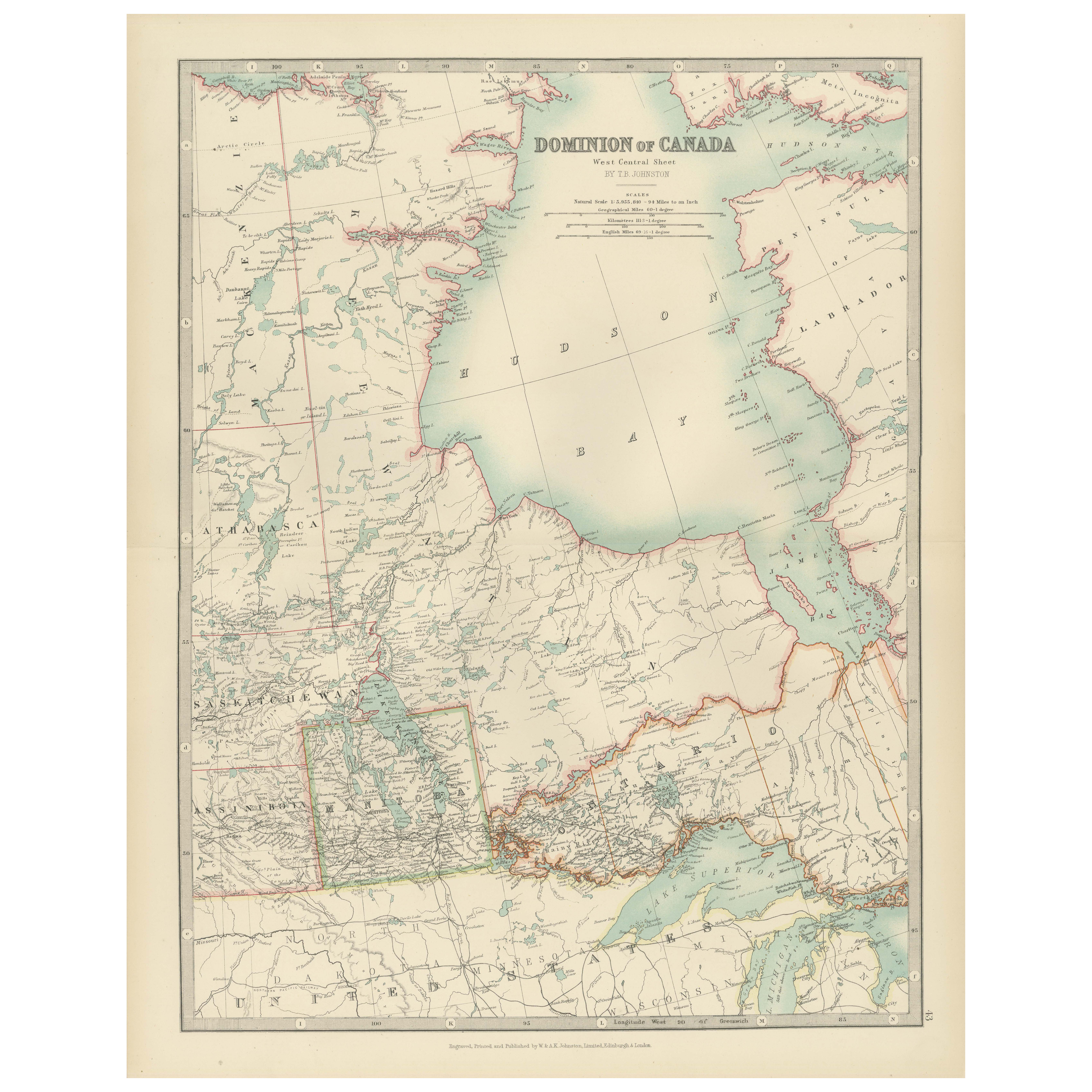
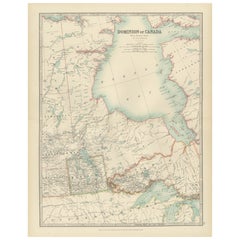
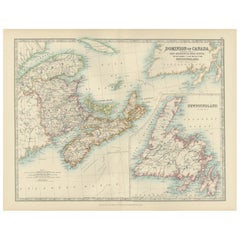
This beautiful and detailed map, titled "Dominion of Canada (Western Sheet)," was created by Keith Johnston and published in 1903.
It presents a fascinating depiction of Canada's western territories, covering regions from British Columbia, Alberta, and parts of Saskatchewan and the Northwest Territories. Johnston, a distinguished Scottish geographer and cartographer, created maps that were not only precise but also highly artistic, reflecting the cartographic standards of the early 20th century.
The map showcases the intricate mountain ranges of British Columbia, the vast plains of Alberta, and the rich river systems that flow through these regions, including the Fraser, Columbia, and Peace Rivers. The rugged coastline of the Pacific Ocean, along with numerous inlets and islands, is carefully delineated, giving insight into the coastal geography of this vast area. The depiction of mountain ranges, particularly the Rocky Mountains, with their shaded relief and meticulous detail, adds depth and a striking visual dimension to the map.
Johnston’s maps were known for their accuracy and elegant typography, evident here in the clean lettering and delicate border treatments. The political boundaries of the provinces and territories are outlined in color, aiding in the visual separation of these areas and providing historical context to the development of Canada's western frontier. Notably, the map also includes names of smaller settlements, indigenous territories, trading posts, and other historical landmarks, reflecting the mapmaker's dedication to comprehensive geographic documentation.
This map is an exceptional piece for collectors, historians, and anyone with an interest in Canada's western development. It speaks to the era's growing interest in exploration and the expansion of railways and settlements across this breathtaking landscape.
The map’s condition is excellent, with clear, sharp impressions and only minor signs of age-related toning, adding to its antique charm.
For framing, consider using a classic wooden or dark-colored frame with a neutral mat to enhance the subtle colors and fine details of the engraving. This would make a striking focal point in a study, office, or living space, offering both historical insight and timeless visual appeal.
- Maße:Höhe: 47 cm (18,51 in)Breite: 36,8 cm (14,49 in)Tiefe: 0,2 mm (0,01 in)
- Materialien und Methoden:
- Zeitalter:
- Herstellungsjahr:1903
- Zustand:The map’s condition is excellent, with clear, sharp impressions and only minor signs of age-related toning, adding to its antique charm.
- Anbieterstandort:Langweer, NL
- Referenznummer:Anbieter*in: BG-13577-441stDibs: LU3054345291632
Anbieterinformationen
5,0
Anerkannte Anbieter*innen
Diese renommierten Anbieter*innen sind führend in der Branche und repräsentieren die höchste Klasse in Sachen Qualität und Design.
Gold-Anbieter*in
Premium-Anbieter*innen mit einer Bewertung über 4,3 und 24 Stunden Reaktionszeit
Gründungsjahr 2009
1stDibs-Anbieter*in seit 2017
2.463 Verkäufe auf 1stDibs
Typische Antwortzeit: <1 Stunde
- VersandAngebot wird abgerufen …Versand von: Langweer, Niederlande
- Rückgabebedingungen
Einige Inhalte dieser Seite wurden automatisch übersetzt. Daher kann 1stDibs nicht die Richtigkeit der Übersetzungen garantieren. Englisch ist die Standardsprache dieser Website.
Authentizitätsgarantie
Im unwahrscheinlichen Fall eines Problems mit der Echtheit eines Objekts kontaktieren Sie uns bitte innerhalb von 1 Jahr für eine volle Rückerstattung. DetailsGeld-Zurück-Garantie
Wenn Ihr Objekt nicht der Beschreibung entspricht, beim Transport beschädigt wurde oder nicht ankommt, kontaktieren Sie uns bitte innerhalb von 7 Tagen für eine vollständige Rückerstattung. DetailsStornierung innerhalb von 24 Stunden
Sie können Ihren Kauf jederzeit innerhalb von 24 Stunden stornieren, ohne jegliche Gründe dafür angeben zu müssen.Geprüfte Anbieter*innen
Unsere Anbieter*innen unterliegen strengen Dienstleistungs- und Qualitätsstandards, wodurch wir die Seriosität unserer Angebote gewährleisten können.Preisgarantie
Wenn Sie feststellen, dass ein*e Anbieter*in dasselbe Objekt anderswo zu einem niedrigeren Preis anbietet, werden wir den Preis entsprechend anpassen.Zuverlässige weltweite Lieferung
Unsere erstklassigen Versandunternehmen bieten spezielle Versandoptionen weltweit, einschließlich individueller Lieferung.Mehr von diesem*dieser Anbieter*in
Alle anzeigenCanada Map 1903 - Dominion of Canada, West Central Sheet
Title: Canada Map 1903 - Dominion of Canada, West Central Sheet
Description:
This fascinating 1903 map of the Dominion of Canada’s West Central regions by T.R. Johnston offers a viv...
Kategorie
Frühes 20. Jahrhundert, Landkarten
Materialien
Papier
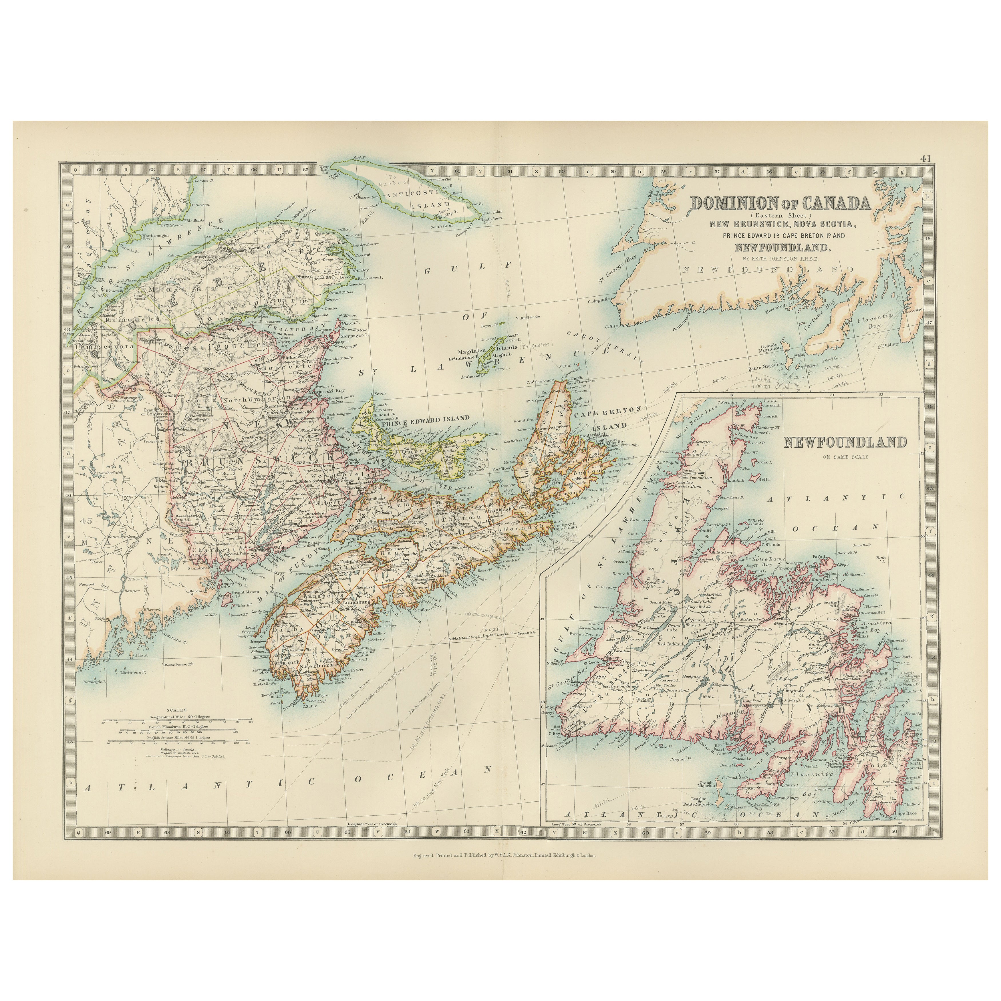
Antike Karte von Kanada von Johnston '1909'
Antike Karte mit dem Titel 'Dominion of Canada'. Original antike Karte von Kanada. Mit beigefügter Karte von Neufundland. Diese Karte stammt aus dem "Royal Atlas of Modern Geography"...
Kategorie
Frühes 20. Jahrhundert, Landkarten
Materialien
Papier
232 $ Angebotspreis
20 % Rabatt
Antike Karte von Kanada von Johnston '1909'
Antike Karte mit dem Titel 'Dominion of Canada'. Original antike Karte von Kanada. Diese Karte stammt aus dem "Royal Atlas of Modern Geography". Herausgegeben von W. & A.K. Johnston,...
Kategorie
Frühes 20. Jahrhundert, Landkarten
Materialien
Papier
232 $ Angebotspreis
20 % Rabatt
Antike Karte von Kanada von Johnston '1909'
Antike Karte mit dem Titel 'Dominion of Canada'. Original antike Karte von Kanada. Mit beigefügten Karten von Niagara, Montreal, Quebec. Diese Karte stammt aus dem "Royal Atlas of Mo...
Kategorie
Frühes 20. Jahrhundert, Landkarten
Materialien
Papier
232 $ Angebotspreis
20 % Rabatt
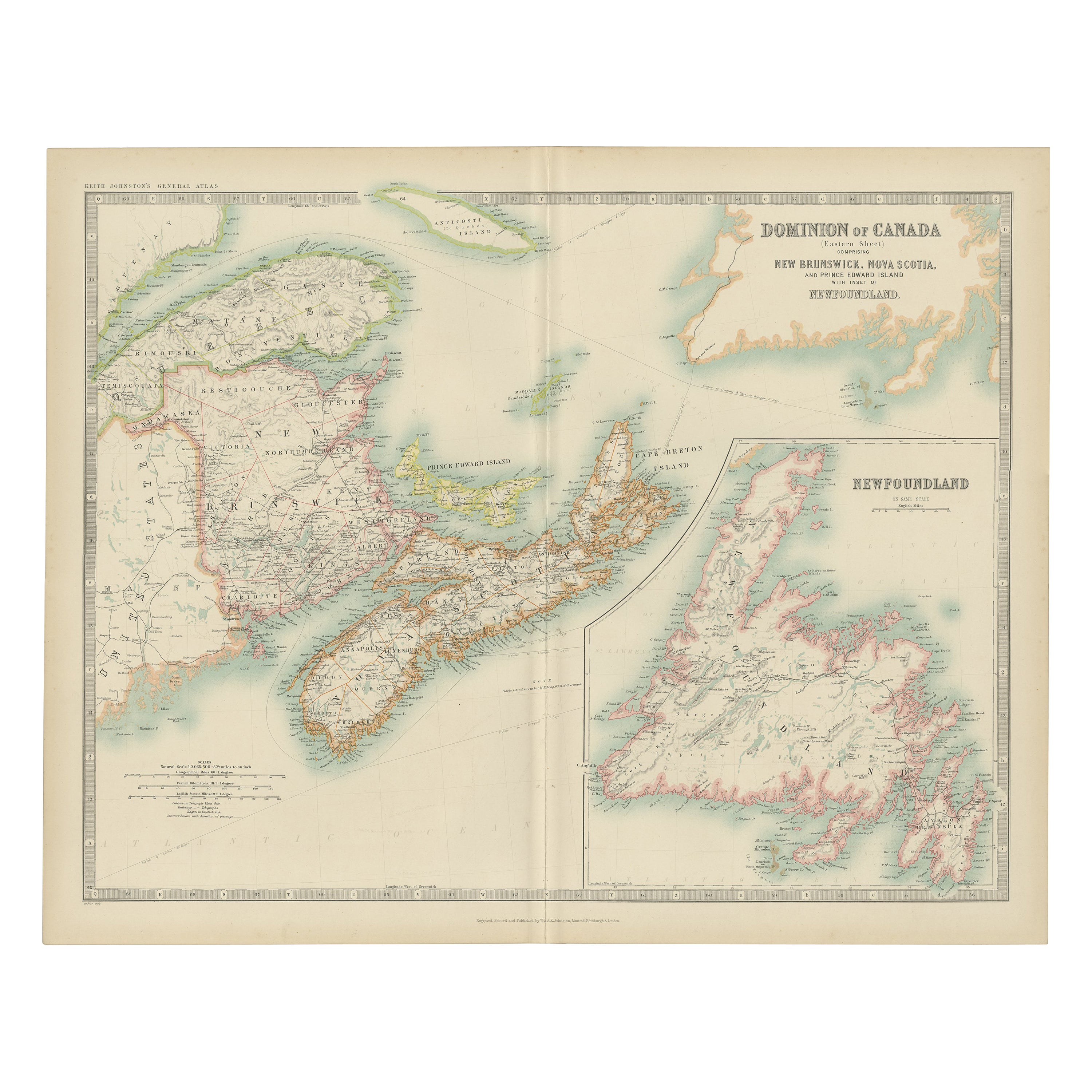
Canada Dominion Map 1903 - A Detailed View of Eastern Canada and Newfoundland
North America, 1903 - A Colorful Historical Map with Detailed Borders
This attractive map of North America was engraved, printed, and published by W. & A.K. Johnston in 1903. A wond...
Kategorie
Frühes 20. Jahrhundert, Landkarten
Materialien
Papier
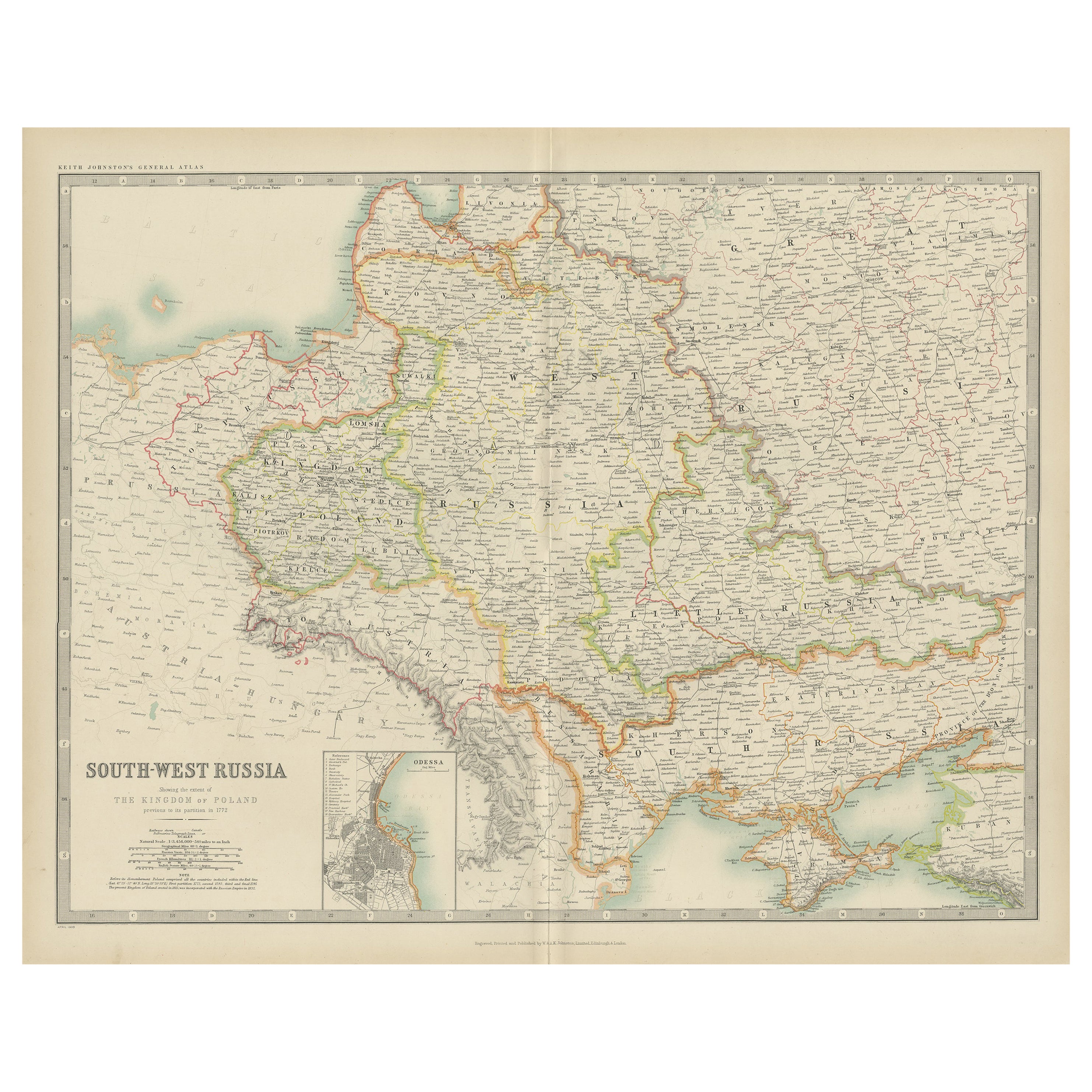
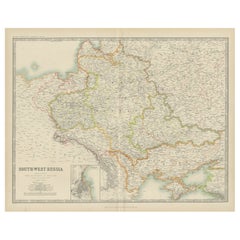
Antike Karte des Südwestens Russlands von Johnston (1909)
Antike Karte mit dem Titel 'Südwest-Russland'. Original antike Karte von Süd-West Russland. Mit beigefügter Karte von Odessa. Diese Karte stammt aus dem "Royal Atlas of Modern Geogra...
Kategorie
Frühes 20. Jahrhundert, Landkarten
Materialien
Papier
232 $ Angebotspreis
20 % Rabatt
Das könnte Ihnen auch gefallen
Map „North America“ von 1846, eingraviert von I. Dower
Präsentiert wird eine Original-Karte von "Nordamerika" aus dem Jahr 1846. Die Karte wurde von I. Dower gezeichnet und gestochen und in London von Orr & Company veröffentlicht. Die Ka...
Kategorie
Antik, 1840er, Englisch, Viktorianisch, Landkarten
Materialien
Papier

Vier gravierte und handkolorierte Karten aus dem 18. Jahrhundert von Weigel
Von Christoph Weigel
Kleine Sammlung von vier gestochenen Karten von Italien, dem Balkan und von Zentralasien.
Zwei sind aus Italien, eine aus Korsika und Norditalien und die andere aus dem süditalieni...
Kategorie
Antik, 18. Jahrhundert, Deutsch, Landkarten
Materialien
Papier
Antike schwedische Karte, eingraviert von Barlow, 1806
Großartige Karte von Schweden
Kupferstich von Barlow
Herausgegeben von Brightly & Kinnersly, Bungay, Suffolk. 1806
Ungerahmt.
Kategorie
Antik, Anfang 1800, Englisch, Landkarten
Materialien
Papier

Antike klappbare Londoner Karte, englisch, Kartografie, historisch, georgianisch, datiert 1783
Dies ist eine antike Faltkarte von London. Eine englische, auf Leinen gedruckte kartografische Studie der Metropole London und ihrer Umgebung, die in der Mitte des georgianischen Zei...
Kategorie
Antik, Spätes 18. Jahrhundert, Britisch, Georgian, Landkarten
Materialien
Leinen, Papier
Originale antike Karte der Schweiz, eingraviert von Barlow, datiert 1807
Tolle Karte der Schweiz
Kupferstich von Barlow
Herausgegeben von Brightly & Kinnersly, Bungay, Suffolk.
Datiert 1807
Ungerahmt.
Kategorie
Antik, Anfang 1800, Englisch, Landkarten
Materialien
Papier

Original Antike Karte des amerikanischen Staates Minnesota, 1903
Antike Karte von Minnesota
Veröffentlicht von A & C Black. 1903
Original Farbe
Guter Zustand
Ungerahmt.
Kostenloser Versand
Kategorie
Antik, Frühes 20. Jhdt., Englisch, Landkarten
Materialien
Papier
