Objekte ähnlich wie Map of Corsica France with Ajaccio and Napoleon Portraits, 19th Century

Möchten Sie mehr Bilder oder Videos?
Zusätzliche Bilder oder Videos von dem*der Anbieter*in anfordern
1 von 10
Map of Corsica France with Ajaccio and Napoleon Portraits, 19th Century
Angaben zum Objekt
Map of Corsica France with Ajaccio and Napoleon Portraits, 19th Century
Description:
This finely engraved 19th-century map of Corsica, the Mediterranean island region of France, was created by Alexandre Vuillemin and published by Migeon in Paris for the *Nouvel Atlas Illustré*. Combining topographic clarity with historical reverence, this map presents Corsica in its full mountainous grandeur, surrounded by finely rendered vignettes that pay tribute to its most famous native—Napoleon Bonaparte.
The map displays the entire island with detailed roads, towns, and natural features, bordered in hand-applied pink watercolor. Ajaccio, the capital and birthplace of Napoleon, is prominently marked on the western coast. Other key towns such as Bastia, Corte, Sartène, and Bonifacio are shown with accuracy, as are the island’s rivers and rugged terrain.
At the top left, a panoramic engraving of Ajaccio is set against a mountainous backdrop, giving visual weight to Corsica’s dramatic landscapes and coastal towns. In the lower corners, two full-length portraits of Napoleon frame the map: one of him as a young military officer, and the other as emperor in coronation robes. These images honor Corsica’s most legendary figure and symbolize the island’s lasting influence on French and European history.
Corsica is known for its fierce regional identity, natural beauty, and distinct cultural heritage. While not a major wine-exporting island in the 19th century, Corsica has long produced wines from native grapes such as Nielluccio, Sciacarello, and Vermentino. Its wine culture has grown substantially over time, now celebrated for producing robust reds and aromatic whites with Mediterranean character. In the 1800s, Corsica was also known for olive oil, citrus, and chestnut production, much of it cultivated on terraced hillsides and in rural villages.
This map is a fitting tribute to the rugged independence and historical richness of Corsica. Its blend of political geography, maritime setting, and symbolic portraiture makes it a standout piece in any collection of antique French maps or Napoleonic memorabilia.
Condition summary:
Very good condition with light age-related toning and a few small foxing marks in the outer margins. Original hand coloring is clean and the engraving remains crisp and detailed.
Framing tips:
Best framed in a dark wood or empire-style frame to echo the Napoleonic theme. A soft ivory or light tan mat will complement the pink border and vignette engravings. Museum glass is recommended for long-term preservation and clarity.
- Maße:Höhe: 32,5 cm (12,8 in)Breite: 26,1 cm (10,28 in)Tiefe: 0,2 mm (0,01 in)
- Materialien und Methoden:Papier,Graviert
- Herkunftsort:
- Zeitalter:
- Herstellungsjahr:circa 1850
- Zustand:Very good condition with light age-related toning and a few small foxing marks in the outer margins. Original hand coloring is clean and the engraving remains crisp and detailed.
- Anbieterstandort:Langweer, NL
- Referenznummer:Anbieter*in: BG-13331-191stDibs: LU3054345363622
Anbieterinformationen
5,0
Anerkannte Anbieter*innen
Diese renommierten Anbieter*innen sind führend in der Branche und repräsentieren die höchste Klasse in Sachen Qualität und Design.
Gold-Anbieter*in
Premium-Anbieter*innen mit einer Bewertung über 4,3 und 24 Stunden Reaktionszeit
Gründungsjahr 2009
1stDibs-Anbieter*in seit 2017
2.469 Verkäufe auf 1stDibs
Typische Antwortzeit: <1 Stunde
- VersandAngebot wird abgerufen …Versand von: Langweer, Niederlande
- Rückgabebedingungen
Einige Inhalte dieser Seite wurden automatisch übersetzt. Daher kann 1stDibs nicht die Richtigkeit der Übersetzungen garantieren. Englisch ist die Standardsprache dieser Website.
Authentizitätsgarantie
Im unwahrscheinlichen Fall eines Problems mit der Echtheit eines Objekts kontaktieren Sie uns bitte innerhalb von 1 Jahr für eine volle Rückerstattung. DetailsGeld-Zurück-Garantie
Wenn Ihr Objekt nicht der Beschreibung entspricht, beim Transport beschädigt wurde oder nicht ankommt, kontaktieren Sie uns bitte innerhalb von 7 Tagen für eine vollständige Rückerstattung. DetailsStornierung innerhalb von 24 Stunden
Sie können Ihren Kauf jederzeit innerhalb von 24 Stunden stornieren, ohne jegliche Gründe dafür angeben zu müssen.Geprüfte Anbieter*innen
Unsere Anbieter*innen unterliegen strengen Dienstleistungs- und Qualitätsstandards, wodurch wir die Seriosität unserer Angebote gewährleisten können.Preisgarantie
Wenn Sie feststellen, dass ein*e Anbieter*in dasselbe Objekt anderswo zu einem niedrigeren Preis anbietet, werden wir den Preis entsprechend anpassen.Zuverlässige weltweite Lieferung
Unsere erstklassigen Versandunternehmen bieten spezielle Versandoptionen weltweit, einschließlich individueller Lieferung.Mehr von diesem*dieser Anbieter*in
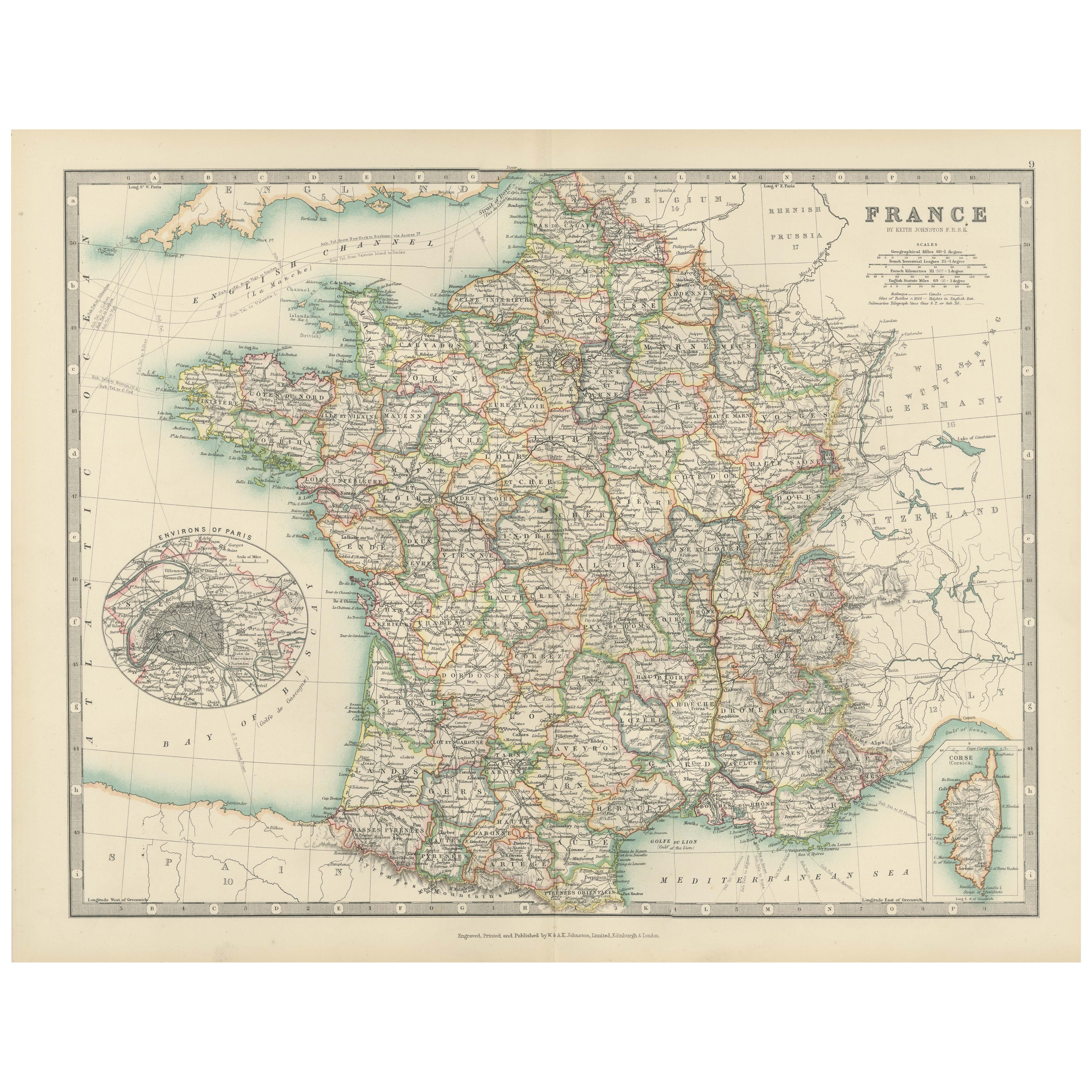
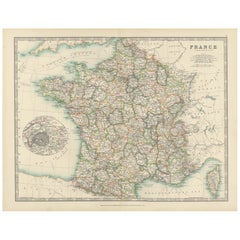
Alle anzeigenAntike Karte von Frankreich, 1903, mit Ausschnitt von Paris und Korsika
Titel: Antike Karte von Frankreich, 1903, mit Inset von Paris und Korsika
Beschreibung:
Diese antike Karte mit dem Titel "Frankreich" wurde 1903 von dem renommierten Verlag W. & A.K...
Kategorie
Frühes 20. Jahrhundert, Landkarten
Materialien
Papier
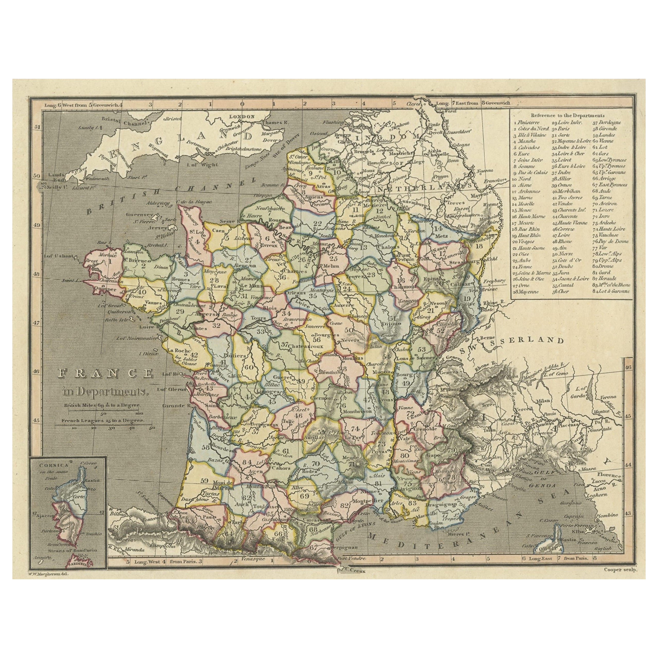
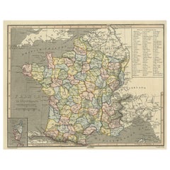
Antike Karte von Frankreich mit eingelassener Karte der Insel Korsika, 1820
Antike Karte mit dem Titel 'Frankreich in Departements'. Alte Karte von Frankreich, mit einer kleinen Karte der Insel Korsika. Enthält eine Tabelle mit Verweisen auf die Abteilungen....
Kategorie
Antik, 19. Jahrhundert, Landkarten
Materialien
Papier
244 $ Angebotspreis
20 % Rabatt
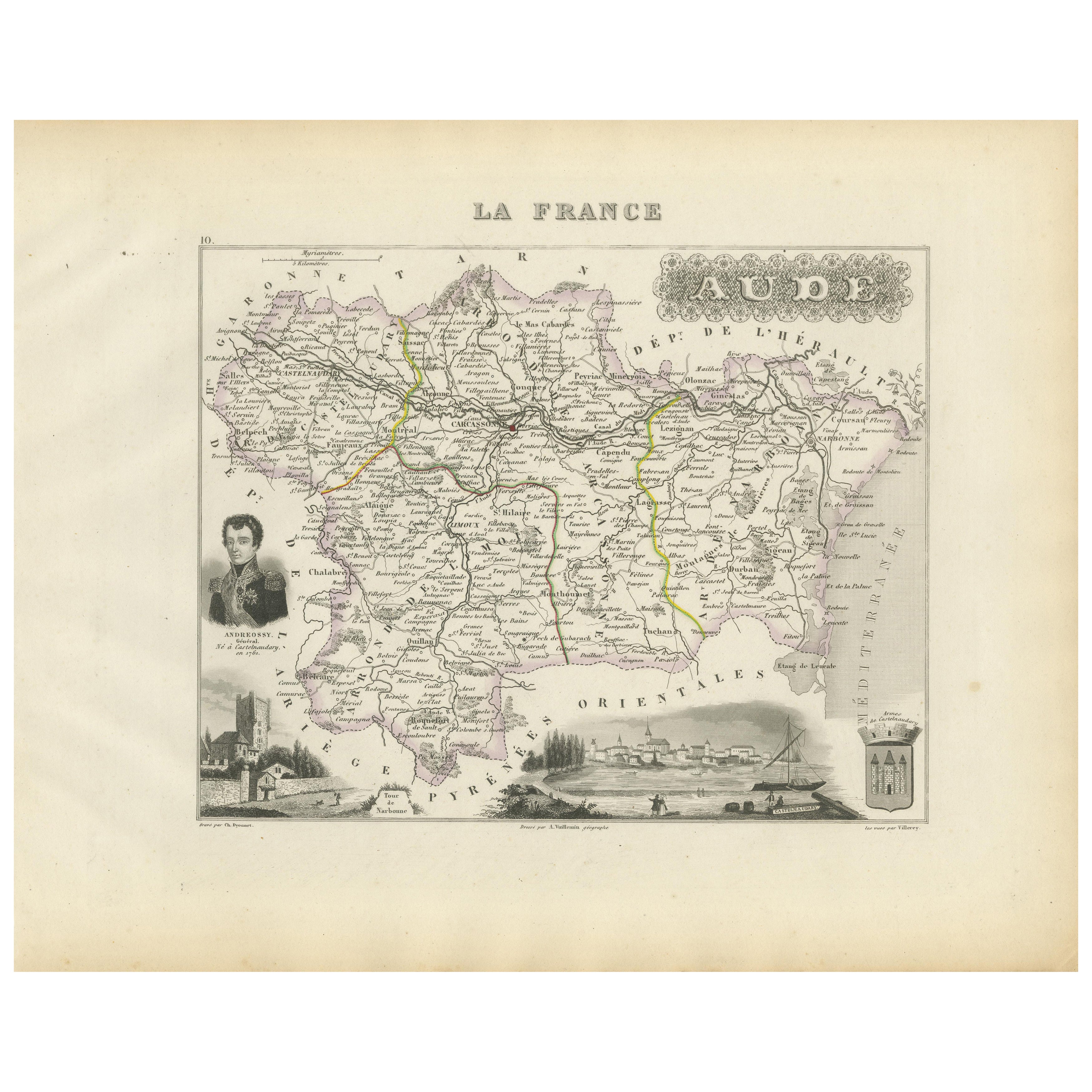
Map of Aude France with Carcassonne and Languedoc Vineyards, 19th Century
Map of Aude France with Carcassonne and Languedoc Vineyards, 19th Century
Description:
This elegant 19th-century map of Aude, a department in southern France along the Mediterranean...
Kategorie
Antik, Mittleres 19. Jahrhundert, Französisch, Landkarten
Materialien
Papier
Antike Karte von Frankreich mit einer eingelassenen Karte der Insel Korsika, um 1820
Antike Karte mit dem Titel 'Frankrijk naar de nieuwste bepalingen meerendeels gevolgd naar Lapie'. Schöne Karte von Frankreich mit einer Einlagekarte der Insel Korsika. Enthält eine ...
Kategorie
Antik, 19. Jahrhundert, Landkarten
Materialien
Papier

169 $ Angebotspreis
20 % Rabatt
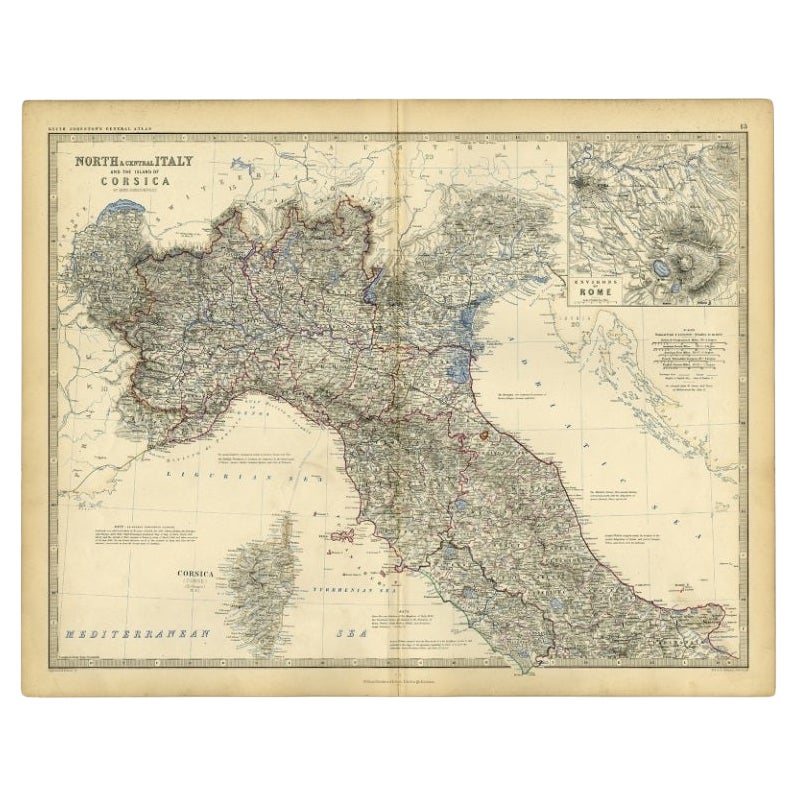
Antike Karte von Italien und Korsica, um 1860
Antike Karte mit dem Titel 'Nord- und Mittelitalien und die Insel Korsika'.
Alte Karte von Nord- und Mittelitalien und der Insel Korsika. Mit einer beigefügten Karte der Region R...
Kategorie
Antik, 19. Jahrhundert, Landkarten
Materialien
Papier
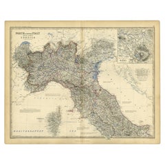
103 $ Angebotspreis
20 % Rabatt
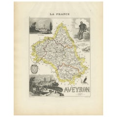
Map of Aveyron France with Rodez, Millau and Wine Routes, 19th Century
Map of Aveyron France with Rodez, Millau and Wine Routes, 19th Century
Description:
This detailed and decorative 19th-century map of Aveyron, a department in southern France, was dr...
Kategorie
Antik, Mittleres 19. Jahrhundert, Französisch, Landkarten
Materialien
Papier
Das könnte Ihnen auch gefallen
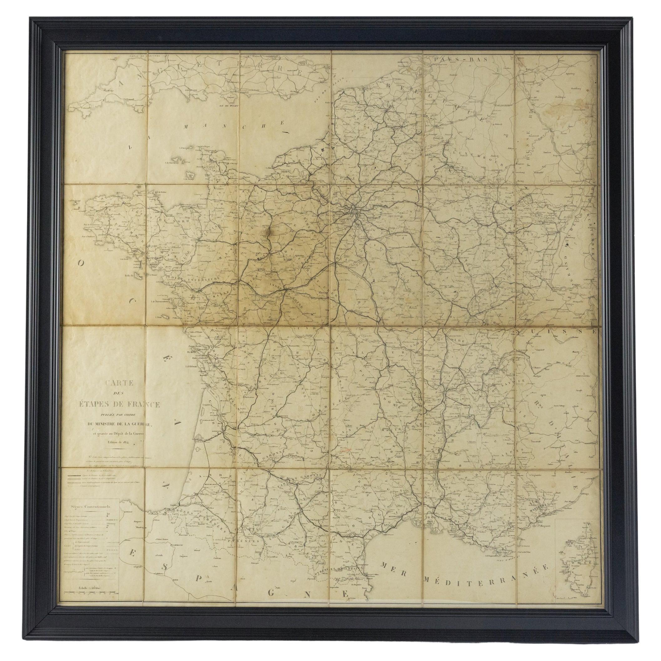
Große Karte von Frankreich aus dem 19.
Große Karte von Frankreich aus dem 19. Jahrhundert.
Bemerkenswerter Zustand, mit einer angenehmen altersbedingten Patina.
Kürzlich gerahmt.
Frankreich CIRCA 1874.
Kategorie
Antik, Spätes 19. Jahrhundert, Französisch, Landkarten
Materialien
Leinen, Papier

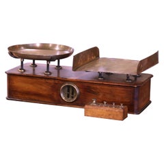
Französische Napoleon III.-Schale aus Nussbaum und Messing mit Gewichten aus dem 19. Jahrhundert
Diese klassische, antike Waage mit Originalplatten wurde um 1870 in Dijon, Frankreich, hergestellt. Die rechteckige Waage aus Obstholz ist mit Intarsien verziert und verfügt über die...
Kategorie
Antik, Spätes 19. Jahrhundert, Französisch, Napoleon III., Wissenschaftl...
Materialien
Messing
Italien, Sizilien, Sardinien, Korsika und die Dalmatinische Küste des 17. Jahrhunderts: Eine niederländische Karte
Von Theodorus Danckerts
Diese handkolorierte niederländische Karte aus dem 17. Jahrhundert mit dem Titel "Novissima et Accuratissima totius Italiae Corsicae et Sardiniae Descriptio" von Theodore Danckerts z...
Kategorie
Antik, Spätes 17. Jahrhundert, Niederländisch, Landkarten
Materialien
Papier

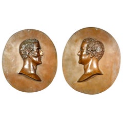
Großes Paar signierte Reliefporträtbüsten von Wellington und Napoleon aus dem 19. Jahrhundert
Von Nathaniel Palmer
Ein sehr hübsches und beeindruckendes Paar Relief-Porträtbüsten aus Kupfer, die links die Porträtbüsten von Arthur Wellesley, 1. Herzog von Wellington (1769-1852), und rechts von Nap...
Kategorie
Antik, 1830er, Englisch, William IV., Historische Sammlerstücke
Materialien
Kupfer
Sammlung antiker Bücher mit französischen Fotos und Porträts aus dem 19
Von Mice di rugiano domenico e c. s.n.c.
Sammlung antiker Bücher mit französischen Fotos und Porträts aus dem 19
Kategorie
Antik, 19th Century, French, Art nouveau, Bücher
Materialien
Papier
Französische Holzmaquette des 19. Jahrhunderts/Modell des Pantheons mit Napoleon I.-Figur, Französisch
Diese exquisite und hochdetaillierte hölzerne Maquette aus dem späten 19. Jahrhundert ist eine bemerkenswerte Darstellung des Pantheons in Paris. Es ist ein bedeutendes Beispiel der ...
Kategorie
Antik, 19. Jahrhundert, Französisch, Empire, Architektonische Modelle
Materialien
Holz