Objekte ähnlich wie Map of the Lakes of the Globe 1856 – Comparative Chart of Inland Seas


Möchten Sie mehr Bilder oder Videos?
Zusätzliche Bilder oder Videos von dem*der Anbieter*in anfordern
1 von 10
Map of the Lakes of the Globe 1856 – Comparative Chart of Inland Seas
280 €pro Objekt|Einschließlich MwSt.
Menge
Versand
Angebot wird abgerufen …Das Versprechen von 1stDibs:
Authentizitätsgarantie,
Geld-Zurück-Garantie,
Stornierung innerhalb von 24 Stunden
Angaben zum Objekt
Map of the Lakes of the Globe 1856 – Comparative Chart of Inland Seas
Description:
This remarkable 19th-century comparative chart is titled Comparative Form and Extent of the Inland Seas and Lakes of the Globe. It was published in 1856 by William Blackwood & Sons of Edinburgh and London, as part of the educational and scientific work The Physical Atlas by Alexander Keith Johnston. This hand-colored lithograph presents a fascinating side-by-side comparison of the world’s major lakes and inland seas, drawn to a uniform scale and annotated with elevations above sea level.
The print is divided by continent: North America, South America, Europe, Asia, and Africa are each represented with carefully rendered lakes shown in proportion to one another. Prominent bodies of water include the Great Lakes of North America, the Caspian Sea, Lake Baikal, the Dead Sea, the Aral Sea, Lake Titicaca, Lake Victoria, and many others. Each lake is labeled with detailed information such as depth, area, and elevation. The chart not only displays geographical features but also offers insight into 19th-century scientific understanding and comparative geography.
One of the most interesting aspects of this print is how it visualizes the scale and location of lakes relative to each other in a single frame. This method of comparison was a hallmark of Johnston’s Physical Atlas, which aimed to make complex scientific data accessible through visual clarity. At a time when global travel and mapping were still developing, this print would have offered viewers a rare opportunity to comprehend distant and diverse geographic phenomena side by side.
Alexander Keith Johnston was a pioneering Scottish geographer and cartographer. He held the title Geographer to the Queen for Scotland and was widely respected for the precision and clarity of his maps. His Physical Atlas, first published in 1848 and revised in the 1850s, was one of the earliest thematic atlases, influencing both cartographic design and geographic education.
Condition summary:
Very good condition. Light overall toning and a few small foxing spots near the margins. The hand-colored blue lake shading is clean and bright, and the paper remains strong and well-preserved.
Framing tips:
This visually structured print pairs well with a simple black or dark oak frame to enhance its scientific tone. A white or light ivory mat will provide contrast while maintaining a clean, archival presentation. UV-protective glass is advised to preserve color and clarity.
- Maße:Höhe: 27,4 cm (10,79 in)Breite: 34,5 cm (13,59 in)Tiefe: 0,2 mm (0,01 in)
- Materialien und Methoden:
- Herkunftsort:
- Zeitalter:
- Herstellungsjahr:1856
- Zustand:Very good condition. Light overall toning near the margins. The hand-colored blue lake shading is clean and bright, and the paper remains strong and well-preserved. Folding line as issued.
- Anbieterstandort:Langweer, NL
- Referenznummer:Anbieter*in: BG-13207-31stDibs: LU3054345385802
Anbieterinformationen
5,0
Anerkannte Anbieter*innen
Diese renommierten Anbieter*innen sind führend in der Branche und repräsentieren die höchste Klasse in Sachen Qualität und Design.
Gold-Anbieter*in
Premium-Anbieter*innen mit einer Bewertung über 4,3 und 24 Stunden Reaktionszeit
Gründungsjahr 2009
1stDibs-Anbieter*in seit 2017
2.472 Verkäufe auf 1stDibs
Typische Antwortzeit: 1 Stunde
- VersandAngebot wird abgerufen …Versand von: Langweer, Niederlande
- Rückgabebedingungen
Einige Inhalte dieser Seite wurden automatisch übersetzt. Daher kann 1stDibs nicht die Richtigkeit der Übersetzungen garantieren. Englisch ist die Standardsprache dieser Website.
Authentizitätsgarantie
Im unwahrscheinlichen Fall eines Problems mit der Echtheit eines Objekts kontaktieren Sie uns bitte innerhalb von 1 Jahr für eine volle Rückerstattung. DetailsGeld-Zurück-Garantie
Wenn Ihr Objekt nicht der Beschreibung entspricht, beim Transport beschädigt wurde oder nicht ankommt, kontaktieren Sie uns bitte innerhalb von 7 Tagen für eine vollständige Rückerstattung. DetailsStornierung innerhalb von 24 Stunden
Sie können Ihren Kauf jederzeit innerhalb von 24 Stunden stornieren, ohne jegliche Gründe dafür angeben zu müssen.Geprüfte Anbieter*innen
Unsere Anbieter*innen unterliegen strengen Dienstleistungs- und Qualitätsstandards, wodurch wir die Seriosität unserer Angebote gewährleisten können.Preisgarantie
Wenn Sie feststellen, dass ein*e Anbieter*in dasselbe Objekt anderswo zu einem niedrigeren Preis anbietet, werden wir den Preis entsprechend anpassen.Zuverlässige weltweite Lieferung
Unsere erstklassigen Versandunternehmen bieten spezielle Versandoptionen weltweit, einschließlich individueller Lieferung.Mehr von diesem*dieser Anbieter*in
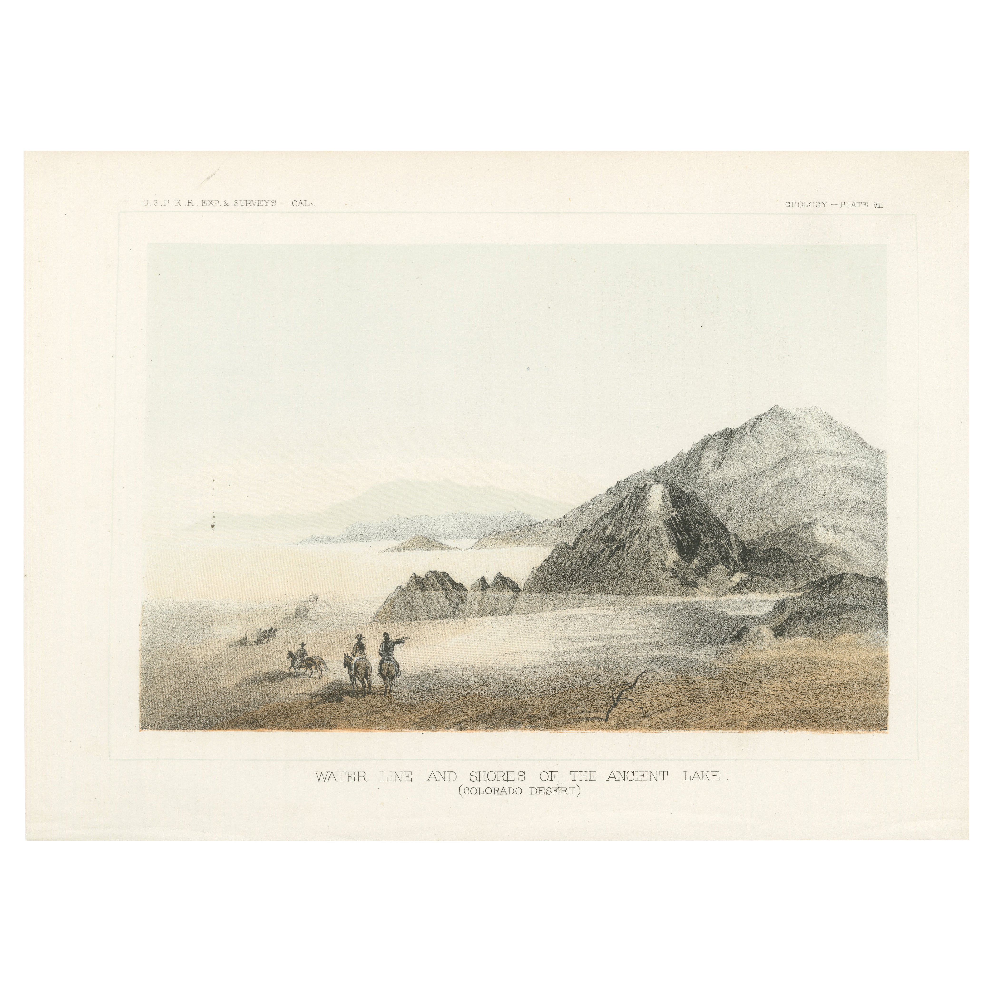
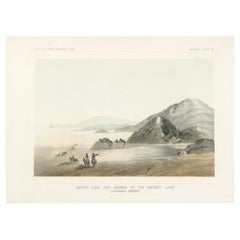
Alle anzeigenGeologische Wunder der Colorado-Wüste - Uralte Seeuferlinie, 1856
Geologische Wunderwerke der Colorado-Wüste - Uralte Seeuferlinie
Diese eindrucksvolle Lithografie zeigt eine fesselnde Darstellung der alten Wasserlinie und des Ufers eines längst...
Kategorie
Antik, 1850er, Drucke
Materialien
Papier
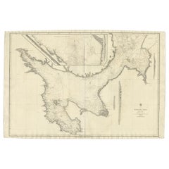
Große Seekarte der britischen Inseln, 1918
Antike Karte mit dem Titel 'Die Britischen Inseln'.
Große Seekarte der Britischen Inseln. Sie zeigt Irland, Schottland, England, die Shetlandinseln und einen Teil Frankreichs.
Die...
Kategorie
Vintage, 1910er, Landkarten
Materialien
Papier

448 € Angebotspreis
20 % Rabatt
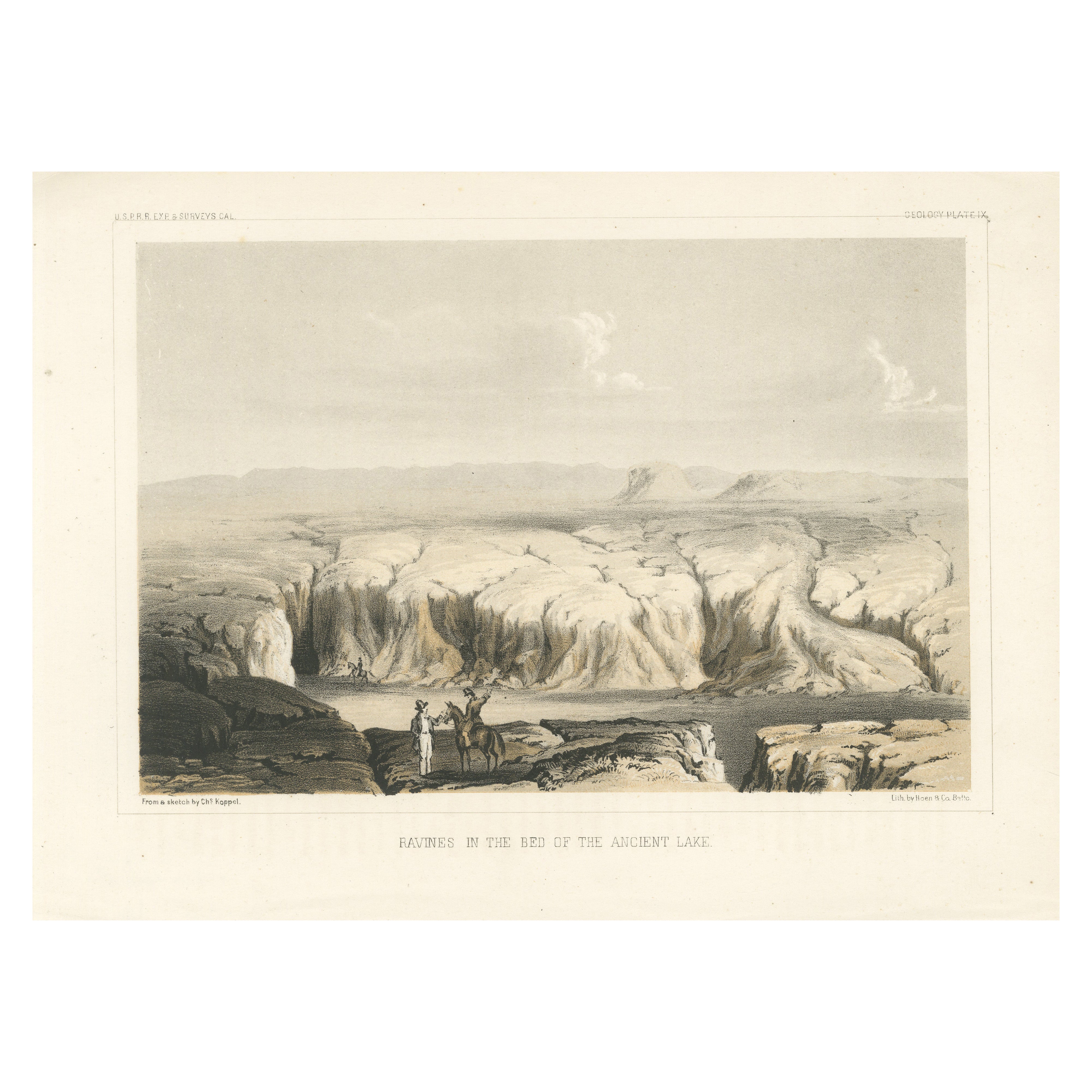
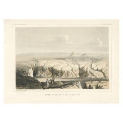
Getönte Lithographie von Schluchten im Bett des Alten Sees in den USA, 1856
Titel: Getönte Lithographie von Schluchten im Bett des Alten Sees, 1856
Beschreibung:
Diese fesselnde Lithografie "Ravines in the Bed of the Ancient Lake" zeigt die dramatischen...
Kategorie
Antik, 1850er, Drucke
Materialien
Papier
176 € Angebotspreis
20 % Rabatt
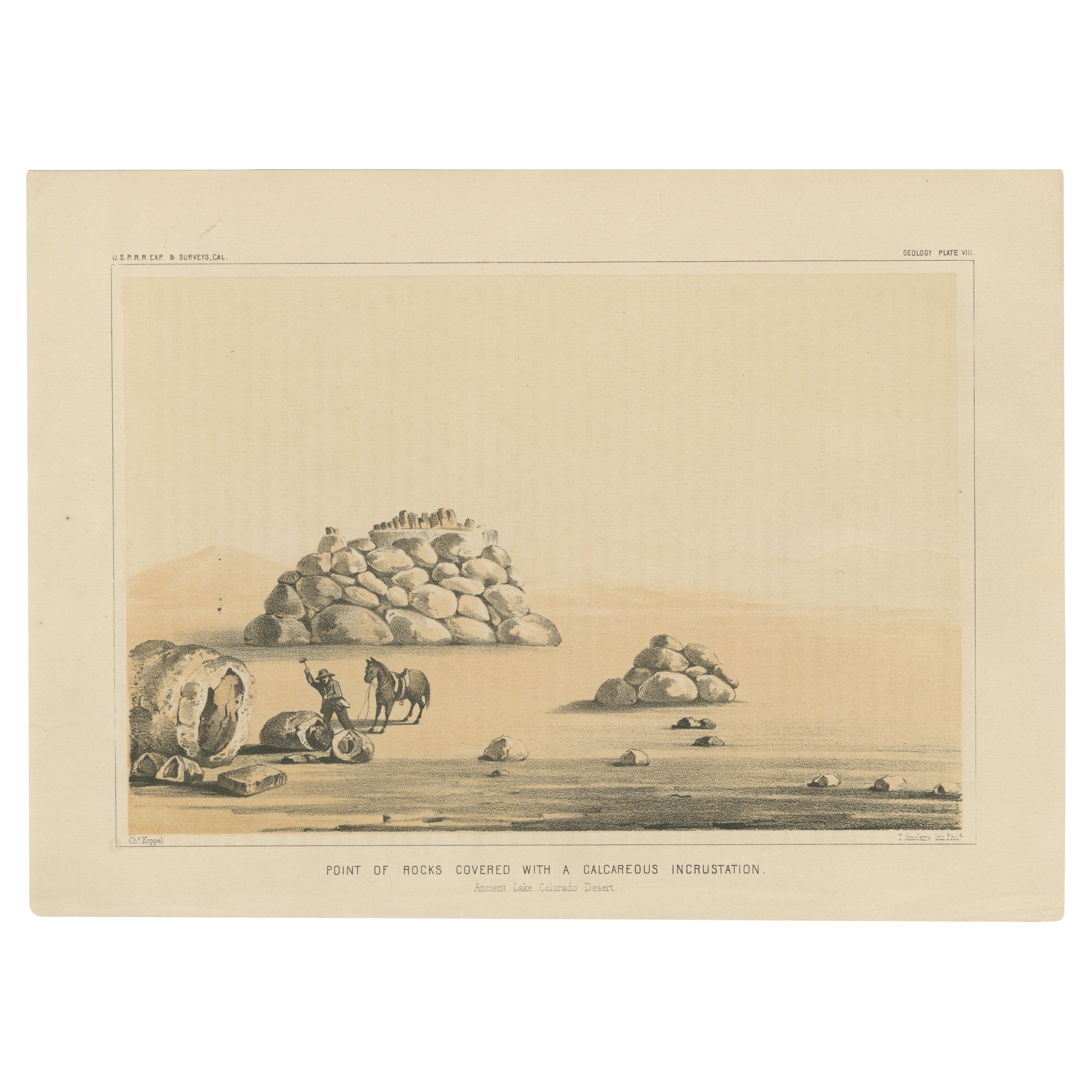
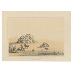
Geological Landmark: Point of Rocks in der Colorado-Wüste im alten Lake Colorado, 1856
Geologisches Wahrzeichen: Point of Rocks in der Wüste des alten Colorado-Sees
Diese bemerkenswerte Lithografie zeigt die faszinierende geologische Formation "Point of Rocks" in d...
Kategorie
Antik, 1850er, Drucke
Materialien
Papier
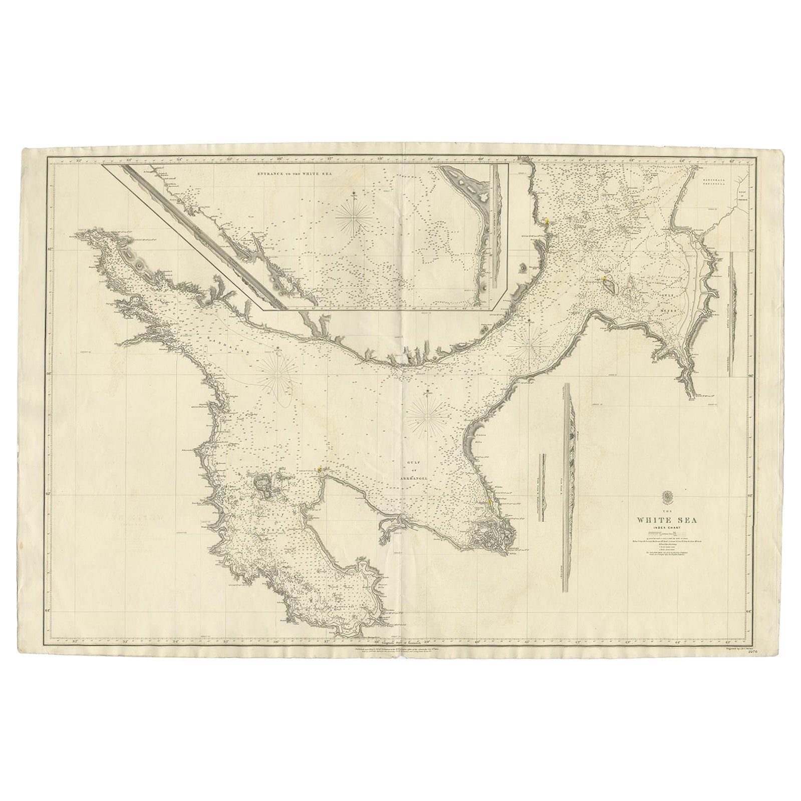
Große antike Charte des weißen Meeres, Russa 1854
Antike Karte mit dem Titel "The White Sea Index Chart". Große, seltene Karte des Weißen Meeres mit einer kleineren Karte des Eingangs zum Weißen Meer. Das Weiße Meer ist ein südliche...
Kategorie
Antik, 19. Jahrhundert, Landkarten
Materialien
Papier
760 € Angebotspreis
20 % Rabatt
Große Karte der Insel und des Meeres von Java, Indonesien
Antike Karte mit dem Titel 'Carte Esférica de la Isla Y Mar de Java'. Große Karte der Insel und des Meeres von Java, Indonesien. Schöne Seekarte, veröffentlicht 1863 in Spanien.
Kategorie
Antik, Mittleres 19. Jahrhundert, Landkarten
Materialien
Papier

2.000 € Angebotspreis
20 % Rabatt
Das könnte Ihnen auch gefallen
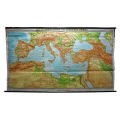
Vintage Mural Map Mittelmeer Naher Osten Länder Rollable Wall Chart
Eine große Länderkarte mit den Ländern rund um das Mittelmeer, herausgegeben von Westermann. Farbenfroher Druck auf mit Leinwand verstärktem Papier.
Abmessungen:
Breite 269 cm (105,9...
Kategorie
Vintage, 1970er, Deutsch, Land, Drucke
Materialien
Leinwand, Holz, Papier
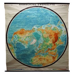
Rollbare Karte der nördlichen Hemisphäre der Erde, Vintage-Wandtafel, Weltkarte
Eine großartige Karte zum Herunterziehen oder eine alte Wandtafel, die die nördliche Hemisphäre der Erde illustriert. Herausgegeben von Prof. Dr. C. Troll, Flemmings Verlag Hamburg. ...
Kategorie
Mitte des 20. Jahrhunderts, Deutsch, Land, Drucke
Materialien
Leinwand, Holz, Papier
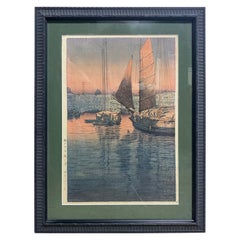
Tsuchiya Koitsu Japanischer Sonnenuntergang mit Holzschnitt im Tomonotsu-Stil, Inlandsee, 1940
Von Tsuchiya Koitsu
Ein sehr schöner, heiterer und relativ seltener Farbholzschnitt des berühmten japanischen Künstlers Tsuchiya Koitsu mit dem Titel "Sonnenuntergang bei Tomonotsu, Binnenmeer" wurde 19...
Kategorie
Vintage, 1940er, Japanisch, Showa, Drucke
Materialien
Papier
Charte der Ostküste Englands
Karte der Ostküste Englands von Dungeness bis Flamborough, einschließlich der Einmündungen der Themse. Gezeichnet vom Hydrographen J.W. Norie im Jahr 1841. Umfasst die Bezirke Kent, ...
Kategorie
Antik, 1840er, Englisch, Nautische Instrumente
Materialien
Papier

1.685 €
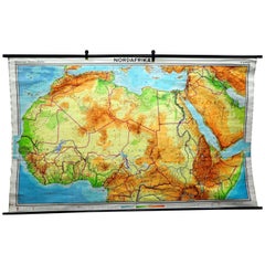
Wandkarte aus Nordafrika, Countrycore, afrikanische Wandtafel-Dekoration
Die Wandkarte zeigt Nordafrika. Sie wurde von Westermann-Schulwandkarten veröffentlicht. Wird als Unterrichtsmaterial in deutschen Schulen verwendet. Farbenfroher Druck auf mit Leinw...
Kategorie
Ende des 20. Jahrhunderts, Deutsch, Land, Drucke
Materialien
Leinwand, Holz, Papier
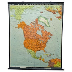
Rollbares Wandkartenplakat „Countries of North America“ von
Die Schulkarte im Vintage-Stil zeigt die Länder / Staaten Nordamerikas. Herausgegeben von Haack-Painke Justus Perthes Darmstadt. Farbenfroher Druck auf mit Leinwand verstärktem Papie...
Kategorie
Ende des 20. Jahrhunderts, Deutsch, Land, Drucke
Materialien
Leinwand, Holz, Papier