Artículos similares a 1791 Gazette of The United States, with Plans for the Capital City of Washington


¿Quieres más imágenes o vídeos?
Solicita imágenes o vídeos adicionales al vendedor
1 de 11
1791 Gazette of The United States, with Plans for the Capital City of Washington
Acerca del artículo
Presented is a very early description of the City of Washington, as the planned Federal capital city. The article, written by an anonymous "Spectator,” was published in the October 8, 1791 issue of the Gazette of the United States. Spanning two columns of text, the article details in full the natural terrain and waterways, the designed plan of Pierre L’Enfant for the city’s layout, buildings, and streets, the ceding of territory from Virginia and Maryland, and the eventual sale of lots to the public. The author argues that “the founding of this city, in such an eligible situation, upon such a liberal and elegant plan, will, by future generations, be considered as one of the most important transactions of the present President of the United States; while its name will keep fresh in mind, to the end of time, the many important services he has rendered his country.”
The authority to establish a federal capital was provided in Article One, Section 8, of the United States Constitution, which permits Congress “to exercise exclusive Legislation in all Cases whatsoever, over such District (not exceeding ten Miles square) as may, by Cession of particular States, and the Acceptance of Congress, become the Seat of the Government of the United States.” The Constitution, however, did not specify a location for the new capital. James Madison explained the need for a federal district on January 23, 1788 in the Federalist No. 43, arguing that the national capital needed to be distinct from the states, in order to provide for its own maintenance and safety. In what later became known as the Compromise of 1790, Madison, Hamilton, and Jefferson came to an agreement that the federal government would assume war debt carried by the states, on the condition that the new national capital would be located in the South. On July 16, 1790, the Residence Act provided for a new permanent capital to be located on the Potomac River, the exact area to be selected by President Washington. Both Maryland and Virginia ceded portions of their territory to form the new capital, located on the north bank of the Potomac. On September 9, 1791, the federal city was named in honor of George Washington and the district was named the Territory of Columbia.
The city's lay-out derived from a number of ideas, Washington's and Jefferson's most famously, but owes most of its initial configuration to Pierre Charles L'Enfant, who had served under Washington during the war as an engineer. In 1791, President Washington asked L'Enfant to design the new capital city in the District of Columbia. L'Enfant designed a city similar in layout to the then French capital city of Versailles. Spreading out from the crux of the Potomac and its East Branch in a north-south grid, the city was planned with fifteen additional avenues (for the then fifteen states) that radiated from the White House or Capitol or parallel one of those avenues. As described in the article, these avenues “not only produce a variety of charming prospects, and facilitate the communication through the city, but remove that insipid sameness, that renders Philadelphia and Charleston unpleasing.”
L’Enfant’s great plan for the federal city, as described in this article, was later modified by Andrew Ellicott. In 1791, troubles arose between the Commissioners of the City and L'Enfant because they needed to have a printed copy of the plan in order to sell buildings and public lots. L'Enfant frustrated them by working too slowly and releasing only sketchy plans. On February 27, 1792, by instruction from Washington, Thomas Jefferson wrote a letter to L'Enfant dismissing him as city planner. Surveyor and mathematician Andrew Ellicott had already completed a detailed survey of the city in 1791, so he was an obvious choice as L’Enfant’s replacement.
The Gazette of the United States was the leading Federalist newspaper of the late 18th century. Adopting the motto, “he that is not for us, is against us,” the newspaper was a stalwart defender of the Federalist administration and a staunch critic of its opponents. Editor John Fenno issued the Gazette as a semiweekly newspaper, published on Wednesdays and Saturdays, with the first edition appearing on April 15, 1789, in New York City, the nation’s capital at the time. One of its most significant supporters was Alexander Hamilton, who organized its initial funding and was a primary, albeit anonymous, contributor of letters and essays. In 1791 the Gazette moved to Philadelphia, located at No. 69 High Street, between Second and Third Streets. The newspaper included foreign news, political essays, letters, and news reports, with very little distinction between the news and editorial comment.
CONDITION:
Very good condition. Paper is very healthy, with only light toning. Light wrinkling and creasing in outer margins. Paper is printed with black ink in three columns of text. Ink has faded only slightly. Attractive masthead at the top, indicating issue number and date, “No. 47 of Vol. III, Saturday, October 8, 1791. Whole No. 255.”
Attractively and archivally framed in a custom-built black wooden frame with gold beaded spandrel, acid-free top mats, and UV conservation glass.
Framed Dimensions: 20 1/8"H x 13 5/8"W x 1"D.
Accompanied by our company's letter of authenticity.
- Dimensiones:Altura: 51,14 cm (20,13 in)Anchura: 34,63 cm (13,63 in)Profundidad: 2,54 cm (1 in)
- Estilo:Federal (Del período)
- Materiales y técnicas:
- Lugar de origen:
- Época:1790-1799
- Fecha de fabricación:1791
- Estado:Adiciones o alteraciones hechas al original: Archivally framed by Artem Art Services in Colorado Springs, Colorado, in November of 2024. Desgaste acorde con la edad y el uso.
- Ubicación del vendedor:Colorado Springs, CO
- Número de referencia:Vendedor: PR5081stDibs: LU909745223842
Sobre el vendedor
4,9
Vendedor Platino
Vendedores premium con una calificación de +4,7 y tiempos de respuesta de 24 horas
Establecido en 2010
Vendedor de 1stDibs desde 2011
452 ventas en 1stDibs
Tiempo de respuesta usual: 1 hora
- EnvíoRecuperando presupuesto…Envío desde: Colorado Springs, CO
- Política de devolución
Partes de esta página se han traducido automáticamente. 1stDibs no puede garantizar la exactitud de las traducciones. El inglés es el idioma predeterminado de este sitio web.
Garantía de autenticidad
En el improbable caso de que haya algún problema con la autenticidad de un artículo, ponte en contacto con nosotros en un plazo de 1 año para recibir un reembolso total. DetallesGarantía de devolución de dinero
Si tu artículo no es como se describe, sufre daños durante el transporte o no llega, ponte en contacto con nosotros en un plazo de 7 días para recibir un reembolso total. DetallesCancelación dentro de las 24 horas
Tienes un período de gracia de 24 horas para reconsiderar tu compra, sin preguntas.Vendedores profesionales aprobados
Nuestros vendedores de primera clase deben cumplir estrictos estándares de servicio para mantener la integridad de nuestros anuncios.Garantía de igualación de precios
Si encuentras que un vendedor publicó el mismo artículo por un precio menor en otro lado, igualaremos ese precio.Entrega global de confianza
Nuestra red de transporte de primera ofrece opciones de envío especializado en todo el mundo, que incluye envío personalizado.Más de este vendedor
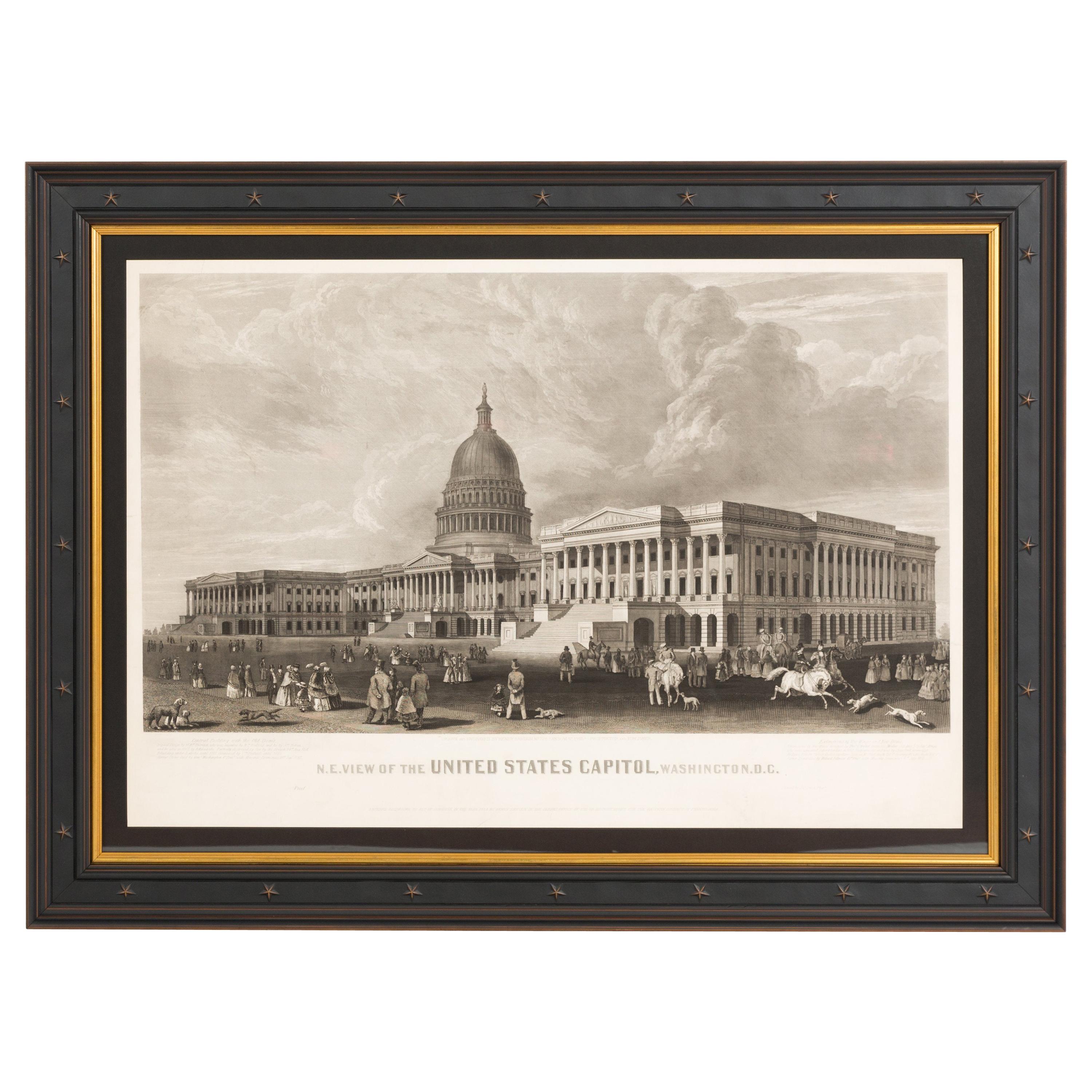
Ver todoN.E. Vista del Capitolio de los Estados Unidos, Washington, DC Prueba de imprenta antigua 1858
Esta estampa grabada muestra una vista del edificio del Capitolio de los Estados Unidos, en Washington, D.C. El grabado representa el edificio neoclásico desde la orientación noreste...
Categoría
Antiguo, Década de 1850, Estadounidense, Impresiones
Materiales
Papel

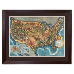
1960 "Los 50 Estados Unidos de América" Mapa pictórico de Lorin Thompson
Este colorido mapa de Estados Unidos fue dibujado por Lorin Thompson y publicado por la General Foods Corporation en 1960. El mapa se publicó como folleto promocional antes de las el...
Categoría
Vintage, Década de 1960, Moderno de mediados de siglo, Impresiones
Materiales
Papel
1750 US$ Precio de venta
Descuento del 22 %
"Los británicos rinden sus armas al Gen. Washington..." según Renault, 1819
Se presenta un grabado titulado "Los británicos rindiendo sus armas al Gen. Washington tras su derrota en Yorktown, Virginia, en octubre de 1781". La dedicatoria continúa en el marge...
Categoría
Antiguo, Década de 1810, Estadounidense, Federal, Impresiones
Materiales
Papel

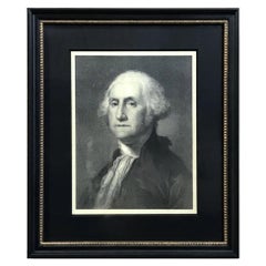
"G. Washington" Litografía según Gilbert Stuart
Por Gilbert Stuart
Se presenta un hermoso retrato litografiado de George Washington. Esta litografía está basada en un cuadro de Gilbert Stuart, el famoso retrato de busto "Athanaeum" de 1796. Washingt...
Categoría
Antiguo, siglo XIX, Estadounidense, Federal, Impresiones
Materiales
Papel
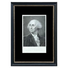
"Georgius Washington" Grabado de Giuseppe Longhi, 1817
Se presenta un hermoso retrato grabado de George Washington, obra del artista italiano Giuseppe Longhi. Titulado "Georgius Washington", este grabado se publicó en Padua, Italia, en 1...
Categoría
Antiguo, Década de 1810, Italiano, Federal, Impresiones
Materiales
Papel
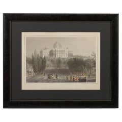
"Vista del Capitolio en Washington" Grabado, según William Henry Bartlett
Se presenta un encantador grabado coloreado a mano de "Vista del Capitolio en Washington". El grabado es una reproducción del grabado de William Henry Bartlett del mismo título, publ...
Categoría
Antiguo, Fines del siglo XIX, Estadounidense, Victoriano, Impresiones
Materiales
Papel
También te puede gustar
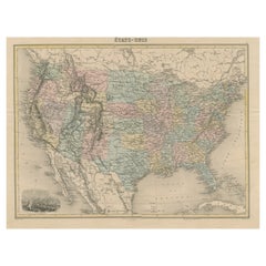
Mapa antiguo de Estados Unidos con viñeta de Washington
Mapa antiguo titulado "États-Unis". Un mapa de Estados Unidos de finales del siglo XIX muy atractivo y detallado, con una fina viñeta decorativa de Washington. Se ilustra claramente ...
Categoría
Antiguo, Fines del siglo XIX, Mapas
Materiales
Papel
444 US$ Precio de venta
Descuento del 20 %
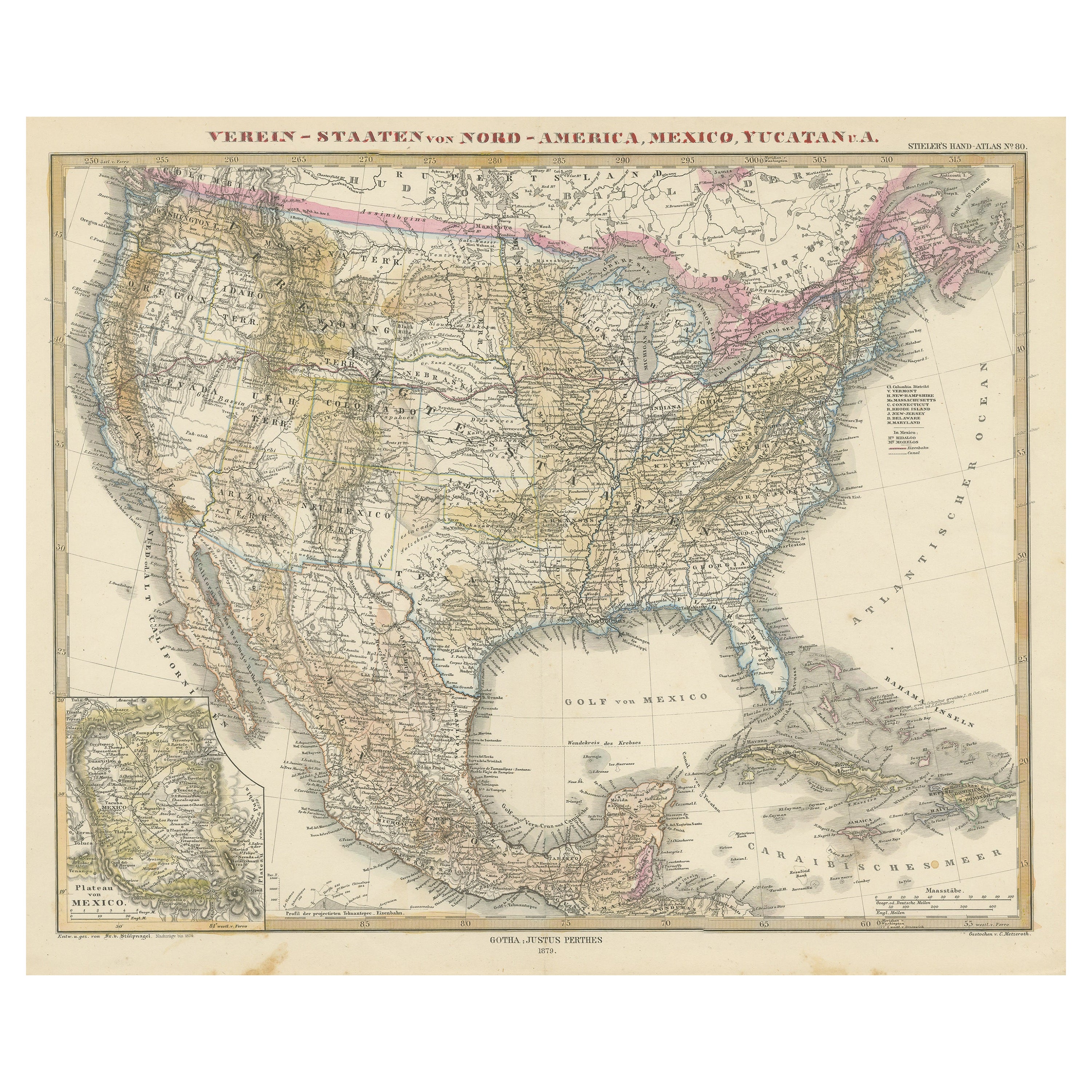
Mapa antiguo de los Estados Unidos con mapa insertado de la región de Ciudad de México
Mapa antiguo titulado 'Verein-Staaten von Nord-America, Mexico, Yucatan u.a.'. Mapa muy detallado de los Estados Unidos de América que muestra el Caribe. Con un mapa de los alrededor...
Categoría
Antiguo, Mediados del siglo XIX, Mapas
Materiales
Papel

796 US$ Precio de venta
Descuento del 20 %
Mapa pequeño de Estados Unidos
Mapa antiguo titulado "Amérique septe. Físico". Pequeño mapa de Estados Unidos. Litografiado por los hermanos C. Callewaert en Bruselas hacia 1870.
Categoría
Antiguo, Mediados del siglo XIX, Mapas
Materiales
Papel

69 US$ Precio de venta
Descuento del 20 %
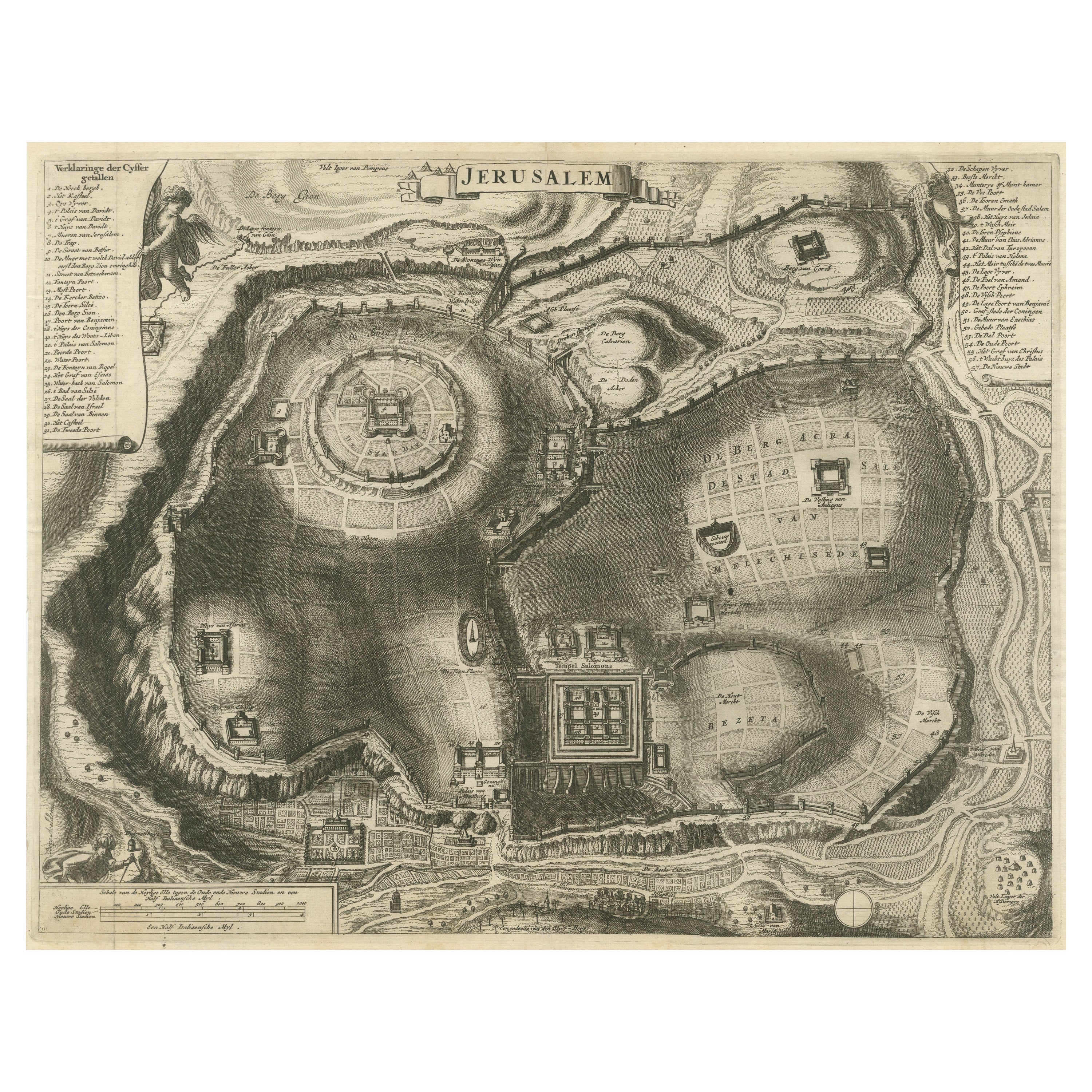
Plano antiguo de la ciudad de Jerusalén
Mapa antiguo titulado "Jerusalén". Plano de la antigua ciudad de Jerusalén. Con amplia clave y escala. Fuente desconocida, por determinar.
Cornelis de Bruijn (también escrito Cornel...
Categoría
Antiguo, finales del siglo XVII, Impresiones
Materiales
Papel
500 US$ Precio de venta
Descuento del 20 %
Mapa antiguo coloreado a mano de Estados Unidos y el Caribe
Mapa antiguo titulado 'Verein-Staaten von Nord-America, Mexico, Yucatan u.a.'. Mapa muy detallado de los Estados Unidos de América que muestra el Caribe. Con un mapa de los alrededor...
Categoría
Antiguo, Fines del siglo XIX, Mapas
Materiales
Papel

518 US$ Precio de venta
Descuento del 20 %
Mapa Antiguo del Este de Estados Unidos con Mapa Inserto de Texas
Mapa antiguo titulado "Verein-Staaten von Nord-America mit Ausnahme Florida's und der Westlichen Territorien". Este mapa se extiende hasta el oeste de Luisiana y sólo incluye la part...
Categoría
Antiguo, Mediados del siglo XIX, Mapas
Materiales
Papel

500 US$ Precio de venta
Descuento del 20 %