Artículos similares a Antique French Map of Isère Region with Grenoble, Vienne, Dauphiné, 1800s


¿Quieres más imágenes o vídeos?
Solicita imágenes o vídeos adicionales al vendedor
1 de 9
Antique French Map of Isère Region with Grenoble, Vienne, Dauphiné, 1800s
140 €IVA incluido
Acerca del artículo
Antique Map of Isère, France by Vuillemin, 19th Century
This decorative 19th-century map presents the département of Isère in southeastern France, engraved by Alexandre Vuillemin. Centered on Grenoble, the map outlines towns, rivers, and transport routes, with departmental boundaries highlighted in original hand color.
The map is enriched with finely engraved vignettes that reflect the region’s identity. At the lower left is a detailed view of Grenoble, framed by the surrounding Alpine landscape. To the right stands an engraved portrait of Pierre Terrail, seigneur de Bayard (1473–1524), known as the “Chevalier sans peur et sans reproche” (the knight without fear and beyond reproach), a legendary figure of French chivalry. At the upper left appears the coat of arms of Isère. Together, these elements capture both the cultural pride and historic importance of the region.
Isère, part of the historical Dauphiné province, is renowned for its Alpine scenery, medieval towns, and strategic role in French history. Vuillemin’s decorative approach celebrates both the geography and heritage of the département.
Alexandre Vuillemin (1812–1880) was one of France’s most accomplished 19th-century cartographers, known for his finely engraved maps and atlases. His *Atlas des départements de la France* is particularly prized for its fusion of geographic accuracy with artistic embellishment.
Condition report: Very good condition with crisp engraving and bright original hand coloring. Light marginal toning and minor foxing spots consistent with age, not affecting the printed area.
Framing tips: A dark green or walnut frame with ivory matting will harmonize beautifully with the Alpine vignette. A slim gilt fillet may also enhance the decorative engravings and coat of arms.
Technique: Engraving with original hand color
Maker: Alexandre Vuillemin, France, mid-19th century
- Dimensiones:Altura: 26,1 cm (10,28 in)Anchura: 32,5 cm (12,8 in)Profundidad: 0,2 mm (0,01 in)
- Materiales y técnicas:Papel,Grabado
- Lugar de origen:
- Época:
- Fecha de fabricación:circa 1850
- Estado:Condition report: Very good condition with crisp engraving and bright original hand coloring. Light marginal toning and minor foxing spots consistent with age, not affecting the printed area.
- Ubicación del vendedor:Langweer, NL
- Número de referencia:Vendedor: BG-13331-371stDibs: LU3054346798142
Sobre el vendedor
5,0
Vendedor reconocido
Estos prestigiosos vendedores son líderes del sector y representan el escalón más alto en cuanto a calidad y diseño de artículos.
Vendedor Platino
Vendedores premium con una calificación de +4,7 y tiempos de respuesta de 24 horas
Establecido en 2009
Vendedor de 1stDibs desde 2017
2654 ventas en 1stDibs
Tiempo de respuesta usual: <1 hora
- EnvíoRecuperando presupuesto…Envío desde: Langweer, Países Bajos
- Política de devolución
Partes de esta página se han traducido automáticamente. 1stDibs no puede garantizar la exactitud de las traducciones. El inglés es el idioma predeterminado de este sitio web.
Garantía de autenticidad
En el improbable caso de que haya algún problema con la autenticidad de un artículo, ponte en contacto con nosotros en un plazo de 1 año para recibir un reembolso total. DetallesGarantía de devolución de dinero
Si tu artículo no es como se describe, sufre daños durante el transporte o no llega, ponte en contacto con nosotros en un plazo de 7 días para recibir un reembolso total. DetallesCancelación dentro de las 24 horas
Tienes un período de gracia de 24 horas para reconsiderar tu compra, sin preguntas.Vendedores profesionales aprobados
Nuestros vendedores de primera clase deben cumplir estrictos estándares de servicio para mantener la integridad de nuestros anuncios.Garantía de igualación de precios
Si encuentras que un vendedor publicó el mismo artículo por un precio menor en otro lado, igualaremos ese precio.Entrega global de confianza
Nuestra red de transporte de primera ofrece opciones de envío especializado en todo el mundo, que incluye envío personalizado.Más de este vendedor
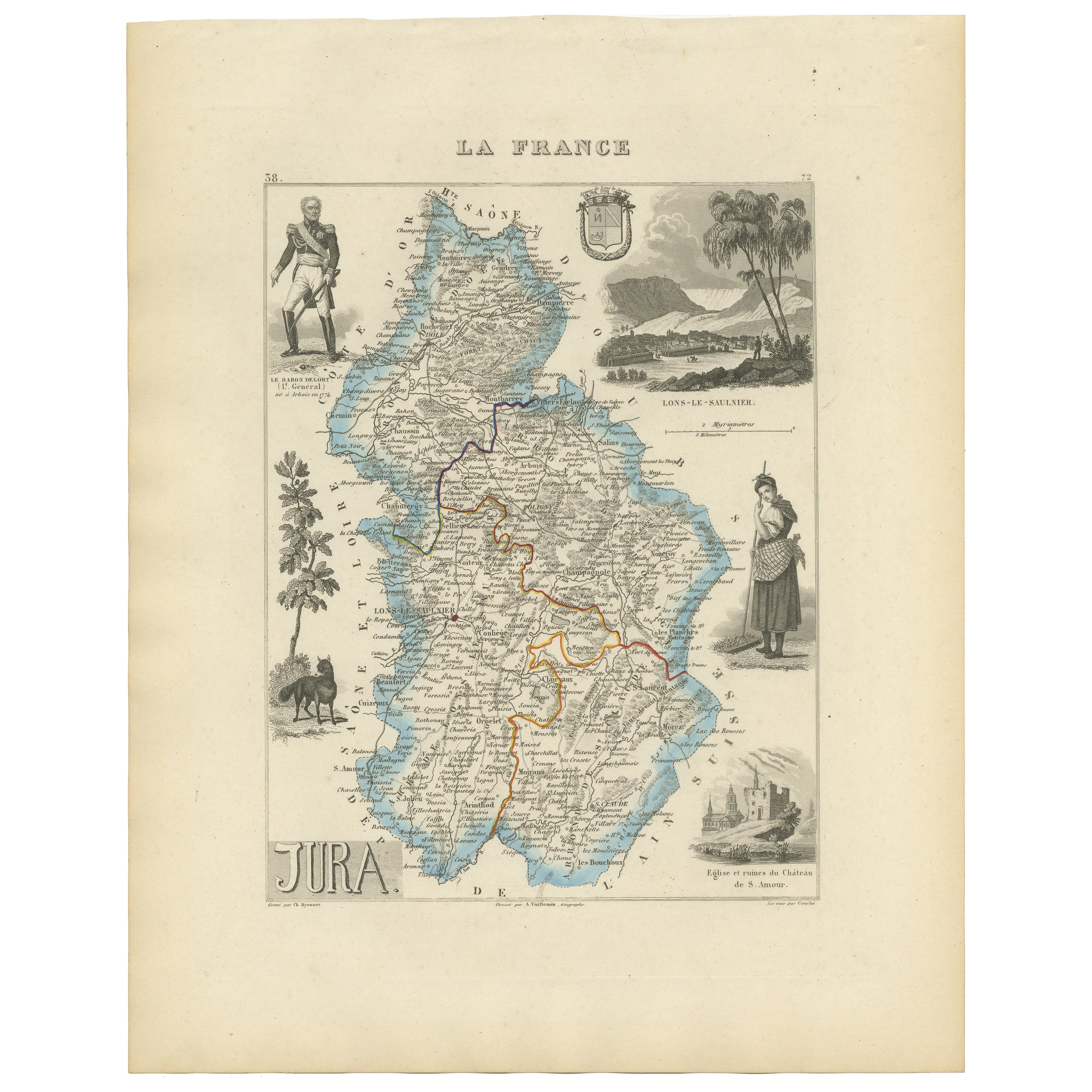
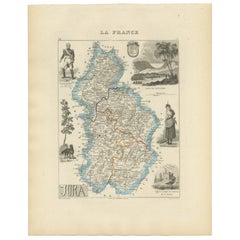
Ver todoAntique French Map of Jura Region with Lons-le-Saunier, Dole, 1800s
Antique Map of Jura, France by Vuillemin, 19th Century
This decorative 19th-century engraved map shows the département of Jura in eastern France, produced by Alexandre Vuillemin. Th...
Categoría
Antiguo, Mediados del siglo XIX, Francés, Mapas
Materiales
Papel
Antique French Map of Ille-et-Vilaine Region with Rennes, Saint-Malo, 1800s
Antique Map of Ille-et-Vilaine, France by Vuillemin, 19th Century
This decorative antique map presents the French département of Ille-et-Vilaine, situated in the Brittany region of ...
Categoría
Antiguo, Mediados del siglo XIX, Francés, Mapas
Materiales
Papel

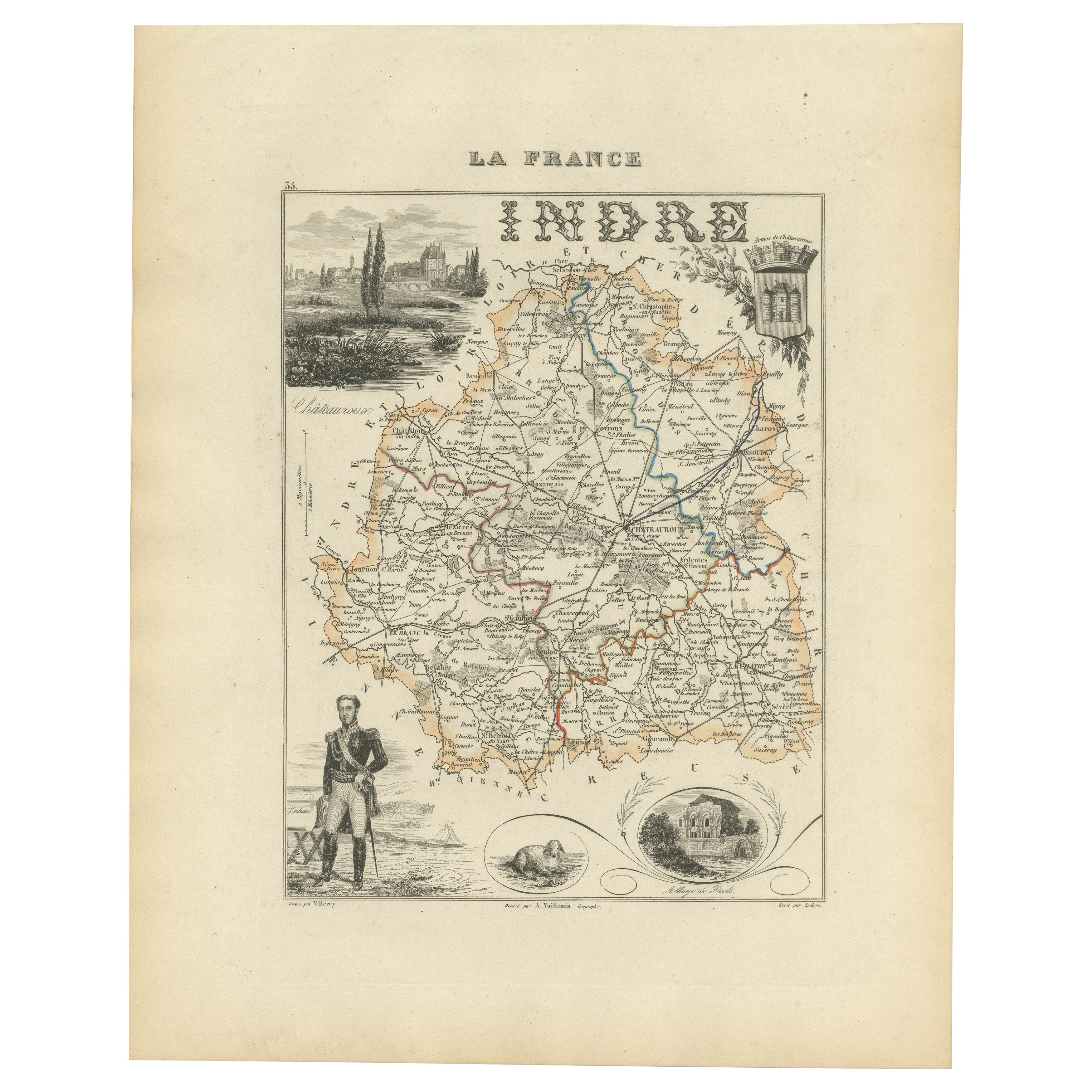
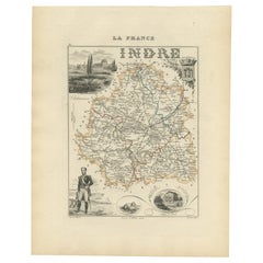
Antique French Map of Indre Region with Châteauroux and Issoudun, 1800s
Antique Map of Indre, France by Vuillemin, 19th Century
This fine decorative map presents the département of Indre, situated in the Centre-Val de Loire region of central France. Eng...
Categoría
Antiguo, Mediados del siglo XIX, Francés, Mapas
Materiales
Papel
Map of Gers France with Auch and Armagnac Wine Region by Vuillemin, 19th c
Map of Gers France with Auch and Armagnac Wine Region by Vuillemin, 19th c
This 19th-century engraved and hand-colored map of the department of Gers in southwestern France was creat...
Categoría
Antiguo, Mediados del siglo XIX, Francés, Mapas
Materiales
Papel

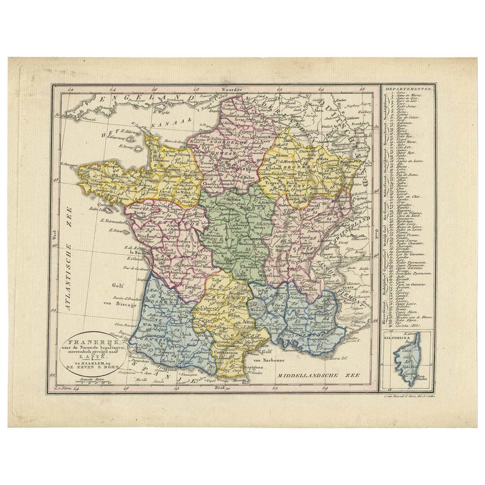
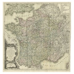
Mapa antiguo de Francia por Van Baarsel (c.1820)
Frankrijk naar de nieuwste bepalingen meerendeels gevolgd naar Lapie". Precioso mapa de Francia con un mapa inserto de la isla de Córcega. Incluye una tabla con referencias a los dep...
Categoría
Antiguo, principios del siglo XIX, Holandés, Mapas
Materiales
Papel

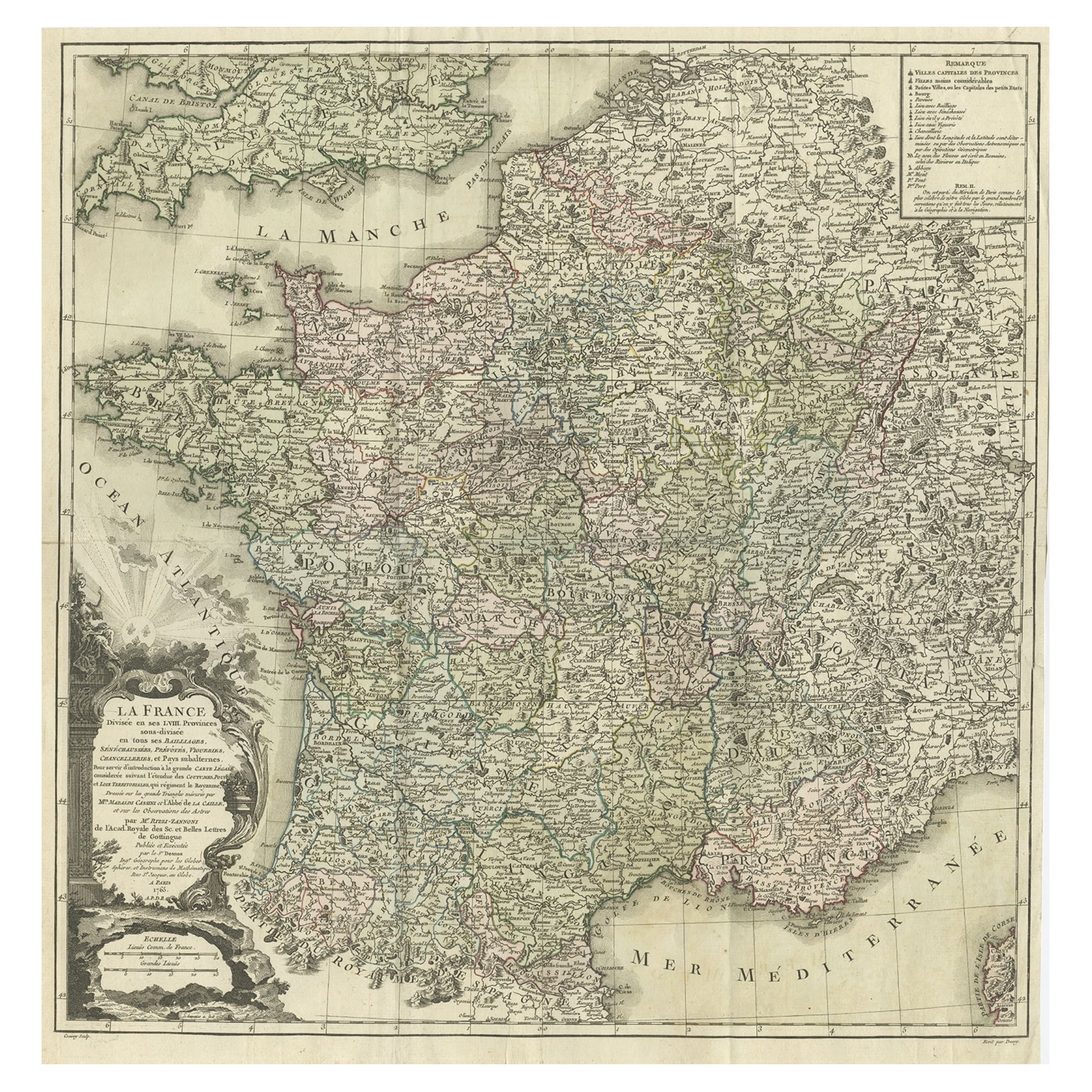
Mapa antiguo de Francia por Zannoni, 1765
Mapa antiguo titulado "La France divisée en ses LVIII Provinces (..)". Precioso mapa antiguo de Francia. Este mapa procede del "Atlas Historique de la France Ancienne et Moderne" de ...
Categoría
Antiguo, siglo XVIII, Mapas
Materiales
Papel
416 € Precio de venta
Descuento del 20 %
También te puede gustar
Aube, Francia. Mapa antiguo de un departamento francés, 1856
Por Victor Levasseur
Dept. de L'Aube", grabado en acero con contorno original coloreado a mano, 1856, del "Atlas National Illustre" de Levasseur.
Esta zona de Francia es conocida por su producción de C...
Categoría
siglo XIX, Naturalista, Impresiones de paisajes
Materiales
Grabado

L'Isere, Francia. Mapa antiguo del departamento francés, 1856
Por Victor Levasseur
Dept. de L'Isere", grabado en acero con contorno original coloreado a mano, 1856, del "Atlas National Illustre" de Levasseur.
Esta zona es conocida por su producción de Bleu du Ver...
Categoría
siglo XIX, Naturalista, Impresiones de paisajes
Materiales
Grabado

Gran mapa de Francia del siglo XIX
Gran mapa de Francia del siglo XIX.
Notable estado, con una agradable pátina desgastada por el tiempo.
Recientemente enmarcado.
Francia Circa 1874.
Categoría
Antiguo, Fines del siglo XIX, Francés, Mapas
Materiales
Lino, Papel

Mapa de Francia - Aguafuerte - 1820
Mapa de Francia es un Grabado Original realizado por un artista desconocido del siglo XIX en 1820.
Muy buen estado en dos hojas de papel blanco unidas por el centro.
El mapa es un ...
Categoría
Década de 1820, Moderno, Impresiones figurativas
Materiales
Grabado químico

Lozere, Francia. Mapa antiguo de un departamento francés, 1856
Por Victor Levasseur
Dept. de La Lozere", grabado en acero con contorno original coloreado a mano, 1856, del "Atlas National Illustre" de Levasseur.
Esta remota zona montañosa de Languedoc es rural, po...
Categoría
siglo XIX, Naturalista, Impresiones de paisajes
Materiales
Grabado

Saona y Loira, Francia. Mapa antiguo de un departamento francés, 1856
Por Victor Levasseur
Dept. de Saone et Loire", grabado en acero con contorno original coloreado a mano, 1856, del Atlas National Illustre de Levasseur.
El departamento francés de Saone et Loire está en...
Categoría
siglo XIX, Naturalista, Impresiones de paisajes
Materiales
Grabado
