Artículos similares a Antique Map of Italy, 1903, Featuring Islands of Sardinia and Sicily

¿Quieres más imágenes o vídeos?
Solicita imágenes o vídeos adicionales al vendedor
1 de 10
Antique Map of Italy, 1903, Featuring Islands of Sardinia and Sicily
Acerca del artículo
Title: Antique Map of Italy, 1903, Featuring Islands of Sardinia and Sicily
Description:
This finely detailed antique map, titled "Italy," was engraved and published in 1903 by the respected cartographic firm W. & A.K. Johnston in Edinburgh and London. It provides a fascinating look at Italy’s political and geographical landscape at the turn of the 20th century, capturing the elegance and precision of early 20th-century cartography.
The map is a masterful depiction of Italy, extending from the Alps in the north down to the sun-drenched islands of Sardinia and Sicily in the south. Colored in soft pastel shades of pink, green, yellow, and blue, it delicately highlights the different provinces and regions. Major cities like Rome, Florence, Venice, and Naples are clearly marked, as well as important natural features such as rivers, mountain ranges, and coastal areas.
A notable feature of this map is the detailed inclusion of the islands of Sardinia and Sicily, which are rendered with exceptional clarity and precision. The surrounding seas—Adriatic, Tyrrhenian, and Mediterranean—are elegantly marked, adding a maritime dimension that underlines Italy’s enduring role as a bridge between Europe and the Mediterranean world.
For collectors, historians, or lovers of Italian culture, this map is not only a decorative centerpiece but also a window into the Italy of 1903—a nation undergoing transformation and modernization, yet steeped in ancient history and timeless landscapes. Its harmonious coloring and refined typography make it an excellent addition to any collection.
Condition report:
This map is in very good antique condition, with only slight foxing and gentle toning at the edges typical for its age. The colors remain vibrant and the paper stable and well-preserved.
Framing tips:
A dark wood frame in walnut or mahogany will add sophistication and warmth to this piece. Use a cream or light beige matting to accentuate the pastel colors and delicate detailing, creating a refined and timeless focal point for any home, office, or study.
- Dimensiones:Altura: 36,8 cm (14,49 in)Anchura: 48 cm (18,9 in)Profundidad: 0,2 mm (0,01 in)
- Materiales y técnicas:
- Época:
- Fecha de fabricación:1903
- Estado:The map is in very good antique condition, with minor age-related foxing and slight edge toning typical for its vintage. The colors remain vibrant and the paper is stable and well-preserved. Folding line as issued.
- Ubicación del vendedor:Langweer, NL
- Número de referencia:Vendedor: BG-13577-121stDibs: LU3054345241832
Sobre el vendedor
5,0
Vendedor reconocido
Estos prestigiosos vendedores son líderes del sector y representan el escalón más alto en cuanto a calidad y diseño de artículos.
Vendedor Oro
Vendedores premium que mantienen una calificación de +4,3 y tiempos de respuesta de 24 horas
Establecido en 2009
Vendedor de 1stDibs desde 2017
2452 ventas en 1stDibs
Tiempo de respuesta usual: <1 hora
- EnvíoRecuperando presupuesto…Envío desde: Langweer, Países Bajos
- Política de devolución
Partes de esta página se han traducido automáticamente. 1stDibs no puede garantizar la exactitud de las traducciones. El inglés es el idioma predeterminado de este sitio web.
Garantía de autenticidad
En el improbable caso de que haya algún problema con la autenticidad de un artículo, ponte en contacto con nosotros en un plazo de 1 año para recibir un reembolso total. DetallesGarantía de devolución de dinero
Si tu artículo no es como se describe, sufre daños durante el transporte o no llega, ponte en contacto con nosotros en un plazo de 7 días para recibir un reembolso total. DetallesCancelación dentro de las 24 horas
Tienes un período de gracia de 24 horas para reconsiderar tu compra, sin preguntas.Vendedores profesionales aprobados
Nuestros vendedores de primera clase deben cumplir estrictos estándares de servicio para mantener la integridad de nuestros anuncios.Garantía de igualación de precios
Si encuentras que un vendedor publicó el mismo artículo por un precio menor en otro lado, igualaremos ese precio.Entrega global de confianza
Nuestra red de transporte de primera ofrece opciones de envío especializado en todo el mundo, que incluye envío personalizado.Más de este vendedor
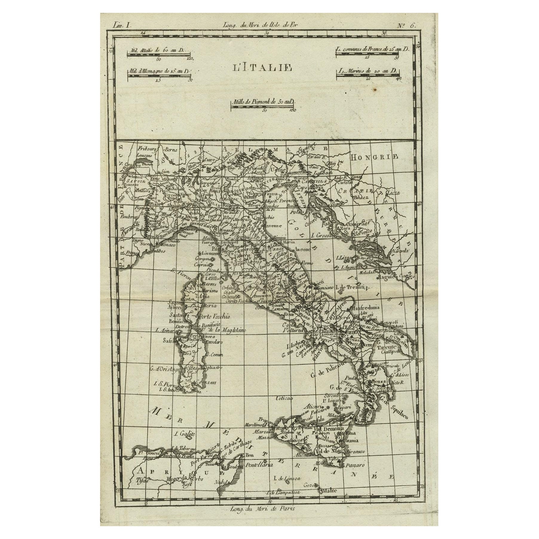
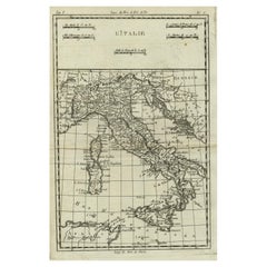
Ver todoMapa antiguo de Italia, Córcega, Cerdeña y Sicilia, ca.1780
Descripción: Mapa antiguo titulado "L'Italie".
Mapa de Italia, Córcega, Cerdeña y Sicilia. Muy detallado, muestra ciudades, ríos, algunos accidentes topográficos y límites políti...
Categoría
Antiguo, Década de 1780, Mapas
Materiales
Papel
297 US$ Precio de venta
Descuento del 20 %
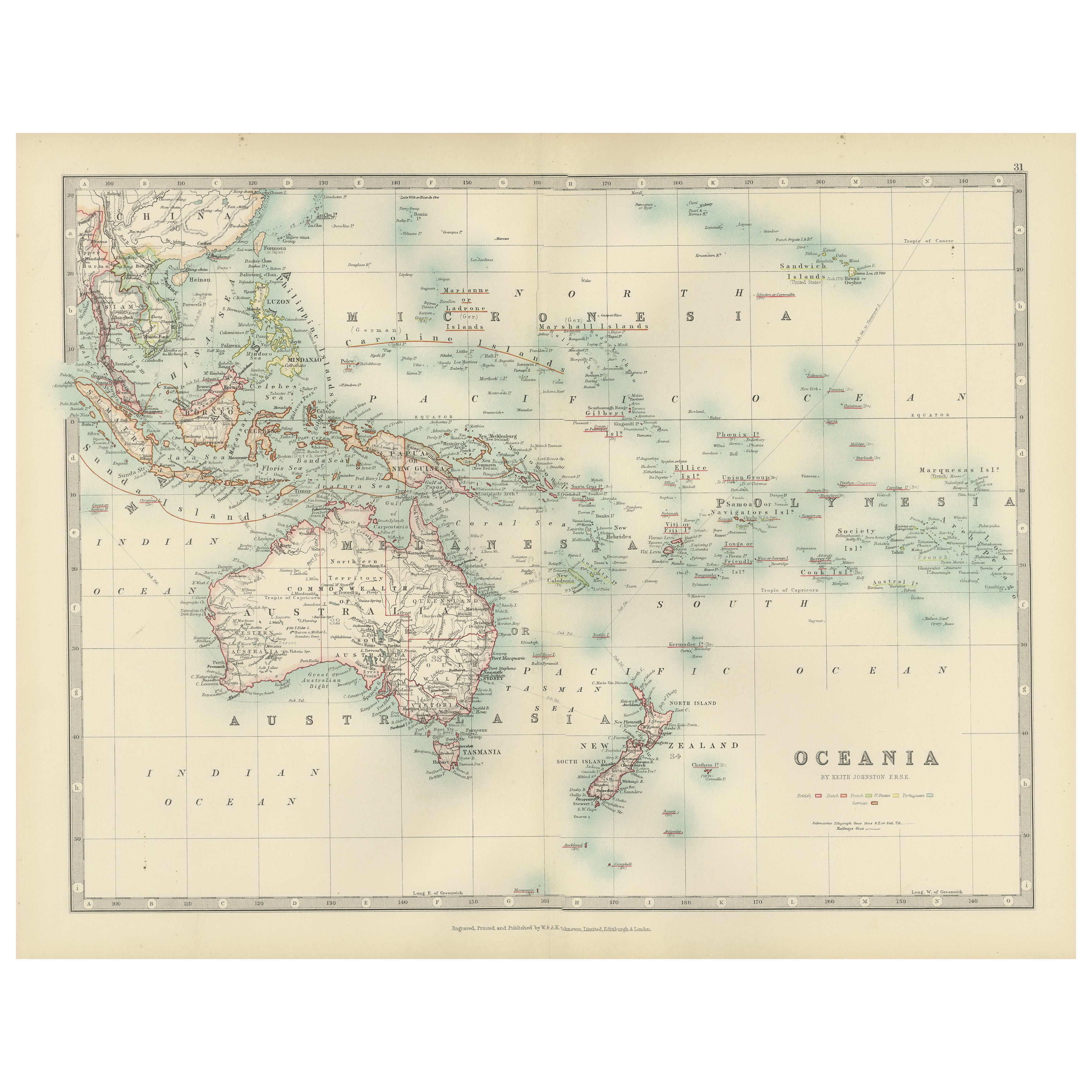
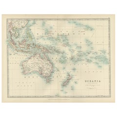
Antique Map of Oceania, 1903, Featuring the Pacific Islands and Australasia
Title: Antique Map of Oceania, 1903, Featuring the Pacific Islands and Australasian Region
Description:
This antique map, titled "Oceania," was engraved and published in 1903 by W. ...
Categoría
principios del siglo XX, Mapas
Materiales
Papel
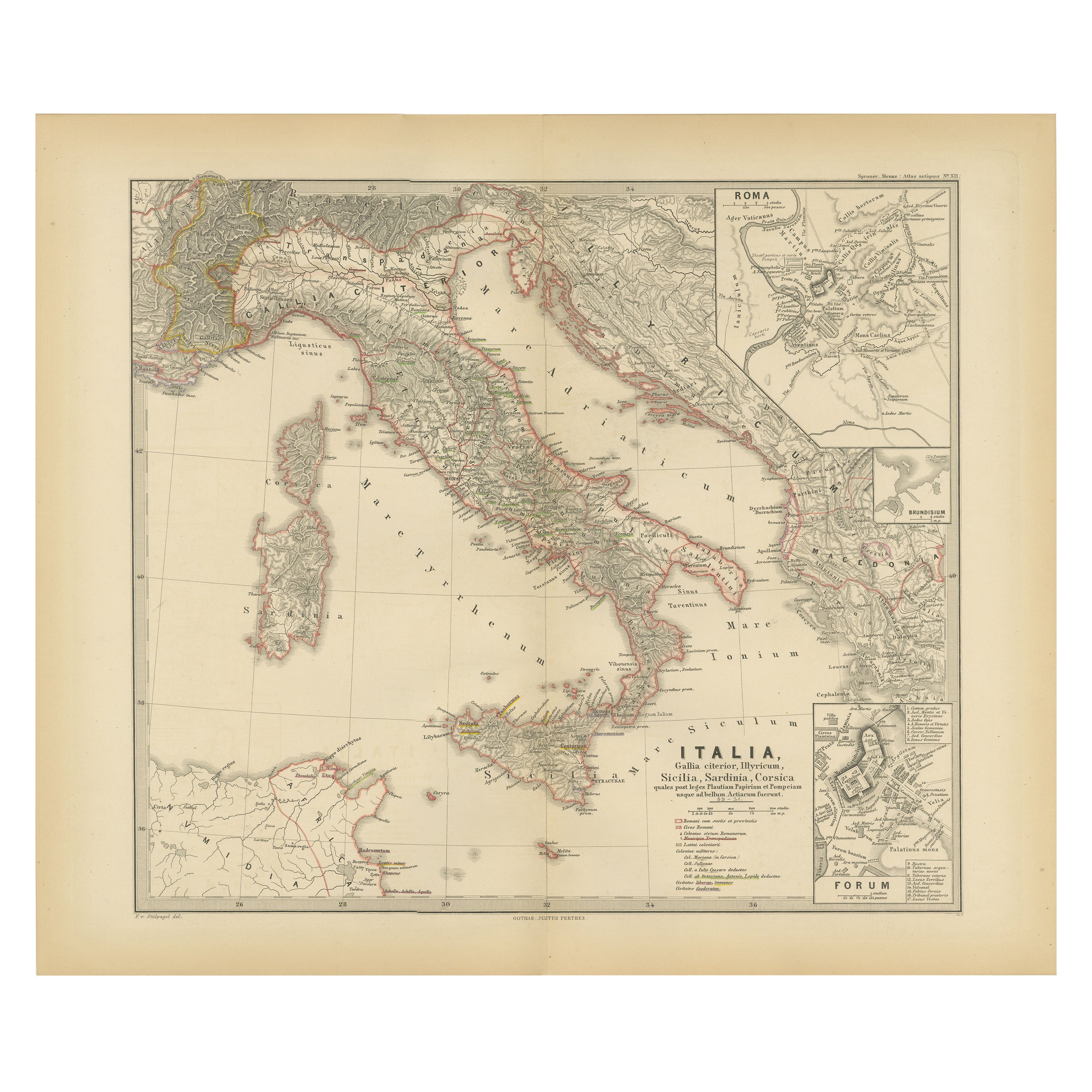
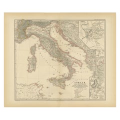
Mapa de la Península Italiana con las islas de Sicilia, Cerdeña y Córcega, 1880
Este mapa, titulado "ITALIA, Sicilia, Cerdeña, Córcega", representa la Península Itálica junto con las islas de Sicilia, Cerdeña y Córcega. Los mapas insertados ofrecen vistas detall...
Categoría
Antiguo, Década de 1880, Mapas
Materiales
Papel
344 US$ Precio de venta
Descuento del 20 %
Envío gratuito
Antique Map of New Zealand, 1903, Featuring the North and South Islands and Alps
Title: Antique Map of New Zealand, 1903, Featuring the North and South Islands and the Southern Alps
Description:
This antique map, titled "New Zealand," was engraved and published ...
Categoría
principios del siglo XX, Mapas
Materiales
Papel

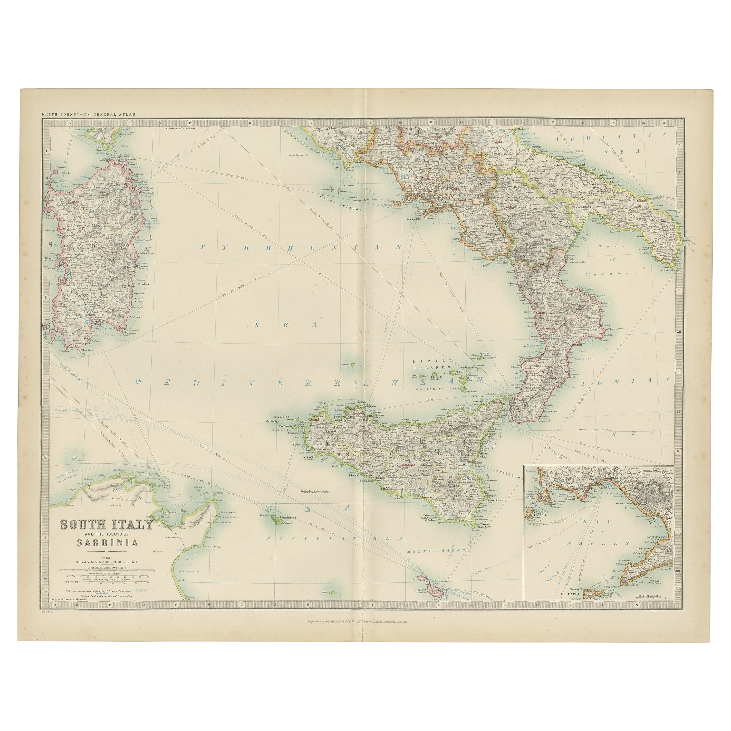
Mapa antiguo del sur de Italia y la isla de Cerdeña por Johnston (1909)
Mapa antiguo titulado "El sur de Italia y la isla de Cerdeña". Mapa antiguo original del sur de Italia y la isla de Cerdeña. Con mapa de Nápoles. Este mapa procede del "Atlas Real de...
Categoría
principios del siglo XX, Mapas
Materiales
Papel

232 US$ Precio de venta
Descuento del 20 %
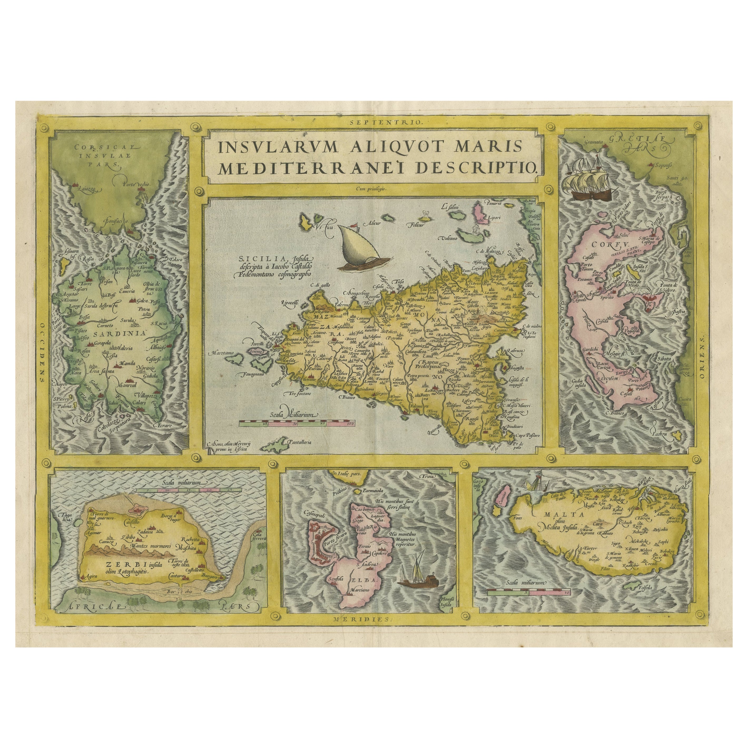
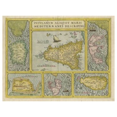
Mapa Antiguo Coloreado de Sicilia, Cerdeña, Corfú, Elba, Malta y Zerbi (Jerba)
Por Abraham Ortelius
Mapa antiguo titulado "Insularum Aliquot Maris Mediterranei Descriptio". Un ejemplo muy atractivo del mapa de Ortelius que combina, en una sola página, mapas de las islas de Sicilia,...
Categoría
Antiguo, siglo XVI, Mapas
Materiales
Papel
1536 US$ Precio de venta
Descuento del 40 %
También te puede gustar
Italia, Sicilia, Cerdeña, Córcega y Costa Dálmata: Un mapa holandés del siglo XVII
Por Theodorus Danckerts
Este mapa holandés del siglo XVII, coloreado a mano y titulado "Novissima et Accuratissima totius Italiae Corsicae et Sardiniae Descriptio" de Theodore Danckerts, representa la Penín...
Categoría
Antiguo, finales del siglo XVII, Holandés, Mapas
Materiales
Papel

Mapa Antiguo Original del Estado Americano de Connecticut y Rhode Island, 1903
Antique map of Connecticut and Rhode Island
Published By A & C Black. 1903
Original colour
Good condition
Unframed.
Free shipping
Categoría
Antiguo, Principios del 1900, Inglés, Mapas
Materiales
Papel

1854 Mapa de Massachusetts, Connecticut y Rhode Island, Mapa mural antiguo
Este llamativo mapa mural fue publicado en 1854 por Ensign, Bridgman & Fanning y tiene tanto el original completo coloreado a mano como los herrajes originales. Esta impresión es a l...
Categoría
Antiguo, siglo XIX, Estadounidense, Mapas
Materiales
Papel

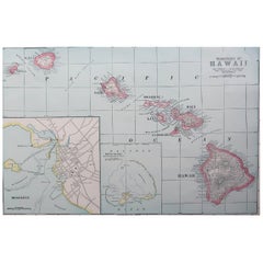
Mapa original antiguo de Hawai y las islas adyacentes. C.1900
Fabuloso mapa de Hawai. Con una viñeta de Honolulu
Color original.
Grabado e impreso por la George F. Cram Company, Indianápolis.
Publicado, C.1900.
Sin enmarcar.
Envío gratuito.
Categoría
Antiguo, Década de 1890, Estadounidense, Mapas
Materiales
Papel
Mapa original antiguo del estado norteamericano de Minnesota, 1903
Mapa antiguo de Minnesota
Publicado por A & C Black. 1903
Color original
Buen estado
Sin enmarcar.
Envío gratuito
Categoría
Antiguo, Principios del 1900, Inglés, Mapas
Materiales
Papel

Mapa original antiguo del estado norteamericano de Alabama, 1903
Antique map of Alabama
Published By A & C Black. 1903
Original colour
Good condition
Unframed.
Free shipping
Categoría
Antiguo, Principios del 1900, Inglés, Mapas
Materiales
Papel
