Artículos similares a Antique Map of Northern Scotland, 1903, with Intricate Coastal Features


¿Quieres más imágenes o vídeos?
Solicita imágenes o vídeos adicionales al vendedor
1 de 10
Antique Map of Northern Scotland, 1903, with Intricate Coastal Features
Acerca del artículo
Title: Antique Map of Northern Scotland and Islands, 1903, with Intricate Coastal Features
Description:
This striking antique map, titled "Scotland (Northern Sheet I)," was engraved and published in 1903 by the renowned cartographers W. & A.K. Johnston in Edinburgh and London. It offers an exceptional and meticulously detailed view of northern Scotland and its many islands, including the Orkney and Shetland archipelagos and the rugged Hebrides.
The map is beautifully engraved and colored in soft pastel shades of pink, green, and yellow to demarcate counties and natural features. Its precision showcases the intricate geography of this stunningly scenic region, with its complex coastlines, dramatic highlands, and offshore islands. The inset of the Shetland Islands and close-up depiction of the Hebrides highlight their remote and maritime importance, offering valuable insight into a time when these islands were integral to Britain’s fishing, trade, and cultural identity.
For collectors and lovers of historical geography, this map represents the artistry and scientific rigor of the early 20th century’s cartographic tradition. It provides a fascinating look at the natural and political landscape of Scotland during a period of modernization, when railways and steamships were beginning to connect these once isolated areas to the rest of the British Isles.
Its finely engraved typography and delicate color palette make this map not just a historical record, but also a work of art suitable for any sophisticated interior. From the rich cultural history of the highlands to the strategic maritime routes of the islands, this map captures the timeless allure of Scotland’s northern reaches.
Condition report:
The map is in very good antique condition, showing slight toning and minor foxing around the edges, typical for its age. Colors remain vibrant and paper is well-preserved. Folding line as issued.
Framing tips:
A dark wood frame such as mahogany or walnut enhances the map’s rich character. Use a cream or light tan matting to highlight the soft pastel colors and intricate detailing, making this map a sophisticated focal point in any home or office.
- Dimensiones:Altura: 36,8 cm (14,49 in)Anchura: 48 cm (18,9 in)Profundidad: 0,2 mm (0,01 in)
- Materiales y técnicas:
- Época:
- Fecha de fabricación:1903
- Estado:The map is in very good antique condition, showing slight toning and minor foxing around the edges, typical for its age. Colors remain vibrant and paper is well-preserved. Folding line as issued.
- Ubicación del vendedor:Langweer, NL
- Número de referencia:Vendedor: BG-13577-61stDibs: LU3054345241202
Sobre el vendedor
5,0
Vendedor reconocido
Estos prestigiosos vendedores son líderes del sector y representan el escalón más alto en cuanto a calidad y diseño de artículos.
Vendedor Oro
Vendedores premium que mantienen una calificación de +4,3 y tiempos de respuesta de 24 horas
Establecido en 2009
Vendedor de 1stDibs desde 2017
2452 ventas en 1stDibs
Tiempo de respuesta usual: <1 hora
- EnvíoRecuperando presupuesto…Envío desde: Langweer, Países Bajos
- Política de devolución
Partes de esta página se han traducido automáticamente. 1stDibs no puede garantizar la exactitud de las traducciones. El inglés es el idioma predeterminado de este sitio web.
Garantía de autenticidad
En el improbable caso de que haya algún problema con la autenticidad de un artículo, ponte en contacto con nosotros en un plazo de 1 año para recibir un reembolso total. DetallesGarantía de devolución de dinero
Si tu artículo no es como se describe, sufre daños durante el transporte o no llega, ponte en contacto con nosotros en un plazo de 7 días para recibir un reembolso total. DetallesCancelación dentro de las 24 horas
Tienes un período de gracia de 24 horas para reconsiderar tu compra, sin preguntas.Vendedores profesionales aprobados
Nuestros vendedores de primera clase deben cumplir estrictos estándares de servicio para mantener la integridad de nuestros anuncios.Garantía de igualación de precios
Si encuentras que un vendedor publicó el mismo artículo por un precio menor en otro lado, igualaremos ese precio.Entrega global de confianza
Nuestra red de transporte de primera ofrece opciones de envío especializado en todo el mundo, que incluye envío personalizado.Más de este vendedor
Ver todoAntique Map of Ireland, 1903, with Intricate County Boundaries & Coastal Details
Title: Antique Map of Ireland, 1903, with Intricate County Boundaries and Coastal Detail
Description:
This antique map of Ireland, engraved and published in 1903 by the esteemed W. ...
Categoría
principios del siglo XX, Mapas
Materiales
Papel

Antique Map of Southern Scotland, 1903, with Coastal and Inland Details
Title: Antique Map of Southern Scotland, 1903, with Coastal and Inland Details
Description:
This exquisite antique map, titled "Scotland (Southern Sheet I)," was engraved and publis...
Categoría
principios del siglo XX, Mapas
Materiales
Papel

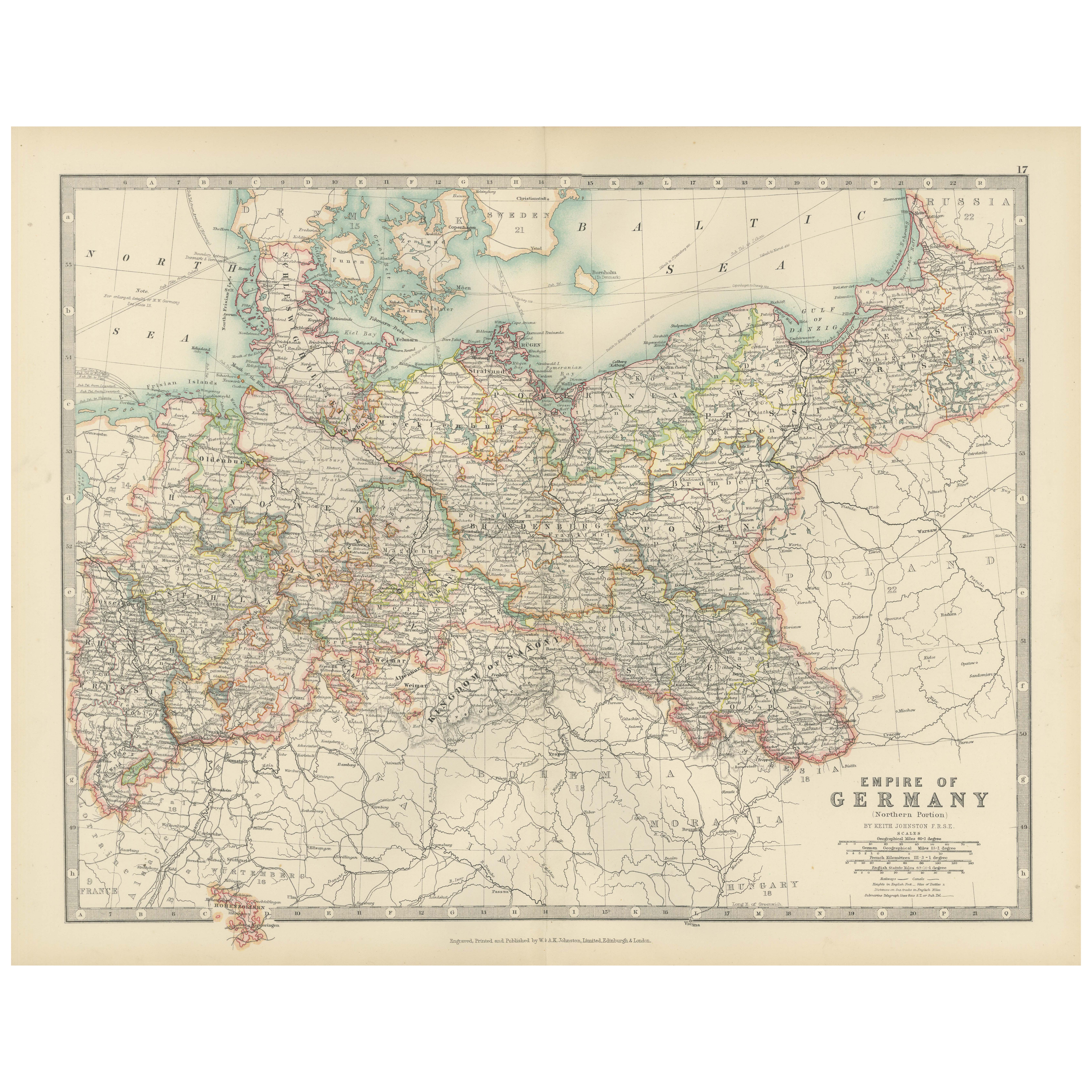
Antique Map of the German Empire, 1903, Northern Portion with Coastal and Inland
Title: Antique Map of the German Empire, 1903, Northern Portion with Coastal and Inland Detail
Description:
This antique map, titled "Empire of Germany (Northern Portion)," was engr...
Categoría
principios del siglo XX, Mapas
Materiales
Papel

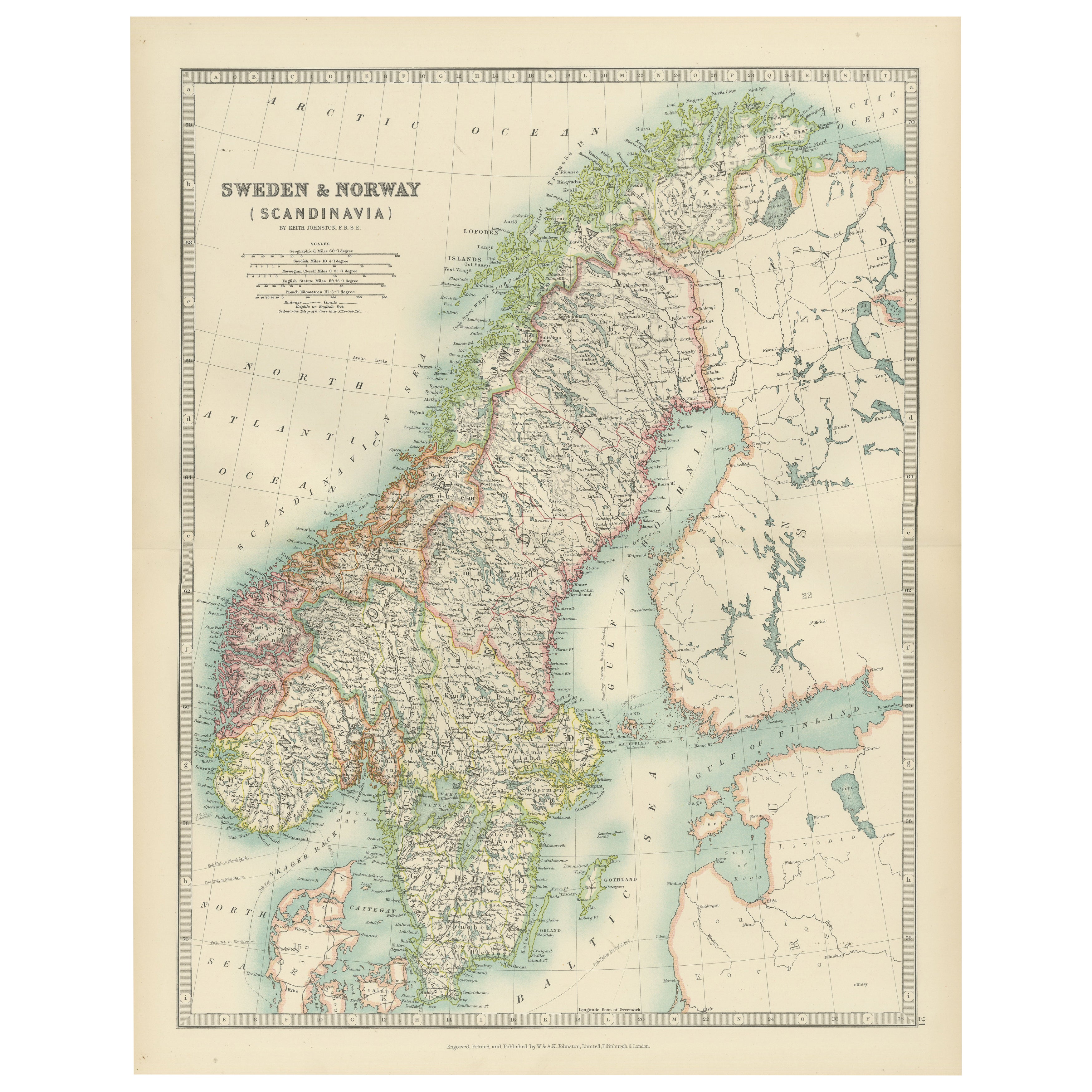
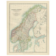
Antique Map of Sweden & Norway, 1903, with Intricate Topographical Detail
Title: Antique Map of Sweden & Norway, 1903, with Intricate Topographical Detail
Description:
This antique map, titled "Sweden & Norway (Scandinavia)," was engraved and published in...
Categoría
principios del siglo XX, Mapas
Materiales
Papel
Antique Map of Asia with Intricate Provincial Boundaries, Published in 1903
Title: Antique Map of Asia, 1903, with Intricate Provincial Boundaries and Coastal Features
Description:
This antique map, titled "Asia," was engraved and published in 1903 by the r...
Categoría
principios del siglo XX, Mapas
Materiales
Papel

Antique Map of the German Empire, 1903, with Intricate Provincial Boundaries
Title: Antique Map of the German Empire, 1903, with Intricate Provincial Boundaries
Description:
This antique map, titled "Empire of Germany (Southern Portion)," was engraved and pu...
Categoría
principios del siglo XX, Mapas
Materiales
Papel

También te puede gustar
Mapa Antiguo Original del Estado Americano de Illinois ( Parte Norte ), 1903
Mapa antiguo de Illinois ( Parte norte )
Publicado por A & C Black. 1903
Color original
Buen estado
Sin enmarcar.
Envío gratuito
Categoría
Antiguo, Principios del 1900, Inglés, Mapas
Materiales
Papel

Mapa Antiguo Original del Estado Americano de Michigan ( Parte Norte ), 1903
Mapa antiguo de Michigan ( parte norte )
Publicado por A & C Black. 1903
Color original
Buen estado
Sin enmarcar.
Envío gratuito
Categoría
Antiguo, Principios del 1900, Inglés, Mapas
Materiales
Papel

Mapa Antiguo Original del Estado Americano de Ohio ( Parte Norte ), 1903
Mapa antiguo de Ohio ( Parte norte )
Publicado por A & C Black. 1903
Color original
Buen estado
Sin enmarcar.
Envío gratuito
Categoría
Antiguo, Principios del 1900, Inglés, Mapas
Materiales
Papel

Mapa Antiguo Original del Estado Americano de California ( Parte Norte ), 1903
Mapa antiguo de California ( Parte norte )
Publicado por A & C Black. 1903
Color original
Buen estado
Sin enmarcar.
Envío gratuito
Categoría
Antiguo, Principios del 1900, Inglés, Mapas
Materiales
Papel

Mapa Antiguo Original del Estado Americano de Missouri ( Parte Norte ), 1903
Mapa antiguo de Missouri ( Parte Norte )
Publicado por A & C Black. 1903
Color original
Buen estado
Sin enmarcar.
Envío gratuito
Categoría
Antiguo, Principios del 1900, Inglés, Mapas
Materiales
Papel

Mapa Antiguo Original del Estado Americano de Nueva York ( Parte Norte ) 1903
Antique map of New York ( Northern Part )
Published By A & C Black. 1903
Original colour
Good condition
Unframed.
Free shipping
Categoría
Antiguo, Principios del 1900, Inglés, Mapas
Materiales
Papel
