Artículos similares a Antique Map of Palestine or The Holy Land, 1903, with Biblical Details

¿Quieres más imágenes o vídeos?
Solicita imágenes o vídeos adicionales al vendedor
1 de 10
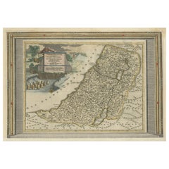
Antique Map of Palestine or The Holy Land, 1903, with Biblical Details
Acerca del artículo
Title: Antique Map of Palestine or The Holy Land, 1903, with Biblical and Geographical Details
Description:
This antique map, titled "Palestine or The Holy Land," was engraved and published in 1903 by W. & A.K. Johnston in Edinburgh and London. It offers a detailed and meticulously rendered depiction of the region known for its profound historical and spiritual significance to the three major Abrahamic religions.
The map shows the territories along the eastern coast of the Mediterranean Sea, extending from the ancient city of Sidon in the north to the Sinai Peninsula in the south. It is hand-colored in soft pastel shades to delineate boundaries and key landmarks, including major biblical sites, ancient cities, rivers, and mountain ranges. The Jordan River and Dead Sea are prominently featured, along with Jerusalem, Bethlehem, Nazareth, and other key locations that have shaped the historical narrative of the Holy Land.
Beyond its spiritual importance, this map also captures the geography and infrastructure of the early 20th century, reflecting the region’s position as a crossroads for trade, pilgrimage, and empire. The fine engraving and delicate typography reflect the cartographic precision and artistry of Johnston’s team.
For collectors, historians, and those interested in the rich tapestry of Middle Eastern history, this map is a rare and evocative piece. It not only illustrates the geography of an ancient land but also evokes the timeless cultural and spiritual resonance that has defined Palestine for millennia.
Condition report:
This map is in very good antique condition, with minor age-related foxing and gentle toning along the edges. The colors remain vivid and the paper is well-preserved, retaining the clarity and charm of the original engraving.
Framing tips:
A classic wooden frame in dark walnut or cherry will add warmth and sophistication to this piece. Use a cream or off-white matting to highlight the delicate pastel colors and intricate detailing, creating a timeless and elegant focal point for any home, study, or sacred space.
- Dimensiones:Altura: 47 cm (18,51 in)Anchura: 36,8 cm (14,49 in)Profundidad: 0,2 mm (0,01 in)
- Materiales y técnicas:
- Época:
- Fecha de fabricación:1903
- Estado:This map is in very good antique condition, with minor age-related foxing and gentle toning along the edges. The colors remain vivid and the paper is well-preserved, retaining the clarity and charm of the original engraving. Folding line as issued.
- Ubicación del vendedor:Langweer, NL
- Número de referencia:Vendedor: BG-13577-251stDibs: LU3054345262352
Sobre el vendedor
5,0
Vendedor reconocido
Estos prestigiosos vendedores son líderes del sector y representan el escalón más alto en cuanto a calidad y diseño de artículos.
Vendedor Oro
Vendedores premium que mantienen una calificación de +4,3 y tiempos de respuesta de 24 horas
Establecido en 2009
Vendedor de 1stDibs desde 2017
2452 ventas en 1stDibs
Tiempo de respuesta usual: <1 hora
- EnvíoRecuperando presupuesto…Envío desde: Langweer, Países Bajos
- Política de devolución
Partes de esta página se han traducido automáticamente. 1stDibs no puede garantizar la exactitud de las traducciones. El inglés es el idioma predeterminado de este sitio web.
Garantía de autenticidad
En el improbable caso de que haya algún problema con la autenticidad de un artículo, ponte en contacto con nosotros en un plazo de 1 año para recibir un reembolso total. DetallesGarantía de devolución de dinero
Si tu artículo no es como se describe, sufre daños durante el transporte o no llega, ponte en contacto con nosotros en un plazo de 7 días para recibir un reembolso total. DetallesCancelación dentro de las 24 horas
Tienes un período de gracia de 24 horas para reconsiderar tu compra, sin preguntas.Vendedores profesionales aprobados
Nuestros vendedores de primera clase deben cumplir estrictos estándares de servicio para mantener la integridad de nuestros anuncios.Garantía de igualación de precios
Si encuentras que un vendedor publicó el mismo artículo por un precio menor en otro lado, igualaremos ese precio.Entrega global de confianza
Nuestra red de transporte de primera ofrece opciones de envío especializado en todo el mundo, que incluye envío personalizado.Más de este vendedor
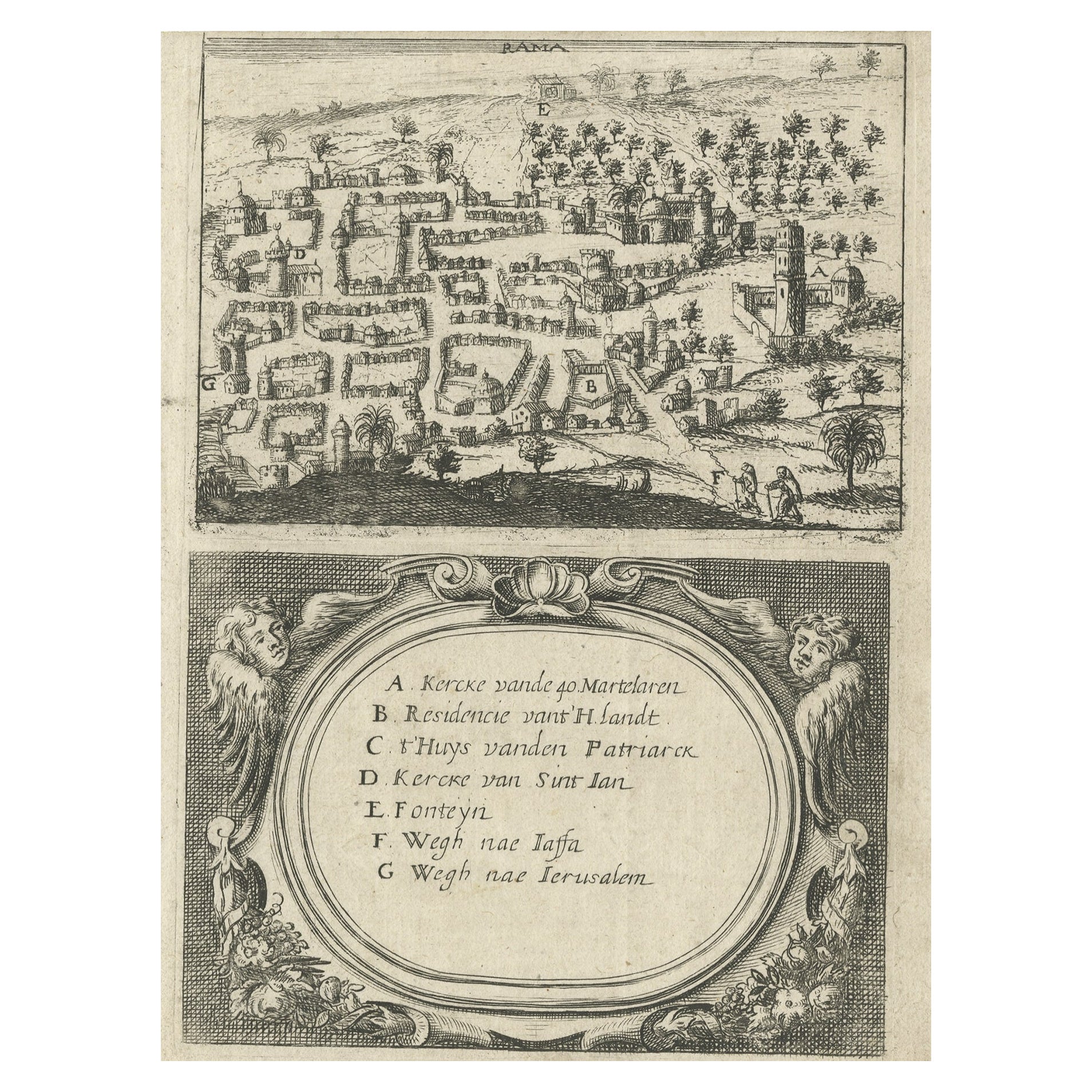
Ver todoRaro mapa de Rama o Ramma "¿Ramallah?" en Palestina o Tierra Santa, ca.1730
Mapa antiguo titulado "Rama".
Este mapa muestra una vista de Ramma (¿Ramala?) en Palestina o Tierra Santa. Con la leyenda holandesa. Fuente desconocida, por determinar.
Artist...
Categoría
Antiguo, Década de 1730, Mapas
Materiales
Papel
260 US$ Precio de venta
Descuento del 20 %
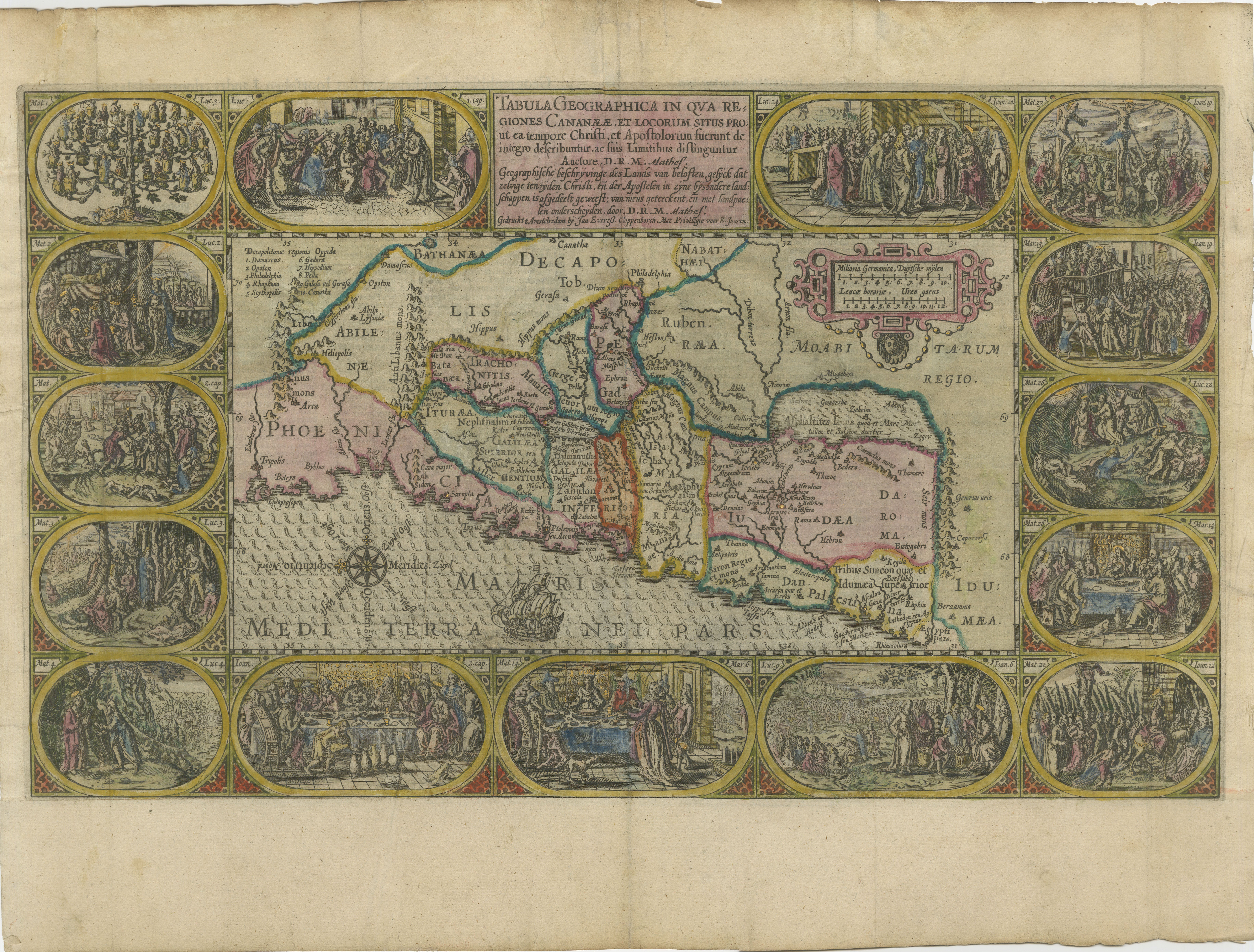
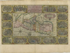
1625 Petrus Plancius / Cloppenburg Mapa de Tierra Santa con viñetas bíblicas
1625 Petrus Plancius / Johannes Cloppenburg Mapa de Tierra Santa con viñetas bíblicas
Este exquisito mapa de 1625, obra de Petrus Plancius y Johannes Cloppenburg, representa Tierra...
Categoría
Antiguo, Década de 1620, Mapas
Materiales
Papel
Mapa antiguo de Tierra Santa, c.1717
Mapa antiguo de Israel titulado "Tabula Geographica Terrae Sanctae". Rara edición realizada a partir de un mapa de Tierra Santa de J. Bonfrerius. El mapa está orientado con el norte ...
Categoría
Antiguo, siglo XVIII, Mapas
Materiales
Papel

363 US$ Precio de venta
Descuento del 20 %
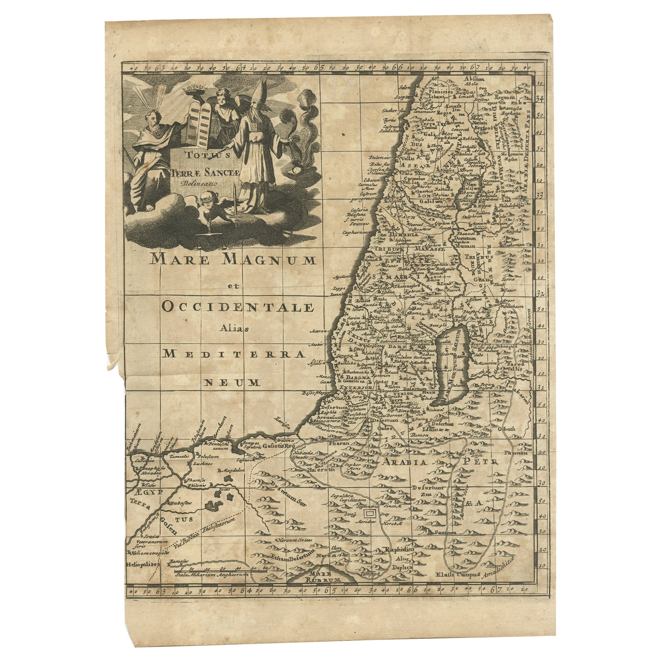
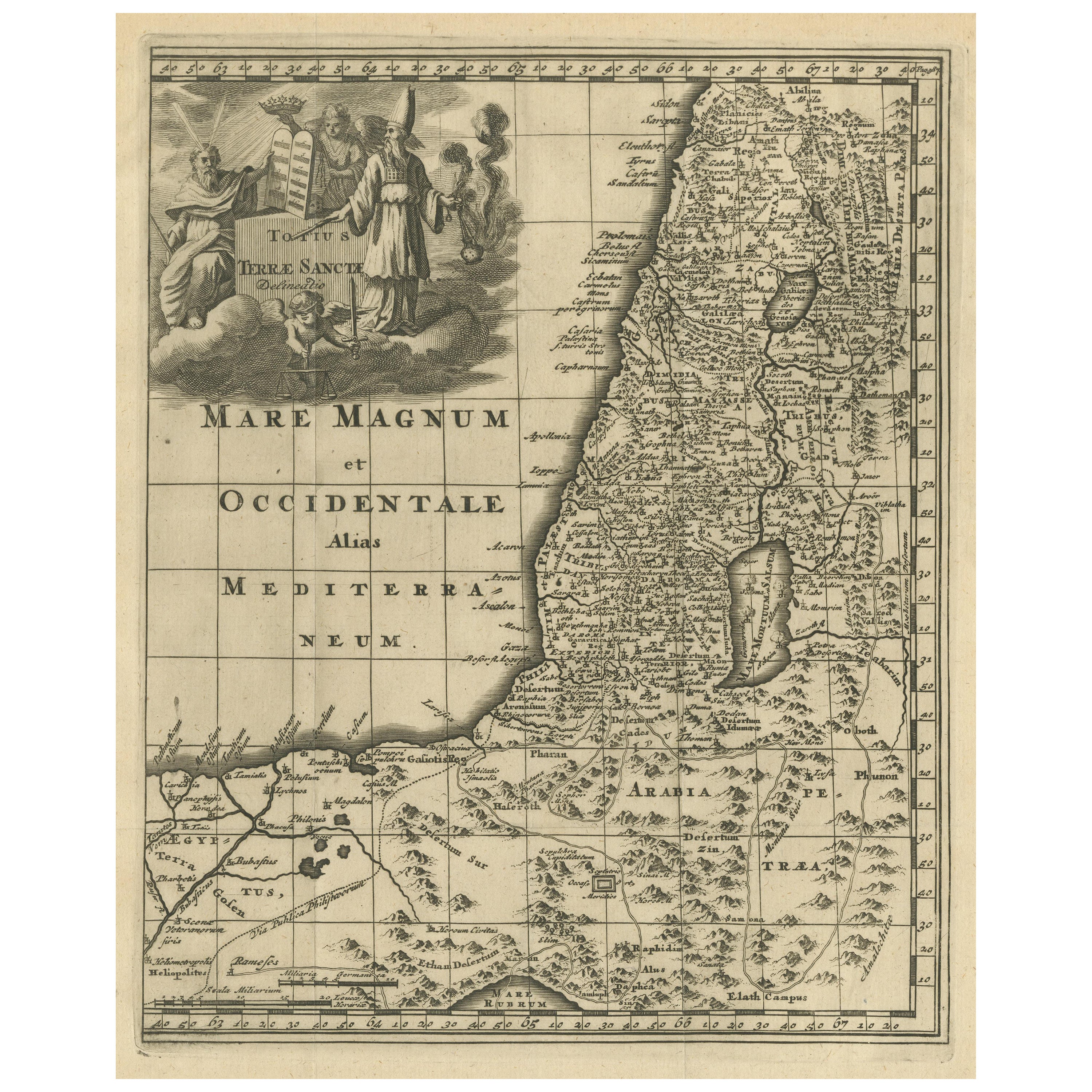
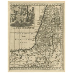
Mapa antiguo de Tierra Santa, c.1710
Mapa antiguo titulado "Totius Terrae Sanctae Delineatio". Mapa de Tierra Santa que se extiende hasta Egipto y muestra la ruta de los Hijos de Israel en su éxodo de Egipto a la Tierra...
Categoría
Antiguo, siglo XVIII, Mapas
Materiales
Papel

111 US$ Precio de venta
Descuento del 20 %
Mapa original antiguo de Tierra Santa con cartela decorativa
Mapa antiguo titulado "Totius Terrae Sanctae". Antiguo mapa original de Tierra Santa, con una gran cartela decorativa. El término "Tierra Santa" suele referirse a un territorio que c...
Categoría
Antiguo, finales del siglo XVII, Mapas
Materiales
Papel
363 US$ Precio de venta
Descuento del 20 %
Mapa antiguo de Tierra Santa con borde de marco de fotos
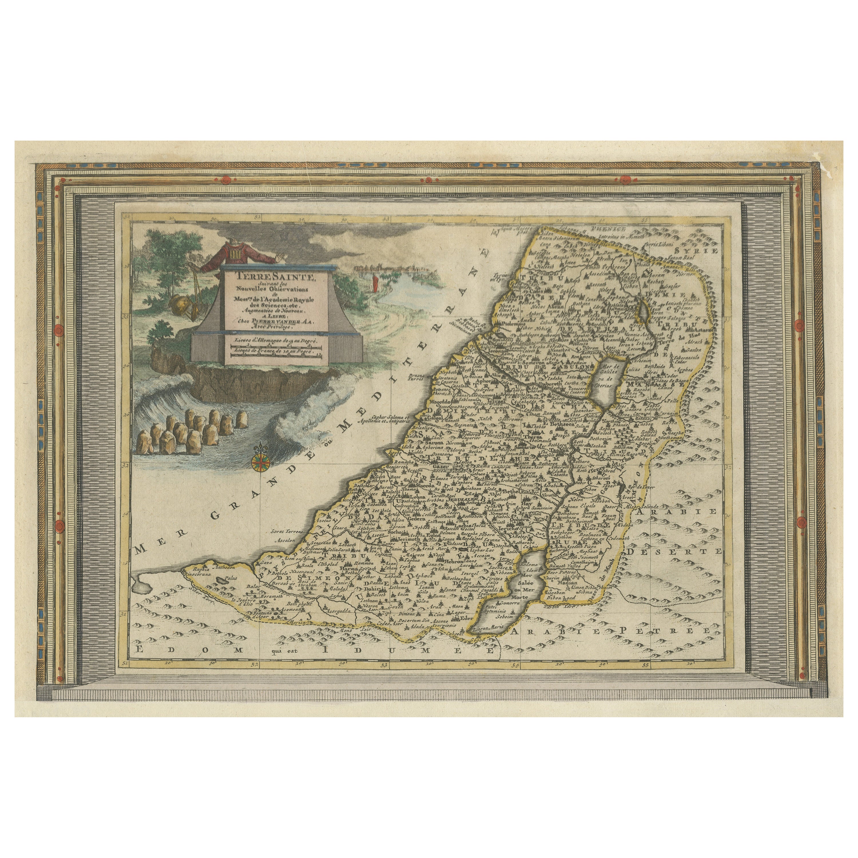
Mapa antiguo titulado 'Terre Sainte Suivant les Nouvelles Observations (..)'. Antiguo mapa original de Tierra Santa con el borde enmarcado. El término "Tierra Santa" suele referirse ...
Categoría
Antiguo, principios del siglo XVIII, Mapas
Materiales
Papel
819 US$ Precio de venta
Descuento del 20 %
Envío gratuito
También te puede gustar
Tierra Santa en tiempos de Jesús: Un mapa holandés del siglo XVII de Visscher
Por Nicolaes Visscher II
Este detallado mapa holandés titulado "Het Beloofe de Landt Canaan door wandelt van onsen Salichmaecker Iesu Christo, nessens syne Apostelen" de Nicolaes Visscher se publicó en Amste...
Categoría
Antiguo, mediados del siglo XVII, Holandés, Mapas
Materiales
Papel

Mapa original antiguo del estado norteamericano de Minnesota, 1903
Mapa antiguo de Minnesota
Publicado por A & C Black. 1903
Color original
Buen estado
Sin enmarcar.
Envío gratuito
Categoría
Antiguo, Principios del 1900, Inglés, Mapas
Materiales
Papel

Mapa original antiguo del estado norteamericano de Alabama, 1903
Antique map of Alabama
Published By A & C Black. 1903
Original colour
Good condition
Unframed.
Free shipping
Categoría
Antiguo, Principios del 1900, Inglés, Mapas
Materiales
Papel

Mapa original antiguo del estado norteamericano de Alaska, 1903
Mapa antiguo de Alaska
Publicado por A & C Black. 1903
Color original
Buen estado
Sin enmarcar.
Envío gratuito
Categoría
Antiguo, Principios del 1900, Inglés, Mapas
Materiales
Papel

Mapa original antiguo del estado norteamericano de Nebraska, 1903
Mapa antiguo de Nebraska
Publicado por A & C Black. 1903
Color original
Buen estado
Sin enmarcar.
Envío gratuito
Categoría
Antiguo, Principios del 1900, Inglés, Mapas
Materiales
Papel

Mapa Antiguo Original del Estado Americano de Washington, 1903
Mapa antiguo de Washington
Publicado por A & C Black. 1903
Color original
Buen estado
Sin enmarcar.
Envío gratuito
Categoría
Antiguo, Principios del 1900, Inglés, Mapas
Materiales
Papel
