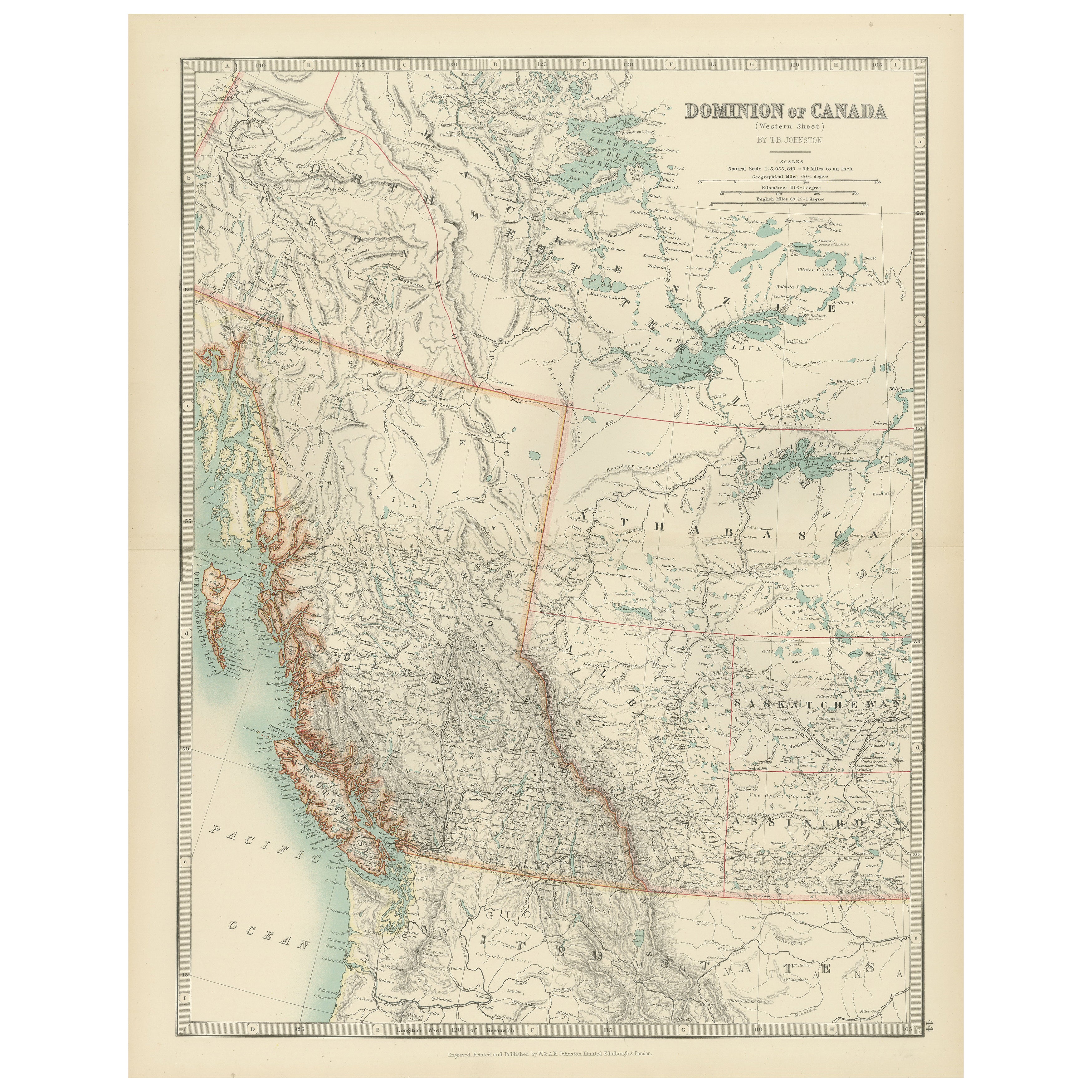
Artículos similares a Canada Map 1903 - Dominion of Canada, West Central Sheet

¿Quieres más imágenes o vídeos?
Solicita imágenes o vídeos adicionales al vendedor
1 de 10
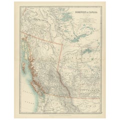
Canada Map 1903 - Dominion of Canada, West Central Sheet
Acerca del artículo
Title: Canada Map 1903 - Dominion of Canada, West Central Sheet
Description:
This fascinating 1903 map of the Dominion of Canada’s West Central regions by T.R. Johnston offers a vivid glimpse into the geographical and political landscape of early 20th-century Canada. It captures the expansive territory stretching across the heart of the Canadian Shield and the Hudson Bay basin. The map’s meticulous detail highlights key features including the Hudson Bay, parts of Manitoba, Saskatchewan, and Ontario, as well as the vast networks of rivers and lakes that define this rugged landscape.
Railway lines, postal routes, and settlements are intricately marked, reflecting the growing infrastructure that was pivotal for trade and migration during the era. The beautifully engraved coastlines and precise border delineations reveal the cartographer’s commitment to accuracy and artistry. The elegant typography and muted color palette add to its classic appeal, making it an exceptional example of antique cartography.
This map not only showcases the physical terrain but also speaks to the spirit of exploration and the consolidation of the Canadian territories during this dynamic period in history. It is a testament to the country’s rich natural resources and the challenges of development in remote and sparsely populated areas.
Condition:
This antique map is in excellent condition, with some mild toning typical of age. The colors remain bright, and there are no major tears or foxing, making it ideal for display or as part of a historical collection.
Framing Tips:
To highlight the natural tones of the map, consider a warm wooden frame, such as walnut or oak, with a cream or pale mat to create a subtle contrast. A protective UV-filtering glass will help preserve the delicate details and coloration, ensuring that this historical piece continues to inspire for years to come.
- Dimensiones:Altura: 47 cm (18,51 in)Anchura: 36,8 cm (14,49 in)Profundidad: 0,2 mm (0,01 in)
- Materiales y técnicas:
- Época:
- Fecha de fabricación:1903
- Estado:This antique map is in excellent condition, with some mild toning typical of age. The colors remain bright, and there are no major tears or foxing, making it ideal for display or as part of a historical collection.
- Ubicación del vendedor:Langweer, NL
- Número de referencia:Vendedor: BG-13577-431stDibs: LU3054345291602
Sobre el vendedor
5,0
Vendedor reconocido
Estos prestigiosos vendedores son líderes del sector y representan el escalón más alto en cuanto a calidad y diseño de artículos.
Vendedor Oro
Vendedores premium que mantienen una calificación de +4,3 y tiempos de respuesta de 24 horas
Establecido en 2009
Vendedor de 1stDibs desde 2017
2463 ventas en 1stDibs
Tiempo de respuesta usual: <1 hora
- EnvíoRecuperando presupuesto…Envío desde: Langweer, Países Bajos
- Política de devolución
Partes de esta página se han traducido automáticamente. 1stDibs no puede garantizar la exactitud de las traducciones. El inglés es el idioma predeterminado de este sitio web.
Garantía de autenticidad
En el improbable caso de que haya algún problema con la autenticidad de un artículo, ponte en contacto con nosotros en un plazo de 1 año para recibir un reembolso total. DetallesGarantía de devolución de dinero
Si tu artículo no es como se describe, sufre daños durante el transporte o no llega, ponte en contacto con nosotros en un plazo de 7 días para recibir un reembolso total. DetallesCancelación dentro de las 24 horas
Tienes un período de gracia de 24 horas para reconsiderar tu compra, sin preguntas.Vendedores profesionales aprobados
Nuestros vendedores de primera clase deben cumplir estrictos estándares de servicio para mantener la integridad de nuestros anuncios.Garantía de igualación de precios
Si encuentras que un vendedor publicó el mismo artículo por un precio menor en otro lado, igualaremos ese precio.Entrega global de confianza
Nuestra red de transporte de primera ofrece opciones de envío especializado en todo el mundo, que incluye envío personalizado.Más de este vendedor
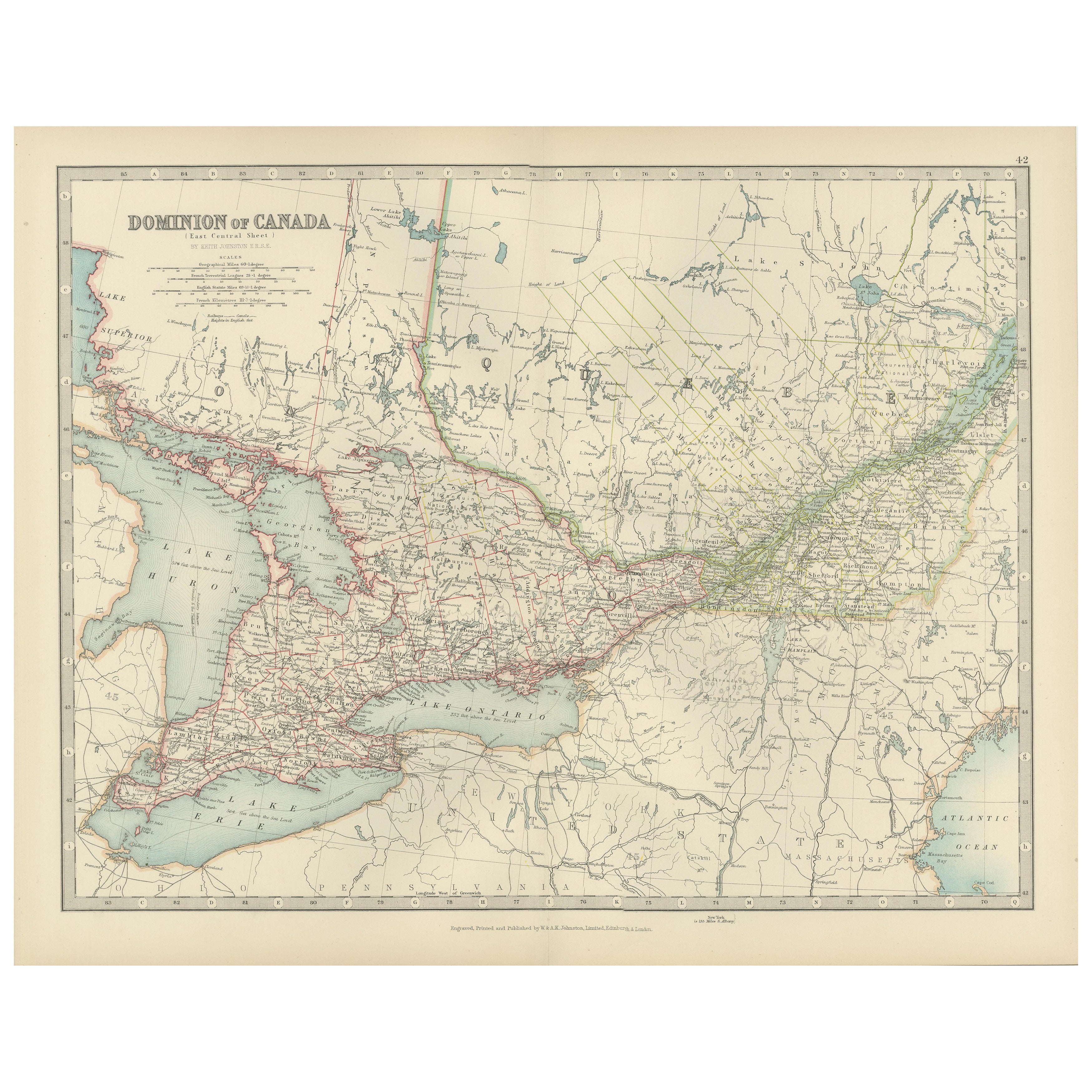
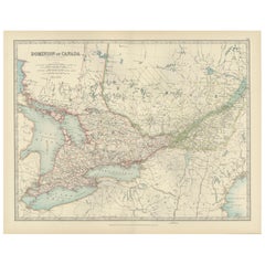
Ver todoCanada Map 1903 - East Central Dominion - Ontario, Quebec & More
Canada Map 1903 - East Central Dominion - Ontario, Quebec & More
This captivating antique map, titled "Dominion of Canada (East Central Sheet)" and published in 1903 by Keith Johnst...
Categoría
principios del siglo XX, Mapas
Materiales
Papel
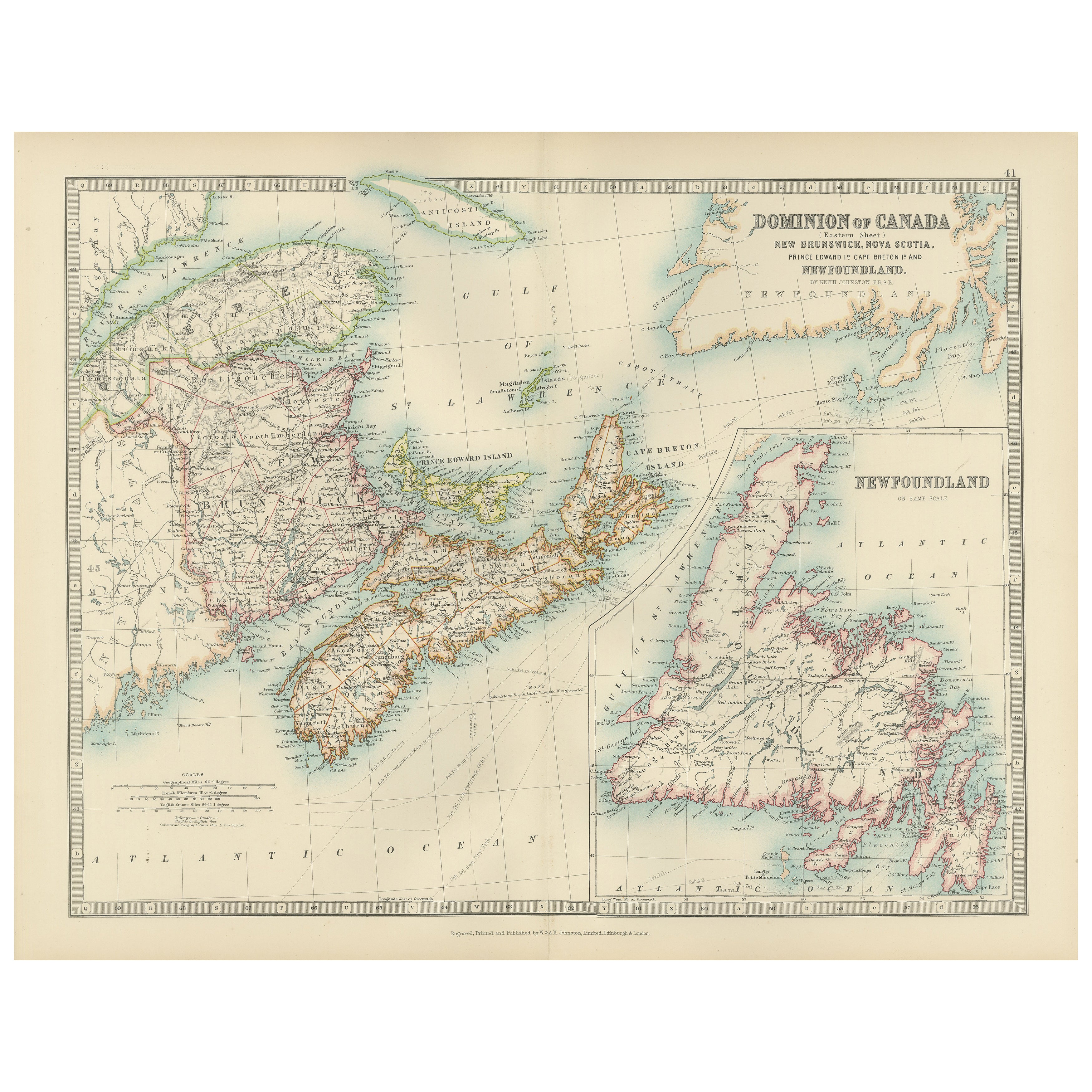
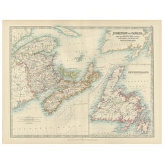
Canada Dominion Map 1903 - A Detailed View of Eastern Canada and Newfoundland
North America, 1903 - A Colorful Historical Map with Detailed Borders
This attractive map of North America was engraved, printed, and published by W. & A.K. Johnston in 1903. A wond...
Categoría
principios del siglo XX, Mapas
Materiales
Papel
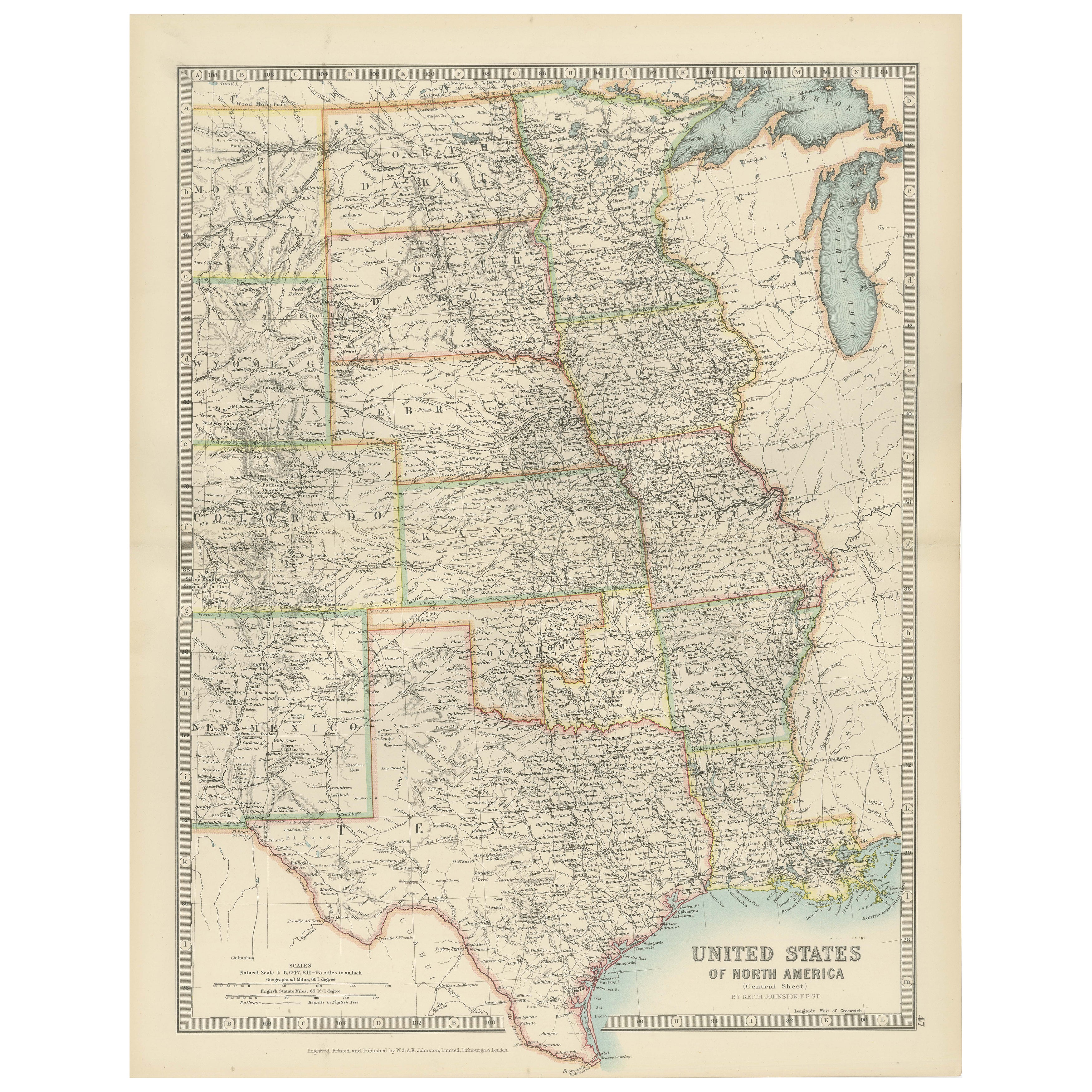
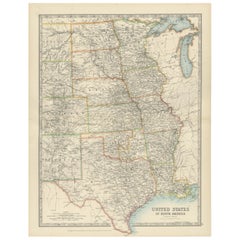
Map of United States Central Sheet 1903 – Railroads, States, and Topography
Map of United States Central Sheet 1903 – Railroads, States, and Topography
This is a finely engraved and beautifully colored map titled "United States of North America (Central She...
Categoría
principios del siglo XX, Mapas
Materiales
Papel
Canada’s West – 1903 Engraved Map by Johnston – Unique and Historic
This beautiful and detailed map, titled "Dominion of Canada (Western Sheet)," was created by Keith Johnston and published in 1903.
It presents a fascinating depiction of Canada's w...
Categoría
principios del siglo XX, Mapas
Materiales
Papel
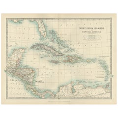
Map of the West India Islands and Central America – Colorful 1903 Engraving
Map of the West India Islands and Central America – Colorful 1903 Engraving
This vibrant engraved map, titled "West India Islands and Central America," was created by Keith Johnston...
Categoría
principios del siglo XX, Mapas
Materiales
Papel
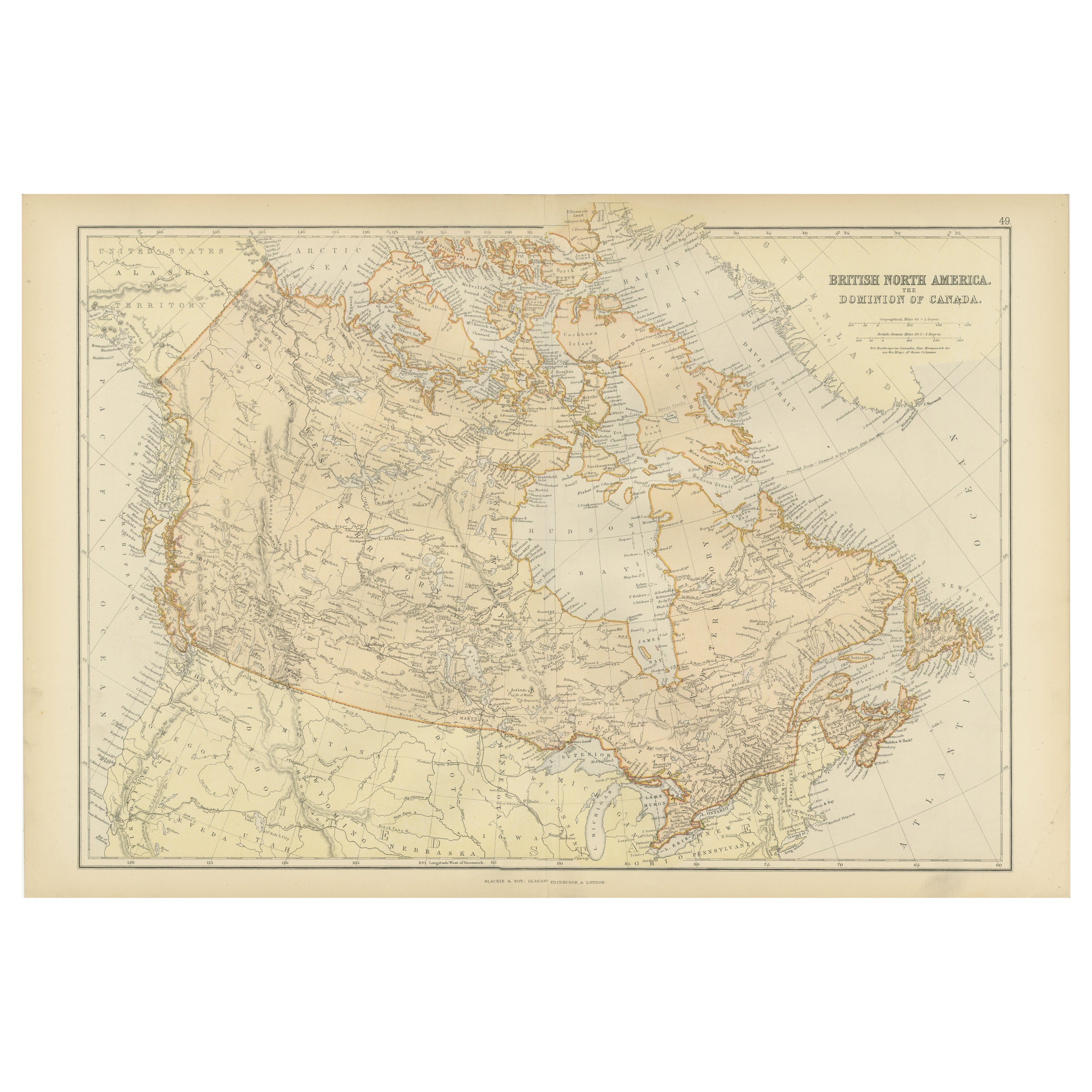
Mapa antiguo de la América del Norte británica, el Dominio de Canadá, 1882
Este mapa se titula "Norteamérica Británica, Dominio de Canadá", del Atlas Blackie de 1882. Presenta la zona geográfica que comprende el actual Canadá, con rasgos notables resaltados...
Categoría
Antiguo, Década de 1880, Mapas
Materiales
Papel

232 US$ Precio de venta
Descuento del 20 %
Envío gratuito
También te puede gustar
Mapa original antiguo del estado norteamericano de Minnesota, 1903
Mapa antiguo de Minnesota
Publicado por A & C Black. 1903
Color original
Buen estado
Sin enmarcar.
Envío gratuito
Categoría
Antiguo, Principios del 1900, Inglés, Mapas
Materiales
Papel

Mapa original antiguo del estado norteamericano de Alabama, 1903
Antique map of Alabama
Published By A & C Black. 1903
Original colour
Good condition
Unframed.
Free shipping
Categoría
Antiguo, Principios del 1900, Inglés, Mapas
Materiales
Papel

Mapa original antiguo del estado norteamericano de Alaska, 1903
Mapa antiguo de Alaska
Publicado por A & C Black. 1903
Color original
Buen estado
Sin enmarcar.
Envío gratuito
Categoría
Antiguo, Principios del 1900, Inglés, Mapas
Materiales
Papel

Mapa original antiguo del estado norteamericano de Nebraska, 1903
Mapa antiguo de Nebraska
Publicado por A & C Black. 1903
Color original
Buen estado
Sin enmarcar.
Envío gratuito
Categoría
Antiguo, Principios del 1900, Inglés, Mapas
Materiales
Papel

Mapa Antiguo Original del Estado Americano de Washington, 1903
Mapa antiguo de Washington
Publicado por A & C Black. 1903
Color original
Buen estado
Sin enmarcar.
Envío gratuito
Categoría
Antiguo, Principios del 1900, Inglés, Mapas
Materiales
Papel

Mapa original antiguo del estado norteamericano de Tennessee, 1903
Antique map of Tennessee
Published By A & C Black. 1903
Original colour
Good condition
Unframed.
Free shipping
Categoría
Antiguo, Principios del 1900, Inglés, Mapas
Materiales
Papel
