Artículos similares a Map of Finistère France with Brest, Quimper and Brittany Coastline, 19th Century


¿Quieres más imágenes o vídeos?
Solicita imágenes o vídeos adicionales al vendedor
1 de 10
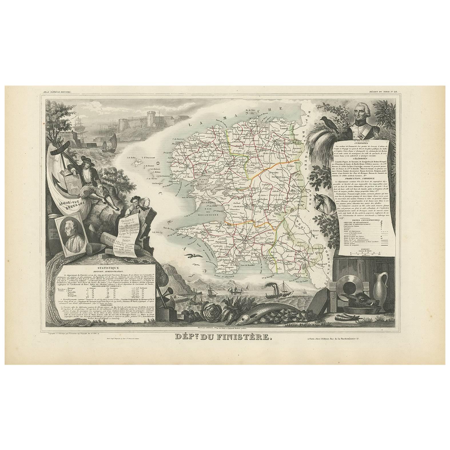
Map of Finistère France with Brest, Quimper and Brittany Coastline, 19th Century
140 €IVA incluido
Acerca del artículo
Map of Finistère France with Brest, Quimper and Brittany Coastline, 19th Century
Description:
This richly engraved 19th-century map of Finistère, the westernmost department of mainland France, was drawn by Alexandre Vuillemin and published by Migeon in Paris for the *Nouvel Atlas Illustré*. The map offers a finely detailed view of this culturally distinct and geographically dramatic region, renowned for its rugged coastline, maritime heritage, and Celtic traditions.
Finistère, meaning "end of the land" in Latin, is presented here with its departmental boundaries hand-colored in soft pink. The map clearly delineates towns, roads, rivers, and coastal features, including the Crozon Peninsula and islands such as Ouessant and Sein. Quimper, the prefecture, and Brest, a strategic naval base, are prominently marked along with other key towns like Morlaix, Douarnenez, and Concarneau.
In the lower left corner is an engraved vignette of the harbor at Quimper, depicting a sailing vessel, waterfront buildings, and a view of the Gothic cathedral. On the right stands a full-length statue of a revolutionary figure, General Hoche, who led troops in Brittany during the counter-revolutionary uprisings. The top left features the coat of arms of Finistère, bearing a ship and marine imagery appropriate to this seafaring region.
Finistère forms part of Brittany (Bretagne), a region steeped in Celtic culture, Breton language, and maritime history. While not a major wine-producing area, the department is famous for its cider, seafood (especially oysters and scallops), buckwheat galettes, and dairy products. Its coastal geography and strong winds have made it a critical location for lighthouses, fishing ports, and naval defenses for centuries.
This antique map is both decorative and historically informative, ideal for collectors interested in Brittany, French maritime history, or regional ethnography. It reflects the cultural independence and dramatic geography of France’s far western frontier.
Condition summary:
Very good condition with minor age toning and light foxing near the edges. Engraved lines are crisp and the original hand coloring remains clean and consistent.
Framing tips:
A rustic oak or driftwood frame complements the coastal and Breton character of the map. A cream or light gray mat enhances the engraving and soft pink tones. UV-protective glass is recommended for preservation and clarity.
- Dimensiones:Altura: 32,5 cm (12,8 in)Anchura: 26,1 cm (10,28 in)Profundidad: 0,2 mm (0,01 in)
- Materiales y técnicas:Papel,Grabado
- Lugar de origen:
- Época:
- Fecha de fabricación:circa 1850
- Estado:Very good condition with minor age toning and light foxing near the edges. Engraved lines are crisp and the original hand coloring remains clean and consistent.
- Ubicación del vendedor:Langweer, NL
- Número de referencia:Vendedor: BG-13331-281stDibs: LU3054345363902
Sobre el vendedor
5,0
Vendedor reconocido
Estos prestigiosos vendedores son líderes del sector y representan el escalón más alto en cuanto a calidad y diseño de artículos.
Vendedor Platino
Vendedores premium con una calificación de +4,7 y tiempos de respuesta de 24 horas
Establecido en 2009
Vendedor de 1stDibs desde 2017
2656 ventas en 1stDibs
Tiempo de respuesta usual: <1 hora
- EnvíoRecuperando presupuesto…Envío desde: Langweer, Países Bajos
- Política de devolución
Partes de esta página se han traducido automáticamente. 1stDibs no puede garantizar la exactitud de las traducciones. El inglés es el idioma predeterminado de este sitio web.
Garantía de autenticidad
En el improbable caso de que haya algún problema con la autenticidad de un artículo, ponte en contacto con nosotros en un plazo de 1 año para recibir un reembolso total. DetallesGarantía de devolución de dinero
Si tu artículo no es como se describe, sufre daños durante el transporte o no llega, ponte en contacto con nosotros en un plazo de 7 días para recibir un reembolso total. DetallesCancelación dentro de las 24 horas
Tienes un período de gracia de 24 horas para reconsiderar tu compra, sin preguntas.Vendedores profesionales aprobados
Nuestros vendedores de primera clase deben cumplir estrictos estándares de servicio para mantener la integridad de nuestros anuncios.Garantía de igualación de precios
Si encuentras que un vendedor publicó el mismo artículo por un precio menor en otro lado, igualaremos ese precio.Entrega global de confianza
Nuestra red de transporte de primera ofrece opciones de envío especializado en todo el mundo, que incluye envío personalizado.Más de este vendedor
Ver todoMap of Côtes-du-Nord France with Saint-Brieuc and Brittany Coastline, c.1850
Map of Côtes-du-Nord France with Saint-Brieuc and Brittany Coastline, 19th c
Description:
This elegant 19th-century map of Côtes-du-Nord, the historic name for what is now known as ...
Categoría
Antiguo, Mediados del siglo XIX, Francés, Mapas
Materiales
Papel

Antique French Map of Ille-et-Vilaine Region with Rennes, Saint-Malo, 1800s
Mapa antiguo de Ille-et-Vilaine, Francia, por Vuillemin, siglo XIX
Este decorativo mapa antiguo presenta el departamento francés de Ille-et-Vilaine, situado en la región de Bretaña,...
Categoría
Antiguo, Mediados del siglo XIX, Francés, Mapas
Materiales
Papel

Mapa antiguo del Finisterre "Francia" por V. Levasseur, 1854
Por Victor Levasseur
Mapa antiguo titulado "Dépt. du Finistère". Mapa del departamento francés de Finistère, Bretaña, Francia. Esta zona de Francia es conocida por su producción de sidra y su excelente c...
Categoría
Antiguo, Mediados del siglo XIX, Francés, Mapas
Materiales
Papel
144 € Precio de venta
Descuento del 20 %
Map of Allier France with Saint-Pourçain Wine Region by Vuillemin, 19th c
Map of Allier France with Saint-Pourçain Wine Region by Vuillemin, 19th c
This decorative 19th-century map of Allier, a central department of France, comes from the celebrated Nouve...
Categoría
Antiguo, Mediados del siglo XIX, Francés, Mapas
Materiales
Papel

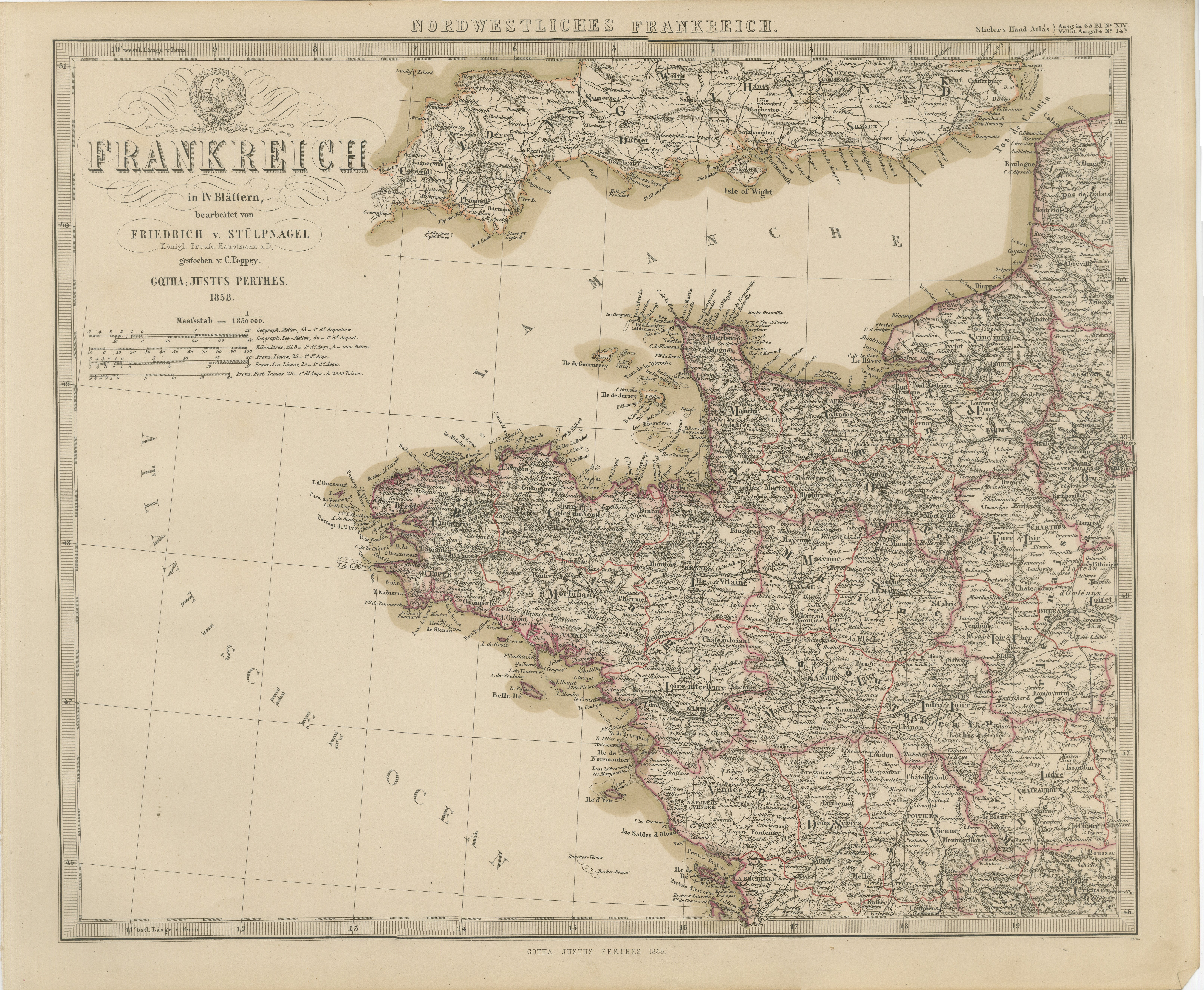
Mapa coloreado a mano del noroeste de Francia - Bretaña al Loira, 1858
Mapa antiguo del noroeste de Francia - Grabado Stülpnagel, Justus Perthes 1858
Mapa impresionantemente detallado de mediados del siglo XIX del noroeste de Francia titulado "Frankrei...
Categoría
Antiguo, Mediados del siglo XIX, Alemán, Mapas
Materiales
Papel
Map of Aisne France with Soissons and Champagne Vineyards by Vuillemin, 19th c
Map of Aisne France with Soissons and Champagne Vineyards by Vuillemin, 19th c
Description:
This richly detailed 19th-century engraved and hand-colored map of the department of Aisn...
Categoría
Antiguo, Mediados del siglo XIX, Francés, Mapas
Materiales
Papel

También te puede gustar
Gran mapa de Francia del siglo XIX
Gran mapa de Francia del siglo XIX.
Notable estado, con una agradable pátina desgastada por el tiempo.
Recientemente enmarcado.
Francia Circa 1874.
Categoría
Antiguo, Fines del siglo XIX, Francés, Mapas
Materiales
Lino, Papel

Mapa de Francia - Aguafuerte - 1820
Mapa de Francia es un Grabado Original realizado por un artista desconocido del siglo XIX en 1820.
Muy buen estado en dos hojas de papel blanco unidas por el centro.
El mapa es un ...
Categoría
Década de 1820, Moderno, Impresiones figurativas
Materiales
Grabado químico

Francia, Parte Norte. Mapa antiguo Century Atlas
El Atlas del Siglo. Francia, Parte Norte".
Mapa antiguo original, 1903.
Mapas en recuadro de "Francia en provincias" y "París y alrededores".
Pliegue central como se emitió. Nombre...
Categoría
principios del siglo XX, Victoriano, Más impresiones
Materiales
Litografía

Indre y Loira, Francia. Mapa antiguo de un departamento francés, 1856
Por Victor Levasseur
"Dept. d'Indre et Loire", grabado en acero con contorno original coloreado a mano., 1856, del "Atlas National Illustre" de Levasseur.
Esta zona es conocida por su producción de Che...
Categoría
siglo XIX, Naturalista, Impresiones de paisajes
Materiales
Grabado

La Gironda, Francia. Mapa antiguo de un departamento francés, 1856
Por Victor Levasseur
La Gironda", grabado en acero con contorno original coloreado a mano, 1856, del "Atlas National Illustre" de Levasseur.
Este departamento costero es la sede de la región vinícola d...
Categoría
siglo XIX, Naturalista, Impresiones de paisajes
Materiales
Grabado

Mapa de Vendée - Aguafuerte - Siglo XIX
Mapa de Vendée es un aguafuerte realizado por un grabador anónimo del siglo XIX.
Impreso en serie de "France Pittoresque" en la parte superior central.
El estado de conservación de...
Categoría
siglo XIX, Moderno, Impresiones figurativas
Materiales
Grabado químico
