Artículos similares a Map of Haute-Garonne France with Toulouse and Garonne River by Vuillemin, c.1850


¿Quieres más imágenes o vídeos?
Solicita imágenes o vídeos adicionales al vendedor
1 de 10
Map of Haute-Garonne France with Toulouse and Garonne River by Vuillemin, c.1850
140 €IVA incluido
Acerca del artículo
Map of Haute-Garonne France with Toulouse and Garonne River by Vuillemin, 19th c
Description:
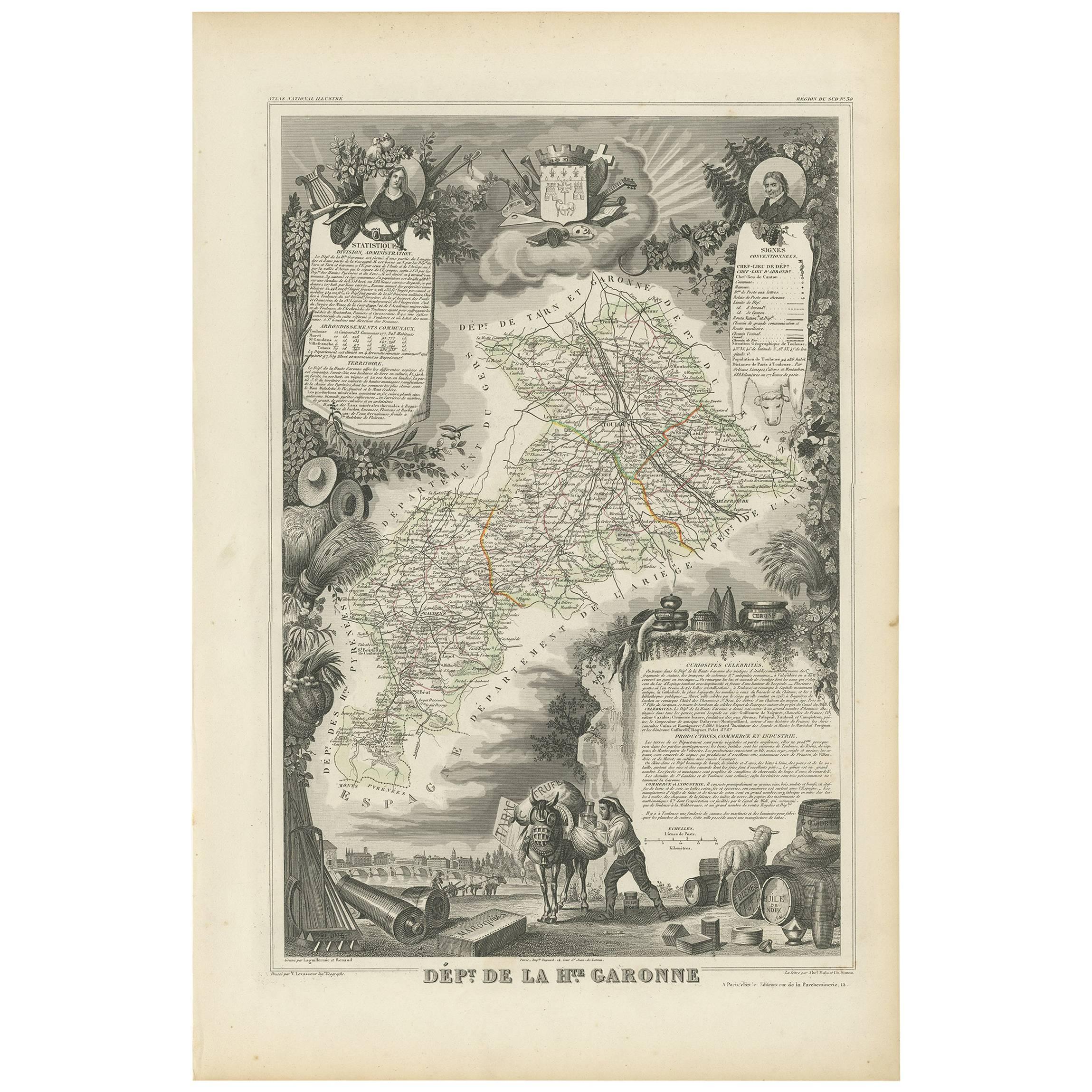
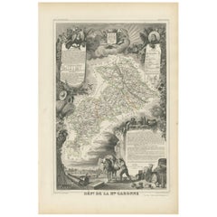
This finely engraved 19th-century map of the department of Haute-Garonne, located in southwestern France, is part of Alexandre Vuillemin’s *Nouvel Atlas Illustré*, published in Paris by Migeon. The map presents a detailed view of the region’s topography and settlements, enriched by charming vignettes and portraits that highlight its cultural and historical importance.
Haute-Garonne is situated in the Occitanie region and is named after the Garonne River, which flows through the department’s capital, Toulouse. The map displays the area’s borders in soft hand-applied pink, and meticulously marks rivers, roads, and towns. Toulouse is prominently featured at the center, reflecting its status as the economic and cultural heart of the department.
The map is visually enriched with several artistic details. At the lower right, an attractive vignette shows the city of Toulouse with the Garonne River and a stone bridge—likely the Pont Neuf—connecting the historic parts of the city. At the top right, a portrait of the Abbé Sicard, a notable educator and pioneer in teaching the deaf, pays homage to one of the region’s historical figures. On the left side, a costumed couple with an ox—representing regional dress and agricultural heritage—adds a folkloric touch. The department's coat of arms is also included, further underscoring its civic identity.
Haute-Garonne is part of the greater Sud-Ouest wine region of France. Though better known today for its high-tech industry centered in Toulouse, the department still has a presence in viticulture. Local wines fall under the Comté Tolosan IGP label, and grape varieties such as Merlot, Cabernet Franc, and Tannat are grown in nearby areas. The region’s climate—characterized by warm summers and cool winters—supports a variety of wine styles, from red to white and rosé.
Alexandre Vuillemin was a noted 19th-century French cartographer who brought artistry and clarity to geographical publishing. His maps, engraved with great precision and often accompanied by cultural illustrations, were widely admired and collected. Publisher Migeon specialized in quality illustrated atlases that served both educational and decorative purposes.
Condition summary:
Very good condition with mild age toning and a few faint foxing spots near the edges. The engraved detail is crisp and the hand coloring remains clean and vivid.
Framing tips:
Best displayed in a natural wood or black frame to enhance the contrast of the engraving. A cream or soft rose-tinted mat will pair well with the pink border. Use UV-protective glass to preserve the fine detail and coloring.
- Dimensiones:Altura: 26,1 cm (10,28 in)Anchura: 32,5 cm (12,8 in)Profundidad: 0,2 mm (0,01 in)
- Materiales y técnicas:Papel,Grabado
- Lugar de origen:
- Época:
- Fecha de fabricación:circa 1850
- Estado:Very good condition with mild age toning and a few faint foxing spots near the edges. The engraved detail is crisp and the hand coloring remains clean and vivid.
- Ubicación del vendedor:Langweer, NL
- Número de referencia:Vendedor: BG-13331-301stDibs: LU3054345363932
Sobre el vendedor
5,0
Vendedor reconocido
Estos prestigiosos vendedores son líderes del sector y representan el escalón más alto en cuanto a calidad y diseño de artículos.
Vendedor Platino
Vendedores premium con una calificación de +4,7 y tiempos de respuesta de 24 horas
Establecido en 2009
Vendedor de 1stDibs desde 2017
2655 ventas en 1stDibs
Tiempo de respuesta usual: <1 hora
- EnvíoRecuperando presupuesto…Envío desde: Langweer, Países Bajos
- Política de devolución
Partes de esta página se han traducido automáticamente. 1stDibs no puede garantizar la exactitud de las traducciones. El inglés es el idioma predeterminado de este sitio web.
Garantía de autenticidad
En el improbable caso de que haya algún problema con la autenticidad de un artículo, ponte en contacto con nosotros en un plazo de 1 año para recibir un reembolso total. DetallesGarantía de devolución de dinero
Si tu artículo no es como se describe, sufre daños durante el transporte o no llega, ponte en contacto con nosotros en un plazo de 7 días para recibir un reembolso total. DetallesCancelación dentro de las 24 horas
Tienes un período de gracia de 24 horas para reconsiderar tu compra, sin preguntas.Vendedores profesionales aprobados
Nuestros vendedores de primera clase deben cumplir estrictos estándares de servicio para mantener la integridad de nuestros anuncios.Garantía de igualación de precios
Si encuentras que un vendedor publicó el mismo artículo por un precio menor en otro lado, igualaremos ese precio.Entrega global de confianza
Nuestra red de transporte de primera ofrece opciones de envío especializado en todo el mundo, que incluye envío personalizado.Más de este vendedor
Ver todoMapa antiguo de Alto Garona 'Francia' por V. Levasseur, 1854
Mapa antiguo titulado "Dépt. de la Hte. Garona". Mapa del departamento francés de Alto Garona, Francia. Esta zona de Francia produce los deliciosos pero menos conocidos vinos de Buze...
Categoría
Antiguo, Mediados del siglo XIX, Mapas
Materiales
Papel
144 € Precio de venta
Descuento del 20 %
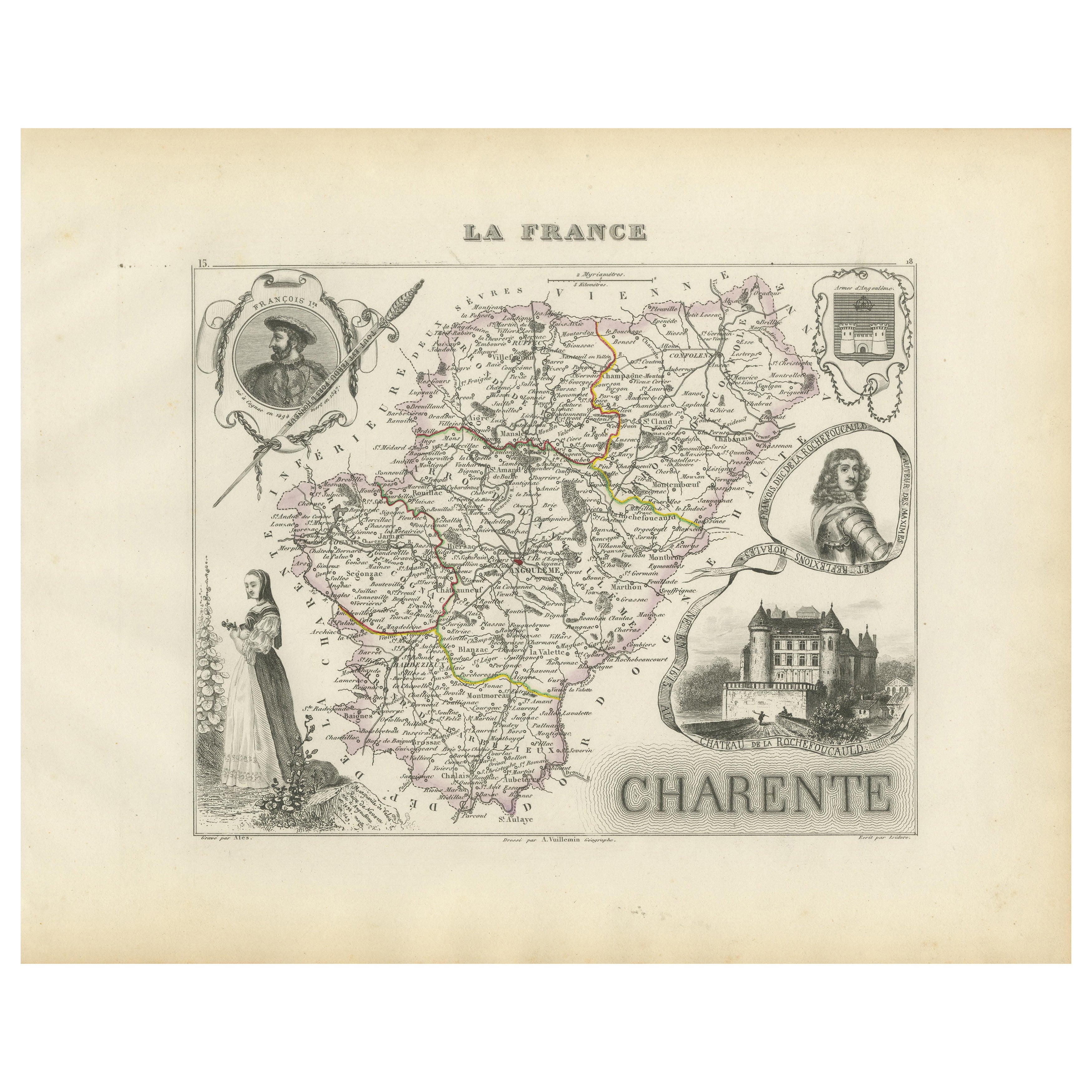
Map of Charente France with Cognac Region and Château de La Rochefoucauld, 1850
Map of Charente France with Cognac Region and Château de La Rochefoucauld, 19th c
Description:
This richly illustrated 19th-century map of the Charente department in southwestern Fr...
Categoría
Antiguo, Mediados del siglo XIX, Francés, Mapas
Materiales
Papel

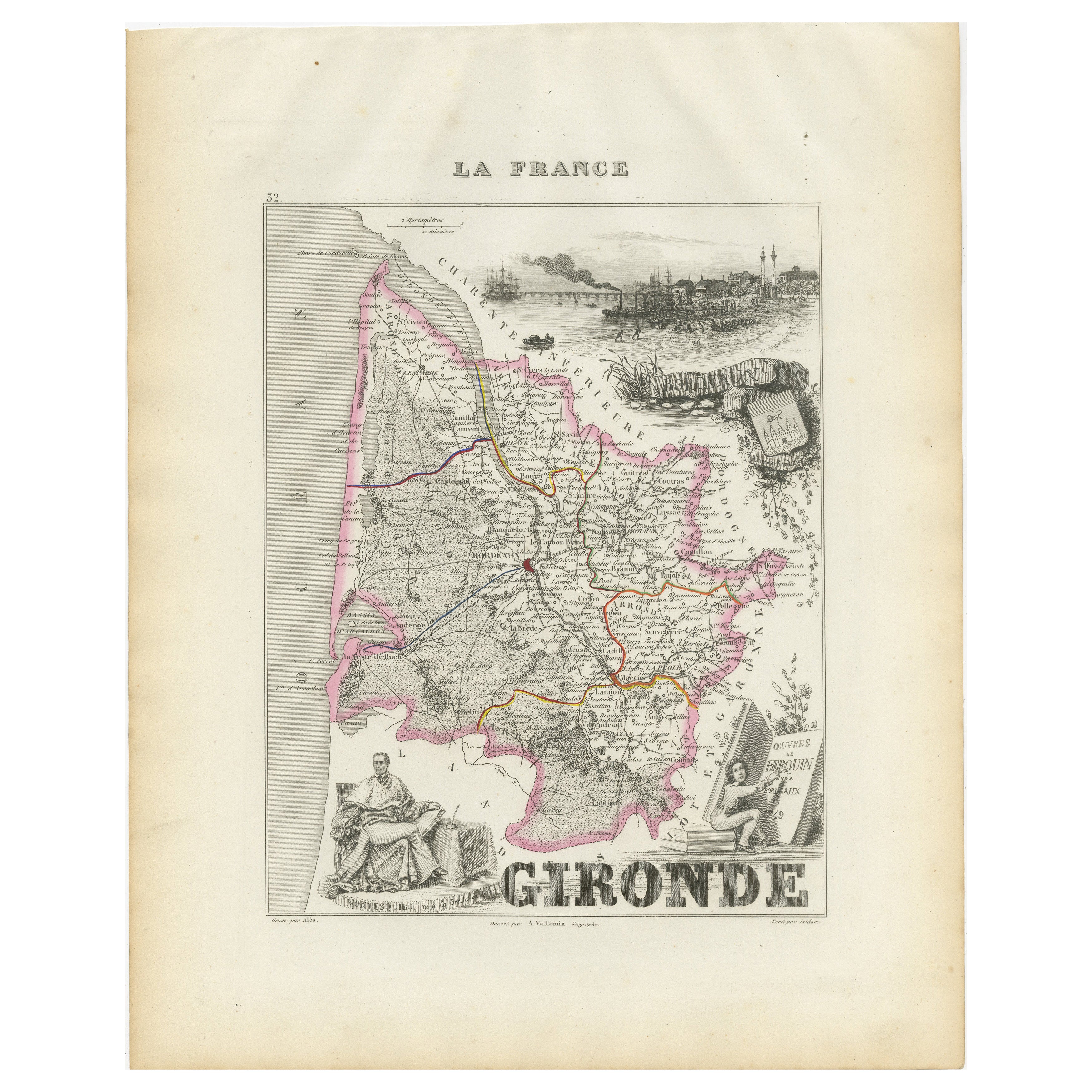
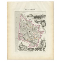
Mapa de la Gironda francesa con la región vinícola de Burdeos por Vuillemin, s. XIX
Mapa de la Gironda francesa con la región vinícola de Burdeos por Vuillemin, s. XIX
Este sorprendente mapa de la Gironda (Francia) del siglo XIX forma parte del Nouvel Atlas Illustr...
Categoría
Antiguo, Mediados del siglo XIX, Francés, Mapas
Materiales
Papel
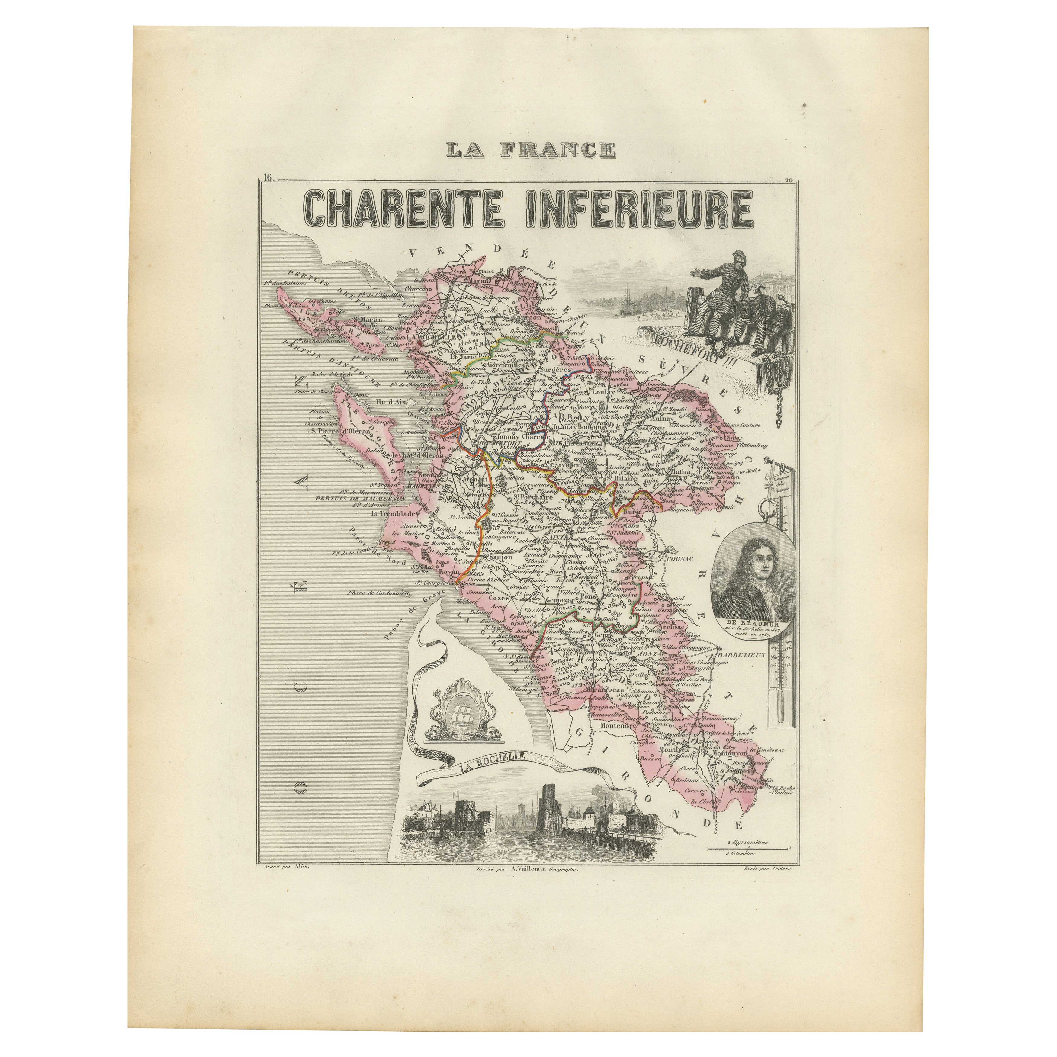
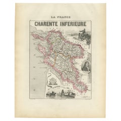
Map of Charente-Inférieure France with La Rochelle and Coastal Vineyards, c.1850
Map of Charente-Inférieure France with La Rochelle and Coastal Vineyards, 19th c
Description:
This decorative 19th-century map of the former department of Charente-Inférieure, now k...
Categoría
Antiguo, Mediados del siglo XIX, Francés, Mapas
Materiales
Papel
Map of Gard France with Pont du Gard and Wine Regions by Vuillemin, 19th c
Title: Map of Gard France with Pont du Gard and Wine Regions by Vuillemin, 19th c
Description:
This finely engraved 19th-century map of the department of Gard in southern France was...
Categoría
Antiguo, Mediados del siglo XIX, Francés, Mapas
Materiales
Papel

Map of Côtes-du-Nord France with Saint-Brieuc and Brittany Coastline, c.1850
Map of Côtes-du-Nord France with Saint-Brieuc and Brittany Coastline, 19th c
Description:
This elegant 19th-century map of Côtes-du-Nord, the historic name for what is now known as ...
Categoría
Antiguo, Mediados del siglo XIX, Francés, Mapas
Materiales
Papel

También te puede gustar
Saona y Loira, Francia. Mapa antiguo de un departamento francés, 1856
Por Victor Levasseur
Dept. de Saone et Loire", grabado en acero con contorno original coloreado a mano, 1856, del Atlas National Illustre de Levasseur.
El departamento francés de Saone et Loire está en...
Categoría
siglo XIX, Naturalista, Impresiones de paisajes
Materiales
Grabado

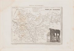
Mapa de Tarn et Garonne - Litografía original - Siglo XIX
Mapa de Tarn et Garonne es una litografía original realizada por un artista Anónimo del siglo XIX.
Impreso en serie de "France Pittoresque" en la parte superior central.
El estado ...
Categoría
siglo XIX, Moderno, Impresiones figurativas
Materiales
Papel, Litografía
L'Herault, Francia. Mapa antiguo de un departamento francés, 1856
Por Victor Levasseur
Dept. de Saone et Loire", grabado en acero con contorno original coloreado a mano, 1856, del Atlas National Illustre de Levasseur.
Esta zona alberga una gran variedad de viñedos y ...
Categoría
siglo XIX, Naturalista, Impresiones de paisajes
Materiales
Grabado

L'Isere, Francia. Mapa antiguo del departamento francés, 1856
Por Victor Levasseur
Dept. de L'Isere", grabado en acero con contorno original coloreado a mano, 1856, del "Atlas National Illustre" de Levasseur.
Esta zona es conocida por su producción de Bleu du Ver...
Categoría
siglo XIX, Naturalista, Impresiones de paisajes
Materiales
Grabado

Aude, Francia. Mapa antiguo de un departamento francés, 1856
Por Victor Levasseur
"Dept. de L' Aude", grabado en acero con contorno original coloreado a mano., 1856, del "Atlas National Illustre" de Levasseur.
Esta zona de Francia es famosa por su gran variedad ...
Categoría
siglo XIX, Naturalista, Impresiones de paisajes
Materiales
Grabado

Aube, Francia. Mapa antiguo de un departamento francés, 1856
Por Victor Levasseur
Dept. de L'Aube", grabado en acero con contorno original coloreado a mano, 1856, del "Atlas National Illustre" de Levasseur.
Esta zona de Francia es conocida por su producción de C...
Categoría
siglo XIX, Naturalista, Impresiones de paisajes
Materiales
Grabado
