Artículos similares a Map of Hautes-Alpes France with Gap and Alpine Scenery by Vuillemin, c.1850

¿Quieres más imágenes o vídeos?
Solicita imágenes o vídeos adicionales al vendedor
1 de 10
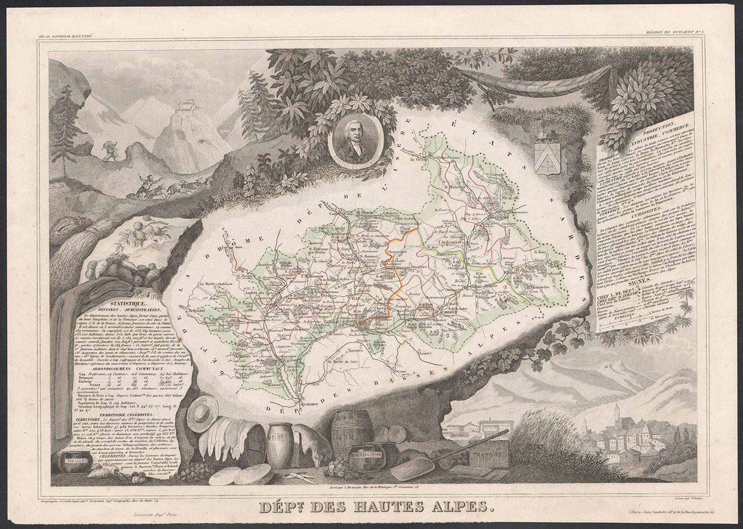
Map of Hautes-Alpes France with Gap and Alpine Scenery by Vuillemin, c.1850
120 €IVA incluido
Acerca del artículo
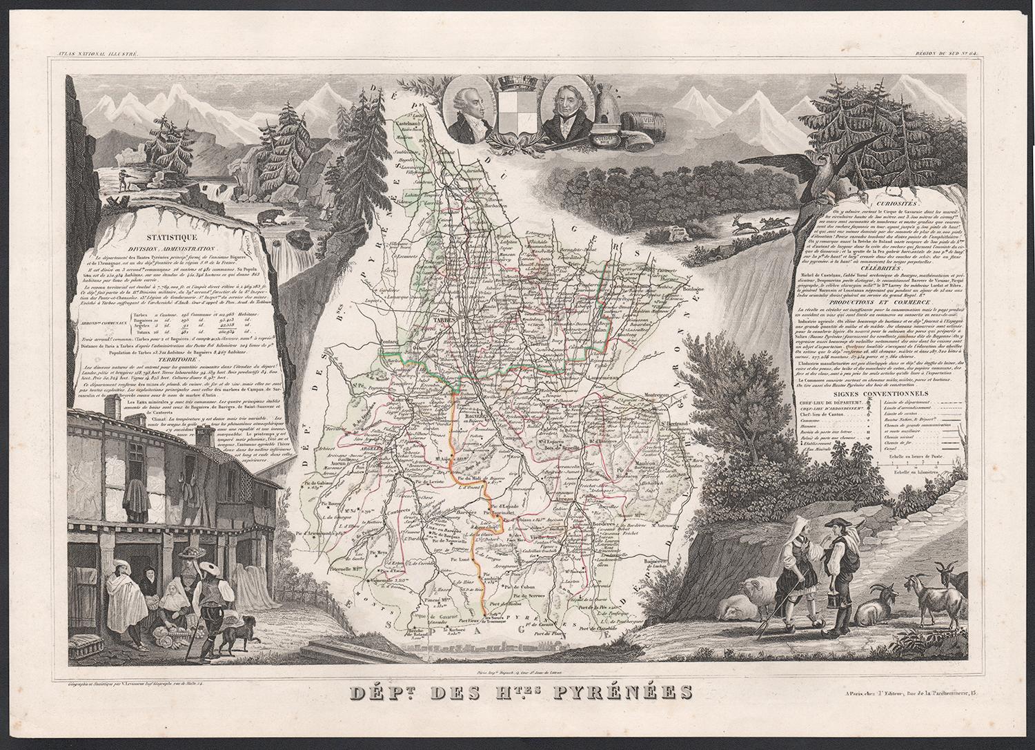
Map of Hautes-Alpes France with Gap and Alpine Scenery by Vuillemin
Description:
This elegant 19th-century map of the Hautes-Alpes department in southeastern France was created by Alexandre Vuillemin and published by Migeon in Paris as part of the richly illustrated Nouvel Atlas Illustré. The map presents a detailed view of this mountainous region, framed by artistic engravings that highlight its historical, topographical, and cultural significance.
Hautes-Alpes is one of the highest and most sparsely populated departments in France, located in the heart of the French Alps. The map is bordered with a soft hand-colored blue to indicate the departmental boundary. Towns, roads, and rivers are carefully engraved, and the mountainous terrain is subtly rendered with engraved shading. The map offers a close view of the towns of Gap, Embrun, Briançon, and the surrounding alpine passes that have long connected France and Italy.
At the upper left, a portrait of the Duc de Lesdiguières is featured. He was a key military leader in the Wars of Religion and the last Constable of France, born in the region and associated with its defense and development. In the upper right, a coat of arms appears with a fortified tower motif. The lower half of the sheet is dominated by an engraved vignette of Gap, the department’s prefecture, nestled in an idyllic alpine valley. Trees, livestock, and cottages contribute to the rural and peaceful atmosphere that characterizes this high-altitude area.
Though Hautes-Alpes is not a major wine-producing region due to its elevation and climate, it is known for small-scale, high-altitude viticulture in valleys such as those around Embrun and Tallard. More than its wine, however, the area is celebrated for winter sports, mountain tourism, and its stunning natural scenery. Hiking, skiing, and nature excursions are key to the region’s identity.
Alexandre Vuillemin was known for his skill in producing maps that were both accurate and decorative. His publisher, Migeon, brought these works to a wide audience through visually engaging atlases, combining educational and artistic appeal.
Condition summary:
Very good antique condition with only minor age-related foxing in the margins. Original hand-coloring is well preserved, and all engraved lines remain crisp and clear.
Framing tips:
This map would suit a natural wood frame or one with a distressed alpine finish. A cream or pale blue mat will complement the hand-colored border and evoke the cool tones of the mountain setting. Museum-quality glass is recommended for protection.
- Dimensiones:Altura: 26,1 cm (10,28 in)Anchura: 32,5 cm (12,8 in)Profundidad: 0,2 mm (0,01 in)
- Materiales y técnicas:Papel,Grabado
- Lugar de origen:
- Época:
- Fecha de fabricación:circa 1850
- Estado:Very good antique condition with only minor age-related foxing in the margins. Original hand-coloring is well preserved, and all engraved lines remain crisp and clear.
- Ubicación del vendedor:Langweer, NL
- Número de referencia:Vendedor: BG-13331-51stDibs: LU3054345359152
Sobre el vendedor
5,0
Vendedor reconocido
Estos prestigiosos vendedores son líderes del sector y representan el escalón más alto en cuanto a calidad y diseño de artículos.
Vendedor Platino
Vendedores premium con una calificación de +4,7 y tiempos de respuesta de 24 horas
Establecido en 2009
Vendedor de 1stDibs desde 2017
2609 ventas en 1stDibs
Tiempo de respuesta usual: <1 hora
- EnvíoRecuperando presupuesto…Envío desde: Langweer, Países Bajos
- Política de devolución
Partes de esta página se han traducido automáticamente. 1stDibs no puede garantizar la exactitud de las traducciones. El inglés es el idioma predeterminado de este sitio web.
Garantía de autenticidad
En el improbable caso de que haya algún problema con la autenticidad de un artículo, ponte en contacto con nosotros en un plazo de 1 año para recibir un reembolso total. DetallesGarantía de devolución de dinero
Si tu artículo no es como se describe, sufre daños durante el transporte o no llega, ponte en contacto con nosotros en un plazo de 7 días para recibir un reembolso total. DetallesCancelación dentro de las 24 horas
Tienes un período de gracia de 24 horas para reconsiderar tu compra, sin preguntas.Vendedores profesionales aprobados
Nuestros vendedores de primera clase deben cumplir estrictos estándares de servicio para mantener la integridad de nuestros anuncios.Garantía de igualaci�ón de precios
Si encuentras que un vendedor publicó el mismo artículo por un precio menor en otro lado, igualaremos ese precio.Entrega global de confianza
Nuestra red de transporte de primera ofrece opciones de envío especializado en todo el mundo, que incluye envío personalizado.Más de este vendedor
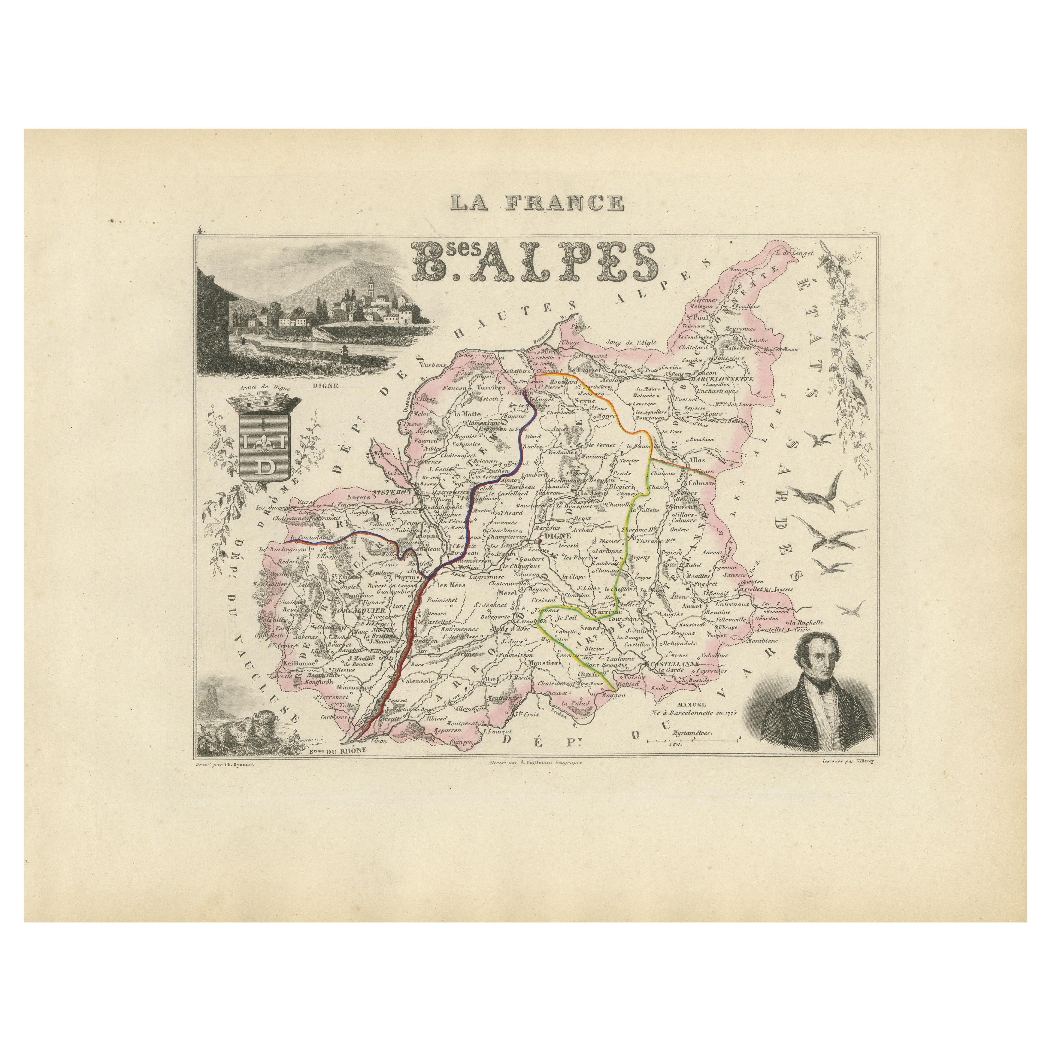
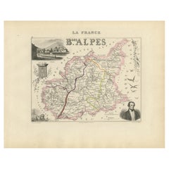
Ver todoMap of Basses-Alpes France with Digne and Lavender Region by Vuillemin, c.1850
Map of Basses-Alpes France with Digne and Lavender Region by Vuillemin, 19th c
This finely engraved 19th-century map of the Basses-Alpes department of France (known today as Alpes-d...
Categoría
Antiguo, Mediados del siglo XIX, Francés, Mapas
Materiales
Papel
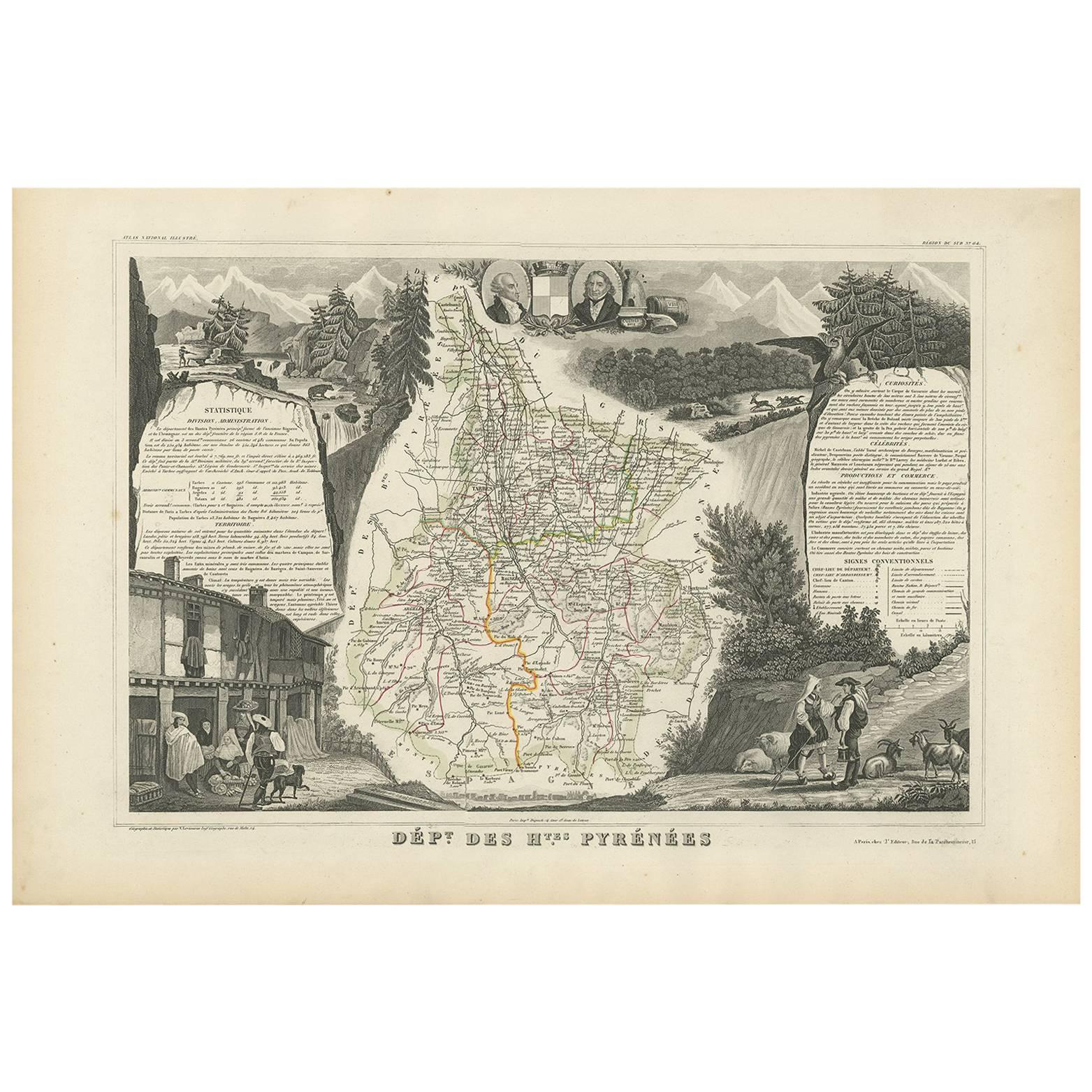
Mapa antiguo de los Altos Pirineos 'Francia' por V. Levasseur, 1854
Por Victor Levasseur
Mapa antiguo titulado "Dépt. des Htes. Pirineos". Mapa del departamento francés de Altos Pirineos, Francia. En esta zona se encuentra la región vinícola de Madiran. Madrian es conoci...
Categoría
Antiguo, Mediados del siglo XIX, Mapas
Materiales
Papel
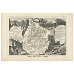
160 € Precio de venta
Descuento del 20� %
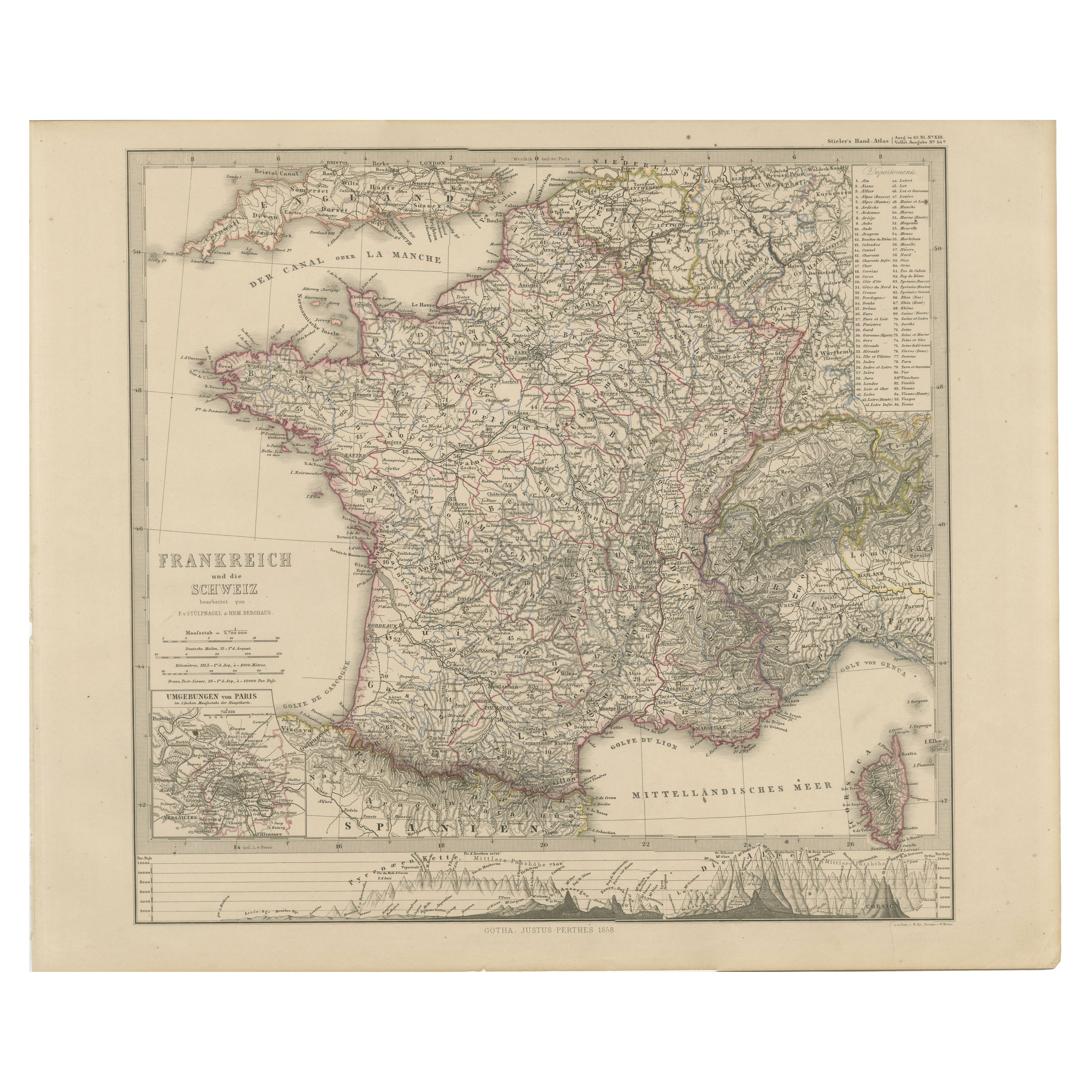
Mapa de Francia y Suiza de 1856 con perfiles montañosos
Mapa de Francia y Suiza de 1856 con París, de Stülpnagel
Este mapa antiguo de Francia y Suiza, finamente detallado, fue publicado en 1856 por el estimado cartógrafo alemán Freiherr ...
Categoría
Antiguo, Mediados del siglo XIX, Alemán, Mapas
Materiales
Papel
Map of Allier France with Saint-Pourçain Wine Region by Vuillemin, 19th c
Map of Allier France with Saint-Pourçain Wine Region by Vuillemin, 19th c
This decorative 19th-century map of Allier, a central department of France, comes from the celebrated Nouve...
Categoría
Antiguo, Mediados del siglo XIX, Francés, Mapas
Materiales
Papel

Map of Côtes-du-Nord France with Saint-Brieuc and Brittany Coastline, c.1850
Map of Côtes-du-Nord France with Saint-Brieuc and Brittany Coastline, 19th c
Description:
This elegant 19th-century map of Côtes-du-Nord, the historic name for what is now known as ...
Categoría
Antiguo, Mediados del siglo XIX, Francés, Mapas
Materiales
Papel

Mapa antiguo de Francia por Lapie, 1842
Mapa antiguo titulado "Carte de France". Mapa de Francia. Este mapa procede del "Atlas universel de géographie ancienne et moderne (..)" de Pierre M. Lapie y Alexandre E. Lapie. Pier...
Categoría
Antiguo, Mediados del siglo XIX, Mapas
Materiales
Papel

440 € Precio de venta
Descuento del 20 %
También te puede gustar
Altos Alpes, Francia. Mapa antiguo de un departamento francés, 1856
Por Victor Levasseur
Dept. des Hautes Alpes", grabado en acero con contorno original coloreado a mano, 1856, del "Atlas National Illustre" de Levasseur.
Esta zona de Francia es conocida por su producci...
Categoría
siglo XIX, Naturalista, Impresiones de paisajes
Materiales
Grabado

Altos Pirineos, Francia. Mapa antiguo de un departamento francés, 1856
Por Victor Levasseur
Dept. des Hautes Pyrenees", grabado en acero con contorno original coloreado a mano., 1856, del Atlas National Illustre de Levasseur.
En esta zona se encuentra la región vinícola d...
Categoría
siglo XIX, Naturalista, Impresiones de paisajes
Materiales
Grabado

Mapa de los Altos Pirineos - Litografía original - Siglo XIX
El Mapa de los Altos Pirineos es una litografía original realizada por un grabador anónimo del siglo XIX.
Impreso en serie de "France Pittoresque" en la parte superior central.
El ...
Categoría
siglo XIX, Moderno, Impresiones figurativas
Materiales
Papel, Litografía

Pirineos Orientales, Francia. Mapa antiguo de un departamento francés, 1856
Por Victor Levasseur
Dept. des Pyrenees Orientales", grabado en acero con contorno original coloreado a mano, 1856, del "Atlas National Illustre" de Levasseur.
Esta zona es una conocida región producto...
Categoría
siglo XIX, Naturalista, Impresiones de paisajes
Materiales
Grabado

Mapa antiguo en acuarela de 1856 del Departamento de Altos Alpes de Levasseur's
Nos complace poner a la venta este impresionante mapa de los Alpes austriacos realizado a mano y acuarelado en 1856, titulado Dept Des Hautes Alpes, extraído del Atlas National Illus...
Categoría
Antiguo, Década de 1850, Francés, Victoriano temprano, Mapas
Materiales
Papel

617 € Precio de venta
Descuento del 30 %
Lozere, Francia. Mapa antiguo de un departamento francés, 1856
Por Victor Levasseur
Dept. de La Lozere", grabado en acero con contorno original coloreado a mano, 1856, del "Atlas National Illustre" de Levasseur.
Esta remota zona montañosa de Languedoc es rural, po...
Categoría
siglo XIX, Naturalista, Impresiones de paisajes
Materiales
Grabado
