Artículos similares a Map of the West India Islands and Central America – Colorful 1903 Engraving


¿Quieres más imágenes o vídeos?
Solicita imágenes o vídeos adicionales al vendedor
1 de 10
Map of the West India Islands and Central America – Colorful 1903 Engraving
Acerca del artículo
Map of the West India Islands and Central America – Colorful 1903 Engraving
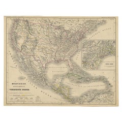
This vibrant engraved map, titled "West India Islands and Central America," was created by Keith Johnston, F.R.G.S., and published by W. & A.K. Johnston, Limited, Edinburgh & London, in 1903. The map offers a detailed depiction of the Caribbean region and Central America at the dawn of the 20th century, skillfully blending geographic accuracy with artistic charm.
The map captures the entire Caribbean basin, stretching from the southern tip of Florida to the shores of South America. It includes the major islands of Cuba, Hispaniola, Jamaica, Puerto Rico, the Bahamas, the Lesser Antilles, and parts of Central America like the Yucatán Peninsula, Honduras, Nicaragua, Costa Rica, and Panama. Intricately engraved lines represent the coastlines, rivers, and mountain ranges, while soft pastel color washes highlight the different political regions, adding clarity and elegance to the visual composition.
An essential feature is the precise labeling of key cities, settlements, and natural landmarks, reflecting the colonial influences and strategic importance of these islands. The map also delineates ocean currents, islands, and smaller cays that were crucial for trade, navigation, and exploration in this era.
This piece stands out not only for its visual appeal but also for its historical significance, marking a time of shifting colonial powers and growing global trade across the Atlantic and Pacific Oceans. T
The condition of this antique map is excellent, with vibrant color retention, clear typography, and minimal wear along the edges.
For framing, a dark wood or sleek black frame with a neutral mat would elegantly complement the delicate engravings and vibrant colors, making this map a striking addition to a study, library, or coastal home. It’s a compelling artifact of exploration and trade routes that shaped the modern Caribbean and Central America, offering a rich narrative for collectors, historians, or anyone fascinated by the region’s dynamic history.
- Dimensiones:Altura: 47 cm (18,51 in)Anchura: 36,8 cm (14,49 in)Profundidad: 0,2 mm (0,01 in)
- Materiales y técnicas:
- Época:
- Fecha de fabricación:1903
- Estado:The condition of this antique map is excellent, with vibrant color retention, clear typography, and minimal wear along the edges.
- Ubicación del vendedor:Langweer, NL
- Número de referencia:Vendedor: BG-13577-491stDibs: LU3054345292032
Sobre el vendedor
5,0
Vendedor reconocido
Estos prestigiosos vendedores son líderes del sector y representan el escalón más alto en cuanto a calidad y diseño de artículos.
Vendedor Oro
Vendedores premium que mantienen una calificación de +4,3 y tiempos de respuesta de 24 horas
Establecido en 2009
Vendedor de 1stDibs desde 2017
2463 ventas en 1stDibs
Tiempo de respuesta usual: <1 hora
- EnvíoRecuperando presupuesto…Envío desde: Langweer, Países Bajos
- Política de devolución
Partes de esta página se han traducido automáticamente. 1stDibs no puede garantizar la exactitud de las traducciones. El inglés es el idioma predeterminado de este sitio web.
Garantía de autenticidad
En el improbable caso de que haya algún problema con la autenticidad de un artículo, ponte en contacto con nosotros en un plazo de 1 año para recibir un reembolso total. DetallesGarantía de devolución de dinero
Si tu artículo no es como se describe, sufre daños durante el transporte o no llega, ponte en contacto con nosotros en un plazo de 7 días para recibir un reembolso total. DetallesCancelación dentro de las 24 horas
Tienes un período de gracia de 24 horas para reconsiderar tu compra, sin preguntas.Vendedores profesionales aprobados
Nuestros vendedores de primera clase deben cumplir estrictos estándares de servicio para mantener la integridad de nuestros anuncios.Garantía de igualación de precios
Si encuentras que un vendedor publicó el mismo artículo por un precio menor en otro lado, igualaremos ese precio.Entrega global de confianza
Nuestra red de transporte de primera ofrece opciones de envío especializado en todo el mundo, que incluye envío personalizado.Más de este vendedor
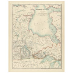
Ver todoMapa antiguo de América Central y las Indias Occidentales, 1882
Mapa antiguo titulado "Islas de las Indias Occidentales y América Central". Antiguo mapa de América Central y las Antillas. Este mapa procede de "El Real Atlas de Geografía Moderna, ...
Categoría
Antiguo, siglo XIX, Mapas
Materiales
Papel

167 US$ Precio de venta
Descuento del 20 %
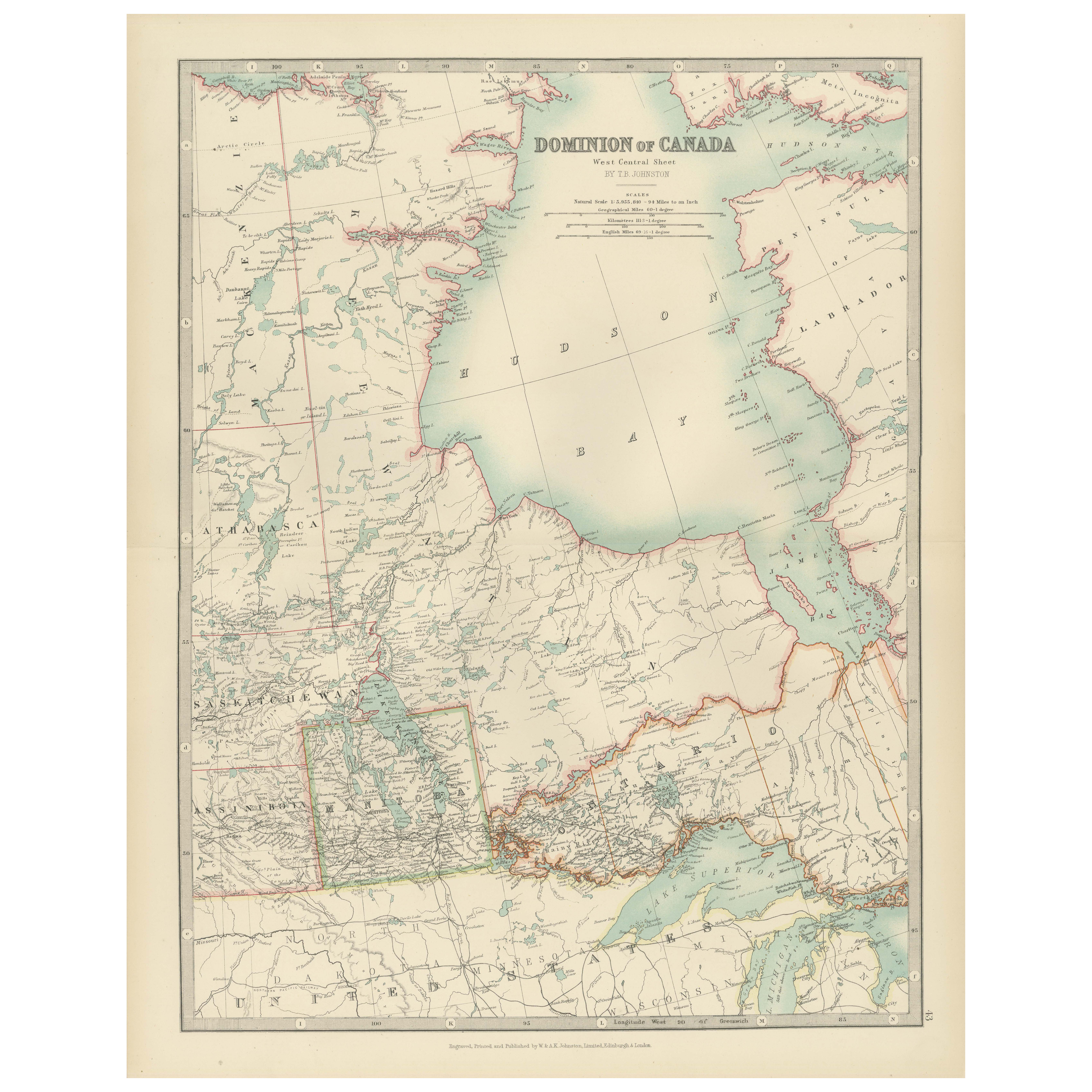
Canada Map 1903 - Dominion of Canada, West Central Sheet
Title: Canada Map 1903 - Dominion of Canada, West Central Sheet
Description:
This fascinating 1903 map of the Dominion of Canada’s West Central regions by T.R. Johnston offers a viv...
Categoría
principios del siglo XX, Mapas
Materiales
Papel
Mapa antiguo de las Indias Occidentales y América Central por Lowry '1852
Mapa antiguo titulado "Indias Occidentales y América Central". Mapa original de las Antillas y Centroamérica. Este mapa procede del "Atlas de Mesa de Lowry construido y grabado a par...
Categoría
Antiguo, Mediados del siglo XIX, Mapas
Materiales
Papel

93 US$ Precio de venta
Descuento del 20 %
Mapa antiguo de las Indias Occidentales y América Central por W. G. Blackie, 1859
Mapa antiguo titulado "La isla de las Indias Occidentales y América Central". Mapa antiguo original de las Indias Occidentales y América Central, con mapa insertado de Jamaica. Este ...
Categoría
Antiguo, Mediados del siglo XIX, Mapas
Materiales
Papel

232 US$ Precio de venta
Descuento del 20 %
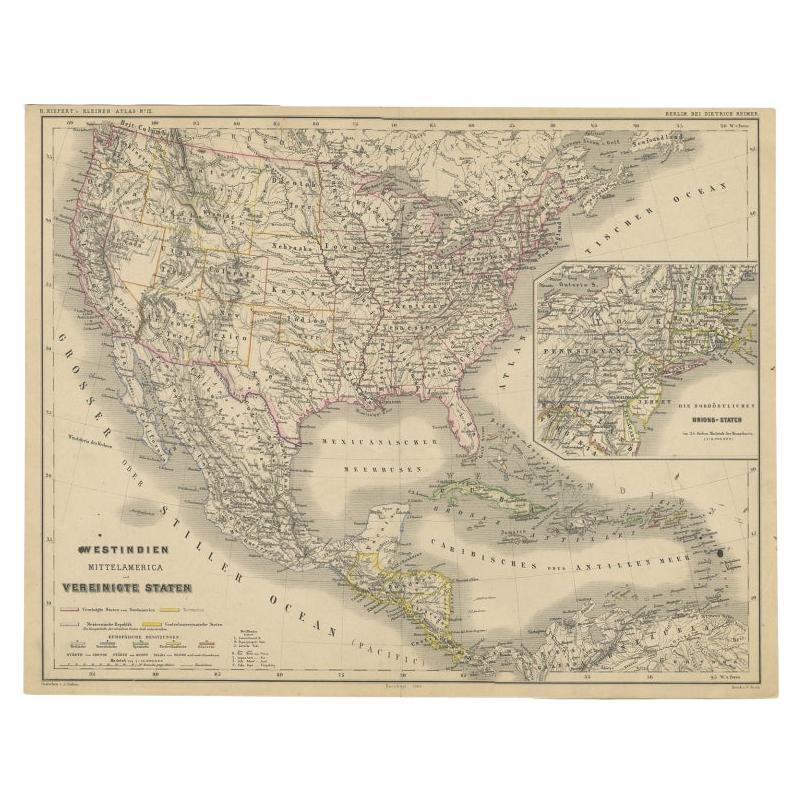
Antiguo mapa alemán de Estados Unidos, América Central y las Indias Occidentales, c.1870
Mapa antiguo titulado "Westindien, Mittelamerica und Vereinigte Staten". Antiguo mapa de Estados Unidos, América Central y las Antillas. Este mapa procede de "H. H. Kiepert's Kleiner...
Categoría
Antiguo, siglo XIX, Mapas
Materiales
Papel
Grabado de un mapa de Florida, la costa del Golfo, el Caribe y América Central, 1728
Este excepcional mapa antiguo, titulado "Nouvelle Carte Marine de Toute les Cotes de l'Amerique" y conocido alternativamente como "Nieuwe groote en seer Curieuse Paskaart van Geheel-...
Categoría
Antiguo, mediados del siglo XVIII, Europeo, Mapas
Materiales
Papel

12.744 US$ Precio de venta
Descuento del 26 %
Envío gratuito
También te puede gustar
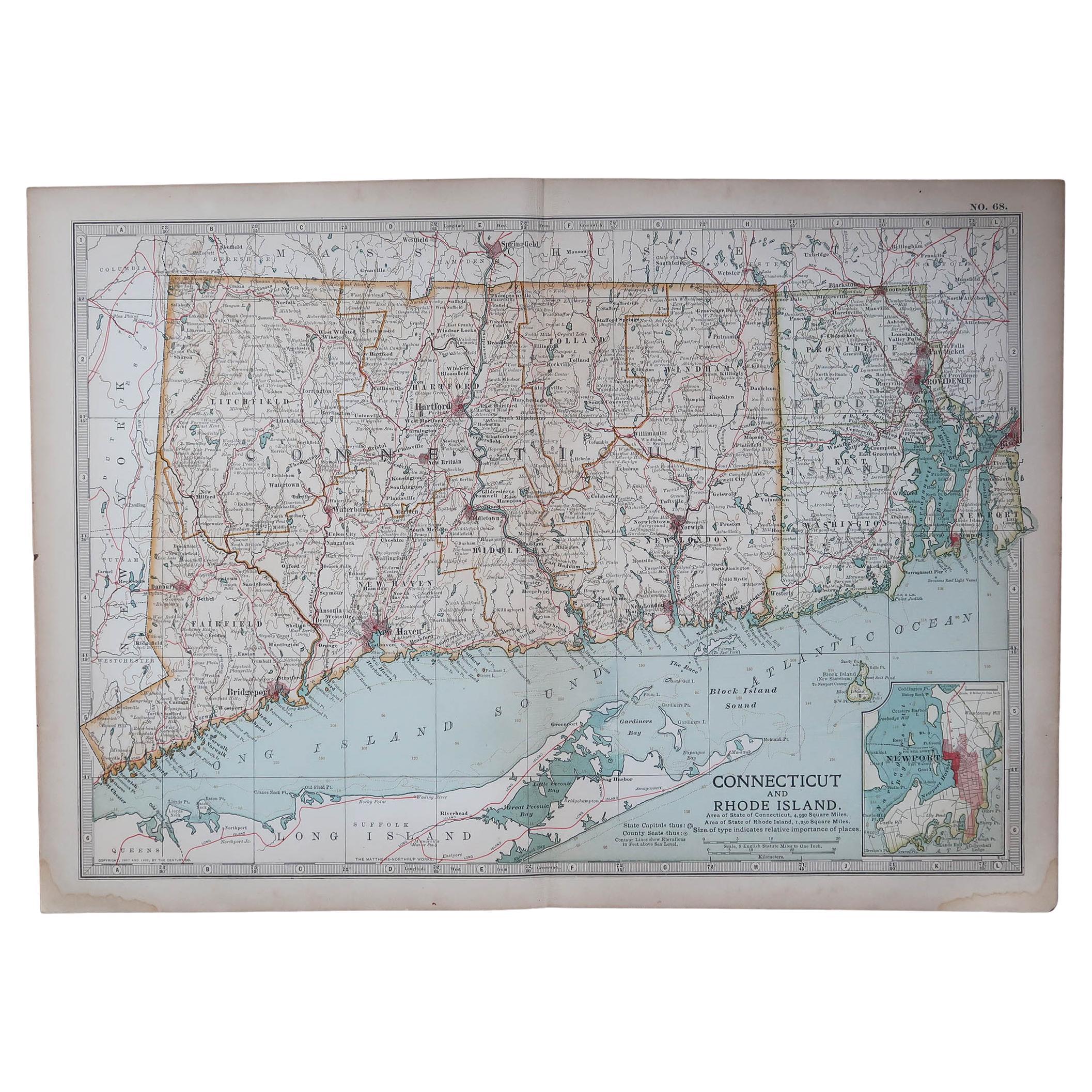
Mapa Antiguo Original del Estado Americano de Connecticut y Rhode Island, 1903
Antique map of Connecticut and Rhode Island
Published By A & C Black. 1903
Original colour
Good condition
Unframed.
Free shipping
Categoría
Antiguo, Principios del 1900, Inglés, Mapas
Materiales
Papel

Mapa original antiguo del estado norteamericano de Minnesota, 1903
Mapa antiguo de Minnesota
Publicado por A & C Black. 1903
Color original
Buen estado
Sin enmarcar.
Envío gratuito
Categoría
Antiguo, Principios del 1900, Inglés, Mapas
Materiales
Papel

Mapa original antiguo del estado norteamericano de Alabama, 1903
Antique map of Alabama
Published By A & C Black. 1903
Original colour
Good condition
Unframed.
Free shipping
Categoría
Antiguo, Principios del 1900, Inglés, Mapas
Materiales
Papel

Mapa original antiguo del estado norteamericano de Alaska, 1903
Mapa antiguo de Alaska
Publicado por A & C Black. 1903
Color original
Buen estado
Sin enmarcar.
Envío gratuito
Categoría
Antiguo, Principios del 1900, Inglés, Mapas
Materiales
Papel

Mapa original antiguo del estado norteamericano de Nebraska, 1903
Mapa antiguo de Nebraska
Publicado por A & C Black. 1903
Color original
Buen estado
Sin enmarcar.
Envío gratuito
Categoría
Antiguo, Principios del 1900, Inglés, Mapas
Materiales
Papel

Mapa Antiguo Original del Estado Americano de Washington, 1903
Mapa antiguo de Washington
Publicado por A & C Black. 1903
Color original
Buen estado
Sin enmarcar.
Envío gratuito
Categoría
Antiguo, Principios del 1900, Inglés, Mapas
Materiales
Papel
