Artículos similares a Mapa imperial del norte de Rusia con Arcángel, Laponia y Permia, c.1730


¿Quieres más imágenes o vídeos?
Solicita imágenes o vídeos adicionales al vendedor
1 de 10
Mapa imperial del norte de Rusia con Arcángel, Laponia y Permia, c.1730
470 €IVA incluido
Envío
Recuperando presupuesto…La promesa de 1stDibs
Garantía de autenticidad,
Garantía de devolución de dinero,
Cancelación dentro de las 24 horas
Acerca del artículo
Imperial map of Northern Russia with Archangel, Lapland, and Permia, c.1730
Description:
This intricately engraved and hand-colored map presents the northern reaches of the Russian Empire as it was known in the early 18th century. Created by Matthäus Seutter of Augsburg, one of the leading German mapmakers of the period, the map is titled *Mappae Imperii Moscovitici pars Septentrionalis*, or “Map of the Northern Part of the Muscovite Empire.”
The composition focuses on the regions from St. Petersburg and Ingria in the west to the Ural regions of Perm and Yugoria in the east. The map also includes parts of Lapland, the White Sea (labeled Mare Album or Biar More), and the coastlines of the Barents Sea (Mare Moscoviticum). Important geographic features such as Lacus Onega and Ladoga are finely rendered, as are major rivers like the Dvina and the Northern Dvina.
Seutter divides the territory into color-coded regions such as Regio Czarn, Permia, Jugoria, and Tzernia, reflecting administrative and historical divisions within the empire. Cities including Archangel (Archangelsk), Novgorod, and Vologda are marked, while dense forests and mountain ranges are illustrated using fine hachuring techniques and symbolic trees.
The cartouche in the upper right corner is decorated in classical baroque style with scrollwork, flags, and figures, flanked by a heraldic crest and a depiction of trading ships—emphasizing the region’s commercial and imperial importance. This map is printed in Latin, underscoring its intended audience of learned European elites.
What makes this print especially appealing is its blend of scientific ambition and artistic flourish. It captures a region that was still largely mysterious to Western Europeans in the 18th century, offering insight into how the Russian north was perceived and mapped by German scholars and cartographers.
Condition:
Fair condition. Original hand coloring is well-preserved with minimal age toning. Central fold with water staining; some paper waviness and discoloration present. Study the images carefully.
Framing tips:
For best presentation, consider a dark wood or black frame with a linen or neutral mat to draw attention to the map’s subtle coloring. The ornate cartouche would benefit from generous spacing to let it stand out visually. Use UV-protective glass to safeguard the hand-applied color. Given the map’s vertical orientation and historical interest, it’s ideal for a study, library, or gallery wall focused on exploration and empire.
- Dimensiones:Altura: 51 cm (20,08 in)Anchura: 59 cm (23,23 in)Profundidad: 0,2 mm (0,01 in)
- Materiales y técnicas:Papel,Grabado
- Lugar de origen:
- Época:
- Fecha de fabricación:circa 1730
- Estado:Fair condition. Original hand coloring is well-preserved with minimal age toning. Central fold with water staining; some paper waviness and discoloration present. Study the images carefully.
- Ubicación del vendedor:Langweer, NL
- Número de referencia:Vendedor: BG-14068-31stDibs: LU3054345402132
Sobre el vendedor
5,0
Vendedor reconocido
Estos prestigiosos vendedores son líderes del sector y representan el escalón más alto en cuanto a calidad y diseño de artículos.
Vendedor Oro
Vendedores premium que mantienen una calificación de +4,3 y tiempos de respuesta de 24 horas
Establecido en 2009
Vendedor de 1stDibs desde 2017
2477 ventas en 1stDibs
Tiempo de respuesta usual: 1 hora
- EnvíoRecuperando presupuesto…Envío desde: Langweer, Países Bajos
- Política de devolución
Partes de esta página se han traducido automáticamente. 1stDibs no puede garantizar la exactitud de las traducciones. El inglés es el idioma predeterminado de este sitio web.
Garantía de autenticidad
En el improbable caso de que haya algún problema con la autenticidad de un artículo, ponte en contacto con nosotros en un plazo de 1 año para recibir un reembolso total. DetallesGarantía de devolución de dinero
Si tu artículo no es como se describe, sufre daños durante el transporte o no llega, ponte en contacto con nosotros en un plazo de 7 días para recibir un reembolso total. DetallesCancelación dentro de las 24 horas
Tienes un período de gracia de 24 horas para reconsiderar tu compra, sin preguntas.Vendedores profesionales aprobados
Nuestros vendedores de primera clase deben cumplir estrictos estándares de servicio para mantener la integridad de nuestros anuncios.Garantía de igualación de precios
Si encuentras que un vendedor publicó el mismo artículo por un precio menor en otro lado, igualaremos ese precio.Entrega global de confianza
Nuestra red de transporte de primera ofrece opciones de envío especializado en todo el mundo, que incluye envío personalizado.Más de este vendedor
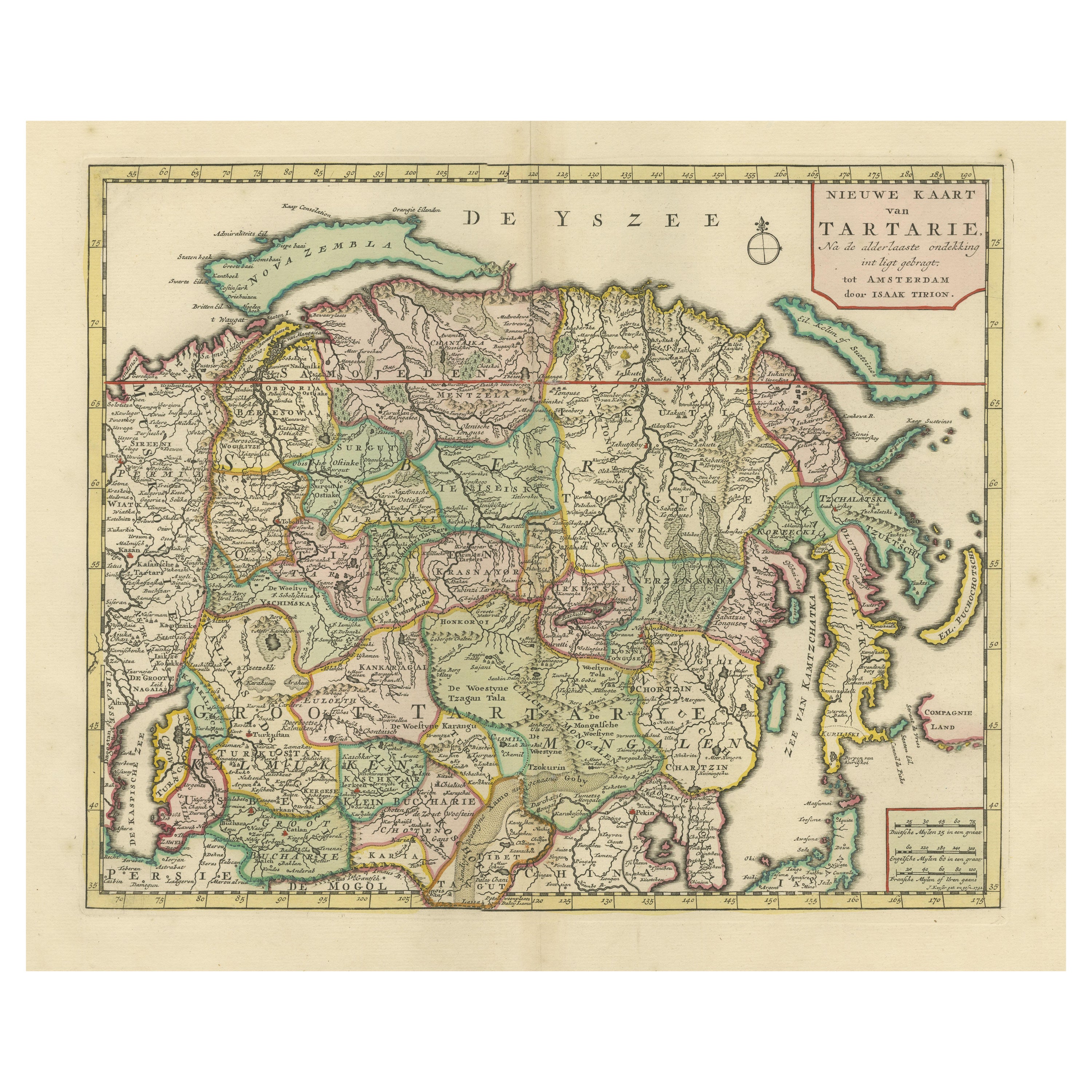
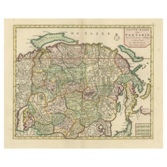
Ver todoMapa antiguo del norte de Asia, con Rusia, Corea y el norte de Japón
Mapa antiguo titulado "Nieuwe Kaart van Tartarie". Mapa op Siberia y tartaria china. En el norte, Novaya Zemlya se enrosca para unirse a tierra firme por un estrecho istmo. Al este, ...
Categoría
Antiguo, mediados del siglo XVIII, Mapas
Materiales
Papel
644 € Precio de venta
Descuento del 34 %
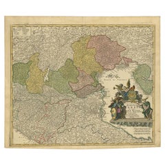
Mapa antiguo del norte de Italia por Homann Heirs, c.1730
Mapa antiguo titulado 'Domini Veneti cum vicinis Parmae Mutinae, Matuae et Mirandol (..).' Mapa detallado del norte de Italia por J. B. Homann. Este mapa muestra Venecia y sus estado...
Categoría
Antiguo, siglo XVIII, Mapas
Materiales
Papel
416 € Precio de venta
Descuento del 20 %
Mapa antiguo del norte de Alemania por M. Seutter, hacia 1730
Por Matthew Seutter
Mapa antiguo titulado "Saxoniae Inferioris Circulus". Antiguo mapa del norte de Alemania por M. Seutter. Cubre la zona de Baja Sajonia, Mecklemburgo-Pomerania Occidental y Schleswig-...
Categoría
Antiguo, mediados del siglo XVIII, Mapas
Materiales
Papel

472 € Precio de venta
Descuento del 20 %
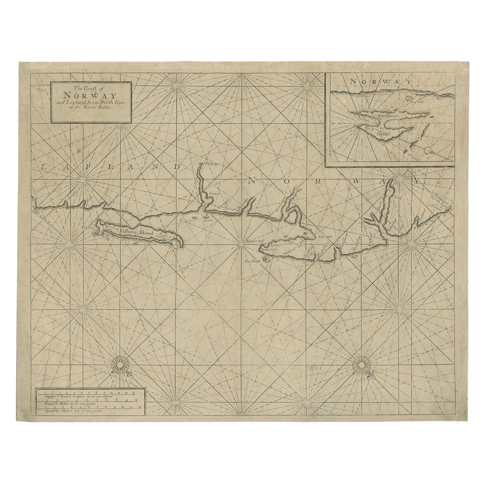
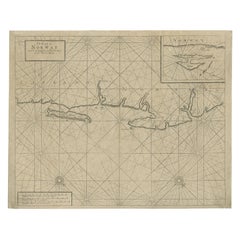
Antigua Carta Marítima del Norte de Noruega, que también representa parte de Laponia y Rusia, 1702
Mapa antiguo titulado "La costa de Noruega y Laponia, desde el norte de Kyn hasta el río Kola".
Carta marítima del norte de Noruega, que también representa parte de Laponia y Rus...
Categoría
Antiguo, Principios del 1700, Mapas
Materiales
Papel
392 € Precio de venta
Descuento del 20 %
Mapa antiguo de Europa del Norte y Rusia europea, ca.1780
Mapa antiguo titulado "Le Nord de L'Europe, Contenant Le Danemark, La Norwege; La Suede et La Laponie avec la Majeure Partie de al Russie Europeenne".
Mapa de Europa del Norte y ...
Categoría
Antiguo, Década de 1780, Mapas
Materiales
Papel

152 € Precio de venta
Descuento del 20 %
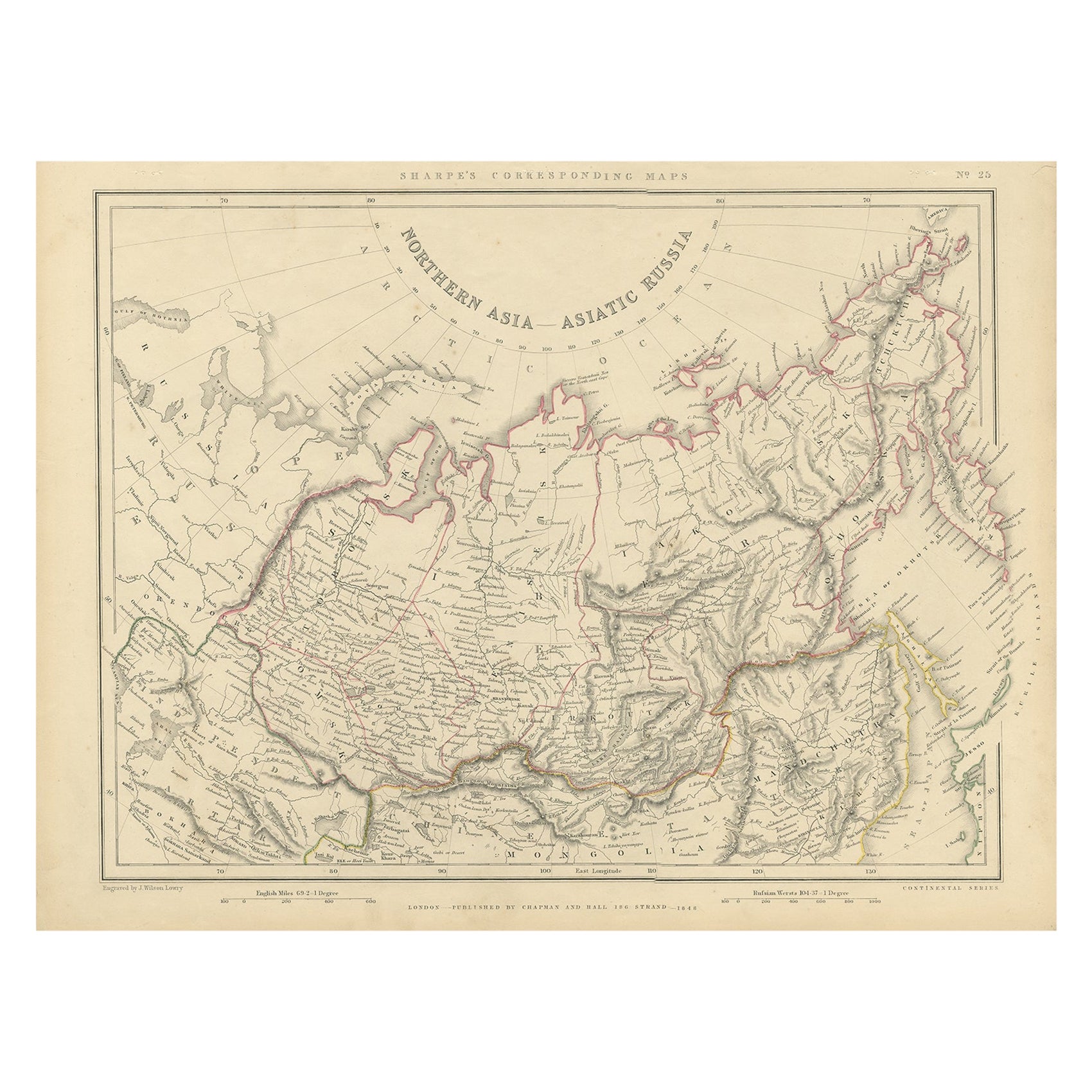
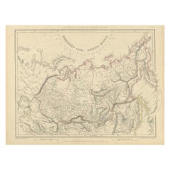
Asia septentrional, Rusia asiática, Antiguo mapa de Rusia en Asia, 1849
Mapa antiguo titulado "Asia septentrional - Rusia asiática".
Antiguo mapa de Rusia en Asia. Este mapa procede del "Atlas Correspondiente de Sharpe (..)" de J. Sharpe.
Artistas...
Categoría
Antiguo, Década de 1840, Mapas
Materiales
Papel
144 € Precio de venta artículo
Descuento del 20 %
También te puede gustar
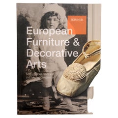
Colección Skinner's the Fletcher de la Imperial Russia
Mobiliario y Artes Decorativas Europeas con Plata Fina y La Colección Fletcher de la Rusia Imperial. Skinner, Boston, 6 de abril de 2013. Catálogo de subasta de tapa blanda. Esta ven...
Categoría
Siglo XXI y contemporáneo, Libros
Materiales
Papel
Matthaus Seutter, Enmarcado Mapa grabado en color de 1730 de "Bélgica Fonderatum"
Etiqueta en el verso. Del Atlas Grosser. El nombre de Bélgica procede de la antigua denominación "Gallis Belgica". Decoración figurada arriba a la izquierda. M. Seutter fue un famoso...
Categoría
Antiguo, siglo XVIII, Europeo, Renacimiento, Mapas
Materiales
Latón

1814 Mapa del "Imperio Ruso" Ric.r032
1814 Mapa de
"Imperio Ruso"
Ric.r032
Imperio Ruso. Descripción: Se trata de un mapa de John Thomson de 1814 del Imperio Ruso. El mapa representa la región desde el mar Báltic...
Categoría
Antiguo, siglo XIX, Desconocido, Mapas
Materiales
Papel

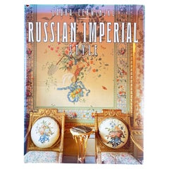
Libro de estilo imperial ruso, encuadernado en rústica, 1ª edición con sobrecubierta
Por Laura Cerwinske
Suntuosamente ilustrado con más de 100 impresionantes fotografías en color a toda página, este exquisito libro muestra la opulencia y la incomparable belleza de los tesoros creados p...
Categoría
Década de 1990, Estadounidense, Balcánico, Libros
Materiales
Papel
1849 Mapa de "Europaische Russland", 'Mapa Meyer de la Rusia europea', Ric. R017
1849 Mapa de
"La Rusia europea"
( Mapa de Meyer de la Rusia europea)
Ric.r017
Precioso mapa de la Rusia europea de 1849, obra de Joseph Meyer. Abarca las partes europeas de R...
Categoría
Antiguo, siglo XIX, Desconocido, Mapas
Materiales
Papel

Huevos Fabergé Fantasías Imperiales Rusas Libro de tapa blanda
Huevos Fabergé Fantasías Imperiales Rusas Libro de tapa blanda.
Casi bien-muy bien.
Nueva York: Harry N. Abrams, Inc.,1995.
Huevos Fabergé - Fantasías imperiales rusas".
Folio elefan...
Categoría
finales del siglo XX, Estadounidense, Barroco, Libros
Materiales
Papel