City Maps
76
to
305
1,698
1,561
1,203
972
833
679
537
423
365
342
197
176
163
155
128
120
105
104
89
88
82
68
65
61
57
45
44
44
44
38
34
33
29
27
24
23
23
23
22
20
17
16
15
15
13
13
12
12
12
12
11
11
11
11
9
8
6
6
6
5
5
3
1
103
97
61
54
51
Sort By
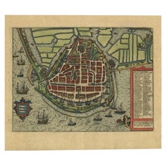
Detailed Copper Engraved City Map of Enkuizen, the Netherlands, c.1620
By L. Guicciardini
Located in Langweer, NL
Antique map titled 'Die stadt Enchuijsen.' Detailed copper engraved city map of Enkuizen, the
Category
Antique 17th Century Maps
Materials
Paper
House on the City Map - Modern Architectural Painting, Modernism Painting
By Maria Kiesner
Located in Salzburg, AT
, from the Fine Arts Academy in Warsaw. In 2009, Maria completed her Ph.D. in Art, titled 'The city
Category
2010s Contemporary Landscape Paintings
Materials
Canvas, Acrylic
H 39.38 in W 55.12 in D 0.79 in
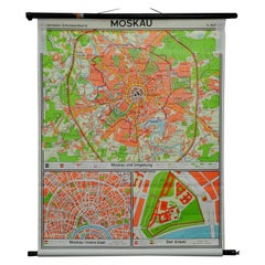
Vintage Mural Pull Down Wall Chart City Map of Moscow Russia Poster
Located in Berghuelen, DE
A classical rollabe vintage wall chart showing an aerial view of the city of Moscow, Russia. It was
Category
Mid-20th Century German Country Prints
Materials
Canvas, Wood, Paper
Just Keep Going Until You Find me - British Abstract oil painting city map red
By Stanza
Located in London, GB
is by London-based artist Stanza. Based on his interest in landscape, cities and surveillance this
Category
21st Century and Contemporary Abstract Abstract Paintings
Materials
Canvas, Paint, Acrylic, Oil
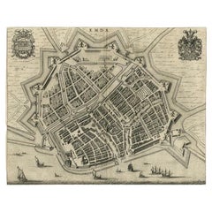
Antique Map of the City of Emden by Blaeu, 1649
Located in Langweer, NL
Antique map titled 'Emda'. Old map of the city of Emden, Germany. This map originates from 'Novum
Category
Antique 17th Century Maps
Materials
Paper
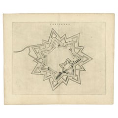
Antique Map of the City of Coevorden by Blaeu, 1649
Located in Langweer, NL
Antique map titled 'Coeverden'. Original map of the city of Coevorden, the Netherlands. This map
Category
Antique 17th Century Maps
Materials
Paper
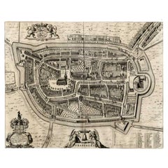
Antique Map of the City of Franeker by Blaeu, 1649
Located in Langweer, NL
Antique map titled 'Franekera'. Old map of the city of Franeker, Friesland. Also shows two
Category
Antique 17th Century Maps
Materials
Paper
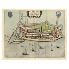
Original Antique Map of the City of Stavoren, Friesland, The Netherlands, 1649
Located in Langweer, NL
Antique map titled 'Staveren'. Original antique map of the city of Stavoren, Friesland, The
Category
Antique 1640s Maps
Materials
Paper
H 19.69 in W 24.1 in D 0 in
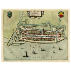
Original Antique Map of the City of Stavoren, Friesland, The Netherlands, 1649
Located in Langweer, NL
Antique map titled 'Staveren'. Original antique map of the city of Stavoren, Friesland, The
Category
Antique 1640s Maps
Materials
Paper
H 17.88 in W 25.52 in D 0 in
Antique Map of the City of Franeker by Blaeu, 1652
Located in Langweer, NL
Antique map titled 'Franekera'. Old map of the city of Franeker, Friesland. Also shows two
Category
Antique 17th Century Maps
Materials
Paper
Antique Map of the City of Franeker by Blaeu, 1652
Located in Langweer, NL
Antique map titled 'Franekera'. Old map of the city of Franeker, Friesland. Also shows two
Category
Antique 17th Century Maps
Materials
Paper
Antique Map of the City of Dokkum by Blaeu, c.1650
Located in Langweer, NL
Antique map titled 'Dockum'. Large map of the city of Dokkum, Friesland, The Netherlands
Category
Antique 17th Century Maps
Materials
Paper
Antique Map of the City of Dokkum, Friesland by Blaeu, c.1650
Located in Langweer, NL
. Around 1649 Joan Blaeu published a collection of Dutch city maps named Tooneel der Steeden (Views of
Category
Antique 17th Century Maps
Materials
Paper
Antique Map of Frisian Cities Sloten, Ylst, Workum and Hindelopen by Blaeu, 1652
Located in Langweer, NL
cartographer of the Dutch East India Company. Around 1649 Joan Blaeu published a collection of Dutch city maps
Category
Antique 1650s Maps
Materials
Paper
H 21.78 in W 25.6 in D 0 in
Antique Map of the City of Goch by Blaeu, 1649
Located in Langweer, NL
Antique map titled 'Gochum vernacule Goch'. Old map of the city of Goch, Germany. This map
Category
Antique 17th Century Maps
Materials
Paper
Old Map of the City of Franeker, Friesland by the Famous Mapmaker Blaeu, 1652
Located in Langweer, NL
Antique map titled 'Franekera'. Old map of the city of Franeker, Friesland. Also shows two
Category
Antique 1650s Maps
Materials
Paper
H 21.82 in W 25.63 in D 0 in
Antique Map of the City of Grave by Blaeu, 1649
Located in Langweer, NL
Antique map titled 'Grave'. Original antique map of the city of Grave, the Netherlands. Published
Category
Antique 17th Century Maps
Materials
Paper
Old Map by Blaeu of the City of Franeker, Friesland, The Netherlands, 1649
Located in Langweer, NL
Antique map titled 'Franekera'.
Old map of the city of Franeker, Friesland. Also shows two
Category
Antique 1640s Maps
Materials
Paper
H 21.82 in W 25.63 in D 0 in
Antique Map of the City of Geldern by Blaeu, 1649
Located in Langweer, NL
Antique map titled 'Gelre'. Old map of the city of Geldern, Germany. This map originates from
Category
Antique 17th Century Maps
Materials
Paper
Antique Map of the City of Tiel by Blaeu, 1649
Located in Langweer, NL
Antique map titled 'Tyel'. Beautiful map of the city of Tiel, The Netherlands. With a coat of arms
Category
Antique 17th Century Maps
Materials
Paper
Antique Map of the City of Workum by Blaeu, 1649
Located in Langweer, NL
Antique map titled 'Worckum'. Old map of the city of Workum, Friesland. Originates from J. Blaeu's
Category
Antique 17th Century Maps
Materials
Paper
Antique Map of the City of Sneek by Blaeu, 1649
Located in Langweer, NL
cartographer of the Dutch East India Company. Around 1649 Joan Blaeu published a collection of Dutch city maps
Category
Antique 17th Century Maps
Materials
Paper
Antique Map of the City of Sneek by Blaeu, 1652
Located in Langweer, NL
a collection of Dutch city maps named Tooneel der Steeden (Views of Cities). In 1651 he was voted
Category
Antique 17th Century Maps
Materials
Paper
Antique Map of the Siege of Breda, City in the Netherlands by Blaeu, 1649
Located in Langweer, NL
cartographer of the Dutch East India Company. Around 1649 Joan Blaeu published a collection of Dutch city maps
Category
Antique 17th Century Maps
Materials
Paper
H 20.87 in W 24.02 in D 0 in
Antique Map of Lower Silesia of The Famous Mapmaker Blaeu, c.1650
Located in Langweer, NL
Dutch East India Company. Around 1649 Joan Blaeu published a collection of Dutch city maps named Tooneel
Category
Antique 17th Century Maps
Materials
Paper
Antique Map of Prussia by Blaeu, c.1680
Located in Langweer, NL
Blaeu published a collection of Dutch city maps named Tooneel der Steeden (Views of Cities). In 1651 he
Category
Antique 17th Century Maps
Materials
Paper
Antique Map of Stavoren by Blaeu, 1649
Located in Langweer, NL
Antique map titled 'Staveren'. Original antique map of the city of Stavoren, Friesland, The
Category
Antique 17th Century Maps
Materials
Paper
Antique Map of Stavoren by Blaeu, 1649
Located in Langweer, NL
Antique map titled 'Staveren'. Original antique map of the city of Stavoren, Friesland, The
Category
Antique 17th Century Maps
Materials
Paper
Antique Map of Stavoren by Blaeu, 1649
Located in Langweer, NL
Antique map titled 'Staveren'. Original antique map of the city of Stavoren, Friesland, The
Category
Antique 17th Century Maps
Materials
Paper
Antique Map of Leeuwarden, Capital of Friesland, the Netherlands, by Blaeu, 1649
Located in Langweer, NL
a collection of Dutch city maps named Tooneel der Steeden (Views of Cities). In 1651 he was voted
Category
Antique 17th Century Maps
Materials
Paper
H 22.37 in W 18.12 in D 0 in
Antique Map of Sloten, IJlst, Workum & Hindeloopen by Blaeu, 1652
Located in Langweer, NL
. Around 1649 Joan Blaeu published a collection of Dutch city maps named Tooneel der Steeden (Views of
Category
Antique 17th Century Maps
Materials
Paper
Original Map of the Military Situation After the Dutch Blockade of Antwerp, 1648
Located in Langweer, NL
. Around 1649 Joan Blaeu published a collection of Dutch city maps named Tooneel der Steeden (Views of
Category
Antique 1640s Maps
Materials
Paper
H 19.69 in W 22.05 in D 0 in
Old Map of Prussia, Embellished with a Large Cartouche and Compass Rose, ca.1680
Located in Langweer, NL
Blaeu published a collection of Dutch city maps named Tooneel der Steeden (Views of Cities). In 1651 he
Category
Antique 1680s Maps
Materials
Paper
H 17.13 in W 21.86 in D 0 in
Original Map with Bird's-Eye View of Zutphen in the Netherlands by Blaeu, 1649
Located in Langweer, NL
. Around 1649 Joan Blaeu published a collection of Dutch city maps named Tooneel der Steeden (Views of
Category
Antique 1640s Maps
Materials
Paper
H 20.16 in W 23.78 in D 0 in
Original Old Map of Leeuwarden, European Cultural Capital 2018, Holland, 1649
Located in Langweer, NL
. Around 1649 Joan Blaeu published a collection of Dutch city maps named Tooneel der Steeden (Views of
Category
Antique 1640s Maps
Materials
Paper
H 20.87 in W 25.79 in D 0 in
"Clason's Guide Map of Montana" by The Clason Map Company, Circa 1920s
Located in Colorado Springs, CO
transitioned to railroad and city maps of the local area. In the 1920’s, as cars became more commonplace, the
Category
Vintage 1920s American Art Deco Maps
Materials
Paper
H 23.13 in W 33.88 in D 1.5 in
Beautiful Original Antique Map of Antwerp, Belgium by Mapmaker Blaeu, ca.1652
Located in Langweer, NL
Dutch East India Company. Around 1649 Joan Blaeu published a collection of Dutch city maps named Tooneel
Category
Antique 1650s Maps
Materials
Paper
H 19.1 in W 24.53 in D 0 in
Antique Map of the Hesse Region of Germany by Blaeu, 1665
Located in Langweer, NL
. Around 1649 Joan Blaeu published a collection of Dutch city maps named Tooneel der Steeden (Views of
Category
Antique 17th Century Maps
Materials
Paper
Antique Map of American Cities, Vignette of New York City, circa 1920
Located in St Annes, Lancashire
Great maps of American Cities
Unframed
Original color
By John Bartholomew and Co
Category
Vintage 1920s British Maps
Materials
Paper
No Reserve
H 18 in W 23 in D 0.07 in
Antique City View and Map of IJlst, City in Friesland, Holland, Framed, 1664
Located in Langweer, NL
Antique map titled 'Ylst'. Old map and city view of the city of IJlst, Friesland. This map
Category
Antique 17th Century Maps
Materials
Paper
H 21.78 in W 18.59 in D 0 in
1855 "New-York City & County Map" by Charles Magnus
By Charles Magnus
Located in Colorado Springs, CO
This is a beautiful hand-colored map titled “New York City & County Map with Vicinity entire
Category
Antique 1850s American Maps
Materials
Paper
Antique Map of the City of Zutphen, c.1650
Located in Langweer, NL
Antique map titled 'Zutphen'. Uncommon original antique map of the city of Zutphen, the Netherlands
Category
Antique 17th Century Maps
Materials
Paper
Vintage Map of the Frisian City of Harlingen, 1930
Located in Langweer, NL
Vintage map titled 'Harlingen'. Original map of the city of Harlingen, Friesland, the Netherlands
Category
20th Century Maps
Materials
Paper
Antique Map of the City of Gouda, c.1750
Located in Langweer, NL
Antique map titled 'Gouda' Plan of Gouda, the Netherlands. With coat of arms and key. Source
Category
Antique 18th Century Maps
Materials
Paper
Antique Map of the United States with inset map of the region of Mexico City
Located in Langweer, NL
Mexico city.
This map originates from Stielers Handatlas, published circa 1859. Stielers Handatlas
Category
Antique Mid-19th Century Maps
Materials
Paper
H 14.69 in W 17.92 in D 0.02 in
Italian Parchment Map of the City of Pisa Dated, 1640
By Matthäus Merian the Elder
Located in Roma, IT
An antique map of the Tuscan city of Pisa engraved for The 'Itinerarium Italiæ Nov-antiquæ' by
Category
Antique 1640s Italian Maps
Materials
Paper
Antique Map of the City of Kampen by Guicciardini, 1613
Located in Langweer, NL
Antique map titled 'Urbis Campensis (..)'. Plan of the city of Kampen, the Netherlands. This map
Category
Antique 17th Century Maps
Materials
Paper
Antique Map of the City of London by Balbi '1847'
Located in Langweer, NL
Antique map titled 'London'. Original antique map of the city of London. This map originates from
Category
Antique Mid-19th Century Maps
Materials
Paper
Antique Map of the City of Kolkata by Balbi '1847'
Located in Langweer, NL
Antique map titled 'Calcutta'. Original antique map of the city of Kolkata, India. This map
Category
Antique Mid-19th Century Maps
Materials
Paper
Antique Map of the City of Berlin in Germany, '1847'
Located in Langweer, NL
Antique map titled 'Berlin'. Original antique map of the city of Berlin, Germany. This map
Category
Antique Mid-19th Century Maps
Materials
Paper
Antique Map of the City of Madrid by Balbi '1847'
Located in Langweer, NL
Antique map titled 'Madrid'. Original antique map of the city of Madrid, Spain. This map originates
Category
Antique Mid-19th Century Maps
Materials
Paper
Antique Map of the City of Vienna by Balbi '1847'
Located in Langweer, NL
Antique map titled 'Vienne'. Original antique map of the city of Vienna, Austria. This map
Category
Antique Mid-19th Century Maps
Materials
Paper
Antique Map of Harlingen, Harbour City in the Netherlands, 1691
Located in Langweer, NL
Plate 'Harlingen.' (Plan of the city of Harlingen, The Netherlands.) This attractive original old
Category
Antique 17th Century Maps
Materials
Paper
Antique Map of the City of Oldenzaal by Orlers, 1615
Located in Langweer, NL
Antique map depicting the Siege of Oldenzaal, the Netherlands. The Siege of Oldenzaal was a short
Category
Antique 17th Century Maps
Materials
Paper
1842 Wall Map of the United States by J. H. Young, Published by S. A. Mitchell
Located in Colorado Springs, CO
city map insets of the vicinities around Boston, New York, Philadelphia, Baltimore and Washington
Category
Antique 1840s American Maps
Materials
Paper
H 45 in W 38 in D 1 in
Antique Map of the City of Groningen by Orlers, 1615
Located in Langweer, NL
Antique map titled 'Gronenga'. Map of the city of Groningen, the Netherlands. This map originates
Category
Antique 17th Century Maps
Materials
Paper
Antique Map of the City of Leeuwarden by Kuyper, 1868
Located in Langweer, NL
Antique map titled 'Provincie Friesland - Gemeente Leeuwarden No. 2 Stad'. Map of the city of
Category
Antique 19th Century Maps
Materials
Paper
Antique Map of the City of Franeker by Guicciardini, 1612
Located in Langweer, NL
Antique map titled 'Franicher'. Original antique map of the city of Franeker, Friesland, the
Category
Antique 17th Century Maps
Materials
Paper
Antique Map of the City of Leeuwarden by Priorato, 1673
Located in Langweer, NL
Antique map titled 'Leverden'. This map depicts the city of Leeuwarden (Friesland, The Netherlands
Category
Antique 17th Century Maps
Materials
Paper
Antique Map of the City of Zutphen by Guicciardini, 1612
Located in Langweer, NL
Antique map Zutphen titled 'Zutphen'. This map depicts the city of Zutphen, Gelderland, The
Category
Antique 17th Century Maps
Materials
Paper
- 1
- ...
Get Updated with New Arrivals
Save "City Maps", and we’ll notify you when there are new listings in this category.
City Maps For Sale on 1stDibs
There is a range of city maps for sale on 1stDibs. Each of these unique city maps was constructed with extraordinary care, often using paper, fabric and wood. City maps have been produced for many years, with earlier versions available from the 18th Century and newer variations made as recently as the 20th Century. City maps made by Victorian designers — as well as those associated with Mid-Century Modern — are very popular at 1stDibs. There have been many well-made city maps over the years, but those made by Rand McNally & Co., Jacques-Nicolas Bellin and Charles Magnus are often thought to be among the most beautiful.
How Much are City Maps?
City maps can differ in price owing to various characteristics — the average selling price at 1stDibs is $952, while the lowest priced sells for $67 and the highest can go for as much as $49,500.
