Early North American Maps
1
to
20
200
133
150
95
86
79
60
42
42
35
28
21
18
15
13
11
11
10
9
8
7
7
7
6
6
6
6
5
3
3
3
2
2
2
2
2
2
2
2
1
1
1
1
1
1
1
1
1
1
75
42
42
4
3
Sort By
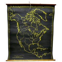
University Chart “Black Map of North America
Located in Chillerton, Isle of Wight
University Chart “Black Map of North America
W&A K Johnston’s Charts of Physical Maps By G W
Category
Early 20th Century Industrial Maps
Materials
Linen
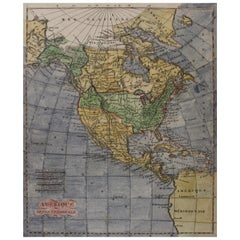
Early 19th Century Hand Coloured Map of North America by Aaron Arrowsmith
By Aaron Arrowsmith
Located in Hamilton, Ontario
Septentionale" (North America).
Map size: 9.5" x 8"
Mat size: 20.5" x 14.25".
Category
Antique Early 19th Century English Maps
Materials
Paper
H 20.5 in W 14.25 in D 0.1 in
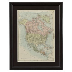
1875 "North America" Map by J. Bartholomew
Located in Colorado Springs, CO
Presented is an original 1875 map of “North America.” The map was issued in Volume 1 of the Ninth
Category
Antique 1870s Scottish Maps
Materials
Paper
1864 Map of North America, Antique Hand-Colored Map, by Adolphe Hippolyte Dufour
Located in Colorado Springs, CO
Offered is a map of North America entitled Amerique du Nord from 1864. This rare, separately
Category
Antique 1860s French Maps
Materials
Paper
H 44.5 in W 33 in D 1.5 in
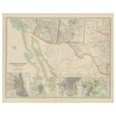
Antique Map of the United States of North America by Johnston '1909'
Located in Langweer, NL
Antique map titled 'United States of North America'. Original antique map of United States of North
Category
Early 20th Century Maps
Materials
Paper
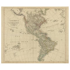
Antique Map of North and South America by Schneider and Weigel, 1818
Located in Langweer, NL
Antique map titled 'America nach Arrowsmiths Weltcharte und dessen Globular Projection (..)'. Map
Category
Antique Early 19th Century Maps
Materials
Paper
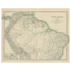
Exploring South America's North: Antique Map from the Royal Atlas of 1909
Located in Langweer, NL
The antique map titled 'South America, Northern Sheet' is a historical cartographic representation
Category
Early 20th Century Maps
Materials
Paper
H 19.49 in W 24.41 in D 0.02 in
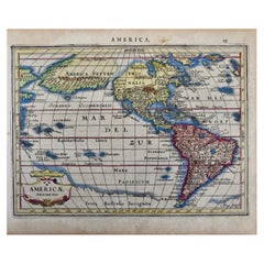
North & South America: A 17th Century Hand-colored Map by Jansson & Goos
By Johannes Janssonius
Located in Alamo, CA
A 17th century hand-colored map of North & South America entitled "Americae Descriptio" by the
Category
Antique 1620s Dutch Maps
Materials
Paper
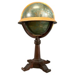
Early 20th Century American Library Globe
Located in Norwell, MA
Overall Dimensions: 26" H x 16" D
Made: America
Material: Wood
Date: 1920.
Category
Vintage 1920s North American Maps
Materials
Wood
Antique Map of the United States ' North East ' by Johnston '1909'
Located in Langweer, NL
Antique map titled 'United States of North America'. Original antique map of United States of North
Category
Early 20th Century Maps
Materials
Paper
Antique Map of the United States 'North West' by Johnston, '1909'
Located in Langweer, NL
Antique map titled 'United States of North America'. Original antique map of the United States of
Category
Early 20th Century Maps
Materials
Paper
Antique Chicago Illinois National Map Commercial Rollup Classroom Census Map 47"
Located in Dayton, OH
Antique early to mid 20th century double sided hanging map titled the New Commercial and Census Map
Category
Early 20th Century North American Maps
Materials
Paper
H 47 in W 41 in D 0.05 in
Colourful Old Detailed Map of Northern Carolina, United States of America
Located in Langweer, NL
Vintage map titled 'The Geographical Publishing Company's Premier Map of North Carolina'. Beautiful
Category
Early 20th Century Maps
Materials
Paper
H 15.56 in W 21.46 in D 0.02 in
Antique Map of America with California as an Island by Homann '1710'
Located in Langweer, NL
conducted by early French Jesuits, with its sources extending farther north than on maps produced a few
Category
Antique Early 18th Century Maps
Materials
Paper
America "Amérique Septentrionale": A 19th Century French Map by Delamarche
By Maison Delamarche 1
Located in Alamo, CA
This framed mid 19th century map of North America entitled "Amérique Septentrionale" by Felix
Category
Antique Mid-19th Century American Other Maps
Materials
Paper
H 20 in W 22.63 in D 0.88 in
1859 "Map of the United States of America..." by J. H. Colton
By J.H. Colton
Located in Colorado Springs, CO
Presented is an 1859 “Map of the United States of America, the British Provinces, Mexico, the West
Category
Antique 1850s American Maps
Materials
Paper
Finely Engraved Antique Map of Europe with inset of America, c.1745
By Guillaume De L'Isle
Located in Langweer, NL
undefined Western coast in North America. Published in Amsterdam by Covens & Mortier.
Artists and
Category
Antique 18th Century Maps
Materials
Paper
Antique Map of South American, The West Indies & Most of Africa, Ca.1775
Located in Langweer, NL
du Commerce des Europeens dans les deux Indes'.
This map is roughly centered on South America
Category
Antique 1770s Maps
Materials
Paper
H 15.04 in W 19.77 in D 0 in
Rare Unusual Antique Map of Asia with a Landbridge from Korea to America, 1717
Located in Langweer, NL
Antique map titled 'L'Asie Suivant les Nouvelles Decouvertes (..).' Interesting and very unusual
Category
Antique 18th Century Maps
Materials
Paper
H 9.65 in W 13.94 in D 0 in
Puzzle Atlas with Maps, Italy, circa 1900
Located in Milan, IT
of Italy, Europe, North America, South America, Asia and Africa. Models for teaching class. G.B
Category
Early 20th Century Italian Maps
Materials
Wood, Paper
Antique Map of the United States ' South East ' by Johnston '1909'
Located in Langweer, NL
Antique map titled 'United States of North America'. Original antique map of United States of North
Category
Early 20th Century Maps
Materials
Paper
Antique Map of Southeast Asia by Ortelius '1587'
By Abraham Ortelius
Located in Langweer, NL
to the north and south. The map also shows parts of the American northwest, including the cities of
Category
Antique 16th Century Maps
Materials
Paper
Antique Geographical, Historical and Statistical Map of Massachusetts, 1822
Located in Langweer, NL
political change in both North and South America, and the detailed maps accompanied by extensive text
Category
Antique 1820s Maps
Materials
Paper
H 17.13 in W 21.46 in D 0 in
Antique Bible World Map by R. & J. Wetstein, 1743
Located in Langweer, NL
map that was probably based on an earlier work by Cornelis Dankerts. This map has two small inset
Category
Antique Mid-18th Century Maps
Materials
Paper
1866 Ensign & Bridgman's Rail Road Map of the United States
Located in Colorado Springs, CO
, where early American rail travel first flourished.
CONDITION:
Engraved map. Hand coloring to outlines
Category
Antique 1860s American Late Victorian Maps
Materials
Paper
1847 Ornamental Map of the United States & Mexico by H. Phelps
Located in Colorado Springs, CO
map of the United States expressing U.S. dominance of the North American continent. The hand-colored
Category
Antique 1840s American Maps
Materials
Paper
Old Map of the Pacific, Incl Australia, Polynesia, Melanesia and Malaysia, 1872
Located in Langweer, NL
considerable detail with parts of North America and Asia included. extends as far north as the Aleutian Islands
Category
Antique 1870s Maps
Materials
Paper
No Reserve
H 12.21 in W 15.16 in D 0 in
1856 U.S. Coast Survey Map of Chesapeake Bay and Delaware Bay
Located in Colorado Springs, CO
from 1856. The map depicts the region from Susquehanna, Maryland to the northern Outer Banks in North
Category
Antique 1850s American Maps
Materials
Paper
California, Alaska and Mexico: 18th Century Hand-Colored Map by de Vaugondy
By Didier Robert de Vaugondy
Located in Alamo, CA
This an 18th century hand-colored map of the western portions of North America entitled "Carte de
Category
Antique 1770s French Maps
Materials
Paper
H 13.75 in W 16.63 in D 0.13 in
1847 Antique Map of Mexico, Texas and California by Samuel Augustus Mitchell
By Samuel Augustus Mitchell 1
Located in Colorado Springs, CO
& Upper California, an important map showing the progress of the Mexican-American War. Published in 1847
Category
Antique 1840s American Maps
Materials
Paper
H 32 in W 23.63 in D 0.5 in
1842 Wall Map of the United States by J. H. Young, Published by S. A. Mitchell
Located in Colorado Springs, CO
North America, including all the recent geographical discoveries'' at bottom right, as well as seven
Category
Antique 1840s American Maps
Materials
Paper
H 45 in W 38 in D 1 in
Mariners Chart of Quicks Hole and Tarpaulin Cove by George Eldridge 1901
Located in Norwell, MA
early twentieth century. George Eldridge was a fisherman who suffered an injury so he flourished as a
Category
Antique Early 1900s North American Maps
Materials
Paper
1918 George Eldridge Chart of Massachusetts Bay
Located in Norwell, MA
Rare early twentieth century chart of Cape Cod bay by George Eldridge showing Massachusetts Bay
Category
Vintage 1910s North American Maps
Materials
Paper
North America. Century Atlas antique vintage map
Located in Melbourne, Victoria
'The Century Atlas. North America'
Original antique map, 1903.
Central fold as issued. Map name
Category
Early 20th Century Victorian More Prints
Materials
Lithograph
Plan for the City of Washington by Andrew Ellicott, Antique Print, 19th Century
Located in Colorado Springs, CO
Territory of Columbia, ceded by the States of Virginia and Maryland to the United States of America and by
Category
Antique Late 19th Century American Maps
Materials
Paper
H 36 in W 43.75 in D 3 in
Alaska, North America. Century Atlas antique vintage map
Located in Melbourne, Victoria
'The Century Atlas. Alaska, North America.'
Original antique map, 1903.
Inset maps of 'Sitka
Category
Early 20th Century Victorian More Prints
Materials
Lithograph
Large University Chart “Political Map of North America” by Bacon
Located in Chillerton, Isle of Wight
Large University chart “Political Map of North America” by Bacon
W&A K Johnston’s Charts of
Category
Early 20th Century American Empire Posters
Materials
Linen
Large University Chart “Political Map of North America” by Bacon
Located in Chillerton, Isle of Wight
Large University Chart “Political Map of North America” by Bacon
W&A K Johnston’s Charts of
Category
Early 20th Century American Empire Posters
Materials
Linen
South America, North-West Part. Century Atlas antique vintage map
Located in Melbourne, Victoria
'The Century Atlas. South America, North-West Part'
Original antique map, 1903.
Central fold as
Category
Early 20th Century Victorian More Prints
Materials
Lithograph
one of the earliest large-scale English maps of North America
By John Senex
Located in London, GB
one of the earliest large-scale English maps of North America
SENEX, John.
North America Corrected
Category
1710s Naturalistic More Art
Materials
Watercolor, Engraving
North and South America: An 18th Century Hand-colored Map by Johann Homann
By Johann Baptist Homann
Located in Alamo, CA
This early 18th century hand-colored copperplate map of North and South America entitled "Totius
Category
Early 18th Century Old Masters Landscape Prints
Materials
Engraving
North & South America: A 17th Century Hand-colored Map by Jansson & Goos
By Johannes Jansson
Located in Alamo, CA
A 17th century hand-colored map of North & South America entitled "Americae Descriptio" by the
Category
1620s Landscape Prints
Materials
Engraving
North America: A Framed Hand-colored 19th Century German Map by Adolph Stieler
By Adolf Stieler
Located in Alamo, CA
This framed early 19th century map of North America entitled "Nord-Amerika" is plate No. LIV (No
Category
1830s Landscape Prints
Materials
Engraving
H 19.5 in W 22 in D 0.88 in
Bermuda: An Early 17th Century Hand-colored Map by Henricus Hondius
By Henricus Hondius
Located in Alamo, CA
earlier maps by John Speed in 1627. Henricus's older brother, Jodocus Hondius II, engraved a version of
Category
Early 17th Century Old Masters Landscape Prints
Materials
Engraving
Map of the World: An Original 18th Century Hand-colored Map by E. Bowen
Located in Alamo, CA
the British Isles, Europe, North America, Africa, and Asia. He also created maps for several important
Category
Mid-18th Century Old Masters Landscape Prints
Materials
Engraving
Large University Chart “Physical Map of Africa” by Bacon
Located in Chillerton, Isle of Wight
Maps By G W Bacon,
This is colorful Physical map of North America, it is large lithograph set on
Category
Early 20th Century Folk Art Posters
Materials
Linen
Important Confederate Field Map of Richmond VA 1864 with Provenance
Located in Dallas, TX
PRESENTING AN HISTORIC AND EXCEPTIONALLY RARE AND IMPORTANT American Civil War Collection
Category
Antique Mid-19th Century American American Classical Historical Memorabilia
Materials
Canvas, Paper
Manitoba, British Columbia and NW Territories, Canada. Century Atlas antique map
Located in Melbourne, Victoria
'The Century Atlas. Manitoba, British Columbia and the Northwest Territories, Canada, North America
Category
Early 20th Century Victorian More Prints
Materials
Lithograph
Bronze Box with a Map of Gronland ‘Greenland’ on the Lid
Located in NYC, NY
continent of North America, Greenland has been politically associated with Europe (specifically Denmark
Category
Early 20th Century Danish Boxes
Materials
Bronze
California: 18th Century Hand-colored Map by de Vaugondy
By Didier Robert de Vaugondy
Located in Alamo, CA
This is an 18th century hand-colored map of the western portions of North America entitled "Carte
Category
1770s Landscape Prints
Materials
Engraving
Map Tabula Asiae IX Pakistan Afghanistan Iran Indian Ocean
Located in Florham Park, NJ
thirty-seven were considered “modern maps”. These showed early glimpses of North and South America
Category
16th Century Realist Prints and Multiples
Materials
Copper
H 16.75 in W 19 in D 2 in
Seminal guide to the East and West Indies, with 42 coloured maps and plates
By Jan Huygen van Linschoten
Located in ZWIJNDRECHT, NL
devoted to North America, the Caribbean, and Brazil.
About 4 sheets were slightly browned and a few
Category
Antique Early 17th Century Dutch Dutch Colonial Books
Materials
Paper
Free Shipping
H 12.6 in W 8.27 in D 1.58 in
China: An Original 18th Century Hand-colored Map by E. Bowen
Located in Alamo, CA
cities of China and a portion of Mongolia in the north and Southeast Asia in the south..
The map is
Category
Mid-18th Century Old Masters Landscape Prints
Materials
Engraving
H 15.75 in W 19.75 in
Chester Williams, Black Artist, Abstract Bronze, Wood African American Sculpture
Located in Surfside, FL
, North Carolina. Chester cultivated a creative mind that eventually led him to pursue an education in
Category
20th Century Abstract Abstract Sculptures
Materials
Metal, Bronze
Lawrence Peabody Wicker Lounge Chair for Craft Associates Furniture
By Lawrence Peabody
Located in Oak Harbor, OH
crafted, woven, and upholstered by artisans in America. These Peabody chairs are licensed reintroductions
Category
2010s North American Mid-Century Modern Lounge Chairs
Materials
Teak
Elementary playful atlas composed of a puzzle, by D. Locchi, Paravia, Italy 1920
Located in Milan, IT
a scale of 1:1.000000. There are six tables: Italy, North America, South America, Africa, Asia
Category
Early 20th Century Italian Scientific Instruments
Materials
Fruitwood, Paper
H 1.25 in W 12.5 in D 10.25 in
French Empire Style Porcelain Cartographic Cabinet Plate
Located in Fort Lauderdale, FL
map of North America highlighted with an apple-green and gilt border with neoclassical motifs.
This
Category
Antique Early 19th Century French Empire Ceramics
Materials
Porcelain
Wonderful and extremely rare Dutch pocketglobe
By Dementz Family DEUR Art Company
Located in ZWIJNDRECHT, NL
still appears misshapen; North America comprises only regions named ‘Florida’, ‘Nova Francia’, and ‘New
Category
Antique Early 18th Century Dutch Dutch Colonial Globes
Materials
Hardwood, Paper
Art Deco Fortune Magazine Cover October 1938
Located in Dallas, TX
Mexican cultural diffusion to the north, particularly to the Mississippian Native American Indian cultures
Category
Early 20th Century American Art Deco Prints
Materials
Paper
HOMANN, Johann Baptist (1663-1724) Nova Anglia. Septentrionali Americæ implantat
Located in Bristol, CT
Cartography of North America, 116, Goss, The Mapping of North America, 50; Sellers & Van Ee, Maps & Charts of
Category
1740s Prints and Multiples
Materials
Paper
- 1
Get Updated with New Arrivals
Save "Early North American Maps", and we’ll notify you when there are new listings in this category.
Early North American Maps For Sale on 1stDibs
An assortment of early North american maps is available at 1stDibs. Each of these unique early North american maps was constructed with extraordinary care, often using paper, fabric and linen. Early North american maps have long been popular, with older editions for sale from the 18th Century and newer versions made as recently as the 20th Century. Early North american maps bearing Folk Art or Industrial hallmarks are very popular at 1stDibs. Many early North american maps are appealing in their simplicity, but Aaron Arrowsmith, George Willdey and Gerard van Keulen produced popular early North american maps that are worth a look.
How Much are Early North American Maps?
The average selling price for at 1stDibs is $1,172, while they’re typically $276 on the low end and $150,000 highest priced.
More Ways To Browse
Dual Time Watches For Men
Vintage Yard Ornaments
Glacier Bay
Tiffany 3 Carat Solitaire Stone
Antique Maps Colorado
Antique Colorado Map
1984 Kramer
Texas Ranger Art
Oxford Maryland
Cuba Map
Cuban Map
Map Of Cuba
African Colonial Figures
Antique Manhattan Map
Antique Map Manhattan
Iraq Silver
Manhattan Antique Map
T Ruiz
