Antique Maps Colorado

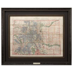
1907 Map of Colorado, Antique Topographical Map, by Louis Nell
Located in Colorado Springs, CO
This highly detailed pocket map is a topographical map of the state of Colorado by Louis Nell from
Category

Early 1900s American Antique Maps Colorado

Materials

Paper

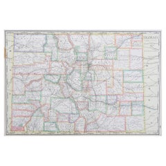
Large Original Antique Map of Colorado, USA circa 1900
Located in St Annes, Lancashire
Fabulous map of Colorado Original color Engraved and printed by the George F. Cram Company
Category

1890s American Antique Maps Colorado

Materials

Paper

Large Original Antique Map of Colorado, USA circa 1900
No Reserve
H 14.75 in W 22 in D 0.07 in
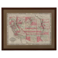
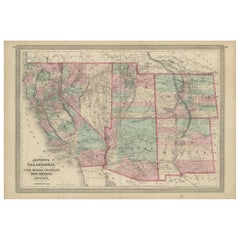
1865 "Johnson's California, Utah, Nevada, Colorado, New Mexico, Arizona" Map
Located in Colorado Springs, CO
Presented is an original 1865 "Johnson's California, with Territories of Utah, Nevada, Colorado
Category

Mid-19th Century Antique Maps Colorado

Materials

Paper

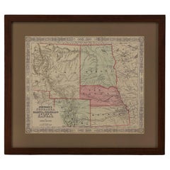
1865 "Johnson's Nebraska, Dakota, Colorado, Idaho & Kansas" Map, Johnson & Ward
Located in Colorado Springs, CO
Presented is an original 1865 "Johnson's Nebraska, Dakota, Colorado, Idaho & Kansas” map. This map
Category

Mid-19th Century Antique Maps Colorado

Materials

Paper

Antique Map of California, Utah, Nevada, Colorado, New Mexico & Arizona '1872'
Located in Langweer, NL
Antique map titled 'Johnson's California (..)'. Original map of California, Utah, Nevada, Colorado
Category

Late 19th Century Antique Maps Colorado

Materials

Paper

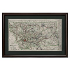
"Clason's Guide Map of Montana" by The Clason Map Company, Circa 1920s
Located in Colorado Springs, CO
Presented is “Clason's Guide Map of Montana,” published in the early 1920s by the Clason Map
Category

1920s American Art Deco Antique Maps Colorado

Materials

Paper

1877 "Geological and Geographical Atlas of Colorado" by F. V. Hayden
Located in Colorado Springs, CO
This is F. V. Hayden's Geological and Geographical Atlas of Colorado and Portions of Adjacent
Category

1870s American Antique Maps Colorado

Materials

Paper

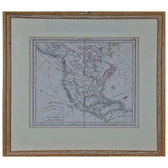
America "Amérique Septentrionale": A 19th Century French Map by Delamarche
By Maison Delamarche 1
Located in Alamo, CA
This framed mid 19th century map of North America entitled "Amérique Septentrionale" by Felix
Category

Mid-19th Century American Other Antique Maps Colorado

Materials

Paper

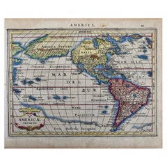
North & South America: A 17th Century Hand-colored Map by Jansson & Goos
By Johannes Janssonius
Located in Alamo, CA
, extending to the southwest, ending in the region of present-day Colorado. The map also includes the
Category

1620s Dutch Antique Maps Colorado

Materials

Paper

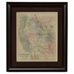
1889 "The Pacific States and Territories"
Located in Colorado Springs, CO
Presented is an uncommon 1889 map of the western United States, titled “The Pacific States and
Category

1880s American Antique Maps Colorado

Materials

Paper

Antique 1889 "The Pacific States and Territories"
1889 "The Pacific States and Territories"
H 16.25 in W 14.25 in D 1 in
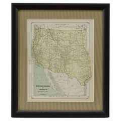
1879 "United States of America, Western Part" by O. J. Stuart
Located in Colorado Springs, CO
This colorful original map, titled “United States of America, Western Part,” was issued in Volume
Category

1870s American Antique Maps Colorado

Materials

Paper

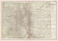
Colorado. USA. Century Atlas state antique vintage map
Located in Melbourne, Victoria
'The Century Atlas. Colorado.' Original antique map, 1903. Central fold as issued. Map name and
Category

Early 20th Century Victorian Antique Maps Colorado

Materials

Lithograph

North & South America: A 17th Century Hand-colored Map by Jansson & Goos
By Johannes Jansson
Located in Alamo, CA
, extending to the southwest, ending in the region of present-day Colorado. The map also includes the
Category

1620s Antique Maps Colorado

Materials

Engraving

"Portrait of an Italian Fencer, " John Frederick Kensett, Hudson River School
By John Frederick Kensett
Located in New York, NY
engraver of labels, banknotes and maps and was employed part of that time by the American Bank Note Company
Category

1840s Hudson River School Antique Maps Colorado

Materials

Watercolor, Paper

People Also Browsed

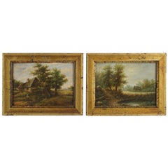
Pair of Small Mid-19th Century European Oil Paintings on Panel
Located in Hudson, NY
These bucolic scenes of rural living and farm life probably come from German or Austrian painters and are most likely meant to be a pair, circa 1850-1860. The works are very detailed...
Category

Mid-19th Century Austrian Antique Maps Colorado

Materials

Paint, Wood

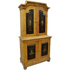
Antique Country French Neoclassical Putti Painted Pine Cupboard Cabinet Hutch
Located in Philadelphia, PA
Primitive French Country neoclassical style cherub painted pine wood cabinet. Item features a distressed solid pine wood two part construction, four swing cabinet doors with hand-pai...
Category

19th Century European Neoclassical Antique Maps Colorado

Materials

Pine

St. Peter's Square in Basel: 17th Century Engraving by Matthäus Merian
By Matthäus Merian the Elder
Located in Alamo, CA
"Campus Divi Petri qui est Basileae" (St. Peter's Platz in Basel) is a 17th century engraving by the old master engraver Matthäus Merian the Elder. It was published as plate 37 in Me...
Category

1650s Old Masters Antique Maps Colorado

Materials

Engraving

Nautical Signal Flag Representing The Letter "I" India
Located in Norwell, MA
Framed nautical signal flag representing the letter “I” for India. Lined flag with a yellow field with round black sewn on panel. White canvas hoist with Manila rope and wood toggle....
Category

1920s North American Antique Maps Colorado

Materials

Linen

'Wisconsin State Fair 1891' Framed Poster, Signed
By Pamela Bachman
Located in Milwaukee, WI
Born in Milwaukee, WI in 1959, Pamela Bachman is a contemporary Wisconsin artist creating folk art acrylic and oil paintings, as well as silkscreen folk art prints. This poster, prod...
Category

1980s Folk Art Antique Maps Colorado

Materials

Offset

Antique Qajar Period Persian Papier Machê Snuff Box Depicting Chovgan or Polo
Located in Philadelphia, PA
A fine antique Persian papier machê snuff box. Consisting of a lacquered papier machê with decoration to the lid and all 4 sides. The lid of the box depicts numerous men on ho...
Category

Early 20th Century Unknown Islamic Antique Maps Colorado

Materials

Paper

19th Century French Green Marble Cross and Holy Water with Cloisonné Technique
Located in Dallas, TX
This marble and cloisonné cross with a holy water recipient was created in France, circa 1880. The beautiful, antique piece has intricate cloisonné work with additional enamel, stone...
Category

Late 19th Century French Antique Maps Colorado

Materials

Multi-gemstone, Marble, Brass

Large Antique 1859 Map of North America
Located in Sag Harbor, NY
This Map was made by Augustus Mitchell in 1859 It is in amazing condition for being 163 years old. This price is for the rolled up easy to ship version of this piece. I will be Frami...
Category

Mid-19th Century American Antique Maps Colorado

Materials

Canvas, Paper

Large Antique 1859 Map of North America
Free Shipping
H 65 in W 65 in D 0.01 in
19th Century Silver Plate Epergne and Cruet Service
Located in New Orleans, LA
This elegant silver plate epergne is a rarity in that it also includes a full, cut-glass cruet set. This service’s delicate central basket is elevated above a plateau holding ten fin...
Category

19th Century Unknown Other Antique Maps Colorado

Materials

Silver Plate

Antique Map Depicting Burma, Siam, Annam (Vietnam) and Japan, 1882
Located in Langweer, NL
The image shows two maps side by side from the 1882 atlas by Blackie & Son. On the left, the map is titled "BURMAH SIAM AND ANAM," while the one on the right is labeled "JAPAN." **B...
Category

1880s Antique Maps Colorado

Materials

Paper

19th Century English Victorian Mahogany Bureau Bookcase
Located in London, GB
This is a fabulous antique English Victorian mahogany and marquetry bureau bookcase, circa 1860 in date and in excellent condition. It has been made from mahogany with satinwood cro...
Category

1860s English Victorian Antique Maps Colorado

Materials

Mahogany

18th Century Venetian Walnut ad Mahogany Commode with Bookmatched Veneer
Located in Atlanta, GA
A Venetian walnut and mahogany commode from the 18th century with four drawers, bookmatched veneer, cross banding and cabriole legs. This Venetian walnut and mahogany commode from th...
Category

18th Century Italian Antique Maps Colorado

Materials

Brass

18th Century French Tapestry 11'4" X 10'2"
Located in Los Angeles, US
A wall hanging tapestry, simply put, is a textile specifically designed and woven to portray an artistic scene with the intent of hanging it on a wall. Antique tapestries, those that...
Category

18th Century Unknown French Provincial Antique Maps Colorado

Materials

Wool, Cotton

18th Century French Tapestry 11'4" X 10'2"
Free Shipping
H 136 in W 122 in D 0.2 in
Late 18th Century English George III Mahogany Knife Box Fitted Out for Letters
Located in San Francisco, CA
Late 18th century, English George III mahogany knife box fitted out for letters / ballots. The interior voided of the old knife compartments. One small removable interior leather ins...
Category

Late 18th Century English George III Antique Maps Colorado

Materials

Metal

Theories of Planetary Orbits: A Framed 18th C. Celestial Map by Doppelmayr
By Johann Gabriel Doppelmayr 1
Located in Alamo, CA
This 18th century hand-colored copperplate celestial map by Johann Doppelmayr entitled "Astronomia Comparativa in qua Planetarum Primaria Phaenomena" (Comparative Astronomy in which ...
Category

Early 18th Century Antique Maps Colorado

Materials

Engraving

Art Deco Fortune Magazine Cover October 1938
Located in Dallas, TX
Presenting a fabulous Original Art Deco Fortune Cover October 1938. The cover of Fortune Magazine for October 1938, framed and matted. This is an original cover, not a re-print...
Category

Early 20th Century American Art Deco Antique Maps Colorado

Materials

Paper

Recent Sales

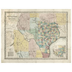
Richardson's New Map of the State of Texas
By Charles Desilver, Willard Richardson 1
Located in Houston, TX
). Richardson's New Map of the State of Texas Including part of Mexico Compiled from Government Surveys and Other
Category

Mid-19th Century American Other Antique Maps Colorado

Antique Richardson's New Map of the State of Texas
H 22.75 in W 30.25 in D 0.5 in
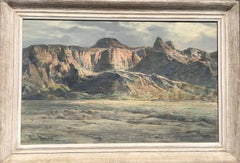
Arizona Mountains
By Paul Lauritz
Located in Graton, CA
commercial artist doing maps, posters and decorations. In Portland, he married Mary Potterton in 1912, and
Category

Early 20th Century Impressionist Antique Maps Colorado

Materials

Oil

1889 Original Map of Colorado
Located in Colorado Springs, CO
This attractive map of Colorado was published in 1889 by William M. Bradley & Bros, a Philadelphia
Category

1880s American Antique Maps Colorado

1889 Original Map of Colorado
H 21 in W 28 in D 2 in
1906 "Tourists Guide to Colorado Springs, Manitou, Colorado City..." Map
Located in Colorado Springs, CO
Presented is "Clason's Guide Map to Colorado Springs, Manitou, Colorado City and Pike's Peak Region
Category

Early 1900s American Antique Maps Colorado

Materials

Paper

1874 Antique Map of Colorado, Utah, New Mexico, and Arizona
Located in Colorado Springs, CO
Presented is an original map of Colorado, Utah, New Mexico, and Arizona from 1874. This authentic
Category

1870s American Antique Maps Colorado

Materials

Paper

1877 General Geological Map of Colorado by F. V. Hayden
Located in Colorado Springs, CO
Offered is an original “General Geological Map of Colorado” by F. V. Hayden. The map was printed as
Category

1870s American Antique Maps Colorado

Materials

Paper

1883 The City of Denver, Colorado, Published by H.L. Thayer, Antique Map
Located in Colorado Springs, CO
particular pocket map would have cost a traveler $1.50. Denver, Colorado was not founded until 1858. Prior
Category

1880s American Antique Maps Colorado

Materials

Paper

1917 "Map of the City of Denver, Colorado" by L. L. Poates Eng, Co.
Located in Colorado Springs, CO
This is a detailed antique map of Denver, Colorado. The map was printed in the 1917 “New
Category

1910s American Antique Maps Colorado

Materials

Paper

1858 "Mitchell's New National Map Exhibiting the United States" Hanging Wall Map
By Samuel Augustus Mitchell 1
Located in Colorado Springs, CO
Presented is a beautifully engraved, large hanging wall map of the United States, Mexico, and West
Category

1850s American Antique Maps Colorado

Materials

Paper

Map of the Denver & Rio Grande Railroad System by S.K. Hooper, Antique Map, 1895
Located in Colorado Springs, CO
booklet titled "The Geography of Colorado and Rocky Mountain Regions with Map", which was compiled by A.D
Category

1890s American Antique Maps Colorado

Materials

Paper

Denver and Rio Grande Railroad System Map, circa 1905
Located in Colorado Springs, CO
Fine early map of Colorado rail system, promoting the lines of the Denver & Rio Grande Western, as
Category

Early 1900s Antique Maps Colorado

Antique Map of Texas, the Rocky Mountains, Southwest and Mexico
Located in Langweer, NL
Antique map titled 'Carte du Mexique'. Fine Humboldt inspired map of Mexico, in the midst of its
Category

Early 19th Century Antique Maps Colorado

Materials

Paper

1885 Denver and Rio Grande System Antique Map by Rand McNally & Co.
Located in Colorado Springs, CO
This map details the Denver & Rio Grande Railroad and was published in 1885. The map extends as far
Category

1880s American Antique Maps Colorado

Materials

Paper

1904 Map of the Denver and Rio Grande & Rio Grande Western System, Rand McNally
Located in Colorado Springs, CO
1904 Map of the Denver and Rio Grande and the Rio Grande Western System by Rand McNally & Co
Category

Early 1900s American Antique Maps Colorado

Materials

Paper

Exploration and Survey of The Colorado River by Ives, First Edition, circa 1861
Located in Colorado Springs, CO
Ives, Joseph C. Report Upon the Colorado River of the West. Washington: Government Printing Office
Category

1860s American Antique Maps Colorado

Materials

Paper

"The Greatest New York" Panoramic Chromolithograph, circa 1911
Located in Colorado Springs, CO
American lithographic printer and map engraver. He studied at the Academy of Fine Arts in Kassel and at the
Category

Early 20th Century American Antique Maps Colorado

Large Original Antique Map of Colorado, USA, 1894
By Rand McNally & Co.
Located in St Annes, Lancashire
Fabulous map of Colorado Original color By Rand, McNally & Co. Published, 1894 Unframed
Category

1890s American Antique Maps Colorado

Materials

Paper

Large Original Antique Map of Colorado, USA, 1894
1 bid
No Reserve
H 20.5 in W 27 in D 0.07 in
1906 Map of Colorado by Rand McNally & Co., Antique County and Township Map
By Rand McNally & Co.
Located in Colorado Springs, CO
This is a 1906 Indexed County and Township Pocket Map and Shipper’s Guide of Colorado published by
Category

Early 1900s American Antique Maps Colorado

Materials

Paper

1905 Guide Map of Denver Colorado, by George Bell Co., Antique Map with Booklet
Located in Colorado Springs, CO
This is a detailed antique map of Denver, Colorado. It was published in 1905 by George Bell Company
Category

Early 1900s American Antique Maps Colorado

Materials

Paper

Pike's Peak Topographical Map Showing Colorado Mountain Ranges, circa 1877
Located in Colorado Springs, CO
. Government to map large parts of the American West. He and his team surveyed Colorado between 1873 and 1876
Category

1870s Antique Maps Colorado

1844 Map of the United States, Antique Map, Featuring the Republic of Texas
Located in Colorado Springs, CO
This is Phelps and Ensign's 1844 travellers guide map of the United States, containing the roads
Category

19th Century American Antique Maps Colorado

Materials

Paper

Antique Map of Texas, California and the Southwest by Tallis, c.1850
Located in Langweer, NL
Antique map titled 'Mexico, California and Texas'. Decorative regional map of the Texas, California
Category

Mid-19th Century Antique Maps Colorado

Materials

Paper

Antique Map of the United States of North America ‘West’ by A.K. Johnston, 1865
Located in Langweer, NL
, Arkansas, Colorado, Nevada, Idaho, Dakota and more. This map originates from the ‘Royal Atlas of Modern
Category

Mid-19th Century Antique Maps Colorado

Large Antique Civil War Map of United States by Theodor Ettling
Located in Gallatin, TN
Civil War Era Map of the United States of American by Theodor Ettling Entitled “United States of
Category

17th Century Antique Maps Colorado

Monumental Pair of Cary's Library Globes
Located in New York, NY
, ending in spade feet on brass casters. The terrestrial globe is mapped with detailed
Category

19th Century English Antique Maps Colorado

Materials

Mahogany

Arbuckle Coffee Company Maps of Colorado, Utah, Montana, Minnesota
Located in New York, NY
Sheet with lithograph maps of four states in full color. Beautifully presented in a antiqued gold
Category

1880s Realist Antique Maps Colorado

Materials

Lithograph

Colton's 1861 Map of United States Forts and Military Stations
Located in New York, NY
William St. New York. For "The Rebellion Record." New York, D. G. P. Putnam. 1861." Rare pocket map of
Category

1860s Realist Antique Maps Colorado

Materials

Lithograph

Get Updated with New Arrivals
Save "Antique Maps Colorado", and we’ll notify you when there are new listings in this category.

Antique Maps Colorado For Sale on 1stDibs

Choose from an assortment of styles, material and more with respect to the antique maps colorado you’re looking for at 1stDibs. Frequently made of paper, every antique maps colorado was constructed with great care. Your living room may not be complete without an antique maps colorado — find older editions for sale from the 19th Century and newer versions made as recently as the 20th Century. A well-made antique maps colorado has long been a part of the offerings for many furniture designers and manufacturers, but those produced by Rand McNally & Co. are consistently popular.

How Much is a Antique Maps Colorado?

Prices for an antique maps colorado start at $276 and top out at $17,650 with the average selling for $1,975.

Read More

Pamela Shamshiri Shares the Secrets behind Her First-Ever Book and Its Effortlessly Cool Interiors

The sought-after designer worked with the team at Hoffman Creative to produce a monograph that beautifully showcases some of Studio Shamshiri's most inspiring projects.

Moroccan Artworks and Objects Take Center Stage in an Extraordinary Villa in Tangier

Italian writer and collector Umberto Pasti opens the doors to his remarkable cave of wonders in North Africa.

Montecito Has Drawn Royalty and Celebrities, and These Homes Are Proof of Its Allure

Hollywood A-listers, ex-pat aristocrats and art collectors and style setters of all stripes appreciate the allure of the coastal California hamlet — much on our minds after recent winter floods.

Whaam! Blam! Pow! — a New Book on Pop Art Packs a Punch

Publishing house Assouline and writer Julie Belcove have teamed up to trace the history of the genre, from Roy Lichtenstein, Andy Warhol and Yayoi Kusama to Mickalene Thomas and Jeff Koons.

The Sparkling Legacy of Tiffany & Co. Explained, One Jewel at a Time

A gorgeous new book celebrates — and memorializes — the iconic jeweler’s rich heritage.

What Makes a Gem-Encrusted Chess Set Worth $4 Million?

The world’s most opulent chess set, weighing in at 513 carats, is literally fit for a king and queen.

Tauba Auerbach’s Geometric Pop-Up Book Is Mighty Rare, Thanks to a Hurricane

This sculptural art book has an epic backstory of its own.

Step inside the Storied Mansions of Palm Beach’s Most Effervescent Architect

From Spanish-style courtyards to fanciful fountains, these acclaimed structures abound in surprising and elegant details.