Map Panama
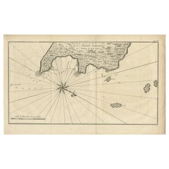
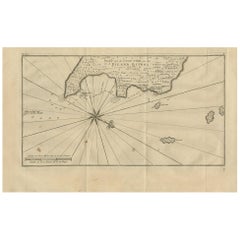
Antique Map of Coiba Island, Panama, South America, C.1740
Located in Langweer, NL
Antique map titled 'Plan de la partie orientale de l'Isle de Quibo'. Map of the eastside of Coiba
Category
Antique 18th Century Maps
Materials
Paper
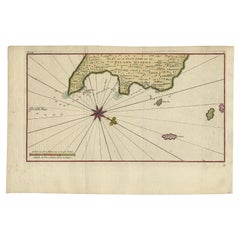
Antique Map of the Eastside of Coiba Island 'Quibo', Panama, 1749
Located in Langweer, NL
Antique map titled 'Plan de la partie orientale de l'Isle de Quibo'. Map of the eastside of Coiba
Category
Antique 18th Century Maps
Materials
Paper
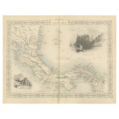
Crossroads of Empires: A John Tallis Map of the Isthmus of Panama, 1851
Located in Langweer, NL
The Tallis map of the Isthmus of Panama is a beautifully detailed work, characteristic of the maps
Category
Antique 1850s Maps
Materials
Paper
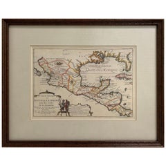
1705 Golfe de Mexico and Florida Framed Map
Located in Stamford, CT
Framed map of Mexico & Florida circa 1705, Paris. Small map with Mexico and the Gulf Coast. Inset
Category
Antique Early 1700s French Spanish Colonial Maps
Materials
Glass, Wood, Paper
Antique Map of Coiba Island by Anson '1749'
Located in Langweer, NL
Antique map titled 'Plan van de Oost-Zyde van het Eiland Quibo'. Original antique map of the
Category
Antique Mid-18th Century Maps
Materials
Paper
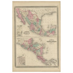
Antique Map of Mexico and Central America by Johnson '1872'
Located in Langweer, NL
America, with inset maps of Tehuantepec and Panama. This map originates from 'Johnson's New Illustrated
Category
Antique Late 19th Century Maps
Materials
Paper
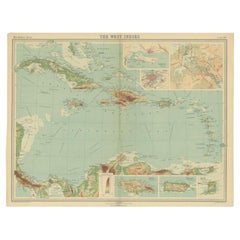
Antique Map of the West Indies in Full Color, 1922
Located in Langweer, NL
Windward Islands) and part of the Bahama Islands. Inset maps show the Panama Canal, Kingston, Havana
Category
20th Century Maps
Materials
Paper
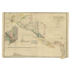
Antique Map of Central America Showing the Communication Lines, 1850
Located in Langweer, NL
Antique map titled 'Map of Central America Shewing the Different Lines of Atlantic & Pacific
Category
Antique 19th Century Maps
Materials
Paper
Antique Map of Part of South America by Kitchin, circa 1770
Located in Langweer, NL
Antique map titled 'Carte der Theile der Süd-See (..)'.
Map of part of South America including
Category
Antique Late 18th Century Maps
Materials
Paper
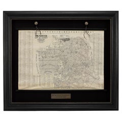
1915 "San Francisco City and County" Hanging Map by W. Bashford Smith
Located in Colorado Springs, CO
1915, this map indicates streets and city districts, and, most notably, shows the site of the Panama
Category
Vintage 1910s American Art Deco Maps
Materials
Wood, Paper
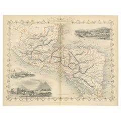
An Old Illustrated Tallis Map of Central America with Volcanic Vignettes, 1851
Located in Langweer, NL
This map of Central America, part of John Tallis & Company's series from "The British Colonies" by
Category
Antique 1850s Maps
Materials
Paper
H 10.71 in W 14.26 in D 0 in
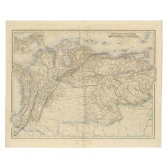
Antique Map of the Northern Part of South America by Fullarton, 1855
Located in Langweer, NL
part of South America. With a small inset map of Panama. Originates from the 'Royal Illustrated Atlas
Category
Antique 19th Century Maps
Materials
Paper
Antique Map of Mexico, Central America and West Indies by A & C. Black, 1870
Located in Langweer, NL
, Central America and West Indies with inset map of Panama railway. This map originates from ‘Black's
Category
Antique Late 19th Century Maps
Materials
Paper
H 13 in W 17.52 in D 0.02 in
"Choke II: Isthmus of Panama & Canal (Panama)" - ceramic - map - black & white
By Gregor Turk
Located in Atlanta, GA
This ceramic wall sculpture features a topographic map in black and white.
Gregor is inspired by
Category
2010s Abstract Sculptures
Materials
Ceramic
Shaw Savill Line by A E Agar brochure Ocean Liners c1940s New Zealand via Panama
Located in London, GB
the brochure size if desired.
Fine image of ocean liner to front cover, map - via Panama Canal - to
Category
Mid-20th Century Modern More Prints
Materials
Lithograph
H 9.45 in W 13.39 in
Original Vintage Travel Poster Hamburg America Line To Los Angeles San Francisco
By Ottomar Anton
Located in London, GB
York and the city names on the route over the map of Canada and America to the Panama Canal - Vancouver
Category
Vintage 1930s German Art Deco Posters
Materials
Paper
H 32.68 in W 23.63 in D 0.04 in
Original Vintage Travel Poster Hamburg America Line To Los Angeles San Francisco
By Ottomar Anton
Located in London, GB
York and the city names on the route over the map of Canada and America to the Panama Canal - Vancouver
Category
1930s Art Deco More Prints
Materials
Paper
People Also Browsed
Worn-In Distressed Antique Persian Karaja Heriz Rug with Rustic Style
Located in Dallas, TX
72988 Worn-In Distressed Antique Persian Karaja Heriz Rug with Rustic Style. This hand-knotted wool distressed antique Persian Karaja Heriz rug with Mid-Century Modern style features...
Category
Early 20th Century Persian Rustic Persian Rugs
Materials
Wool
Personal Memoirs of U. S. Grant, Two-Volume Set, 1885-86
Located in Colorado Springs, CO
Grant, Ulysses S., Personal Memoirs of U.S. Grant. New York: Charles L. Webster and Co., 1885-1886. Two volume set. Octavo, beautifully rebound in quarter green leather and cloth boa...
Category
Antique 1880s American Books
Materials
Leather, Paper
Antique 18th Century Spanish Colonial Carved Cedar Coffer Chest Mexico 1750
Located in Portland, OR
Antique 18th century Spanish Colonial carved cedar coffer/chest, Mexico, circa 1750.
The chest having a lift up lid with hand cut iron strap hinges, the chest is profusely chip-carve...
Category
Antique Mid-18th Century Mexican Spanish Colonial Blanket Chests
Materials
Cedar
H 30.5 in W 52.5 in D 24 in
19th Century English Victorian Campaign Style Travel Desk Writing Box
Located in Forney, TX
A antique Victorian era English campaign style brass bound mahogany portable lap desk / writing slope with nicely aged patina. circa 1850
Commonly used by military officers in the f...
Category
Antique Mid-19th Century English Campaign Decorative Boxes
Materials
Brass
The Holy Bible, Containing the Old and New Testaments, 1887
Located in Colorado Springs, CO
The Holy Bible, Containing the Old and New Testaments, Translated out of the Original Tongues: And with the Former Translations Diligently Compared and Revised, by His Majesty’s Spec...
Category
Antique 1880s English Late Victorian Books
Materials
Leather, Paper
Antique Decorative Coloured Map of North America, 1882
Located in Langweer, NL
This original antique map of North America is from the Blackie & Son Atlas published in 1882. Here are several points of interest about this map:
1. **Political Borders**: The map l...
Category
Antique 1880s Maps
Materials
Paper
Charte von Sud-America (Map of South America) - Etching with Hand-Drawn Outlines
Located in Soquel, CA
Map of south America, engraved by Franz Pluth (Czech, 1800-1871), from the book "Neueste Länder - und Völkerkunde, ein geographisches Lesebuch für alle Stände" by Linder, F. L. (Prag...
Category
1820s Other Art Style More Prints
Materials
Paper, Printer's Ink, Etching
H 23 in W 19 in D 0.75 in
18C Mexican/Texan Bargueno Style Chest on Stand
Located in Dallas, TX
PRESENTING A STUNNING AND IMPORTANT piece of North American, Texan, HISTORIC furniture, namely, an 18C Mexican/Texan Bargueno Style Chest on Stand.
This is one of the MOST INTRUIGIN...
Category
Antique Mid-18th Century American Spanish Colonial Cabinets
Materials
Maple, Walnut, Pine
19th Century Original Mexican Retablo "Exvoto" Oil on Tin
Located in Mexico City, CDMX
Dated 1870, we offer this 19th century original Mexican retablo "Exvoto" oil on tin, due to the effects of time, the writing has been erased but we can read the nex:
“Le aconteció...
Category
Antique 1870s Mexican Folk Art Religious Items
Materials
Metal
Antique Map of The United States of North America, 1882
Located in Langweer, NL
This is a historical map titled "The United States of North America, Central Part" from the 1882 Blackie Atlas. It depicts the continental United States with a high level of detail, ...
Category
Antique 1880s Maps
Materials
Paper
John Sloan Etching, 1916, "McSorley's Back Room"
By John Sloan
Located in Phoenix, AZ
John Sloan (1871-1951) etching created 1916.
Edition: 100
Titled: “McSorley’s Back Room”
Plate size: 5 1/4" H x 7 " W
Sheet size: 7 1/2" H x 10 3/8" W
In excellent condition, un...
Category
Vintage 1910s Prints
Materials
Paper
The Grandeur of Viceregal Mexico; Treasures from the Museo Franz Mayer
Located in valatie, NY
The Grandeur of Viceregal Mexico; Treasures from the Museo Franz Mayer. Houston: The Museum of Fine Arts, 2002. First edition hardcover with dust jacket. Spanish and English text. 36...
Category
21st Century and Contemporary American Books
Materials
Paper
Large 18th Century Spanish Colonial Santos Torchère
Located in Forney, TX
An impressive Spanish Colonial santos figure church altar stick (candle holder), handcrafted in Mexico, in the 18th century, possibly earlier. Constructed in plaster, with hand carve...
Category
Antique 18th Century Mexican Spanish Colonial Torchères
Materials
Plaster, Wood, Paint
Antique Persian Mahal Rug with English Country Cottage Style
Located in Dallas, TX
74414 Antique Persian Mahal Rug with English Country Cottage Style 09'00 X 11'05. Boasting a floral bounty in a range of warm hues, this antique Persian Mahal rug is a delightful exa...
Category
Early 20th Century Persian Romantic Persian Rugs
Materials
Wool
19th Century Bronze Coin with Silver Bezel Earrings by Jewels
Located in Point Richmond, CA
19th Century Bronze Coin with Silver Bezel Earrings by Jewels of Santa Fe/Marrakesh
A pair of earrings made by Jewels with bronze coins from Morocco and Egypt set in silver bezels a...
Category
Antique 19th Century Moroccan Tribal Tribal Art
Materials
Silver, Bronze
Original Antique Map of the American State of Washington, 1889
Located in St Annes, Lancashire
Great map of Washington
Drawn and Engraved by W. & A.K. Johnston
Published By A & C Black, Edinburgh.
Original colour
Unframed.
Category
Antique 1880s Scottish Victorian Maps
Materials
Paper
Recent Sales
1857 Wall Map of the United States by Fanning, Bridgman & Ensign
By Thayer, Bridgman and Fanning
Located in Colorado Springs, CO
, Cuba, and Central America as far as Panama. Inset maps in the lower left illustrate the World on a
Category
Antique 1850s American Maps
Materials
Paper
1856 a New Map of the Union with the Adjacent Islands and Countries
Located in Colorado Springs, CO
This is a very rare hanging wall map of the North, Central, and part of South America. The map is
Category
Antique 1850s American Maps
Choke: Panama – Land (left) Water (right)
By Gregor Turk
Located in Atlanta, GA
Gregor Turk’s new series titled “CONFLUX” features wall-mounted box-like maps of global choke
Category
21st Century and Contemporary Contemporary Mixed Media
Materials
Rubber, Wood
Unique Sterling Silver 'Map of the World' Inkstand, by Cartier, Paris
By Cartier
Located in London, GB
an embossed map of the Americas and Europe, illustrating a round-trip journey taken by train and by
Category
Vintage 1930s French Art Deco Inkwells
Materials
Enamel, Sterling Silver
Original Vintage Pacific Line Cruise Ship Poster Sunshine Route to South America
Located in London, GB
Bermuda Bahamas Havana Jamaica Panama Canal - The Pacific Steam Navigation Co., Liverpool or principal
Category
Vintage 1930s British Posters
Materials
Paper
H 40.16 in W 25.01 in D 0.04 in
1964 Harland & Wolff Boat Ship Martime Naval Blueprint Diagram Rigging Plans
By Harland and Wolff
Located in Dayton, OH
"Monumental 1964 Harland & Wolff architectural ship map / rigging plan print. H&W were naval
Category
Vintage 1960s Prints
Materials
Paper
H 40 in W 1.25 in D 89 in
Antique Map of Part of South America by Kitchin, 1821
Located in Langweer, NL
Antique map titled 'Map of the Countries on the South Sea from Panama to Guayquil'. Antique map of
Category
Antique 19th Century Maps
Materials
Paper
Framed 19th Century Colton Map of Mexico, Texas, California and US Territories
By J.H. Colton
Located in Alamo, CA
the Panama Canal was proposed but never built. The map is tinted and lightly colored in green and pink
Category
Antique Mid-19th Century American Other Maps
Materials
Paper
H 20 in W 22.63 in D 0.88 in
Panama
By José Maria Cruxent
Located in Norwich, GB
of ancient maps.
It is signed and dated 1976 at the lower right, it is titled "Panama", situated
Category
1970s Abstract Expressionist Abstract Paintings
Materials
Oil
SOUTHERN US, FLORIDA, MEXICO & CARRIBIAN etc. - Mappa INDIAE OCCIDENTILIS..
By Homann Heirs
Located in Santa Monica, CA
map of the United Stated Gulf Coast, Florida, the Caribbean, Mexico., Panama and Central America
Category
1740s Old Masters Landscape Prints
Materials
Engraving
Latin American Figurative Abstract Expressionist Cuban Oil Painting
By David Duany
Located in Surfside, FL
, Chile , United States , Panama , Switzerland , Germany .
Awards and mentions
First prize room " Leopoldo
Category
20th Century Abstract Expressionist Abstract Paintings
Materials
Canvas, Mixed Media, Oil
Living with Textiles, French Book by Nicholas Barnard, 1989
By Modern History
Located in Atlanta, GA
fabrics from Congo. As for the molas of the Cuna Indians of Panama, they feature strong personalities
Category
Vintage 1980s French Arts and Crafts Books
Materials
Paper
Pansies Still Life
By Witold Gordon
Located in Wilton Manors, FL
Radio City Music Hall; History of Cosmetics in the lower level Ladies's Lounge, and A Map of the World
Category
Mid-20th Century Realist Still-life Paintings
Materials
Gouache
Floral Still Life
By Witold Gordon
Located in Wilton Manors, FL
Radio City Music Hall; History of Cosmetics in the lower level Ladies's Lounge, and A Map of the World
Category
1930s Realist Still-life Paintings
Materials
Oil
Fishing Trawler Boat
By Witold Gordon
Located in Wilton Manors, FL
Cosmetics in the lower level Ladies's Lounge, and A Map of the World in the Gentlemen's Smoking Room on the
Category
Mid-20th Century Abstract Abstract Paintings
Materials
Masonite, Oil
Original Pacific Line Cruise Ship Poster - The Sunshine Route To South America
Located in London, GB
Bermuda Bahamas Havana Jamaica Panama Canal - The Pacific Steam Navigation Co., Liverpool or principal
Category
1930s More Prints
Materials
Paper
Map of Neuve Castille
By Alain Manesson Mallet
Located in New York, NY
Published in 1685 this hand-colored map was created by Alain Manesson Mallet. Also shows Puerto
Category
18th Century and Earlier Realist More Prints
Materials
Engraving
Get Updated with New Arrivals
Save "Map Panama", and we’ll notify you when there are new listings in this category.
Map Panama For Sale on 1stDibs
Find many varieties of an authentic map panama available at 1stDibs. Frequently made of paper, glass and wood, every map panama was constructed with great care. You’ve searched high and low for the perfect map panama — we have versions that date back to the 18th Century alongside those produced as recently as the 20th Century are available. A map panama made by Art Deco designers — as well as those associated with Arts and Crafts — is very popular. A well-made map panama has long been a part of the offerings for many furniture designers and manufacturers, but those produced by Ottomar Anton are consistently popular.
How Much is a Map Panama?
Prices for a map panama can differ depending upon size, time period and other attributes — at 1stDibs, they begin at $144 and can go as high as $2,114, while the average can fetch as much as $355.
More Ways To Browse
Caribbean Map Antique
Caribbean Antique Maps
Antique Caribbean Map
Antique Maps Of The Caribbean
Antique Map Of The Caribbean
Antique Map Of Caribbean
Moss Beach Painting
Ship Diagram
Original San Francisco Travel Poster
Shell Oil Poster
Map Of Caribbean
British Isles Antique Map
Caribbean Map
Antique Puerto Rico
Stephen Douglas
Primitive African Coffee Table
Vintage Food Scale
Vintage Food Scales
