Maritime Chart
1
to
9
80
16
60
53
33
24
11
10
9
8
8
7
5
5
5
4
3
3
3
3
2
2
2
2
1
1
1
1
1
1
1
1
1
1
1
1
1
1
9
1
1
1
1
Sort By
Vintage Mural Wall Chart Quentell Freshwater Algae Plants Maritime Decoration
Located in Berghuelen, DE
A countrycore rollable Jung-Koch-Quentell wall chart showing freshwater algae. Used as teaching
Category
Mid-20th Century German Country Prints
Materials
Canvas, Wood, Paper
H 44.49 in W 32.68 in D 0.79 in
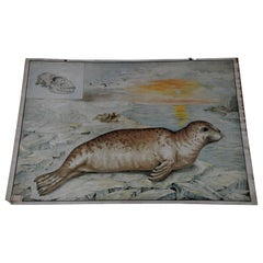
Countrycore Mural Cottagecore Wall Chart Vintage Poster Seal Maritime Wildlife
Located in Berghuelen, DE
information on the history of school wall charts:
The idea to upgrade every day school life by using pictures
Category
Mid-20th Century German Country Prints
Materials
Paper
H 25.2 in W 35.44 in D 0.79 in
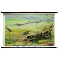
Rollable Vintage Murall Poster Wall Chart Eel Underwater Scene Fish Maritime
Located in Berghuelen, DE
A cottagecore pull-down wall chart illustrating a lovely under water scenery with eels. Painter M
Category
Late 20th Century Swedish Country Prints
Materials
Canvas, Wood, Paper
H 26.38 in W 39.38 in D 0.79 in
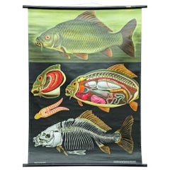
Countrycore Mural Vintage Wall Chart Jung Koch Quentell Carp Maritime Decoration
Located in Berghuelen, DE
information on the history of school wall charts:
The idea to upgrade every day school life by using pictures
Category
Mid-20th Century German Country Prints
Materials
Canvas, Wood, Paper
H 44.1 in W 32.29 in D 0.79 in
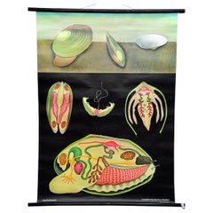
Maritime Decorative Art Print by Jung Koch Quentell River Mussel Wall Chart
Located in Berghuelen, DE
not include the poles.
Background information on the history of school wall charts:
The idea to
Category
Vintage 1970s German Country Prints
Materials
Canvas, Wood, Paper
H 44.1 in W 32.29 in D 0.79 in
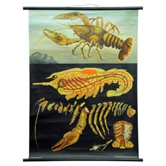
Vintage Poster Pull-Down Wall Chart Jung Koch Quentell Crayfish Maritime Mural
Located in Berghuelen, DE
information on the history of school wall charts:
The idea to upgrade every day school life by using pictures
Category
Mid-20th Century German Country Prints
Materials
Canvas, Wood, Paper
H 44.1 in W 32.68 in D 0.79 in
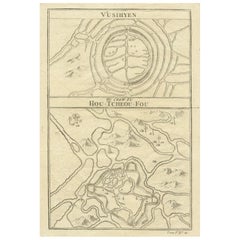
Map of Vusihyen, Hu Chew Fu and Hou-Tcheou-Fou, Historical Chinese Cities, 1754
Located in Langweer, NL
forefront of maritime charting and exploration. The detail and accuracy of Bellin's maps reflected not only
Category
Antique 1750s Prints
Materials
Paper
H 9.97 in W 7.05 in D 0 in
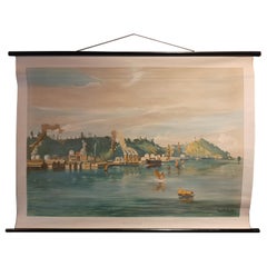
Vintage Wall Chart of Balikpapan 'Indonesia'
Located in Langweer, NL
maritime trade and a strategic location for the colonial powers.
The chart presents a view of Balikpapan
Category
Early 20th Century Prints
Materials
Paper
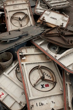
"Watertight Hatches" Maritime Large Scale Color Fine Art Photograph
By Stephen Mallon
Located in New York, NY
charts the final stages of the decommissioned US. Navy Spruance-class Destroyer's life and the
Category
21st Century and Contemporary Contemporary Abstract Photography
Materials
C Print
Large Sea Chart of the British Islands, 1918
Located in Langweer, NL
Office, the chart is designed with a focus on maritime navigation, including details like sea routes
Category
Vintage 1910s Maps
Materials
Paper
Vintage USSR Book: 'Tanker Derbent' by Yuri Krymov - A Maritime Tale, 1J115
Located in Bordeaux, FR
Embark on a maritime adventure through the pages of history with this captivating vintage book
Category
Vintage 1980s Books
Materials
Paper
H 0.6 in W 5.12 in D 7.88 in
Large Antique Chart of The White Sea, Russa 1854
Located in Langweer, NL
Antique map titled 'The White Sea Index Chart'. Large uncommon map of the White Sea with a smaller
Category
Antique 19th Century Maps
Materials
Paper
Natural Look Art Print by Jung Koch Quentell Wall Chart Freshwater Polyp
Located in Berghuelen, DE
The maritime decorative vintage pull-down wall chart by Jung-Koch-Quentell is depicting a
Category
Vintage 1970s German Country Prints
Materials
Canvas, Wood, Paper
H 44.89 in W 32.68 in D 0.79 in
Original Antique Sea Chart of the Northern Part of Hispaniola, Western Cuba
Located in Langweer, NL
Antique map titled 'Pas kaart van de Noord Kust van Espaniola (..)'. Beautiful sea chart of the
Category
Antique Late 17th Century Maps
Materials
Paper
H 21.26 in W 24.02 in D 0.02 in
Charting the Course of Empire: Bonne's 1770 Masterpiece Maps of the Indian Ocean
Located in Langweer, NL
, study, or office.
Let the "Charting the Course of Empire" collection transport you to an age where the
Category
Antique 1770s Maps
Materials
Paper
Free Shipping
H 14.18 in W 20.28 in D 0 in
Antique Plan of Port-Vendres, Roussillon, France
Located in Langweer, NL
, France. This map originates from 'Le Petit Atlas Maritime (..)' by J.N. Bellin. Published 1764
Category
Antique Mid-18th Century Maps
Materials
Paper
Antique Map of the Bay of Brusc, France
Located in Langweer, NL
originates from 'Le Petit Atlas Maritime (..)' by J.N. Bellin. Published 1764.
Bellin was an important
Category
Antique Mid-18th Century Maps
Materials
Paper
Antique Plan of Aigues-Mortes, France
Located in Langweer, NL
, France. This map originates from 'Le Petit Atlas Maritime (..)' by J.N. Bellin. Published 1764
Category
Antique Mid-18th Century Maps
Materials
Paper
Antique Plan of the Region of Cassis, France
Located in Langweer, NL
. This map originates from 'Le Petit Atlas Maritime (..)' by J.N. Bellin. Published 1764.
Bellin was
Category
Antique Mid-18th Century Maps
Materials
Paper
Antique Plan of the City of Bayonne, France
Located in Langweer, NL
originates from 'Le Petit Atlas Maritime (..)' by J.N. Bellin. Published 1764.
Bellin was an important
Category
Antique Mid-18th Century Maps
Materials
Paper
Antique Map of the Region of Aigues-Mortes and Camargue, France
Located in Langweer, NL
the region of Aigues-Mortes and Camargue, France. This map originates from 'Le Petit Atlas Maritime
Category
Antique Mid-18th Century Maps
Materials
Paper
Antique Map of the Languedoc Coast between Agde and Sète 'Cette', France
Located in Langweer, NL
Maritime (..)' by J.N. Bellin. Published 1764.
Bellin was an important maker of charts for the French
Category
Antique Mid-18th Century Maps
Materials
Paper
H 12.49 in W 8.98 in D 0.02 in
Antique Map of the Adour River, Near Bayonne, France
Located in Langweer, NL
of the Adour river, near Bayonne, France. This map originates from 'Le Petit Atlas Maritime (..)' by
Category
Antique Mid-18th Century Maps
Materials
Paper
Antique Map of the Coast of Roussillon, France
Located in Langweer, NL
map of the coast of Roussillon, France. This map originates from 'Le Petit Atlas Maritime (..)' by J.N
Category
Antique Mid-18th Century Maps
Materials
Paper
Antique Map of the Region of Berre-l'Étang, France
Located in Langweer, NL
of Berre-l'Étang, France. This map originates from 'Le Petit Atlas Maritime (..)' by J.N. Bellin
Category
Antique Mid-18th Century Maps
Materials
Paper
Antique Map of the Languedoc Canal, Between Touloouse and Marseillette, France
Located in Langweer, NL
from 'Le Petit Atlas Maritime (..)' by J.N. Bellin. Published 1764.
Bellin was an important maker
Category
Antique Mid-18th Century Maps
Materials
Paper
H 12.49 in W 17.45 in D 0.02 in
Antique Map of Hondarribia Near the Bidasoa River, France & Spain
Located in Langweer, NL
originates from 'Le Petit Atlas Maritime (..)' by J.N. Bellin. Published 1764.
Bellin was an important
Category
Antique Mid-18th Century Maps
Materials
Paper
Antique Map of the Gironde, part of the Dordogne and the Garonne, France
Located in Langweer, NL
Garonne, France. This map originates from 'Le Petit Atlas Maritime (..)' by J.N. Bellin. Published 1764
Category
Antique Mid-18th Century Maps
Materials
Paper
H 12.49 in W 16.7 in D 0.02 in
Antique Map of the Region of Fréjus, France
Located in Langweer, NL
depiction of the region of Fréjus, France. It is part of the work "Le Petit Atlas Maritime," authored by J.N
Category
Antique Mid-18th Century Maps
Materials
Paper
Antique Map of the Region of Martigues, France
Located in Langweer, NL
features and surroundings of Martigues during the 18th century. The map is part of "Le Petit Atlas Maritime
Category
Antique Mid-18th Century Maps
Materials
Paper
1856 U.S. Coast Survey Map of Chesapeake Bay and Delaware Bay
Located in Colorado Springs, CO
Presented is U.S. Coast Survey nautical chart or maritime map of Chesapeake Bay and Delaware Bay
Category
Antique 1850s American Maps
Materials
Paper
1797 Tardieu Map of Southeast Asia: The Malay Archipelago and Beyond
Located in Langweer, NL
. This rare collector's piece, from the Atlas Universel, offers a detailed glimpse into the maritime
Category
Antique 1790s Maps
Materials
Paper
Free Shipping
H 25.2 in W 19.1 in D 0 in
Large Antique Plan of St. Philiou Bay or Sant Feliu Catalonia Spain, circa 1746
Located in Langweer, NL
This antique map is a black and white harbor chart, specifically a port plan of St. Philiou, which
Category
Antique Mid-18th Century Maps
Materials
Paper
Free Shipping
H 13.59 in W 20.75 in D 0.02 in
Map of the Russian Islands of Novaya Zemlya and Pechorskaya Guba, 1758
Located in Langweer, NL
Maritime (1764), which contained 580 charts, as well as maps to illustrate l' Abbe Prevost's Histoire
Category
Antique 1750s Maps
Materials
Paper
Original Antique Map of the Virgin Islands with Insets of Caribbean Isles, 1787
Located in Langweer, NL
as Royal Hydrographer at the Depot de la Marine in 1773. He published many charts for the Depot
Category
Antique Late 18th Century Maps
Materials
Paper
Free Shipping
H 16.26 in W 10.52 in D 0.02 in
Antique Map of Southern India, the Maldives and Sri Lanka with Currents
Located in Langweer, NL
of Southern India, the Maldives and Sri Lanka. Includes a month by month charting of the currents
Category
Antique Late 18th Century Maps
Materials
Paper
H 9.77 in W 14.85 in D 0.02 in
Old Map of the island of Saint Christopher or St. Kitts in the Caribbean, c.1765
Located in Langweer, NL
format, he issued the Petit Atlas Maritime (1764), which contained 580 charts, as well as maps to
Category
Antique 18th Century Maps
Materials
Paper
H 10.24 in W 15.67 in D 0 in
The Decorative Arts of The Mariner by Gervis Frere-Cook, Stated 1st American Ed
Located in valatie, NY
, Mississippi river craft, charts and maps, navigational instruments, figureheads, decorative rope, ship models
Category
Vintage 1960s American Books
Materials
Paper
H 12.25 in W 9.5 in D 1 in
Jacques Nicolas Bellin, St Lucia, West Indies, Hand Colored Map
By Jacques-Nicolas Bellin
Located in Norwich, GB
the single most active center for the production of sea charts and maps, including a large folio
Category
Antique 1770s Dutch Georgian Prints
Materials
Paper
Detailed Regional Map of the Gulf of Bengal and the Lower Ganges River, ca.1750
Located in Langweer, NL
Atlas Maritime, containing 580 finely-detailed charts. He also contributed a number of maps for the 15
Category
Antique 1750s Maps
Materials
Paper
H 11 in W 13.5 in D 0.02 in
Antique Map of Novaya Zemlya by Bellin, 1758
Located in Langweer, NL
Maritime (1764), which contained 580 charts, as well as maps to illustrate l' Abbe Prevost's Histoire
Category
Antique 18th Century Maps
Materials
Paper
Antique Map of Novaya Zemlya and the Russian Mainland by Bellin, c.1760
Located in Langweer, NL
Petit Atlas Maritime (1764), which contained 580 charts, as well as maps to illustrate l' Abbe Prevost's
Category
Antique 18th Century Maps
Materials
Paper
Nicely Hand-Colored Antique Map of Part of India, the Ganges & Hindustan, 1755
Located in Langweer, NL
voyages of discovery and descriptions of far flung parts and including around 240 maps, plans and charts
Category
Antique 1750s Maps
Materials
Paper
H 10.28 in W 14.34 in D 0 in
Harbour of a Trade City Hanseatic Port Rollable Vintage Wallchart
Located in Berghuelen, DE
The maritime look vintage pull-down wall chart shows the historical picture of a port of an ancient
Category
Vintage 1970s German Country Prints
Materials
Canvas, Wood, Paper
Decorative Original Old Map of Nova Zembla and the Russian Mainland, ca.1760
Located in Langweer, NL
Maritime (1764), which contained 580 charts, as well as maps to illustrate l' Abbe Prevost's Histoire
Category
Antique 1760s Maps
Materials
Paper
H 9.65 in W 12.21 in D 0 in
Antique Print of the Malabar Coast of India showing the VOC establishments, 1726
Located in Langweer, NL
(publisher)
MALABAR COAST
Sea chart of the Malabar Coast, also known as the Pepper Coast, in southwestern
Category
Antique 1720s Maps
Materials
Paper
H 13.39 in W 16.74 in D 0 in
Territories of Antiquity: The Northern Division of Syria, A Detailed 1882 Map
Located in Langweer, NL
features such as mountain ranges and valleys depicted using hachures. The map meticulously charts cities
Category
Antique 1880s Maps
Materials
Paper
H 14.97 in W 11.03 in D 0 in
Authentic Antique Map of the Caribbean, Gulf Coast and Central America, 1787
Located in Langweer, NL
Marine in 1773. He published many charts for the Depot, including some of those for the Atlas Maritime of
Category
Antique Late 18th Century Maps
Materials
Paper
Free Shipping
H 10.52 in W 16.38 in D 0.02 in
Antique Map of the Island Anjouan by Van Schley, c.1750
Located in Langweer, NL
smaller format, he issued the Petit Atlas Maritime (1764), which contained 580 charts, as well as maps to
Category
Antique 18th Century Maps
Materials
Paper
Island of Giants: The de Bry Engraving of Mauritius' Wonders, 1601
Located in Langweer, NL
maritime history, natural history, and the art of engraving, promising to be a focal point of fascination
Category
Antique Early 17th Century Prints
Materials
Paper
Antique Map of Sumatra by Bellin, 1764
Located in Langweer, NL
Straits of Malacca, including Singapore. This map originates from 'Le Petit Atlas Maritime Recueti de
Category
Antique 18th Century Maps
Materials
Paper
Antique Map of the Mouth of the Chiang River by Bellin, 1764
By Jacques-Nicolas Bellin
Located in Langweer, NL
Province de Fokyen en Chine’. This impressive map or sea chart details the mouth of the Chiang River in the
Category
Antique 18th Century Maps
Materials
Paper
Stunning Large Scale Antique Map of Martinique, Rare, Published 1758
Located in Langweer, NL
Journaux de la Marine.'
Superb, large scale chart of the island Martinique filled with incredible
Category
Antique 18th Century Maps
Materials
Paper
North & South America: A 17th Century Hand-colored Map by Jansson & Goos
By Johannes Jansson
Located in Alamo, CA
goal of many explorations maritime for centuries, including the Vikings, Christopher Columbus, Captain
Category
1620s Landscape Prints
Materials
Engraving
Cortesi's Masterpiece: A Comprehensive and Authoritative Map of Uruguay, 1903
Located in Langweer, NL
being a meticulous sea chart of the Rio de la Plata and the adjacent waters of the Atlantic. The
Category
Early 20th Century Maps
Materials
Paper
Free Shipping
H 72.84 in W 50.79 in D 0.02 in
North & South America: A 17th Century Hand-colored Map by Jansson & Goos
By Johannes Janssonius
Located in Alamo, CA
goal of many explorations maritime for centuries, including the Vikings, Christopher Columbus, Captain
Category
Antique 1620s Dutch Maps
Materials
Paper
'Ginette', French Art Deco Portrait
By Charles Picart le Doux
Located in Cotignac, FR
year, Picart le Doux became a member of the UMBM (Union Maritime de la Butte Montmartre) chaired by
Category
Early 20th Century Art Deco Portrait Paintings
Materials
Canvas, Oil
Herzogin Cecilie, signed oil painting
By Louis Letouche
Located in Cirencester, Gloucestershire
chart room were salvaged and used to construct a small room in the Cottage Hotel at Hope Cove, which can
Category
1990s Realist Portrait Paintings
Materials
Oil
Maritime Still Life with Maps, Charts and a Telescope
By Charles Cerny
Located in New York, NY
painter who specialized in still life paintings. His favorite theme was maritime but he also painted
Category
1950s Realist Still-life Prints
Materials
Lithograph
A Large Chart of the White Sea.
Located in Zeeland, Noord-Brabant
.
Mount & Page was a firm of maritime and religious publishers that flourished in the eighteenth century.
Category
Early 18th Century More Prints
Materials
Engraving
- 1
Get Updated with New Arrivals
Save "Maritime Chart", and we’ll notify you when there are new listings in this category.
Maritime Chart For Sale on 1stDibs
Find many varieties of an authentic piece of maritime chart available at 1stDibs. Frequently made of paper, canvas and fabric, every item from our selection of maritime chart was constructed with great care. Your living room may not be complete without a choice in our collection of maritime chart — find older editions for sale from the 18th Century and newer versions made as recently as the 20th Century. An object in our assortment of maritime chart is a generally popular piece of furniture, but those created in Georgian styles are sought with frequency. Jacques-Nicolas Bellin, G. A. Rizzi-zannoni and Johannes Janssonius each produced at least one beautiful option in this array of maritime chart that is worth considering.
How Much is a Maritime Chart?
The average selling price for a piece of maritime chart at 1stDibs is $380, while they’re typically $75 on the low end and $12,310 for the highest priced.
More Ways To Browse
Antique Puerto Rico Map
Antique Map Of Puerto Rico
Jan Luyken
Antique Maps Of Puerto Rico
Norddeutscher Lloyd Bremen
Jules Noel
Revenue Cutter
Uruguay Antique Map
Land Deed
Map Of Cape Cod
Cape Cod Map
Unknown Oil English 1970s
Oil Ship Full Moon
East Coast Australia Charts
Deed File
Vintage Wood Fishing Pole
Antique Horn Cutter
Port Vintage Chart

