Vintage West Indies Map
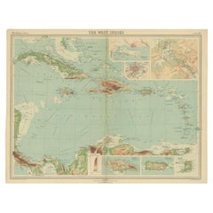
Antique Map of the West Indies in Full Color, 1922
Located in Langweer, NL
Antique map titled 'The West Indies.' A map of the West Indies, the Carribean region. This includes
Category
20th Century Vintage West Indies Map
Materials
Paper
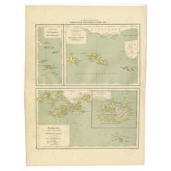
Antique Map of the West Indies and Ambon in Indonesia, 1900
Located in Langweer, NL
-Eilanden en Banda-Eilanden'. Old map of the Dutch West Indies and Ambon Island, Indonesia. This map
Category
20th Century Vintage West Indies Map
Materials
Paper
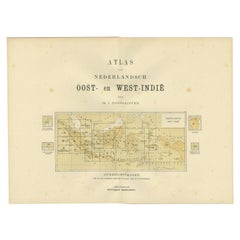
Antique Map of the East Indies by Dornseiffen, 1900
Located in Langweer, NL
of the various maps included in this atlas. Included are the Dutch East Indies and the Kingdom of the
Category
20th Century Vintage West Indies Map
Materials
Paper
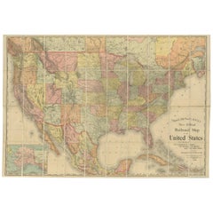
Antique Railroad Map of the United States by Rand, McNally & Co, 1900
Located in Langweer, NL
portions of The Dominion of Canada, The Republic of Mexico and the West Indies'. Large railroad map of the
Category
20th Century Vintage West Indies Map
Materials
Linen, Paper
Free Shipping
H 30.91 in W 43.9 in D 0.02 in
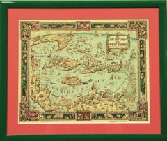
"The Story Map Of The West Indies" 1936
Located in Bristol, CT
Framed colour map of the West Indies published 1936 w/ border design motif adapted from native West
Category
1930s Vintage West Indies Map
Materials
Paper
'Balinese Boy' by Arie Smit - Original Signed Lithograph (circa 1980s) 75/99
Located in London, GB
Arts in Rotterdam. He was sent to the Netherlands East Indies (Indonesia) for military service in 1938
Category
1980s Modern Vintage West Indies Map
Materials
Lithograph
People Also Browsed
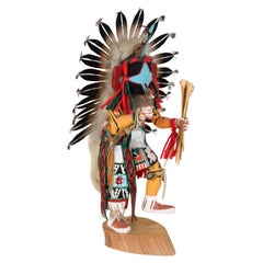
Chasing Star Performing a Dance - Kachina Doll by Rena Jean (Whitehorse)
Located in Soquel, CA
Chasing Star Performing a Dance - Kachina Doll by Rena Jean (Whitehorse)
Brightly painted, dynamic sculpture by Rena W. Jean ( Rena Whitehorse Jean) Hopi. The figure is dressed in o...
Category
1990s American Native American Vintage West Indies Map
Materials
Fur, Leather, Wood, Paint, Feathers
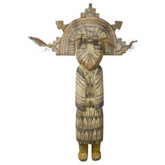
Native American Hopi Hemis Large Wood Kachina Katsina Doll Totem Sculpture 1800s
Located in Studio City, CA
A wonderfully hand-painted and decorated, monumental Native American Hopi Hemis Kachina Katsina doll/totem. Made from heavy wood this work features an elaborate headdress, called a t...
Category
Early 20th Century American Native American Vintage West Indies Map
Materials
Wood, Paint
H 21.5 in W 11 in D 3.5 in
Vintage Map of the Greater Antilles and Lesser Antilles
Located in Langweer, NL
Vintage map titled 'Antilles'. Original map of the Antilles. Shows the Cayman Islands, Cuba, Hispaniola (subdivided into the nations of the Dominican Republic and Haiti), Jamaica, an...
Category
20th Century Vintage West Indies Map
Materials
Paper
A truly delightful miniature terrestrial pocket globe
By Nathaniel Mills
Located in ZWIJNDRECHT, NL
A truly delightful miniature terrestrial pocket globe in a celestial case, 3 inches / 6.8 cm. The globe consists of 12 wonderful varnished, engraved hand-coloured gores that stretch ...
Category
Mid-18th Century British Dutch Colonial Vintage West Indies Map
Materials
Other
Engraving by Tallis and Rapkin of Map of the West Indies in The Caribbean, 1851
Located in Langweer, NL
John Tallis' 1851 map of the West Indies stands as a striking example of his renowned cartographic work. With meticulous detail and artistic embellishments, this map offers a compreh...
Category
Mid-19th Century Vintage West Indies Map
Materials
Paper
H 10.44 in W 14.57 in D 0 in
Native American Roach, Plains, 20th Century
Located in Denver, CO
A plains Indian roach “Headdress or Hair Ornament”. Custom display stand is included. Dimensions without stand measures 15 x 15 x 16 inches. Height with stand is 21 inches.
Category
20th Century American Native American Vintage West Indies Map
Materials
Fur
Delicate Hepplewhite Oval Stand, Circa:1780
By George Hepplewhite
Located in Alexandria, VA
This beautiful and delicate Hepplewhite stand has an usual feature. While it is mahogany veneer, the secondary wood including the sides & bottom of the drawer is cedar, which indicat...
Category
Late 18th Century Unknown Hepplewhite Vintage West Indies Map
Materials
Mahogany, Cedar
Rare Aztec Colonial Polychromed Wood Sculpture! Holy Imagene Bultos Santos Icons
Located in Peoria, AZ
MUSEUM PERFECTION !
AZTEC INFLUENCED
LATIN AMERICAN
COLONIAL ART
AMAZINGLY RARE PIECE !
Approx. 14" x 8" x 2 1/2"
After Hernán Cortés conquered the Aztec empire, paint...
Category
17th Century Mexican Spanish Colonial Vintage West Indies Map
Materials
Wood
H 8 in W 14 in D 2.5 in
19th Century Northern Plains Hair Drop
By Native American Art
Located in Coeur d'Alene, ID
Northern Plains hair drop with red beading with accents on hide, long quilled drops ending in tin cones with red feather fluffs, long black horsehair drop now doubled up on beading.
...
Category
Late 19th Century American Native American Vintage West Indies Map
Materials
Hide, Beads, Feathers
Important Folk Art Trade Sign
Located in Greenwich, CT
A mid 19th Century folk art trade sign of demilune form, depicting a Native American chief holding a peace pipe and tomahawk wearing a headdress of white and red feathers, wearing a ...
Category
19th Century American Folk Art Vintage West Indies Map
Materials
Wood
Large Antique 1859 Map of North America
Located in Sag Harbor, NY
This Map was made by Augustus Mitchell in 1859 It is in amazing condition for being 163 years old. This price is for the rolled up easy to ship version of this piece. I will be Frami...
Category
Mid-19th Century American Vintage West Indies Map
Materials
Canvas, Paper
Antique Map of Cuba, Haiti and Porto Rico by W. G. Blackie, 1859
Located in Langweer, NL
Antique map titled 'The Leeward or North Caribbean Islands'. Original antique map of Cuba, Haiti and Porto Rico. This map originates from ‘The Imperial Atlas of Modern Geography’. Pu...
Category
Mid-19th Century Vintage West Indies Map
Materials
Paper
Antique World Map by P. Schenk '1706'
By Peter Schenk
Located in Langweer, NL
Antique map titled 'Diversa Orbis Terrae. Visu Incedente per Coluros Tropicorum, Ambos Ejus Polos, et Parciularis Sphaerae Zenith, in Planum Orthographica Projectio (..) Plat Ontwerp...
Category
Early 18th Century Vintage West Indies Map
Materials
Paper
Lapis Lazuli Native American Indian Chief Statue
Located in Somis, CA
We discovered, and through extraordinary efforts acquired this rare lapis lazuli Indian chief statue, capturing the essence of a Native American leader adorned in his magnificent fea...
Category
20th Century North American Native American Vintage West Indies Map
Materials
Lapis Lazuli
Original Antique Map of the West Indies by J. Arrowsmith, 1842
Located in Langweer, NL
Title: "J. Arrowsmith's 19th Century Map of the West Indies"
This original antique map, crafted by J. Arrowsmith, details the West Indies with a focus on the Caribbean Sea and its s...
Category
Early 19th Century Vintage West Indies Map
Materials
Paper
No Reserve
H 20.87 in W 27.17 in D 0 in
Full Body Weathervane of American Indian Warrior
Located in Atlanta, GA
An Americana folk art copper weathervane circa early 20th century. The full-bodied piece depicts a Native American warrior in feather headdress and a wide belt shooting an arrow from...
Category
Early 20th Century American Folk Art Vintage West Indies Map
Materials
Copper
Recent Sales
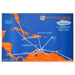
Original Vintage Poster KLM Air Travel West Indies Caribbean Islands Route Map
Located in London, GB
Original vintage travel poster for KLM Royal Dutch Airlines West Indies Division Caribbean Routes
Category
1950s Trinidadian Vintage West Indies Map
Materials
Paper
H 20.87 in W 30.71 in D 0.04 in
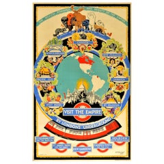
Original Vintage London Underground Poster Visit The Empire Map Tube Travel Art
Located in London, GB
Dinkel (1894-1983) showing a map marking the British Empire islands and areas in North America and South
Category
1930s British Vintage West Indies Map
Materials
Paper
H 39.77 in W 25.01 in D 0.04 in
Original Vintage Poster West Indies Pan American Airways Educational Travel Map
Located in London, GB
Original vintage poster featuring a colorful pictorial map of the West Indies showing the different
Category
1950s American Vintage West Indies Map
Materials
Paper
H 20.87 in W 25.99 in D 0.04 in
Original Vintage Poster West Indies Pan American Airways Educational Travel Map
Located in London, GB
Original vintage poster featuring a colourful pictorial map of the West Indies showing the
Category
1950s Vintage West Indies Map
Materials
Paper
Original Vintage London Underground Poster Visit The Empire Map Tube Travel Art
Located in London, GB
Dinkel (1894-1983) showing a map marking the British Empire islands and areas in North America and South
Category
1930s Vintage West Indies Map
Materials
Paper
Original Vintage Poster KLM Air Travel West Indies Caribbean Islands Route Map
By Baker
Located in London, GB
Original vintage travel poster for KLM Royal Dutch Airlines West Indies Division Caribbean Routes
Category
1950s Vintage West Indies Map
Materials
Paper
Get Updated with New Arrivals
Save "Vintage West Indies Map", and we’ll notify you when there are new listings in this category.
More Ways To Browse
Vintage Colombia Poster
Colombia Vintage Posters
Cuba Travel Poster
Retro Klm Poster
Caribbean Map Vintage
Haiti Antique
Cuba Travel Posters Vintage
Cuba Vintage Travel Poster
Rand Mcnally Vintage Maps
Stork Statue
Vintage Bartholomew Maps
Vintage Tube Map Poster
Banana Boat
Vintage Bartholomews Maps
Puerto Rico Map
Kew Gardens Poster
Trinidad Map
Pineapple Statues
