World Map Art
10
to
126
1,603
997
1,807
1,164
653
415
291
161
112
91
88
88
84
79
76
73
70
56
49
47
36
34
31
28
22
22
21
16
13
13
11
11
10
10
10
10
9
9
8
6
6
5
4
3
3
3
3
2
2
2
2
2
2
2
1
1
1
1
135
94
79
54
42
Sort By
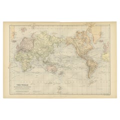
Colorful Detailed Antique Map of The World on Mercators Projection, 1882
Located in Langweer, NL
The 'World of Mercator's Projection' is a map with a stunning portrayal of global geography and
Category
Antique 1880s Maps
Materials
Paper
H 14.97 in W 22.45 in D 0 in
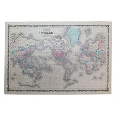
1864 Johnson's Map of the World on Mercator's Projection, Ric.B009
Located in Norton, MA
An 1864 Johnson's map of
the World on Mercator's Projection
Ric.b009
About this Item
Category
Antique 19th Century Dutch Maps
Materials
Paper
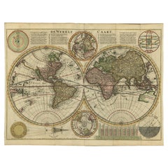
Antique Double Hemisphere World Map with California as an Island, 1710
Located in Langweer, NL
hemisphere world map from a Dutch bible by Cornelis Dankerts (Danckerts), engraved by Albert Schut, printed
Category
Antique 1710s Maps
Materials
Paper
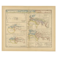
Original Old Composite of Several Maps of the Ancient World on One Sheet, 1880
Located in Langweer, NL
Theodorus Menke. The map is a detailed depiction of the ancient world. The atlas it comes from is known for
Category
Antique 1880s Maps
Materials
Paper
Free Shipping
H 15.56 in W 18.51 in D 0 in
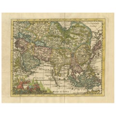
Cartographic Elegance: The Art and Science of 17th-Century Asian Maps, ca.1681
Located in Langweer, NL
geographical knowledge of its time but also the intertwining of art and science in map-making.
The
Category
Antique 1680s Maps
Materials
Paper
H 7.49 in W 9.22 in D 0 in
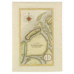
Antique Map of the Wadden Islands, 1792
Located in Langweer, NL
Antique map titled 'Der Vlie Strom'. Map of the Wadden islands with Vlieland in the middle (The
Category
Antique 18th Century Maps
Materials
Paper
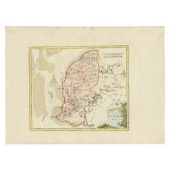
Antique Map of Westergo in Friesland, 1791
Located in Langweer, NL
Reilly (1766-1820) was a Vienna based art dealer. He is also known as the author of two atlases. The maps
Category
Antique 18th Century Maps
Materials
Paper
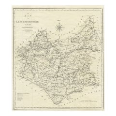
Large Antique County Map of Leicestershire, England, 1805
Located in Langweer, NL
Explore Leicestershire's Past: Antique Map by John Cary
Step into the history of Leicestershire
Category
Antique Early 19th Century Maps
Materials
Paper
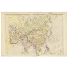
Historical Map Depicting the Continent of Asia, 1882
Located in Langweer, NL
This 1882 map presents a meticulously detailed representation of the continent of Asia, a testament
Category
Antique 1880s Maps
Materials
Paper
Antique Map of Friesland by Von Reilly, 1791
Located in Langweer, NL
(1766-1820) was a Vienna based art dealer. He is also known as the author of two atlases. The maps were
Category
Antique 18th Century Maps
Materials
Paper
1915 "San Francisco City and County" Hanging Map by W. Bashford Smith
Located in Colorado Springs, CO
Presented is a rare wall map of San Francisco by W. Bashford Smith. Published in San Francisco in
Category
Vintage 1910s American Art Deco Maps
Materials
Wood, Paper
Antique Map of Northern Asia by Mallet, 1719
Located in Langweer, NL
star maps, maps of the ancient and modern world, and a synopsis of the customs, religion and government
Category
Antique 18th Century Maps
Materials
Paper
Antique Map of the Holy Land by Schut, 1710
Located in Langweer, NL
original antique maps to collectors, historians, educators and interior decorators all over the world. Our
Category
Antique 18th Century Maps
Materials
Paper
Antique Map of Southern Zeeland by Von Reilly, 1790
Located in Langweer, NL
' (Wien: Reilly, 1791-1806), a world atlas in 830 maps by Franz Joseph Johann von Reilly. Artists and
Category
Antique 18th Century Maps
Materials
Paper
Antique Map of Friesland by Bussemacher in Frame, c.1592
Located in Langweer, NL
Original antique map titled 'Frisiae Antiquissimae (..)'. Original antique map of Friesland
Category
Antique 18th Century Maps
Materials
Paper
Antique Map of the Spice Islands by Van Linschoten, 1598
Located in Langweer, NL
makers’ art showing the latest geography of an area of the world that became the Holy Grail for the
Category
Antique 16th Century Maps
Materials
Paper
Antique Map of the Netherlands and Belgium by Hérisson, 1829
Located in Langweer, NL
map, was a known figure in the cartographic and publishing world of the early 19th century. His work
Category
Antique Mid-19th Century Maps
Materials
Paper
Antique Map of the Middle East by Von Sandrart, 1708
Located in Langweer, NL
Antique map titled 'Die Gegend des Irdlisches Paradieses und des Landes Kanaan.' Map of the Middle
Category
Antique 18th Century Maps
Materials
Paper
19th Century Illustrated Map of Ceylon (Sri Lanka) with Notable Landmarks
Located in Langweer, NL
John Tallis & Company is known for producing maps and atlases that were highly regarded for their
Category
Antique 1850s Maps
Materials
Paper
H 14.26 in W 10.71 in D 0 in
Map of Independent Tartary with Vignettes of the Region's Culture, 1851
Located in Langweer, NL
& Company:**
Known for the high level of detail and ornate borders, Tallis maps are works of art in the
Category
Antique 1850s Maps
Materials
Paper
No Reserve
H 10.71 in W 14.26 in D 0 in
Antique Map of the Westerkwartier Region, a Region in Groningen, 1791
Located in Langweer, NL
Antique map titled 'Das Wester Quartier'. Original antique map of Westerkwartier, a region in the
Category
Antique 18th Century Maps
Materials
Paper
Antique Map of the Northern Part of Scotland by Black '1854'
Located in Langweer, NL
the Orkney Isles. This map originates from 'General Atlas Of The World: Containing Upwards Of Seventy
Category
Antique Mid-19th Century Maps
Materials
Paper
1644 Janssonius Original Wine Regions Map: The Ducal and Comital Burgundy
Located in Langweer, NL
This authentic handcolored map is a detailed 17th-century depiction of the Burgundy region
Category
Antique 1640s Maps
Materials
Paper
Free Shipping
H 19.1 in W 22.84 in D 0 in
Original Antique Map of the West Indies by J. Arrowsmith, 1842
Located in Langweer, NL
Title: "J. Arrowsmith's 19th Century Map of the West Indies"
This original antique map, crafted by
Category
Antique Early 19th Century Maps
Materials
Paper
No Reserve
H 20.87 in W 27.17 in D 0 in
Antique Map of the Region of Gaasterland, Friesland, The Netherlands, 1791
Located in Langweer, NL
the world. Our collection includes a wide range of authentic antique maps from the 16th to the 20th
Category
Antique 18th Century Maps
Materials
Paper
H 11.42 in W 12.41 in D 0 in
Antique Map of Overijssel and Drenthe by Von Reilly, c.1795
Located in Langweer, NL
Netherlands. This map originates from 'Schauplatz Der Funf Theile der Welt' (Wien: Reilly, 1791-1806), a world
Category
Antique 18th Century Maps
Materials
Paper
Antique Map of the Province Groningen in The Netherlands, c.1680
Located in Langweer, NL
(..)'.
Artists and Engravers: The Visscher family were art and map dealers in Amsterdam during the 17th century
Category
Antique 17th Century Maps
Materials
Paper
Antique Map of the Empire of the Assyriens by Mallet, 1683
By Alain Manesson Mallet
Located in Langweer, NL
decorators all over the world. Our collection includes a wide range of authentic antique maps from the 16th
Category
Antique 17th Century Maps
Materials
Paper
Antique Map of Overijssel and Drenthe by Von Reilly, c.1795
Located in Langweer, NL
Netherlands. From 'Schauplatz Der Funf Theile der Welt' (Wien: Reilly, 1791-1806), a world atlas in 830 maps
Category
Antique 18th Century Maps
Materials
Paper
Mid-19th Century Decorative Map of Asia with Cultural and Natural Vignettes
Located in Langweer, NL
-off lands. These maps are especially valued for their portrayal of the world during an era when the
Category
Antique 1850s Maps
Materials
Paper
H 10.71 in W 14.26 in D 0 in
Mid-19th Century Decorative Map of India with Cultural and Natural Vignettes
Located in Langweer, NL
The Tallis maps, including the one of India, are known for their detailed and ornamental style
Category
Antique 1850s Maps
Materials
Paper
H 14.26 in W 10.71 in D 0 in
An Ornate and Historical Tallis Map of Jamaica with Decorative Vignettes, 1851
Located in Langweer, NL
This original antique map of Jamaica is part of the renowned series created by the Tallis Company
Category
Antique 1850s Maps
Materials
Paper
H 10.71 in W 14.26 in D 0 in
Antique Map of the Provinces of Gelderland and Overijssel by Kaerius, 1617
Located in Langweer, NL
), containing altogether 63 maps of the entire world.
Condition: Good, general age-related toning; some light
Category
Antique 17th Century Maps
Materials
Paper
H 15.75 in W 20.67 in D 0 in
Antique Map of the Region of the Sok River in Russia, 1794
Located in Langweer, NL
world. Our collection includes a wide range of authentic antique maps from the 16th to the 20th
Category
Antique 18th Century Maps
Materials
Paper
Antique Map of Northern India and the Bengal Gulf by Mallet, 1686
Located in Langweer, NL
information, including star maps, maps of the ancient and modern world, and a synopsis of the customs
Category
Antique 17th Century Maps
Materials
Paper
1817 Map of Puerto Rico and the Virgin Islands with Original Hand Coloring
Located in Langweer, NL
map. This piece would have served as both a practical guide for navigation and a work of art for those
Category
Antique Early 19th Century Maps
Materials
Paper
Free Shipping
H 25.99 in W 11.03 in D 0 in
Scarce Antique Map of Greece, the Aegean, Crete and part of Asia Minor
Located in Langweer, NL
geographical accuracy of their many maps. Particularly outstanding - not only as maps but as works of art - are
Category
Antique Late 17th Century Maps
Materials
Paper
H 21.15 in W 24.49 in D 0.02 in
Antique Map of the Region of Bolsward and Sneek by Von Reilly, 1791
Located in Langweer, NL
a Vienna based art dealer. He is also known as the author of two atlases. The maps were engraved by
Category
Antique 18th Century Maps
Materials
Paper
Antique Map of the Region of Leeuwarden and Dokkum in The Netherlands, 1791
Located in Langweer, NL
a Vienna based art dealer. He is also known as the author of two atlases. The maps were engraved by
Category
Antique 18th Century Maps
Materials
Paper
H 11.42 in W 15.56 in D 0 in
Antique Map of the Region of Franeker and Harlingen by Von Reilly, 1791
Located in Langweer, NL
) was a Vienna based art dealer. He is also known as the author of two atlases. The maps were engraved
Category
Antique 18th Century Maps
Materials
Paper
Antique Map of the Region of Bolsward and Sneek by Von Reilly, 1791
Located in Langweer, NL
) was a Vienna based art dealer. He is also known as the author of two atlases. The maps were engraved
Category
Antique 18th Century Maps
Materials
Paper
Antique Map of the Coast of North and East Asia by Diderot, 1751
By Denis Diderot
Located in Langweer, NL
original antique maps to collectors, historians, educators and interior decorators all over the world. Our
Category
Antique 18th Century Maps
Materials
Paper
1948 "A Hysterical Map of Yellowstone National Park" by Jolly Lindgren, 2nd Ed.
Located in Colorado Springs, CO
Presented is a second edition printing of Jolly Lindgren’s “Hysterical Map of Yellowstone National
Category
Vintage 1940s American Maps
Materials
Paper
H 20 in W 20 in D 0.75 in
Old Map of the Empire of the Assyriens & the Tigres and Euphrates Rivers, 1683
Located in Langweer, NL
, maps of the ancient and modern world, and a synopsis of the customs, religion and government of the
Category
Antique 1680s Maps
Materials
Paper
H 8.27 in W 5.12 in D 0 in
Antique Map of Asia and the East Indies and Korea as a Peninsula, ca.1660
Located in Langweer, NL
.
Artists and Engravers: The Visscher family were art and map dealers in Amsterdam during the 17th century
Category
Antique 17th Century Maps
Materials
Paper
Free Shipping
H 19.69 in W 24.02 in D 0 in
Antique Map of the Rhine and Moselle River Region in Germany and France, c.1680
Located in Langweer, NL
family were important art dealers and map publishers in Amsterdam. The founder of the business, C. J
Category
Antique 17th Century Maps
Materials
Paper
H 20.4 in W 23.94 in D 0 in
World Map I
Located in New York, NY
Leign Wen’s works reflect her personal and cultural histories. Having grown up on the island of Taiwan, she has a deep affinity for the elemental power of water and the forces of nat...
Category
2010s Mixed Media
Materials
Oil
World Map II
Located in New York, NY
Leign Wen’s works reflect her personal and cultural histories. Having grown up on the island of Taiwan, she has a deep affinity for the elemental power of water and the forces of nat...
Category
2010s Mixed Media
Materials
Oil
A Map of the World
By Max Ferguson
Located in Greenwich, CT
Map Room at the Public Library, Bryant Park, NYC
Born in New York City in 1959, Max Ferguson
Category
2010s Photorealist Figurative Paintings
Materials
Oil, Panel
Oil Tank map of the world
By Cal Lane
Located in Montreal, Quebec
animal-studded landscapes, to name a few scenarios. Whole worlds are mapped out and carved from the metal
Category
21st Century and Contemporary Sculptures
Materials
Metal
Money Map of the World
By Justine Smith
Located in Deddington, GB
Justine Smith.
Money Map of the World- archival inkjet print with pearlised screen print detail
Category
21st Century and Contemporary Contemporary Landscape Prints
Materials
Paper, Archival Ink, Archival Pigment
World Trade Routes - Paula Scher, Maps, Screenprint, Contemporary Art
By Paula Scher
Located in London, GB
Signed in pencil, numbered from the edition of 150.
Printed by Alexander Heinrici, New York.
Published by ARTContent Editions Limited, Vancouver.
Category
2010s Contemporary Prints and Multiples
Materials
Screen
Oil Drum Map of the World #1
By Cal Lane
Located in Montreal, Quebec
animal-studded landscapes, to name a few scenarios. Whole worlds are mapped out and carved from the metal
Category
21st Century and Contemporary Contemporary Sculptures
Materials
Metal
[World War Two map] - Dunkirk to Berlin June 1940.
Located in London, GB
[World War Two map]
Dunkirk to Berlin June 1940 - July 1945 - A Map of the Journeys Undertaken by
Category
1940s Other Art Style More Art
Materials
Color
Ornate Cartography of Colonial Grandeur: The West India Islands around 1851
Located in Langweer, NL
but also historical artifacts and works of art.
The map includes islands such as Cuba, Jamaica
Category
Antique 1850s Maps
Materials
Paper
No Reserve
H 10.71 in W 14.26 in D 0 in
Detailed Antique Cartography of Asian Russia, 1882
Located in Langweer, NL
reference works, ensured that this map was not only a tool for scholars and explorers but also a work of art
Category
Antique 1880s Maps
Materials
Paper
The Roman Empire from the Time of Constantine the Great, Published in 1880
Located in Langweer, NL
Antique map titled: "IMPERIUM ROMANORUM inde a Constantini Magni tempore," which translates to "The
Category
Antique 1880s Maps
Materials
Paper
No Reserve
H 15.56 in W 18.51 in D 0 in
1902 Americacentric Map of the World - Painting, Mixed Media, Gilding, Ink, Map
By Marco Araldi
Located in London, GB
and the awareness of geometry.
When he decided to create art, he was naturally drawn to cartography
Category
2010s Contemporary Paintings
Materials
Gold
H 24.02 in W 32.29 in D 2.37 in
Levasseur's 1852 Cartographic Portrait of Gironde: Celebrating the Bordeaux Wine
Located in Langweer, NL
products.
Maps from this era, especially those by Levasseur, are notable for their combination of art and
Category
Antique 1850s Maps
Materials
Paper
H 20.67 in W 14.06 in D 0 in
Huesca 1901: A Geographic Overview of Aragon's Northern Frontier in Spain
Located in Langweer, NL
The map provided is of the province of Huesca, located in the northeastern part of Spain, within
Category
Antique Early 1900s Maps
Materials
Paper
Free Shipping
H 20.08 in W 14.77 in D 0 in
- 1
- ...
Get Updated with New Arrivals
Save "World Map Art", and we’ll notify you when there are new listings in this category.
World Map Art For Sale on 1stDibs
Find the exact piece of world map art you’re shopping for in the variety available on 1stDibs. Find Old Masters versions now, or shop for Old Masters creations for a more modern example of these cherished works. You’re likely to find the perfect item from our selection of world map art among the distinctive items we have available, which includes versions made as long ago as the 18th Century as well as those made as recently as the 21st Century. Adding a choice in our collection of world map art to a room that is mostly decorated in warm neutral tones can yield a welcome change — find a piece on 1stDibs that incorporates elements of beige, gray, black, green and more. Creating an object in our assortment of world map art has been a part of the legacy of many artists, but those crafted by Cal Lane, Piero Pizzi Cannella, John Senex, Gregor Turk and Carel Allard are consistently popular. Artworks like these — often created in engraving, paper and lithograph — can elevate any room of your home.
How Much is a World Map Art?
The price for a piece of world map art in our collection starts at $250 and tops out at $150,000 with the average selling for $1,545.
