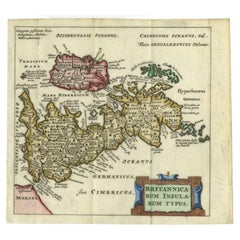
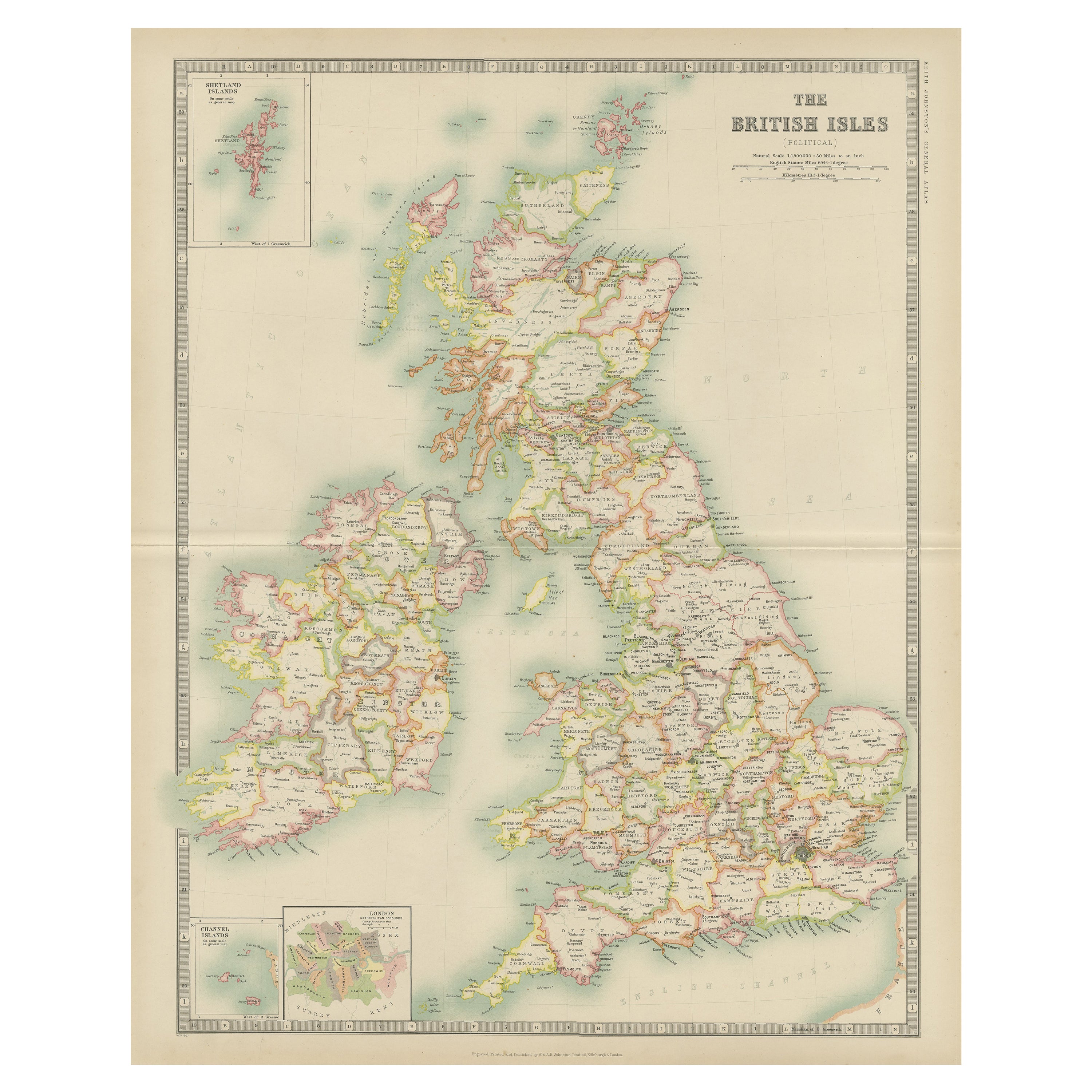
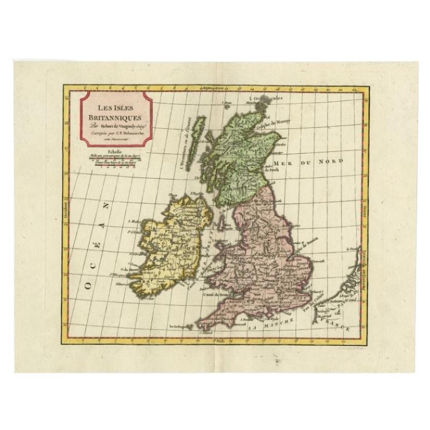
Antique Map of the British Isles by Cluver, 1685
View Similar Items


Want more images or videos?
Request additional images or videos from the seller
1 of 5
Antique Map of the British Isles by Cluver, 1685
About the Item
- Dimensions:Height: 5.12 in (13 cm)Width: 5.6 in (14.2 cm)Depth: 0 in (0.01 mm)
- Materials and Techniques:
- Period:
- Date of Manufacture:1685
- Condition:
- Seller Location:Langweer, NL
- Reference Number:Seller: PCT-620551stDibs: LU3054327770832
About the Seller
5.0
Platinum Seller
These expertly vetted sellers are 1stDibs' most experienced sellers and are rated highest by our customers.
Established in 2009
1stDibs seller since 2017
1,950 sales on 1stDibs
More From This SellerView All
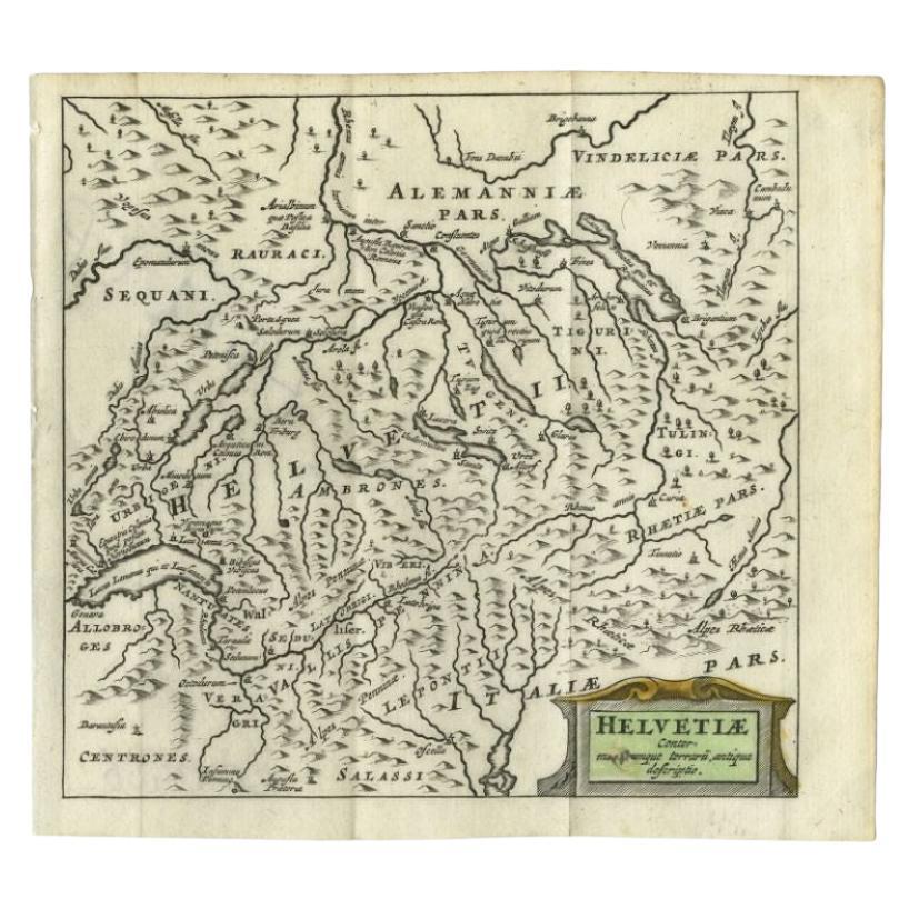
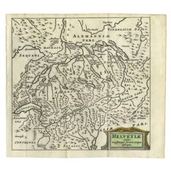
- Antique Map of Switzerland by Cluver, 1685Located in Langweer, NLAntique map titled 'Helvetiae Conterminarumque Terrarii, antiqua descriptio.' Miniature map of Switzerland, from the pocket atlas 'Introductionis in...Category
Antique 17th Century Maps
MaterialsPaper
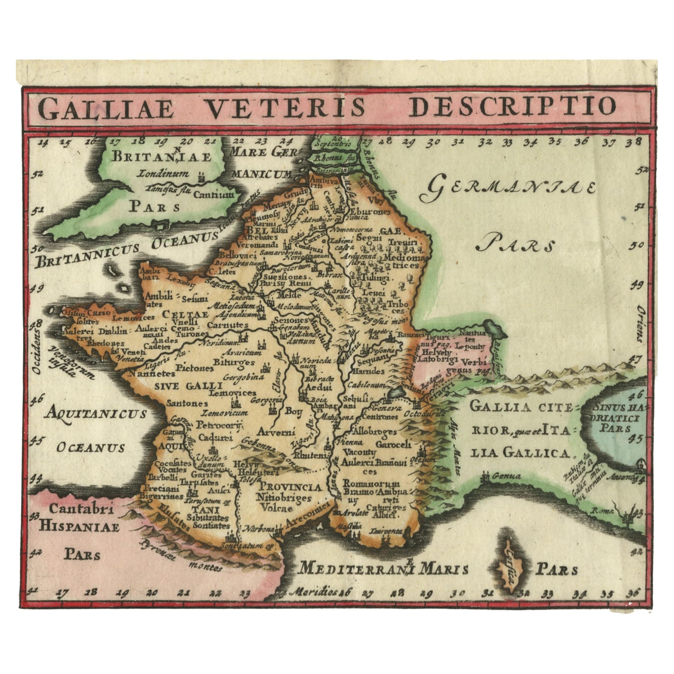
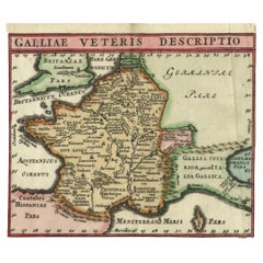
- Antique Map of France by Cluver, 1685Located in Langweer, NLAntique map titled 'Galliae Veteris Descriptio.' Charming miniature map of France from the pocket atlas 'Introductionis in Universam Geographiam tam Veterem quam novam .. Acessit P. ...Category
Antique 17th Century Maps
MaterialsPaper
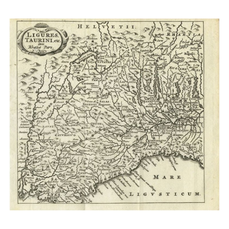
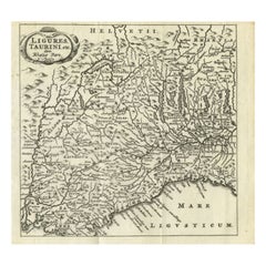
- Antique Map of Northwest Italy by Cluver, 1685Located in Langweer, NLAntique map titled 'Ligures, Taurini, etc.' Miniature map of northwest Italy. From the pocket atlas 'Introductionis in Universam Geographiam tam Veterem quam novam .. Acessit P. Bert...Category
Antique 17th Century Maps
MaterialsPaper
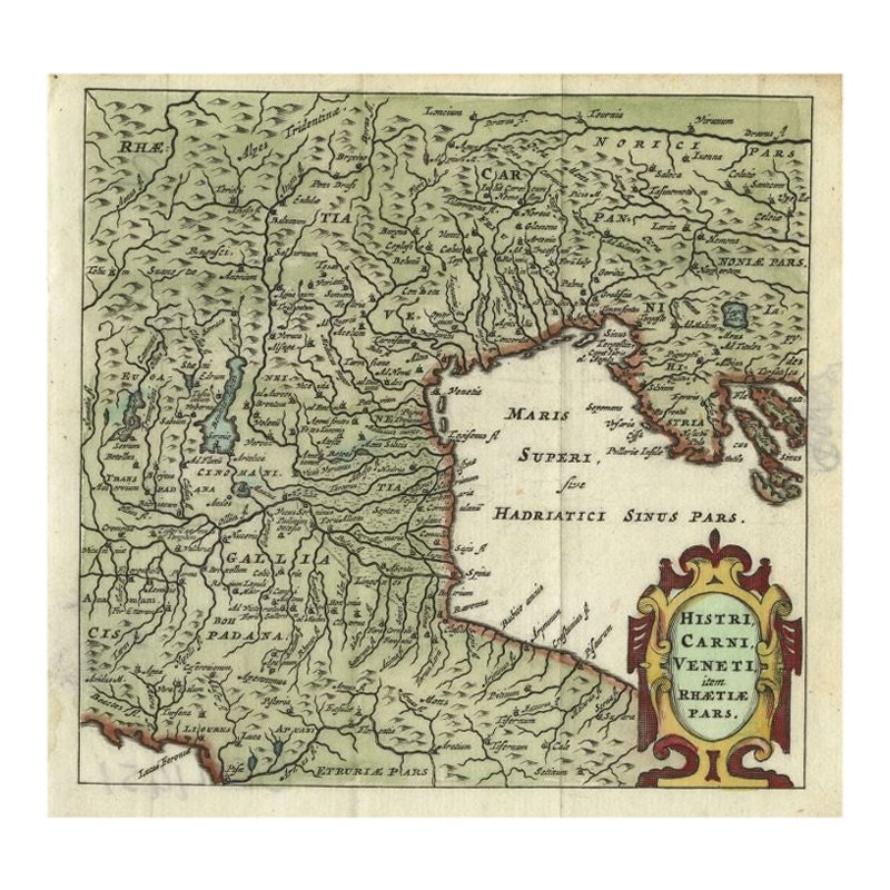
- Antique Map of Northern Italy by Cluver, 1685Located in Langweer, NLAntique map titled 'Histri, Carni, Veneti item Rhaetiae Pars.' Charming miniature map of northern Italy with the Adriatic or upper sea, now called the Gulf of Venice, from the pocket...Category
Antique 17th Century Maps
MaterialsPaper
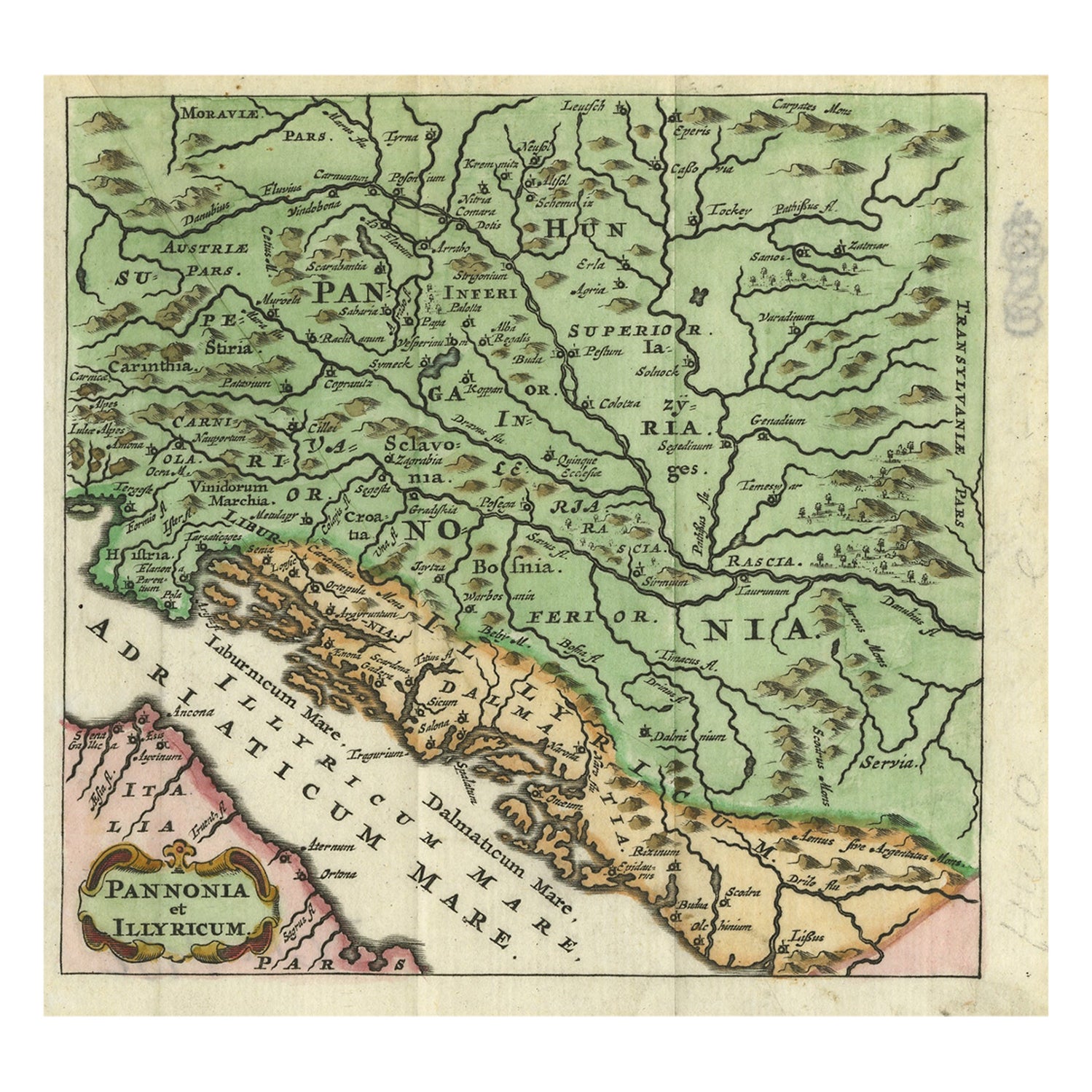
- Antique Map of Pannonia and Illyria by Cluver, 1685Located in Langweer, NLAntique map titled 'Pannonia et Illyricum.' Charming miniature map of Pannonia and Illyria, from the pocket atlas 'Introductionis in Universam Geographiam tam Veterem quam novam .. A...Category
Antique 17th Century Maps
MaterialsPaper
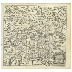
- Antique Map of Southern Germany and Switzerland by Cluver, 1685Located in Langweer, NL"Antique map titled 'Vindeliciae et Norici conterminarunque terrarum antiqua descriptio.' Miniature map of south Germany and Switzerland in Celtic times, From the pocket atlas 'Intro...Category
Antique 17th Century Maps
MaterialsPaper


You May Also Like
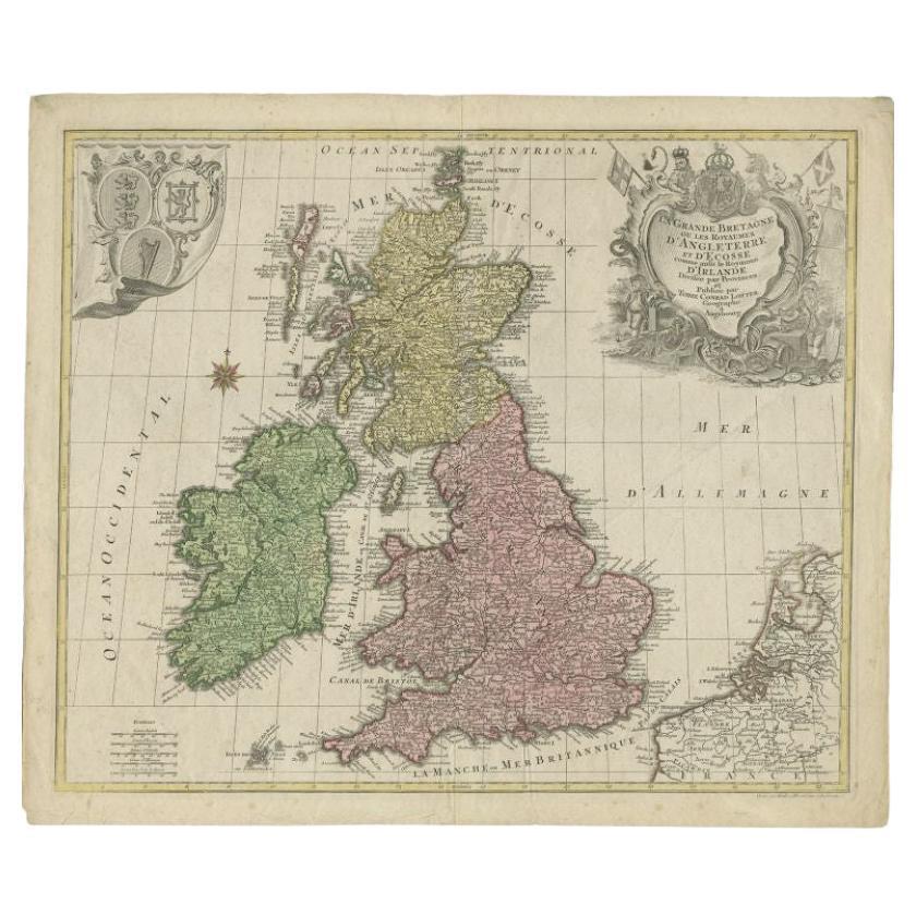
- Large 17th Century Hand Colored Map of England and the British Isles by de WitBy Frederick de WitLocated in Alamo, CAA large hand colored 17th century map of England and the British Isles by Frederick de Wit entitled "Accuratissima Angliæ Regni et Walliæ Principatus", published in Amsterdam in 1680. It is a highly detailed map of England, Scotland, the Scottish Isles...Category
Antique Late 17th Century Dutch Maps
MaterialsPaper
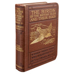
- Antique Book, Birds Of The British Isles, English, Ornithology Reference, C.1920Located in Hele, Devon, GBThis is an antique illustrated book of The Birds of the British Isles. An English, bound ornithology reference title, dating to the early 20th century, published 1920. Full Title - ...Category
Early 20th Century European Mid-Century Modern Books
MaterialsLeather, Paper
- Antique Lithography Map, Isle of Wight, English, Framed, Engraving, CartographyLocated in Hele, Devon, GBThis is an antique lithography map of the Isle of Wight. An English, framed atlas engraving of cartographic interest, dating to the early 19th century and later. Superb lithography ...Category
Antique Early 19th Century British Regency Maps
MaterialsWood
- Antique Lithography Map, Isle of Thanet, Kent, English, Cartography, VictorianLocated in Hele, Devon, GBThis is an antique lithography map of The Isle of Thanet in Kent. An English, framed atlas engraving of cartographic interest, dating to the mid 19th century and later. Superb litho...Category
Antique Mid-19th Century British Victorian Maps
MaterialsWood
- Northwest Coast and Isle of Man MapLocated in Cheshire, GBGreenville Collins Northwest Coast and Isle of Man. hand coloured chart, encased in an ebonised frame. Dimensions Height 26.5 Inches Width 30 Inches Depth 1 InchesCategory
Early 20th Century British Maps
MaterialsPaper
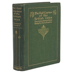
- Golf Book, Bernhard Darwin, Golf Courses of the British IslesLocated in Oxfordshire, GBAntique Golf Book, The Golf Courses of the British Isles Described by Bernard Darwin. A fantastic first edition golf book written by Bernard Darwin, one of the greatest golf writers ever to put pen to paper. 'THE GOLF COURSES OF THE BRITISH ISLES, DESCRIBED BY BERNARD DARWIN, PAINTED BY HARRY ROUNTREE...Category
Vintage 1910s British Sporting Art Books
MaterialsPaper


Recently Viewed
View AllMore Ways To Browse
Antique British Plates
Antique Plate With Metal Handle
Antique Miniature Plates
Antique German Decor
Maps Of Long Island
Map Of Long Island
Antique Map Britain
Antique Britain Map
17th Century German Engravings
Miniature Maps
Miniature Map
Antique Maps Of Long Island
Antique Map Of Long Island
Antique Map Long Island
Antique Long Island Map
Pocket Map
British Isles Antique Map
Rare Compass