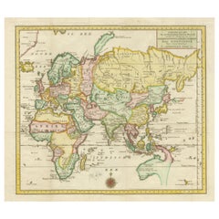
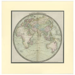
Antique Map of the Eastern Hemisphere, with Australia Connected to New Guinea
View Similar Items


Want more images or videos?
Request additional images or videos from the seller
1 of 6
Antique Map of the Eastern Hemisphere, with Australia Connected to New Guinea
About the Item
- Dimensions:Height: 16.15 in (41 cm)Width: 16.34 in (41.5 cm)Depth: 0.02 in (0.5 mm)
- Materials and Techniques:
- Period:
- Date of Manufacture:1753
- Condition:General age-related toning. Original folding lines. Shows a defect near the compass rose. Small closed tear sl. affecting image top right. Minor wear, blank verso. Please study image carefully.
- Seller Location:Langweer, NL
- Reference Number:Seller: BG-13388-31stDibs: LU3054333548732
About the Seller
5.0
Platinum Seller
These expertly vetted sellers are 1stDibs' most experienced sellers and are rated highest by our customers.
Established in 2009
1stDibs seller since 2017
1,946 sales on 1stDibs
More From This SellerView All
- Antique Map of the Eastern Hemisphere by Wyld '1845'Located in Langweer, NLAntique map titled 'Eastern Hemisphere'. Original antique map of the eastern hemisphere. This map originates from 'An Atlas of the World, Comprehending Separate Maps of its...Category
Antique Mid-19th Century Maps
MaterialsPaper

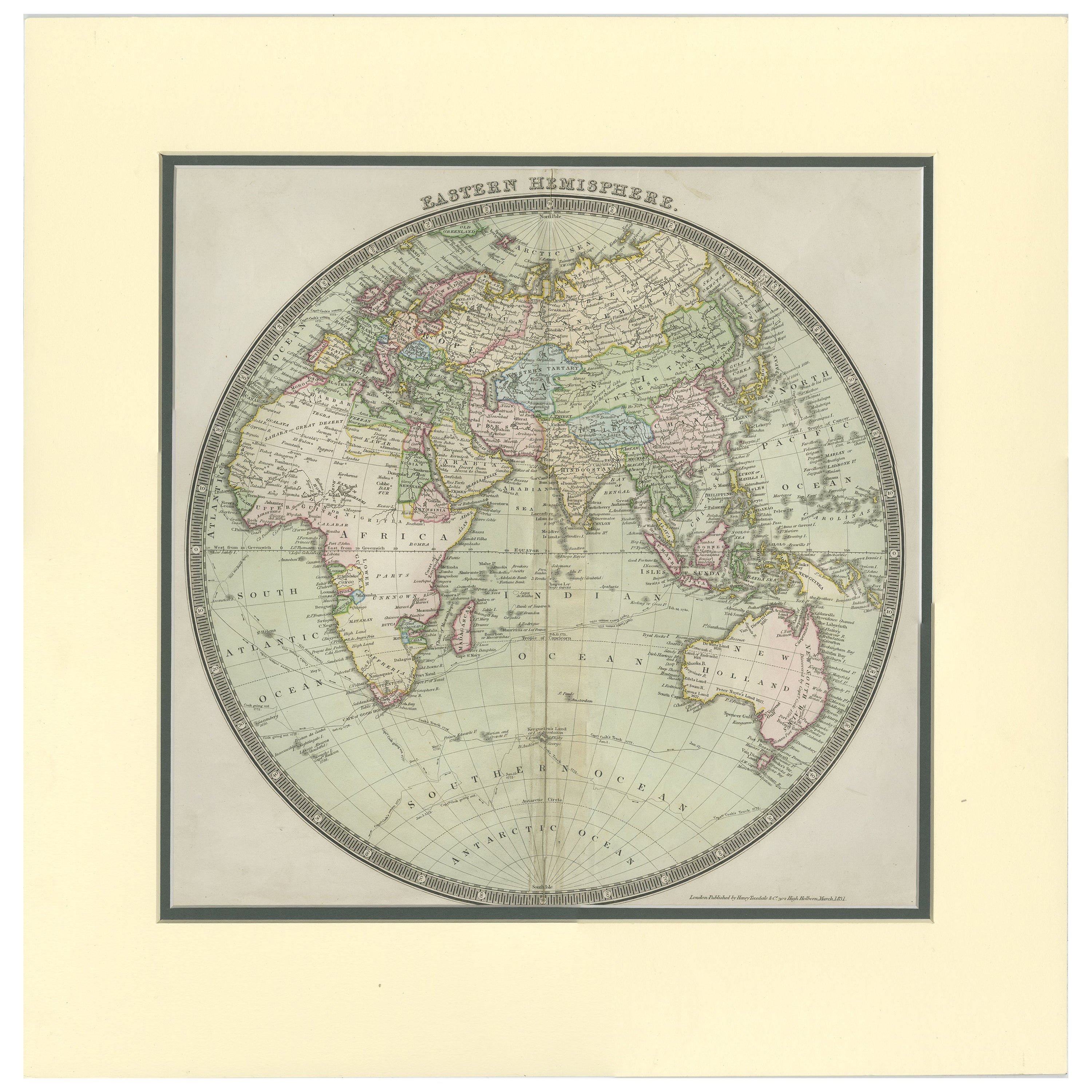
- Antique Map of the Eastern Hemisphere by Teesdale, '1831'Located in Langweer, NLAntique map titled 'Eastern Hemisphere'. Hemispherical map of eastern hemisphere showing tracks of the navigators James Cook and John Gore. Plate 1 fro...Category
Antique Mid-19th Century Maps
MaterialsPaper
 $219 Sale Price20% Off
 - Antique Map of the Eastern Hemisphere in Frame, 'circa 1683'Located in Langweer, NLAntique map titled 'Climats selon les Anciens'. Miniature map of the Eastern Hemisphere showing the climatic regions. This map originates from 'Description de l'Univers' by A.M. Mall...Category
Antique Late 17th Century Maps
MaterialsPaper
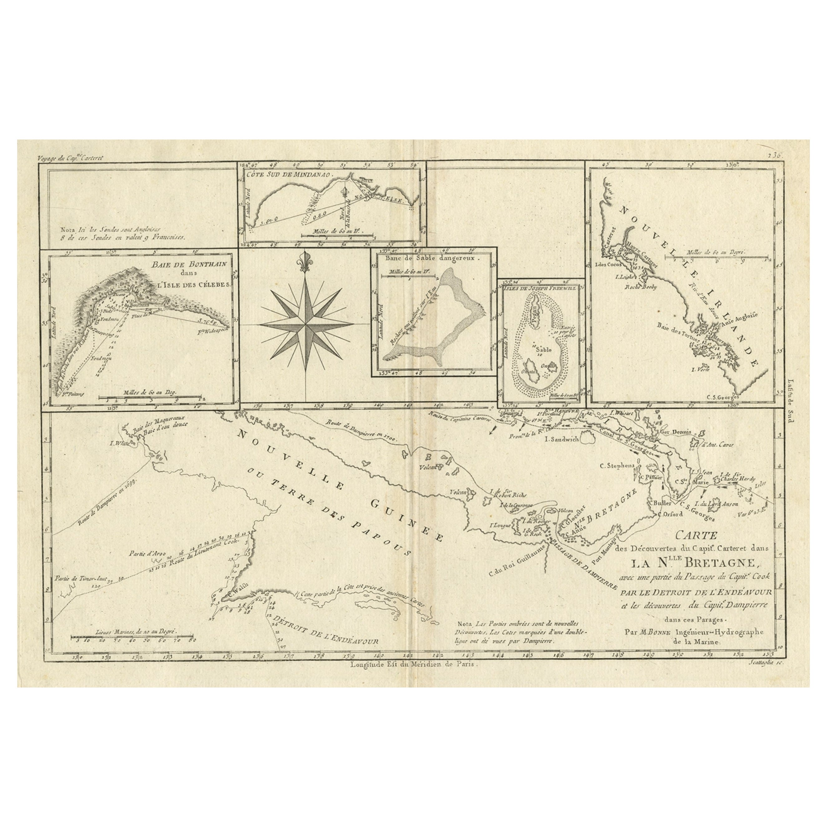
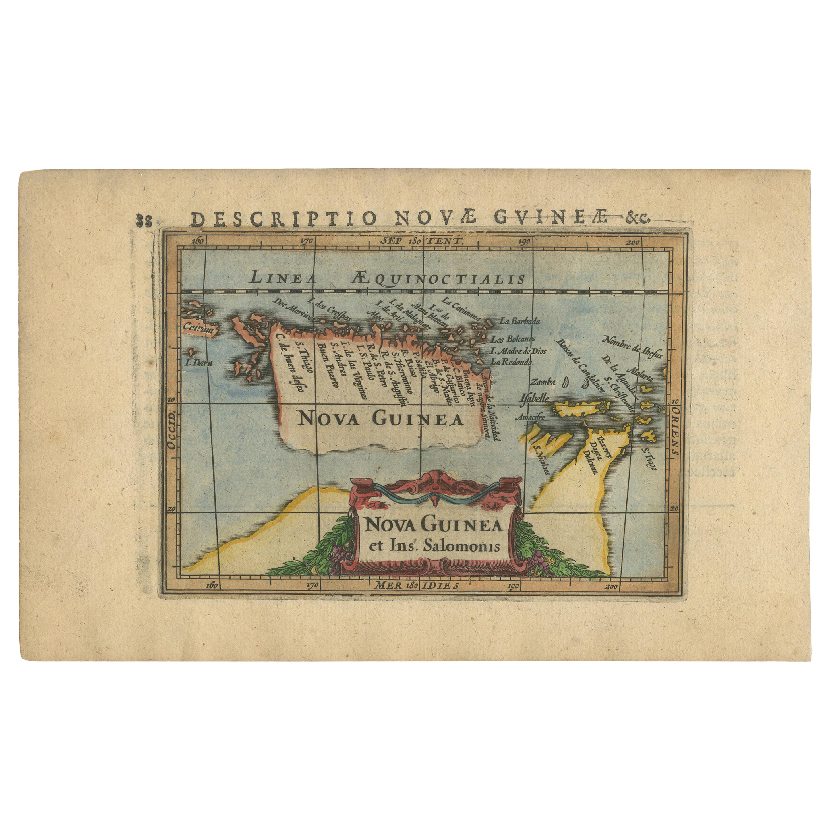
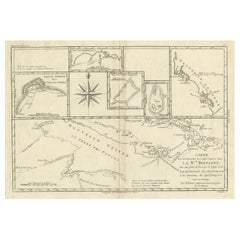
- Antique Detailed Map of Papua New Guinea and the Regions to the West, ca.1780Located in Langweer, NLAntique map titled 'Carte des Decouvertes du Capite. Carteret dans La Nlle. Bretagne avec une parte du passage du Capite. Cook Par Le Detroit De L'Endeavor ...Category
Antique 1780s Maps
MaterialsPaper
- Antique Map of the Eastern United States with Inset Map of TexasLocated in Langweer, NLAntique map titled 'Verein-Staaten von Nord-America mit Ausnahme Florida's und der Westlichen Territorien'. This map extends as far west as Louisiana and only includes the northern p...Category
Antique Mid-19th Century Maps
MaterialsPaper
 $474 Sale Price20% Off
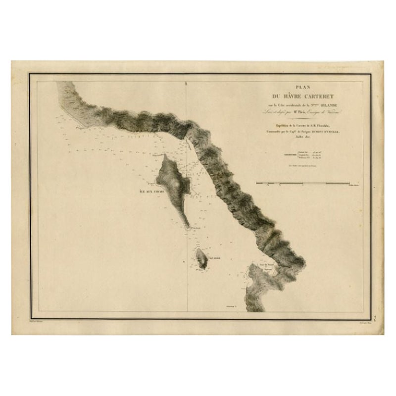
 - Antique Map of New Ireland Island in the Bismarck Archipelago, New Guinea, 1772Located in Langweer, NLAntique map titled 'Nova Hibernia'. Antique map of New Ireland, an island in the Bismarck Archipelago, New Guinea. Lying just north of New Britain, from which it is separated by St. ...Category
Antique 18th Century Maps
MaterialsPaper
 $193 Sale Price20% Off

You May Also Like
- New Map of North America from the Latest Discoveries, 1763Located in Philadelphia, PAA fine antique 18th century map of the North American seaboard. Entitled "A New Map of North America from the Latest Discoveries 1763". By the Cartographer/Engraver - John Spil...Category
Antique Mid-18th Century English Georgian Maps
MaterialsPaper
- Antique 1901 National Publishing Company's Road Map of New Jersey GeologicalLocated in Dayton, OHThe National Publishing Company's road map of New Jersey, showing all county and township divisions, cities villages and post-offices, railroads, ste...Category
Antique Early 1900s Victorian Prints
MaterialsPaper
- Scandinavia & Portions of Eastern Europe: 18th Century Hand-Colored Homann MapBy Johann Baptist HomannLocated in Alamo, CAAn early 18th century hand-colored copper-plate map entitled "Regni Sueciae in omnes suas Subjacentes Provincias accurate divisi Tabula Generalis" by Johann Baptist Homann (1663-1724...Category
Antique Early 18th Century German Maps
MaterialsPaper
- Map of the Republic of GenoaLocated in New York, NYFramed antique hand-coloured map of the Republic of Genoa including the duchies of Mantua, Modena, and Parma. Europe, late 18th century. Dimension: 25...Category
Antique Late 18th Century European Maps
- Map Silk Embroidered Western Eastern Hemisphere New Old World Asia America AfriLocated in BUNGAY, SUFFOLKA rare, late-18th century, silk, embroidered, double hemisphere, world map, blackwork, sampler, showing the tracks of captain cook’s three voyages - Illustrating public understanding of the world in the late-18th century and the recent discoveries of the time delineating the tracks of Captain Cook’s three voyages. - Shows the incentive for further exploration during the 19th century as no mass is indicated within the southern polar region, the interior portions of western North America, Africa, and Australia are still relatively void of detail even though California is no longer shown as an island. - Includes beautifully worked allegories of the four continents Asia, the Americas, Africa & Europe, a cartouche being supported by two angels and a compass - The cream, silk ground is finely embroidered with a variety of stiches in black, silk threads emulating the black ink on maps. -“Recent international conflicts and voyages by Captain Cook and others made the study of geography exciting at the time this map was made. Elaborate embroidered maps...Category
Antique 18th Century British Georgian Maps
MaterialsSilk
- Antique Map of Principality of MonacoBy Antonio Vallardi EditoreLocated in Alessandria, PiemonteST/619 - "Old Geographical Atlas of Italy - Topographic map of ex-Principality of Monaco" - ediz Vallardi - Milano - A somewhat special edition ---Category
Antique Late 19th Century Italian Other Prints
MaterialsPaper
 $228 Sale Price74% Off


Recently Viewed
View AllMore Ways To Browse
Australasia Antique Map
New Guinea African
Antique Map Bahamas
Antique Map Ontario
Antique Maps Ontario
Map Lebanon
Antique Map Montreal
Antique Maps San Diego
Lebanon Antique Map
Montreal Map
Antique Furniture Perth Australia
Antique Maps Perth
Barbados Map
Antique Map Connecticut
Antique Map Of Republic Of Texas
Antique Route 66
Giovanni Maria Cassini On Sale
Antique Map Cleveland