Mid-18th Century Maps
17
402
to
147
391
11
402
402
402
2
1
2,886
2,122
411
5
228
30
11
85
7
56
6
3
3
4
5
2
398
4
2
1
1
25
8
5
5
5
10
6
3
3
3
Period: Mid-18th Century
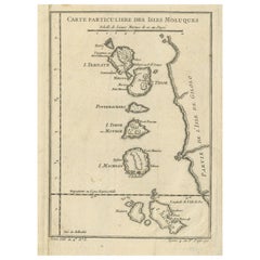
Antique Map of the Maluku Islands or Moluccas, Indonesia
Located in Langweer, NL
Antique map titled 'Carte Particuliere des Isles Moluques'. This map depicts the islands of Herij, Ternate, Tidor, Pottebackers, Timor, Machian and Bachian. The Moluccan islands were...
Category
Antique Mid-18th Century Maps
Materials
Paper
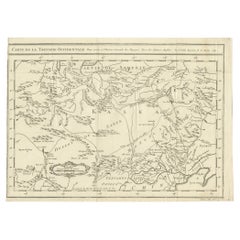
Antique Map of Western Tartary, with Information from Kyrkov's Surveys
Located in Langweer, NL
Antique map titled 'Carte de la Tartarie Occidentale'. This map covers western Tartary with a focus on the region of present-day Mongolia. This map includes information from Kyrkov's...
Category
Antique Mid-18th Century Maps
Materials
Paper
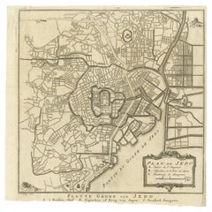
Antique Street Map of the City of Edo 'Modern Tokyo' in Japan
Located in Langweer, NL
Antique map titled 'Plan de Jedo - Platte Grond van Jedo'. A detailed street map of the city of Edo (modern Tokyo) in Japan, originally engraved by Bellin and Schley and reissued for...
Category
Antique Mid-18th Century Maps
Materials
Paper
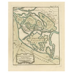
Antique Map of the Region of Aigues-Mortes and Camargue, France
Located in Langweer, NL
Antique map titled 'Environs d'Aiguemortes de Peccais &a et la petite Camargue'. Original map of the region of Aigues-Mortes and Camargue, France. This map originates from 'Le Petit ...
Category
Antique Mid-18th Century Maps
Materials
Paper
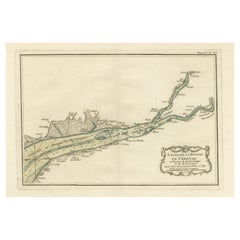
Antique Map of the Gironde, part of the Dordogne and the Garonne, France
Located in Langweer, NL
Antique map titled 'Cours de la riviere de Gironde et parties de la Dordogne et de la Garonne depuis Bourdeaux jusqu'au banc de Bey'. Original old map of the Gironde, part of the Dor...
Category
Antique Mid-18th Century Maps
Materials
Paper
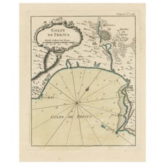
Antique Map of the Region of Fréjus, France
Located in Langweer, NL
Title: "Golf de Fréjus"
Description: This antique map, titled "Golf de Fréjus," is an original depiction of the region of Fréjus, France. It is part of the work "Le Petit Atlas Mari...
Category
Antique Mid-18th Century Maps
Materials
Paper
Original Antique Map of Normandy, France
Located in Langweer, NL
Antique map titled 'Carte de Normandie (..)'. Attractive map of Normandy, France. it depicts the former French Duchy of Normandy, covers the region fro...
Category
Antique Mid-18th Century Maps
Materials
Paper
Interesting Map of Great Britain and Northern Europe with various Illustrations
Located in Langweer, NL
Antique map titled 'Itinera Varia Auctoris'. Very interesting map of Great Britain and Northern Europe. The map shows Edwards' journeys between 1716-1730 to study his beloved birds a...
Category
Antique Mid-18th Century Maps
Materials
Paper
Antique Map of Manchuria and the Northeast Portion of Tartary
Located in Langweer, NL
Antique map titled 'Carte de la Tartarie Orientale (..)'. Detailed map of Manchuria and the Northeast portion of Tartary, including Sagallan Anga Hata--Isle de la Bouche...
Category
Antique Mid-18th Century Maps
Materials
Paper
Antique Map of the Languedoc Coast between Agde and Sète 'Cette', France
Located in Langweer, NL
Antique map titled 'Coste de Languedoc depuis Agde jusqu'a Cette'. Original map of the Languedoc coast between Agde and Sète (historically Cette), France. This map originates from 'L...
Category
Antique Mid-18th Century Maps
Materials
Paper
Antique Map of the Coast of Roussillon, France
Located in Langweer, NL
Antique map titled 'Coste de Roussillon depuis Port Vendres, jusqu'au golphe de Rozes'. Original map of the coast of Roussillon, France. This map originates from 'Le Petit Atlas Mari...
Category
Antique Mid-18th Century Maps
Materials
Paper
Antique Map Centered on Turkestan
Located in Langweer, NL
Antique map titled 'Carte de Karazm, Turkestan et Grande Bukarie'. Engraved map centered on Turkestan. Extends to include the Black and Caspian Seas, Uzbekistan, Tajikistan, Turkmeni...
Category
Antique Mid-18th Century Maps
Materials
Paper
Antique Map of the Bay of Brusc, France
Located in Langweer, NL
Antique map titled 'Carte de la rade du Brusc'. Original map of the bay of Brusc, France. This map originates from 'Le Petit Atlas Maritime (..)' by J.N. Bellin. Published 1764.
...
Category
Antique Mid-18th Century Maps
Materials
Paper
Antique Plan of Port-Vendres, Roussillon, France
Located in Langweer, NL
Antique map titled 'Plan de Port Vendre en Roussillon'. Original plan of Port-Vendres, Roussillon, France. This map originates from 'Le Petit Atlas Maritime (..)' by J.N. Bellin. Pub...
Category
Antique Mid-18th Century Maps
Materials
Paper
Antique Plan of Meaco, Kyoto, Japan
Located in Langweer, NL
Antique map titled 'Plan de la Ville de Meaco - Platte-Grond van de Stad Miaco'. Detailed and unusual antique copper engraved plan of Kyoto, ancient named Meaco, when it was the capi...
Category
Antique Mid-18th Century Maps
Materials
Paper
Antique Map of the Region of Berre-l'Étang, France
Located in Langweer, NL
Antique map titled 'Carte des etangs de Berre de Martigue et environs'. Original map of the region of Berre-l'Étang, France. This map originates from 'Le Petit Atlas Maritime (..)' b...
Category
Antique Mid-18th Century Maps
Materials
Paper
Antique Map of France with Decorative Title Cartouche
Located in Langweer, NL
Antique map titled 'Carte de la France'. Original old map of France. This map originates from 'Le Petit Atlas Maritime Recueil De Cartes et Plans Des Quatre Parties Du Monde (..) by ...
Category
Antique Mid-18th Century Maps
Materials
Paper
Antique Plan of the Region of Cassis, France
Located in Langweer, NL
Antique map titled 'Plan de Cassis et environs'. Original plan of the region of Cassis, France. This map originates from 'Le Petit Atlas Maritime (..)' by J.N. Bellin. Published 1764...
Category
Antique Mid-18th Century Maps
Materials
Paper
Small Antique Map of England and Wales as It Was During the Heptarchy
Located in Langweer, NL
Antique map titled 'La Britannique dans sa Heptarchie Anglois Saxonique'. This little map shows England and Wales as it was during the Heptarchy, a phrase referring to the seven king...
Category
Antique Mid-18th Century Maps
Materials
Paper
Antique Map of Guyenne, Gascony and Béarn, France
Located in Langweer, NL
Antique map titled 'Guyenne et Gascogne et Bearn'. Original old map of Guyenne (or Guienne), Gascony and Béarn, France. This map originates from 'Le Petit Atlas Maritime Recueil De C...
Category
Antique Mid-18th Century Maps
Materials
Paper
Antique Map of the Coast of France Between Brest and Bayonne
Located in Langweer, NL
Antique map titled 'Carte des Costes de France depuis Brest jusquá Bayone'. Original old map of the coast of France between Brest and Bayonne. This map originates from 'Le Petit Atla...
Category
Antique Mid-18th Century Maps
Materials
Paper
Antique Map of the Region of Martigues, France
Located in Langweer, NL
Title: "Etang de Martigues et Environs: Antique Map of the Martigues Region, France"
Description: This antique map, titled "Etang de Martigue et Environs," offers a detailed view of...
Category
Antique Mid-18th Century Maps
Materials
Paper
Antique Map of the Languedoc Canal, Between Touloouse and Marseillette, France
Located in Langweer, NL
Antique map titled 'Carte du canal de Languedoc depuis Toulouse jusqu'a I'etang de Marceillette'. Original old map of the Languedoc Canal, between Touloouse and Marseillette, France....
Category
Antique Mid-18th Century Maps
Materials
Paper
Antique Map of Champagne and surrounding Regions, France
Located in Langweer, NL
Antique map titled 'Carte de la Champagne et des Pays Voisins (..)'. Detailed map of Champagne and surrounding regions of Chalons and Soissons, Reims, Vedun, Mouzon, Sean, Charlemont...
Category
Antique Mid-18th Century Maps
Materials
Paper
Original Map of The Northern Arabian Peninsula, Palestine, Iraq & Iran, 1732
Located in Langweer, NL
Antique map titled 'Nieuwe kaart van Irak Arabi, Kurdistan, Diarbek (..).'
Detailed map including the northern part of the Arabian peninsula, Pales...
Category
Antique Mid-18th Century Maps
Materials
Paper
New Map of North America from the Latest Discoveries, 1763
Located in Philadelphia, PA
A fine antique 18th century map of the North American seaboard.
Entitled "A New Map of North America from the Latest Discoveries 1763".
By the Cartographer/Engraver - John Spil...
Category
English Georgian Antique Mid-18th Century Maps
Materials
Paper
Large Antique Map of Gaul, or France in Ancient Roman Times
Located in Langweer, NL
Original antique map titled 'Gallia Antiqua ex Aevi Romani Monumentis (..)'. Large map of Gaul, or France in ancient Roman times, showing Roman provinces. Inset bottom left a detaile...
Category
Antique Mid-18th Century Maps
Materials
Paper
Antique Print of the Batavia Massacre 'Present-Day Jakarta', Indonesia
Located in Langweer, NL
Antique print titled 'Tableau de la Partie de Batavia, ou s'est fait proprement le terrible Massacre des Chinois (..)'. Original antique print of the Batavia massacre. The 1740 Batav...
Category
Antique Mid-18th Century Maps
Materials
Paper
Original Antique Map of Malabar, Coromandel 'India' and Ceylon
Located in Langweer, NL
Antique map titled 'Peninsula Indiae citra Gangem, hoc est Orae celeberrimae Malabar & Coromandel (..)'. Large and attractive original hand colored map of Sri Lanka and the Southern ...
Category
Antique Mid-18th Century Maps
Materials
Paper
Beautiful Antique Map of the Northern Hemisphere with California as an Island
By Isaak Tirion
Located in Langweer, NL
Antique map titled 'Nieuwe Kaart van de Noord Pool na de alderlaatste ontdekking int licht gebracht tot Amsterdam door Isaak Tirion'. Beautiful map of the Northern Hemisphere and Nor...
Category
Antique Mid-18th Century Maps
Materials
Paper
Antique Print with a Plan of Kunta Kinteh Island and views of Fort James, Gambia
Located in Langweer, NL
Antique print titled 'Plan of Iames Island in the Gambia - N.E. Prospect of Iames Fort - N.N.W. Prospect of Iames Fort'. Print with a plan of Kunta Kinteh I...
Category
Antique Mid-18th Century Maps
Materials
Paper
Original Antique Map of Northern India
Located in Langweer, NL
Antique map titled 'Carte de l'Indoustan (..) - Kaart van Hindoestan (..)'. Original antique map of northern India. This map originates from 'His...
Category
Antique Mid-18th Century Maps
Materials
Paper
Antique Plan of Plan of St. Julian's Harbour on the Coast of Patagonia
Located in Langweer, NL
Antique map titled 'Plan des Hafens St. Iulian auf der Küste von Patagonien'. Plan of St. Julian's Harbour on the Coast of Patagonia. This map originates from a German edition of 'Voyage around the World...
Category
Antique Mid-18th Century Maps
Materials
Paper
Antique Map of India, the East Indies and the Philippines
Located in Langweer, NL
Antique map titled 'Les Indes Orientales et leur Archipel'. Original antique map of India, the East Indies and the Philippines. Source unknown, to be determined. Published circa 1760.
Category
Antique Mid-18th Century Maps
Materials
Paper
Antique Map of the Bay of Manila, Capital of the Philippines
Located in Langweer, NL
Antique map titled 'Abzeichnung des Meerbusens bey Manila'. Map of the Bay of Manila, capital of the Philippines. This map originates from a German edition of 'Voyage around the World...
Category
Antique Mid-18th Century Maps
Materials
Paper
Original Antique Map of North and South America in Attractive Old Coloring
By Isaak Tirion
Located in Langweer, NL
Antique map titled 'Nieuwe Kaart van America'. Beautiful map of America. The fabled Quivira is used to name a large mountain range placed just north of Mexico. Published by I. Tirion...
Category
Antique Mid-18th Century Maps
Materials
Paper
Antique Map of Senegal, West Africa
Located in Langweer, NL
Original antique map titled 'Carta del Senegal'. Antique map of Senegal, West Africa. This map originates from 'Compendio della storia generale dei viaggi (..)'. Published by De la Harpe...
Category
Antique Mid-18th Century Maps
Materials
Paper
Antique Map Plan of Town and Mole of CAP D'agde & Fort De Brescou, France, 1759
Located in Langweer, NL
Antique Plan titled 'Plan of the Town and Mole of Agde with the Fort de Brescou'. Antique town plan of Agde, engraved for the Geographical Dictionary, by Rol...
Category
Antique Mid-18th Century Maps
Materials
Paper
Rare Handcolored Map of Isle de Juan Fernandes 'Robinson Crusoe Island', Chili
Located in Langweer, NL
Antique map titled 'Die Insel Iuan Fernandes in der Sudsee (..)'. This map depicts Robinson Crusoe, one of the Juan Fernández Islands.
Robinson Crusoe Island, formerly known as Más a Tierra, is the second largest of the Juan Fernández Islands. From 1704 to 1709, the island was home to the marooned sailor Alexander Selkirk, who at least partially inspired novelist Daniel Defoe's fictional Robinson Crusoe in his 1719 novel, although the novel is explicitly set in the Caribbean.
This was just one of several survival stories from the period of which Defoe would have been aware. To reflect the literary lore associated with the island and attract tourists, the Chilean government renamed the place Robinson Crusoe Island in 1966. This map originates from a German edition of 'Voyage around the World...
Category
Antique Mid-18th Century Maps
Materials
Paper
Detailed Decorative Antique Map of the Coast of Malabar and Coromandel, India
Located in Langweer, NL
Antique map titled 'Carte des Côtes de Malabar et de Coromandel'. Finely engraved map of the southern part of India, first issued in 1723 by acclaimed French mapmaker Guillaume De L’...
Category
Antique Mid-18th Century Maps
Materials
Paper
Antique Map of the Coast of Guinea from, Cape Apollonia to the Volta River
Located in Langweer, NL
Antique map titled 'Suite de la Coste de Guinée (..) - Vervolg van de Kust van Guinée (..)'. Decorative map of the coast of Guinea from, Cape Apollonia to the Volta River. Engraved b...
Category
Antique Mid-18th Century Maps
Materials
Paper
Antique Map of Gambia, West Africa
Located in Langweer, NL
Antique map titled 'Carte du Cours de la Riviere de Gambra ou Gambie (..)'. Detailed map of Gambia, West Africa, surrounded by Senegal with decorative title based on information supp...
Category
Antique Mid-18th Century Maps
Materials
Paper
Original Antique Map of Southern India and Ceylon 'Present-Day Sri Lanka'
Located in Langweer, NL
Antique map titled 'Suite de la Carte de l'Indoustan (..) - Vervolg van de Kaart van Hindoestan (..)'. Original antique map of Southern India and Ceylon (present-day Sri Lanka). This...
Category
Antique Mid-18th Century Maps
Materials
Paper
Antique Print of the Battle of Camaret in the Nine Years War, Near Brest, France
Located in Langweer, NL
Antique print titled 'Plan of the Attack of Camaret Bay, on the Coast of Bretagne, thro which lies the Harbour of Brest'. Striking plan showing the details of the battle at the mouth of Cameret Bay. Includes a battle plan...
Category
Antique Mid-18th Century Maps
Materials
Paper
Large German Chart of the Islands of the Philippines with Hand-Colored Borders
Located in Langweer, NL
Original antique map titled 'Karte von dem Canal in den Philippinischen Inseln (..)'. Large detailed chart of the islands of the Philippines. One of the most detailed charts of the Philippines of the era. Shows Islands, bays, reefs, soundings tracks of the Manila Galleon route, etc. Includes a large compass rose and rhumb lines. Originates from a German edition of "Voyage around the World...
Category
Antique Mid-18th Century Maps
Materials
Paper
London 1744 Published Watercolour Antique Map of East Africa by Eman Bowen
Located in GB
We are delighted to offer for sale this New and Accurate Map of Nubia & Abissinia, together with all the Kingdoms Tributary Thereto, and bordering upon them published in 1744 by Emanuel Bowen
This is a decorative antique engraved map of East Africa...
Category
English George III Antique Mid-18th Century Maps
Materials
Paper
Old Original Copper Engraving Depicting a Viceroy with Entourage in China, 1735
Located in Langweer, NL
Original handtinted copper engraving with title: 'Cortege d'un Viceroy tout les fois qu'il sort de son palais'.
Translate in English: 'Procession of a Viceroy whenever he leaves h...
Category
Antique Mid-18th Century Maps
Materials
Paper
Rare Map of Rama or Ramma 'Ramallah?' in Palestine or the Holy Land, ca.1730
Located in Langweer, NL
Antique map titled 'Rama'.
This maps shows a view of Ramma (Ramallah?) in Palestine or the Holy Land. With Dutch legend. Source unknown, to be determined.
Artists and Engraver...
Category
Antique Mid-18th Century Maps
Materials
Paper
City View of Nuremberg, Germany: An 18th Century Hand-Colored Map by M. Seutter
Located in Alamo, CA
An 18th century hand-colored city view of Nuremburg, Germany entitled "Geometrischer Grundris der des Heiligen Römischen Reichs Freyen Stadt Nürnberg" by Matthaus Seutter from his "A...
Category
German Antique Mid-18th Century Maps
Materials
Paper
Attractive Hand-Tinted Antique Map of Japan, Published in 1752
Located in Langweer, NL
Nice decorative hand tinted map of Japan with the title (in French): Carte de L'Empire du Japon Bellin, 1752
This antique map is engraved with very attractive title cartouche.
...
Category
Antique Mid-18th Century Maps
Materials
Paper
Old Engraving of Batavia 'Jakarta, Indonesia' with Map and Harbour View, 1750
Located in Langweer, NL
Antique map titled 'Carte des environs de Batavia '. French map of the Batavia area (Jakarta) in Indonesia. With cartouche, scale and compass rose. Published circa 1750.
The map i...
Category
Antique Mid-18th Century Maps
Materials
Paper
Antique Print of the King of Barsalli & the Yamyamakunda Factory, Gambia, C1730
Located in Langweer, NL
Old Engraving with Title: Bumey Haman Seaka, King of Barsalli on the Gambia // plan of Yamyamakunda Factory on ye Gambia.
Artist/engraver/cartographer: ...
Category
Antique Mid-18th Century Maps
Materials
Paper
Interesting Map of the Thousand Islands in the Bay of Batavia 'Jakarta', ca.1740
Located in Langweer, NL
A single unfolded page border colored engraved map, printed no. 107 in top corner. This same map is found as plate 107 in Atlas Universelle aus dem Jahre 1787 by Philippe de Pretot b...
Category
Antique Mid-18th Century Maps
Materials
Paper
Map of the Ottoman Empire in Europe, incl. the Balkans, Greece & Turkey, c.1760
Located in Langweer, NL
Antique map Turkey titled 'An Accurate Map of Turky in Europe drawn from the best Authorities'.
Map of the Ottoman Empire in Europe, the Balkans, Greece, and Turkey in Europe. Engr...
Category
Antique Mid-18th Century Maps
Materials
Paper
Old Map of the Kingdoms of Fez, Algiers, Segelmese, Tafilet and Morocco, ca.1760
Located in Langweer, NL
Antique map titled 'A Map of the Empire of Morocco Comprehending the Kingdoms of Fez, Morocco'.
Original antique map of the kingdoms of Fez, Algiers, Segelmese, Tafilet and Moroc...
Category
Antique Mid-18th Century Maps
Materials
Paper
Spectacular View of the Siege of Jerusalem by King Nebuchadnezzar, ca.1730
Located in Langweer, NL
Antique print titled 'Belegering van Jerusalem door Nebucadnezar (..)'.
This original antique print shows the siege of Jerusalem by King Nebucha...
Category
Antique Mid-18th Century Maps
Materials
Paper
Original Antique Map of Abyssinia, Sudan and the Red Sea, 1749
Located in Langweer, NL
Antique map titled 'Nubie, Abissinie et Cote d'Ajan'.
Map of Abyssinia, Sudan and the Red Sea by Robert Vaugondy. Covers from Arabia and Egypt south to Mogadishu and includes parts...
Category
Antique Mid-18th Century Maps
Materials
Paper
Detailed Original Antique Map of the Russian Empire in Asia, 1750
Located in Langweer, NL
Antique map titled 'Partie Orientale de l'Empire de Russie en Asie (..)'.
Detailed map of the Russian Empire in Asia.
Artists and Engravers: Gilles Robert de Vaugondy (1688-1766) was the head of a leading family of geographers in eighteenth century France. Gilles got his start when he jointly inherited the shop of Pierre-Moullart Sanson, grandson of the famous geographer Nicholas Sanson. The inheritance included the business, its stock of plates, and a roller press...
Category
Antique Mid-18th Century Maps
Materials
Paper
Recently Viewed
View AllMore Ways To Browse
Map Of Colorado
Ottoman Empire Map
Rene Descartes
The Gambia
Vintage Wooden Roller
Antique Furniture Arkansas
Antique Furniture Kingston
Antique Indian Furniture Australia
Antique Map Burgundy
Antique Map Of Yorkshire
Antique Maps Of Cape Of Good Hope
Antique Maps Yorkshire
Antique Outpost
Chinese Wall Pocket
Map Manila
Map Of Essex
Map Of Normandy
Victorian Floor Vase
