Mid-18th Century Maps
15
402
to
148
391
11
402
402
402
2
1
2,888
2,121
411
5
228
30
11
85
7
56
6
3
3
4
5
2
398
4
2
1
1
25
8
5
5
5
10
6
3
3
3
Period: Mid-18th Century
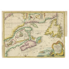
Antique Map Dedicated to British Merchants Trading to North America, ca.1746
Located in Langweer, NL
Description: Antique map titled 'A New Chart of the Coast of New England, Nova Scotia, New France or Canada, with the islands of Newfoundland, Capte Breton, St John's (..)'. Map stre...
Category
Antique Mid-18th Century Maps
Materials
Paper
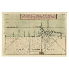
Authentic Map of the Coast from Cape Formosa to the Dony River, Africa, 1732
Located in Langweer, NL
Antique map titled 'The New Correct Mapp of Calbar River vulgarly call'd Calabar (..)'.
An interesting map of the coast from Cape Formosa to the Dony River stated on the map to be ...
Category
Antique Mid-18th Century Maps
Materials
Paper
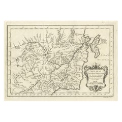
Antique Map of Northern China and Far Eastern Russia Around the Amur River, 1754
Located in Langweer, NL
Antique map titled 'Carte De La Tartarie Orientale (..)'. A map for this far eastern portion of what is present day northern China and far eastern Russia...
Category
Antique Mid-18th Century Maps
Materials
Paper
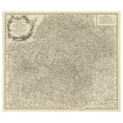
Map of the Circle of Franconia, Germany Bamberg, Wurtzburg and Nuremberg, 1757
Located in Langweer, NL
Antique map titled 'Cercle de Franconie (..)'.
Map of the Circle of Franconia, Germany. Centered on Bamberg, Wurtzburg and Nuremberg. This map originates from 'Atlas Universel (..)'.
Artists and Engravers: Gilles Robert de Vaugondy (1688 - 1766), also known as Le Sieur or Monsieur Robert, and his son, Didier Robert de Vaugondy (c.1723 - 1786), were leading mapmakers in France during the 18th century. In 1757, they published The Atlas Universel, one of the most important atlases of the 18th century. To produce the atlas, the Vaugondys integrated older sources with more modern surveyed maps...
Category
Antique Mid-18th Century Maps
Materials
Paper
Antique Map of Siberia and Chinese Tartary, Incl Nova Zembla, ca.1732
Located in Langweer, NL
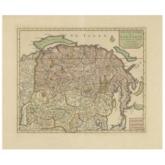
Antique map of Tartary titled 'Nieuwe Kaart van Tartarie na de alderlaatste ondekking int ligt gebracht tot Amsterdam door Isaak Tirion'.
Map op Siberia and Chinese tartary. In t...
Category
Antique Mid-18th Century Maps
Materials
Paper
Attractive Engraved Old Map Showing Spain, Portugal Majorca, Ibiza etc. ca.1760
Located in Langweer, NL
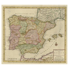
Antique map titled 'Nieuwe Kaart van Spanje en Portugal.'
Attractive detailed map showing Spain and Portugal. Including Majorca, Minorca and Ibiza. Title in block-style cartouche...
Category
Antique Mid-18th Century Maps
Materials
Paper
Decorative Hand-Colored Antique Map of Groningen in the Netherlands, ca.1730
Located in Langweer, NL
Antique print, titled: 'Groningae et Omlandiae Dominium vulgo de Provincie van Stadt en Lande (…) ' - This map shows Groningen, the Netherlands. Lower left scale sticks in the decora...
Category
Antique Mid-18th Century Maps
Materials
Paper
Excellent Antique Map of America with Unusual Northwest Coast of America, c.1754
Located in Langweer, NL
Description: Antique map titled 'Nieuwe Kaart Van het Westelykste Deel Der Weereld, dienende tot aanwyzing an de Scheepstogten der Nederlanderne Naar West Indie.' Excellent map of America, featuring an unusual northwest coast of America, which includes Martin d'Aguilar's strait which provides for a Northwest Passage via the Great Lakes. The rest of the NW coast...
Category
Antique Mid-18th Century Maps
Materials
Paper
Nice Antique Map of the Empire of Japan. Centered on the Bay of Osaka, ca.1752
Located in Langweer, NL
Antique map titled 'Carte de L'Empire de Japon (..).'
Map of the Empire of Japan. Centered on the Bay of Osaka, this map covers from Hirado (here identified as I. Firando) and Naga...
Category
Antique Mid-18th Century Maps
Materials
Paper
Old Original Antique Map of the Sunda Islands of Indonesia, 1756
Located in Langweer, NL
Title: Isles De La Sonde.
Attractive old decorative map of the Isles de la Sonde, Borneo, Sumatra, Java and Malacca ( Malaysia) with the Straits of Malacca. Penang is spelled as P...
Category
Antique Mid-18th Century Maps
Materials
Paper
Original Old Map of St Kitts, Antigua, Bermuda, Barbados, and Jamaica, ca.1745
Located in Langweer, NL
Antique map titled 'Dominia Anglorum in praecipuis Insulis Americae ut sunt Insula S. Christophori, Antegoa, Iamaica, Barbados nec non Insulae Bermudes vel Sommers dictae. Die Englis...
Category
Antique Mid-18th Century Maps
Materials
Paper
Antique Sea Chart of the Shetland Islands, Scotland, ca.1745
Located in Langweer, NL
Antique map of Scotland titled 'Nieuwe Paskaard van Hitland met de daar omleggende eylanden na de nieuwe aftekening gemaakt by den Lofwaarden en onvermoeyden Hit en Zeeman Ian Bruyst...
Category
Antique Mid-18th Century Maps
Materials
Paper
Fine Engraving of the 2nd Corps de Garde in the Low Countries 'Holland', 1760
Located in Langweer, NL
Title on page (Dutch and French): TWEEDE CORPS DE GARDE van Hollandsche Officiers / Second Corps de Garde d'Officiers Hollandois". Amst., P. Fouquet, 1760.
An interior with several Dutch officers. On the right a man is sitting at a writing table, on the left a man is working on fire from the fireplace, in the middle three gentlemen are looking at a map. Above the chimney a coat of arms and above it a portrait of a man in profile, surrounded by a laurel wreath.
Fine engraved print depicting an officer's mess by J. Houbraken after a painting by C. Troost, with coat of arms engraved in lower margin and dedication to D. Muilman.
Cornelis Troost...
Category
Antique Mid-18th Century Maps
Materials
Paper
Fine Engraving Depicting an Officer's Mess in the Low Countries, 'Holland', 1754
Located in Langweer, NL
Title on Page (Dutch and French): CORPS DE GARDE van Hollandsche Officiers / Corps de Garde des Officiers Hollandois". Amst., 1754.
Fine engraving depicting an officer's mess by J. Punt and P. Tanjé after a painting by C. Troost, with coat of arms engraved in lower margin and dedication to G. Braamcamp ("beminnaar der schilderkonst").
Waiting room with reading, smoking and card playing officers. Right, one of them studies a map of the Netherlands. On the wall a coat of arms with the Dutch lion. At the bottom of the margin the coat of arms and an assignment to Gerrit Braamcamp, who had the original painting in his collection.
Cornelis Troost...
Category
Antique Mid-18th Century Maps
Materials
Paper
Detailed Antique Map Showing Mansfeld in Saxony-Anhalt, Germany, ca.1750
Located in Langweer, NL
Description: Antique map titled 'Die Grafschaft Mansfeld Konigl. Preuss. Churfurstl. Sachsischen Antheils mit allen darinnen befindlichen Stadten Dorfschaften.'
Detailed map show...
Category
Antique Mid-18th Century Maps
Materials
Paper
Old Map of Ceylon 'Sri Lanka' with The North Oriented to The Left, 1731
Located in Langweer, NL
Description: Antique map Ceylon titled 'Nieuwe Kaart van t Eland Ceilon'.
Old map of present-day Sri Lanka with north oriented to the left. The ...
Category
Antique Mid-18th Century Maps
Materials
Paper
Antique Map of The Harbour of Acapulco in Mexico, 1749
Located in Langweer, NL
Description: Antique map titled 'Plan van de Haven van Acapulco (..) - Plan du Port d'Acapulco (..)'. Original antique map of the Port of Acapulco on the coast of Mexico in the South...
Category
Antique Mid-18th Century Maps
Materials
Paper
Rare Antique Map of the Rio De La Plata, Buenos Ayres, Brazil, ca.1760
Located in Langweer, NL
Description: Antique map titled 'De Ingang van Rio de la Plata, Waar aan de Stad Buenos Ayres ligt, in Zuid-Amerika'. A map showing the Rio de la Plata es...
Category
Antique Mid-18th Century Maps
Materials
Paper
Antique Map with Details of Berings' Expedition into Russians' Far East, 1737
Located in Langweer, NL
Antique map titled 'Carte Des Pays traverses par le Capne. Beerings depuis la Ville de Tobolsk jusqua'a Kamtschatka'.
This is the first printed map to illustrate Vitus Bering's fir...
Category
Antique Mid-18th Century Maps
Materials
Paper
Antique Engraving of Malaysia, Brunei, Singapore, Java, Borneo, Sumatra, c.1750
Located in Langweer, NL
Nice decorative and detailed map from the Gulf of Siam and Mindoro to Timo, Java and Sumatra Borneo and Roy de Siam. Large compass rose and nice cartouche.
Title: Carte des Isles ...
Category
Antique Mid-18th Century Maps
Materials
Paper
Old Original Antique Map of the Islands of East Indonesia, 1756
Located in Langweer, NL
Title: Isles Moluques.
Old and rare, this decorative map of the Maluku Islands in the period it was still controlled by the Dutch colonial power. It also shows the island of Bali, Lombok, part of Borneo (Kalimantan), Celebes (Sulawesi), Timor, The Lesser Sunda Islands, West Papua...
Category
Antique Mid-18th Century Maps
Materials
Paper
Decorative Original Old Map of Nova Zembla and the Russian Mainland, ca.1760
Located in Langweer, NL
Antique map titled 'Carte Des Pais Habites par les Samojedes et Ostiacs.'
Map of Novaya Zemlya and the Russian mainland. Source unknown, to be determined.
Artists and Engraver...
Category
Antique Mid-18th Century Maps
Materials
Paper
Antique Engraved Map of Saxonia in Northern Germany, ca.1721-1750
Located in Langweer, NL
Duitsland, Sassonia; Johannes Baptist Homann - Circulus Saxoniae Inferioris in omnes suos Status et Principatus accurate divisus ex conatibus -
A large map of Lower Saxony, exten...
Category
Antique Mid-18th Century Maps
Materials
Paper
Antique Engraved Map of the Northern Part of Greece and the Aegean Sea, Ca.1730
Located in Langweer, NL
Title: "GRÆCIÆ PARS Septentrionalis".
Hand Coloured Engraved map by G. Delisle of the northern part of the Aegean. In the top left corner a distance scale included.
Condition...
Category
Antique Mid-18th Century Maps
Materials
Paper
Antique Hand-Coloured Map of North and South America, ca.1765
Located in Langweer, NL
Description: Antique map titled 'Nieuwe Kaart van Amerika.' Attractive map of North and South America, the western part of Africa and south west Europe. Source unknown, to be determi...
Category
Antique Mid-18th Century Maps
Materials
Paper
Striking Antique Map of Cayenne in French Guyana, South America, ca.1760
Located in Langweer, NL
Description: Antique map titled 'Land-kaart van het Eiland en de Volkplanting van Cayenne aan de Kust van Zuid-Amerika'.
Striking map of the island and settlement of Cayenne in F...
Category
Antique Mid-18th Century Maps
Materials
Paper
Attractive Antique Hand-Coloured Map of South America, ca.1765
Located in Langweer, NL
Antique map titled 'Kaart van het Onderkoningschap van Peru zig uitstrekkende: over Chile, Paraguay en andere Spaansche Landen als ook van Brazil en verdere Bezittingen van Portugal ...
Category
Antique Mid-18th Century Maps
Materials
Paper
Antique Map of Juan Fernandez Island by Anson '1749'
Located in Langweer, NL
Antique map titled 'l'Ile de Juan Fernandes dans la Mer du Sud (..) - Het Eiland Juan Fernandes in de Zuid Zee (..)'. This map depicts Juan Fernandez Island in the Southern Sea. This...
Category
Antique Mid-18th Century Maps
Materials
Paper
West Coast of Africa, Guinea & Sierra Leone: An 18th Century Map by Bellin
Located in Alamo, CA
Jacques Bellin's copper-plate map entitled "Partie de la Coste de Guinee Dupuis la Riviere de Sierra Leona Jusquau Cap das Palmas", depicting the coast of Guinea and Sierra Leone in ...
Category
French Antique Mid-18th Century Maps
Materials
Paper
Antique Map of the Siege of Batavia by Van Schley 'c.1750'
Located in Langweer, NL
Antique map titled 'Batavia assiecé en 1629 - Batavia 1629 belegerd'. Bird's eye view map of the siege of Batavia in 1629, Jakarta, Indonesia. This print originates from the Dutch ed...
Category
Antique Mid-18th Century Maps
Materials
Paper
Antique Map of New England and Part of Canada by Vaugondy 'circa 1755'
Located in Langweer, NL
Antique map titled 'Partie de l'Amérique septent qui comprend la nouvelle France ou le Canada'. Decorative and highly detailed map of New England an...
Category
Antique Mid-18th Century Maps
Materials
Paper
West Africa Entitled "Guinea Propria": An 18th Century Hand Colored Homann Map
Located in Alamo, CA
This is a scarce richly hand colored copper plate engraved map of Africa entitled "Guinea Propria, nec non Nigritiae vel Terrae Nigrorum Maxima Pars" by Johann Baptist Homann (1664-1...
Category
German Antique Mid-18th Century Maps
Materials
Paper
Antique Plan of the Kungur Ice Cave by Bellin, '1768'
Located in Langweer, NL
Antique map titled 'Plan de la Grotte de Kungur'. Original plan of the Kungur Ice Cave, a karst cave located in the Urals, near the town Kungur in Perm Krai, Russia, on the right ban...
Category
Antique Mid-18th Century Maps
Materials
Paper
Antique Map of Batavia by Van Schley 'c.1750'
Located in Langweer, NL
Antique map titled 'Batavia'. Original antique map of Batavia, Jakarta, Indonesia. This print originates from the Dutch edition of Prevost's 'Histoire Generale des Voyages' (Paris 17...
Category
Antique Mid-18th Century Maps
Materials
Paper
Antique Map of the Tunquin River and Bay by Van Schley 'c.1750'
Located in Langweer, NL
Antique map titled ‘Kaart van den Loop der Rivier van Tonkin van Cacho tot aan de Zee / Carte du Cours de la Riviere de Tunquin Depuis Cacho jusqu'à la Mer J. v. Schley direx.’ Detai...
Category
Antique Mid-18th Century Maps
Materials
Paper
St. Christophe 'St. Kitts' Island: An 18th Century Hand-colored Map by Bellin
Located in Alamo, CA
Jacques Bellin's copper-plate map of the Caribbean island of Saint Kitts entitled "Carte De De l'Isle St. Christophe Pour servir á l'Histoire Genle. des V...
Category
French Antique Mid-18th Century Maps
Materials
Paper
Antique Map of the Sunda Islands by Tirion 'c.1760'
Located in Langweer, NL
Antique map titled 'Nuova Carta delle Isole di Sunda come Borneo, Sumatra e Iava Grande'. Detailed map of the Sunda Islands, Southeast Asia, extending from the tip of Cambodia to Jav...
Category
Antique Mid-18th Century Maps
Materials
Paper
Antique Map of the Arabian Peninsula by Bellin 'c.1740'
Located in Langweer, NL
Antique map titled 'Carte de la Coste d'Arabie, Mer Rouge et Golfe de Perse'. Original antique map of the Arabian Peninsula, labes both Mecca and Med...
Category
Antique Mid-18th Century Maps
Materials
Paper
Antique Bible Map of the Middle East by A. Schut, 1743
Located in Langweer, NL
Antique map titled 'De Gelegentheyt van 't Paradys en 't Landt Canaan'. Dutch Bible map covering the region between the Mediterranean and the Persian Gulf, ...
Category
Antique Mid-18th Century Maps
Materials
Paper
Antique Plan of the Town and Harbour of Boulogne-sur-Mer by Barrow 'c.1760'
Located in Langweer, NL
Antique map titled 'Plan of the Town and Harbour of Boulogne'. Original antique plan of the town and harbour of Boulogne-sur-Mer, France. This map originates from John Barrow...
Category
Antique Mid-18th Century Maps
Materials
Paper
Antique Map of Bali 'Indonesia' by Bellin, 'c.1750'
Located in Langweer, NL
Antique map titled 'Ile de Baly ou petite Java'. Map of Bali, Indonesia. The map depicts the island from the north with Java to the right and Lombok to the...
Category
Antique Mid-18th Century Maps
Materials
Paper
Antique Map of Asia by Tirion 'c.1760'
Located in Langweer, NL
Antique map titled 'Nuova Carta dell Asia'. Decorative map of Asia. Published by I. Tirion, circa 1760.
Category
Antique Mid-18th Century Maps
Materials
Paper
Antique Map of the Port of Zihuatanejo by Anson '1749'
Located in Langweer, NL
Antique map titled 'Plan du Port de Chequetan ou Seguataneo - Plan van de Haven van Chequetan of Seguataneo'. Map of the Mexican port of Zihuatanejo. This area was originally named C...
Category
Antique Mid-18th Century Maps
Materials
Paper
Antique Map of New England and Eastern Canada by Homann Heirs, circa 1755
Located in Langweer, NL
Antique map titled 'Partie Orientale de la Nouvelle France ou du Canada (..)'. Original antique map of New England and Eastern Canada made a...
Category
Antique Mid-18th Century Maps
Materials
Paper
England, Scotland & Ireland: A Hand Colored Map of Great Britain by Tirion
By Isaak Tirion
Located in Alamo, CA
This is a hand-colored double page copperplate map of Great Britain entitled "Nieuwe Kaart van de Eilanden van Groot Brittannien Behelzende de Kon...
Category
Dutch Antique Mid-18th Century Maps
Materials
Paper
Antique Map of the Region of Boulogne-sur-Mer by Bellin '1764'
Located in Langweer, NL
Antique map titled 'Plan de Boulogne et des Environs'. Original antique map of the region of Boulogne-sur-Mer, France. This map originates from 'Le petit atlas maritime: recueil de c...
Category
Antique Mid-18th Century Maps
Materials
Paper
Antique Map of Boulogne-sur-Mer by Bellin '1764'
Located in Langweer, NL
Antique map titled 'Plan de la Ville de Boulogne'. Original antique map of Boulogne-sur-Mer, France. This map originates from 'Le petit atlas maritime: recueil de cartes et plans des...
Category
Antique Mid-18th Century Maps
Materials
Paper
Antique Map of the Region Centered on the Malay Peninsula by Tirion 'c.1760'
Located in Langweer, NL
Antique map titled 'Nuova Carta dell' India (..)'. Decorative map of the region centered on the Malay Peninsula and extending from the Straits of Singapore, Malacca and Borneo in the South to China in the east and the Bay of Bengal...
Category
Antique Mid-18th Century Maps
Materials
Paper
Antique Map of the Turkish Empire by Tirion 'c.1760'
Located in Langweer, NL
Antique map titled 'Nieuwe Kaart van het Turksche Ryk gelegen in Europa, Asia en Africa'. Original antique map of the Turkish Empire. The map is centered on the Mediterranean Sea but...
Category
Antique Mid-18th Century Maps
Materials
Paper
Antique Map of the Arctic Ocean and Novaya Zemlya by Bellin '1759'
Located in Langweer, NL
Antique map titled 'Partie de la Mer Glaciale contenant la Nouvelle Zemle et le Pais des Samoiedes (..)'. Original antique map of the Arctic Ocean containing Novaya Zemlya and the co...
Category
Antique Mid-18th Century Maps
Materials
Paper
Original Antique Map of Syria Phoenice by Van Dùren '1749'
Located in Langweer, NL
Interesting Antique map published in Germany titled 'Neue Vorstellung von Phoenice und Syrien (..)' This map is engraved with a lot of details. It is an original antique map of Syria...
Category
Antique Mid-18th Century Maps
Materials
Paper
Antique Map of Eastern Siberia by Bellin '1768'
Located in Langweer, NL
Antique map titled 'Suite de la Carte de la Siberie et le Pays de Kamtchatka'. Original antique map of the eastern portion of Siberia, centered on eastern Russia and the Mer d'Ochozk (Sea of Okhotsk) showing the Kamchatka Peninsula and I. de Beringe and I. Sagalin. The map shows the tracks of Russian ships...
Category
Antique Mid-18th Century Maps
Materials
Paper
Antique Map of the Country Inhabited by the Samoyedic and Khanty People '1768'
Located in Langweer, NL
Antique map titled 'Carte des Païs Habités par les Samojedes et Ostiacs'. Original antique map of the country inhabited by the Samoyedic and Khanty (Ostyak) peoples. Engraved by J.N....
Category
Antique Mid-18th Century Maps
Materials
Paper
Antique Map of Khwarezm, Turkestan and Great Bukhara by Bellin, '1749'
Located in Langweer, NL
Antique map titled 'Carte de Karazm, Turkestan, et Grande Bukarie'. Original antique map of Khwarezm, Turkestan and Great Bukhara. Engraved by J.N. Bellin for 'Histoire Générale des ...
Category
Antique Mid-18th Century Maps
Materials
Paper
Antique Plan of the Fortress of Tobolsk by Bellin '1768'
Located in Langweer, NL
Antique map titled 'Plan de la Forteresse de Tobolsk'. Original plan of the Fortress of Tobolsk, a town in Tyumen Oblast, Russia. Engraved by J.N. Bellin ...
Category
Antique Mid-18th Century Maps
Materials
Paper
Antique Map with Plans of Cremona, Pavia, Montferrato & Others by Homann, '1734'
Located in Langweer, NL
Antique map titled 'Plan von Cremona und denen übrigen Maylaendischen (..)'. Original antique map showing plans of Cremona, Pavia, Casale Montferrato, Fort de Fuentes, Novara, Serava...
Category
Antique Mid-18th Century Maps
Materials
Paper
Uncoulored Original Antique Map of Western Africa, 1749
Located in Langweer, NL
Interesting detailed German antique map titled 'Neue Vorstellung der Abendlaendischen Küsten von Africa (..)'. Original antique map of Western Africa. This map originates from 'Neue ...
Category
Antique Mid-18th Century Maps
Materials
Paper
Antique Map of Islands in the Mediterranean by Bowen, 'c.1760'
Located in Langweer, NL
Antique map titled 'Particular Draughts of some of the chief African Islands (..)'. Eight small maps on one sheet including 'Islands of Malta Goze & Cuming, An Accurate Chart of Cape de Verde Islands…, Island of St Helena.., Island of Madera, Island of Teneriffe, The Bay of Agoa…, The Dutch Fort at the Cape of Good Hope…, A Draught of Table Bay...
Category
Antique Mid-18th Century Maps
Materials
Paper
Recently Viewed
View AllMore Ways To Browse
Map Of Colorado
Ottoman Empire Map
Rene Descartes
The Gambia
Vintage Wooden Roller
Antique Furniture Arkansas
Antique Furniture Kingston
Antique Indian Furniture Australia
Antique Map Burgundy
Antique Map Of Yorkshire
Antique Maps Of Cape Of Good Hope
Antique Maps Yorkshire
Antique Outpost
Chinese Wall Pocket
Map Manila
Map Of Essex
Map Of Normandy
Victorian Floor Vase
