Antique Map Of New Holland
2
to
25
108
10
93
66
36
22
22
10
8
7
7
6
6
5
4
4
3
3
3
3
2
2
2
2
2
2
2
2
2
1
1
1
1
1
1
1
1
1
1
1
1
19
2
1
1
1
Sort By
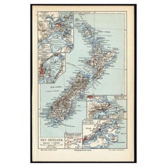
Antique Map of New Zealand, 1895
Located in Langweer, NL
Antique map titled 'Neu-Seeland.' Map of New Zealand. With inset maps of the large cities. This
Category
Antique 19th Century Maps
Materials
Paper
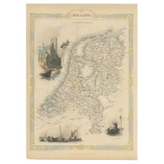
Antique Map of Holland with Colorful Vignettes, 1851
Located in Langweer, NL
Antique map titled 'Holland'.
Decorative map of Holland. Includes vignettes of Rotterdam, Dutch
Category
Antique 19th Century Maps
Materials
Paper
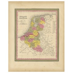
Antique Nicely Colored Map of Holland and Belgium, 1846
Located in Langweer, NL
Antique map titled 'Holland and Belgium'. Old map of the Netherlands and Belgium. This map
Category
Antique 19th Century Maps
Materials
Paper
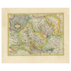
Antique Map of The Dutch Provinces of Gelderland and Overijssel, 1623
Located in Langweer, NL
Antique map titled 'Geldria et Transysulana'. One of the earliest maps of Gelderland and Overijssel
Category
Antique 17th Century Maps
Materials
Paper
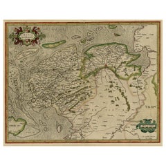
Early Antique Map of the Dutch Provinces of Friesland and Groningen, 1604
Located in Langweer, NL
Antique map titled 'Frisiae Occidentalis.'
This attractive map shows the Dutch Provinces of
Category
Antique Early 1600s Maps
Materials
Paper
H 16.93 in W 21.07 in D 0 in
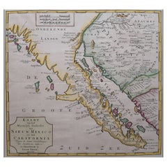
Original Antique Map of the Western Part of NEW MEXICO & CALIFORNIA
Located in Langweer, NL
Title: "Map of the Western Part of NEW MEXICO and CALIFORNIA According to the Latest Discoveries by
Category
Antique 1760s Maps
Materials
Paper
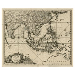
Antique Map of the Strait of Malacca, Malay Peninsula & Dutch Indies, c.1670
Located in Langweer, NL
Antique map titled 'Indiae Orientalis, nec non Insularum Adiacentium Nova Descriptio.'
Map of
Category
Antique 1670s Maps
Materials
Paper
H 20.6 in W 24.93 in D 0 in
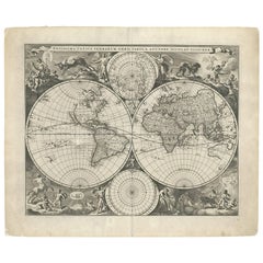
Gorgeous Antique World Map by the Dutch Mapmaker Visscher, published circa 1679
Located in Langweer, NL
Antique map titled 'Novissima Totius Terrarum Orbis Tabula, Auctore Nicolao Visscher'. Gorgeous
Category
Antique Late 17th Century Maps
Materials
Paper
Free Shipping
H 20.79 in W 25.2 in D 0.02 in
Old Map of the Dutch Provinces of Friesland and Groningen, The Netherlands, 1604
Located in Langweer, NL
Antique print, titled: 'Frisiae Occidentalis.'
Handsome map of the Dutch Provinces of Friesland
Category
Antique Early 1600s Maps
Materials
Paper
H 17.05 in W 21.15 in D 0 in
Antique Map of the Eastern Part of the World
Located in Langweer, NL
Antique map titled 'Nieuwe Kaart van het Oostelykste Deel der Weereld, diendende tot aanwyzing van
Category
Antique Mid-18th Century Maps
Materials
Paper
Antique Map of Mar del Sur, Chile, Peru, New Guinea and Tierra del Fuego, 1621
Located in Langweer, NL
Uncommon and rare map of Mar del Sur and the coast of Peru. With inset maps of part of New Guinea
Category
Antique 17th Century Maps
Materials
Paper
H 17.33 in W 6.7 in D 0 in
Antique Map of Polynesia and Australasia by Neele, 1825
Located in Langweer, NL
Antique map titled 'Polynesia and Australasia'. It shows Australia (New Holland), part of Asia, New
Category
Antique Early 19th Century Maps
Materials
Paper
Antique Map of East Asia by Coronelli, circa 1690
Located in Langweer, NL
Antique map of East Asia showing New Holland and parts of Van Diemens Land and New Zealand. This
Category
Antique Late 17th Century Maps
Materials
Paper
Antique Map of the Low Countries by Cary, 1813
Located in Langweer, NL
Antique map of the Netherlands titled 'A New Map of the United Provinces comprehending Holland
Category
Antique 19th Century Maps
Materials
Paper
Antique Map of Southeast Asia by Blaeu, c.1640
Located in Langweer, NL
"Antique map titled 'India quae Orientalis dicitur et Insulae adiacentes'. Map of Southeast Asia
Category
Antique 17th Century Maps
Materials
Paper
Antique Map of Australia and Polynesia, inset of Tasmania c.1860
Located in Langweer, NL
German antique map titled 'Australien und Polynesien'. Old map of Australia (New Holland) and
Category
Antique 19th Century Maps
Materials
Paper
Antique Map of Westfalia, Germany by Mercator/Hondius, circa '1620'
Located in Langweer, NL
Antique map titled 'Westfalia cum dioecelsi Bremensi'. Original antique map of Germany. Published
Category
Antique 16th Century Maps
Materials
Paper
Antique Map of the Malay Archipelago with Images of Indigenous People, 1851
Located in Langweer, NL
, but at the time of the map's creation, the region was known as the Dutch East Indies, a collection of
Category
Antique 1850s Maps
Materials
Paper
H 10.71 in W 14.26 in D 0 in
Antique Map of the Eastern Part of the World by Tirion, 1755
By Isaak Tirion
Located in Langweer, NL
Antique map titled 'Nieuwe Kaart van het Oostelykste Deel der Weereld, dienende tot Aanwyzing van
Category
Antique Mid-18th Century Dutch Maps
Materials
Paper
Free Shipping
H 15.56 in W 15.56 in D 0.02 in
Antique Map of the World on Mercator Projection by Anson, 1749
Located in Langweer, NL
'. Original antique map of the world on Mercator's Projection from a Dutch edition of Anson's voyages. The map
Category
Antique 18th Century Maps
Materials
Paper
Antique Map of the Region of Osaka and Hirado Island in Japan, 1725
By Pieter Van Der Aa
Located in Langweer, NL
Antique map titled 'Description exacte et fidele des villes, bourgs et villages qui les
Category
Antique 18th Century Maps
Materials
Paper
Map of Southeast Asia, Extending from India to Tibet & Japan to New Guinea, 1640
Located in Langweer, NL
Antique map titled 'India quae Orientalis dicitur et Insulae adiacentes'.
Map of Southeast Asia
Category
Antique 1640s Maps
Materials
Paper
H 19.89 in W 23.63 in D 0 in
Antique Map of Northern Ireland by Mercator/Hondius, Early 1600's
Located in Langweer, NL
Antique map titled 'Ultoniae Orientalis Pars'. Original antique map of Northern Ireland. Published
Category
Antique 16th Century Maps
Materials
Paper
Antique Map of the Sunda Islands Including Sumatra, Java, and Borneo, 1705
Located in Langweer, NL
Title: “Antique Map of the Sunda Islands Including Sumatra, Java, and Borneo”
This print is a
Category
Antique Early 1700s Maps
Materials
Paper
Free Shipping
H 8.67 in W 11.89 in D 0 in
Important and Scarce Antique Map of Asia from Jesuit Sources, C.1713
Located in Langweer, NL
Antique map titled 'L'Asie selon les nouvelles observations de Messrs de l'Academie des Sciences
Category
Antique 18th Century Maps
Materials
Paper
Antique Map of the Northern Part of South America by J. Tallis, circa 1851
Located in Langweer, NL
the last decorative world atlas. The 'Venezuela, New Granada...' map was typical of the many Fine ones
Category
Antique Mid-19th Century Maps
Materials
Paper
H 10.6 in W 14.41 in D 0.02 in
Original Blaeu Map of Southeast Asia from India to Tibet and Japan to New Guinea
Located in Langweer, NL
Antique map titled 'India quae Orientalis dicitur et Insulae Adiacentes'.
Beautiful map of
Category
Antique 1640s Maps
Materials
Paper
H 19.49 in W 23.63 in D 0 in
Attractive Antique Map of Western Africa with Lots of Details on the Coast, 1655
Located in Langweer, NL
veües jusques a present".
Handsome map of Western Africa filled with information, much of it
Category
Antique 1650s Maps
Materials
Paper
H 16.74 in W 22.64 in D 0 in
Cartographic Elegance of the Mughal Dominion in a Hand-Colored Antique Map, 1705
Located in Langweer, NL
This original antique map titled “'T Ryk van den Grooten Mogol” by Nicolas Sanson from 1705 is an
Category
Antique Early 1700s Maps
Materials
Paper
Free Shipping
H 8.67 in W 11.89 in D 0 in
Antique Map of the Passage Between the Atlantic and Pacific Oceans, circa 1753
Located in Langweer, NL
trade route for the Dutch. The map is adorned with a fine compass rose.Source unknown, to be determined
Category
Antique 18th Century Maps
Materials
Paper
H 9.61 in W 12.8 in D 0 in
Antique Detailed World Map Drawn on Mercator's Projection, 1700
Located in Langweer, NL
Antique world map titled 'Carte generale du monde, ou description du monde terrestre & Aquatique
Category
Antique 17th Century Maps
Materials
Paper
Rare Unusual Antique Map of Asia with a Landbridge from Korea to America, 1717
Located in Langweer, NL
Antique map titled 'L'Asie Suivant les Nouvelles Decouvertes (..).' Interesting and very unusual
Category
Antique 18th Century Maps
Materials
Paper
H 9.65 in W 13.94 in D 0 in
Old Map of Cook's Discovery and Charting of the East Coast of Australia, 1803
Located in Langweer, NL
Antique map titled 'Kaart van Nieuw Zuid Wales of de Oostlyke Kust van Nieuw Holland ontdekt en
Category
Antique Early 1800s Maps
Materials
Paper
H 15.36 in W 31.3 in D 0 in
Map of The East Indies with the Route of Capt. William Dampier's Voyage, 1698
Located in Langweer, NL
Antique map titled 'Kaart van Oost Indie'.
Old map of the East Indies. It shows the routes of
Category
Antique 1690s Maps
Materials
Paper
H 7.88 in W 12.41 in D 0 in
Old Decorative Map of the West African Coast & St. Thomae Island, c.1600
Located in Langweer, NL
Antique map titled 'Guineae Nova Descriptio.'
This very decorative map shows the West African
Category
Antique Early 1600s Maps
Materials
Paper
H 15.63 in W 20.48 in D 0 in
Rare Engraving of Dutch and Danish Forts on the West African Gold Coast, 1744
Located in Langweer, NL
Antique print, titled: 'The Dutch Fort Croevecoeur (…).'
A four panel plate showing forts on
Category
Antique 1740s Maps
Materials
Paper
H 15.36 in W 13.67 in D 0 in
VOC Ships, Native People & Coastal Views of Islands near Papua New Guinea, 1726
Located in Langweer, NL
sheet showing the native boats and peoples and coastal views of islands near New Guinea. Dutch (V.O.C
Category
Antique 1720s Maps
Materials
Paper
H 13.39 in W 15.75 in D 0 in
Original Antique Sea Chart of the Northern Part of Hispaniola, Western Cuba
Located in Langweer, NL
Antique map titled 'Pas kaart van de Noord Kust van Espaniola (..)'. Beautiful sea chart of the
Category
Antique Late 17th Century Maps
Materials
Paper
H 21.26 in W 24.02 in D 0.02 in
Antique Chart of the Straits of Makassar, Indonesia with Borneo and Celebes-1820
Located in Langweer, NL
Description: Antique map titled 'A New Chart of the Straits of Macassar with various additions
Category
Antique 1820s Maps
Materials
Paper
H 37.8 in W 25.99 in D 0 in
Old Engraving of A Panoramic Bird's Eye View of Miaco 'Kyoto', Japan, 1669
Located in Langweer, NL
Description: Antique print, titled: 'Miako.' - A panaromic bird's eye view of Miaco (Kyoto
Category
Antique 1660s Maps
Materials
Paper
H 12.68 in W 30.71 in D 0 in
Loudun and Mirebeau: A Cartographic Masterpiece of 17th Century France by Blaeu
Located in Langweer, NL
uploaded is an original antique map titled "Loudonois - Mirebalais," created by Willem Janszoon Blaeu, a
Category
Antique 1650s Maps
Materials
Paper
Free Shipping
H 20.08 in W 23.82 in D 0 in
Old Copper Engraving of the Port City Dabhol in India, 1757
Located in Langweer, NL
Antique print titled 'Dabul'.
Old print of the port city Dabhol in India. In the 15th and 16th
Category
Antique 1750s Maps
Materials
Paper
Colored Antique Print of New Guinea Fishermen and views of New Guinea
By F. Valentijn
Located in Langweer, NL
Antique print titled 'Volkeren van Nova Guinea , en hun Vaertuygen Het Brandende Eyland als het
Category
Antique Mid-18th Century Prints
Materials
Paper
H 13.19 in W 15.56 in D 0.02 in
Antique Print of the Dutch Trading Post Deshima in Japan, circa 1738
By Giambattista Albrizzi
Located in Langweer, NL
antique maps to collectors, historians, educators and interior decorators all over the world. Our
Category
Antique 18th Century Prints
Materials
Paper
Colored Antique Print of the Islands of Marken, New Ireland and Other Islands
Located in Langweer, NL
New East-India") describes the history of the Dutch East India Company while also making notes on
Category
Antique Mid-18th Century Prints
Materials
Paper
H 13.19 in W 15.56 in D 0.02 in
Engraving of a Meeting of the Dutch Synode in Amsterdam, The Netherlands, 1732
Located in Langweer, NL
Antique print titled 'Synode tenu dans le Choeur (..)'. Old print of a meeting of the Dutch Synode
Category
Antique 18th Century Prints
Materials
Paper
H 15.36 in W 9.65 in D 0 in
Colored Antique Print of a Lobster
Located in Langweer, NL
Untitled antique print of a lobster from Indonesia. This print originates from 'Oud en Nieuw Oost
Category
Antique Mid-18th Century Prints
Materials
Paper
Set of 2 Colored Antique Prints of Various Fishes and Crustaceans
By F. Valentijn
Located in Langweer, NL
) was a Dutch Calvinist minister, naturalist and author whose Oud en Nieuw Oost-Indiën ("Old and New
Category
Antique Mid-18th Century Prints
Materials
Paper
Set of 4 Colored Antique Prints of Various Fishes and Crustaceans
By F. Valentijn
Located in Langweer, NL
) was a Dutch Calvinist minister, naturalist and author whose Oud en Nieuw Oost-Indiën ("Old and New
Category
Antique Mid-18th Century Prints
Materials
Paper
Set of 8 Colored Antique Prints of Various Fishes and Crustaceans
By F. Valentijn
Located in Langweer, NL
) was a Dutch Calvinist minister, naturalist and author whose Oud en Nieuw Oost-Indiën ("Old and New
Category
Antique Mid-18th Century Prints
Materials
Paper
Set of 3 Colored Antique Prints of various Fishes and Crustaceans
By F. Valentijn
Located in Langweer, NL
a Dutch Calvinist minister, naturalist and author whose Oud en Nieuw Oost-Indiën ("Old and New East
Category
Antique Mid-18th Century Prints
Materials
Paper
Set of 12 Colored Antique Prints of Various Fishes and Crustaceans
By F. Valentijn
Located in Langweer, NL
) was a Dutch Calvinist minister, naturalist and author whose Oud en Nieuw Oost-Indiën ("Old and New
Category
Antique Mid-18th Century Prints
Materials
Paper
Set of 3 Colored Antique Prints of various Sea Shells and Molluscs
By F. Valentijn
Located in Langweer, NL
a Dutch Calvinist minister, naturalist and author whose Oud en Nieuw Oost-Indiën ("Old and New East
Category
Antique Mid-18th Century Prints
Materials
Paper
Set of 6 Colored Antique Prints of various Sea Shells and Molluscs
By F. Valentijn
Located in Langweer, NL
) was a Dutch Calvinist minister, naturalist and author whose Oud en Nieuw Oost-Indiën ("Old and New
Category
Antique Mid-18th Century Prints
Materials
Paper
Set of 2 Colored Antique Prints of various Sea Shells and Molluscs
By F. Valentijn
Located in Langweer, NL
a Dutch Calvinist minister, naturalist and author whose Oud en Nieuw Oost-Indiën ("Old and New East
Category
Antique Mid-18th Century Prints
Materials
Paper
Set of 4 Colored Antique Prints of various Sea Shells and Molluscs
By F. Valentijn
Located in Langweer, NL
a Dutch Calvinist minister, naturalist and author whose Oud en Nieuw Oost-Indiën ("Old and New East
Category
Antique Mid-18th Century Prints
Materials
Paper
Colored Antique Print of a Grasshopper, Hedgehogs and the Horn of Doe
By F. Valentijn
Located in Langweer, NL
Antique print titled 'A. De Hoorn van een Ternaatsche Hinde (..)'. This print depicts the horn of a
Category
Antique Mid-18th Century Prints
Materials
Paper
Colored Antique Print of a Swallow, Kingfisher and other Birds of Indonesia
By F. Valentijn
Located in Langweer, NL
: Kazuwaris etc. François Valentyn or Valentijn (17 April 1666 – 6 August 1727) was a Dutch Calvinist minister
Category
Antique Mid-18th Century Prints
Materials
Paper
H 13.19 in W 8.08 in D 0.02 in
Antique Print of Amsterdam and St. Paul Island, 1753
Located in Langweer, NL
ship on 17 June 1633 in turn named after the Dutch settlement of New Amsterdam that later became New
Category
Antique 18th Century Prints
Materials
Paper
Colored Antique Print of various Sea Shells and Molluscs
By F. Valentijn
Located in Langweer, NL
Dutch Calvinist minister, naturalist and author whose Oud en Nieuw Oost-Indiën ("Old and New East-India
Category
Antique Mid-18th Century Prints
Materials
Paper
- 1
Get Updated with New Arrivals
Save "Antique Map Of New Holland", and we’ll notify you when there are new listings in this category.
Antique Map Of New Holland For Sale on 1stDibs
With a vast inventory of beautiful furniture at 1stDibs, we’ve got just the antique map of new holland you’re looking for. Each antique map of new holland for sale was constructed with extraordinary care, often using paper, animal skin and leather. You’ve searched high and low for the perfect antique map of new holland — we have versions that date back to the 18th Century alongside those produced as recently as the 20th Century are available. An antique map of new holland is a generally popular piece of furniture, but those created in Baroque styles are sought with frequency. Many designers have produced at least one well-made antique map of new holland over the years, but those crafted by F. Valentijn, Jacques-Nicolas Bellin and Frederick de Wit are often thought to be among the most beautiful.
How Much is a Antique Map Of New Holland?
The average selling price for an antique map of new holland at 1stDibs is $574, while they’re typically $94 on the low end and $8,254 for the highest priced.
