Landscape Maps
12
to
139
1,441
967
1,658
1,096
448
307
241
226
148
107
105
94
85
68
61
55
54
54
52
50
41
39
38
38
32
32
30
26
26
25
23
22
19
17
13
12
11
11
11
10
10
9
8
8
8
7
6
6
6
6
5
4
4
4
4
3
3
3
3
2
1
1
1
161
135
54
52
42
Sort By
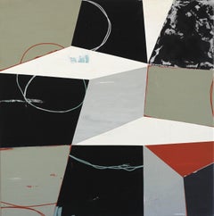
Walking in Circles - Geometric Abstract Neutral Colored Landscape Map Painting
By Heny Steinberg
Located in Los Angeles, CA
Mexican artist Heny Steinberg’s abstracted landscapes invite us to travel from the map to the
Category
21st Century and Contemporary Abstract Abstract Paintings
Materials
Canvas, Mixed Media, Acrylic
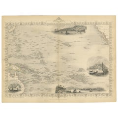
Map of Polynesia Highlighting Cultural Landscapes and Maritime Activities, 1851
Located in Langweer, NL
John Tallis & Company was a London-based map publisher that flourished during the 19th century
Category
Antique 1850s Maps
Materials
Paper
H 10.71 in W 14.26 in D 0 in
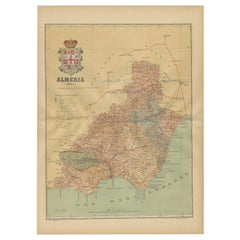
Almería 1901: Coastal Contours and Landscapes in a Map of Southeastern Spain
Located in Langweer, NL
An original antique map of the province of Almería, Spain, from the year 1901.
The Mediterranean
Category
Antique Early 1900s Maps
Materials
Paper
Free Shipping
H 14.77 in W 20.08 in D 0 in
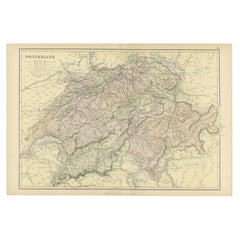
Original Antique Map of Switzerland, 1882
Located in Langweer, NL
Embark on a historical journey with an original Antique Map of Switzerland from the renowned
Category
Antique 1880s Maps
Materials
Paper
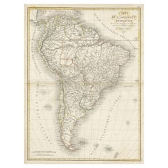
Scarce Antique Map of South America
Located in Langweer, NL
Antique map titled 'Carte de l'Amérique Méridionale'. Scarce map of South America, published in
Category
Antique Early 19th Century Maps
Materials
Paper
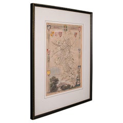
Antique Lithography Map, Buckinghamshire, English, Framed Cartography, Victorian
Located in Hele, Devon, GB
This is an antique lithography map of Buckinghamshire. An English, framed atlas engraving of
Category
Antique Mid-19th Century British Victorian Maps
Materials
Wood, Paper
H 16.15 in W 13.19 in D 0.6 in
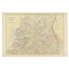
Original Antique Map of Russia in Europe, 1882
Located in Langweer, NL
Embark on an enthralling journey with an original Antique Map of European Russia from the esteemed
Category
Antique 1880s Maps
Materials
Paper
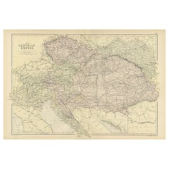
Original Antique Map of The Austrian Empire, 1882
Located in Langweer, NL
diverse landscapes with unparalleled detail.
More than a map, it's a doorway to a captivating historical
Category
Antique 1880s Maps
Materials
Paper
Original Antique Map of Spain and Portugal, 1882
Located in Langweer, NL
Embark on a historical voyage with an original Antique Map of Spain and Portugal from the esteemed
Category
Antique 1880s Maps
Materials
Paper
Large Antique County Map of Leicestershire, England, 1805
Located in Langweer, NL
cartographic landscape. His dedication to accuracy and distinct style is evident in this Leicestershire map
Category
Antique Early 19th Century Maps
Materials
Paper
Historical Map Depicting the Continent of Asia, 1882
Located in Langweer, NL
This 1882 map presents a meticulously detailed representation of the continent of Asia, a testament
Category
Antique 1880s Maps
Materials
Paper
Antique Map of the Region of Martigues, France
Located in Langweer, NL
Title: "Etang de Martigues et Environs: Antique Map of the Martigues Region, France"
Description
Category
Antique Mid-18th Century Maps
Materials
Paper
Antique Map of Persia, Afghanistan and Balochistan, 1859
Located in Langweer, NL
The antique map titled "Persia, Afghanistan and Beloochistan" is a remarkable historical document
Category
Antique Mid-19th Century Maps
Materials
Paper
Antique Map of Pomerania by Schenk, circa 1750
Located in Langweer, NL
The "Ducatus Pomeraniae" is a historical map depicting the Duchy of Pomerania, a region that
Category
Antique Mid-18th Century Maps
Materials
Paper
Antique Map of Denmark by Valk 'circa 1690'
Located in Langweer, NL
The map titled "Regnum Daniae, divisum in Dioeceses Arhusiam, Albergum, Viborgum, et Ripam (..)" is
Category
Antique Late 17th Century Maps
Materials
Paper
Antique Map of Northern Asia by Mallet, 1719
Located in Langweer, NL
Antique map titled 'Das Mitternächtige Theil des Alten Asien'. This sheet of five miniature maps
Category
Antique 18th Century Maps
Materials
Paper
Antique Decorative Coloured Map Marocco, Algeria and Tunis, 1882
Located in Langweer, NL
. This map offers a snapshot of the geopolitical landscape of the time, just before the 'Scramble for
Category
Antique 1880s Maps
Materials
Paper
Free Shipping
H 14.97 in W 22.45 in D 0 in
Colorful Detailed Antique Map of England and Wales, 1882
Located in Langweer, NL
collection, this map presents a captivating view of the enchanting landscapes, cities, and historical
Category
Antique 1880s Maps
Materials
Paper
Antique Map of The German Empire (East Sheet), 1882
Located in Langweer, NL
through its delineated boundaries, cities, rivers, and landscapes.
More than a map, it's a portal to a
Category
Antique 1880s Maps
Materials
Paper
Antique Map of The German Empire (West Sheet), 1882
Located in Langweer, NL
stunningly detailed map paints a vivid picture of the German political landscape, adorned with boundaries
Category
Antique 1880s Maps
Materials
Paper
Authentic Old Map of Sumatra, Malaysia and Singapore, 1745
Located in Langweer, NL
L'Isle" translates to "Map of the Island of Sumatra and the Malayan Coast based on the work of G. de
Category
Antique 1740s Maps
Materials
Paper
Madrid 1901: A Historical Map of Spain's Capital Province
Located in Langweer, NL
The map is of the province of Madrid, the capital region of Spain, as it appeared in 1901. Here are
Category
Antique Early 1900s Maps
Materials
Paper
1859 Classic Map of France: Blackie's Imperial Geographic Masterpiece
Located in Langweer, NL
Coverage**: The map encompasses the entirety of France, illustrating the country's diverse landscapes, from
Category
Antique Mid-19th Century Maps
Materials
Paper
H 21.26 in W 14.57 in D 0.02 in
Western Africa Antique Map by W. G. Blackie, 1859
Located in Langweer, NL
The antique map titled 'Western Africa' presents an original depiction of the region. Originating
Category
Antique Mid-19th Century Maps
Materials
Paper
1859 Antique Swiss Panorama: Blackie's Detailed Map of Switzerland
Located in Langweer, NL
The "Antique Map of Switzerland" is a distinguished piece from 'The Imperial Atlas of Modern
Category
Antique Mid-19th Century Maps
Materials
Paper
Cartographic Tapestry: Antique Map of Asia Minor, circa 1640
Located in Langweer, NL
Title: "Historical Tapestry: Antique Map of Asia Minor, circa 1640"
Description:
This authentic
Category
Antique Mid-17th Century Maps
Materials
Paper
Antique 19th Century Map of China by Blackie & Son, 1882
Located in Langweer, NL
This map is an 1882 Blackie & Son map of China. The title "CHINA." is prominently displayed at the
Category
Antique 1880s Maps
Materials
Paper
Original Steel Engraved Map of French Colonies in America, 1854
Located in Langweer, NL
Antique map titled 'Colonies Francaises (en Amerique)'. Detailed map bordered by vignettes showing
Category
Antique Mid-19th Century Maps
Materials
Paper
Free Shipping
H 13.12 in W 18.71 in D 0.02 in
1866 Ensign & Bridgman's Rail Road Map of the United States
Located in Colorado Springs, CO
Presented is an 1866 issue of “Ensign & Bridgeman’s Rail Road Map of the United States, showing
Category
Antique 1860s American Late Victorian Maps
Materials
Paper
Roseaux, St. Lucia Island Map by BELLIN, Handcolored Engraving, 1763
Located in Langweer, NL
part of Bellin's renowned "Petit atlas maritime," this map showcases an exquisite depiction of the
Category
Antique 1760s Maps
Materials
Paper
Authentic Old Map of Persia with Original Border Coloring, 1745
Located in Langweer, NL
Title: "Kaartje van Persien na de stelling van den Heer Guillaume de L'Isle"
Translates to "Map
Category
Antique 1740s Maps
Materials
Paper
Topographical and Infrastructure Map of the Province of Valencia, 1901
Located in Langweer, NL
A historical map of the province of Valencia, dated 1901. The map includes intricate details such
Category
Antique Early 1900s Maps
Materials
Paper
Free Shipping
H 20.08 in W 14.77 in D 0 in
Copper Engraved Grenada Map by John Thompson Published in 1810
Located in Langweer, NL
John Thomson's original antique map of Grenada, dating back to 1810 and hailing from Edinburgh
Category
Antique Early 19th Century Maps
Materials
Paper
Antique Map of The United States of North America, 1882
Located in Langweer, NL
This is a historical map titled "The United States of North America, Central Part" from the 1882
Category
Antique 1880s Maps
Materials
Paper
Antique Map of Alentejo: Land of Tradition and Tranquility, 1903
Located in Langweer, NL
The image is a historical original antique map of the Alentejo region in Portugal. This map
Category
Antique Early 1900s Maps
Materials
Paper
Free Shipping
H 20.08 in W 14.77 in D 0 in
Girona 1902: Geographic and Infrastructural Map of Catalonia’s Northern Province
Located in Langweer, NL
:
The map details the mountainous landscape of the Pyrenees along the northern border and the more
Category
Antique Early 1900s Maps
Materials
Paper
Free Shipping
H 14.77 in W 20.08 in D 0 in
Burgos 1902: Geographic Map of Castile's Historic Heartland in Spain
Located in Langweer, NL
The map of the province of Burgos in the autonomous community of Castile and León in Spain, dated
Category
Antique Early 1900s Maps
Materials
Paper
Free Shipping
H 14.77 in W 20.08 in D 0 in
Antique Map of the German Empire by De Leth, 1749
Located in Langweer, NL
Antique map Germany titled 'L'Empire d'Allemagne divisé en ses dix cercles et Autres Estats
Category
Antique 18th Century Maps
Materials
Paper
Antique Map of the Netherlands and Belgium by Hérisson, 1829
Located in Langweer, NL
For your online catalogue, here is a detailed description of the antique map titled 'Carte Routière
Category
Antique Mid-19th Century Maps
Materials
Paper
Historical Large Map of Kyoto, Japan (1905) - Published by Kobayashi
Located in Langweer, NL
Old map of Kyoto, Japan. Published by Kobayashi, 1905.
This is an old map of Kyoto, Japan
Category
Early 20th Century Maps
Materials
Paper
No Reserve
H 21.26 in W 30.91 in D 0.02 in
Original Antique Map of Palencia Province, in Northern Spain, 1901
Located in Langweer, NL
This historical map is of Palencia, a province in the northern part of Spain.
Palencia is
Category
Antique Early 1900s Maps
Materials
Paper
Free Shipping
H 14.77 in W 20.08 in D 0 in
Colorful Detailed Antique Map of England and Wales (South Part), 1882
Located in Langweer, NL
Map! This map provides a vivid portrayal of the captivating landscapes and cultural heritage of the
Category
Antique 1880s Maps
Materials
Paper
Original Antique Map of Italy with an Inset of Sardinia, 1882
Located in Langweer, NL
Embark on a historical odyssey with an original Antique Map of Italy from the esteemed
Category
Antique 1880s Maps
Materials
Paper
Old Map of Vaucluse, France: A Cartographic Celebration of Viticulture, 1852
Located in Langweer, NL
landscape, economy, and cultural significance.
The text included in the map's design provides statistical
Category
Antique 1850s Maps
Materials
Paper
H 14.18 in W 20.99 in D 0 in
The World After the Battle of Corupedium: Hellenistic Kingdoms Map, 1880
Located in Langweer, NL
depicted on the map was crucial for shaping the political and cultural landscape of the Hellenistic world
Category
Antique 1880s Maps
Materials
Paper
Free Shipping
H 15.56 in W 18.51 in D 0 in
Cartographic Elegance of Touraine: A 17th-Century Map Showing French Heritage
Located in Langweer, NL
"Ducatus Turonensis - Touraine," is a original antique historical map of the Touraine region, which
Category
Antique 1630s Maps
Materials
Paper
Free Shipping
H 20.08 in W 23.82 in D 0 in
Map of Independent Tartary with Vignettes of the Region's Culture, 1851
Located in Langweer, NL
The map of Independent Tartary is part of the collection by John Tallis & Company, which were
Category
Antique 1850s Maps
Materials
Paper
No Reserve
H 10.71 in W 14.26 in D 0 in
Orense in Depth: A 1902 Topographical Map of Galicia's Mountainous Province
Located in Langweer, NL
The map is a detailed cartographic representation of the province of Orense (Ourense in Galician
Category
Antique Early 1900s Maps
Materials
Paper
Free Shipping
H 14.77 in W 20.08 in D 0 in
Large Map of Castile's Southern Realms - Granada, Andalusia, and Murcia, 1652
Located in Langweer, NL
This antique map, titled 'Les Etats de la Couronne de Castille', represents the southern regions of
Category
Antique Mid-17th Century Maps
Materials
Paper
H 17.64 in W 23.75 in D 0.02 in
An Antique Map of Extremadura: Crossroads of History and Nature, 1903
Located in Langweer, NL
The image is a historical map of Extremadura, an autonomous community of Spain, from an unspecified
Category
Antique Early 1900s Maps
Materials
Paper
Free Shipping
H 20.08 in W 14.77 in D 0 in
Mediterranean Tapestry: A 19th Century Map of the Mediterranean Shores, 1882
Located in Langweer, NL
This map, titled "The Shores of the Mediterranean," is part of the 1882 atlas by Blackie & Son, and
Category
Antique 1880s Maps
Materials
Paper
H 11.03 in W 14.97 in D 0 in
Oriental Realms: A Detailed Map of Persia, Afghanistan, and Beloochistan, 1882
Located in Langweer, NL
This historical map from the 1882 atlas published by Blackie & Son is a comprehensive depiction of
Category
Antique 1880s Maps
Materials
Paper
H 14.97 in W 22.45 in D 0 in
Antique Map of the Province of Constantine, Algeria by Migeon, 1880
Located in Langweer, NL
Antique map titled 'Province de Constantine'. Old map of the province of Constantine, Algeria. The
Category
Antique 19th Century Maps
Materials
Paper
Antique Map of the Province of Oran Algeria by Migeon, 1880
Located in Langweer, NL
engravings illustrating the landscape and the town of Oran and the indigenous Algerians. This map originates
Category
Antique 19th Century Maps
Materials
Paper
1859 Vintage Maps of England and Wales: Blackie's Imperial Geographic Detail
Located in Langweer, NL
Wales during the mid-19th century. This map captures the geographical and political landscape of the
Category
Antique Mid-19th Century Maps
Materials
Paper
H 14.57 in W 21.26 in D 0.02 in
Cartographic Heritage: The 1901 Map of the Vizcaya Province in Spain
Located in Langweer, NL
This is a historical map of the province of Vizcaya (Biscay) in Spain, dated 1901. The title on the
Category
Antique Early 1900s Maps
Materials
Paper
Free Shipping
H 14.77 in W 20.08 in D 0 in
1859 Vintage Map of Holland and Belgium: Blackie's Imperial Geographic Insight
Located in Langweer, NL
, Brussels, and Antwerp are prominently marked. The map provides insights into the urban landscape
Category
Antique Mid-19th Century Maps
Materials
Paper
H 21.26 in W 14.57 in D 0.02 in
Antique Map of The Siege of Gennep, the Netherlands, c.1650
Located in Langweer, NL
Antique map titled 'Belagerung des Besten Schloss und Passes Gennep'. Old map of the Siege of
Category
Antique 17th Century Maps
Materials
Paper
Antique Map of Victoria, or Port Phillip in Australia, ca. 1850
Located in Langweer, NL
geographical insights, this map serves as a valuable artifact, portraying the landscape and cultural elements
Category
Antique Mid-19th Century European Maps
Materials
Paper
Antique Map of Italy, North Part, by W. G. Blackie, 1859
Located in Langweer, NL
The "Antique Map of Italy, North Part" by W. G. Blackie, dated 1859, is a historically significant
Category
Antique Mid-19th Century Maps
Materials
Paper
- 1
- ...
Get Updated with New Arrivals
Save "Landscape Maps", and we’ll notify you when there are new listings in this category.
Landscape Maps For Sale on 1stDibs
On 1stDibs, there are several options of landscape maps available for sale. Finding the perfect Old Masters, Contemporary or Expressionist examples of these works for your space is difficult — today, we have a vast range of variations and more on offer. There are many variations of these items available, from those made as long ago as the 18th Century to those made as recently as the 21st Century. You can search the landscape maps that we have for sale on 1stDibs by color — popular works were created in bold and neutral palettes with elements of beige, gray, brown and black. Frans Hogenberg, Victor Levasseur, Isaac Slater, Thomas Kitchin and Johann Baptist Homann took a thoughtful approach to this subject that are worth considering. Each of these unique pieces was handmade with extraordinary care, with artists most often working in engraving, etching and lithograph.
How Much are Landscape Maps?
Prices for art of this kind can differ depending upon size, time period and other attributes — landscape maps in our inventory begin at $165 and can go as high as $14,000, while the average can fetch as much as $675.
More Ways To Browse
Moon Map
Alaska Map
Crossing The Ohio
17th Century Mythology Oil Painting
Map Utrecht
Aspen 1972
Wide Awake
Cliff Landscape Pastel
Reproduction Vintage Maps
San Francisco Map Vintage
San Francisco Vintage Map
Antique Advertising Bicycles
Antique Maps Persia
Pickup Truck
White Columns Portfolio
Antique Map Of Persia
Antique Map Philadelphia
Tasmania Antique
