Map Multiple Frames

3
to
40
426
165
221
216
157
142
117
70
56
51
49
39
32
32
29
28
27
26
16
15
14
13
13
11
10
9
7
7
7
6
6
5
5
5
5
4
4
4
4
3
3
2
2
2
2
1
1
1
1
1
1
1
1
1
1
42
42
29
20
14
Sort By
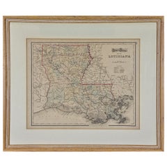
Louisiana: A Framed 19th Century Map by O. W. Gray
By Gray and Co
Located in Alamo, CA
This framed 19th century map of the Louisiana territory was published in "Gray's Atlas of the
Category

Antique Mid-19th Century American Other Maps

Materials

Paper

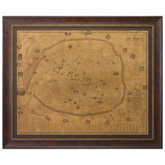
Plan of Paris, France, by A. Vuillemin, Antique Map, 1845
Located in Colorado Springs, CO
atlases during his career; many of which were so popular they went through multiple editions. His maps are
Category

Antique 1840s American Maps

Materials

Paper

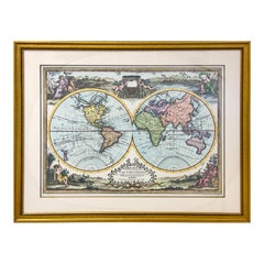
Double Hemisphere Old World Map Print, Matted & Framed
Located in Plainview, NY
framing the double round maps. The old world map print Will elevate the style of a library, office or
Category

20th Century Landscape Prints

Materials

Paper

Louisiana: A Framed 19th Century Map by O.W. Gray
Located in Alamo, CA
This framed 19th century map of the Louisiana territory was published in "Gray's Atlas of the
Category

1870s Landscape Prints

Materials

Engraving

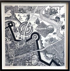
Map of Days
By Grayson Perry
Located in London, GB
Silk scarf framed with museum-grade UV-resistant glass. 90 x 90 cm 35 7/16 x 35 7/16 inches 103 x
Category

2010s Contemporary Prints and Multiples

Materials

Silk, Screen

Map of Days
Map of Days
H 35.44 in W 35.44 in
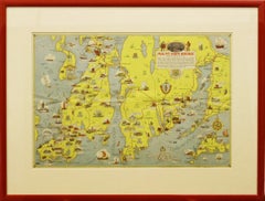
"Rhode Island Map, 1933"
Located in Bristol, CT
Classic c1933 colour (12 fold) red framed map of Rhode Island designed by H.W. Hetherington from
Category

1930s Prints and Multiples

Materials

Lithograph

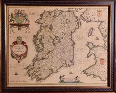
Ireland: A Framed 17th Century Hand-colored Map by Jan Jannson
By Johannes Janssonius
Located in Alamo, CA
This is a 17th century hand-colored map entitled "Hibernia Regnum Vulgo Ireland" by Johannes
Category

Mid-17th Century Old Masters Landscape Prints

Materials

Engraving

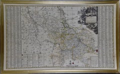
Meissen, Germany : A Large Framed 18th Century Map by Petrus Schenk
Located in Alamo, CA
corner and an explanation of symbols in the lower left. This large framed copperplate 18th century map
Category

Mid-18th Century Old Masters Landscape Prints

Materials

Engraving

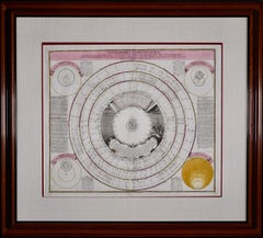
Theories of Planetary Orbits: A Framed 18th C. Celestial Map by Doppelmayr
By Johann Gabriel Doppelmayr 1
Located in Alamo, CA
our 1stdibs storefront that are presented in identical frames and maps. Two or three of these would
Category

Early 18th Century Landscape Prints

Materials

Engraving

Persia & Afghanistan: A Framed Hand-colored 17th Century Map by John Cary
By John Cary
Located in Alamo, CA
are included. This hand-colored map is presented in a brown wood frame with a gold inner trim and a
Category

Early 19th Century Old Masters More Prints

Materials

Engraving

Canterbury: An Original 16th C. Framed Hand-colored Map by Braun & Hogenberg
By Franz Hogenberg
Located in Alamo, CA
This is a framed 16th century map and city view of Canterbury, England entitled "Cantuarbury" by
Category

16th Century Old Masters Landscape Prints

Materials

Engraving

Theories of Planetary Motion: An 18th C. Framed Celestial Map by Doppelmayr
By Johann Gabriel Doppelmayr 1
Located in Alamo, CA
Mercator. This framed 18th century double page hand-colored engraved celestial map is printed on chain
Category

Early 18th Century Landscape Prints

Materials

Engraving

Untitled (Road Maps)
By Tom Friedman
Located in Saint Louis, MO
Tom Friedman Untitled (Road Maps), 2005 Lambda print Image Dimensions: 40 1/4 x 31 1/4 inches
Category

Early 2000s Contemporary Abstract Prints

Materials

Lambda

North America: A Framed Hand-colored 19th Century German Map by Adolph Stieler
By Adolf Stieler
Located in Alamo, CA
This framed early 19th century map of North America entitled "Nord-Amerika" is plate No. LIV (No
Category

1830s Landscape Prints

Materials

Engraving

Map Of The Island Of Antigua
Located in Bristol, CT
Classic colour plate depicting a 'Map of the Island of Antigua' by Eman Bowen Print Sz: 13 1/2"H x
Category

19th Century Prints and Multiples

Materials

Lithograph

Stanford's Portable Map of India
Located in London, GB
STANFORD, Edward Stanford's Portable Map of India. Shewing its Present Divisions and the Adjacent
Category

1870s Other Art Style Prints and Multiples

Materials

Watercolor, Engraving

Stanford's Portable Map of India
H 37.8 in W 34.06 in D 1.97 in
Antique Copper Engraving of Folding Plan of London, Published in 1804
Located in Langweer, NL
London on strong paper. This authentic map will look stunning in a nice frame on your wall. Study the
Category

Antique Early 1800s Maps

Materials

Paper

Map of the North of Scotland 17th century hand-coloured map by Gerardus Mercator
Located in London, GB
Gerardus Mercator (1512 - 1594) Map of the North of Scotland (1683) Engraving with later hand
Category

1680s Prints and Multiples

Materials

Engraving

Cadiz Island: A Framed 17th Century Hand-colored Map from Blaeu's Atlas Major
By Joan (Johannes) Blaeu
Located in Alamo, CA
fisheries.” 
 This 17th century hand-colored map is framed in an ornate, partially textured bronze-colored
Category

Mid-17th Century Old Masters Landscape Prints

Materials

Engraving

A Hand Colored 18th Century Framed Map of South America by Thomas Jefferys
Located in Alamo, CA
This detailed hand colored map of South America by Thomas Jefferys was published in London in 1750
Category

Mid-18th Century Other Art Style Landscape Prints

Materials

Engraving

The Orbits of Venus and Mercury: An 18th C. Framed Celestial Map by Doppelmayr
By Johann Gabriel Doppelmayr 1
Located in Alamo, CA
depicted above the vignette. This framed 18th century double page hand-colored engraved celestial map is
Category

Early 18th Century Landscape Prints

Materials

Engraving

Edinburgh, Scotland Coast: A 17th Century Hand-Colored Sea Chart by Collins
By Captain Greenvile Collins
Located in Alamo, CA
are framed and matted identically. The frames are a unique plexiglass sleeve design, measuring: 27.75
Category

Antique Late 17th Century English Maps

Materials

Paper

Flanders, Holland & Norfolk: Hand-Colored 17th Century Sea Chart by Collins
By Captain Greenvile Collins
Located in Alamo, CA
charts that are all the same size and are framed and matted identically. The frames are a unique
Category

Antique Late 17th Century English Maps

Materials

Paper

Original 1917 Railroad Map of Washington State railway map
Located in Spokane, WA
. “Railroad Map of Washington, 1917, The Public Service Commission. Archival linen backed and ready to frame
Category

1910s Academic Landscape Prints

Materials

Lithograph

Map of Northumberland by Joan Blaeu
By Joan (Johannes) Blaeu
Located in London, GB
To see our other original maps, scroll down to "More from this Seller" and below it click on "See
Category

1660s Landscape Prints

Materials

Engraving

Mapped, Claimed, Evaluated
By Jessica Houston
Located in Montreal, Quebec
Business As Usual. In What Nations Come and Go a pale purple oval nearly fills the frame, revealing only in
Category

2010s Contemporary Abstract Prints

Materials

Color

Map of Denmark, 1724
Located in Houston, TX
antique map displayed on a white mat with a gold border and fits a standard-size frame. Archival plastic
Category

17th Century Other Art Style More Prints

Materials

Paper, Ink, Watercolor

Map of Denmark,  1724
H 18 in W 24 in D 0.1 in
Map of Hampshire County, Britain/England, from Camden's" Britannia" in 1607
By John Norden
Located in Alamo, CA
part of the Isle of Wight. The map is presented in a gold-colored wood frame with black trim and a
Category

Early 1600s Prints and Multiples

Materials

Engraving

"The Story Map Of The West Indies" 1936
Located in Bristol, CT
Framed colour map of the West Indies published 1936 w/ border design motif adapted from native West
Category

1930s More Prints

Materials

Paper

American Revolution Map Drawn For John Marshall's "Life Of Washington" First Acc
Located in Bristol, CT
Wilderness Through Which Gerneral Arnold Marched To Attack Plate VI Map Sz: 11"H x 9 1/4"W Frame Sz: 20"H x
Category

Early 1800s Prints and Multiples

Materials

Paper, Engraving

Map of Crete - Etching by Johannes Blaeu - 1650s
Located in Roma, IT
Map of Crete (Candia olim Creta) is an etching realized by Johannes BLAEU (1596-1673) in 1650s
Category

1650s Modern Figurative Prints

Materials

Etching

17th Century Dutch Map of Italy, Sicily, Sardinia, Corsica and Dalmatian Coast
By Theodorus Danckerts
Located in Alamo, CA
This hand colored 17th century Dutch map entitled "Novissima et Accuratissima totius Italiae
Category

1690s Prints and Multiples

Materials

Engraving

A Map of the Colne Valley Cloth District, West Yorkshire by Max Gill
Located in London, GB
To see our other original maps, scroll down to "More from this Seller" and below it click on "See
Category

1940s Prints and Multiples

Materials

Lithograph

Map of Oxfordshire by Joan Blaeu with college crests
By Joan (Johannes) Blaeu
Located in London, GB
To see our other original maps, scroll down to "More from this Seller" and below it click on "See
Category

1660s Landscape Prints

Materials

Engraving

Original 'Map of the United States as Californians See It' vintage map poster
Located in Spokane, WA
is in very good fine condition, ready to frame. A humorous satirical pictorial map from 1947 with
Category

1940s American Modern Landscape Prints

Materials

Offset

Northern Scotland: 16th Century Hand-colored Map by Mercator
By Gerard Mercator
Located in Alamo, CA
This is a framed hand-colored 16th century map of Northern Scotland by Gerard Mercator entitled
Category

16th Century Other Art Style Landscape Prints

Materials

Engraving

17th Century map of Cumberland, UK by Robert Morden
Located in Petworth, West Sussex
Robert Morden (British, circa 1650 – 1703) A map of Cumberland with hand colouring An engraving
Category

17th Century Academic Landscape Prints

Materials

Engraving

Northern Scotland: 17th Century Hand-colored Map by Mercator
By Gerard Mercator
Located in Alamo, CA
This is a framed hand-colored 17th century map of Northern Scotland by Gerard Mercator entitled
Category

Mid-17th Century Other Art Style Landscape Prints

Materials

Engraving

Antique Map of the Southern Oceans, South America and Africa
Located in Larchmont, NY
Antique Map of the South Atlantic, c. 1800s Engraving 20 x 28 in. Framed: 25 3/4 x 33 3/4 in.
Category

19th Century Realist Figurative Prints

Materials

Engraving

18th Century French Map and City View of Joppe/Jaffa (Tel Aviv) by Sanson
By Nicholas Sanson d'Abbeville
Located in Alamo, CA
copperplate and was published in 1709 by his descendants. The map is presented in an ornate brown wood frame
Category

Early 1700s Prints and Multiples

Materials

Engraving

Europe - mixed media passport map print hand painted
By Yanko Tihov
Located in London, GB
Yanko Tihov is a painter and printmaker who trained in Sofia and works in London. In his passport series the design is determined by the colours and motifs of each country’s passport...
Category

2010s Contemporary More Prints

Materials

Gold Leaf

17th Century Dutch Map of the Holy Land at the Time of Jesus by Visscher
By Nicolaus Visscher
Located in Alamo, CA
Apostle Paul. The map is presented in an ornate brown wood frame embellished by gold-colored leaves and
Category

1660s Prints and Multiples

Materials

Engraving

Northern Italy: A 16th Century Hand-colored Map by Abraham Ortelius
By Abraham Ortelius
Located in Alamo, CA
This is a framed 16th century hand-colored copperplate map of northern Italy entitled "Veronae
Category

16th Century Old Masters Landscape Prints

Materials

Engraving

Dutch Map and City Plan of La Roche-sur-Foron, France, 17th Century Hand Colored
By Coenraet Decker
Located in Alamo, CA
issued. The map is in excellent condition. There are small abrasions and chips to the frame. Provenance
Category

1680s Prints and Multiples

Materials

Engraving

Antique Map of The City of Rome by Sebastian Münster, 1549
By Sebastian Münster
Located in Larchmont, NY
Sebastian Münster (German, 1488-1552) LA SITUATION DE LA VILLE DE ROME Antique Map of Rome, 1549
Category

1960s Realist Figurative Prints

Materials

Woodcut

"Newport's Famous Ten Mile Drive" c1939 Map
Located in Bristol, CT
beautiful summer residences of many prominent people Map Sz: 12 1/2"H x 17 1/4" Frame Sz: 21 1/2"H x 26 1
Category

1930s Other Art Style Landscape Prints

Materials

Lithograph

Southern Holland: An Original 17th C. Hand-colored Visscher Map "Hollandiae"
By Nicolaus Visscher
Located in Alamo, CA
This a beautiful framed hand colored 17th century map of the southern portions of Holland by
Category

Late 17th Century Other Art Style Landscape Prints

Materials

Engraving

Belgium and the Netherlands: A Hand-colored 17th Century Map by Visscher
By Nicolaus Visscher
Located in Alamo, CA
This is an original hand-colored 17th century map of Belgium by Nicolaus (Nicolas) Visscher II
Category

Late 17th Century Other Art Style Landscape Prints

Materials

Engraving

A Map Of Western Long Island Sound Showing Yacht Clubs, Aids To Navigation...
Located in Bristol, CT
Classic color map/ nautical chart (by Nolf Klep '39) of the North Shore of Long Island Sound for
Category

1930s More Prints

Materials

Paper

Original 'The Evergreen Playground' Easter Washington State map
Located in Spokane, WA
Original The Evergreen Playground Kroll Map Company vintage poster. Archival linen backed in fine
Category

1940s American Realist Landscape Prints

Materials

Lithograph

Persia, Armenia & Adjacent Regions: A Hand-colored 17th Century Map by De Wit
By Frederick de Wit
Located in Alamo, CA
on a map. This hand-colored map is presented in an antiqued gold-colored wood frame with an eggplant
Category

Late 17th Century Old Masters More Prints

Materials

Engraving

Europe 1960s Cold War - mixed media passport map print hand painted
By Yanko Tihov
Located in London, GB
Yanko Tihov is a painter and printmaker who trained in Sofia and works in London. In his passport series the design is determined by the colours and motifs of each country’s passport...
Category

2010s Contemporary More Prints

Materials

Gold Leaf

L'Isle de France: A Hand-colored 17th Century Map by De Wit
By Frederick de Wit
Located in Alamo, CA
in the lower right. This hand-colored map is presented in a brown burl wood frame with a cream
Category

Early 18th Century Old Masters More Prints

Materials

Engraving

Original Las Vegas Fun Map vintage 1960s travel poster
Located in Spokane, WA
Original 1960 Las Vegas Fun Map. Archival linen backed and in very good condition, ready to
Category

1960s American Modern Landscape Prints

Materials

Offset

Union Pacific West vintage fun map railroad travel poster
Located in Spokane, WA
Original “The Union Pacific West fun map, archivally linen backed in very good condition. Ready to
Category

1960s American Modern Landscape Prints

Materials

Offset

Original Southern California Home Federal Fun Map vintage poster
Located in Spokane, WA
that is ready to frame. Artist: Darrel Millsap. This fun map of California shows about everything and
Category

1970s American Modern Landscape Prints

Materials

Offset

Charte von Sud-America (Map of South America) - Etching with Hand-Drawn Outlines
Located in Soquel, CA
Map of south America, engraved by Franz Pluth (Czech, 1800-1871), from the book "Neueste Länder
Category

1820s Other Art Style More Prints

Materials

Paper, Printer's Ink, Etching

Original Los Angeles, California Funny Funny World vintage fun map
Located in Spokane, WA
very fine condition. Ready to frame. This is the 1976 printing of this map, now 50 years old. This
Category

1970s American Modern Landscape Prints

Materials

Offset

Map of the Holy Land "Carte de la Syrie et de l'Egypte" by Pierre Lapie
By Pierre M. Lapie
Located in Alamo, CA
This is an early 19th century map of ancient Syria and Egypt entitled "Carte de la Syrie et de
Category

1830s Landscape Prints

Materials

Engraving

Original Vins du Sud-Ouest vintage French wine map poster
Located in Spokane, WA
. Size 36.5" x 27". Archival linen backed and ready to frame. Original French horizontal poster (map
Category

Late 20th Century American Modern Landscape Prints

Materials

Lithograph

  • 1
Get Updated with New Arrivals
Save "Map Multiple Frames", and we’ll notify you when there are new listings in this category.

Map Multiple Frames For Sale on 1stDibs

There is a broad range of map multiple frames for sale on 1stDibs. Browse a selection of contemporary, Old Masters or modern versions of these works for sale today — there are 43 contemporary, 9 Old Masters and 1 modern examples available. These items have been produced for many years, with earlier versions available from the 18th Century and newer variations made as recently as the 21st Century. Map multiple frames available on 1stDibs span a range of colors that includes gold, gray, brown, black and more. Yanko Tihov, Frederick de Wit, Gerard Mercator, Johann Gabriel Doppelmayr and Nicolaus Visscher took a thoughtful approach to this subject that are worth considering. The range of these distinct pieces — often created in gold leaf, gold and metal — can elevate any room of your home.

How Much are Map Multiple Frames?

Map multiple frames can differ in price owing to various characteristics — the average selling price for items in our inventory is $1,475, while the lowest priced sells for $183 and the highest can go for as much as $44,722.

Read More

Art Brings the Drama in These Intriguing 1stDibs 50 Spaces

The world’s top designers explain how they display art to elicit the natural (and supernatural) energy of home interiors.

Welcome (Back) to the Wild, Wonderful World of  Walasse Ting

Americans are rediscovering the globe-trotting painter and poet, who was connected to all sorts of art movements across a long and varied career.

Shapero Modern’s Director Tells Us All about 20th-Century Prints

Tabitha Philpott-Kent knows a lot of art multiples. Here, the London gallery director talks about what makes printmaking so fabulous.

Yoshitomo Nara Puts a Punk Rock Twist on the Traditional Prints of His Ancestors

The forever-rebellious Japanese artist craftily defaces famous Edo Period woodblock prints with “In the Floating World.”

Red Grooms Salutes the ‘Ninth Street Women’ Who Revolutionized Modern Art

In a new show of peppy portraits, the 85-year-old artist looks back at 1950s New York, when the Abstract Expressionists ruled the scene. Only now, the women Ab-Ex artists get more of the spotlight than the men.

Just What Is an Intaglio Print, and What Makes It a Good Investment?

Bay Area art publisher Rhea Fontaine explains the difference between intaglio and woodcut printing, how to frame fine art prints and what makes them attractive to collectors.

Andy Warhol Piles Up the Gifts in This Fanciful Christmas Print

Created in the late 1950s, it’s one of a surprising number of holiday-themed works by the prolific Pop artist.

A Derrick Adams Double Portrait Brings Out the Interior Lives of His Subjects

Adams has skyrocketed to art superstardom with his exuberant depictions of Black life. Here's what makes his work important to our times.