Map Of European Countries
10
130
5
3
to
17
108
28
138
137
137
7
6
4
3
2
1
1
52
45
33
8
9
17
6
2
2
1
7
1
3
1
1
1
109
17
17
9
7
69
23
16
12
8
2
2
2
2
1
Sort By
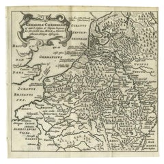
Antique Map of the Low Countries and Surroundings in Europe, 1685
By Philipp Clüver
Located in Langweer, NL
Mose ac Rheni.' Miniature map of the Low Countries and part of Germany and France. From the pocket
Category
Antique 17th Century Maps
Materials
Paper
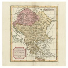
Old Engraved Map of Hungary, European Balkan Countries, Greece and Crete, 1806
Located in Langweer, NL
Antique map titled 'Hongrie, Turquie Europe'.
Decorative map of Hungary, southeast European
Category
Antique 19th Century Maps
Materials
Paper
H 15.08 in W 11.34 in D 0 in
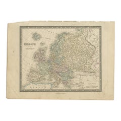
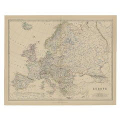
Antique Map of Europe by Wyld '1845'
Located in Langweer, NL
Antique map titled 'Europe'. Original antique map of Europe. This map originates from 'An Atlas of
Category
Antique Mid-19th Century Maps
Materials
Paper
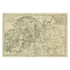
Antique Map of Northern Europe and European Russia, ca.1780
Located in Langweer, NL
Antique map titled 'Le Nord de L'Europe, Contenant Le Danemark, La Norwege; La Suede et La Laponie
Category
Antique 1780s Maps
Materials
Paper
Antique Map of the European Continent, 1882
Located in Langweer, NL
Antique map titled 'Europe'. Old map of the European continent. This map originates from 'The Royal
Category
Antique 19th Century Maps
Materials
Paper
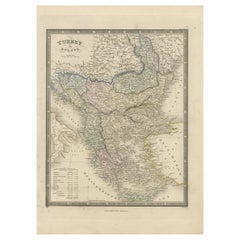
Antique Map of Turkey in Europe by Wyld, '1845'
Located in Langweer, NL
Antique map titled 'Turkey in Europe'. Original antique map of Turkey in Europe. This map
Category
Antique Mid-19th Century Maps
Materials
Paper
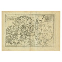
Antique Map of Northern Europe by Bonne, c.1780
Located in Langweer, NL
Antique map titled 'Le Nord de L'Europe, Contenant Le Danemark, La Norwege; La Suede et La Laponie
Category
Antique 18th Century Maps
Materials
Paper
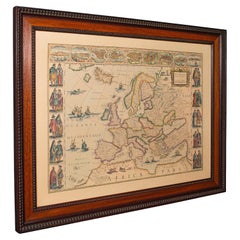
Vintage Reproduction 17th Century Map of Europe, American, Cartography, Blaeuw
Located in Hele, Devon, GB
This is a vintage reproduction map of Europe. An American, paper stock cartography print in frame
Category
Late 20th Century Central American Mid-Century Modern Maps
Materials
Glass, Wood, Paper
H 30.32 in W 38.39 in D 1.38 in
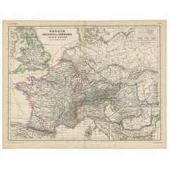
Antique Map of Western Europe by H. Kiepert, circa 1870
By Heinrich Kiepert
Located in Langweer, NL
Antique map titled 'Gallia, Britannia, Germania'. This map depicts a large part of Western Europe
Category
Antique Late 19th Century Maps
Materials
Paper
Antique Map of Russia in Europe and Poland by Wyld '1845'
Located in Langweer, NL
Antique map titled 'Russia in Europe including Poland'. Original antique map of Russia in Europe
Category
Antique Mid-19th Century Maps
Materials
Paper
Old Map of Turkey in Europe, incl Romania, Servia, Montenegro & Bulgaria, 1882
Located in Langweer, NL
Antique map titled 'Turkey in Europe'.
Old map of Turkey in Europe, also depicting part of
Category
Antique 1880s Maps
Materials
Paper
H 19.53 in W 24.14 in D 0 in
Antique Plan of Turkey in Europe with Inset Map of the Bosporus, ca.1850
Located in Langweer, NL
Antique map titled 'Turkey in Europe'.
A map of European Turkey and the surrounding countries
Category
Antique 1850s Maps
Materials
Paper
H 11.82 in W 17.33 in D 0 in
Antique 1803 Italian Map of Asia Including China Indoneseia India
Located in Amsterdam, Noord Holland
.
Additional information:
Type: Map
Country of Manufacturing: Europe
Period: 19th century Qing (1661 - 1912
Category
Antique 19th Century European Maps
Materials
Paper
Antique French Map of Asia Including China Indoneseia India, 1783
Located in Amsterdam, Noord Holland
Very nice map of Asia. 1783 Dedie au Roy.
Additional information:
Country of Manufacturing: Europe
Category
Antique 18th Century European Maps
Materials
Paper
Super Rare Antique French Map of Chine and the Chinese Empire, 1780
Located in Amsterdam, Noord Holland
Made by Bonne.
Additional information:
Type: Map
Country of Manufacturing: Europe
Period: 18th century
Category
Antique 18th Century European Maps
Materials
Paper
Antique Decorative Coloured Map of North America, 1882
Located in Langweer, NL
This original antique map of North America is from the Blackie & Son Atlas published in 1882. Here
Category
Antique 1880s Maps
Materials
Paper
Antique Map of The United States of North America, 1882
Located in Langweer, NL
19th century. The map also includes the Gulf of Mexico and parts of adjacent countries such as Canada
Category
Antique 1880s Maps
Materials
Paper
Antique Map of British North America, The Dominion of of Canada, 1882
Located in Langweer, NL
This map is titled "British North America, Dominion of Canada," from the 1882 Blackie Atlas. It
Category
Antique 1880s Maps
Materials
Paper
No Reserve
H 14.97 in W 22.45 in D 0 in
Antique Carte de L'Inde Myanmar, Malaysia Vietnam Map of Asia the Chinese Empire
Located in Amsterdam, Noord Holland
Asia.
Additional information:
Type: Map
Country of Manufacturing: Europe
Period: 18th century Qing
Category
Antique 18th Century European Maps
Materials
Paper
H 12.09 in W 16.15 in D 0.04 in
Map of Independent Tartary with Vignettes of the Region's Culture, 1851
Located in Langweer, NL
both charm and educational value to the map, reflecting the 19th-century European interest in exotic
Category
Antique 1850s Maps
Materials
Paper
No Reserve
H 10.71 in W 14.26 in D 0 in
1859 Classic Map of France: Blackie's Imperial Geographic Masterpiece
Located in Langweer, NL
Coverage**: The map encompasses the entirety of France, illustrating the country's diverse landscapes, from
Category
Antique Mid-19th Century Maps
Materials
Paper
H 21.26 in W 14.57 in D 0.02 in
Antique Geographical, Historical and Statistical Map of Massachusetts, 1822
Located in Langweer, NL
This attractive map of Massachusetts presents a finely detailed overview of the state in the first
Category
Antique 1820s Maps
Materials
Paper
H 17.13 in W 21.46 in D 0 in
Antique Map of North Africa by Ortelius, c.1580
Located in Langweer, NL
Antique map titled 'Barbariae et Biledulgerid Nova Descriptio'. Original antique map of North
Category
Antique 16th Century Maps
Materials
Paper
Original Antique Coloured Map of Western Africa, Published in 1882
Located in Langweer, NL
Detail**: The map shows the region just before the "Scramble for Africa" where European countries
Category
Antique 1880s Maps
Materials
Paper
No Reserve
H 14.97 in W 22.45 in D 0 in
Map of Polynesia Highlighting Cultural Landscapes and Maritime Activities, 1851
Located in Langweer, NL
John Tallis & Company was a London-based map publisher that flourished during the 19th century
Category
Antique 1850s Maps
Materials
Paper
H 10.71 in W 14.26 in D 0 in
Swiss Splendor: Antique Map of Switzerland and Its Cantons, 1852
Located in Langweer, NL
, as a country surrounded by multiple nations, makes this map historically and geopolitically
Category
Antique Mid-19th Century Maps
Materials
Paper
Original Antique Map of the Road from Andover to Crewkerne
Located in Langweer, NL
-atlas of any country in Western Europe. It was composed of maps of seventy-three major roads and cross
Category
Antique Late 17th Century Maps
Materials
Paper
Antique Old Map of Africa with Insets of Mauritius, Reunion and Natal, 1882
Located in Langweer, NL
The uploaded image is a historical map of Africa from the 1882 atlas by Blackie & Son. The map
Category
Antique 1880s Maps
Materials
Paper
Free Shipping
H 14.97 in W 22.45 in D 0 in
Antique Map of Sweden, Norway and Denmark by Johnson, 1872
Located in Langweer, NL
two countries occupying the Scandinavian Peninsula, with a clear delineation between them. The map is
Category
Antique Late 19th Century Maps
Materials
Paper
19th Century Illustrated Map of Ceylon (Sri Lanka) with Notable Landmarks
Located in Langweer, NL
shifted, countries have gained independence, and names have changed. The maps offer a snapshot of the
Category
Antique 1850s Maps
Materials
Paper
H 14.26 in W 10.71 in D 0 in
Mediterranean Tapestry: A 19th Century Map of the Mediterranean Shores, 1882
Located in Langweer, NL
Europe down to the northern coastlines of Africa.
The map is a vivid document of the time, with each
Category
Antique 1880s Maps
Materials
Paper
H 11.03 in W 14.97 in D 0 in
Original Antique Map of the Peninsula of India with Part of Ceylon by Wyld, 1844
Located in Langweer, NL
This extensive map of India, spanning two sheets, draws from Reynell’s original map and
Category
Antique Mid-18th Century Maps
Materials
Paper
No Reserve
H 33.47 in W 23.23 in D 0 in
Cartographic Heritage: The 1901 Map of the Vizcaya Province in Spain
Located in Langweer, NL
This is a historical map of the province of Vizcaya (Biscay) in Spain, dated 1901. The title on the
Category
Antique Early 1900s Maps
Materials
Paper
Free Shipping
H 14.77 in W 20.08 in D 0 in
Original Antique Hand-Colored Map of Friesland by C. Merian, 1659
Located in Langweer, NL
their artistry and precision. His works include a vast series of topographical studies and maps known
Category
Antique Mid-17th Century Maps
Materials
Paper
Free Shipping
H 11.74 in W 14.3 in D 0.02 in
1899 Poole Brothers Antique Railroad Map of the Illinois Central Railroad
Located in Colorado Springs, CO
This is an 1899 railroad map of the Illinois Central and Yazoo and Mississippi Valley Railroads
Category
Antique 1890s American Maps
Materials
Paper
Mid-19th Century Decorative Map of Asia with Cultural and Natural Vignettes
Located in Langweer, NL
John Tallis & Company, known for their decorative mid-19th-century maps, created this map of Asia
Category
Antique 1850s Maps
Materials
Paper
H 10.71 in W 14.26 in D 0 in
"Nova Barbariae Descriptio", a 17th Century Hand-Colored Map of North Africa
By Johannes Janssonius
Located in Alamo, CA
adjacent countries in southern Europe, including Portugal, Spain, Italy, Greece and Asia Minor. The map is
Category
Antique Mid-17th Century Dutch Maps
Materials
Paper
H 22.38 in W 29 in D 0.13 in
Antique Map of Northern Africa "Barbary Coast" by R. Bonne, circa 1780
Located in Langweer, NL
adjacent Spain, Italy and Greece. This map was made in response to European interest in the region due to
Category
Antique Late 18th Century Maps
Materials
Paper
H 10.24 in W 15.08 in D 0.02 in
Cartographic Elegance: The Art and Science of 17th-Century Asian Maps, ca.1681
Located in Langweer, NL
This original antique map is an artifact from a pivotal era in cartography, reflecting not only the
Category
Antique 1680s Maps
Materials
Paper
H 7.49 in W 9.22 in D 0 in
Road Map John Ogilby No 75 Kings Lyn Harwich, Britannia Framed Wallhanging
By John Ogilby
Located in BUNGAY, SUFFOLK
Europe. It was composed of maps of seventy-three major roads and cross-roads, presented in a continuous
Category
Antique 1670s European Baroque Maps
Materials
Paper
H 15.75 in W 19.69 in D 0.6 in
Hand-Colored 18th Century Homann Map of Denmark and Islands in the Baltic Sea
By Johann Baptist Homann
Located in Alamo, CA
, becoming the leading map publisher in Germany and an important entity in the European map market. In 1715
Category
Antique Early 18th Century German Maps
Materials
Paper
H 20.25 in W 23.25 in D 0.07 in
1633 Map Entitled "Beauvaisis Comitatus Belova Cium, Ric.0002
Located in Norton, MA
den Keere * 1595 Europe (wall map): with Pieter van den Keere * 1598 World and the Continents * 1599
Category
Antique 17th Century Dutch Maps
Materials
Paper
Road Map, John Ogilby, No 54, London, Yarmouth, Britannia
By John Ogilby
Located in BUNGAY, SUFFOLK
Europe. It was composed of maps of seventy-three major roads and cross-roads, presented in a continuous
Category
Antique 1670s English Baroque Maps
Materials
Paper
Antique Map of the Journey from Zhe-Hol in Tartary to Beijing and Hang-Tchoo Foo
Located in Langweer, NL
Europeans valuable new information on China's geography and social customs.
This map originates from 'An
Category
Antique Late 18th Century Maps
Materials
Paper
No Reserve
H 26.78 in W 20.08 in D 0.02 in
South America: Hand-colored 18th Century Framed Map by Thomas Jefferys
By Thomas Jefferys
Located in Alamo, CA
. The map shows countries, early colonial possessions, towns, rivers, mountains, and adjacent islands as
Category
Antique Mid-18th Century English Maps
Materials
Paper
1630 Pierre Petit map "Description du Gouvernement de la Capelle" Ric0010
Located in Norton, MA
leading role in astronomy. Petit argued that France had fallen behind some other European countries and
Category
Antique 17th Century Dutch Maps
Materials
Paper
H 18.9 in W 22.45 in D 0.4 in
North & South America: A 17th Century Hand-colored Map by Jansson & Goos
By Johannes Janssonius
Located in Alamo, CA
route between Europe and Asia. The map includes portions of Japan, as well as multiple islands in the
Category
Antique 1620s Dutch Maps
Materials
Paper
West Africa Entitled "Guinea Propria": An 18th Century Hand Colored Homann Map
By Johann Baptist Homann
Located in Alamo, CA
flourished, becoming the leading map publisher in Germany and an important entity in the European map market
Category
Antique Mid-18th Century German Maps
Materials
Paper
H 20.5 in W 23.5 in D 0.13 in
California, Alaska and Mexico: 18th Century Hand-Colored Map by de Vaugondy
By Didier Robert de Vaugondy
Located in Alamo, CA
cartes publiees au commencement de 17e Siecle" (Map of California and the Northwestern Countries
Category
Antique 1770s French Maps
Materials
Paper
H 13.75 in W 16.63 in D 0.13 in
Map Road Strip Britannia Sheet 2 John Ogilby London Aberistwith Islip Bramyard
By John Ogilby
Located in BUNGAY, SUFFOLK
national road-atlas of any country in Western Europe. It was composed of maps of seventy-three major roads
Category
Antique 17th Century English Baroque Maps
Materials
Paper
H 14.38 in W 19.3 in D 0.79 in
Map Road John Ogilby Britannia No 74 Ipswich to Norwich Cromer Framed
By John Ogilby
Located in BUNGAY, SUFFOLK
national road-atlas of any country in Western Europe. It was composed of maps of seventy-three major roads
Category
Antique 1670s English Baroque Maps
Materials
Paper
Road Map No43 London to Kings Lynn, Royston to Downham, John Ogilby, Britannia
By John Ogilby
Located in BUNGAY, SUFFOLK
amazing simplicity. The 'Britannia' was the first national road-atlas of any country in Western Europe. It
Category
Antique Late 17th Century British Charles II Maps
Materials
Paper
H 20.48 in W 24.41 in D 0.4 in
Road Map John Ogilby London St David's Britannia No 15 Abingdon Monmouth Framed
By John Ogilby
Located in BUNGAY, SUFFOLK
amazing simplicity. The 'Britannia' was the first national road-atlas of any country in Western Europe. It
Category
Antique 1670s English Baroque Maps
Materials
Paper
H 20.48 in W 24.41 in D 0.6 in
Road Map Britannia No 32 the Road from London to Barnstable John Ogilby Framed
By John Ogilby
Located in BUNGAY, SUFFOLK
Europe. It was composed of maps of seventy-three major roads and cross-roads, presented in a continuous
Category
Antique Late 17th Century English Charles II Maps
Materials
Paper
H 20.48 in W 24.41 in D 0.6 in
Road Map Britannia No 15 London to St Davids John Ogilby Brown Gilt Frame
By John Ogilby
Located in BUNGAY, SUFFOLK
amazing simplicity. The 'Britannia' was the first national road-atlas of any country in Western Europe. It
Category
Antique Late 17th Century British Charles II Maps
Materials
Paper
H 22.05 in W 26.19 in D 0.6 in
Road Map Britannia No 25 London to the Lands End, John Ogilby Brown Gilded Frame
By John Ogilby
Located in BUNGAY, SUFFOLK
amazing simplicity. The 'Britannia' was the first national road-atlas of any country in Western Europe. It
Category
Antique Late 17th Century British Charles II Maps
Materials
Paper
H 22.05 in W 26.19 in D 0.6 in
Road Map Britannia 1675/6 No 5 Road London to Barwick, London Stilton Grey Frame
By John Ogilby
Located in BUNGAY, SUFFOLK
. The 'Britannia' was the first national road-atlas of any country in Western Europe. It was composed of
Category
Antique Late 17th Century British Charles II Maps
Materials
Paper
H 22.84 in W 25.99 in D 0.4 in
Antique Print of the City of Ten-Tchoo-Foo, China, 1796
Located in Langweer, NL
Great Britain and China by allowing the British to have a permanent embassy in the country. Sir George
Category
Antique 1790s Maps
Materials
Paper
Antique Engraving of a Print with a View of Masulipatam, India, 1672
Located in Langweer, NL
.' (transl: Description of the East Indian Countries of Malabar, Coromandel, Ceylon, etc.), printed in
Category
Antique 1670s Maps
Materials
Paper
Antique Engraving of a Print Showing the Indian City of Suratte 'Surat', 1672
Located in Langweer, NL
Countries of Malabar, Coromandel, Ceylon, etc.), printed in Amsterdam by Jacob van Velsen and published by
Category
Antique 1670s Maps
Materials
Paper
H 12.01 in W 14.73 in D 0 in
- 1
Get Updated with New Arrivals
Save "Map Of European Countries", and we’ll notify you when there are new listings in this category.
Map Of European Countries For Sale on 1stDibs
At 1stDibs, there are several options of map of European countries available for sale. Frequently made of paper, wood and fabric, all map of European countries available were constructed with great care. We have 81 antique and vintage map of European countries in-stock, while there are 3 modern editions to choose from as well. Map of European countries have been made for many years, and versions that date back to the 18th Century alongside those produced as recently as the 21st Century. Map of European countries are generally popular furniture pieces, but Baroque, modern and Art Deco styles are often sought at 1stDibs. Many map of European countries are appealing in their simplicity, but Johann Baptist Homann, Johannes Janssonius and Heinrich Kiepert produced popular map of European countries that are worth a look.
How Much are Map Of European Countries?
Prices for map of European countries start at $30 and top out at $275,000 with the average selling for $775.
More Ways To Browse
Vintage London Underground Map Poster
Japan Propaganda
J Friedman
Rolex Label
Catalina Island
Rolex Gallery
Farming Posters
Used Office Furniture Vancouver
Paul Lambert Art
Antique Map Of Philadelphia
Antique Carriage Wheel
Antique Map Of Georgia
Antique Maps Of Philadelphia
Madrid Map
Greek Key Tray
Astronomical Clock
Astronomical Clocks
Printer Stand
