Map Of New York City
7
to
43
864
80
583
403
259
126
119
82
59
42
37
36
25
21
20
20
20
19
16
15
12
11
11
10
10
10
9
8
8
7
4
4
4
3
3
3
2
2
2
2
1
1
1
1
1
1
1
61
45
28
27
23
Sort By
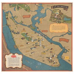
Pictorial Vintage Map of New York City Showing Numerous Landmarks, 1939
Located in Langweer, NL
This pictorial souvenir map focuses on New York City and the site of the 1939 World's Fair. It was
Category
Vintage 1930s Maps
Materials
Paper
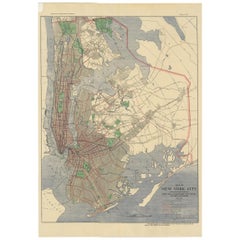
Antique Map of the Passenger Transportation Systems of New York, 1901
Located in Langweer, NL
Antique map titled 'Map of New York City except Richmond Borough showing Passenger Transportation
Category
20th Century Maps
Materials
Paper
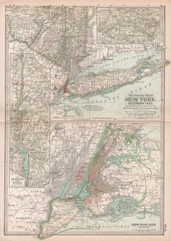
New York. Southern Part. USA. Century Atlas state antique vintage map
Located in Melbourne, Victoria
'The Century Atlas. New York. Southern Part.'
Original antique map, 1903.
Inset maps of 'New York
Category
Early 20th Century Victorian More Prints
Materials
Lithograph
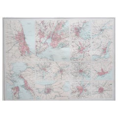
Antique Map of American Cities, Vignette of New York City, circa 1920
Located in St Annes, Lancashire
Great maps of American Cities
Unframed
Original color
By John Bartholomew and Co
Category
Vintage 1920s British Maps
Materials
Paper
No Reserve
H 18 in W 23 in D 0.07 in
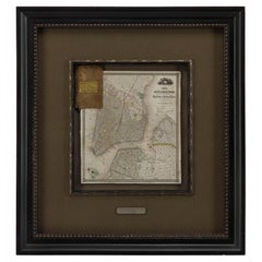
1840 "New Map of the City of New York With Part of Brooklyn & Williamsburg"
Located in Colorado Springs, CO
Presented is a hand-colored, engraved folding map titled "New Map of the City of New York With Part
Category
Antique 1840s American Maps
Materials
Paper
H 30 in W 27.5 in D 3 in
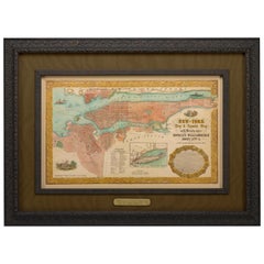
1855 "New-York City & County Map" by Charles Magnus
By Charles Magnus
Located in Colorado Springs, CO
This is a beautiful hand-colored map titled “New York City & County Map with Vicinity entire
Category
Antique 1850s American Maps
Materials
Paper
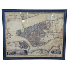
Vintage Oversized New York City Lower Manhattan 1840s Map Print
Located in Dayton, OH
Vintage late 20th century reproduction print of New York City featuring lower Manhattan in 1840.
Category
Late 20th Century Victorian Maps
Materials
Paper
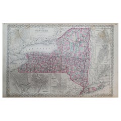
1858 Colton's Map of New York, Ric.B011
Located in Norton, MA
, Syracuse, Albany, Troy and New York City. The main map in center has typical pastel coloring of counties
Category
Antique 19th Century Unknown Maps
Materials
Paper
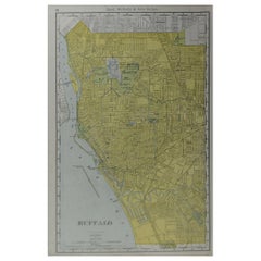
Original Antique City Plan of Buffalo, New York, USA, circa 1900
By Rand McNally & Co.
Located in St Annes, Lancashire
Fabulous colorful map of Buffalo
Original color
By Rand, McNally & Co.
Published, circa
Category
Antique Early 1900s American Maps
Materials
Paper
No Reserve
H 20.5 in W 14 in D 0.07 in
1912 "Panoramic View of New York City and Vicinity" by Jacob Ruppert
Located in Colorado Springs, CO
This is an attractive and very scarce map of New York, published by the Yorkville brewer Jacob
Category
Vintage 1910s American Maps
Materials
Paper
Antique Rand McNally & Company Schoolmap. Ancient Oriental Empires. Historical
By Rand McNally & Co.
Located in ROTTERDAM, ZH
Road Map of New York City & Vicinity, in 1904. In 1910,[citation needed] the company acquired the line
Category
Vintage 1920s American American Classical Maps
Materials
Fabric, Paper
H 43.31 in W 64.18 in D 1.19 in
1863 "Lloyd's New Map of the United States, the Canadas, and New Brunswick"
Located in Colorado Springs, CO
, two shipping agents and their routes are drawn out of New York City. The map includes details of the
Category
Antique 1860s American Maps
Materials
Linen, Wood, Paper
H 37 in W 49.5 in D 1 in
1859 "Colton's New Map of the State of Texas..." by Johnson & Browning
Located in Colorado Springs, CO
surrounded by Colton's decorative scroll borders.
Alvin J. Johnson came to New York City in 1857 and worked
Category
Antique 1850s American Maps
Materials
Paper
H 27.75 in W 38.5 in D 1.38 in
1865 "Johnson's California, Utah, Nevada, Colorado, New Mexico, Arizona" Map
Located in Colorado Springs, CO
, New Mexico, and Arizona” map. First published in 1864, this map was issued as pages 66 and 67 in the
Category
Antique Mid-19th Century Maps
Materials
Paper
H 22.5 in W 30.5 in D 0.75 in
1854 Map of Massachusetts, Connecticut and Rhode Island, Antique Wall Map
Located in Colorado Springs, CO
some of these companies maintained offices in both Buffalo and New York City.
This map has been
Category
Antique 19th Century American Maps
Materials
Paper
H 38.13 in W 45 in D 3.5 in
1851 Map of "Independent Tartary", Ric. R018
Located in Norton, MA
. (London & New York) between 1838 and 1851. After 1850-51, their maps were published by the London Printing
Category
Antique 19th Century Unknown Maps
Materials
Paper
Nelson's Guide to the City of New York and its Neighbourhood, 1858
Located in Langweer, NL
"Nelson's Guide to the City of New York and its Neighbourhood," published in 1858 by T. Nelson in
Category
Antique 1850s Books
Materials
Paper
French Geographical, Statistical and Historical Map of Pensylvania, 1825
Located in Langweer, NL
Maryland, Delaware, New York and New jersey. Printed on the same page as the map is geographical
Category
Antique 1820s Maps
Materials
Paper
H 20.08 in W 25.99 in D 0 in
1859 "Map of the United States of America..." by J. H. Colton
By J.H. Colton
Located in Colorado Springs, CO
,” “Astoria, Oregon,” “Saratoga Lake, New York”, “Valley of the Connecticut,” as well as four monuments, inset
Category
Antique 1850s American Maps
Materials
Paper
1868 Map of the Upper Part of the Island of Manhattan Above 86th Street
By Wm. Rogers Mfg. Co.
Located in San Francisco, CA
This wonderful piece of New York City history is over 150 years old. It depicts 86th street and
Category
Antique 1860s American American Colonial Maps
Materials
Paper
Antique Map of Peru and Bolivia by J. Tallis, circa 1851
Located in Langweer, NL
The Illustrated Atlas (London & New York: circa 1851).
The Illustrated Atlas, published from 1849
Category
Antique Mid-19th Century Maps
Materials
Paper
1847 Ornamental Map of the United States & Mexico by H. Phelps
Located in Colorado Springs, CO
to the rest of the U.S. The map details a potential route for a railroad running from New York City
Category
Antique 1840s American Maps
Materials
Paper
1899 Poole Brothers Antique Railroad Map of the Illinois Central Railroad
Located in Colorado Springs, CO
, with the short rail distances to New York listed above the stop and short rail distances to New Orleans
Category
Antique 1890s American Maps
Materials
Paper
1856 U.S. Coast Survey Map of Chesapeake Bay and Delaware Bay
Located in Colorado Springs, CO
Presented is U.S. Coast Survey nautical chart or maritime map of Chesapeake Bay and Delaware Bay
Category
Antique 1850s American Maps
Materials
Paper
1847 “World at One View” Antique Hand-Colored Wall Map of the World
Located in Colorado Springs, CO
and Thayer, New York.
This pictorial map was printed as a broadside and features a beautiful double
Category
Antique 19th Century American Maps
Materials
Paper
Rare and Early Plaster Relief Map of Adirondack Mountains by F J H Merrill
By E. W. Merrill, P.F. Howells
Located in Buffalo, NY
to check the amazing detail,, Hand delivery avail to New York City or anywhere en route from Buffalo
Category
Vintage 1910s American Industrial Maps
Materials
Plaster, Wood
1842 Wall Map of the United States by J. H. Young, Published by S. A. Mitchell
Located in Colorado Springs, CO
city map insets of the vicinities around Boston, New York, Philadelphia, Baltimore and Washington
Category
Antique 1840s American Maps
Materials
Paper
H 45 in W 38 in D 1 in
"The United States from the Latest Authorities" Antique Wall Map, 1835
Located in Colorado Springs, CO
noted.
The map is bordered with vignettes of Boston, New York, Philadelphia, Hartford, Cincinnati
Category
Antique 1830s American Maps
Materials
Paper
Antique 1844 J Calvin Smith JH Colton Midwest United States Survey Map 27"
By J.H. Colton
Located in Dayton, OH
. Colton in New York. It was tipped into the back of a small travel guide titled “The Western Tourist and
Category
Antique 1840s Maps
Materials
Paper
H 21 in W 26.5 in D 0.5 in
Pair of Monumental National Air Map Company Manhattan Aerial Photo Maps, 1955
Located in San Francisco, CA
Manhattan in New York City by the National Air Map Company, including its original cover sheet.
Titled
Category
Vintage 1950s American Mid-Century Modern Photography
Materials
Acrylic, Wood, Paper
H 47.75 in W 33.25 in D 1.5 in
Civil War Panorama of the Seat of War by John Bachmann, Antique Print circa 1864
Located in Colorado Springs, CO
).
"At the outset of the Civil War, John Bachmann, of New York City, one of the finest American artists
Category
Antique 1860s American Maps
Materials
Paper
H 33.5 in W 41.5 in D 2 in
Old Framed Map of a Plan of the City of New York as Surveyed in 1767
Located in Lambertville, NJ
Old framed map of a plan of the City of New York as surveyed in 1767. Published by the Common
Category
Antique Late 19th Century American Prints
Materials
Wood, Paper
The Timeline History of New York City Book
Located in North Hollywood, CA
The Timeline History of New York City Book
Playne Books Ltd;
Worth Press Ltd;
Hardcover book
Category
21st Century and Contemporary American Expressionist Books
Materials
Paper
Antique New York Wall Map by Westermann
By Westermann
Located in Stockbridge, GB
Antique New York Map By Westermann
A rare early school pull down wall map of New York. The map
Category
Mid-20th Century British Schoolhouse Posters
Materials
Canvas, Wood
"Chance" Contemporary Surrealist Perspectival Map Drawing of Albany, New York
By Ken Ragsdale
Located in New York, NY
historical lithograph of Albany, New York made by J. W. Hill in the 1850's. This work on paper is an orginal
Category
2010s Contemporary Figurative Drawings and Watercolors
Materials
Color Pencil, Graphite, Ink
c.1900 Handwoven French Tapestry Map New Netherlands, Amsterdam, 1626 New York
Located in Jensen Beach, FL
Amsterdam or modern day New York City. Handmade in France around the turn of the 20th century.
Category
Early 20th Century Tapestries
Materials
Wool
H 44 in W 55 in D 0.01 in
Columbus Circle, New York City, Painting, Oil on Canvas
By Ansgar Dressler
Located in Yardley, PA
One from the map series, showing a street map of Manhattan, New York City, Columbus Circle being
Category
2010s Abstract Abstract Paintings
Materials
Oil
H 40 in W 32 in D 1.8 in
New York
Located in Miami, FL
present - his plans of cities are an act of resistance in the era of google maps
Category
2010s Contemporary Landscape Prints
Materials
Canvas, Ink
Framed Original Land Map Survey of Tyler Park, Jersey City Railroad
Located in Lambertville, NJ
A framed and matted historical map of Tyler park jersey city New Jersey Railroad. The paper on
Category
Antique 1870s American Posters
Materials
Canvas, Glass, Wood
A Map of the World
By Max Ferguson
Located in Greenwich, CT
Map Room at the Public Library, Bryant Park, NYC
Born in New York City in 1959, Max Ferguson
Category
2010s Photorealist Figurative Paintings
Materials
Oil, Panel
New France and Labrador - Graphite Drawing, Landscape, On Antiqued Map
By Don Pollack
Located in Chicago, IL
shown many solo shows in, Chicago, New York, Atlanta, and Canada.
True Life Novelettes is the most
Category
21st Century and Contemporary Contemporary Landscape Paintings
Materials
Canvas, Oil
Section of Word Map-A Puzzle
By Oyvind Fahlstrom
Located in New York, NY
This lithograph by Oyvind Fahlstrom, produced in an edition of 100, is offered by CLAMP in New York
Category
1970s Contemporary Prints and Multiples
Materials
Lithograph
New Morning
By Ross Racine
Located in New York, NY
by the artist. Ross Racine is an artist living in Montreal (Quebec), Canada, and New York. Racine's
Category
2010s New Media More Prints
Materials
Inkjet
All About New York: An Intimate Guide by Rian James (Book)
Located in North Yorkshire, GB
). The introduction briefly states: "New York has night-life and day-life, high-life and low-life, it has
Category
20th Century Books
Materials
Paper
Fiber painting: 'The City of Books'
Located in New York, NY
The City of Books shows a map of an imaginary city made up by words: 140 quotations, taken from 40
Category
2010s Contemporary Still-life Sculptures
Materials
Foil
Central Park, New York, Detailed Cityscape, Illustrative Art, NYC Art, BrightArt
By Laura Jordan
Located in Deddington, GB
ability to put pen to paper and map out complex, yet aesthetically beautiful and stimulating cityscapes
Category
2010s Contemporary Landscape Prints
Materials
Archival Paper, Glitter, Screen
H 23.43 in W 23.43 in D 0.04 in
Incandescent City
By Richard Florsheim
Located in New York, NY
Chicago (1935-36) and studied in New York with Aaron Bohrod (1934–35). Florsheim continued his studies in
Category
1960s American Modern Landscape Prints
Materials
Lithograph
Glowing City
By Richard Florsheim
Located in New York, NY
studied in New York with Aaron Bohrod (1934–35). Florsheim continued his studies in Europe between the
Category
1960s American Modern Landscape Prints
Materials
Lithograph
"The Story Map Of The West Indies" 1936
Located in Bristol, CT
Santiago. Cities in the United States are also noted, including New York City (illustrated by its famous
Category
1930s More Prints
Materials
Paper
The Nature of Ascension - Original Figurative Drawing Map
Located in Los Angeles, CA
across the globe, including New York, Singapore, Zurich, Los Angeles, and Hong Kong, and have garnered
Category
21st Century and Contemporary Surrealist Figurative Paintings
Materials
Charcoal, Paper, Ink, Mixed Media
Tar Paint Map, Orev-Raven
By Ken Goldman
Located in Surfside, FL
- Neve Schechter Tel Aviv
2015 - Rooted - Manny Cantor Center - New York
2015 - To Forgive and Remember
Category
21st Century and Contemporary Contemporary Photography
Materials
Digital
Map Fragment (2/5/2015)
By Matthew Langley
Located in London, GB
New York City.
Category
2010s Minimalist Abstract Paintings
Materials
Acrylic, Board
Blade Takes the City Again
Located in Englishtown, NJ
reminiscent of the letter style graffiti the artist painted on subway trains in the 70’s in New York City
Category
21st Century and Contemporary Street Art Paintings
Materials
Spray Paint, Permanent Marker
Map Fragment (2/5/2015) (Abstract Painting)
By Matthew Langley
Located in London, GB
improvisation. He lives and works in New York City.
Category
2010s Minimalist Abstract Paintings
Materials
Board, Acrylic
Lost Cities of Asia Hardcover Book 1st Edition 1966 by Wim Swaan
Located in North Hollywood, CA
Wim Swaan Author.
Published by Elek, London, 1966.
FIRST EDITION.
New York [1966], Putnams. Buff
Category
Mid-20th Century Tibetan Books
Materials
Paper
Seeking Alignment - Original Surrealist Art Map Figurative
Located in Los Angeles, CA
across the globe, including New York, Singapore, Zurich, Los Angeles, and Hong Kong, and have garnered
Category
21st Century and Contemporary Surrealist Figurative Paintings
Materials
Charcoal, Paper, Ink, Mixed Media
Geobond - Colorful Authentic Urban Map Currency Painting
By Fabio Coruzzi
Located in Los Angeles, CA
2020 LA Art Show – Los Angeles, CA
2019 Artspace Warehouse – Los Angeles
2017 AAF New York, NY
2016
Category
21st Century and Contemporary Pop Art Figurative Paintings
Materials
Canvas, Oil Pastel, Mixed Media, Acrylic, Ink, Graphite
Dolce & Gabbana 'Underground Map' Printed Pattern Denim Jeans
By D&G by DOLCE & GABBANA
Located in Sheffield, GB
cities, such as Paris, New York & London.
Features;
Below naval fit
Button fasten crotch
Classic x4
Category
Early 2000s Italian Jeans
"City of Echos", Geometric Abstract Oil Painting on Canvas Mounted on Wood Panel
By Nancy Newman Rice
Located in St. Louis, MO
Nancy Newman Rice was born in New York City and was educated at Cornell University and at
Category
2010s Contemporary Abstract Paintings
Materials
Canvas, Oil, Panel
New Horizons
By Nemo Jantzen
Located in New York, NY
, new york city, decoration, graphic design, black, red, blue, yellow, white, face, puzzles, posters
Category
2010s Contemporary Mixed Media
Materials
Textile, Thread, Plexiglass, Mixed Media, Wood Panel
- 1
- ...
Get Updated with New Arrivals
Save "Map Of New York City", and we’ll notify you when there are new listings in this category.
Map Of New York City For Sale on 1stDibs
With a vast inventory of beautiful furniture at 1stDibs, we’ve got just the map of new york city you’re looking for. Frequently made of paper, fabric and linen, every map of new york city was constructed with great care. Your living room may not be complete without a map of new york city — find older editions for sale from the 19th Century and newer versions made as recently as the 20th Century. Many designers have produced at least one well-made map of new york city over the years, but those crafted by Charles Magnus, Rand McNally & Co. and Richard Harrison are often thought to be among the most beautiful.
How Much is a Map Of New York City?
A map of new york city can differ in price owing to various characteristics — the average selling price 1stDibs is $1,800, while the lowest priced sells for $67 and the highest can go for as much as $12,000.
Questions About Map Of New York City
- 1stDibs ExpertMarch 31, 2023The artist of the painting called "New York City" is the Dutch painter Piet Mondrian. He was a part of the De Stijl art movement, which emphasized depicting objects, scenes and figures as their basic geometric shapes in simple primary colors. You can see this approach reflected in "New York City," where the architecture of the Big Apple is depicted in simple grid lines in yellow, red and blue. Find a variety of abstract art from some of the world's top galleries on 1stDibs.
More Ways To Browse
Rope Ceiling Light
Balloon Table Lamp
Round Mirror Vintage Large
Flight Dining Table
Ceiling Room Divider
Candy Lamp
Vintage Dining Chairs Uk
Chinese Alter
Roll Top Chair
Rolled Top Chair
Vintage Wooden Set Square
Kitchen Still Life Small
Modern Vintage Cape Cod
Antique Fruit Wood Table
Live Edge Wood Art
Mid Century Drafting Table
Rolling Plater
Flight Chair
