Map Of Switzerland
7
to
35
226
196
159
159
111
82
67
52
39
39
32
24
23
22
21
19
16
16
12
10
9
7
7
7
7
6
6
6
5
4
4
4
3
3
3
3
3
2
2
2
2
2
1
1
1
1
1
1
1
1
1
42
42
38
22
17
Sort By
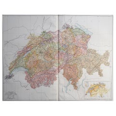
Large Original Vintage Map of Switzerland, circa 1920
Located in St Annes, Lancashire
Great map of Switzerland
Original color.
Good condition
Published by Alexander Gross
Category
Vintage 1920s English Maps
Materials
Paper
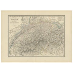
Antique Map of Switzerland by Lapie, 1842
Located in Langweer, NL
Antique map titled 'Carte de la Suisse ou Helvetie'. Map of Switzerland. This map originates from
Category
Antique Mid-19th Century Maps
Materials
Paper
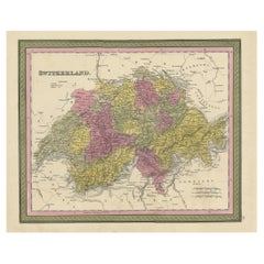
Colourful Antique Map of Switzerland, 1846
Located in Langweer, NL
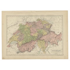
Antique map titled 'Switzerland'. Old map of Switzerland.
This map originates from 'A New
Category
Antique 1840s Maps
Materials
Paper
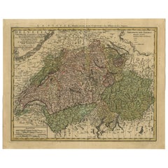
Antique Map of Switzerland by J.B. Homann, 1751
By Johann Baptist Homann
Located in Langweer, NL
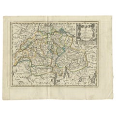
Decorative example of Homann's map of Switzerland, with decorative cartouche and the coat of arms
Category
Antique Mid-18th Century Maps
Materials
Paper
Antique Map of Switzerland by A & C. Black, 1870
Located in Langweer, NL
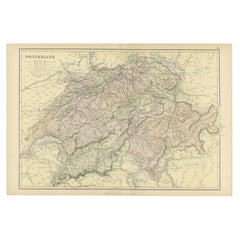
Antique map titled 'Switzerland'. Original antique map of Switzerland. This map originates from
Category
Antique Late 19th Century Maps
Materials
Paper
Original Antique Map of Switzerland, 1882
Located in Langweer, NL
Embark on a historical journey with an original Antique Map of Switzerland from the renowned
Category
Antique 1880s Maps
Materials
Paper
Original Antique Map of Switzerland, Engraved By Barlow, Dated 1807
Located in St Annes, Lancashire
Great map of Switzerland
Copper-plate engraving by Barlow
Published by Brightly & Kinnersly
Category
Antique Early 1800s English Maps
Materials
Paper
No Reserve
H 8 in W 10 in D 0.07 in
Antique Map of Switzerland by Keizer & de Lat, 1788
Located in Langweer, NL
Antique map titled 'La Suisse (..)'. Uncommon original antique map of Switzerland. This map
Category
Antique Late 18th Century Maps
Materials
Paper
Small Original Antique Map of Switzerland and Surroundings, 1807
Located in Langweer, NL
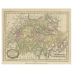
Antique map titled 'Switzerland with its subjects & allies from the best authorities'.
Small
Category
Antique Early 1800s Maps
Materials
Paper
Decorative and Detailed Original Antique Map of Switzerland, 1657
Located in Langweer, NL
Antique map of Switzerland titled 'Helvetiae Rhetiae & Valesiae'.
Decorative and detailed map
Category
Antique 1650s Maps
Materials
Paper
Antique Map of Switzerland by Barlow, 1807
Located in Langweer, NL
Antique map titled 'Switzerland with its subjects & allies from the best authorities'. Small map of
Category
Antique 19th Century Maps
Materials
Paper
Antique Map of Switzerland by Janssonius, 1657
Located in Langweer, NL
Antique map of Switzerland titled 'Helvetiae Rhetiae & Valesiae'. Decorative and detailed map of
Category
Antique 17th Century Maps
Materials
Paper
Antique Map of Switzerland by Cluver, 1685
Located in Langweer, NL
Antique map titled 'Helvetiae Conterminarumque Terrarii, antiqua descriptio.' Miniature map of
Category
Antique 17th Century Maps
Materials
Paper
1859 Antique Swiss Panorama: Blackie's Detailed Map of Switzerland
Located in Langweer, NL
The "Antique Map of Switzerland" is a distinguished piece from 'The Imperial Atlas of Modern
Category
Antique Mid-19th Century Maps
Materials
Paper
Original Hand-Colored Antique Regional Map of Switzerland, 1753
Located in Langweer, NL
Antique map Switzerland titled 'Territorium Reipublicae liberae Helveticae Scaphusiensis
Category
Antique 1750s Maps
Materials
Paper
Antique Map of Switzerland by J. Tallis, circa 1851
Located in Langweer, NL
A decorative and detailed mid-19th century map of Switzerland which was drawn and engraved by J
Category
Antique Mid-19th Century Maps
Materials
Paper
Antique Map of Switzerland by N. Visscher, circa 1690
Located in Langweer, NL
Beautifully detailed map of Switzerland and surrounding regions in present-day France, Germany, and
Category
Antique Late 17th Century Maps
Materials
Paper
Antique Map of Switzerland by Homann, 1753
Located in Langweer, NL
Antique map Switzerland titled 'Territorium Reipublicae liberae Helveticae Scaphusiensis
Category
Antique 18th Century Maps
Materials
Paper
Antique Map of Switzerland by Johnston, 1882
Located in Langweer, NL
Antique map titled 'Switzerland and the Alps of Savoy and Piedmont'. Old map of Switzerland and the
Category
Antique 19th Century Maps
Materials
Paper
Swiss Splendor: Antique Map of Switzerland and Its Cantons, 1852
Located in Langweer, NL
The antique map titled 'Carte de la Suisse' is an attractive map of Switzerland. Here are the key
Category
Antique Mid-19th Century Maps
Materials
Paper
Antique Map of Switzerland by Homann Heirs, c.1732
Located in Langweer, NL
Antique map titled 'Potentissimae Helvetiorum Reipublicae (..)'. Beautiful detailed map of
Category
Antique 18th Century Maps
Materials
Paper
Beautiful Antique Handcolored Map of Switzerland with 33 Coats of Arms, ca.1705
Located in Langweer, NL
(..)'.
Beautiful map of Switzerland with 33 coats of arms. The map is dedicated to the Duke of Burgundy and is
Category
Antique Early 1700s Maps
Materials
Paper
Free Shipping
H 52.5 in W 63.5 in D 0.002 in
Antique Map of Switzerland by N. Visscher, circa 1690
Located in Langweer, NL
Antique map titled 'Tabula Geogaphica qua Pars Meridionalis sive Superior Rheni, Mosae, et Mosellae
Category
Antique Late 17th Century Maps
Materials
Paper
Antique Map of Switzerland by J. van Waesbergen, circa 1680
Located in Langweer, NL
Antique map titled 'Vera totius marchionatus Badensis, et Hochbergensis ; ceterorumque ducatuum
Category
Antique Late 17th Century Maps
Materials
Paper
Map of Switzerland - Etching - 19th Century
Located in Roma, IT
This map of Netherlands is an etching realized in 19th century.
The state of preservation of the
Category
19th Century Figurative Prints
Materials
Etching
CIRCA 1850 MALBY & CO MAP OF SWiTZERLAND BY BAUERKELLER BURR WALNUT CHESS TABLE
By Malby & Co.
Located in GB
and unique 3D made of Switzerland by Bauerkeller
Please note the delivery fee listed is just a guide
Category
Antique 1850s Swiss Early Victorian Game Tables
Materials
Walnut
H 27.76 in W 30.32 in D 23.63 in
Antique Map of the Region of Aargau by Janssonius, '1657'
By Johannes Janssonius
Located in Langweer, NL
Antique map 'Argow cum parte merid. Zurichgow'. Detailed map of Switzerland showing Aargau with the
Category
Antique Mid-17th Century Maps
Materials
Paper
Genuine Antique Engraved Map of Helvetia or Switzerland, 1729
Located in Langweer, NL
Decorative early 18th century engraved map of Switzerland.
Title: Helvetia Conterminarumq terra
Category
Antique 1720s Maps
Materials
Paper
Antique Map of the Region of Lake Geneva by Janssonius '1657'
By Johannes Janssonius
Located in Langweer, NL
Antique map 'Das Wiflispur Gergow'. Detailed map of Switzerland showing Waadt and the Lake of
Category
Antique Mid-17th Century Maps
Materials
Paper
18 Karat Yellow Gold Red Enamel Switzerland Map Charm Pendant
Located in London, GB
An 18 karat (18K) yellow gold charm pendant designed as a map of Switzerland with white and red
Category
20th Century Swiss Charm Bracelets
Materials
Gold, 18k Gold, Yellow Gold, Enamel
Free Shipping
W 0.83 in D 0.04 in L 0.44 in
Antique Map of Northern Switzerland by Janssonius '1657'
By Johannes Janssonius
Located in Langweer, NL
Antique map 'Zurichgow et Basiliensis provincia'. Detailed map of northern Switzerland, including
Category
Antique Mid-17th Century Maps
Materials
Paper
Antique Map of Germany and Switzerland by Lowry, '1852'
Located in Langweer, NL
Antique map titled 'Germany and Switzerland'. Four individual sheets of Germany and Switzerland
Category
Antique Mid-19th Century Maps
Materials
Paper
Antique Map of Southern Germany and Switzerland by Cluver, 1685
Located in Langweer, NL
map of south Germany and Switzerland in Celtic times, From the pocket atlas 'Introductionis in
Category
Antique 17th Century Maps
Materials
Paper
Antique Map of the Kanton Luzerne 'Switzerland' by Homann Heirs, 1763
Located in Langweer, NL
Antique map titled 'Canton Lucern (..)'. Fine decorative copper plate engraved antique map of the
Category
Antique Mid-18th Century Maps
Materials
Paper
Antique Map of Germany, the Netherlands, Bohemia, Bavaria and Switzerland, 1785
Located in Langweer, NL
Antique map titled 'Germany and the Netherlands from the latest authorities'. Depicts Germany, the
Category
Antique 18th Century Maps
Materials
Paper
H 8.27 in W 10.24 in D 0 in
Beautiful Original Copper Engraved Map of Lake Geneva in Switzerland, 1613
Located in Langweer, NL
Description: Antique map titled 'Lacus Lemanus'.
Old map of Lake Geneva with good detail of
Category
Antique 1610s Maps
Materials
Paper
Map of the Region of Basel and Northern Switzerland by Ortelius, circa 1603
Located in Langweer, NL
Two original antique maps on one sheet titled 'Basiliensis Territorii Descriptio Nova [with
Category
Antique Early 17th Century Maps
Materials
Paper
H 17.72 in W 22.05 in D 0.02 in
Antique Map of Germany and Switzerland from an Old Dutch School Atlas, 1852
Located in Langweer, NL
Antique map titled 'Duitschland en Zwitersland'. Map of Germany and Switzerland. This map
Category
Antique 19th Century Maps
Materials
Paper
H 10.63 in W 13.59 in D 0 in
Very Old Original Hand-Colored Map of the Basel Region, Switzerland, Ca.1578
Located in Langweer, NL
Antique print titled 'Basiliensis territorii descriptio nova'.
Old map of the Basel region
Category
Antique 16th Century Maps
Materials
Paper
H 39 in W 27.3 in D 0.002 in
Antique Map of Germany and Switzerland from an Old Dutch School Atlas, c.1873
Located in Langweer, NL
Antique map titled 'Deutschland en Zwitserland'. Old map depicting Germany and Switzerland. This
Category
Antique 19th Century Maps
Materials
Paper
H 12.88 in W 10.32 in D 0 in
Antique Map of Germany including surrounding countries
Located in Langweer, NL
Antique map titled 'Tabula Germaniae'. Orginal antique map of Germany by Claes Jansz. Visscher
Category
Antique Mid-17th Century Maps
Materials
Paper
Italian Parchment Map of the City of Pisa Dated, 1640
By Matthäus Merian the Elder
Located in Roma, IT
An antique map of the Tuscan city of Pisa engraved for The 'Itinerarium Italiæ Nov-antiquæ' by
Category
Antique 1640s Italian Maps
Materials
Paper
Small Detailed Antique Map of France, c.1780
Located in Langweer, NL
Antique map titled 'France'. Small, detailed map of France with legend. Also depicting the English
Category
Antique 18th Century Maps
Materials
Paper
Antique Map of the Swabia Region of Germany by Cary, '1811'
By John Cary
Located in Langweer, NL
Antique map titled 'A New Map of the Circle of Swabia'. Antique map of Swabia in Southwestern
Category
Antique Early 19th Century Maps
Materials
Paper
Antique Map of the City of Verdun by Merian, c.1650
Located in Langweer, NL
Antique map titled 'Verdun'. Orginal antique map of Verdun, a small city in the Meuse department in
Category
Antique 17th Century Maps
Materials
Paper
Antique Map of Germany by J.B. Elwe, 1792
Located in Langweer, NL
Antique map titled 'Germanie vulgo Duitschland (..)'. Decorative map of Germany with Silesia
Category
Antique Late 18th Century Maps
Materials
Paper
Antique Map of the Region of Franche-Comté by Janssonius, circa 1650
Located in Langweer, NL
Antique map titled 'Burgundiae Comitatus Franche Comté'. Old map of the historical and former
Category
Antique Mid-17th Century Maps
Materials
Paper
Antique Map of France by British Mapmaker Wells, c.1710
Located in Langweer, NL
France and parts of Belgium and Switzerland. This map originates from 'A new sett of maps both of antient
Category
Antique 18th Century Maps
Materials
Paper
Attractive Original Hand-Colored Map of the Swabia Region of Germany, 1799
Located in Langweer, NL
Antique map titled 'A New Map of the Circle of Swabia, from the Latest Authorities'.
Attractive
Category
Antique 1790s Maps
Materials
Paper
H 19.97 in W 23.23 in D 0 in
Antique Map of Jura, a Famous Wine Area in France, 1854
Located in Langweer, NL
Antique map titled 'Dépt. du Jura'. Map of the French department Jura, France.
Jura is a
Category
Antique 19th Century Maps
Materials
Paper
Original Antique Hand-Colored Map of Friesland by C. Merian, 1659
Located in Langweer, NL
Swiss-born engraver and artist Matthäus Merian (1593–1650) and included in "Topographia Germaniae
Category
Antique Mid-17th Century Maps
Materials
Paper
Free Shipping
H 11.74 in W 14.3 in D 0.02 in
Antique Map of Germany, Bohemia, Hungary and Part of Poland by R. Bonne ‘1780’
Located in Langweer, NL
Francois Raynal (1713-1796). This map shows current Holland, Germany, Belgium, Switzerland, Austria
Category
Antique Late 18th Century Maps
Materials
Paper
H 10.24 in W 15.04 in D 0.02 in
Antique Map of the German Empire, Johannes Janssonius van Waesbergen, circa 1670
Located in Langweer, NL
Antique map titled 'Nova Totius Germaniae Descriptio'. Uncommon map of the German Empire including
Category
Antique Late 17th Century Maps
Materials
Paper
H 20.48 in W 23.43 in D 0.02 in
Antique Map of Germany During the Mid-18th Century, Published in 1747
Located in Langweer, NL
Antique map Germany titled 'A New & Accurate Map of Germany'. It covers Germany during the mid-18th
Category
Antique 18th Century Maps
Materials
Paper
Original Vintage Winter Sports Travel Poster Andermatt Gotthard Switzerland Ski
By Alex W. Diggelmann
Located in London, GB
featuring a great graphic design outline of a map of Switzerland with a Swiss flag in the shape of a heart
Category
Vintage 1950s Swiss Posters
Materials
Paper
H 39.38 in W 24.81 in D 0.04 in
Antique Map of the Danube River and Surroundings by Homann Heirs, c.1730
By Homann Heirs
Located in Langweer, NL
Antique map titled 'Danubii Fluminus (a fontibus prope Doneschingam usq Posonium urbem defignati
Category
Antique 18th Century Maps
Materials
Paper
H 21.15 in W 25.01 in D 0 in
Southern & Eastern Europe: A Large 17th C. Hand-colored Map by Sanson & Jaillot
By Nicolas Sanson
Located in Alamo, CA
This large hand-colored map entitled "Estats de L'Empire des Turqs en Europe, ou sont les
Category
Antique 1690s French Maps
Materials
Paper
H 24.88 in W 38 in D 0.13 in
The Valley of Inspruck: An 18th-Century Engraved Perspective, 1792
Located in Langweer, NL
antique maps and prints, as well as for those who cherish the enduring allure of the Alpine regions.
The
Category
Antique Late 18th Century Maps
Materials
Paper
Large Panoramic View of Eisenerz, an Old Mining Town in Styria, Austria, c.1650
Located in Langweer, NL
Merian der Ältere (or "Matthew", "the Elder", or "Sr."; 22 September 1593 – 19 June 1650) was a Swiss
Category
Antique 1650s Maps
Materials
Paper
H 11.82 in W 28.35 in D 0 in
Roman Frontiers Engraved: Germania, Raetia, and Noricum, Published in 1880
Located in Langweer, NL
, Switzerland, and the Balkans.
Features of the map include:
1. **Regional Divisions**: The map is divided
Category
Antique 1880s Maps
Materials
Paper
No Reserve
H 15.56 in W 18.51 in D 0 in
- 1
Get Updated with New Arrivals
Save "Map Of Switzerland", and we’ll notify you when there are new listings in this category.
Map Of Switzerland For Sale on 1stDibs
Choose from an assortment of styles, material and more with respect to the map of switzerland you’re looking for at 1stDibs. A map of switzerland — often made from paper — can elevate any home. Whether you’re looking for an older or newer map of switzerland, there are earlier versions available from the 18th Century and newer variations made as recently as the 19th Century. A map of switzerland is a generally popular piece of furniture, but those created in Victorian styles are sought with frequency. Johann Baptist Homann, Covens & Mortier and Johannes Janssonius each produced at least one beautiful map of switzerland that is worth considering.
How Much is a Map Of Switzerland?
The average selling price for a map of switzerland at 1stDibs is $463, while they’re typically $67 on the low end and $1,013 for the highest priced.
Questions About Map Of Switzerland
- 1stDibs ExpertApril 5, 2022Yes, all Certina watches are made in Switzerland. Adolf and Alfred Kurth founded the watchmaker in 1888 in Grenchen, Switzerland. Today, the Swatch Group owns the company. On 1stDibs, shop a variety of Certina watches from some of the world’s top sellers.
More Ways To Browse
Diamond Gauge
St Diamond
1994 18k
Vacheron Gold
Vacheron Constantin Gold
Swiss 18k Chain
Swiss Antique 18k
Geneve 18k
Mint Quartz
Mint Quartz Jewelry
Vacheron Constantin Yellow Gold
Vacheron Constantin Vintage 18k
Vacheron Constantin 18k Yellow Gold
Vacheron Retro Watch
Vacheron Constantin Watch Retro
Vacheron Box
Long Pivot
Swiss Link Chain
