Rome Maps
10
to
70
246
126
171
137
105
53
52
48
43
34
20
20
16
16
13
11
9
8
7
7
7
6
6
6
5
5
4
4
4
4
4
4
3
2
2
2
2
2
2
2
2
1
1
1
1
1
1
1
1
1
33
10
8
7
5
Sort By
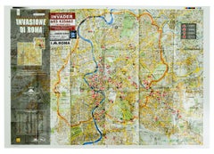
INVADER Invasione di Roma (Rome Map) Limited Edition Signed Print Version
By Invader
Located in Englishtown, NJ
Print version of the Invader Rome Map. Never folded example.
Hand signed and numbered by Invader on
Category
21st Century and Contemporary Contemporary Prints and Multiples
Materials
Color
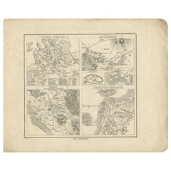
Antique Map of Rome and Athens by Perthes, 1848
Located in Langweer, NL
Antique map titled 'Roma Vetus, Athenae, Urbs, Campus Trojae'. Old map of Rome, Athens and
Category
Antique 19th Century Maps
Materials
Paper
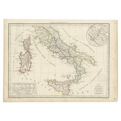
Antique Map of Italy with an Inset of Rome, 1812
Located in Langweer, NL
of Rome. This map originates from 'Atlas Supplementaire du Precis de la Geographie Universelle de M
Category
Antique 19th Century Maps
Materials
Paper
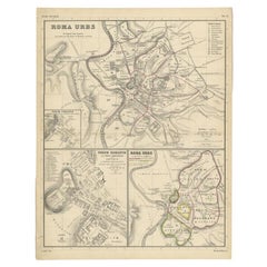
Detailed Original Antique Map of the Region of Rome in Italy, c.1870
By Heinrich Kiepert
Located in Langweer, NL
Antique map titled 'Roma Urbs'. Old map of Italy, it shows three inset maps of the region of Rome
Category
Antique 19th Century Maps
Materials
Paper
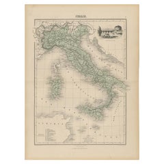
Antique Map of Italy with Vignette of Saint Angu Castle in Rome, 1880
Located in Langweer, NL
Saint Angu castle in Rome. This map originates from 'Géographie Universelle Atlas-Migeon' by J. Migeon
Category
Antique 19th Century Maps
Materials
Paper
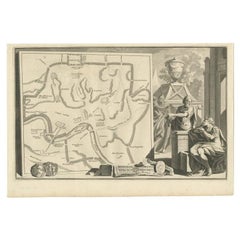
Old Map of Ancient Rome Illustrating Major Monuments and the Seven Hills, c.1704
Located in Langweer, NL
Antique map Rome titled 'Omnia Romanae cedant Miracula Terrae (..)'. Map of Ancient Rome
Category
Antique 18th Century Maps
Materials
Paper
H 9.65 in W 14.18 in D 0 in
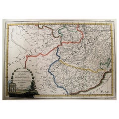
Map of the Kingdom of Sardinia and Part of the Kingdom of Genoa, Rome
By Giovanni Maria Cassini
Located in Hamilton, Ontario
18th century map by Italian engraver Giovanni Maria Cassini (Italy 1745-1824). Map of Part of the
Category
Antique 18th Century Italian Maps
Materials
Paper
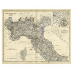
Old Coloure Map of North & Central Italy & Corsica with an Inset of Rome, c.1860
Located in Langweer, NL
Central Italy, and the island of Corsica. With an inset map of the region of Rome. Originates from 'The
Category
Antique 1860s Maps
Materials
Paper
H 19.38 in W 24.41 in D 0 in
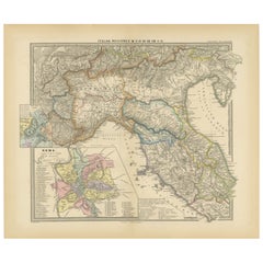
Ancient Italy: Regions and Rome in the Roman Empire, Published in 1880
Located in Langweer, NL
. **Inset Map of Rome (ROMA)**: There is an inset map of ancient Rome, with color-coding to highlight
Category
Antique 1880s Maps
Materials
Paper
Free Shipping
H 15.56 in W 18.51 in D 0 in
Antique Map of Italy and Corsica, c.1860
Located in Langweer, NL
Central Italy, and the island of Corsica. With an inset map of the region of Rome. Originates from 'The
Category
Antique 19th Century Maps
Materials
Paper
Antique Map of the East Indies by Rossi, 1683
Located in Langweer, NL
-seventeenth century it was the best-known printing house in Rome. For his maps, Giovanni worked with Giacomo
Category
Antique 17th Century Maps
Materials
Paper
Antique Italian Map of Viaggio da Roma a Napoli 1775
Located in Roma, IT
An original print from 1775 showing an early route map of the journey from Rome to Naples. This
Category
Antique 1770s Italian Maps
Materials
Parchment Paper
Original Antique Plan of the Harbor of Nettuno, Near Rome, by Munster, c.1580
By Sebastian Münster
Located in Langweer, NL
Antique map titled 'Der Statt Neptun (.).' Detailed plan of the Harbor of Nettuno, near Rome, from
Category
Antique 16th Century Maps
Materials
Paper
H 12.6 in W 8.15 in D 0 in
Remarkable Antique Map of West Europe by Scherer, circa 1703
Located in Langweer, NL
Antique map of Western Europe. Depicting Bergen, Stockholm, Dublin, Paris, Wien, Madrid, Rome
Category
Antique 18th Century Maps
Materials
Paper
Black Sea in Antiquity: Pontus Euxinus Map, Published in 1880
Located in Langweer, NL
This map, titled "PONTUS EUXINUS," depicts the Black Sea region, historically known as the Pontus
Category
Antique 1880s Maps
Materials
Paper
Free Shipping
H 15.56 in W 18.51 in D 0 in
Antique Map of Northern Italy by J. Tallis, circa 1851
Located in Langweer, NL
A highly decorative mid-19th century map of Northern Italy which was drawn and engraved by John
Category
Antique Mid-19th Century Maps
Materials
Paper
Antique Map of Western Europe and Spain by Scherer, circa 1703
Located in Langweer, NL
Untitled map of Western Europe and Spain. Depicting Rome, Edinburgh, Paris, Madrid, Stockholm and
Category
Antique 18th Century Maps
Materials
Paper
Rare Antique Bible Map of Southern Europe by A. Schut, 1743
Located in Langweer, NL
Rome. This map originates from ‘Biblia Sacra, dat is, de H. Schriftuer van het Oude, en het Nieuwe
Category
Antique Mid-18th Century Maps
Materials
Paper
18th Century Map of the Southern Balkans by Giovanni Maria Cassini
By Giovanni Maria Cassini
Located in Hamilton, Ontario
18th century map by Italian engraver Giovanni Maria Cassini (Italy 1745-1824).
Map of the Southern
Category
Antique 18th Century Italian Maps
Materials
Paper
Original Italian Antique Map of Asia Minor and Cyprus and Neighboring Regions
Located in Langweer, NL
century it was the best-known printing house in Rome.
For his maps, Giovanni worked with Giacomo
Category
Antique Late 17th Century Maps
Materials
Paper
H 19.02 in W 24.22 in D 0.02 in
Original Copper Engraving of a Map of Syria and Lebanon, 1698
Located in Langweer, NL
Antique map titled 'Syriae, sive Soriae, Nova et Accurata Descriptio.'
Map of Syria and Lebanon
Category
Antique 1690s Maps
Materials
Paper
Free Shipping
H 12.41 in W 14.45 in D 0 in
Map of The Italian Peninsula with the islands of Sicily, Sardinia, Corsica, 1880
Located in Langweer, NL
military campaigns, which were instrumental in Rome's expansion.
This map would be particularly useful for
Category
Antique 1880s Maps
Materials
Paper
Free Shipping
H 15.56 in W 18.51 in D 0 in
Imperium Romanum: A Detailed Map of the Roman Empire in its Zenith, 1880
Located in Langweer, NL
This original antique map, titled "IMPERIVM ROMANVM", is a detailed depiction of the Roman Empire
Category
Antique 1880s Maps
Materials
Paper
Free Shipping
H 15.56 in W 18.51 in D 0 in
Antique Map of Oceania and the Pacific Ocean, Australia and New Zealand, 1826
Located in Langweer, NL
Geneva, Venice, and Rome. Walch published several atlases and sheet maps. As with his atlases, many of
Category
Antique 19th Century Maps
Materials
Paper
H 8.47 in W 9.85 in D 0 in
Scarce Map of the Mediterranean and Parts of Europe, Africa & Middle East, 1725
Located in Langweer, NL
Antique map titled: Byzondere afbeelding der landschappen, van de Apostelen bevaren en doorwandelt
Category
Antique 1720s Maps
Materials
Paper
H 15.75 in W 18.51 in D 0 in
Antique Map of the Danube River and Surroundings by Homann Heirs, c.1730
By Homann Heirs
Located in Langweer, NL
Antique map titled 'Danubii Fluminus (a fontibus prope Doneschingam usq Posonium urbem defignati
Category
Antique 18th Century Maps
Materials
Paper
H 21.15 in W 25.01 in D 0 in
Highly Decorative Map of The Eastern Mediterranean and The Middle East, ca.1700
Located in Langweer, NL
from Jerusalem to Rome. The map is filled with mountains, forests, and oases, and is decorated with a
Category
Antique Early 1700s Maps
Materials
Paper
Free Shipping
H 16.74 in W 19.89 in D 0 in
1847 “World at One View” Antique Hand-Colored Wall Map of the World
Located in Colorado Springs, CO
This is a highly desirable hanging wall map of the "World at One View", published in 1847 by Ensign
Category
Antique 19th Century American Maps
Materials
Paper
Large Italian Map of Islands of Oceania, incl Papua, Timor, Banda, Ceram, 1855
Located in Langweer, NL
Description: Antique map titled 'Carta di una parte dell'Oceania'. Beautiful large map of the
Category
Antique 1850s Maps
Materials
Paper
H 29.14 in W 21.26 in D 0 in
Old Map of Mediterranean Powers: Pompey to Actium (66-31 BC), Published in 1880
Located in Langweer, NL
This is a historical map that depicts the Mediterranean region during a specific timeframe in Roman
Category
Antique 1880s Maps
Materials
Paper
Free Shipping
H 15.56 in W 18.51 in D 0 in
Antique Map of North and Central Italy and the Island of Corsica, c.1860
Located in Langweer, NL
Central Italy, and the island of Corsica. With an inset map of the region of Rome. Originates from 'The
Category
Antique 19th Century Maps
Materials
Paper
Antique Detailed Map of Jerusalem in Israël with Extensive Key and Scale, 1698
Located in Langweer, NL
Antique map titled 'Jerusalem.'
Plan of the ancient city of Jerusalem. With extensive key and
Category
Antique 17th Century Maps
Materials
Paper
H 15.16 in W 12.01 in D 0 in
North African Coasts: Marmarica to Mauretania in Roman Times, Published in 1880
Located in Langweer, NL
The map with the title "MARMARICA, CYRENAICA, AFRICA, NUMIDIA, MAURETANIA secundum Italiam Poetarum
Category
Antique 1880s Maps
Materials
Paper
Free Shipping
H 15.56 in W 18.51 in D 0 in
Ancient Realms of Northeast Africa: Arabia, Ethiopia, and Egypt, Published 1880
Located in Langweer, NL
This map, titled "ARABIA, AETHIOPIA, AEGYPTUS," illustrates the regions of ancient Arabia, Ethiopia
Category
Antique 1880s Maps
Materials
Paper
Free Shipping
H 15.56 in W 18.51 in D 0 in
The Roman Empire from the Time of Constantine the Great, Published in 1880
Located in Langweer, NL
Antique map titled: "IMPERIUM ROMANORUM inde a Constantini Magni tempore," which translates to "The
Category
Antique 1880s Maps
Materials
Paper
No Reserve
H 15.56 in W 18.51 in D 0 in
Roman Balkans: Pannonia, Illyricum, Dacia, Moesia, Thracia, Macedonia and Thyris
Located in Langweer, NL
This original antique map showcases the Roman provinces in the Balkan region and parts of Central
Category
Antique 1880s Maps
Materials
Paper
Free Shipping
H 15.56 in W 18.51 in D 0 in
Atlas of Fernão Vaz Dourado / One-Time Only Limited Edition Facsimile
Located in BARCELONA, ES
tanned leather.
In the mid-16th century, while Rome, Venice, Leuven and Antwerp printed hundreds of
Category
2010s Portuguese Renaissance Maps
Materials
Leather
Free Shipping
H 23.23 in W 16.54 in D 2.37 in
Panoramic Antique View of Bandar-Abbas 'Formerly Gamron, Persia' in Iran, 1714
Located in Langweer, NL
. Best known as a landscape artist, Le Bruyn travelled widely from a young age to Vienna, on to Rome then
Category
Antique 1710s Maps
Materials
Paper
H 6.7 in W 15.16 in D 0 in
Map of Rome
Located in Los Angeles, CA
A reproduction of an antique map of Rome. Can be sold framed or unframed.
Category
2010s American Victorian Drawings
Materials
Wood, Paper
Pair of Framed Maps of Rome
Located in Locust Valley, NY
A pair of framed maps of Rome, illustrated in the style of 18th century map illustrators
Category
20th Century Drawings
Materials
Paper
Rome - Paula Scher, Maps, Screenprint, Contemporary Art
By Paula Scher
Located in London, GB
Signed in pencil, numbered from the edition of 150.
Printed by Alexander Heinrici, New York.
Published by ARTContent Editions Limited, Vancouver.
Category
2010s Contemporary Prints and Multiples
Materials
Screen
Little World Map Rome Peking - Olympic Games Beijing 2008
By Piero Pizzi Cannella
Located in Roma, IT
Little world map Rome Peking, Olympic Games Beijing 2008 is an original litography print realized
Category
Early 2000s Contemporary Figurative Prints
Materials
Lithograph
H 37.01 in W 27.56 in D 0.04 in
Little World Map Rome Peking - Olympic Games Beijing 2008
By Piero Pizzi Cannella
Located in Roma, IT
, with two cross folding which are related to the characteristic of the artwork as a map.
Category
Early 2000s Contemporary Figurative Prints
Materials
Lithograph
H 37.01 in W 27.56 in D 0.04 in
Little World Map Rome Peking - Olympic Games Beijing 2008
By Piero Pizzi Cannella
Located in Roma, IT
conditions, with two cross folding which are related to the characteristic of the artwork as a map.
Category
Early 2000s Contemporary Figurative Prints
Materials
Lithograph
H 37.01 in W 27.56 in D 0.04 in
Map of Ancient Rome - Original Etching by Alessandro Moschetti - 1848
By Alessandro Moschetti
Located in Roma, IT
Plan of Rome is a beautiful original black and white etching, a rare and antique illustrated map of
Category
1840s Figurative Prints
Materials
Etching
H 14.18 in W 18.9 in D 0.04 in
Antique Map of The City of Rome by Sebastian Münster, 1549
By Sebastian Münster
Located in Larchmont, NY
Sebastian Münster (German, 1488-1552)
LA SITUATION DE LA VILLE DE ROME
Antique Map of Rome, 1549
Category
1960s Realist Figurative Prints
Materials
Woodcut
Rome
By Nemo Jantzen
Located in New York, NY
nails on a wooden board as his canvas, and using his photography as a road map, Nemo zigzags thread from
Category
2010s Contemporary Mixed Media
Materials
Textile, Thread, Plexiglass, Mixed Media, Wood Panel
Tom Lollar and Jane Manus "Map of Rome" Rectangular Coffee Table, 2010
By Jane Manus, Thomas W. Lollar
Located in New York, NY
Contemporary artists Tom Lollar and Jane Manus' "Map of Rome" Rectangular Coffee Table. Hand-carved
Category
21st Century and Contemporary American Modern Coffee and Cocktail Tables
Materials
Marble, Aluminum
Plan de la Ville de Rome
Located in Florham Park, NJ
Plan de la Ville de Rome,
Principali Monumento de Roma.
After Giambattista Nolli (1701-56)
Pietro
Category
Mid-19th Century Academic Prints and Multiples
Materials
Engraving
Orley Shabahang "Rome" Wool Persian Carpet, 12' x 18'
By Bahram Shabahang, Orley Shabahang
Located in New York, NY
This Persian carpet titled "Rome" by Orley Shabahang, handcrafted in black and white wool, measures
Category
2010s Persian Persian Rugs
Materials
Wool
The Americas - Vintage Map - 18th century
Located in Roma, IT
The Americas is a very beautiful vintage map realized in the 18th century by an Italian
Category
18th Century Figurative Prints
Materials
Paper, Etching
Antique Handcolored Print of a Capuchin of Rome, Italy, 1845
Located in Langweer, NL
Antique print titled 'Capucin a Rome'. Print of a Capuchin of Rome. This print originates from
Category
Antique 19th Century Prints
Materials
Paper
Double Hemisphere Old World Map Print, Matted & Framed
Located in Plainview, NY
Mondo made in Rome Italy. The map is decorated with cherubs , angels and demons with a garden scenery
Category
20th Century Landscape Prints
Materials
Paper
Antique Print of the Tiber River in Rome, Italy, 1704
Located in Langweer, NL
shows a view of the Tiber River in Rome with the Bridge 'Ponte dei Senatori'. Above more images of Rome
Category
Antique 18th Century Prints
Materials
Paper
A Series of Historical Maps of Italian Cities
Located in New York, NY
interesting. Each is a charming reinterpretation of historical city maps (Rome, Venice and Florence). We love
Category
20th Century Italian Prints
Materials
Paper
Geobond - Colorful Authentic Urban Map Currency Painting
By Fabio Coruzzi
Located in Los Angeles, CA
International Print Festival 2009 – Quijian – China
Eco Art Project ’09 – Rome
IMPACT
Category
21st Century and Contemporary Pop Art Figurative Paintings
Materials
Canvas, Oil Pastel, Mixed Media, Acrylic, Ink, Graphite
Old Antique Print showing a Rostral Column in Rome, Italy, 1704
Located in Langweer, NL
rostral column in Rome, Italy. It is a type of victory column, originating in ancient Greece and Rome
Category
Antique 18th Century Prints
Materials
Paper
Antique Engraving of Circus Flaminius, a Circular Area in Ancient Rome, 1704
Located in Langweer, NL
shows a reconstruction of Circus Flaminius, a large, circular area in ancient Rome, located in the
Category
Antique Early 1700s Prints
Materials
Paper
H 14.18 in W 9.22 in D 0 in
1750 Schaffhausen, Seutter, Large and Detailed Map Switzerland
By Matthew Seutter
Located in Norwich, GB
is base upon Pirro Ligorio's monumental plan of 1553, illustrating Rome at the time of Augustus
Category
Antique 1670s Italian Baroque Prints
Materials
Paper
Antique Print of a Canon of Saint John Lateran in Rome, 1845
Located in Langweer, NL
sell original antique maps to collectors, historians, educators and interior decorators all over the
Category
Antique 19th Century Prints
Materials
Paper
- 1
Get Updated with New Arrivals
Save "Rome Maps", and we’ll notify you when there are new listings in this category.
Rome Maps For Sale on 1stDibs
An assortment of rome maps is available at 1stDibs. Frequently made of paper and wood, all rome maps available were constructed with great care. We have 9 antique and vintage rome maps in-stock, while there are 2 modern editions to choose from as well. Rome maps have been produced for many years, with earlier versions available from the 18th Century and newer variations made as recently as the 21st Century. Rome maps bearing Victorian hallmark is very popular at 1stDibs. Rome maps have been a part of the life’s work for many furniture makers, but those produced by Giovanni Maria Cassini and Heinrich Kiepert are consistently popular.
How Much are Rome Maps?
Rome maps can differ in price owing to various characteristics — the average selling price at 1stDibs is $770, while the lowest priced sells for $173 and the highest can go for as much as $3,800.
