20th Century Maps
61
413
to
51
360
52
413
413
413
13
8
5
5
4
2
1
1
1
2,897
2,121
413
5
228
32
11
85
7
57
7
3
3
4
5
2
380
25
21
18
13
92
58
37
35
30
9
3
1
1
1
Period: 20th Century
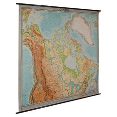
Very Large Vintage Map of Canada, German, Education, Institution, Cartography
Located in Hele, Devon, GB
This is a very large vintage map of Canada. A German, quality printed educational or institution map, dating to the mid 20th century, circa 1965....
Category
German 20th Century Maps
Materials
Paper
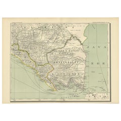
Antique Map of the Region of Lampung, Sumatra, Indonesia, 1900
Located in Langweer, NL
Antique map of the region of Lampung, Sumatra. Also depicting part of Palembang and Java. This map originates from 'Atlas van Nederlandsch Oost- en West-Indië' by I. Dornseiffen.
A...
Category
20th Century Maps
Materials
Paper
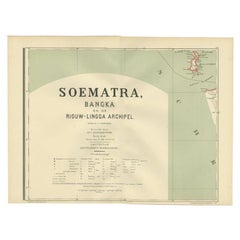
Antique Map of the Batu Islands by Dornseiffen, 1900
Located in Langweer, NL
Antique map of the Batu Islands with the large title 'Soematra, Bangka en de Riouw-Lingga Archipel'. This map originates from 'Atlas van Nederlandsch Oost- en West-Indië' by I. Dorns...
Category
20th Century Maps
Materials
Paper
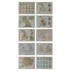
Set of 10 Large Scale Vintage Maps of The United Kingdom, circa 1900
Located in St Annes, Lancashire
Great set of maps of the UK
Lithographs. By John Bartholomew & Co.
Published by The Edinburgh Geographical Institute
Unframed.
The measurement ...
Category
English Antique 20th Century Maps
Materials
Paper
Building Design Print of Hôtel Rue Vernet Paris, Chabat, c.1900
Located in Langweer, NL
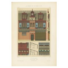
Antique print titled 'Dépendances (Hôtel Rue Vernet Paris) Mr. Paul Sédille, Architecte'. This print depicts the design of a hotel in Paris, France. Originates from 'La Brique et La ...
Category
20th Century Maps
Materials
Paper
Architectural Building Design Print of Ecuries in France, Chabat, c.1900
Located in Langweer, NL
Antique print titled 'Ecuries Rue Cros (Paris) Mr. L. Lethorel Architecte'. This print depicts the design of buildings in France. Originates from 'La Brique et La Terre Cuite' by P. ...
Category
20th Century Maps
Materials
Paper
Pl. XIX Maison de Jardinier, Chabat, c.1900
Located in Langweer, NL
Antique print titled 'Maison de Jardinier Mr. Pierre Chabat, Architecte'. This print depicts the design of a building in France. Originates from 'La Brique et La Terre Cuite' by P. C...
Category
20th Century Maps
Materials
Paper
Terrestrial Globe on a Metal Stand, France, Early 20th Century
Located in New York, NY
A charming globe on metal base dating from the early 20th century, and executed in France.
Category
French 20th Century Maps
Materials
Metal
Large Sea Chart of the British Islands, 1918
Located in Langweer, NL
Antique map titled 'The British Islands'.
Large sea chart of the British Islands. It shows Ireland, Scotland, England, the Shetland Islands and part of Fra...
Category
Vintage 20th Century Maps
Materials
Paper
Pl. XL Beuzeval 'Calvados', Chabat, c.1900
Located in Langweer, NL
Antique print titled 'Villa Brodu, Beuzeval (Calvados) Mr. Baumier, Architecte'. This print depicts the design of a villa in Calvados, France. Originates from 'La Brique et La Terre ...
Category
20th Century Maps
Materials
Paper
Antique Map of the Region of Bussum, c.1910
Located in Langweer, NL
Antique map titled 'Bussum'. Map of the region of Bussum, the Netherlands. Published by the 'ANWB', circa 1910.
Artists and Engravers: Anonymous.
Condition: Fair/good, general...
Category
20th Century Maps
Materials
Paper
Pl. XXXIII Villa Eugène Decan, Chabat, c.1900
Located in Langweer, NL
Antique print titled 'Villa Eugène Decan, Villers-Sur-Mer'. This print depicts the design of a building in France. Originates from 'La Brique et La Terre Cuite' by P. Chabat. Artists...
Category
20th Century Maps
Materials
Paper
Pl. LXXX Maison Rue de la Faisanderie Paris, Chabat, c.1900
Located in Langweer, NL
Antique print titled 'Maison Rue de la Faisanderie Paris, Mr. Sellier de Gisors Architecte'. This print depicts the design of a building in France. Originates from 'La Brique et La T...
Category
20th Century Maps
Materials
Paper
Pl. VI Habitations Ouvrières a Laeken, Chabat, c.1900
Located in Langweer, NL
Antique print titled 'Habitations Ouvrières a Laeken pour les ouvriers de l'usine a gaz de la Ville de Bruxelles, Mr. V. Jamaer, Architecte'. This print depicts the design of a buidl...
Category
20th Century Maps
Materials
Paper
Pl. XXVIII Ecuries, Chabat, c.1900
Located in Langweer, NL
Antique print titled 'Ecuries (Boulevard Beauséjour) Mr. Pierre Chabat Architecte'. This print depicts the design of buildings in France. Originates from 'La Brique et La Terre Cuite...
Category
20th Century Maps
Materials
Paper
Architectural Print of French Pavillon de la Grande Tuilerie, Chabat, c.1900
Located in Langweer, NL
Antique print titled 'Pavillon de la Grande Tuilerie de Bourgogne (de Montghanin) Exposition Universelle de 1889, Mrs. Wulliam et Farge Architectes'. This print depicts the design of...
Category
20th Century Maps
Materials
Paper
Architectural Print of Ecuries Avenue Raphaël, Paris by Chabat, c.1900
Located in Langweer, NL
Antique print titled 'Ecuries Avenue Raphaël Paris, Mr. A. Feine Architecte'. This print depicts the design of a building in France. Originates from 'La Brique et La Terre Cuite' by ...
Category
20th Century Maps
Materials
Paper
Architectural French print of Pavillon du Concierge in France, Chabat, c.1900
Located in Langweer, NL
Antique print titled 'Bureau d'Architecte a Houlgate, Pavillon du Concierge a Bénéreville, Mr. Edouard Lewicki Architecte'. This print depicts the design of a building in France. Ori...
Category
20th Century Maps
Materials
Paper
Building Design Print of Quartier St. Hilaire in France, Chabat, C.1900
Located in Langweer, NL
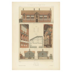
Antique print titled 'Groupe Scolaire a St. Maur (Quartier St. Hilaire) Mr. F. Marin, Architecte'. This print depicts the design of a building in France. Originates from 'La Brique e...
Category
20th Century Maps
Materials
Paper
Architectural Print of Villa Boulevard de Boulogne in France by Chabat, c.1900
Located in Langweer, NL
Antique print titled 'Villa Boulevard de Boulogne (Seine) Mr. L. Magne, Architecte'. This print depicts the design of a villa in France. Originates from 'La Brique et La Terre Cuite'...
Category
20th Century Maps
Materials
Paper
French Architectural Print of Souches de Cheminées - Chabat, c.1900
Located in Langweer, NL
Antique print titled 'Souches de Cheminées'. This print depicts the design of a building in France. Originates from 'La Brique et La Terre Cuite' by P. Chabat. Artists and Engravers:...
Category
20th Century Maps
Materials
Paper
Architectural Print of 'Ecole Rue Madame' in France by Chabat, c.1900
Located in Langweer, NL
Antique print titled 'Ecole Rue Madame (Paris) Mr. H. Errard Architecte'. This print depicts the design of a school in Paris, France. Originates from 'La Brique et La Terre Cuite' by...
Category
20th Century Maps
Materials
Paper
French Pavillon de la Grande Tuilerie, Chabat, Architectural Print, c.1900
Located in Langweer, NL
Antique print titled 'Pavillon de la Grande Tuilerie de Bourgogne (de Montghanin) Exposition Universelle de 1889, Mrs. Wulliam et Farge Architectes'. This print depicts the design of...
Category
20th Century Maps
Materials
Paper
French Print of Pavillon du Concierge, Chabat, c.1900
Located in Langweer, NL
Antique print titled 'Pavillon du Concierge école nationale professionnelle d'armentiéres, Mr. Charles Chipiez Architecte'. This print depicts the design of...
Category
20th Century Maps
Materials
Paper
Architectural Print From France of the Galerie des Machines, Chabat, c.1900
Located in Langweer, NL
Antique print titled 'Gallerie des Machines Exposition Universelle de 1889, Mr. F. Dufert Architecte'. This print depicts the design of a building in France. Originates from 'La Briq...
Category
20th Century Maps
Materials
Paper
Pl. LXXVII Maison au Bord de la Mer, Chabat, C.1900
Located in Langweer, NL
Antique print titled 'Maison au Bord de la Mer, Mr. Hügelin Architecte'. This print depicts the design of a building in France. Originates from 'La Brique et La Terre Cuite' by P. Ch...
Category
20th Century Maps
Materials
Paper
Pl. XLIII Villa a Fontenay-Sous-Bois, Chabat, c.1900
Located in Langweer, NL
Antique print titled 'Villa A Fontenay-Sous-Bois Mr. Ed. Jandelle-Ramier, architecte'. This print depicts the design of a villa in France. Originates from 'La Brique et La Terre Cuit...
Category
20th Century Maps
Materials
Paper
Pl. LXXVI Pavillon Royaux Fils, Chabat, c.1900
Located in Langweer, NL
Antique print titled 'Pavillon Royaux Fils Exposition Universelle de 1889, Mrs. P. Chabat Architecte'. This print depicts the design of a building in France. Originates from 'La Briq...
Category
20th Century Maps
Materials
Paper
Vintage Swedish Topographic School Map of European Alps, Made in Sweden 1922
Located in Los Angeles, CA
Vintage Swedish Topographic School map of European Alps, Made in Sweden 1922
This vintage Swedish school map is so unique and a great example of why these are so collectible.
W...
Category
Swedish Vintage 20th Century Maps
Materials
Linen, Wood, Paper
Four Rare Heliograph Views of Mining Near Sungei Bessi River in Malaysia, 1907
Located in Langweer, NL
Four views of early Mining operations in Malaysia at the beginning of the 20th century. Published in 1907.
1) A Sand-Lake of Residue (Sungai of Sungei Bessi)
2) Chinese Smelting...
Category
Antique 20th Century Maps
Materials
Paper
Pl. XIV Remise De Locomotives, Chabat, c.1900
Located in Langweer, NL
Antique print titled 'Remise de Locomotives'. This print depicts the design of locomotives and a station. Originates from 'La Brique et La Terre Cuite' by P. Chabat. Artists and Engr...
Category
20th Century Maps
Materials
Paper
Pl. XX Villa Mon Caprice, Chabat, c.1900
Located in Langweer, NL
Antique print titled 'Villa mon Caprice Villers-Sur-Mer. Mr. E. Macé, Architecte'. This print depicts the design of a building in France. Originates from 'La Brique et La Terre Cuite...
Category
20th Century Maps
Materials
Paper
Pl. XXII Maison rue Friant, Chabat, c.1900
Located in Langweer, NL
Antique print titled 'Maison rue Friant. Mr. A. Hedin, Architecte'. This print depicts the design of a building in France. Originates from 'La Brique et La Terre Cuite' by P. Chabat....
Category
20th Century Maps
Materials
Paper
Pl. LXXIII Dôme Central, Chabat, c.1900
Located in Langweer, NL
Antique print titled 'Dôme Central Exposition Universelle de 1889, Mr. J. Bouvard, Architecte'. This print depicts the design of a building in France. Originates from 'La Brique et L...
Category
20th Century Maps
Materials
Paper
Pl. XLII Villa a Fontenay-Sous-Bois, Chabat, C.1900
Located in Langweer, NL
Antique print titled 'Villa A Fontenay-Sous-Bois, Mr. Ed. Jandelle-Ramier, Architecte'. This print depicts the design of a villa in France. Originates from 'La Brique et La Terre Cui...
Category
20th Century Maps
Materials
Paper
Pl. LXXV Atelier de Peintre - Chabat, c.1900
Located in Langweer, NL
Antique print titled 'Atelier de Peintre, Mr. Simonet Architecte'. This print depicts the design of a building in France. Originates from 'La Brique et La Terre Cuite' by P. Chabat. ...
Category
20th Century Maps
Materials
Paper
Pl. XVIII Maison de Jardinier, Chabat, C.1900
Located in Langweer, NL
Antique print titled 'Maison de Jardinier Mr. Pierre Chabat, Architecte'. This print depicts the design of a building in France. Originates from 'La Brique et La Terre Cuite' by P. C...
Category
20th Century Maps
Materials
Paper
Pl. XV Dépendances, Chabat, c.1900
Located in Langweer, NL
Antique print titled 'Dépendances Mr. Simonet, Architecte'. This print depicts the design of a building in France. Originates from 'La Brique et La Terre Cuite' by P. Chabat. Artists...
Category
20th Century Maps
Materials
Paper
Pl. XXI Antique Print of a Building in France by Chabat, c.1900
Located in Langweer, NL
Antique print titled 'Villa mon Caprice Villers-Sur-Mer. Mr. E. Macé, Architecte'. This print depicts the design of a building in France. Originates from 'La Brique et La Terre Cuite...
Category
20th Century Maps
Materials
Paper
Pl. XLI Villa A Villemonble, Chabat, c.1900
Located in Langweer, NL
Antique print titled 'Villa A Villemonble'. This print depicts the design of a villa in France. Originates from 'La Brique et La Terre Cuite' by P. Chabat. Artists and Engravers: P. ...
Category
20th Century Maps
Materials
Paper
Pl. xi Châlet D'ambricourt, Chabat, c.1900
Located in Langweer, NL
Antique print titled 'Châlet d'Ambricourt Villers-Sur-Mer, Mr. Feine Architecte'. This print depicts the design of a building in France. Originates from 'La Brique et La Terre Cuite'...
Category
20th Century Maps
Materials
Paper
Pl. X Villa au Vésinet, Chabat, c.1900
Located in Langweer, NL
Antique print titled 'Villa au Vésinet (Seine et Oise) Mr. Héret Architecte'. This print depicts the design of a villa in France. Originates from 'La Brique et La Terre Cuite' by P. ...
Category
20th Century Maps
Materials
Paper
Pl. XXIII Halle a Marchandises, Chabat, c.1900
Located in Langweer, NL
Antique print titled 'Halle à Marchandises'. This print depicts the design of a building in France. Originates from 'La Brique et La Terre Cuite' by P. Chabat. Artists and Engravers:...
Category
20th Century Maps
Materials
Paper
Pl. LXXIV Dôme Central, Chabat, C.1900
Located in Langweer, NL
Antique print titled 'Dôme Central Exposition Universelle de 1889, Mr. J. Bouvard Architecte'. This print depicts the design of a building in France. Originates from 'La Brique et La...
Category
20th Century Maps
Materials
Paper
Pl. XIII Remise de Locomotives, Chabat, c.1900
Located in Langweer, NL
Antique print titled 'Remise de Locomotives'. This print depicts the design of a building for locomotives. Originates from 'La Brique et La Terre Cuite' by P. Chabat. Artists and Eng...
Category
20th Century Maps
Materials
Paper
Large Detailed Map of Australia Wint Inset of Tasmania, 1937
Located in Langweer, NL
Antique map titled 'Australia'. Large folding map of Australia. With inset map of Tasmania. Printed by L.F. Johnston, Canberra.
Artists and Engravers: Compiled and drawn by Propert...
Category
20th Century Maps
Materials
Paper
Architectural Print of Pharmacie Gymnase in France, Chabat, c.1900
Located in Langweer, NL
Antique print titled 'Pharmacie Gymnase, École Nationale Professionnelle d'Armentières, Mr. Charles Chipiez Architecte'. This print depicts the design of a building in France. Origin...
Category
20th Century Maps
Materials
Paper
Cortesi's Masterpiece: A Comprehensive and Authoritative Map of Uruguay, 1903
Located in Langweer, NL
Antique map titled 'Mapa de la Republica Oriental del Uruguay'. Large and detailed folding map of Uruguay. This monumental map depicts all of Uruguay with unprecedented accuracy and detail. Impressively, it serves the multiple roles of being an advanced topographic, economic and political map, as well as being a meticulous sea chart of the Rio de la Plata and the adjacent waters of the Atlantic. The republic's 20 departments are defined in various colors, while a legend, 'Referencias' identifies symbols representing the locations of departmental capitals, town, roads, railways, public schools and lighthouses, amongst other details. Every single river and stream is delineated and named and the ridges of hills are delicately expressed. The map features four insets, including a large map of the capital, Montevideo, as well as maps of Colonia, Maldonado and Punta del Este and the Island of Flores. The hydrographical information provided is truly profound, and renders the map fit for use in maritime commerce.
In 1901, the Uruguayan House of Representatives commissioned the geographer Saturnino Cortesi to employ the most progressive geographical sources, both military and civilian, to devise an authoritative national map of the republic. Cortesi clearly had access to a vast archive of topographical surveys...
Category
20th Century Maps
Materials
Paper
Antique Map of Persia and Afghanistan by Johnston '1909'
Located in Langweer, NL
Antique map titled 'Persia and Afghanistan'. Original antique map of Persia and Afghanistan. This map originates from the ‘Royal Atlas o...
Category
20th Century Maps
Materials
Paper
Vintage Framed United States Map
Located in New York, NY
Vintage aged paper map of the United States mounted on particle board and framed in a simple wooden frame.
Category
American Mid-Century Modern 20th Century Maps
Materials
Wood, Paper
Old Map of South East Asia Showing the Malay Archipelago, incl Borneo etc, 1922
Located in Langweer, NL
Antique map of South East Asia titled 'Malay Archipelago'.
Old map of South East Asia depicting the Malay Archipelago including Sumatra, Java...
Category
Vintage 20th Century Maps
Materials
Paper
Vintage Swedish School Map of Vastergötland, Made in Sweden 1920
Located in Los Angeles, CA
Vintage Swedish School Map of Vastergötland, Made in Sweden 1920
Västergötland also known as West Gothland or the Latinized version Westrogothia in older literature, is one of the...
Category
Swedish Vintage 20th Century Maps
Materials
Linen, Wood, Paper
Large Original Vintage Map of Western Canada, circa 1920
Located in St Annes, Lancashire
Great map of Western Canada
Unframed
Original color
By John Bartholomew and Co. Edinburgh Geographical Institute
Published, circa 1920
Fr...
Category
British Vintage 20th Century Maps
Materials
Paper
Antique Map of Scotland 'Northern' by Johnston, '1909'
Located in Langweer, NL
Antique map titled 'Scotland'. Original antique map of Scotland. With inset map of the Shetland Islands. This map originates from the ‘Royal Atlas of M...
Category
20th Century Maps
Materials
Paper
Large Original Vintage Map of Quebec & Ontario, Canada, circa 1920
Located in St Annes, Lancashire
Great map of Quebec and Ontario.
Unframed
Original color
By John Bartholomew and Co. Edinburgh Geographical Institute
Published, circa 1920
...
Category
British Vintage 20th Century Maps
Materials
Paper
Antique Map of South Italy and the Island of Sardinia by Johnston (1909)
Located in Langweer, NL
Antique map titled 'South Italy and the Island of Sardinia'. Original antique map of South Italy and the Island of Sardinia. With inset map of Naples. Th...
Category
20th Century Maps
Materials
Paper
Gold Leaf Foil Pictorial Plan Map of the West Country of England Antique Style
Located in GB
We are delighted to offer for sale this lovely Antique style pictorial plan map of the West Country of England etched in gold leaf foil
This is a very interesting and decorative p...
Category
English Adam Style 20th Century Maps
Materials
Gold Leaf
Original Antique Map of South Dakota by Rand McNally, circa 1900
Located in St Annes, Lancashire
Fabulous monochrome map with red outline color
Original color
By Rand, McNally & Co.
Published, circa 1900
Unframed
Minor edge tears.
Category
American Edwardian Antique 20th Century Maps
Materials
Paper
Recently Viewed
View AllMore Ways To Browse
Antique Nautical Maps
Antique Classroom
Antique Mexican Maps
Antique Nautical Map
Antique Map Box
Sea Chart Map
Antique Nautical Charts
King Charles I Of England
17th Century Corpus
Mexican Antique Map
Antique Celestial Map
Celestial Maps Antique
Antique Celestial Maps
Middle East Antique Map
Topographical Plate
Central America Map
Antique Map Middle East
Vintage Wooden Roller
