Late 19th Century Maps
66
373
to
95
360
13
373
373
373
8
2,886
2,122
411
5
228
30
11
85
7
56
6
3
3
4
5
2
370
3
2
2
1
50
49
30
22
19
20
5
1
Period: Late 19th Century
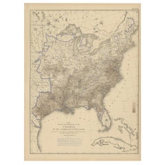
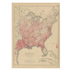
Pl. 22 Antique Chart of the US Colored Population Proportion in 1870, '1874'
Located in Langweer, NL
Antique chart titled 'Map showing the proportion of the colored to the aggregate population. Compiled from the returns of population at the ninth census of the United States, 1870'. ...
Category
Antique Late 19th Century Maps
Materials
Paper
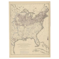
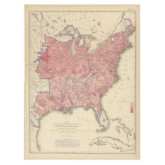
Pl. 23 Antique Chart of the US Foreign Parentage in 1870, '1874'
Located in Langweer, NL
Antique chart titled 'Map showing, in five degrees of density, the distribution, within the territory of the United States east of the 100th Meridian, of that portion of the populati...
Category
Antique Late 19th Century Maps
Materials
Paper
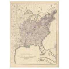
Pl. 17 Antique Chart of the US Population 1850 by Walker, 1874
Located in Langweer, NL
Antique chart titled 'Map showing in five degrees of density, the distribution, within the territory east of the 100th Meridian, of the population of the United States, excluding Ind...
Category
Antique Late 19th Century Maps
Materials
Paper
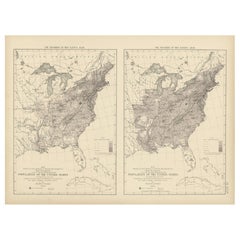
Pl. 16A Antique Chart of the US Population 1830-1840 by Walker, 1874
Located in Langweer, NL
Antique chart titled 'Map showing, in five degrees of density, the distribution, within the territory east of the 100th Meridian, of the population of the United States, excluding In...
Category
Antique Late 19th Century Maps
Materials
Paper
Antique Chart of the US Malarial Deaths, '1874'
Located in Langweer, NL
Antique chart titled 'Map showing the proportion of deaths from malarial diseases to deaths from all causes. Compiled from the returns of mortality at th...
Category
Antique Late 19th Century Maps
Materials
Paper
Pl. 45 Antique Chart of the US Inestinal Diseases Deaths, 1874
Located in Langweer, NL
Antique chart titled 'Map showing the proportion of deaths from intestinal diseases to deaths from all causes. Compiled from the returns of mortality at the ninth census of the Unite...
Category
Antique Late 19th Century Maps
Materials
Paper
Pl. 36 Antique Chart of US Crops, Wheat, Rice, Tobacco, Hops, Oats '1874'
Located in Langweer, NL
Antique chart titled 'Maps showing the range, and within the range, the degree of cultivation of certain principal crops. Compiled from the statistics of agriculture, ninth census 18...
Category
Antique Late 19th Century Maps
Materials
Paper
Antique Chart of the US Enteric, Cerebro-Spinal, Typhus Deaths, '1874'
Located in Langweer, NL
Antique chart titled 'Map showing the proportion of deaths from enteric, cerebro-spinal and typhus fevers to deaths from all causes. Compiled from the returns of mortality at the nin...
Category
Antique Late 19th Century Maps
Materials
Paper
Antique Map of Part of the Roman Empire by H. Kiepert, circa 1870
Located in Langweer, NL
Antique map titled 'Imperia Persarum et Macedonum'. Depicts part of the Roman Empire, from Greece to Eastern India. This map originates from 'Atlas Antiqus. Zwölf Karten zur Alten Ge...
Category
Antique Late 19th Century Maps
Materials
Paper
1899 Poole Brothers Antique Railroad Map of the Illinois Central Railroad
Located in Colorado Springs, CO
This is an 1899 railroad map of the Illinois Central and Yazoo and Mississippi Valley Railroads, published by the Poole Brothers. The map focuses on the continuous United States from the Atlantic to the Pacific Oceans, the Gulf of Mexico, and the Antilles. Remarkably detailed, the rail routes of the Illinois Central RR are marked in red, which each stop labeled. Major stops are overprinted in red, bold letters, with the short rail distances to New York listed above the stop and short rail distances to New Orleans listed below the name.
In addition to the Illinois Central network, numerous different rail lines are illustrated and the company running that line is noted along with many stops along each route. Sea routes from New Orleans to locations in Central America, the Caribbean, and Europe are marked and labeled with destination and distance, along with routes originating from Havana. Inset at bottom left is a map of Cuba; an inset map of Puerto Rico...
Category
American Antique Late 19th Century Maps
Materials
Paper
Antique Map of Java in 4 sheets by Dornseiffen, 1884
Located in Langweer, NL
Detailed map of Java in 4 sheets, with an inset map of Batavia (Jakarta). This map originates from 'Atlas van Nederlandsch Oost- en West-Indie' by Dr. I. Dornseiffen. Published by Se...
Category
Antique Late 19th Century Maps
Materials
Paper
Antique Map of South America by Migeon '1880'
By J. Migeon
Located in Langweer, NL
Antique map titled 'Amérique Méridionale'. Old map of South America. With an inset map of the Galapagos Islands and decorative vignettes. This map...
Category
French Antique Late 19th Century Maps
Materials
Paper
Antique Map of Western Europe by H. Kiepert, circa 1870
Located in Langweer, NL
Antique map titled 'Gallia, Britannia, Germania'. This map depicts a large part of Western Europe including countries like Germany, France, Great Britain, The Netherlands and more. T...
Category
Antique Late 19th Century Maps
Materials
Paper
Antique Map of Italy and Greece by H. Kiepert, circa 1870
Located in Langweer, NL
Antique map titled 'Italiae pars media'. This map originates from 'Atlas Antiquus. Zwölf Karten zur Alten Geschichte' by H. Kiepert. Published in Berlin, circa 187.
Category
Antique Late 19th Century Maps
Materials
Paper
Antique Map of North and Central America by Migeon '1880'
By J. Migeon
Located in Langweer, NL
Antique map titled 'Amérique Septentrionale'. Old map of North and Central America. With a decorative vignette of the Niagara Falls. This map originates from 'Géographie Universelle ...
Category
French Antique Late 19th Century Maps
Materials
Paper
1877 "Geological and Geographical Atlas of Colorado" by F. V. Hayden
Located in Colorado Springs, CO
This is F. V. Hayden's Geological and Geographical Atlas of Colorado and Portions of Adjacent Territory, an unmatched geological record for its time. Published by the Department of the Interior in 1877, the Atlas of Colorado consists of twenty double elephant sized sheets, divided into two series. The first series, four sheets, embrace the entire area on a scale of twelve miles to an inch, and include Triangulations, Drainage, an Economic Map, and a General Geological map...
Category
American Antique Late 19th Century Maps
Materials
Paper
Antique Map of Australia by H. Kiepert, 1875
Located in Langweer, NL
Antique map titled 'Australien'. Large and detailed map of Australia and New Zealand. With color key in lower left. The map is prepared by H. Kiepert...
Category
Antique Late 19th Century Maps
Materials
Paper
Antique Map of Asia by K. Johnston, circa 1879
Located in Langweer, NL
No. 28 of Keith Johnston's General Atlas. Published by William Blackwood & Sons Edinburgh & London, circa 1879.
Category
Antique Late 19th Century Maps
Materials
Paper
Antique Plan of the City of Calcutta 'India' by Letts, 1883
Located in Langweer, NL
Beautiful colored plan showing buildings (with key), Fort William, race ground, canals, railroads, etc. This plan originates from Letts's Popular Atlas.
Category
Antique Late 19th Century Maps
Materials
Paper
Antique Map of the British Islands to the White Sea by J. Imray
Located in Langweer, NL
Antique large nautical chart of the British Islands to the White Sea. With insets of Veshnyak Channel, Sosnovets and the Bay of Arkhangel. Published by James Irmay and Son, circa 1875.
Category
Antique Late 19th Century Maps
Materials
Paper
Balkan Convergence: A Map of Turkey and Greece with the Balkan States, 1882
Located in Langweer, NL
This map, "TURKEY AND GREECE including ROUMANIA, SERVIA, BULGARIA, BOSNIA & MONTENEGRO," extracted from Blackie & Son's 1882 atlas, captures the complex political and geographical la...
Category
Antique Late 19th Century Maps
Materials
Paper
1889 Sea Chart Map of Delaware Bay by George Eldridge, Chart No. 11
Located in Colorado Springs, CO
Presented is an original Eldridge's Chart No. 11, Delaware Bay and River, from The United States Coast and George Eldridge's Surveys, published in 1889. The sea chart shows the Delaw...
Category
Antique Late 19th Century Maps
Materials
Paper
Antique Map of the United States by Johnson, 1872
Located in Langweer, NL
Antique map titled 'Johnson's United States'. Original map of the United States. This map originates from 'Johnson's New Illustrated Family Atlas of the World' by A.J. Johnson. Publi...
Category
Antique Late 19th Century Maps
Materials
Paper
Antique Map of the City of Zürich, 1889
Located in Langweer, NL
Antique map titled 'Grundriss und ussgemässne Verzeynuss der wyte Becirckh und Innhalts dess genanten Stadelhoffer Zehendens der Stifft S. Felix und Regula zum Grossen Münster alhie ...
Category
Antique Late 19th Century Maps
Materials
Paper
Plan for the City of Washington by Andrew Ellicott, Antique Print, 19th Century
Located in Colorado Springs, CO
By Andrew Ellicott (1754-1820) and Pierre Charles L'Enfant (1754-1825). Plan of the City of Washington. Published by Thackara & Vallance, Philadelphia, 1792. Later impression printed on 19th century wove paper.
This is a fine 19th century printing of the "official" plan of Washington, D.C. First printed in 1792 by the original publishers, Thackara & Vallance in Philadelphia, this is a later 19th century printing of the fifth recorded engraving of the L’Enfant / Ellicott city plan. The first three issues of this city plan were in published in periodicals, making the fifth edition only the second separately-issued engraving of the plan. In full, the title reads, “Plan of the City of Washington in the Territory of Columbia, ceded by the States of Virginia and Maryland to the United States of America and by them established as the Seat of their Government after the year 1800.”
The national capital city is laid out according to a plan originally proposed by Pierre Charles L'Enfant and modified by Andrew Ellicott. L'Enfant was born in Paris, where he trained to be an architect. He came to America in 1777, and served under George Washington as an engineer during the Revolutionary War. In 1791, Washington asked L'Enfant to design the new capital city in the District of Columbia. However, trouble arose between the city and L'Enfant. The City Commissioner needed a finished, printed copy of the plan in order to sell building lots but L'Enfant worked slowly and released only incomplete plans, and proved to be quite obstinate. On instruction from President Washington...
Category
American Antique Late 19th Century Maps
Materials
Paper
Recently Viewed
View AllMore Ways To Browse
Map Of Colorado
Ottoman Empire Map
Rene Descartes
The Gambia
Vintage Wooden Roller
Antique Furniture Arkansas
Antique Furniture Kingston
Antique Indian Furniture Australia
Antique Map Burgundy
Antique Map Of Yorkshire
Antique Maps Of Cape Of Good Hope
Antique Maps Yorkshire
Antique Outpost
Chinese Wall Pocket
Map Manila
Map Of Essex
Map Of Normandy
Victorian Floor Vase
