Maps
319
5,423
3
2
to
1,186
5,175
246
5,428
5,428
5,428
51
34
16
11
9
5
5
4
4
2
1
1
1
2,888
2,123
412
5
228
31
11
85
7
56
7
3
3
4
5
2
5,339
94
31
31
29
479
264
169
123
116
106
63
29
26
16
Maps For Sale
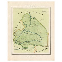
Antique Map of The Province of Drenthe in the Northern Netherlands, 1865
Located in Langweer, NL
Antique map titled 'Provincie Drenthe'. Original antique map of Drenthe, the Netherlands. These scarse detailed maps of Dutch Towns originate from the 'Gemeente-atlas' of Jacob Kuype...
Category
19th Century Antique Maps
Materials
Paper
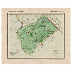
Antique Map of the Township of Anloo in the Netherlands, 1865
Located in Langweer, NL
Drenthe - Gemeente Anloo, Eext, Gasteren, Annen, Schipborg. These scarse detailed maps of Dutch Towns originate from the 'Gemeente-atlas' of Jacob Kuyper. This atlas of all towns in ...
Category
19th Century Antique Maps
Materials
Paper
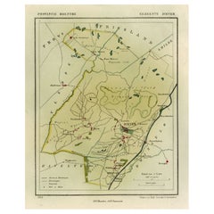
Antique Map of the Township of Diever, Drenthe in The Netherlands, 1865
Located in Langweer, NL
Drenthe: Gemeente Diever, Veenhuizen, Aendiever, Wittelte. These scarse detailed maps of Dutch Towns originate from the 'Gemeente-atlas' of Jacob Kuyper. This atlas of all towns in t...
Category
19th Century Antique Maps
Materials
Paper
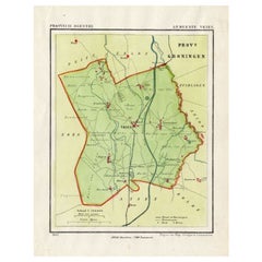
Antique Map of the Township of Vries in the Dutch Province of Drenthe, 1865
Located in Langweer, NL
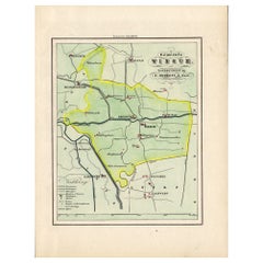
Drenthe: Gemeente Vries, Bunne, Donderen, Tijnaarloo, Zeijen. These scarse detailed maps of Dutch Towns originate from the 'Gemeente-atlas' of Jacob Kuyper. This atlas of all towns i...
Category
19th Century Antique Maps
Materials
Paper
Antique Map of the Township of Winsum, Groningen in The Netherlands, 1862
Located in Langweer, NL
Groningen: Gemeente Obergum-Winsum. These scarse detailed maps of Dutch Towns originate from the 'Gemeente atlas van de Provincie Groningen in 62 kaarten.' by C. Fehse. This atlas of...
Category
19th Century Antique Maps
Materials
Paper
Antique Map of the Township of Het Zandt in The Netherlands, 1862
Located in Langweer, NL
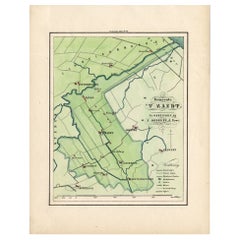
Groningen: Gemeente Het Zandt. These scarse detailed maps of Dutch Towns originate from the 'Gemeente atlas van de Provincie Groningen in 62 kaarten.' by C. Fehse. This atlas of all ...
Category
19th Century Antique Maps
Materials
Paper
Antique Map of the Township of Zuidhorn in The Netherlands, 1862
Located in Langweer, NL
Groningen: Gemeente Noordhorn-Zuidhorn. These scarse detailed maps of Dutch Towns originate from the 'Gemeente atlas van de Provincie Groningen in 62 kaarten.' by C. Fehse. This atla...
Category
19th Century Antique Maps
Materials
Paper
Original Antique Map of Arabia and the Red Sea
Located in Langweer, NL
Antique map titled 'Carte de la Coste d'Arabie (..) - Kaart van de Kust van Arabië (..)'. This is a Dutch version, engraved by J. van Schley, of Bellin's map of Arabia and the Red Se...
Category
Mid-18th Century Antique Maps
Materials
Paper
Antique Map of the region of Trier, Mainz and Cologne, Germany
Located in Langweer, NL
Antique map titled 'Synopsis Circuli Rhenani Inferioris sive Electorum Rheni (..)'. Original antique map of the region of Trier, Mainz and Cologne, Germany. Published by T.C. Lotter,...
Category
Late 18th Century Antique Maps
Materials
Paper
Antique Map of the Rhine centered on Cologne, Germany, with outline coloring
Located in Langweer, NL
Antique map titled 'Archiepsiscopatus et Electoratus Coloniensis (..)'. Original antique map of the Rhine river, centered on Cologne, Germany. The Rhine River cuts across this map fr...
Category
Early 18th Century Antique Maps
Materials
Paper
Four Antique Battle Plans of Echmühl, Hohenlinden, Abensberg and Marengo, 1852
Located in Langweer, NL
Set of 4 antique battle plans. Included are:
1) Battle of Hohenlinden 3d. December 1800
2) Battle of Echmühl 22. April 1809
3) Battle of Arensberg 20. Ap...
Category
Mid-19th Century Antique Maps
Materials
Paper
Antique Miniature Map of the Roman Province of Illyricum 'Dalmatia'
Located in Langweer, NL
Antique miniature map titled 'Illyricum'. Original small map of Illyricum. The Roman province of Illyricum stretched from the Drilon River (the Drin, in...
Category
Early 17th Century Antique Maps
Materials
Paper
Antique Map of present-day North-Rhine Westphalia, Germany
Located in Langweer, NL
Antique map titled 'Nova et Accurata Ducatus Cliviae et Comitatus Marchiae (..)'. Detailed regional map of Germany showing the region bounded by the Maas River in the west and to par...
Category
Mid-18th Century Antique Maps
Materials
Paper
Antique Map of West Flanders in Belgium, c.1840
Located in Langweer, NL
Antique map titled 'Kaart van West Vlaanderen'. Original antique map of West Flanders, Belgium. Source unkown, to be determined. Published circa 1840.
Artis...
Category
19th Century Antique Maps
Materials
Paper
Antique Map of both sides of the Central Rhine River, Germany
Located in Langweer, NL
Antique map titled 'Mappa Geographica continens Archiepiscopatum et Electoratum Coloniensem (..)'. Decorative map of region on either side of the Central Rhine River, showing Dusseld...
Category
Mid-18th Century Antique Maps
Materials
Paper
Antique Map of the Rhine centered on Cologne, Germany, with original coloring
Located in Langweer, NL
Antique map titled 'Archiepsiscopatus et Electoratus Coloniensis (..)'. Original antique map of the Rhine river, centered on Cologne, Germany. The Rhine River cuts across this map fr...
Category
Early 18th Century Antique Maps
Materials
Paper
Nicely Hand-Colored Antique Print of Various Apples, 1758
Located in Langweer, NL
Antique print depicting apple variaties including the Enkelste Griet, Witte Platte Appel, Bloem-Suir, Eyer-Appel, Brand-Appel, Heer-Appel, Pomme Rose, Rode Soete Jopen, Somer Striepe...
Category
18th Century Antique Maps
Materials
Paper
Antique Map of the Rhine centered on Cologne, Germany
Located in Langweer, NL
Antique map titled 'Archiepsiscopatus et Electoratus Coloniensis (..)'. Original antique map of the Rhine river, centered on Cologne, Germany. The Rhine River cuts across this map fr...
Category
Early 18th Century Antique Maps
Materials
Paper
Antique World Map before the Voyages of Christopher Columbus, 1880
Located in Langweer, NL
Antique world map titled 'Monde Connu des Anciens'. Antique map of the World and continents before the voyages of Christopher Columbus. This map originates from 'Géographie Universel...
Category
19th Century Antique Maps
Materials
Paper
Antique Map of the Township of Eelde in Drenthe, The Netherlands, 1865
Located in Langweer, NL
Drenthe: Gemeente Eelde. These scarse detailed maps of Dutch Towns originate from the 'Gemeente-atlas' of Jacob Kuyper. This atlas of all towns in the Netherlands was published from ...
Category
19th Century Antique Maps
Materials
Paper
Antique Map of West Kalimantan (Schwaner Mountains), Borneo, Indonesia, 1900
Located in Langweer, NL
Antique map of West Kalimantan, Borneo. It shows the region of the Schwaner Mountains. This map originates from 'Atlas van Nederlandsch Oost- en West-Indië' by I. Dornseiffen.
Arti...
Category
20th Century Maps
Materials
Paper
Antique Map of the Westerkwartier Region, a Region in Groningen, 1791
Located in Langweer, NL
Antique map titled 'Das Wester Quartier'. Original antique map of Westerkwartier, a region in the province of Groningen, the Netherlands. This map orginates from 'Schauplatz der fünf...
Category
18th Century Antique Maps
Materials
Paper
Antique Plan of the City of Grave in Holland With Coats of Arms and Compass Rose
By Isaak Tirion
Located in Langweer, NL
Antique map titled 'Grondtekening der Stad Graave'. Plan of Grave, The Netherlands. With coats of arms, compass rose and key. From: Isaak Tirion's 'Hedendaagsche Historie, of Tegenwo...
Category
18th Century Antique Maps
Materials
Paper
Antique Map of Utrecht in The Netherlands, 1883
Located in Langweer, NL
Antique map titled 'Utrecht'. Map of Utrecht, a province of the Netherlands. This map originates from 'Atlas van Nederland volgens de nieuwe spelregels' by J. Kuyper.
Artists and En...
Category
19th Century Antique Maps
Materials
Paper
Antique Map of Part of Java, Indonesia, 1900
Located in Langweer, NL
Antique map of West Java. This map originates from 'Atlas van Nederlandsch Oost- en West-Indië' by I. Dornseiffen.
Artists and Engravers: Published by Seyffardt's Boekhandel, Amste...
Category
20th Century Maps
Materials
Paper
Antique Map of Turkey and Greece by Petri, c.1873
Located in Langweer, NL
Antique map titled 'Europisch Turkije en Griekenland'. Old map depicting Turkey in Europe and Greece. This map originates from 'School-Atlas van alle Deelen der Aarde'.
Artists and...
Category
19th Century Antique Maps
Materials
Paper
Large Original Antique Map of Kentucky, USA, C.1900
Located in St Annes, Lancashire
Fabulous map of Kentucky
Original color
Engraved and printed by the George F. Cram Company, Indianapolis.
Published, C.1900
Unframed.
Category
1890s American Antique Maps
Materials
Paper
Antique Map of the Region of Twente, in The East of The Netherlands, 1884
Located in Langweer, NL
Antique map titled 'Twente '. Old map of the region of Twento including cities and villages like Oldenzaal, Delden and Hengelo. This map orginates from 'Atlas behoorende bij Wandelin...
Category
19th Century Antique Maps
Materials
Paper
German Antique Map of Oceania, 1895
Located in Langweer, NL
Antique map titled 'Oceanie.' Map of Oceania. This attractive original old antique print / plate / map originates from 1885-1907 editions of a famous German encyclopedia: 'Meyers grosses Konversations-Lexikon.', published in Leipzig and Vienna. Meyers Konversations-Lexikon was a major German encyclopedia that existed in various editions from 1839 until 1984, when it merged with the Brockhaus encyclopedia. Several of the plates were also used in Dutch Encyclopedia's like Winkler Prins...
Category
19th Century Antique Maps
Materials
Paper
Antique Map of the West Indies and Ambon in Indonesia, 1900
Located in Langweer, NL
Two maps on one sheet titled 'De West-Indische Eilanden (Nederlandsch Gedeelte)' and 'Ambon, Leasi-Eilanden en Banda-Eilanden'. Old map of the Dutch West Indies and Ambon Island, Ind...
Category
20th Century Maps
Materials
Paper
Antique Map of the Middle East with a Large Arabia, 1799
Located in Langweer, NL
Antique map titled 'Perse, Turquie Asiatique et Arabie (..)'. Map of the Middle East with a large Arabia, extending from the Black Sea to the In...
Category
Late 18th Century Antique Maps
Materials
Paper
Antique Map of Tibet, The Gobi Desert and China by Bellin, circa 1764
Located in Langweer, NL
Antique map titled 'Carte de l'Empire de Hya et Partie de Tangut'. Old map of Tibet, Gobi desert and China depicting the Great Wall of China and caravan routes. Originates from Prevo...
Category
18th Century Antique Maps
Materials
Paper
Antique Map of New Zealand, 1895
Located in Langweer, NL
Antique map titled 'Neu-Seeland.' Map of New Zealand. With inset maps of the large cities. This attractive original old antique print / plate / map ...
Category
19th Century Antique Maps
Materials
Paper
XL Old School Map of Belgium 'Printed by Procure', 1950s
Located in Oostende, BE
XL Old school map of Belgium (Printed by Procure). Presumably from around 1950-1960.
Category
1950s Belgian Mid-Century Modern Vintage Maps
Materials
Metal
Antique Print with Views of Sir Charles Saunders Island and Other Islands, 1774
Located in Langweer, NL
Explore the captivating world of the 18th century with this exquisite antique print titled 'Isles de Sir Charles Saunder Latitude (...)'. I A journey through time as you delve into t...
Category
Late 18th Century Antique Maps
Materials
Paper
Antique Print of a Fort on the Ivory Coast and Axim, Africa, 1748
Located in Langweer, NL
Antique print titled 'Vue de la Cote pres de Rio San Andero - Gezigt van de Kust van Rio San Andero' and 'Fort St. Antoine a Axim - Fort St. Antoni, te Axim'. View of the Ivory coast...
Category
18th Century Antique Maps
Materials
Paper
Antique Map of Asia with the Porcelain Tower at Nanjing, China, 1884
Located in Langweer, NL
Antique map titled 'Asie'. Map of the Asian continent, with an illustration of the porcelain tower at Nanjing, China. Migeon's Geographie Universelle, ...
Category
19th Century Antique Maps
Materials
Paper
Large Original Antique Map of Kansas, USA, 1894
Located in St Annes, Lancashire
Fabulous map of Kansas
Original color
By Rand, McNally & Co.
Published, 1894
Unframed
Free shipping.
Category
1890s American Antique Maps
Materials
Paper
Antique Map of Turkey, Persia and Afghanistan, 1842
Located in Langweer, NL
Antique map titled 'Carte de la Turquie d'Asia, de la Perse, de l'Afghanistan'. Map of Turkey, Persia and Afghanistan. This map originates from 'Atlas universel de géographie ancienn...
Category
19th Century Antique Maps
Materials
Paper
Antique Map of Upper Saxony in Germany by Tirion, circa 1740
By Isaak Tirion
Located in Langweer, NL
Antique map titled 'Nieuwe Kaart van de Opper Saxise Kreits (..).' Attractive detailed map showing Upper Saxony, Germany with Meissen, Thuringen, Anhalt, Brandenburg, Pommeren etc. S...
Category
18th Century Antique Maps
Materials
Paper
Antique World Map by Johnston, 1882
Located in Langweer, NL
Antique map titled 'The World in Hemispheres'. Old double-hemisphere world map. This map originates from 'The Royal Atlas of Modern Geography, Exhibiting, in a Series of Entirely Ori...
Category
19th Century Antique Maps
Materials
Paper
Antique Map of Wuxi and Huzhou in China, 1746
Located in Langweer, NL
Antique map titled 'Vusihyen. Hu Chew Fu'. Plans of Wuxi and Huzhou, China. Originates from Prévost's 'Histoire générale des voyages'.
Artists and Engravers: Antoine François Prévo...
Category
18th Century Antique Maps
Materials
Paper
Rare Small Antique Map of Great Britain and Ireland
Located in Langweer, NL
Antique map titled 'La Grande Bretagne et Irlande'. Small antique map of Great Britain and Ireland. Source unknown, to be determined. Publ...
Category
Mid-18th Century Antique Maps
Materials
Paper
Antique Physical Map of the World by Reynolds, 1849
Located in Langweer, NL
Antique physical map of the world, showing the discoveries of the most eminent modern geographers. Originates from 'Geographical Diagrams '.
Artists and Engravers: Published by J...
Category
19th Century Antique Maps
Materials
Paper
Antique Map of Zuid-Holland and Utrecht in The Netherlands, 1902
Located in Langweer, NL
Antique map titled 'Zuid-Holland en Utrecht'. Lithographed map of the provinces of Zuid-Holland and Utrecht, the Netherlands. This map originates from 'Atlas van Nederland'.
Artist...
Category
20th Century Maps
Materials
Paper
Plan of Hulst with its Forts and Outworks, Holland, War of Spanish Succession
Located in Langweer, NL
Antique map titled 'Plan of Hulst with its Forts and Outworks (..)' Plan of Hulst with its Forts and Outworks, Holland, War of Spanish Succession, 1729 - With details of the area including forts and outworks. The map features a very large and decorative legend naming specific forts and the direction of cannon fire...
Category
18th Century Antique Maps
Materials
Paper
Antique Plan of Grave, The Netherlands, Showing the Siege of Grave in 1602
Located in Langweer, NL
Antique map titled 'Die Stat Grave' Bird's eye view plan of Grave, The Netherlands, Holland. Showing the siege of Grave in the year 1602 by Prince Maurits of The Netherlands. Source ...
Category
16th Century Antique Maps
Materials
Paper
Antique Map of Turkey and Greece, 1842
Located in Langweer, NL
Antique map titled 'Carte de la Turquie d'Europe et de la Grèce Moderne'. Map of Turkey and Greece. This map originates from 'Atlas universel de géographie ancienne et moderne (..)' ...
Category
19th Century Antique Maps
Materials
Paper
Antique Map of Persia, Also Showing the Indus River, circa 1673
Located in Langweer, NL
Antique map titled 'Persia sive Sophorum Regnum'. Original old map of Persia. The map extends from the Eastern Mediterranean to Tacalistan and the Indus River and the Dalanguer Mount...
Category
Late 17th Century Antique Maps
Materials
Paper
Antique Plan of the Battle of Abensberg in Germany
Located in Langweer, NL
Antique battle map titled 'Battle of Abensberg 20 April 1809'. Plan of the Battle of Abensberg, fought on 20 April 1809 between a Franco-German force under ...
Category
Mid-19th Century Antique Maps
Materials
Paper
Antique Map of the Township of Marum in Groningen, The Netherlands, 1862
Located in Langweer, NL
Groningen: Gemeente Marum-Noordwijk-NuiS. These scarse detailed maps of Dutch Towns originate from the 'Gemeente atlas van de Provincie Groningen in 62 kaarten.' by C. Fehse. This at...
Category
19th Century Antique Maps
Materials
Paper
Eason's War Map of Europe, circa 1914
Located in Langweer, NL
Antique map titled 'Eason's War Map of Europe'. Printed in Ireland. Source unknown, to be determined.
Artists and Engravers: Anonymous.
Condition: Good, ...
Category
20th Century Maps
Materials
Paper
Antique Map of the Siege of Groningen by Le Clerc, 1730
Located in Langweer, NL
Plate : 'Het Belegh der Stadt Groningen in den Jaere MDXCIV '. (The siege of Groningen in the year 1594.) This plate shows the fortified city of Groningen, The Netherlands. With legend. This attractive original old antique print / plate was published in several works by Hugo de Groot ('Nederlandtsche Jaerboeken' published in 1681.), P.C. Hooft ('Nederlandsche Historien ...', published 1703-1704.), P.C. Bor ('Oorsprongk, begin, en vervolgh der Nederlandsche oorlogen', published in 1680.)or Jean Le Clerc...
Category
18th Century Antique Maps
Materials
Paper
Antique Map of the City of Grave by Blaeu, 1649
Located in Langweer, NL
Antique map titled 'Grave'. Original antique map of the city of Grave, the Netherlands. Published by J. Blaeu, 1649.
Artists and Engravers: Joan Blaeu (23 September 1596 - 28 May...
Category
17th Century Antique Maps
Materials
Paper
Antique Map of the City of Assen in The Netherlands, 1865
Located in Langweer, NL
Drenthe - Gemeente Assen. (no 2, Stad). These scarse detailed maps of Dutch Towns originate from the 'Gemeente-atlas' of Jacob Kuyper. This atlas of all towns in the Netherlands was ...
Category
19th Century Antique Maps
Materials
Paper
Antique Map of the Township of Hoogkerk in Groningen, The Netherlands, 1862
Located in Langweer, NL
Groningen: Gemeente Dorkwerd-Hoogkerk-Leegkerk-Vinkhuizen. These scarse detailed maps of Dutch Towns originate from the 'Gemeente atlas van de Provincie Groningen in 62 kaarten.' by ...
Category
19th Century Antique Maps
Materials
Paper
Antique Map of the Township of Meeden in Groningen, the Netherlands, 1862
Located in Langweer, NL
Groningen: Gemeente Meeden. These scarse detailed maps of Dutch Towns originate from the 'Gemeente atlas van de Provincie Groningen in 62 kaarten.' by C. Fehse. This atlas of all tow...
Category
19th Century Antique Maps
Materials
Paper
Antique Plan of the Harbour of Taloo by Cook, 1784
Located in Langweer, NL
Antique map titled 'Sketch of the Harbours on the North Side of Eimeo (..)'. Plan of the harbour of Taloo in the Island of Moorea, one of the Society Islands, French Polynesia. Origi...
Category
18th Century Antique Maps
Materials
Paper
Recently Viewed
View AllMore Ways To Browse
Antique Sailing Map
Antique Sailing Maps
Bay Area Antique Furniture
West Coat Of Arms
Greek Asia Minor
Hemisphere World Map
Speed Map
Antique Maps Canada
Antique Map Canada
Canada Antique Map
Malaysian Antique
West Indies Map
Blaeu World Map
Charing Cross
Antique Maps Of Canada
Bali Map
Antique Portuguese Plates
Map Of Brazil
