Maps
319
5,423
3
2
to
1,186
5,175
246
5,428
5,428
5,428
51
34
16
11
9
5
5
4
4
2
1
1
1
2,888
2,123
412
5
228
31
11
85
7
56
7
3
3
4
5
2
5,339
94
31
31
29
479
264
169
123
116
106
63
29
26
16
Maps For Sale
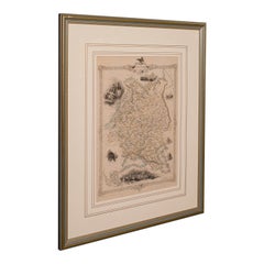
Antique Lithography Map, Western Russia, English, Framed, Cartography, Victorian
Located in Hele, Devon, GB
This is an antique lithography map of Western Russia. An English, framed atlas engraving of cartographic interest by John Rapkin, dating to the early Victorian period and later, circ...
Category
Mid-19th Century British Early Victorian Antique Maps
Materials
Wood
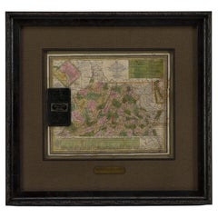
1837 Mitchell's "Tourist's Pocket Map of the State of Virginia" by J.H. Young
Located in Colorado Springs, CO
This is J. H. Young's pocket map of the Virginia, which shows county development current to 1835. The map was engraved by E. Yeager and F. Dankworth and published by S. A. Mitchell. ...
Category
1830s American Antique Maps
Materials
Paper
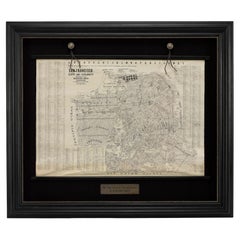
1915 "San Francisco City and County" Hanging Map by W. Bashford Smith
Located in Colorado Springs, CO
Presented is a rare wall map of San Francisco by W. Bashford Smith. Published in San Francisco in 1915, this map indicates streets and city districts, and, most notably, shows the si...
Category
1910s American Art Deco Vintage Maps
Materials
Wood, Paper
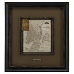
1840 "New Map of the City of New York With Part of Brooklyn & Williamsburg"
Located in Colorado Springs, CO
Presented is a hand-colored, engraved folding map titled "New Map of the City of New York With Part of Brooklyn & Williamsburg" by J. Calvin Smith. The map was issued bound in the bo...
Category
1840s American Antique Maps
Materials
Paper
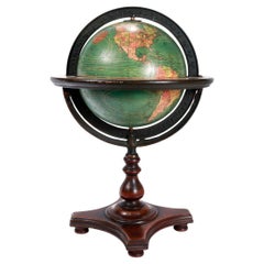
Antique Kittinger 8-inch Terrestrial World Globe on a Mahogany Wooden Stand
Located in Philadelphia, PA
A fine, antique 8 inch terrestrial globe.
Manufactured by Kittinger Company, Inc. (in collaboration with the publishers W. & A.K. Johnston, Ltd. of Edinburgh, Scotland).
On a turne...
Category
Early 20th Century Maps
Materials
Mahogany, Gesso, Wood, Paper
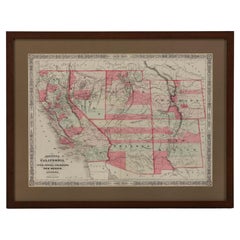
1865 "Johnson's California, Utah, Nevada, Colorado, New Mexico, Arizona" Map
Located in Colorado Springs, CO
Presented is an original 1865 "Johnson's California, with Territories of Utah, Nevada, Colorado, New Mexico, and Arizona” map. First published in 1864, thi...
Category
Mid-19th Century Antique Maps
Materials
Paper
Antique Map of the City of Copenhagen in Denmark c.1720
Located in Langweer, NL
Antique map titled 'Copenhagen'. Original antique map of the city of Copenhagen, Denmark. This map originates from 'Unterschiedliche dieser Zeit Beruffene Laender, Gegenden, Staedte ...
Category
18th Century Antique Maps
Materials
Paper
Antique Decorative Coloured Map of North America, 1882
Located in Langweer, NL
This original antique map of North America is from the Blackie & Son Atlas published in 1882. Here are several points of interest about this map:
1. **Political Borders**: The map l...
Category
1880s Antique Maps
Materials
Paper
Amsterdam city plan - Joost van Sassen
Located in UTRECHT, UT
“Afbeeldinge der Stad Amsterdam, gelyk deselve in den jaren 1536 door Cornelis Antonisz na ’t leven is geschildert, en Ao 1544 in druk uytgegeven.”, engraved by Joost van Sassen and ...
Category
1720s Dutch Other Antique Maps
Materials
Paper
Early 20th Century Terrestrial Globe by G. Thomas Paris
Located in Pease pottage, West Sussex
Early 20th Terrestrial Globe by G. Thomas. 44 Rue ND des Champs, Paris. Found on original ebonised turned base and brass fittings. Paris, France Circa 1920.
Category
Early 20th Century French Maps
Materials
Wood, Paper
Antique Map of Russia by Tyrer, 1821
Located in Langweer, NL
Antique map titled 'Russia'. Beautiful antique map of Russia engraved by Tyrer. Artists and Engravers: Published by J. Souter, London.
Artist...
Category
19th Century Antique Maps
Materials
Paper
Cram's 16" Deluxe Globe W/Daily Sun Ray and Season Indicator
Located in San Francisco, CA
Cram's 16" Deluxe Globe W/Daily Sun Ray and Season Indicator
1936
Category
1930s Vintage Maps
Materials
Metal
1865 "Johnson's Missouri and Kansas" Map by Johnson and Ward
Located in Colorado Springs, CO
Presented is an original 1865 "Johnson's Missouri and Kansas” map. This map was issued as pages 59 and 60 in the 1865 edition of “Johnson's New Illustrated ...
Category
Mid-19th Century Antique Maps
Materials
Paper
Utrecht city plan
Located in UTRECHT, UT
“Platte grond der Stad Utrecht vertonende alle Gragten, Straaten, Stegen, Gangen, Markten, en plaatsen der openbare Gebouwen”, engraving published by Johannes van Schoonhoven in Amst...
Category
1770s Dutch Other Antique Maps
Materials
Paper
Curaçao map - C. van Baarsel en zoon
Located in UTRECHT, UT
“Kaart van het eiland Curaçao.”, “Algemeene kaart der Caraïbische eilanden”, “Plan van het fort Amsterdam op Curaçao” from the atlas “Atlas der overzeesche bezittingen van Zijne Maje...
Category
1810s Dutch Other Antique Maps
Materials
Paper
Antique Map of The United States of North America, 1882
Located in Langweer, NL
This is a historical map titled "The United States of North America, Central Part" from the 1882 Blackie Atlas. It depicts the continental United States with a high level of detail, ...
Category
1880s Antique Maps
Materials
Paper
Antique Map of The United States of North America, Pacific States, 1882
Located in Langweer, NL
The map is from the same 1882 Blackie Atlas and focuses on the Pacific States of the United States of America during that period. Here are some details and historical context about t...
Category
1880s Antique Maps
Materials
Paper
Original Antique Map of West Central France in Frame, 1748
Located in Langweer, NL
A nicely framed and hand-coloured decorative map titled "Gouvernemens Generaux De Poitou et De Saintonge" and engraved by M. Robert. This historical international map includes severa...
Category
1740s Antique Maps
Materials
Paper
Antique Old Map of Africa with Insets of Mauritius, Reunion and Natal, 1882
Located in Langweer, NL
The uploaded image is a historical map of Africa from the 1882 atlas by Blackie & Son. The map includes the entire African continent, with various countries, regions, and topographic...
Category
1880s Antique Maps
Materials
Paper
Old Map of the Chinese Empire and Japan, 1882
Located in Langweer, NL
An original antique map titled "The Chinese Empire and Japan," dating from an 1882 atlas by Blackie & Son. It is a color map with geographical features such as mountain ranges, river...
Category
1880s Antique Maps
Materials
Paper
Antique Map of British North America, The Dominion of of Canada, 1882
Located in Langweer, NL
This map is titled "British North America, Dominion of Canada," from the 1882 Blackie Atlas. It features the geographical area that comprises modern-day Canada, with notable features...
Category
1880s Antique Maps
Materials
Paper
Antique Decorative Coloured Map Egypt, Nubia, Abyssinia and more, 1882
Located in Langweer, NL
This image contains two maps, with the left one being labeled "Egypt" and the right one "Nubia, Abyssinia and the Adjacent Lands." These maps highlight the Nile Valley and surroundin...
Category
1880s Antique Maps
Materials
Paper
Original Antique Coloured Map of Western Africa, Published in 1882
Located in Langweer, NL
This is a map of Western Africa from the 1882 Blackie & Son atlas. The map details the West African coast from the Sahara Desert in the north down to the Gulf of Guinea, including a ...
Category
1880s Antique Maps
Materials
Paper
Antique Map Depicting Burma, Siam, Annam (Vietnam) and Japan, 1882
Located in Langweer, NL
The image shows two maps side by side from the 1882 atlas by Blackie & Son. On the left, the map is titled "BURMAH SIAM AND ANAM," while the one on the right is labeled "JAPAN."
**B...
Category
1880s Antique Maps
Materials
Paper
Antique Decorative Coloured Map of South Africa and Madagascar, 1882
Located in Langweer, NL
The map of South Africa is from the Blackie & Son Atlas, published in 1882. This historical map is quite interesting for several reasons:
1. **Historical Period**: This map was crea...
Category
1880s Antique Maps
Materials
Paper
1865 "Johnson's Nebraska, Dakota, Colorado, Idaho & Kansas" Map, Johnson & Ward
Located in Colorado Springs, CO
Presented is an original 1865 "Johnson's Nebraska, Dakota, Colorado, Idaho & Kansas” map. This map was issued as page 63 in the 1865 edition of “Johnson's N...
Category
Mid-19th Century Antique Maps
Materials
Paper
Original Antique Map of the American State of Washington, 1889
Located in St Annes, Lancashire
Great map of Washington
Drawn and Engraved by W. & A.K. Johnston
Published By A & C Black, Edinburgh.
Original colour
Unframed.
Category
1880s Scottish Victorian Antique Maps
Materials
Paper
Antique Map of Canada, The Province of Ontario and Part of Quebec, 1882
Located in Langweer, NL
This is a historical map from the 1882 Blackie Atlas, this time detailing "The Province of Ontario, and Part of Quebec" in Canada. The map presents a detailed illustration of Ontario...
Category
1880s Antique Maps
Materials
Paper
Antique Decorative Coloured Map Marocco, Algeria and Tunis, 1882
Located in Langweer, NL
The maps is from the 1882 atlas by Blackie & Son and offers a detailed view of the North African regions as understood in the late 19th century.
**Map of Morocco, Algeria, and Tun...
Category
1880s Antique Maps
Materials
Paper
Antique 19th Century Map of China by Blackie & Son, 1882
Located in Langweer, NL
This map is an 1882 Blackie & Son map of China. The title "CHINA." is prominently displayed at the bottom. The map is colored to differentiate various regions, possibly indicating di...
Category
1880s Antique Maps
Materials
Paper
Decorative Antique Map of Eastern Canada, Published in 1882
Located in Langweer, NL
This is a historical map from the 1882 Blackie Atlas, focused on eastern Canada and the maritime provinces. The map is titled "Canada. No. 2. Provinces of Nova Scotia, New Brunswick,...
Category
1880s Antique Maps
Materials
Paper
Antique Map of the City of Batavia by Van der Aa 'c.1730'
Located in Langweer, NL
Antique map titled 'Plan de la Ville et du Chateau de Batavia en l'Isle de Iava - Ware affbeeldinge wegens het Casteel ende Stadt Batavia gelegen op groot Eylant Java'. Detailed plan...
Category
Mid-18th Century Antique Maps
Materials
Paper
Ancient Italy: Regions and Rome in the Roman Empire, Published in 1880
Located in Langweer, NL
This print is an original detailed map titled "ITALIAE REGIONES I VII VIII IX XI," representing the regions of ancient Italy.
Key Features of the Print:
1. **Regional Demarcations...
Category
1880s Antique Maps
Materials
Paper
Antique Map of the Northern Portion of the Philippines by J.N. Bellin, 1764
Located in Langweer, NL
Detailed map of the Northern portion of the Philippines, extending from Batanes and Babuyanes to Mindonoro and Masbate, and centered on Luzon. One of the most detailed maps of the pe...
Category
Mid-18th Century Antique Maps
Materials
Paper
Old Map of The Mughal Empire and the Indian Peninsula South of the Ganges, 1787
Located in Langweer, NL
This is a historical map titled "L'Empire Du Mogol, Et La Presqu Isle De L'Inde En Deca Du Gange."
An original authentic map, created by Rigobert Bonne (1727-1794), an influential ...
Category
1780s Antique Maps
Materials
Paper
Decorative Original Antique Map of Valencia in Southern Spain, circa 1601
Located in Langweer, NL
This is an original antique map titled 'Valentiae Regni olim Contestanorum Si Ptolemaeo, Edentanorum Si Plinio Credimus Typus'. This is a historical map of the Kingdom of Valencia in...
Category
Early 17th Century Antique Maps
Materials
Paper
Original Map of Greece at the Time of the Dorian Migration, Published in 1880
Located in Langweer, NL
The map titled "GRAECIA TEMPORI MIGRATIONIS DORICAE," translates to "Greece at the Time of the Dorian Migration." This map showcases the regions of ancient Greece during the period f...
Category
1880s Antique Maps
Materials
Paper
Ancient Realms of Northeast Africa: Arabia, Ethiopia, and Egypt, Published 1880
Located in Langweer, NL
This map, titled "ARABIA, AETHIOPIA, AEGYPTUS," illustrates the regions of ancient Arabia, Ethiopia, and Egypt.
Features that make this map interesting include:
1. **Geographical ...
Category
1880s Antique Maps
Materials
Paper
Gold Rush Era Masterpiece: The Tallis & Rapkin Rare Map of Pre-Queensland, 1851
Located in Langweer, NL
The image is an original historical map of Australia from the year 1851, created by John Rapkin with illustrations by J. Marchant and engravings by J. B. Allen. The map was published...
Category
1850s Antique Maps
Materials
Paper
Roman Frontiers Engraved: Germania, Raetia, and Noricum, Published in 1880
Located in Langweer, NL
The map, titled "GERMANIA, RAETIA, NORICUM," depicts the regions of Germania, Raetia, and Noricum, which correspond to parts of modern-day Central and Eastern Europe, including areas of Germany, Austria, Switzerland, and the Balkans.
Features of the map include:
1. **Regional Divisions**: The map is divided into the regions of Germania, Raetia, and Noricum, each likely differentiated by color or shading.
2. **Topography**: It details the mountain ranges, rivers, and other geographical features of the region. The Alps, which are central to Raetia, are prominently displayed.
3. **Roman Settlements and Roads**: The map likely marks Roman...
Category
1880s Antique Maps
Materials
Paper
Historical Map of the Black Sea and Surrounding Regions, 1705
Located in Langweer, NL
Title: "Map of Turcomania, Georgia, and Comania"
This print presents an intricately detailed map of the Caucasus region, titled “Turcomania, Georgien Commanie,” by the esteemed cart...
Category
Early 1700s Antique Maps
Materials
Paper
Cartographic Elegance: The Art and Science of 17th-Century Asian Maps, ca.1681
Located in Langweer, NL
This original antique map is an artifact from a pivotal era in cartography, reflecting not only the geographical knowledge of its time but also the intertwining of art and science in...
Category
1680s Antique Maps
Materials
Paper
Antique Map of The Kingdom of Alexander the Great, Published in 1880
Located in Langweer, NL
The map is titled "ALEXANDRI MAGNI REGNUM," which translates to "The Kingdom of Alexander the Great." It depicts the vast territories conquered by Alexander the Great during his reig...
Category
1880s Antique Maps
Materials
Paper
The Roman Empire from the Time of Constantine the Great, Published in 1880
Located in Langweer, NL
Antique map titled: "IMPERIUM ROMANORUM inde a Constantini Magni tempore," which translates to "The Roman Empire from the time of Constantine the Great."
This map is designed to re...
Category
1880s Antique Maps
Materials
Paper
Antique Lithography Map, Isle of Thanet, Kent, English, Cartography, Victorian
Located in Hele, Devon, GB
This is an antique lithography map of The Isle of Thanet in Kent. An English, framed atlas engraving of cartographic interest, dating to the mid 19th century and later.
Superb litho...
Category
Mid-19th Century British Victorian Antique Maps
Materials
Wood
18th Century Cartographic Depiction of Upper India and Ceylon, 1835
Located in Langweer, NL
An exquisite set of two maps, 'Carte de la Partie Superieure De L'Inde en de Cadu Gange,' masterfully crafted by the renowned 18th-century French cartographer, Charles Marie Rigobert...
Category
1830s Antique Maps
Materials
Paper
Antique Lithography Map, Bedfordshire, English, Framed Engraving, Cartography
Located in Hele, Devon, GB
This is an antique lithography map of Bedfordshire. An English, framed atlas engraving of cartographic interest, dating to the mid 19th century and...
Category
Mid-19th Century British Victorian Antique Maps
Materials
Wood
Charting the Course of Empire: Bonne's 1770 Masterpiece Maps of the Indian Ocean
Located in Langweer, NL
A voyage through history with an exquisite collection of Rigobert Bonne's 1770 maps, as featured in the coveted Atlas Moderne circa 1770. Each map, a cartographic treasure, captures ...
Category
1770s Antique Maps
Materials
Paper
Art Deco Cartoon Style Map of Paris possibly by Arthur Zaindenberg circa 1930's
By Arthur Zaidenberg
Located in New York, NY
Art Deco cartoon style map of Paris possibly by Arthur Zaidenberg. The map depicts witty references to Parisians lifestyle, along with drawings of notable landmarks, circa 1930's. T...
Category
1930s American Art Deco Vintage Maps
Materials
Paper
Antique Map of the Sunda Islands Including Sumatra, Java, and Borneo, 1705
Located in Langweer, NL
Title: “Antique Map of the Sunda Islands Including Sumatra, Java, and Borneo”
This print is a beautifully detailed and relatively rare map of Western Indonesia, encompassing the reg...
Category
Early 1700s Antique Maps
Materials
Paper
Historical Map of Canaan with Insets of Jerusalem and Surrounding Regions, 1880
Located in Langweer, NL
The map titled "CANAAN" depicts the historical region known as Canaan, located in the Levant, which corresponds to modern-day Israel, Palestinian territories, Lebanon, and parts of S...
Category
1880s Antique Maps
Materials
Paper
Cartographic Elegance of the Mughal Dominion in a Hand-Colored Antique Map, 1705
Located in Langweer, NL
This original antique map titled “'T Ryk van den Grooten Mogol” by Nicolas Sanson from 1705 is an interesting historical artifact. It depicts the extent of the Mughal Empire in North...
Category
Early 1700s Antique Maps
Materials
Paper
Map of The Italian Peninsula with the islands of Sicily, Sardinia, Corsica, 1880
Located in Langweer, NL
This map, titled "ITALIA, Sicilia, Sardinia, Corsica," represents the Italian Peninsula along with the islands of Sicily, Sardinia, and Corsica. Inset maps offer detailed views of "R...
Category
1880s Antique Maps
Materials
Paper
Antique Map of New England and Part of Canada by Vaugondy 'circa 1755'
Located in Langweer, NL
Antique map titled 'Partie de l'Amérique septent qui comprend la nouvelle France ou le Canada'. Decorative and highly detailed map of New England an...
Category
Mid-18th Century Antique Maps
Materials
Paper
The World in the Assyrian Empire's Era: A Historical Map, Published in 1880
Located in Langweer, NL
This map from the "Spruner-Menke Atlas Antiquus" is titled "ORBIS TERRARVM regni Assyrii tempore," which translates to "The World at the Time of the Assyrian Kingdom." It depicts the...
Category
1880s Antique Maps
Materials
Paper
Ancient Iberia: Hispania Map from Spruner-Menke Atlas Antiquus, 1880
Located in Langweer, NL
This map is titled "HISPANIA," indicating it is a historical map of ancient Spain.
It is an original antique map from the "Spruner-Menke Atlas Antiquus," a 19th-century historical a...
Category
1880s Antique Maps
Materials
Paper
Black Sea in Antiquity: Pontus Euxinus Map, Published in 1880
Located in Langweer, NL
This map, titled "PONTUS EUXINUS," depicts the Black Sea region, historically known as the Pontus Euxinus. The Black Sea was central to ancient trade routes and cultural exchange, bo...
Category
1880s Antique Maps
Materials
Paper
Original Antique Map of Greece and Epirus after the Persian Wars, Published 1880
Located in Langweer, NL
The map titled "GRAECIA, EPIRUS post bella Persica," translates to "Greece and Epirus after the Persian Wars." It covers the regions of ancient Greece and Epirus following the Greco-Persian Wars, a series of conflicts between the Greek city-states and the Persian Empire during the 5th century BC.
What makes this map interesting:
1. **Historical Context**: The period after the Persian Wars was pivotal for ancient Greece, leading to the rise of Athens as a major power and the Golden Age of Athens.
2. **Inset Maps**: Detailed insets, such as the one showing the Acropolis of Athens, provide close-up views of historically significant locations.
3. **Topography**: It features the diverse terrain of Greece, from the rugged mountain ranges to the intricate coastlines and islands, influencing the development of Greek city-states.
4. **City-States**: The map likely details the various polis or city-states, such as Athens, Sparta, Thebes, and others, which played critical roles in the Persian Wars.
5. **Battle Sites**: It might mark important battle sites from the wars, like Marathon, Thermopylae, Salamis, and Plataea.
6. **Latin Labels**: The use of Latin for place names and descriptions adds to the map's scholarly quality.
7. **Cultural Landmarks**: The map may include locations of significant cultural and historical landmarks from the era, such as temples, theatres, and agoras.
This map is from the "Spruner-Menke Atlas Antiquus," compiled by Karl Spruner von Merz and edited by Theodorus Menke. The atlas, known for its detailed maps of historical and ancient geographies, was a significant educational tool in the 19th century.
The Greco-Persian Wars, which included famous battles such as Marathon and Salamis, were crucial for the preservation of Greek independence...
Category
1880s Antique Maps
Materials
Paper
Recently Viewed
View AllMore Ways To Browse
Antique Sailing Map
Antique Sailing Maps
Bay Area Antique Furniture
West Coat Of Arms
Greek Asia Minor
Hemisphere World Map
Speed Map
Antique Maps Canada
Antique Map Canada
Canada Antique Map
Malaysian Antique
West Indies Map
Blaeu World Map
Charing Cross
Antique Maps Of Canada
Bali Map
Antique Portuguese Plates
Map Of Brazil
