Maps
319
5,423
3
2
to
1,186
5,175
246
5,428
5,428
5,428
51
34
16
11
9
5
5
4
4
2
1
1
1
2,888
2,123
412
5
228
31
11
85
7
56
7
3
3
4
5
2
5,339
94
31
31
29
479
264
169
123
116
106
63
29
26
16
Maps For Sale
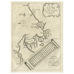
Old Dutch Map of the City of Carthage and the Bay of Carthage, 1773
Located in Langweer, NL
Antique print titled 'Kaart van de Legging van het Oude Karthago'. Old map of the city of Carthage and the Bay of Carthage. It was the center or capital city of the ancient Carthagin...
Category
1770s Antique Maps
Materials
Paper
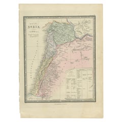
Antique Map of Syria by Wyld '1845'
Located in Langweer, NL
Antique map titled 'Map of Syria'. Original antique map of Syria. This map originates from 'An Atlas of the World, Comprehending Separate Maps of its
Var...
Category
Mid-19th Century Antique Maps
Materials
Paper
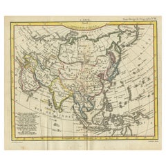
Antique Map of Asia from the Middle East to the Coast of Alaska, 1816
Located in Langweer, NL
Antique map titled ‘L’Asie‘. This is an original antique map of Asia, by Hérisson, taken from atlas ""Nouv. Abrége de Géographie"". An engraved map with coloring of Asia from the Mid...
Category
19th Century Antique Maps
Materials
Paper
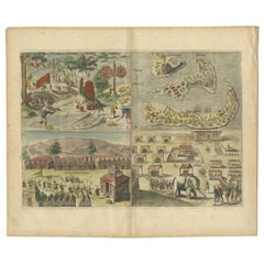
Antique Engravings of Mauritius and Indonesia, incl de Banda Islands, c.1730
Located in Langweer, NL
Title on page: "Ins. de Cerno a. Nostatibus Mauritius Nominata [on sheet with] Gunnanappi Labetacq [and] Civitas Gammelamme [and] Rex Tubatus", Le Clerc, Jean
This sheet includes fo...
Category
1730s Antique Maps
Materials
Paper
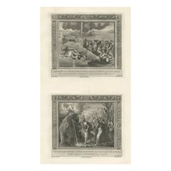
Religious Old Print of Moses Making Water & The Crossing of the Red Sea, ca.1850
Located in Langweer, NL
Large antique print with two religious engravings. The upper image depicts the crossing of the Red Sea. The lower image depicts Moses makes the water spring out from the rock. This print originates from a work illustrating the complete series of Vatican frescos painted...
Category
1850s Antique Maps
Materials
Paper
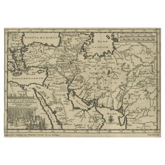
Old Engraved Map of the Middle East, Arabia and Part of Greece 'Cyprus', 1706
Located in Langweer, NL
Title: Antique map titled 'De Zee en Land-Reyse, van Ioh. Mildenhal en Cartwrigt na Persien en Mogol, opt spoor gevolgd'.
Old map of the Middle East, also depicting part of Greece ...
Category
Early 1700s Antique Maps
Materials
Paper
The 'Brazen Sea' in Solomon's Temple and a Cross Section of the Brazen Sea, 1725
Located in Langweer, NL
Two religious images on one sheet titled 'Kopere Zee in den Tempel van Salomon' and 'Doorsnede van de Kopere Zee des Tempels van Salomon'.
The 'Brazen Sea' in Solomon's Temple an...
Category
1720s Antique Maps
Materials
Paper
Map of The East Indies with the Route of Capt. William Dampier's Voyage, 1698
Located in Langweer, NL
Antique map titled 'Kaart van Oost Indie'.
Old map of the East Indies. It shows the routes of Captain William Dampier's voyage throughout the regio...
Category
1690s Antique Maps
Materials
Paper
Steel Engraved Map of Part of the Bengal Presidency 'India & Bangladesh', 1831
Located in Langweer, NL
Antique map titled 'India Bengal Presidency'. Old steel engraved map of part of the Bengal Presidency. The Bengal Presidency (1757–1912), later reorganized as the Bengal Province (19...
Category
1830s Antique Maps
Materials
Paper
Original Antique Print of a Street Scene in Naha, Okinawa in Japan, 1856
Located in Langweer, NL
Antique print titled ‘Street in Napha Lew-Chew'.
Antique print of a street scene in Naha, the capital city of the Okinawa Prefecture, Japan. Okinawa used to be called Great Lew C...
Category
1850s Antique Maps
Materials
Paper
Danube River Incl Serbia, Moldavia, Transylvania, Romania, Bulgaria Etc, ca.1720
Located in Langweer, NL
Antique map titled 'Danubii Fluminis (..)'.
Regional map of the Donau river, Shows the Danube river from Belgrade in Serbia, along the border between ...
Category
1720s Antique Maps
Materials
Paper
Antique Map of Asia and Australia with a Speculative Coastline, 1777
Located in Langweer, NL
Antique map titled 'A New & Accurate Map of Asia'. Detailed map of Asia and Australia, shows a still largely speculative Southern Australian coastline. Originates from Middleton's 'C...
Category
18th Century Antique Maps
Materials
Paper
Detailed Map of the Island of Gorée off of the Coast of Dakar, Senegal, 1747
Located in Langweer, NL
Antique plan titled 'Plan de l'Isle de Goree
The island of Gorée lies off the coast of Senegal, opposite Dakar. From the 15th to the 19th century, it was the largest slave-tradin...
Category
1740s Antique Maps
Materials
Paper
Original Hand-Colored Antique Costume Print of a Peasant from Hungary, 1804
Located in Langweer, NL
Old print of a Hungarian peasant. This print originates from 'The Costume of the Hereditary States of the House of Austria' by William Miller.
Artists and Engravers: Engraved by William Ellis.
Category
Early 1800s Antique Maps
Materials
Paper
Antique Map of China by Larousse, 1897
Located in Langweer, NL
Sheet: Front: 'Chine.' (China map). Verso: 'China.' (China views, nature, animals, costume). This rare early lithographic print originates from: 'Nouveau Lar...
Category
19th Century Antique Maps
Materials
Paper
Beautiful Antique Map of the Moluccas or Spice Islands, Indonesia, ca.1650
Located in Langweer, NL
Antique map titled 'Insularum Moluccarum Nova Descriptio.'
Beautiful map of the Moluccas. The famous Spice Islands, the cornerstone of the Dutc...
Category
1650s Antique Maps
Materials
Paper
Antique Print of Elements of Stowe Park, Stowe, Buckinghamshire, England, c.1785
Located in Langweer, NL
Antique print titled 'Stowe - L'Arc Corinthien - Obelisque du Général Wolfe (..)'.
Copper engraving showing several elements of Stowe Park, Buckingha...
Category
18th Century Antique Maps
Materials
Paper
Map of the Holy Land Divided into 12 Tribes, the Travels of Jesus Christ, 1700
Located in Langweer, NL
Antique map titled 'Het Heylige Land verdeeld in de Twaalf Stammen Israels (..)'.
Decorative and detailed map of the Holy Land divided into 12 Tribes, sh...
Category
Early 1700s Antique Maps
Materials
Paper
Map of the Vietnamese Coast, Centered on Turon Harbor 'Da Nang Area', 1796
Located in Langweer, NL
Antique map titled 'A chart of part of the coast of Cochin-China including Turon Harbour and the Island Callao'.
Detailed map of the Vietnamese Coast, centered on Turon Harbor (D...
Category
1790s Antique Maps
Materials
Paper
Original Antique Map of Ancient Greece- Boeotia, Thebes, 1787
Located in St Annes, Lancashire
Great map of Ancient Greece. Showing the region of Boeotia, including Thebes
Drawn by J.D. Barbie Du Bocage
Copper plate engraving by P.F T...
Category
1780s French Other Antique Maps
Materials
Paper
Highly Decorative Map of The Eastern Mediterranean and The Middle East, ca.1700
Located in Langweer, NL
Antique map titled 'Byzondere Kaart van de Landen Daar de Apostelen Het Evangelium Gepredikt Hebben (..).'
Highly decorative map of the eastern Mediterranean...
Category
Early 1700s Antique Maps
Materials
Paper
Antique Print of Ornamental Decorations of Door & Ceiling of a Paris Hotel, 1877
Located in Langweer, NL
Antique print titled 'Antichambre. Hotel rue du Faubg. St. Honore No. 131. a Paris. Face du cote de la Porte et Plafond. Par M. M. Croiseau et Letrosne, architectes et Denuelle, pein...
Category
19th Century Antique Maps
Materials
Paper
Antique Map of the Moluccas or the Famed Spice Islands of Indonesia, 1724
Located in Langweer, NL
Antique map Spice Islands titled 'De landvoogdy van Amboina met de elf onderhoorige Eylanden'.
This map depicts the central islands of the Maluku Arc...
Category
1720s Antique Maps
Materials
Paper
Château de Versailles 'Paris, France' with a View from the Park/Garden, 1861
Located in Langweer, NL
Antique print titled 'Château de Versailles'.
This print depicts Versailles (Paris, France) with a view from the park/garden. This print originates from 'Paris dans sa splendeur'...
Category
1860s Antique Maps
Materials
Paper
Antique Map of Peru and Bolivia, 1836
Located in Langweer, NL
Antique map titled 'Pérou et Bolivia'.
Decorative map of Peru and Bolivia with outline coloring. Originates from 'Atlas Complet Du Precis De La Geograp...
Category
1830s Antique Maps
Materials
Paper
Antique Map of Israel Filled with Biblical Scenes, Published in 1748
Located in Langweer, NL
Antique map Holy Land titled 'Het beloofde landt Canaan doorwandelt van onsen Saligmaker Jesu Christo neffens zyne Apostelen'.
Antique map of Israel ...
Category
1740s Antique Maps
Materials
Paper
Antique Map of the Savoy and Piedmont Regions, Centered on Torino, ca.1735
Located in Langweer, NL
Antique map titled 'Ducatus Sabaudiae, Principatus Pedemontium et ducatis Montisferrati (..).'
Map of the Savoy and Piedmont regions, centered on Torino. The map coverage extends...
Category
1730s Antique Maps
Materials
Paper
Beautiful Decorative Hand-Colored Antique Map of West Canada, 1851
Located in Langweer, NL
Description: Antique map of Canada titled 'West Canada'.
With decorative vignettes titled Kingston and Falls of Niagara. Originates from 'The Illustrated Atlas, And Modern History Of The World Geographical, Political, Commercial & Statistical, Edited By R. Montgomery Martin'. Published; John Tallis London, New York, Edinburgh & Dublin. 1851.
Drawn and Engraved by J. Rapkin.
Artists and Engravers: John Tallis (1817-1876) was a British map...
Category
1850s Antique Maps
Materials
Paper
Antique Map of Cuba, Haiti and Porto Rico by W. G. Blackie, 1859
Located in Langweer, NL
Antique map titled 'The Leeward or North Caribbean Islands'. Original antique map of Cuba, Haiti and Porto Rico. This map originates from ‘The Imperial Atla...
Category
Mid-19th Century Antique Maps
Materials
Paper
Neatly Framed Decorative Hand-Colored View of Zierikzee, the Netherlands, 1858
Located in Langweer, NL
Antique print titled 'Zierikzee'.
View of the city of Zierikzee, the Netherlands. This print originates from 'Het koningrijk der Nederlanden voorgesteld in eene reeks van 136 naa...
Category
1850s Antique Maps
Materials
Paper
Old Bird's Eye View of the European Trading Posts at Sabi, Benin, Africa, 1748
Located in Langweer, NL
Antique print titled 'Vue des comtoirs Europeins de Xavier ou Sabi (..) - Gezigt der Europese Faktooryen, te Xavier of Sabi (..)'.
Bird's eye view of the European trading posts a...
Category
1740s Antique Maps
Materials
Paper
Original Hand-Coloured Nautical Chart of West-Africa, c.1680
Located in Langweer, NL
NIEUWE PASKAERT VAN DE KUST VAN GENEHOA (Senegal) alsmede een gedeelte van Gambia beginnende an C. Blanco tot C. Verde (...). Amsterdam, Johannus van Keulen, c. 1680.
Large folio...
Category
17th Century Antique Maps
Materials
Paper
Antique Map of the Europe Continent, 1880
Located in Langweer, NL
Antique map titled 'Europe'. Old map of the European continent. This map originates from 'Géographie Universelle Atlas-Migeon' by J. Migeon.
Artists and Engravers: Published by J....
Category
19th Century Antique Maps
Materials
Paper
Antique Copper Engraving with a Panoramic View of Mexico City, ca.1760
Located in Langweer, NL
Description: Antique print titled 'Nouveau Mexico'.
Copper engraving with a panoramic view of Mexico city. Source unknown, to be determined.
Artists and Engravers: Engraved af...
Category
1760s Antique Maps
Materials
Paper
Decorative Original Antique Print Depicting the Cavalry Marching in China, 1665
Located in Langweer, NL
Antique print titled ‘Kryghs-Ordre in het Marseren. L’Ordre de la Cavallerie en Marchant’.
Decorative print depicting the cavalry. This print originates from ‘Joan Nieuhof, Het G...
Category
1660s Antique Maps
Materials
Paper
Antique Map of the Siege of Syracuse, Sicilia, Italy, 'ca.1675'
Located in Langweer, NL
Antique map titled 'Syracus beseeged by the Athenians.' This original uncommon antique map shows the siege of Syracuse, Italy, by the Athenians. Key top left.
The siege of Syracus...
Category
1670s Antique Maps
Materials
Paper
Engraving of Amalia, Princess of Orange, 1757
Located in Langweer, NL
Rare antique portrait ( proof print circa 1750) with title Amelia, Gravinne van Solms, gemalinne van Frederik Hendrik, Prins van Oranje etc.
Engraving of Amalia, Princess of Orange. Half length with curled hair with pearl ropes, pearl earrings and necklace, low gown, and jewelled bodice.
Artists and Engravers: Jakob Houbraken was a very productive Dutch 18th century engraver...
Category
1750s Antique Maps
Materials
Paper
Antique Engraved Map of Italy in Roman Times, ca.1730
Located in Langweer, NL
Plain engr. map of Italy according to the division of Emperor Augustus by G. Delisle.
Title: "Tabula Italiae Antiquae In Regiones XI Ab Augusto Divisae Et Tum Ad Mensuras Itinerari...
Category
1730s Antique Maps
Materials
Paper
Old Original Map of Chormandel & Malabar, India & Ceylon, Now Sri Lanka, 1726
Located in Langweer, NL
Antique map titled 'Nieuwe Kaart van Choromandel ende Malabar'.
Antique map depicting the southern part of India and the northern tip of Ceylon, Sri Lanka. This map originates from...
Category
1720s Antique Maps
Materials
Paper
Print of Various Ceremonies 'Marriage, Funeral, Baptism, Magic' of Finland, 1726
Located in Langweer, NL
Antique print titled 'Mariage des Lapons (..)'.
Old print of various ceremonies (marriage, funeral, baptism, magic) of Finland. This print originates from 'Ceremonies et costumes...
Category
1720s Antique Maps
Materials
Paper
Large Original Antique Map of the Dutchy of Holstein, Germany, ca.1840
Located in Langweer, NL
Antique map titled 'A Map of the Dutchy of Holstein, with the Territories of the Imperial Towns Hamburg & Lubek, Also The Bishoprick of Eutin, Laid down from Fischer's Map (..)'. Sca...
Category
1840s Antique Maps
Materials
Paper
Original Antique Map of Tartary 'Northern China & Far Eastern Russia', 1757
Located in Langweer, NL
Antique map titled 'Carte de la Tartarie Orientale (..)'.
Original antique map of what is present day northern China and far eastern Russia. Centere...
Category
1750s Antique Maps
Materials
Paper
Stunning Large Scale Antique Map of Martinique, Rare, Published 1758
Located in Langweer, NL
Antique map titled 'Carte Reduite de l'Isle de la Martinique Dressee au Depost des Cartes Plans et Journaux de la Marine.'
Superb, large scale chart of th...
Category
18th Century Antique Maps
Materials
Paper
Ancient Babylon with The Tower of Babel According to Herodotus & Kircherus, 1730
Located in Langweer, NL
Antique print titled 'Platte Grond van de Stad Babilon, volgens Herodotus en A. Kircherus'.
This original antique print shows a view of ancient Babylon with the tower of Babel...
Category
1730s Antique Maps
Materials
Paper
Antique Print of a Section of the Kew Gardens, London, England, c.1785
Located in Langweer, NL
Antique print titled 'Coupe sur la longueur d'une partie de la Galerie des Antiques dans les jardins de Kew'.
Copper engraving showing a section of the Royal Botanic...
Category
18th Century Antique Maps
Materials
Paper
Antique Hand-Colored Map of Northern Portugal, 1756
Located in Langweer, NL
Antique map Portugal titled 'Parte Sepentrional del Reyno de Portugal'.
Antique map of Northern Portugal. This map originates from 'Atlas Port...
Category
1750s Antique Maps
Materials
Paper
The Biblical Kingdom of Israel under the Kings Saul, David and Solomon, Ca.1758
Located in Langweer, NL
Antique map titled 'De IVde Landkaart vertoonende het Koningryk Israels benevens deszelfs overheerde Landschappen (..).'
Map of the biblical Kingdom of Israel under the Kings Sau...
Category
1750s Antique Maps
Materials
Paper
Antique Map of Eastern Tartary as Surveyed by the Jesuits, 1746
Located in Langweer, NL
Antique map titled 'A Map of Eastern Tartary as Surveyed by the Jesuits in 1709, 10 & 11'. The map covers much of the course of the Amur River or Heilong Jiang, the world's tenth lon...
Category
18th Century Antique Maps
Materials
Paper
Original Antique Map of Juan Fernandez by Van Schley, 1757
Located in Langweer, NL
Antique map titled 'Carte Particuliere de l'Isle de Juan Fernandez - Byzondere Kaart van 't Eiland Juan Fernandez'.
Map of the Chilean Juan Fernandez Island, topped by a view of it...
Category
18th Century Antique Maps
Materials
Paper
Old Portrait of Henry Frederick, Prince of Wales, c.1750
Located in Langweer, NL
Antique portrait titled 'Henry, Prince of Wales, Son of K. James I'.
Old portrait of Henry Frederick. Henry Frederick, Prince of Wales (1594-1612) was the elder son of James VI and I, King of England and Scotland, and his wife, Anne of Denmark. Prince Henry was widely seen as a bright and promising heir to his father's thrones. However, at the age of 18, he predeceased his father when he died of typhoid fever. His younger brother Charles succeeded him as heir apparent to the English, Irish and Scottish thrones...
Category
1750s Antique Maps
Materials
Paper
Prince of Orange, First King of the Netherlands & Grand Duke of Luxembourg, 1750
Located in Langweer, NL
Antique portrait titled 'Willem de I. Prins van Oranje enz. enz. enz'.
Portrait of William I, Prince of Orange. William I Frederick, born Willem Frederik Prins van Oranje-Nassau ...
Category
1750s Antique Maps
Materials
Paper
Original Antique Map the Imperial States of the Habsburg Netherlands, 1609
Located in Langweer, NL
Antique map titled 'Belgii inferioris descriptio (..)'.
Old map of the Seventeen Provinces, the Imperial states of the Habsburg Netherlands in the 16th century. They roughly cove...
Category
Early 1600s Antique Maps
Materials
Paper
"Africa Vetus": a 17th Century Hand-Colored Map by Sanson
Located in Alamo, CA
This original hand-colored copperplate engraved map of Africa entitled "Africa Vetus, Nicolai Sanson Christianiss Galliar Regis Geographi" was originally created by Nicholas Sanson d...
Category
Late 17th Century French Antique Maps
Materials
Paper
Antique Map of Brazil of Southern Brazil, Uruguay, and Northern Argentina, c1780
Located in Langweer, NL
Antique map titled 'Carte de la Partie Méridionale du Bresil (..)'. This antique map of Brazil depicts southern Brazil, Uruguay, and northern Argentina, including Rio de Janeiro, Montevideo, and Buenos Aires. Published by R. Bonne.
Artists and engravers: Rigobert Bonne (October 6, 1727 - September 2, 1794) was one of the most important French cartographers of the late 18th century. Bonne was born in Ardennes à Raucourt, France. He taught himself mathematics and by eighteen was a working engineer. During the War of the Austrian Succession...
Category
1780s Antique Maps
Materials
Paper
Detailed Map of Dutch Rivers, with the Rhine, Maas, de Merwe en de Lek, C.1750
Located in Langweer, NL
Antique map titled 'Kaart van den Loop der Rivieren de Rhyn, de Maas, de Waal, de Merwe en de Lek, door de Provincien van Gelderland, Holland en Utrecht'.
...
Category
1750s Antique Maps
Materials
Paper
View of the Island Onrust Near Batavia 'Jakarta', Indonesia, 1739
Located in Langweer, NL
Antique print titled 'Ein Prospect der Insul Onrust oder Unruhe 2 Meilen von Batavia gelegen.' (View of the island ' Onrust' near Batavia.)
Onrust Island also known as Pulau Onrust or Pulau Kapal (ship island) is an Indonesian island off the coast of Jakarta. It measures about 3.5 km2 (1.4 sq mi) and is part of the Thousand Islands. The town on the island had houses and warehouses, but it also had a gunpowder magazine, a storage for water transported from Batavia, general warehouses, and a lot of warehouses specifically meant to store pepper. Specific to the shipyard were the reservoirs for trees. Sawing windmills processed these trees to make planks for the shipyards. There was also a smithy that served the shipyard. Near the waterfront there were special installations to easily pull ships on their side. Sometimes ships for local use were built at the island. The VOC employees were only allowed to leave the island two times a year.
In 1911 Onrust Island was turned into a quarantine station for pilgrims returning from the Hajj. The island had the advantage of being completely isolated. Furthermore, it was so small that it was possible to make it malaria free by the only method known at the time. This was done by filling up all the small ponds and other fresh water instances on the island and by removing most vegetation. Later a sanatorium for lung diseases was established on the island, because of the very much improved health situation. From 1933 it was used to lock up the mutineers of the 1933 mutiny on the HNLMS De Zeven Provinciën (1909).
In 1940 German nationals were interned on Onrust. In May 1940 the Netherlands were attacked by Germany. In the Dutch East Indies thousands of Germans, Hungarians, Czechs, Italians, Dutchmen with a German family name, and members of the National Socialist Movement in the Netherlands were arrested and locked up at Onrust and in Ngawai. After war with Japan broke out on 8 December 1941 a small part of these prisoners was evacuated to Suriname. The Japanese also used Onrust as a prison.
On 23 January 1950 Raymond Westerling attempted the APRA coup d'état. It failed, and most of the APRA military were seized by the Dutch troops that were still on Java. The Dutch military...
Category
1730s Antique Maps
Materials
Paper
Old Print of VOC Ships in the Sea Near Batavia (Jakarta, Indonesia), 1779
Located in Langweer, NL
Antique print Batavia titled 'De Reede van Batavia'.
Beautiful view of the sea near Batavia (Jakarta, Indonesia), with several ships lying at anchor.
Artists and Engravers: Ma...
Category
1770s Antique Maps
Materials
Paper
Old Original Hand-Colored Print of a Peasant of Little Russia, 1804
Located in Langweer, NL
Old print of a peasant of Little Russia.
This print originates from 'The Costume of the Hereditary States of the House of Austria' by William Miller....
Category
Early 1800s Antique Maps
Materials
Paper
Recently Viewed
View AllMore Ways To Browse
Antique Sailing Map
Antique Sailing Maps
Bay Area Antique Furniture
West Coat Of Arms
Greek Asia Minor
Hemisphere World Map
Speed Map
Antique Maps Canada
Antique Map Canada
Canada Antique Map
Malaysian Antique
West Indies Map
Blaeu World Map
Charing Cross
Antique Maps Of Canada
Bali Map
Antique Portuguese Plates
Map Of Brazil
