Articles similaires à Geological Map of Europe by A.K. Johnston – Mountains and Valleys 1852


Vous voulez plus d'images ou de vidéos ?
Demander au vendeur plus d'images ou de vidéos
1 sur 10
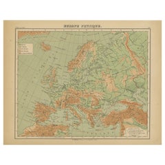
Geological Map of Europe by A.K. Johnston – Mountains and Valleys 1852
260 €par article|TVA incluse
Quantité
À propos de cet article
Geological Map of Europe by A.K. Johnston – Mountains and Valleys 1852
This elegant 1852 map titled "The Mountains, Table Lands, Plains & Valleys of Europe" was designed by the acclaimed Scottish geographer Alexander Keith Johnston and published by William Blackwood & Sons, Edinburgh and London. Issued as Plate 5 in Johnston’s pioneering work *The Physical Atlas of Natural Phenomena*, this map presents a physical topographic view of Europe with a focus on land elevation and terrain structure, rather than political borders.
Rendered in soft shades of beige, green, and blue, the map clearly delineates Europe’s major mountain ranges, including the Alps, Pyrenees, Carpathians, Apennines, and the Scandinavian Mountains. Valleys, upland plateaus, and lowlands are carefully shaded and labeled, giving a three-dimensional sense of the landscape. The careful use of hachuring and color gradients creates a tactile impression of Europe’s relief, from the Scottish Highlands to the Ural Mountains.
Rather than showing countries, the map categorizes the land by geological and geomorphological features. The title and key in the lower right explain the distinctions between highlands, tablelands, and low plains, emphasizing natural geography over human boundaries. This approach reflects the 19th-century scientific movement toward thematic cartography—maps made not to navigate or govern, but to understand physical phenomena.
Alexander Keith Johnston (1804–1871), Geographer in Ordinary to the Queen for Scotland, was one of the most respected mapmakers of the Victorian era. His *Physical Atlas* was a groundbreaking work in visual science, and among the first to systematically map climate, geology, hydrology, and landforms across the globe.
This plate is a beautifully executed example of early data visualization and remains highly relevant for collectors of antique scientific prints, students of European geography, or those seeking refined decorative maps for libraries, studies, or offices.
Condition and framing tips:
Very good antique condition with minor toning and slight edge wear. The print retains sharp detail and gentle original coloring. Best displayed in a black or walnut frame with a warm ivory or soft grey mat to highlight the topographic textures and historic typographic style. Ideal for natural history interiors or scholarly settings.
- Dimensions:Hauteur : 27,4 cm (10,79 po)Largeur : 34,5 cm (13,59 po)Profondeur : 0,2 mm (0,01 po)
- Matériaux et techniques:
- Lieu d'origine:
- Période:
- Date de fabrication:1852
- État:Very good condition. Light overall toning near the margins. The paper remains strong and well-preserved. Folding line as issued.
- Adresse du vendeur:Langweer, NL
- Numéro de référence:Vendeur : BG-13207-51stDibs : LU3054345386522
À propos du vendeur
5,0
Vendeur reconnu
Ces vendeurs prestigieux sont des leaders du secteur. Ils représentent le summum en matière de qualité et de design.
Vendeur Platine
Vendeurs premium dont la note est supérieure à 4,7 et le délai de réponse de 24 heures maximum
Établi en 2009
Vendeur 1stDibs depuis 2017
2 641 ventes sur 1stDibs
Temps de réponse habituel : <1 heure
- ExpéditionRecherche du devis...Expédition depuis : Langweer, Pays-Bas
- Politique des retours
Certaines parties de cette page ont été traduites automatiquement. 1stDibs ne garantit pas l'exactitude des traductions. L'anglais est la langue par défaut de ce site web.
Garantie d'authenticité
Bien qu'il soit peu probable que la situation se présente, dans le cas où vous rencontreriez un problème d'authenticité d'un article, contactez-nous dans un délai d'un an pour obtenir un remboursement intégral. DétailsGarantie de remboursement
Si votre article n'est pas conforme à la description, est endommagé pendant le transport ou ne vous est pas livré, contactez-nous sous 7 jours pour obtenir un remboursement intégral. DétailsAnnulation sous 24 heures
Vous disposez d'un délai de 24 heures pour annuler votre achat sans motif.Des vendeurs professionnels agréés
Nos vendeurs de renommée mondiale doivent respecter des normes strictes en matière de service et de qualité, afin de préserver l'intégrité de nos fiches produit.Garantie d'alignement des prix
Si vous constatez qu'un autre vendeur a mis en vente le même article à un prix inférieur sur un autre site, nous nous alignerons sur ce prix.Livraison en toute confiance à l'international
Notre réseau de transporteurs de premier ordre propose des options d'expédition spécialisées dans le monde entier, y compris des livraisons personnalisées.Plus d'articles de ce vendeur
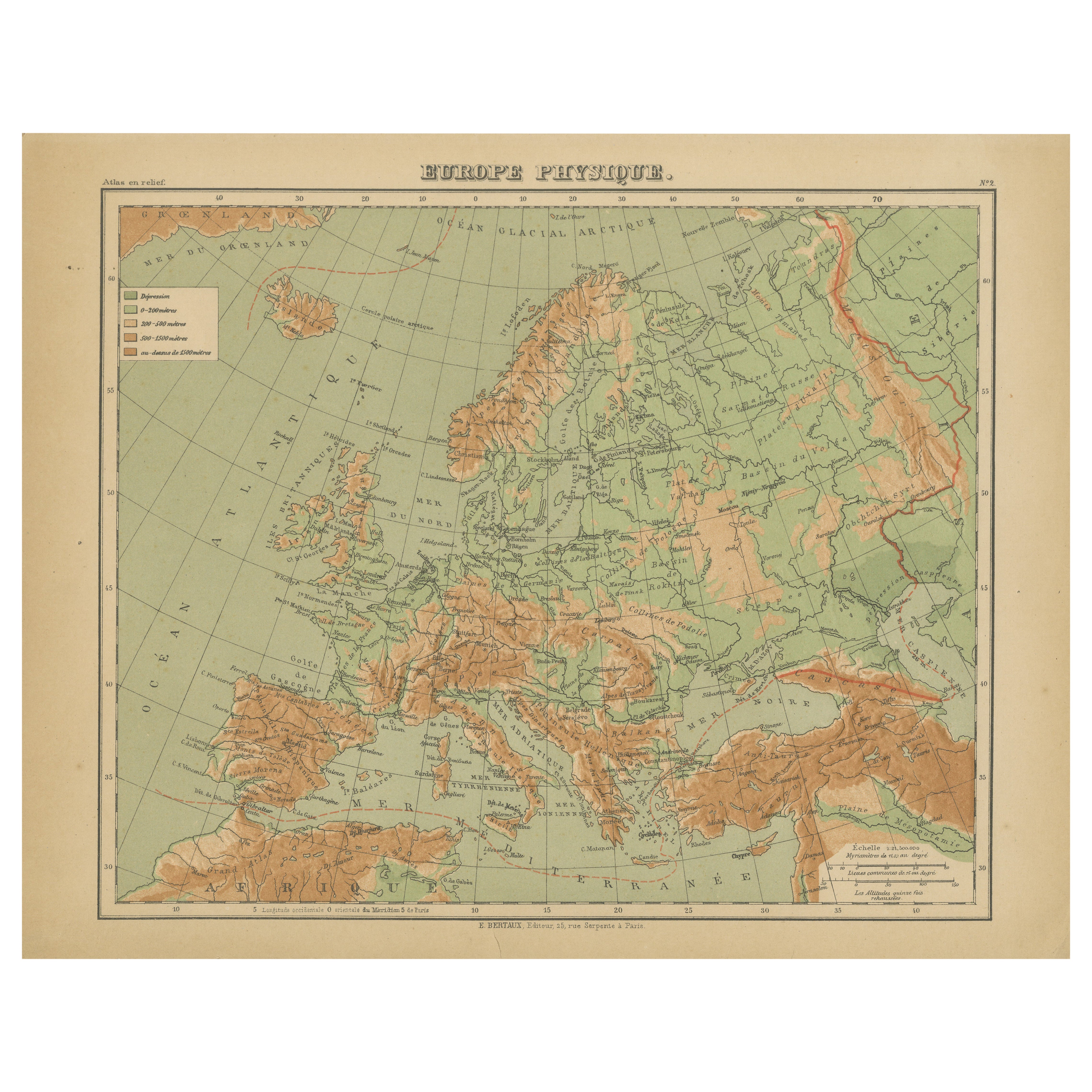
Tout afficherAtlas en relief de l'Europe par Hachette - Antique French Map c.1883
Carte ancienne de l'Europe - Carte en relief physique par Hachette, circa 1883
Description :
Cette carte ancienne intitulée "Europe Physique" a été publiée par Hachette à Paris vers...
Catégorie
Antiquités, Fin du XIXe siècle, Français, Cartes
Matériaux
Papier
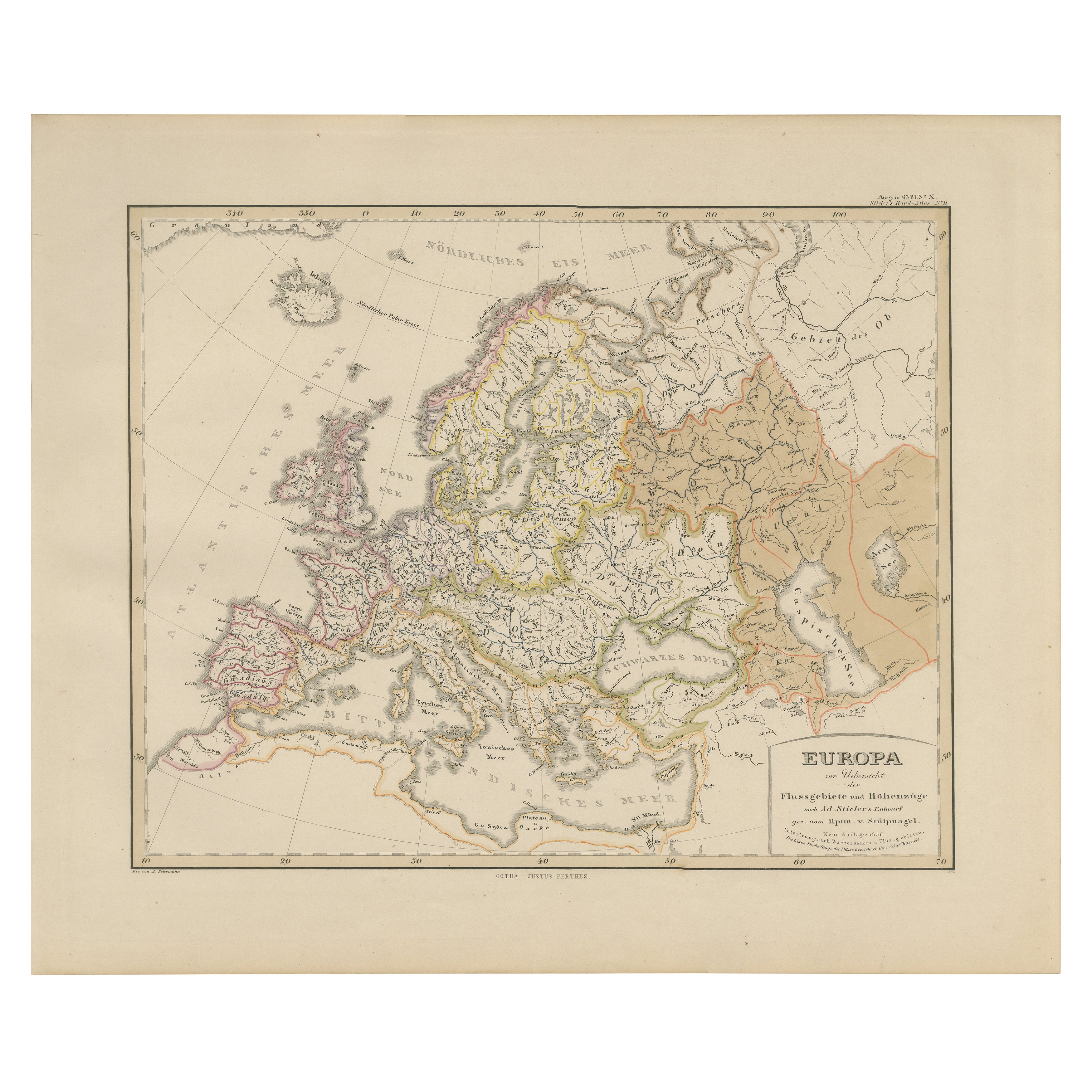
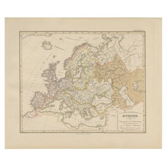
Carte d'Europe - Rivières, bassins versants et altitude, publiée en 1857
Carte d'Europe - Rivières, bassins versants et altitude 1857
Cette belle estampe ancienne montre l'Europe avec ses réseaux fluviaux et ses bassins versants. Elle est intitulée "Euro...
Catégorie
Antiquités, Milieu du XIXe siècle, Allemand, Cartes
Matériaux
Papier
Carte ancienne de l'Europe, 1903, avec des frontières politiques complexes et de riches détails
Titre : Carte ancienne de l'Europe, 1903, avec des frontières politiques complexes et de riches détails
Description :
Cette carte ancienne, intitulée "Europe", est un chef-d'œuvre c...
Catégorie
Début du 20ème siècle, Cartes
Matériaux
Papier

Carte ancienne d'Europe par W. G. Blackie, 1859
Carte ancienne intitulée "Europe". Carte ancienne originale de l'Europe. Cette carte provient de l'"Atlas impérial de géographie moderne". Publié par W. G. Blackie, 1859.
Catégorie
Antiquités, Milieu du XIXe siècle, Cartes
Matériaux
Papier

200 € Prix de vente
20 % de remise
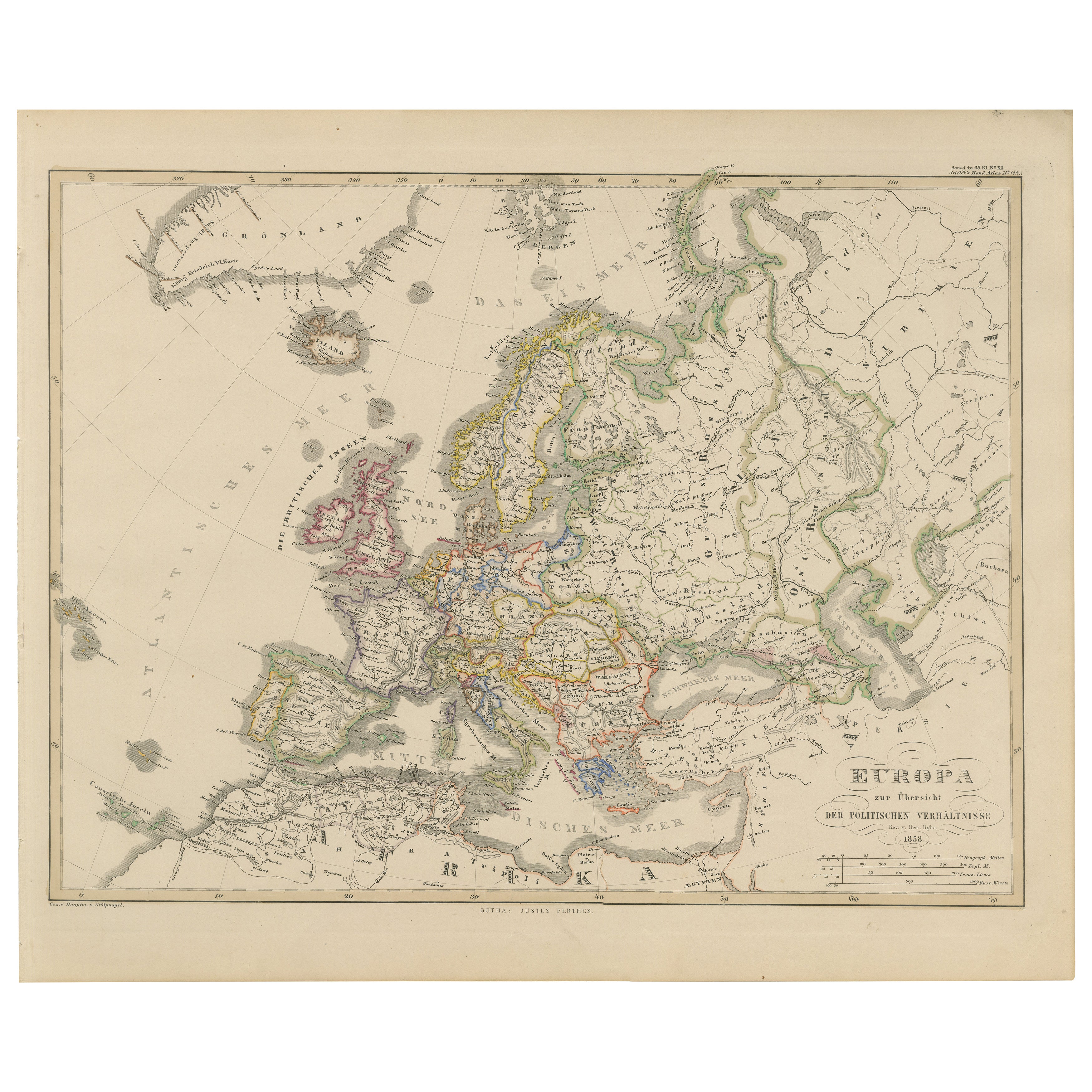
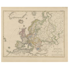
Carte de l'Europe - Divisions politiques et frontières, publiée en 1858
Carte d'Europe - Divisions politiques et frontières 1858
Cette belle gravure ancienne montre l'Europe avec ses divisions politiques. Elle est intitulée "Europa zur Übersicht der pol...
Catégorie
Antiquités, Milieu du XIXe siècle, Allemand, Cartes
Matériaux
Papier
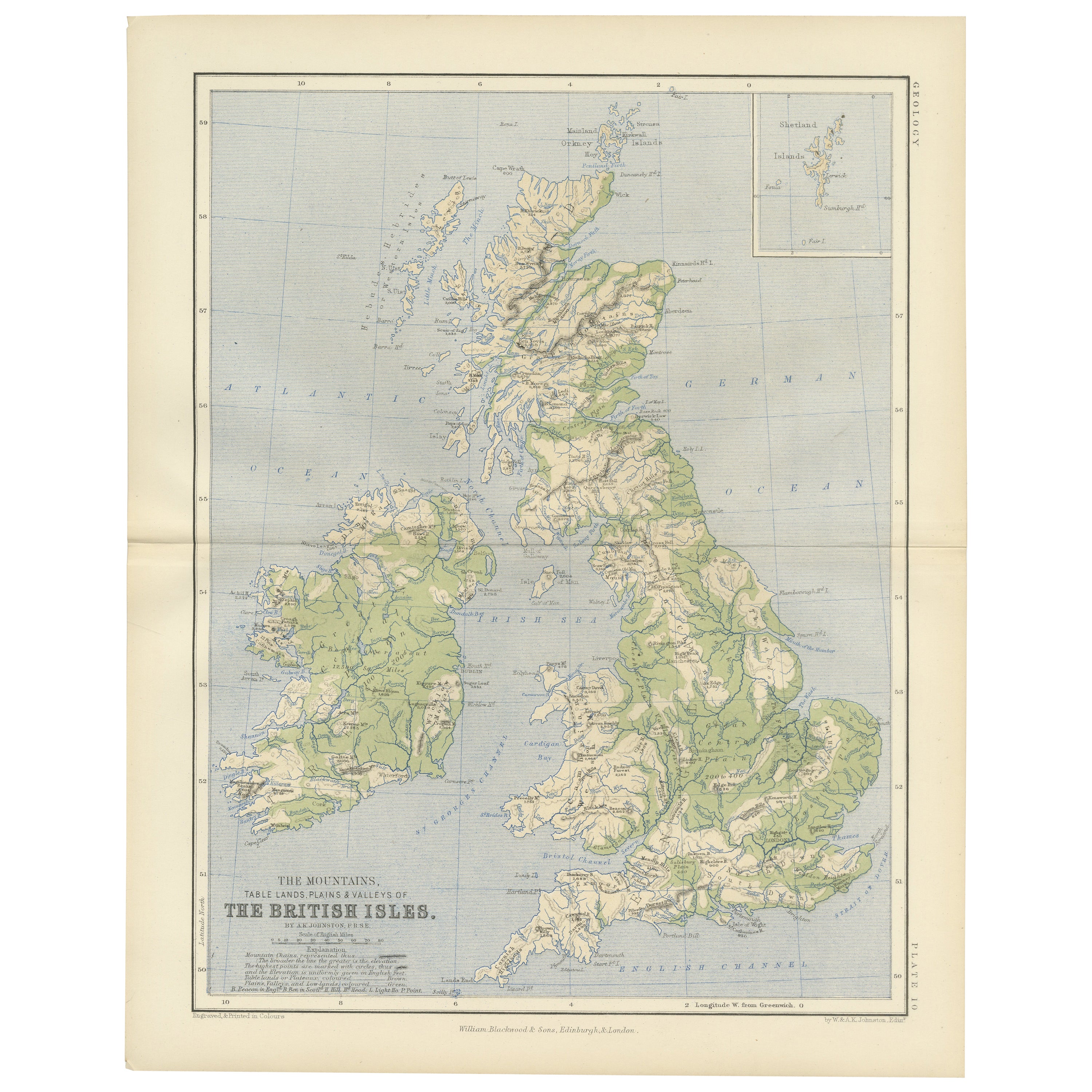
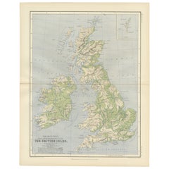
Geological Map of the British Isles by A.K. Johnston – Highlands & Valleys 1852
Geological Map of the British Isles by A.K. Johnston – Highlands & Valleys 1852
This antique topographic map titled "The Mountains, Table Lands, Plains & Valleys of the British Isle...
Catégorie
Antiquités, Milieu du XIXe siècle, Écossais, Estampes
Matériaux
Papier
Suggestions
Carte de l'Europe, 1844
Carte gravée de l'Europe par Olney, datant de 1844 et vieille de plus de 150 ans. Couleur originale à la main. Montre l'Europe du Nord, la Prusse et l'Allemagne.
Carte originale...
Catégorie
années 1840, Plus d'Estampes
Matériaux
Encre, Aquarelle, Papier fait main

Grande carte ancienne originale d'Europe par Sidney Hall, 1847
Grande carte de l'Europe
Dessiné et gravé par Sidney Hall
Gravure sur acier
Schéma de couleur original
Publié par A & C Black. 1847
Non encadré
Livraison gratuite....
Catégorie
Antiquités, années 1840, Écossais, Cartes
Matériaux
Papier

Carte ancienne originale d'Europe, orfèvrerie, 1820
Grande carte de l'Europe
Dessiné sous la direction d'Arrowsmith.
Gravure sur cuivre.
Publié par Longman, Hurst, Rees, Orme et Brown, 1820
Non encadré.
Catégorie
Antiquités, années 1820, Anglais, Cartes
Matériaux
Papier

Grande carte d'Europe colorée à la main en deux parties, datant de 1798
Par Thomas Kitchin
Carte de l'Europe imprimée sur deux feuilles séparées à partir de A New Universal Atlas par Thomas Kitchin. Publié à Londres par Laurie & Whittle, 1798. Gravures originales coloriées...
Catégorie
années 1790, Plus d'Art
Matériaux
Papier

1 469 € Prix de vente
33 % de remise
Carte de Thomas Stackhouse de 1790, intitulée « Russie en Europe, », Ric.a004
1790 Carte de Thomas Stackhouse, intitulée
"La Russie en Europe
Ric.a004
Stackhouse, Thomas
La Russie en Europe [carte]
Londres : AT&T, 1783. Carte. Gravure sur cuivre color...
Catégorie
Antiquités, 17ème siècle, Inconnu, Cartes
Matériaux
Papier

France, partie nord. Carte de l'Atlas du siècle
L'Atlas du siècle. France, partie nord".
Carte originale ancienne, 1903.
Cartes en médaillon de "La France en provinces" et de "Paris et ses environs".
Pli central tel que publié. ...
Catégorie
Début du 20ème siècle, Victorien, Plus d'Estampes
Matériaux
Lithographie
