Articles similaires à World Map of Ocean Currents by A.K. Johnston, Educational Print 1852


Vous voulez plus d'images ou de vidéos ?
Demander au vendeur plus d'images ou de vidéos
1 sur 10
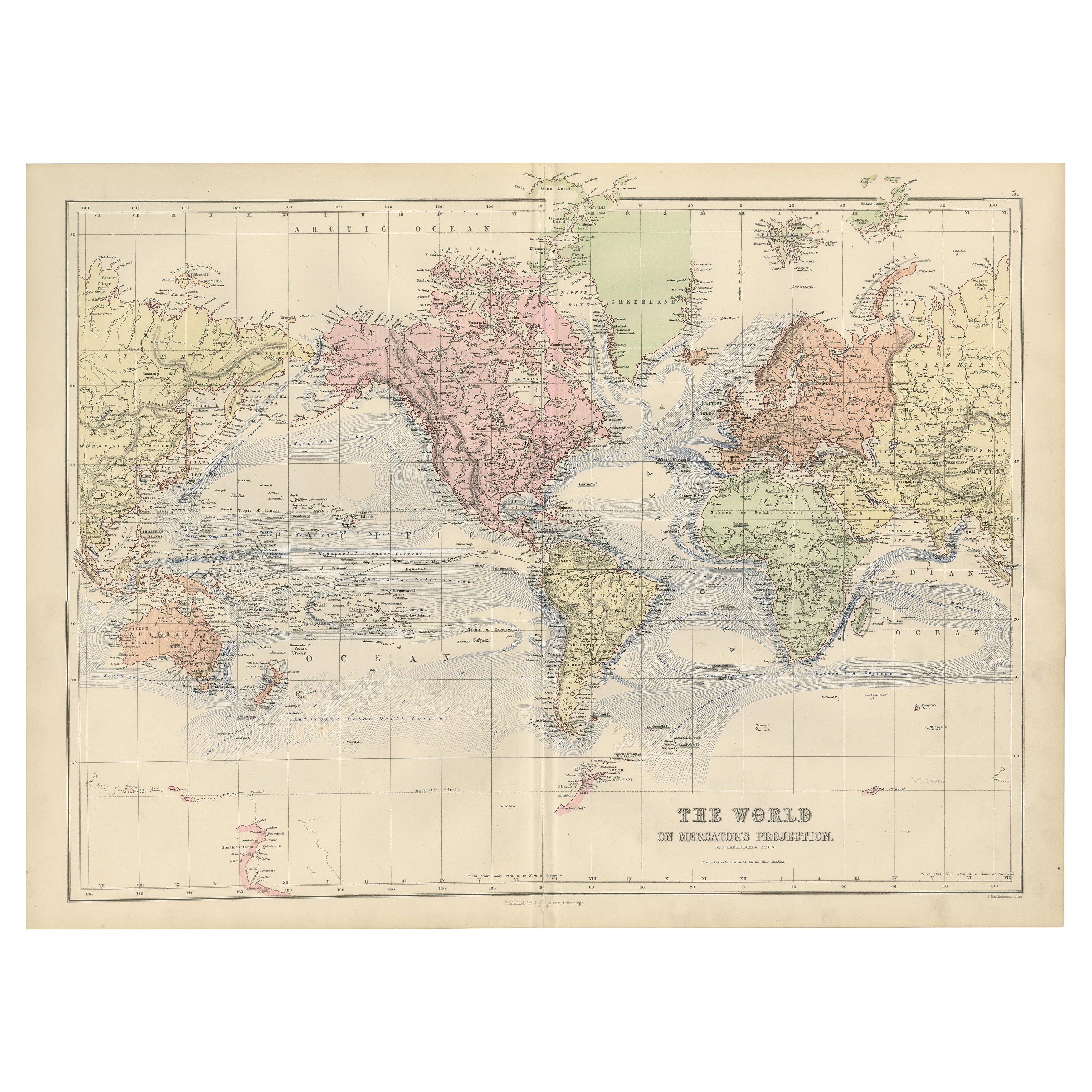
World Map of Ocean Currents by A.K. Johnston, Educational Print 1852
240 €par article|TVA incluse
Quantité
À propos de cet article
World Map of Ocean Currents by A.K. Johnston, Educational Print 1852
This detailed and scientifically rich chart titled 'Chart of the World Showing the Form & Direction of the Ocean Currents' was created by the Scottish cartographer Alexander Keith Johnston and published in 1852 by William Blackwood & Sons of Edinburgh and London. Issued as Plate 2 in a series on hydrology, it appeared in Johnston’s influential educational work *The Physical Atlas*.
The map illustrates the world’s ocean currents with remarkable clarity, using finely engraved directional arrows and shading to indicate both warm and cold currents across the globe’s seas. The Equatorial Current, Gulf Stream, Brazil Current, Kuroshio, and Antarctic Circumpolar Current are all clearly labeled and presented in relation to the major continents and climatic zones. The precise depiction of ocean flow patterns reveals the 19th-century understanding of global oceanography and its connection to trade, navigation, and climatology.
This map is not just a geographic representation, but a visual explanation of hydrological science. Two insets enhance the plate’s instructional value: one shows the “Proportion of Land & Water on the Globe,” and the other compares the relative elevation of mountain chains and ocean depths, including the Mariana Trench and Mount Everest. These contextual diagrams reflect the Enlightenment ideal of synthesizing visual data with scientific observation for public education.
Johnston (1804–1871) was known for merging scientific accuracy with elegant presentation. As “Geographer in Ordinary to Her Majesty for Scotland,” his maps were widely used in schools and universities. His Physical Atlas is considered one of the first thematic atlases, combining cartography with natural sciences.
This print is a compelling artifact of early scientific cartography, ideal for collectors of antique maps, maritime history, or 19th-century educational materials.
Condition and framing tips:
Excellent condition with minor age toning and clean margins. Frame in dark wood or matte black with a pale blue or neutral-toned mat to complement the soft blue engraving and highlight the fine scientific detailing.
- Dimensions:Hauteur : 27,4 cm (10,79 po)Largeur : 34,5 cm (13,59 po)Profondeur : 0,2 mm (0,01 po)
- Matériaux et techniques:
- Lieu d'origine:
- Période:
- Date de fabrication:1852
- État:Very good antique condition. Clean impression with light age-toning and minimal foxing. Edges show only minor wear. Fold in middle as issued. Suitable for immediate display or archival framing.
- Adresse du vendeur:Langweer, NL
- Numéro de référence:Vendeur : BG-13207-21stDibs : LU3054345385652
À propos du vendeur
5,0
Vendeur reconnu
Ces vendeurs prestigieux sont des leaders du secteur. Ils représentent le summum en matière de qualité et de design.
Vendeur Platine
Vendeurs premium dont la note est supérieure à 4,7 et le délai de réponse de 24 heures maximum
Établi en 2009
Vendeur 1stDibs depuis 2017
2 641 ventes sur 1stDibs
Temps de réponse habituel : <1 heure
- ExpéditionRecherche du devis...Expédition depuis : Langweer, Pays-Bas
- Politique des retours
Certaines parties de cette page ont été traduites automatiquement. 1stDibs ne garantit pas l'exactitude des traductions. L'anglais est la langue par défaut de ce site web.
Garantie d'authenticité
Bien qu'il soit peu probable que la situation se présente, dans le cas où vous rencontreriez un problème d'authenticité d'un article, contactez-nous dans un délai d'un an pour obtenir un remboursement intégral. DétailsGarantie de remboursement
Si votre article n'est pas conforme à la description, est endommagé pendant le transport ou ne vous est pas livré, contactez-nous sous 7 jours pour obtenir un remboursement intégral. DétailsAnnulation sous 24 heures
Vous disposez d'un délai de 24 heures pour annuler votre achat sans motif.Des vendeurs professionnels agréés
Nos vendeurs de renommée mondiale doivent respecter des normes strictes en matière de service et de qualité, afin de préserver l'intégrité de nos fiches produit.Garantie d'alignement des prix
Si vous constatez qu'un autre vendeur a mis en vente le même article à un prix inférieur sur un autre site, nous nous alignerons sur ce prix.Livraison en toute confiance à l'international
Notre réseau de transporteurs de premier ordre propose des options d'expédition spécialisées dans le monde entier, y compris des livraisons personnalisées.Plus d'articles de ce vendeur
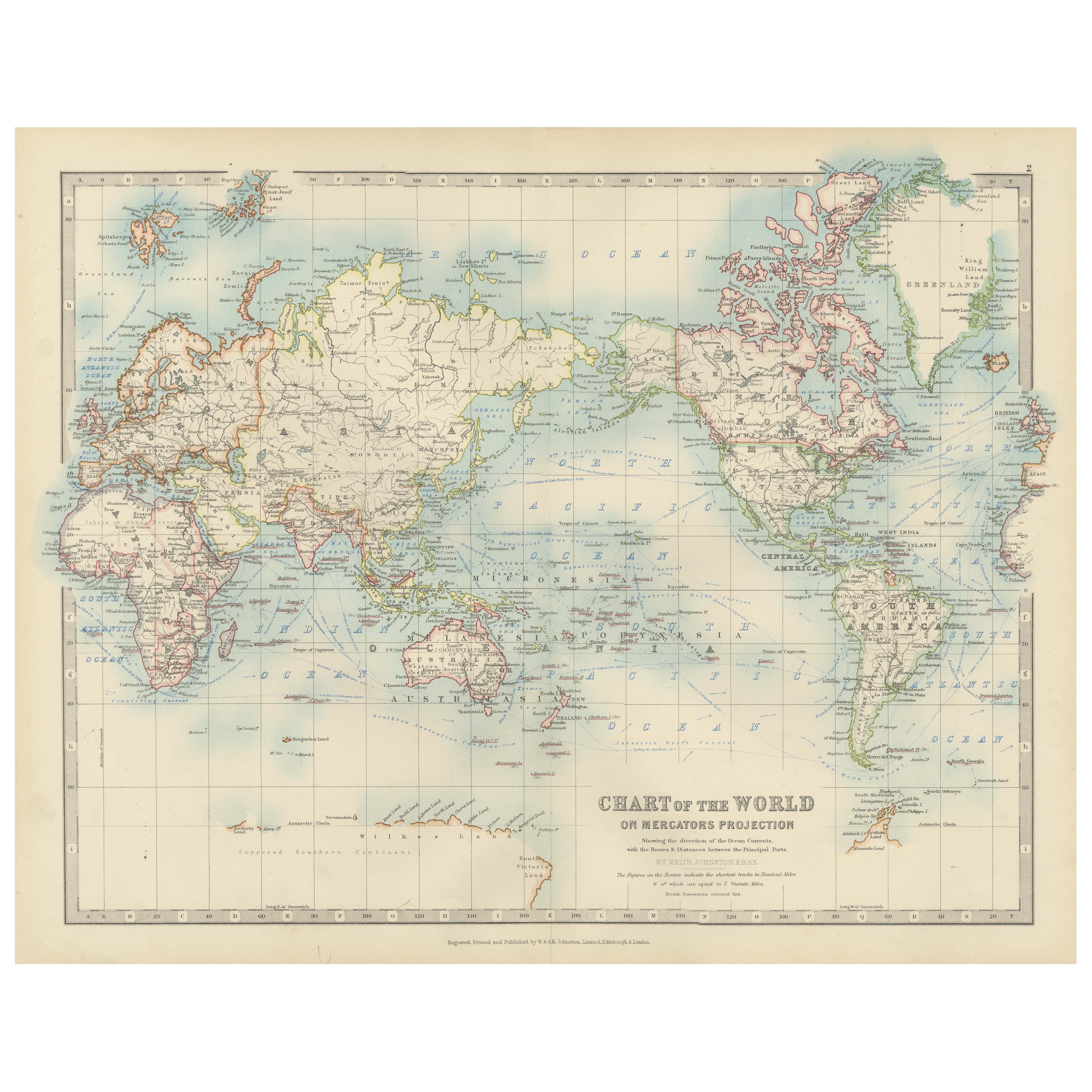
Tout afficherAncienne carte du monde sur la projection de Mercator, courants océaniques et routes commerciales 1903
Titre : Carte du monde ancienne sur la projection de Mercator, 1903, montrant les courants océaniques et les routes commerciales
Description :
Cette carte ancienne, intitulée "Chart...
Catégorie
Début du 20ème siècle, Cartes
Matériaux
Papier

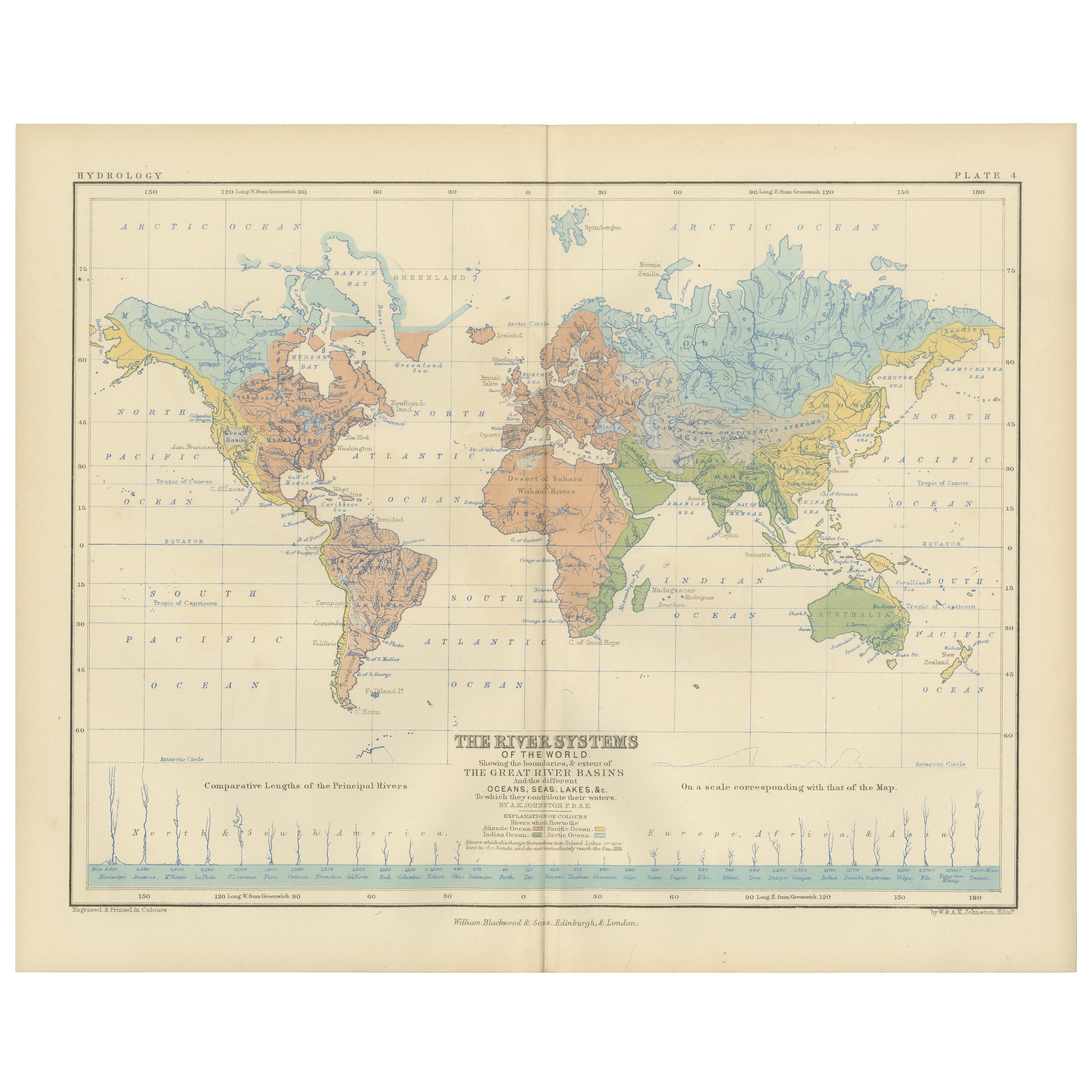
River Systems Map of the World by A.K. Johnston – Educational Print 1852
River Systems Map of the World by A.K. Johnston – Educational Print 1852
This striking 1852 map titled "The River Systems of the World" was created by the noted Scottish geographer ...
Catégorie
Antiquités, Milieu du XIXe siècle, Écossais, Estampes
Matériaux
Papier

Carte ancienne montrant les courants océaniques et la température de l'air, '1872'
Deux cartes sur une feuille intitulées 'Johnson's Oceans Currents (...)' et 'Johnson's World showing the Distribution of the Temperature of the Air'. Carte du monde originale montran...
Catégorie
Antiquités, Fin du XIXe siècle, Cartes
Matériaux
Papier

280 € Prix de vente
20 % de remise
Wind and Hurricane Map by A.K. Johnston – Meteorological Chart 1852
Wind and Hurricane Map by A.K. Johnston – Meteorological Chart 1852
This scientifically significant 1852 map titled "The Distribution of the Constant, Periodical & Variable Winds Ov...
Catégorie
Antiquités, Milieu du XIXe siècle, Écossais, Estampes
Matériaux
Papier

Carte ancienne montrant la distribution des courants d'air par Johnston '1850'
Carte ancienne intitulée "Distribution géographique des courants d'air". Carte ancienne originale montrant la répartition des courants d'air. Cette carte provient de "The Physical At...
Catégorie
Antiquités, Milieu du XIXe siècle, Cartes
Matériaux
Papier

160 € Prix de vente
20 % de remise
1884 Carte du monde décorative ancienne - Projection de Mercator, Impression de l'époque victorienne
Ancienne carte du monde sur la projection de Mercator - Black's Atlas, 1884
Cette carte finement gravée et colorée, intitulée The World on Mercator's Projection, a été publiée dans ...
Catégorie
Antiquités, années 1880, Écossais, Cartes
Matériaux
Papier

Suggestions
Grande carte ancienne originale de l'océan Pacifique, Fullarton, C.1870
Grande carte de l'océan Pacifique
Extrait du célèbre Royal Illustrated Atlas
Lithographie par Swanston. Couleur originale.
Publié par Fullarton, Edinburgh. C.1870
Répara...
Catégorie
Antiquités, années 1870, Écossais, Cartes
Matériaux
Papier

Carte du monde originale et ancienne par Dower, vers 1835
Belle carte du monde
Dessiné et gravé par J.Dower
Publié par Orr & Smith. C.1835
Non encadré.
Expédition gratuite
Catégorie
Antiquités, années 1830, Anglais, Cartes
Matériaux
Papier

Planisphere originale illustrée - Carte du monde - Géographie, 1864
Plongez dans l'épopée du passé avec le Planisphère historique illustré de 1864 par Charpentier ! 🗺️ Ce trésor cartographique vous transporte dans les méandres de l'histoire, avec de...
Catégorie
années 1860, Estampes et éditions
Matériaux
Lin, Lithographie, Papier

Carte ancienne originale de l'hémisphère occidental par Dower, vers 1835
Belle carte de l'hémisphère occidental
Dessiné et gravé par J.Dower
Publié par Orr & Smith. C.1835
Non encadré.
Expédition gratuite
Catégorie
Antiquités, années 1830, Anglais, Cartes
Matériaux
Papier

Carte ancienne de l'Océanie - gravure originale - XIXe siècle
Cette carte de l'Océanie est une gravure réalisée au 19ème siècle.
L'état de conservation des œuvres d'art est bon. En haut du papier, l'inscription "Longitudine del Meridiano dell'...
Catégorie
XIXe siècle, Plus d'Estampes
Matériaux
Eau-forte

Carte du monde - Gravure originale - 1820
Carte du monde est une gravure originale réalisée par un artiste inconnu du 19ème siècle en 1820.
Très bon état sur deux feuilles de papier blanc j...
Catégorie
années 1820, Moderne, Estampes - Figuratif
Matériaux
Eau-forte
