Articles similaires à Antique Map of England and Wales, 1903, with Detailed Counties and Railways

Vous voulez plus d'images ou de vidéos ?
Demander au vendeur plus d'images ou de vidéos
1 sur 10
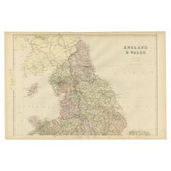
Antique Map of England and Wales, 1903, with Detailed Counties and Railways
À propos de cet article
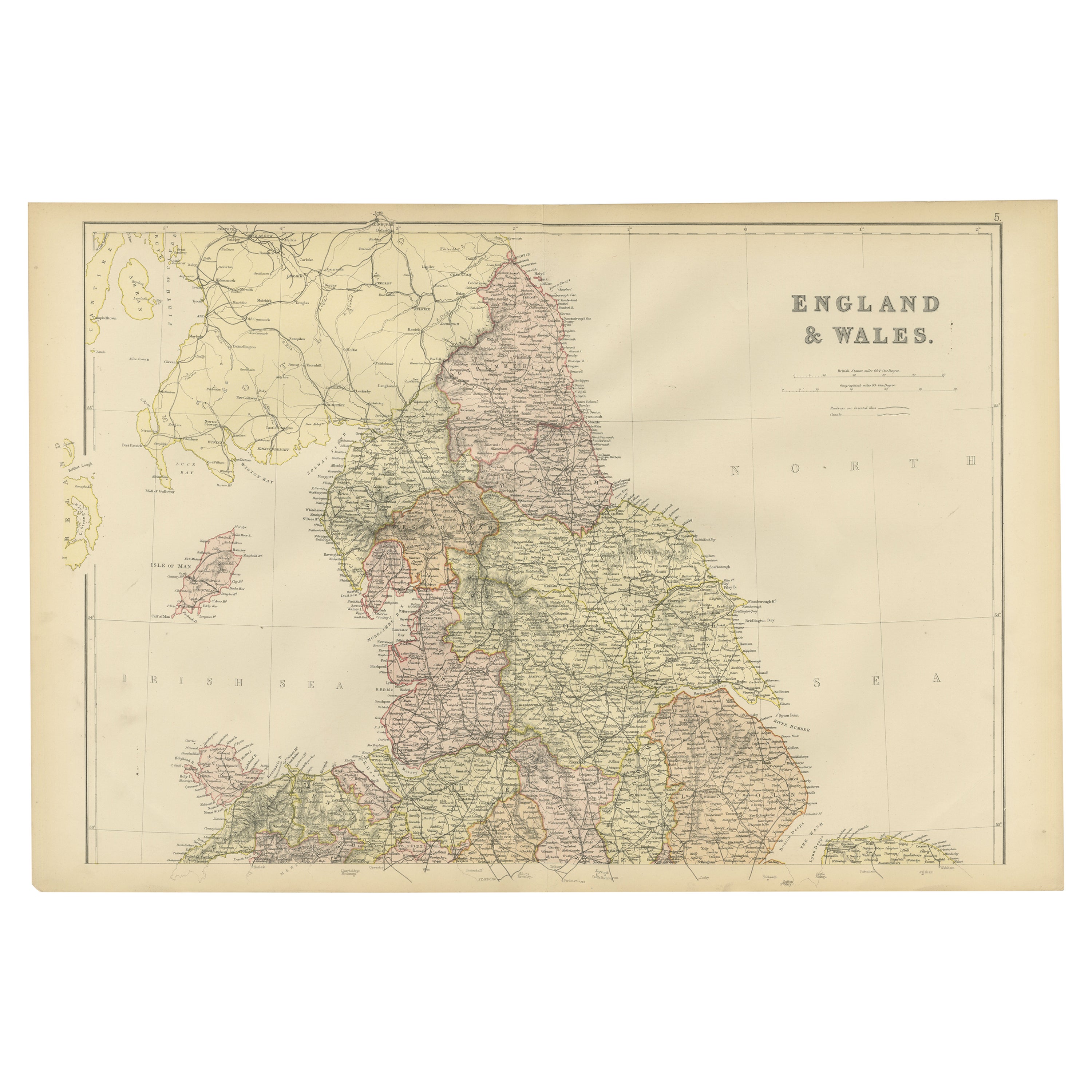
Title: Antique Map of England and Wales, 1903, with Detailed Counties and Railways
Description:
This beautifully detailed antique map, titled "England and Wales," was engraved and published in 1903 by the esteemed cartographic firm W. & A.K. Johnston in Edinburgh and London. It offers a comprehensive and precise depiction of England and Wales at the turn of the 20th century, capturing the dynamic infrastructure and geography of the era.
The map intricately delineates county boundaries with delicate coloring in pastel hues of pink, green, and yellow, each carefully engraved to create a visually striking and harmonious composition. Major cities, towns, and an extensive network of railways are all clearly marked, reflecting the rapid industrial expansion and urban growth that characterized this period. The fine detail also highlights the natural geography of the region, from mountain ranges and rivers to coastal features and offshore islands.
This map is not just a piece of historical documentation—it is a glimpse into a time when the United Kingdom was at the peak of its industrial might and global influence. Railways, noted with precision, underscore the transformation of the landscape and the vital role of transportation in connecting communities and fostering economic growth.
For collectors, this map is a testament to the artistry and accuracy of Johnston’s cartography, combining technical excellence with an aesthetic that remains timeless. It’s an ideal centerpiece for anyone interested in British history, geography, or antique maps.
Condition report:
The map is in very good antique condition, with only minor age-related foxing and slight edge toning that do not detract from its clarity and charm. The colors remain vivid and the paper is well-preserved. Folding line as issued.
Framing tips:
A classic wooden frame in rich mahogany or walnut will add warmth and sophistication to this antique map. Use a light cream or off-white matting to enhance the fine details and bring out the soft pastel colors, creating a refined and elegant presentation for any setting.
- Dimensions:Hauteur : 36,8 cm (14,49 po)Largeur : 48 cm (18,9 po)Profondeur : 0,2 mm (0,01 po)
- Matériaux et techniques:
- Période:
- Date de fabrication:1903
- État:This map is in very good antique condition. Minor foxing and light toning around the edges, consistent with its age, do not detract from its beauty. The colors remain fresh and the paper stable. Folding line as issued.
- Adresse du vendeur:Langweer, NL
- Numéro de référence:Vendeur : BG-13577-41stDibs : LU3054345241002
À propos du vendeur
5,0
Vendeur reconnu
Ces vendeurs prestigieux sont des leaders du secteur. Ils représentent le summum en matière de qualité et de design.
Vendeur Or
Vendeurs premium dont la note est supérieure à 4,3 et le délai de réponse de 24 heures maximum
Établi en 2009
Vendeur 1stDibs depuis 2017
2 463 ventes sur 1stDibs
Temps de réponse habituel : <1 heure
- ExpéditionRecherche du devis...Expédition depuis : Langweer, Pays-Bas
- Politique des retours
Certaines parties de cette page ont été traduites automatiquement. 1stDibs ne garantit pas l'exactitude des traductions. L'anglais est la langue par défaut de ce site web.
Garantie d'authenticité
Bien qu'il soit peu probable que la situation se présente, dans le cas où vous rencontreriez un problème d'authenticité d'un article, contactez-nous dans un délai d'un an pour obtenir un remboursement intégral. DétailsGarantie de remboursement
Si votre article n'est pas conforme à la description, est endommagé pendant le transport ou ne vous est pas livré, contactez-nous sous 7 jours pour obtenir un remboursement intégral. DétailsAnnulation sous 24 heures
Vous disposez d'un délai de 24 heures pour annuler votre achat sans motif.Des vendeurs professionnels agréés
Nos vendeurs de renommée mondiale doivent respecter des normes strictes en matière de service et de qualité, afin de préserver l'intégrité de nos fiches produit.Garantie d'alignement des prix
Si vous constatez qu'un autre vendeur a mis en vente le même article à un prix inférieur sur un autre site, nous nous alignerons sur ce prix.Livraison en toute confiance à l'international
Notre réseau de transporteurs de premier ordre propose des options d'expédition spécialisées dans le monde entier, y compris des livraisons personnalisées.Plus d'articles de ce vendeur
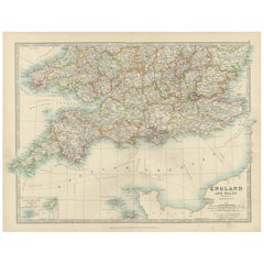
Tout afficherAntique Map of Southern England & Wales, 1903, with Coastal Details and Railways
Title: Antique Map of Southern England and Wales, 1903, with Coastal Details and Railways
Description:
This detailed antique map, titled "England and Wales (Southern Sheet I)," was ...
Catégorie
Début du 20ème siècle, Cartes
Matériaux
Papier
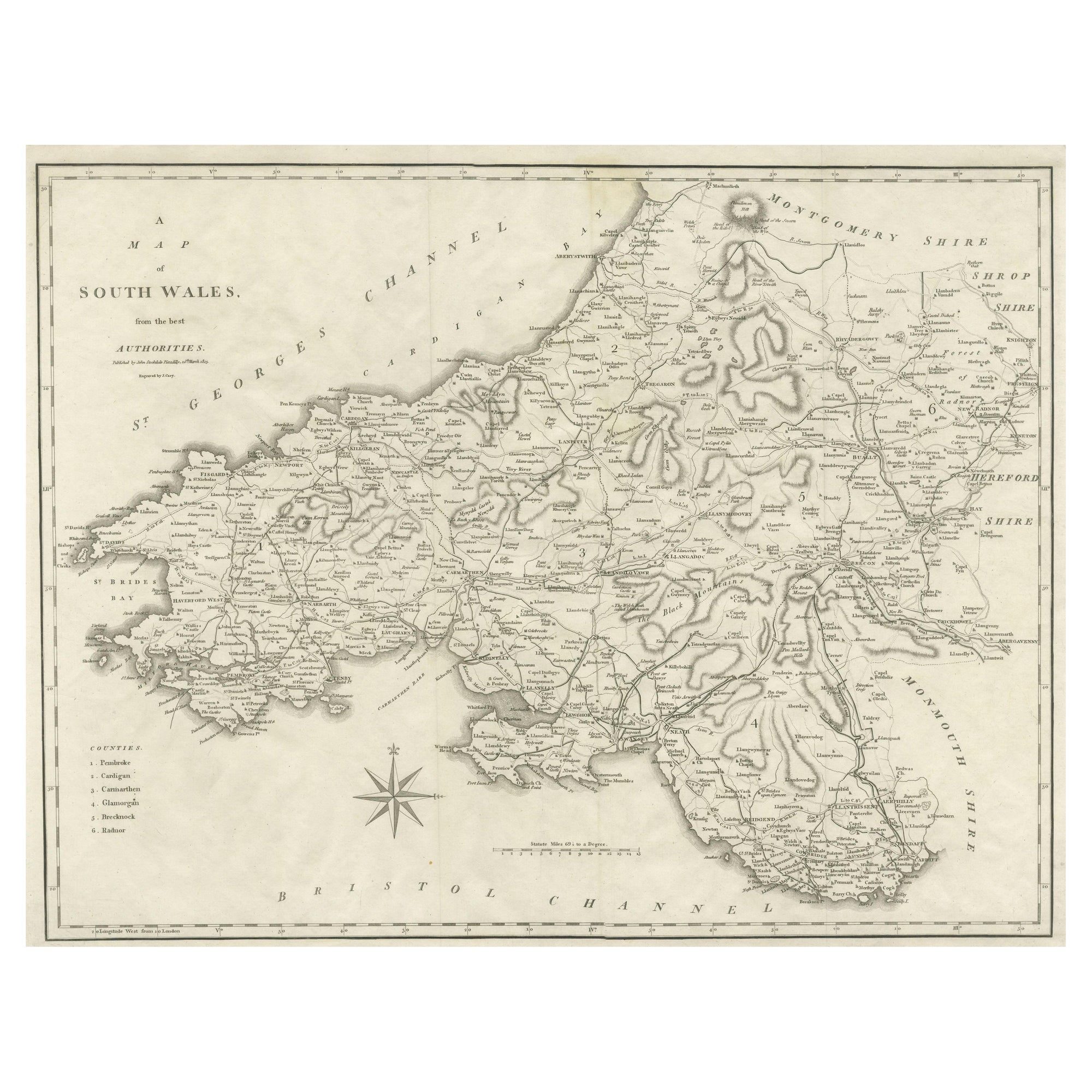
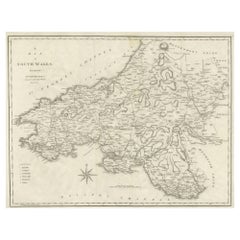
Grande carte ancienne du comté de Galles du Sud, Angleterre
Carte ancienne intitulée 'A Map of South Antiques from the best Authorities'. Ancienne carte originale du sud du Pays de Galles, Angleterre. Gravure de John Cary. Tiré du "New Britis...
Catégorie
Antiquités, Début du XIXe siècle, Cartes
Matériaux
Papier
167 $US Prix de vente
20 % de remise
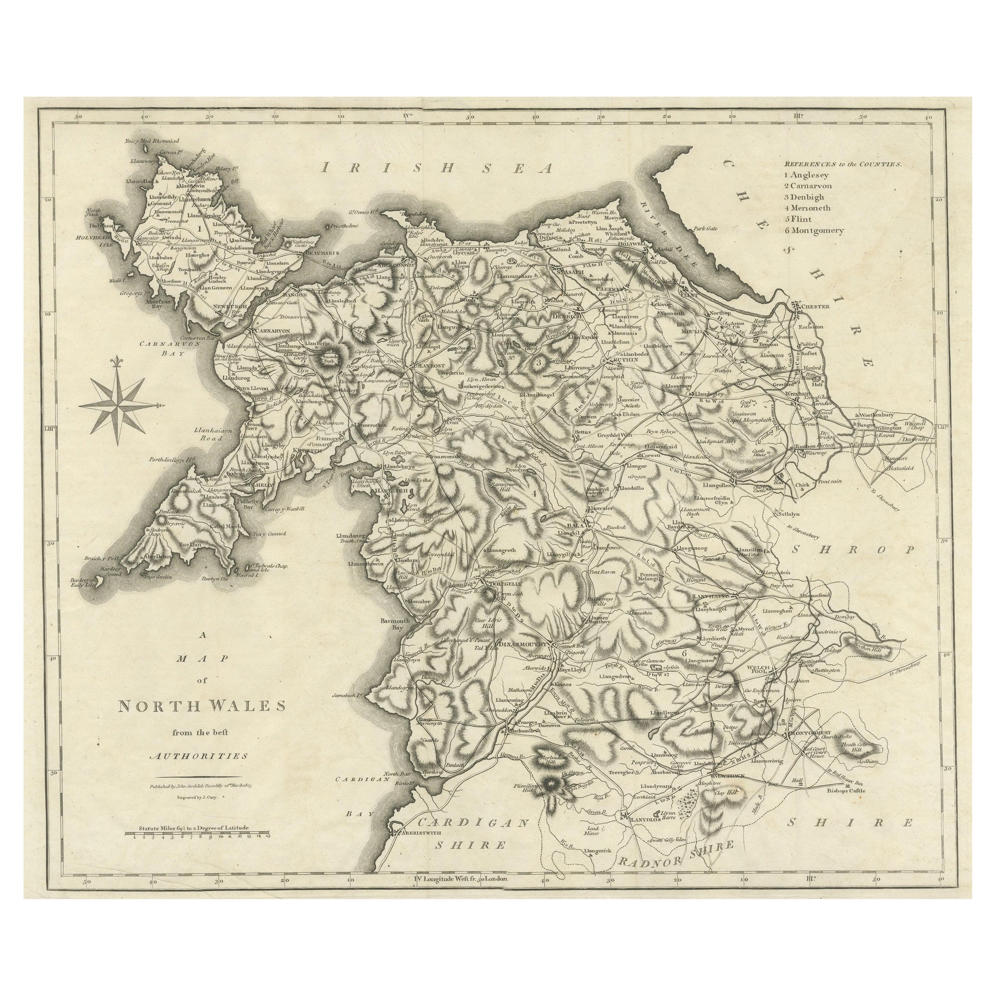
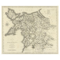
Grande carte ancienne du comté de Galles du Nord, Angleterre
Carte ancienne intitulée "A Map of North Wales from the best Authorities". Ancienne carte originale du nord du Pays de Galles, Angleterre. Gravure de John Cary. Tiré du "New British ...
Catégorie
Antiquités, Début du XIXe siècle, Cartes
Matériaux
Papier
167 $US Prix de vente
20 % de remise
Carte ancienne colorée d'Angleterre et de Galles, 1882
Explorez la splendeur historique de l'Angleterre et du Pays de Galles avec cette carte ancienne ! Faisant partie d'une collection distinguée, cette carte présente une vue captivante ...
Catégorie
Antiquités, années 1880, Cartes
Matériaux
Papier
158 $US Prix de vente
20 % de remise
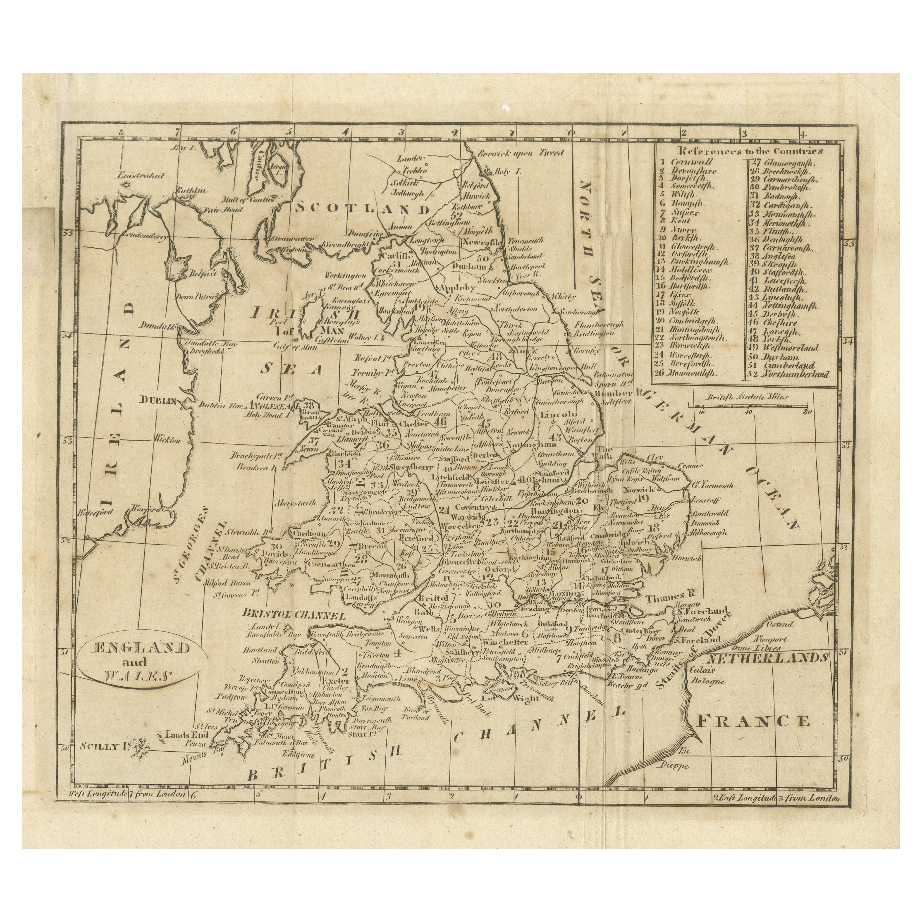
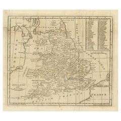
Carte ancienne d'Angleterre et de Galles, avec références aux Pays-Bas
Carte ancienne intitulée "Angleterre et Pays de Galles". Carte originale ancienne de l'Angleterre et du Pays de Galles, avec références aux comtés. Source inconnue, à déterminer. Pub...
Catégorie
Antiquités, Début du XIXe siècle, Cartes
Matériaux
Papier
130 $US Prix de vente
20 % de remise
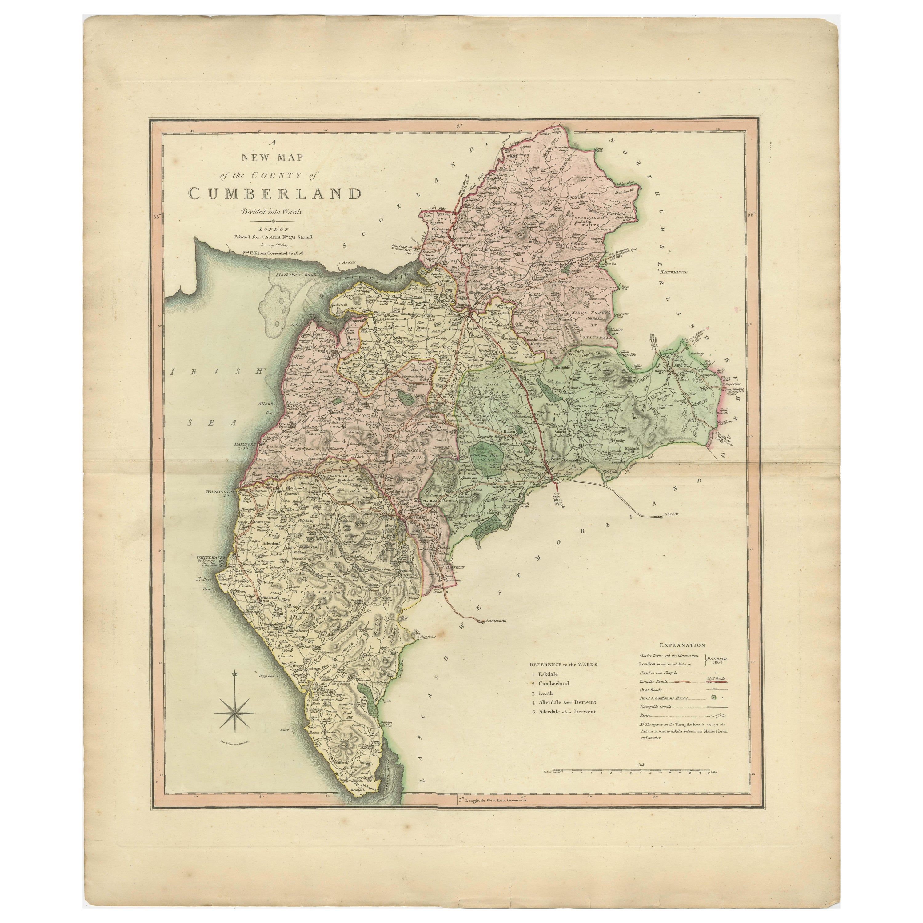
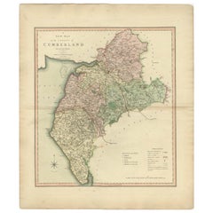
Carte décorative et détaillée ancienne du comté de Cumberland, Angleterre, 1804
Carte ancienne du comté de Cumberland publiée pour la première fois vers 1800. Les villages, villes et villages illustrés comprennent Carlisle, Penrith, Copeland Forest et Wigton.
...
Catégorie
Antiquités, Début des années 1800, Cartes
Matériaux
Papier
302 $US Prix de vente
20 % de remise
Suggestions
1903 Angleterre heureuse
Par Helen Allingham
Un magnifique ouvrage signé, en édition limitée, présentant les aquarelles d'Helen Allingham sur l'Angleterre.
L'édition de luxe. Limité à 750 exemplaires, celui-ci étant le numéro ...
Catégorie
Antiquités, Début des années 1900, Britannique, Livres
Matériaux
Papier
1 310 $US
Comté du Hampshire, Grande-Bretagne/Angleterre : Une carte de Camden's « Britannia » en 1607
Par John Norden
Carte ancienne, colorée à la main, du comté de Hampshire en Grande-Bretagne, publiée dans l'édition de 1607 de la grande description historique des îles britanniques de William Camde...
Catégorie
Antiquités, Début du XVIIe siècle, Anglais, Cartes
Matériaux
Papier

Carte ancienne de l'État américain du Minnesota, 1903
Carte ancienne du Minnesota
Publié par A.I.C Black. 1903
Couleur originale
Bon état
Sans cadre.
Expédition gratuite
Catégorie
Antiquités, Début des années 1900, Anglais, Cartes
Matériaux
Papier

Carte ancienne de l'État américain de l'Alabama, 1903
Antique map of Alabama
Published By A & C Black. 1903
Original colour
Good condition
Unframed.
Free shipping
Catégorie
Antiquités, Début des années 1900, Anglais, Cartes
Matériaux
Papier

Carte ancienne de l'État américain de l'Alaska, 1903
Carte ancienne de l'Alaska
Publié par A.I.C Black. 1903
Couleur originale
Bon état
Sans cadre.
Expédition gratuite
Catégorie
Antiquités, Début des années 1900, Anglais, Cartes
Matériaux
Papier

Carte ancienne de l'État américain du Nebraska, 1903
Carte ancienne du Nebraska
Publié par A.I.C Black. 1903
Couleur originale
Bon état
Sans cadre.
Expédition gratuite
Catégorie
Antiquités, Début des années 1900, Anglais, Cartes
Matériaux
Papier
