Articles similaires à Antique Map of Southern India and South Eastern Provinces, 1903

Vous voulez plus d'images ou de vidéos ?
Demander au vendeur plus d'images ou de vidéos
1 sur 10
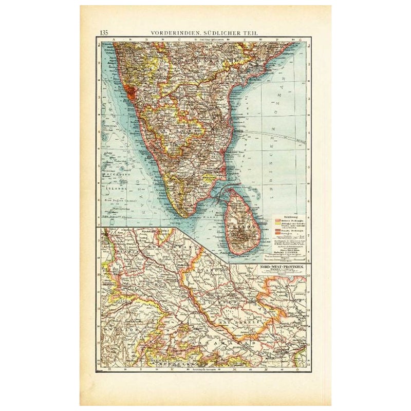
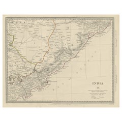
Antique Map of Southern India and South Eastern Provinces, 1903
À propos de cet article
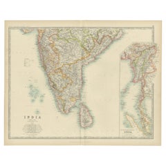
Title: Antique Map of Southern India and South Eastern Provinces, 1903, with Intricate Detail
Description:
This antique map, titled "India (Southern Sheet) and the South Eastern Provinces," was engraved and published in 1903 by W. & A.K. Johnston in Edinburgh and London. It provides a beautiful and detailed depiction of the southern part of the Indian subcontinent and the southeastern provinces of what is now Myanmar (Burma).
The map is delicately colored in soft pastel shades to highlight provincial and regional boundaries, illustrating the rich geographical and cultural diversity of the region. Major cities, rivers, mountain ranges, and coastal features are marked with precision, reflecting the cartographic skill and artistry of Johnston’s team. The inset map of the South Eastern Provinces provides a closer look at the territories of Burma and its relationship to the Indian subcontinent.
This map captures the dynamic interplay between ancient cultures and British colonial influence at the turn of the 20th century, offering a fascinating window into an era of significant political and social change. The careful engraving and elegant typography make this map not just a historical document, but also a work of art that celebrates the beauty and complexity of southern Asia.
For collectors, historians, and lovers of Indian history and culture, this map is a testament to a time of exploration, trade, and cultural exchange, showcasing the enduring legacy of these lands at the crossroads of empires.
Condition report:
This map is in very good antique condition, with minor age-related foxing and gentle toning along the edges. The colors remain vibrant and the paper is stable and well-preserved.
Framing tips:
A classic wooden frame in walnut or cherry will enhance the warm pastel tones and intricate detailing of the map. Use a cream or off-white matting to highlight the refined linework and create a sophisticated, timeless focal point for any home, study, or library.
- Dimensions:Hauteur : 36,8 cm (14,49 po)Largeur : 47 cm (18,51 po)Profondeur : 0,2 mm (0,01 po)
- Matériaux et techniques:
- Période:
- Date de fabrication:1903
- État:This map is in very good antique condition, with minor age-related foxing and gentle toning along the edges. The colors remain vibrant and the paper is stable and well-preserved. Folding line as issued.
- Adresse du vendeur:Langweer, NL
- Numéro de référence:Vendeur : BG-13577-291stDibs : LU3054345262582
À propos du vendeur
5,0
Vendeur reconnu
Ces vendeurs prestigieux sont des leaders du secteur. Ils représentent le summum en matière de qualité et de design.
Vendeur Or
Vendeurs premium dont la note est supérieure à 4,3 et le délai de réponse de 24 heures maximum
Établi en 2009
Vendeur 1stDibs depuis 2017
2 462 ventes sur 1stDibs
Temps de réponse habituel : <1 heure
- ExpéditionRecherche du devis...Expédition depuis : Langweer, Pays-Bas
- Politique des retours
Certaines parties de cette page ont été traduites automatiquement. 1stDibs ne garantit pas l'exactitude des traductions. L'anglais est la langue par défaut de ce site web.
Garantie d'authenticité
Bien qu'il soit peu probable que la situation se présente, dans le cas où vous rencontreriez un problème d'authenticité d'un article, contactez-nous dans un délai d'un an pour obtenir un remboursement intégral. DétailsGarantie de remboursement
Si votre article n'est pas conforme à la description, est endommagé pendant le transport ou ne vous est pas livré, contactez-nous sous 7 jours pour obtenir un remboursement intégral. DétailsAnnulation sous 24 heures
Vous disposez d'un délai de 24 heures pour annuler votre achat sans motif.Des vendeurs professionnels agréés
Nos vendeurs de renommée mondiale doivent respecter des normes strictes en matière de service et de qualité, afin de préserver l'intégrité de nos fiches produit.Garantie d'alignement des prix
Si vous constatez qu'un autre vendeur a mis en vente le même article à un prix inférieur sur un autre site, nous nous alignerons sur ce prix.Livraison en toute confiance à l'international
Notre réseau de transporteurs de premier ordre propose des options d'expédition spécialisées dans le monde entier, y compris des livraisons personnalisées.Plus d'articles de ce vendeur
Tout afficherCarte ancienne de l'Inde du Sud par Andree, 1904
Carte ancienne intitulée "Vorderindien, sudlicher Teil". Carte de l'Inde, partie sud. Cette carte provient du "Andrees Allgemeiner Handatlas in 126 Haupt-Und 139 Nebenkarten", Bielef...
Catégorie
20ième siècle, Cartes
Matériaux
Papier
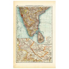
67 $US Prix de vente
20 % de remise
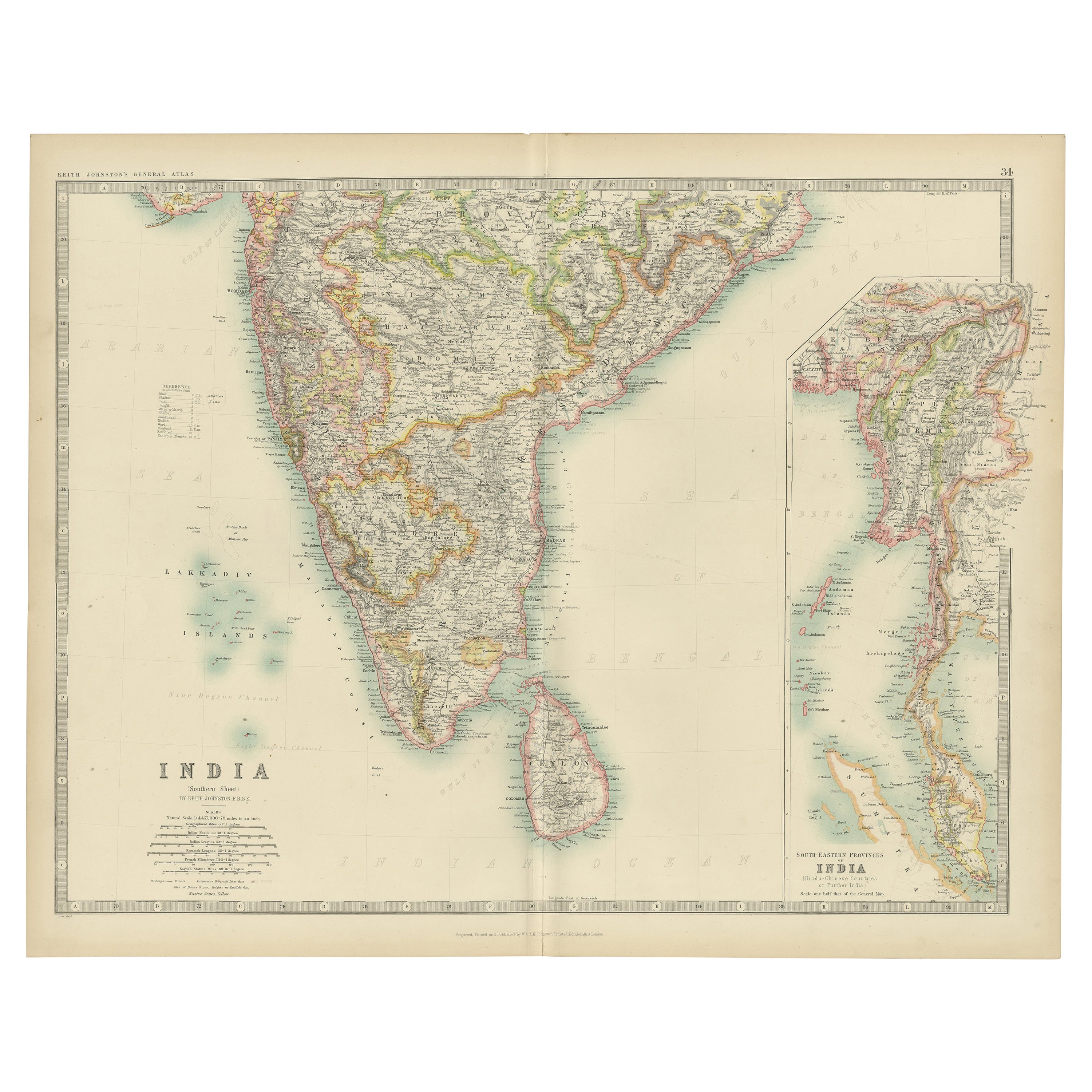
Carte ancienne de l'Inde (Souest) par Johnston (1909)
Carte ancienne intitulée "Inde". Carte ancienne originale de l'Inde feuille du sud. Avec des cartes en médaillon des provinces du sud-est de l'Inde. Cette carte provient du "Royal At...
Catégorie
Début du 20ème siècle, Cartes
Matériaux
Papier
232 $US Prix de vente
20 % de remise
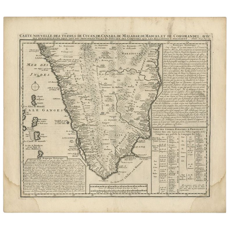
Carte ancienne de l'Inde du Sud par Chatelain, vers 1720
"Carte ancienne intitulée 'Carte Nouvelle des Terres de Cucan, de Canara, de Malabar, de Madura, et de Coromandel'. Carte de la partie sud de l'Inde, provenant de l'Atlas historique ...
Catégorie
Antiquités, XVIIIe siècle, Cartes
Matériaux
Papier
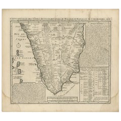
288 $US Prix de vente
20 % de remise
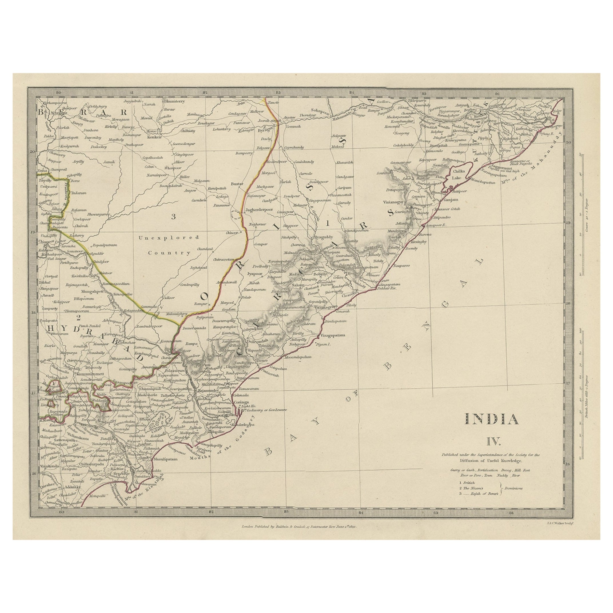
Carte ancienne intéressante et détaillée de l'Inde de l'Est, 1832
Carte ancienne intitulée "India IV". Ancienne carte gravée sur acier de la partie orientale de l'Inde, comprenant la baie du Bengale, Hydrabad et Masulipatam.
Artistes et graveurs...
Catégorie
Antiquités, XIXe siècle, Cartes
Matériaux
Papier
269 $US Prix de vente
20 % de remise
Antique Map of Southern Scotland, 1903, with Coastal and Inland Details
Title: Antique Map of Southern Scotland, 1903, with Coastal and Inland Details
Description:
This exquisite antique map, titled "Scotland (Southern Sheet I)," was engraved and publis...
Catégorie
Début du 20ème siècle, Cartes
Matériaux
Papier

Carte ancienne de l'Inde orientale par Kuyper, C.1880
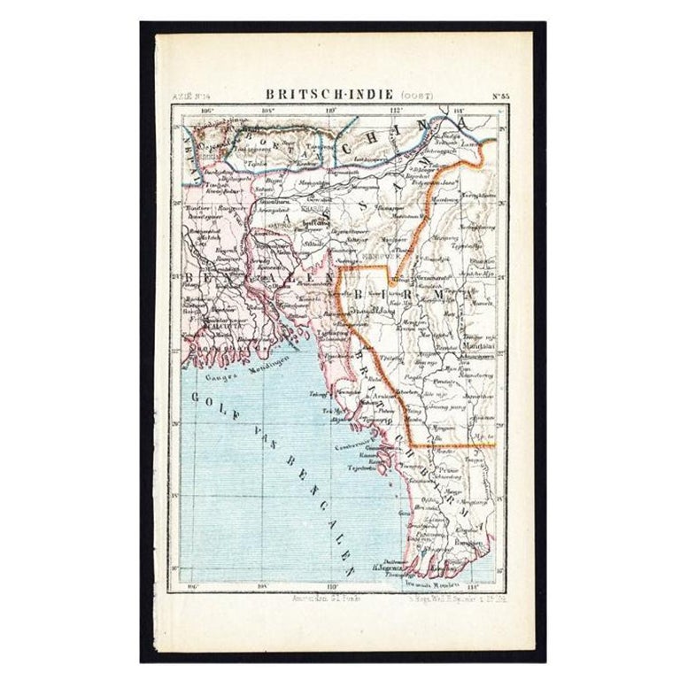
Planche 55 : "Britsch-Indie, Oost." (Indes britanniques, Est) (Indes britanniques, Est). Cette carte lithographiée provient de : 'Wereld-atlas voor Kantoor en Huiskamer' (traduction ...
Catégorie
Antiquités, XIXe siècle, Cartes
Matériaux
Papier
Suggestions
Carte ancienne de l'État américain du Michigan (partie sud du Michigan), 1903
Carte ancienne du Michigan (partie sud)
Publié par A.I.C Black. 1903
Couleur originale
Bon état
Sans cadre.
Expédition gratuite
Catégorie
Antiquités, Début des années 1900, Anglais, Cartes
Matériaux
Papier

49 $US
Livraison gratuite
Carte ancienne de l'État américain de l'Ohio (partie sud de l'Ohio), 1903
Carte ancienne de l'Ohio (partie sud)
Publié par A.I.C Black. 1903
Couleur originale
Bon état
Sans cadre.
Expédition gratuite
Catégorie
Antiquités, Début des années 1900, Anglais, Cartes
Matériaux
Papier

Carte ancienne de l'État américain de Californie (partie sud), 1903
Carte ancienne de la Californie (partie sud)
Publié par A.I.C Black. 1903
Couleur originale
Bon état
Sans cadre.
Expédition gratuite
Catégorie
Antiquités, Début des années 1900, Anglais, Cartes
Matériaux
Papier

Carte ancienne de l'État américain de l'Illinois (partie sud de l'Illinois), 1903
Carte ancienne de l'Illinois (partie sud)
Publié par A.I.C Black. 1903
Couleur originale
Bon état
Sans cadre.
Expédition gratuite
Catégorie
Antiquités, Début des années 1900, Anglais, Cartes
Matériaux
Papier

49 $US
Livraison gratuite
Carte ancienne de l'État américain du Missouri (partie sud du Missouri), 1903
Carte ancienne du Missouri (partie sud)
Publié par A.I.C Black. 1903
Couleur originale
Bon état
Sans cadre.
Expédition gratuite
Catégorie
Antiquités, Début des années 1900, Anglais, Cartes
Matériaux
Papier

49 $US
Livraison gratuite
Carte ancienne de l'État américain de Pennsylvanie (partie est), 1903
Antique map of Pennsylvania ( Eastern part )
Published By A & C Black. 1903
Original colour
Good condition
Unframed.
Free shipping
Catégorie
Antiquités, Début des années 1900, Anglais, Cartes
Matériaux
Papier
